Category:Billesdon
Aller à la navigation
Aller à la recherche
Cebuano: Billesdon maoy parokya sa Hiniusang Gingharian. Ang Billesdon nahimutang sa kondado sa Leicestershire ug apil sa nasod sa Inglatera, sa habagatang bahin sa nasod, km sa amihanan sa ulohang dakbayan London. (→Billesdon)
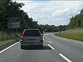
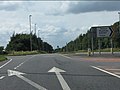
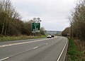
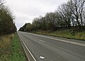
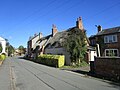
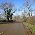
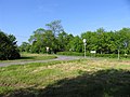
English: Billesdon is a village and civil parish in the Harborough district of Leicestershire, England, with a population of 745 according to the 2001 census, increasing to 901 at the 2011 census. It is just off the A47, nine miles east of Leicester. The Billesdon bypass opened in October 1986. Nearby places include Houghton on the Hill (the next village towards Leicester), and Skeffington (the next village east towards Uppingham), Tilton on the Hill, and Gaulby. The Billesdon Brook flows through the village. (→Billesdon)
Nederlands: Billesdon is een plaats en civil parish in het bestuurlijke gebied Harborough, in het Engelse graafschap Leicestershire met 745 inwoners. (→Billesdon)
Polski: Billesdon – wieś w Anglii, w hrabstwie Leicestershire, w dystrykcie Harborough. Leży 14 km na wschód od miasta Leicester i 136 km na północny zachód od Londynu. Miejscowość liczy 745 mieszkańców. (→Billesdon)
Svenska: Billesdon är en parish i Storbritannien. Den ligger i grevskapet Leicestershire och riksdelen England, i den södra delen av landet, km norr om huvudstaden London. (→Billesdon)

localité britannique du comté anglais de Leicestershire  | |||||
| Téléverser des médias | |||||
| Nature de l’élément | |||||
|---|---|---|---|---|---|
| Lieu | Harborough, Leicestershire, Midlands de l'Est, Angleterre | ||||
| Population |
| ||||
| Superficie |
| ||||
 | |||||
Sous-catégories
Cette catégorie comprend 2 sous-catégories, dont les 2 ci-dessous.
B
- Billesdon War Memorial (1 F)
Média dans la catégorie « Billesdon »
Cette catégorie comprend 230 fichiers, dont les 200 ci-dessous.
(page précédente) (page suivante)-
 1 Uppingham Road, Billesdon (geograph 6984918).jpg 1 024 × 768 ; 213 kio
-
 25 Church Street, Billesdon (geograph 6984920).jpg 1 024 × 768 ; 168 kio
-
 27 Church Street, Billesdon (geograph 6984922).jpg 1 024 × 768 ; 190 kio
-
 38 Church Street, Billedon (geograph 6984907).jpg 1 024 × 768 ; 182 kio
-
 A47 approaching Tilton Lane junction - geograph.org.uk - 3587920.jpg 640 × 480 ; 63 kio
-
 A47 at Leicester Road junction, Billesdon - geograph.org.uk - 3587913.jpg 640 × 480 ; 71 kio
-
 A47 at the B6047 crossroads - geograph.org.uk - 3587895.jpg 640 × 480 ; 62 kio
-
 A47 at Tilton Lane junction - geograph.org.uk - 3587922.jpg 640 × 480 ; 70 kio
-
 A47 Billesdon Bypass - geograph.org.uk - 3296335.jpg 2 510 × 1 853 ; 1,36 Mio
-
 A47 Billesdon bypass - geograph.org.uk - 3587903.jpg 640 × 480 ; 74 kio
-
 A47 road towards Leicester - geograph.org.uk - 4942287.jpg 640 × 457 ; 77 kio
-
 A47 towards Peterborough - geograph.org.uk - 4942295.jpg 640 × 460 ; 91 kio
-
 A47 towards Peterborough - geograph.org.uk - 5935498.jpg 640 × 455 ; 49 kio
-
 A47 Uppingham Road crossing Coplow Brook - geograph.org.uk - 3414241.jpg 2 730 × 1 806 ; 1,42 Mio
-
 A47 west of Billesdon - geograph.org.uk - 3587918.jpg 640 × 480 ; 69 kio
-
 A47 west of the B6047 crossroads - geograph.org.uk - 3587899.jpg 640 × 480 ; 70 kio
-
 A47-Coplow Lane junction - geograph.org.uk - 4942286.jpg 640 × 334 ; 52 kio
-
 An avenue in the making - geograph.org.uk - 147917.jpg 640 × 480 ; 99 kio
-
 An avenue in the making from the other end - geograph.org.uk - 238810.jpg 640 × 480 ; 59 kio
-
 Approaching Noseley - geograph.org.uk - 238815.jpg 640 × 480 ; 119 kio
-
 Avenue to Rolleston Hall - geograph.org.uk - 181077.jpg 640 × 480 ; 124 kio
-
 Benchmark on toppled triangulation pillar - geograph.org.uk - 4623863.jpg 1 024 × 683 ; 263 kio
-
 A view of Billesdon Church - geograph.org.uk - 751664.jpg 640 × 474 ; 83 kio
-
 Church Street - geograph.org.uk - 202897.jpg 640 × 480 ; 83 kio
-
 Church Street in Billesdon - geograph.org.uk - 751563.jpg 640 × 448 ; 78 kio
-
 Billesdon cemetery - geograph.org.uk - 3296328.jpg 4 000 × 3 000 ; 3,75 Mio
-
 Billesdon Community Post Office - geograph.org.uk - 751599.jpg 640 × 315 ; 55 kio
-
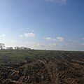
 Billesdon farmland - geograph.org.uk - 2264309.jpg 640 × 427 ; 108 kio
-
 Billesdon Fire Station - geograph.org.uk - 203572.jpg 640 × 390 ; 57 kio
-
 Billesdon Fire Station - geograph.org.uk - 5329826.jpg 640 × 480 ; 42 kio
-
 Billesdon footpath - geograph.org.uk - 5329831.jpg 640 × 480 ; 51 kio
-
 Billesdon Manor - geograph.org.uk - 2264295.jpg 640 × 427 ; 78 kio
-
 Billesdon old fire station - geograph.org.uk - 629888.jpg 640 × 427 ; 237 kio
-
 Billesdon Queens Head Pub - geograph.org.uk - 2763643.jpg 640 × 480 ; 104 kio
-
 Billesdon Village Sign - geograph.org.uk - 5329828.jpg 480 × 640 ; 48 kio
-
 Billesdon, Leics - St John the Baptist Church - geograph.org.uk - 5243514.jpg 2 920 × 5 184 ; 4,33 Mio
-
 Billesdon, Leics - village centre - geograph.org.uk - 5243513.jpg 5 184 × 2 920 ; 5,3 Mio
-
 Bridleway across sheep pasture - geograph.org.uk - 3417328.jpg 4 000 × 3 000 ; 3,34 Mio
-
 Bridleway along Uppingham Road - geograph.org.uk - 3296330.jpg 3 991 × 2 827 ; 3,36 Mio
-
 Bridleway to Billesdon Lodge - geograph.org.uk - 3414444.jpg 3 599 × 2 724 ; 3,31 Mio
-
 Bus on Leicester Road - geograph.org.uk - 3414262.jpg 1 372 × 1 170 ; 513 kio
-
 Bushby Road - geograph.org.uk - 203571.jpg 640 × 480 ; 121 kio
-
 Camp 94 - geograph.org.uk - 4519370.jpg 640 × 480 ; 120 kio
-
 Capital - geograph.org.uk - 2264323.jpg 640 × 427 ; 76 kio
-
 Church Cottage, Billesdon (geograph 6985113).jpg 1 024 × 785 ; 144 kio
-
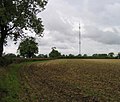
 Communications mast near Tilton Lane - geograph.org.uk - 6174409.jpg 632 × 800 ; 178 kio
-
 Copley Lane, Billesdon - geograph.org.uk - 5329830.jpg 640 × 480 ; 53 kio
-

-
 Coplow Lane in Billesdon - geograph.org.uk - 3414412.jpg 3 745 × 2 970 ; 3,25 Mio
-
 Coplow Lane joining Tilton Lane - geograph.org.uk - 6416403.jpg 3 776 × 2 520 ; 4,29 Mio
-
 Coplow Lane junction, A47, Billesdon - geograph.org.uk - 3587905.jpg 640 × 480 ; 73 kio
-
 Cottages along Church Street - geograph.org.uk - 3296303.jpg 4 000 × 3 000 ; 3,68 Mio
-
 Countryside near Rolleston - geograph.org.uk - 753262.jpg 640 × 616 ; 114 kio
-
 Crossroads at the end of Green Lane - geograph.org.uk - 6012504.jpg 640 × 470 ; 91 kio
-
 Crossroads on Tilton Lane - geograph.org.uk - 6012505.jpg 640 × 398 ; 63 kio
-
 Driveway leading to Glebe Farm - geograph.org.uk - 4165131.jpg 1 600 × 1 128 ; 375 kio
-
 Driveway to Nethercourt Farm - geograph.org.uk - 6012506.jpg 640 × 444 ; 68 kio
-
 End of bridleway off Uppingham Road, Billesdon - geograph.org.uk - 6421103.jpg 3 776 × 2 520 ; 3,3 Mio
-
 Entrance to Billesdon cemetery - geograph.org.uk - 3296326.jpg 3 829 × 2 905 ; 3,09 Mio
-
 Entrance to Billesdon Coplow Lodge - geograph.org.uk - 6416401.jpg 3 776 × 2 520 ; 3,25 Mio
-
 Entrance to Brooklands Farm - geograph.org.uk - 3414440.jpg 3 407 × 2 649 ; 3,03 Mio
-
 Entrance to Seldom Seen Farm - geograph.org.uk - 2044558.jpg 640 × 457 ; 88 kio
-
 Entrance to the Woodland Pool site - geograph.org.uk - 4519367.jpg 640 × 480 ; 98 kio
-
 Farm gate onto sheep pasture - geograph.org.uk - 3414201.jpg 3 094 × 2 208 ; 1,79 Mio
-
 Farm track near Coplow Farm - geograph.org.uk - 3414250.jpg 3 627 × 2 533 ; 2,22 Mio
-
 Farmland west of Billesdon - geograph.org.uk - 3417365.jpg 4 000 × 3 000 ; 3,44 Mio
-
 Field by Green Lane - geograph.org.uk - 2044554.jpg 640 × 543 ; 96 kio
-
 Fields along the A47 Billesdon bypass - geograph.org.uk - 3414450.jpg 3 832 × 3 000 ; 3,82 Mio
-
 Fields off Green Lane - geograph.org.uk - 2044553.jpg 640 × 432 ; 59 kio
-
 Footpath to Billesdon - geograph.org.uk - 181075.jpg 640 × 480 ; 95 kio
-
 Footpath to Billesdon - geograph.org.uk - 4942288.jpg 640 × 461 ; 128 kio
-
 Footpath to Tilton - geograph.org.uk - 4942296.jpg 640 × 439 ; 63 kio
-
 Former Leicester Road - geograph.org.uk - 6040824.jpg 640 × 473 ; 89 kio
-
 Freshly laid hedge - geograph.org.uk - 5935499.jpg 640 × 468 ; 72 kio
-
 Gate on Bushby Road - geograph.org.uk - 3417245.jpg 4 000 × 3 000 ; 3,47 Mio
-
 Gate onto farmland - geograph.org.uk - 3414448.jpg 4 000 × 3 000 ; 3,6 Mio
-
 Gates of commuications tower compound - geograph.org.uk - 6012508.jpg 640 × 445 ; 73 kio
-
 Gateway off Melton Road - geograph.org.uk - 2796694.jpg 640 × 472 ; 82 kio
-
 Gaulby Road in Billesdon - geograph.org.uk - 3296288.jpg 4 000 × 3 000 ; 3,26 Mio
-
 Gaulby Road towards Billesdon - geograph.org.uk - 5518069.jpg 528 × 640 ; 52 kio
-
 Glebe Farm viewed from Tilton Lane - geograph.org.uk - 4165113.jpg 1 600 × 1 464 ; 696 kio
-
 Grassland and hedge north of the A47 Billesdon bypass - geograph.org.uk - 3414455.jpg 4 000 × 3 000 ; 4,43 Mio
-
 Grassland north of Leicester Road - geograph.org.uk - 3414268.jpg 3 378 × 2 484 ; 2,54 Mio
-
 Grazing sheep near Billesdon - geograph.org.uk - 3414338.jpg 2 503 × 1 791 ; 1,14 Mio
-
 Green Lane northwards - geograph.org.uk - 2044555.jpg 640 × 475 ; 136 kio
-

-

-
 Green Lane passing the entrance to Seldom Seen Farm - geograph.org.uk - 6416138.jpg 3 776 × 2 520 ; 3,02 Mio
-
 Green Lane southwards - geograph.org.uk - 2044556.jpg 640 × 577 ; 125 kio
-
 Green Lane-Tilton Road junction - geograph.org.uk - 4942297.jpg 640 × 464 ; 98 kio
-
 Green Lane-Tilton Road junction - geograph.org.uk - 4942298.jpg 640 × 493 ; 70 kio
-
 Heading south along the B6047 - geograph.org.uk - 4327932.jpg 1 600 × 1 074 ; 522 kio
-
 Heading south along the B6047 Melton Road - geograph.org.uk - 3297354.jpg 4 000 × 3 000 ; 3,69 Mio
-
 Hedge along Rolleston Road - geograph.org.uk - 3417277.jpg 4 000 × 3 000 ; 4,93 Mio
-
 Horses and barns - geograph.org.uk - 4942289.jpg 640 × 444 ; 83 kio
-
 Interested horse - geograph.org.uk - 4942290.jpg 640 × 558 ; 137 kio
-

-

-
 Leicester Road dropping down Old Hill, west of Billesdon - geograph.org.uk - 6421049.jpg 3 776 × 2 520 ; 3,14 Mio
-
 Leicester Road entering Billesdon - geograph.org.uk - 6421043.jpg 3 776 × 2 520 ; 4,08 Mio
-
 Leicester Road in Billesdon - geograph.org.uk - 3414370.jpg 3 033 × 2 156 ; 1,89 Mio
-
 Leicester Road towards Billesdon - geograph.org.uk - 6074657.jpg 640 × 438 ; 62 kio
-
 Leicester Road towards Tilton on the Hill - geograph.org.uk - 3297359.jpg 3 817 × 2 560 ; 2,93 Mio
-
 Leicester Road-A47 junction - geograph.org.uk - 6040825.jpg 640 × 385 ; 45 kio
-
 Life Hill triangulation pillar 0001 - geograph.org.uk - 6012512.jpg 640 × 471 ; 79 kio
-
 Life Hill triangulation pillar 0002 - geograph.org.uk - 6012513.jpg 640 × 467 ; 128 kio
-
 Life Hill triangulation pillar 0003 - geograph.org.uk - 6012514.jpg 640 × 382 ; 105 kio
-
 Life Hill triangulation pillar 0004 - geograph.org.uk - 6012515.jpg 640 × 469 ; 133 kio
-

-

-

-

-

-

-
 Life Hill triangulation pillar 0013 in hedge - geograph.org.uk - 6012522.jpg 640 × 529 ; 140 kio
-
 Life Hill triangulation pillar 0014 Bottom - geograph.org.uk - 6012521.jpg 640 × 508 ; 162 kio
-
 Life Hill triangulation pillar 0015 - geograph.org.uk - 6012520.jpg 640 × 518 ; 149 kio
-
 Life Hill triangulation pillar 0016 Top - geograph.org.uk - 6012519.jpg 640 × 489 ; 133 kio
-

-
 Looking north along the B6047 Melton Road - geograph.org.uk - 3296338.jpg 4 000 × 3 000 ; 4,81 Mio
-
 Looking west along Leicester Road - geograph.org.uk - 3414348.jpg 4 000 × 3 000 ; 4,8 Mio
-
 Main gate of communications tower compound - geograph.org.uk - 6012516.jpg 640 × 447 ; 77 kio
-
 Market Cross, Billesdon (geograph 6984913).jpg 772 × 1 024 ; 263 kio
-
 Melton Road near Tilton on the Hill - geograph.org.uk - 4159794.jpg 640 × 480 ; 212 kio
-
 Milestone outside the Coplow Centre - geograph.org.uk - 3296319.jpg 2 628 × 2 613 ; 2,17 Mio
-
 Mill Farm on the B6047 near Billesdon - geograph.org.uk - 4327927.jpg 1 600 × 1 136 ; 571 kio
-
 Near Billesdon Coplow - geograph.org.uk - 1810331.jpg 640 × 480 ; 127 kio
-
 Nethercourt Farm sign - geograph.org.uk - 6012517.jpg 640 × 353 ; 73 kio
-
 New Greyhound - geograph.org.uk - 751636.jpg 640 × 421 ; 63 kio
-
 New hedge along Uppingham Road - geograph.org.uk - 3296333.jpg 4 000 × 3 000 ; 4,83 Mio
-
 North along the B6047 Harborough Road - geograph.org.uk - 3417263.jpg 2 207 × 1 561 ; 1,01 Mio
-
 Path to Life Hill - geograph.org.uk - 4877629.jpg 640 × 640 ; 76 kio
-
 Path to Life Hill - geograph.org.uk - 4877631.jpg 640 × 640 ; 69 kio
-
 Path to Life Hill - geograph.org.uk - 4877633.jpg 640 × 640 ; 78 kio
-
 Path towards Billesdon - geograph.org.uk - 4877635.jpg 640 × 640 ; 71 kio
-
 Ploughed field along Coplow Lane - geograph.org.uk - 3414385.jpg 2 899 × 2 140 ; 2,11 Mio
-
 Pond by driveway to Cold Newton Lodge - geograph.org.uk - 4434203.jpg 640 × 470 ; 118 kio
-
 Postbox along Gaulby Road - geograph.org.uk - 3417314.jpg 3 020 × 2 061 ; 2,26 Mio
-
 Private track to Billesdon Brook - geograph.org.uk - 3414328.jpg 3 594 × 2 360 ; 2,66 Mio
-
 Road to Tilton on the Hill - geograph.org.uk - 2127014.jpg 800 × 531 ; 158 kio
-
 ROC site - geograph.org.uk - 4519362.jpg 480 × 640 ; 127 kio
-
 ROC site - geograph.org.uk - 4519363.jpg 640 × 480 ; 105 kio
-
 Rolleston Road - geograph.org.uk - 2264311.jpg 640 × 427 ; 64 kio
-
 Rolleston Road in Billesdon - geograph.org.uk - 3417303.jpg 2 193 × 1 696 ; 1,02 Mio
-
 Seldom Seen Farm sign - geograph.org.uk - 6012518.jpg 640 × 470 ; 103 kio
-
 Sheep and pasture near Billesdon - geograph.org.uk - 3417287.jpg 3 510 × 2 369 ; 2,47 Mio
-
 Sheep and pasture south of Gaulby Road - geograph.org.uk - 3417341.jpg 3 650 × 3 000 ; 3,38 Mio
-
 Sheep north of Gaulby Road - geograph.org.uk - 3296284.jpg 3 334 × 2 583 ; 2,63 Mio
-
 Sheep pasture near the A47 Uppingham Road - geograph.org.uk - 3414199.jpg 3 047 × 2 249 ; 2,18 Mio
-
 Sheep pasture south of Leicester Road - geograph.org.uk - 3414310.jpg 4 000 × 2 888 ; 3,81 Mio
-
 Sign as St Annes Farm Entrance - geograph.org.uk - 6074658.jpg 640 × 540 ; 76 kio
-
 St Annes Farm and sign - geograph.org.uk - 6074659.jpg 640 × 480 ; 82 kio
-
 St Annes Farm Entrance - geograph.org.uk - 6074660.jpg 640 × 369 ; 84 kio
-
 St Annes Farm sign - geograph.org.uk - 6074661.jpg 640 × 587 ; 86 kio
-
 St John the Baptist's church in Billesdon - geograph.org.uk - 3296296.jpg 3 563 × 2 728 ; 2,83 Mio
-
 St. John the Baptist's church - geograph.org.uk - 3417337.jpg 3 780 × 2 836 ; 3,18 Mio
-
 St.John the Baptist's church - geograph.org.uk - 2264318.jpg 427 × 640 ; 68 kio
-
 St.John the Baptist's nave - geograph.org.uk - 2264321.jpg 640 × 427 ; 89 kio
-
 Start of crawler lane - geograph.org.uk - 3414421.jpg 2 762 × 1 888 ; 1,34 Mio
-
 Stile towards A47 road - geograph.org.uk - 4942291.jpg 640 × 504 ; 159 kio
-
 Thatched cottages, Church Street, Billesdon (geograph 6984897).jpg 1 024 × 768 ; 172 kio
-
 The B6047 at Fairwinds - geograph.org.uk - 6416140.jpg 3 776 × 2 520 ; 3,1 Mio
-
 The Old School (geograph 2264299).jpg 640 × 427 ; 126 kio
-
 The Queens Head - geograph.org.uk - 751612.jpg 640 × 513 ; 70 kio
-
 The Queens Head, Billesdon (geograph 6984903).jpg 1 024 × 768 ; 164 kio
-
 The road to Ingarsby from Tilton Lane - geograph.org.uk - 6418528.jpg 3 776 × 2 520 ; 4,24 Mio
-
 Tilton Lane - geograph.org.uk - 4877628.jpg 640 × 640 ; 135 kio
-
 Tilton Lane at the crossroads on Life Hill - geograph.org.uk - 6416135.jpg 3 776 × 2 520 ; 2,99 Mio
-
 Tilton Lane joining the A47 - geograph.org.uk - 6416581.jpg 3 776 × 2 520 ; 2,98 Mio
-
 Tilton Lane near Billesdon Coplow - geograph.org.uk - 4165165.jpg 1 600 × 1 233 ; 685 kio
-
 Tilton Lane passing the entrance to Billesdon Coplow - geograph.org.uk - 6416413.jpg 3 776 × 2 520 ; 4 Mio
-

-
 Towards A47 road - geograph.org.uk - 4942292.jpg 640 × 489 ; 99 kio
-
 Towards Billesdon - geograph.org.uk - 5329824.jpg 480 × 640 ; 46 kio
-
 Towards Billesdon Coplow - geograph.org.uk - 4942293.jpg 640 × 442 ; 61 kio
-
 Towards Home Farm - geograph.org.uk - 5329833.jpg 640 × 480 ; 49 kio
-
 Towards Home Farm - geograph.org.uk - 5329834.jpg 640 × 480 ; 90 kio
-
 Towards Keyham - geograph.org.uk - 4434204.jpg 640 × 440 ; 66 kio
-
 Track and footpath near the A47 Billesdon bypass - geograph.org.uk - 3414433.jpg 4 000 × 3 000 ; 3,75 Mio
-
 Transmitter tower - geograph.org.uk - 4877636.jpg 640 × 640 ; 78 kio
-
 Uppingham Road heading towards Billesdon - geograph.org.uk - 3296334.jpg 3 071 × 2 215 ; 2,31 Mio
-
 Uppingham Road in Billesdon - geograph.org.uk - 3296324.jpg 4 000 × 3 000 ; 3,25 Mio
-
-
 View towards Billesdon Coplow - geograph.org.uk - 3414405.jpg 3 772 × 2 827 ; 3,13 Mio
-
 Watchful horse - geograph.org.uk - 4942294.jpg 640 × 491 ; 116 kio
-
 Willow Cottage, Brook Lane, Billesdon (geograph 6984919).jpg 1 024 × 768 ; 158 kio
-
 Woodland Pool path - geograph.org.uk - 4519369.jpg 480 × 640 ; 123 kio
-
 Woodland Pool path - geograph.org.uk - 4519372.jpg 480 × 640 ; 128 kio
-
 A47 Billesdon bypass - geograph.org.uk - 751699.jpg 640 × 476 ; 74 kio
-
 A47 Billesdon Bypass - geograph.org.uk - 751735.jpg 640 × 413 ; 67 kio
-
 Ashlands Road - geograph.org.uk - 181074.jpg 640 × 480 ; 127 kio
-
 Ashlands Road Junction with B6047 - geograph.org.uk - 181076.jpg 640 × 480 ; 88 kio
-
 Billesdon Coplow Lodge - geograph.org.uk - 522692.jpg 640 × 473 ; 138 kio
-
 Billesdon Lodge Farm - geograph.org.uk - 213068.jpg 640 × 427 ; 81 kio
-
 Billesdon Parochial Primary School - geograph.org.uk - 203407.jpg 640 × 453 ; 72 kio
-
 Billesdon ROC Post - geograph.org.uk - 423138.jpg 640 × 480 ; 110 kio
-
 Blenheim Plantation - geograph.org.uk - 753673.jpg 640 × 453 ; 88 kio
-
 Bridleway - geograph.org.uk - 202896.jpg 640 × 581 ; 95 kio
-
 Bridleway and A47, Billesdon - geograph.org.uk - 213519.jpg 640 × 427 ; 75 kio
-
 Bushby Gated Road near Rolleston - geograph.org.uk - 753668.jpg 640 × 491 ; 105 kio
.jpg)
.jpg)
.jpg)
.jpg)


.jpg)


.jpg)


.jpg)

.jpg)

.jpg)


.jpg)


