Category:Bingen am Rhein
Navigatsiya qismiga oʻtish
Qidirish qismiga oʻtish
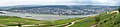
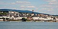
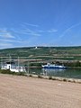
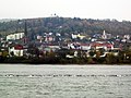
German town on the Rhine, home of the Mäuseturm    | |||||
| Fayl yuklash | |||||
| Bu konsepsiyaning alohida holati |
| ||||
|---|---|---|---|---|---|
| Location | Mainz-Bingen, Rheinland-Pfalz, Germaniya | ||||
| Located in or next to body of water | |||||
| Visitor center | |||||
| Mahalliy hokimiyat boshligʻi |
| ||||
| Aholisi |
| ||||
| Hudud |
| ||||
| Dengiz sathidan balandligi |
| ||||
| rasmiy vebsayti | |||||
 | |||||
Ostturkumlar
Quyida ushbu turkumga kiruvchi 35 ta ostturkumdan 35 tasi koʻrsatilgan.
B
- Binger Inschrift (1 F)
- Binger Schiffswerft (3 F)
D
- D-AIAR (aircraft) (16 F)
E
G
H
- Hafenpark Bingen am Rhein (19 F)
J
N
P
- Pegel Bingen (2 F)
R
S
- Stolpersteine in Bingen am Rhein (191 F)
V
- Viewpoint Burg Klopp Bingen (12 F)
- Viewpoint Saint Roch chapel (12 F)
- Views of Bingen am Rhein (35 F)
W
„Bingen am Rhein“ turkumidagi fayllar
Quyida ushbu turkumga kiruvchi 123 ta fayldan 123 tasi koʻrsatilgan.
-
 "Fliegen", sculpture in Bingen.jpg 4 000 × 3 000; 1,76 MB
-
 "St. Nikolaus I".jpg 3 648 × 2 736; 3,38 MB
-
 140 070-4 Bingen am Rhein.jpg 4 708 × 2 856; 8,65 MB
-
 20071009-DSC 0031.jpg 3 872 × 2 592; 4,64 MB
-
 201610 bingen rhein vom niederwald.jpg 4 000 × 3 000; 7,27 MB
-

-

-
 Altes Zollamt.jpg 4 000 × 3 000; 5,91 MB
-
 Auenlandschadt Bingerbrück 246-47-fLh.jpg 2 430 × 1 223; 859 KB
-
 Ausoniusweg Start.jpg 2 496 × 1 664; 1,62 MB
-
 BIN-DA205.jpg 5 312 × 2 988; 5,3 MB
-
 Bingen - 50Pf. 1918.jpg 1 011 × 1 446; 651 KB
-
 Bingen 2009-08-06 16.jpg 3 888 × 2 592; 1,13 MB
-
 Bingen 2018.JPG 8 192 × 1 856; 10,44 MB
-
 Bingen am Rhein - no-nb digifoto 20160211 00032 NB NS NM 00086b.jpg 2 872 × 2 890; 880 KB
-
 Bingen am Rhein - panoramio.jpg 4 600 × 2 304; 2,74 MB
-
 Bingen am Rhein - The Rhine Riverbank - geo.hlipp.de - 27381.jpg 640 × 425; 76 KB
-
 Bingen am Rhein - Zollamt Restaurant - geo.hlipp.de - 27383.jpg 640 × 425; 101 KB
-
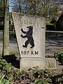 Bingen am Rhein Berlin-Meilenstein Hindenburganlage (Bild 1).jpg 3 672 × 4 896; 6,59 MB
-
 Bingen am Rhein Bildstock bei Mariahilfstraße 14 (Bild 2).jpg 3 672 × 4 896; 5,49 MB
-
 Bingen am Rhein Haustür an Amtsstraße 15 (Bild 1).jpg 3 672 × 4 896; 5,17 MB
-
 Bingen am Rhein in MZ.svg 349 × 241; 224 KB
-
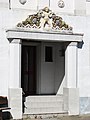 Bingen am Rhein Portalbekrönung Dr.-Sieglitz-Straße 17 (Bild 2).jpg 3 672 × 4 896; 4,95 MB
-
 Bingen am Rhein Villa Am Burggraben 3 (Bild 2).jpg 4 896 × 3 672; 10,52 MB
-
 Bingen am Rhein Wohnhaus Mariahilfstraße 1 (Bild 1).jpg 3 672 × 4 896; 6,12 MB
-
 Bingen am Rhein Wohnhäuser Schloßbergstraße 41-43 (Bild 1).jpg 4 896 × 3 672; 6,4 MB
-
 Bingen am Rhein, Nahemündung 20151007-SAM 0992.jpg 5 472 × 3 648; 18,53 MB
-
 Bingen am Rhein; Stadtplan a.jpg 4 585 × 2 900; 2,14 MB
-
 Bingen am Rhein; Uferpromenade a.jpg 3 456 × 2 400; 1,22 MB
-
 Bingen am Rhein; Uferpromenade b.jpg 3 369 × 5 100; 5,04 MB
-
 Bingen am Rhein; Uferpromenade c.jpg 5 184 × 3 456; 6,14 MB
-
 Bingen Burg Klopp - geo.hlipp.de - 21486.jpg 480 × 640; 78 KB
-
 Bingen Burg Klopp - panoramio.jpg 3 831 × 2 395; 3,73 MB
-
 Bingen Federle 1845.jpg 3 000 × 2 183; 5,4 MB
-
 Bingen Nahemündung 213-dh.jpg 1 612 × 1 197; 579 KB
-
 Bingen Rhein Ehrenfels 2016-03-26-17-51-00.jpg 4 896 × 3 264; 12,3 MB
-
 Bingen Rheinufer Büste Victor Hugo.jpg 3 000 × 4 000; 3,43 MB
-
 Bingen StMartin basilica Burg Klopp.jpg 1 600 × 1 200; 718 KB
-

-

-
 Bingen – die Burg Klopp ist Teil des UNESCO-Welterbes Oberes Mittelrheintal - panoramio.jpg 3 240 × 4 320; 3,54 MB
-
 Bingen – im Hintergrund Rheinhessen - panoramio.jpg 3 335 × 1 870; 2,44 MB
-
 Bingen – Speisenmarkt – Weinfestbrunnen 1680 - panoramio.jpg 3 240 × 4 320; 2,32 MB
-
 Bingen, park along the Rhine.jpg 4 000 × 3 000; 4,12 MB
-
 Bingen, the pharmacy "Adler Apotheke".JPG 1 701 × 2 551; 1 MB
-
 Bingen- Rathaus (Bingen Town Hall) - geo.hlipp.de - 21476.jpg 640 × 480; 72 KB
-
 Binger Bleistift.jpg 3 504 × 2 336; 2,98 MB
-
 Binger Loch 2011 1.JPG 3 932 × 2 760; 2,63 MB
-
 Binger Loch.JPG 1 536 × 1 024; 1,14 MB
-

-
 Brunnen am Speisemarkt, Bingen - geo.hlipp.de - 21483.jpg 478 × 640; 72 KB
-

-
 Cycle track along the Rhine west of Bingen - geo.hlipp.de - 21461.jpg 480 × 640; 124 KB
-
De-Bingen.ogg 1,7 soniya; 17 KB
-
 Denkmal am Binger Loch Nahaufnahme 2012 05 13 15 04 23.JPG 3 264 × 4 928; 8,52 MB
-
 Der Hafen im Bingen - geo.hlipp.de - 21424.jpg 640 × 480; 104 KB
-
 Die Nahe im Rhein.jpg 1 600 × 1 200; 287 KB
-
 Die Nahe in Bingen (The Nahe at Bingen) - geo.hlipp.de - 21480.jpg 640 × 480; 59 KB
-
 Don't do it!! - geo.hlipp.de - 21428.jpg 480 × 640; 73 KB
-
 E. Hoefer, Bingen, nach Emminger, Lithographie, D1390.jpg 1 050 × 704; 277 KB
-
 Ehrenfels1900.jpg 3 474 × 2 570; 3,74 MB
-
 Einwohnerentwicklung von Bingen am Rhein.svg 800 × 400; 50 KB
-
 Enlargement-Rheinburgenweg (section) - Wikivoyage-20140207.png 448 × 655; 36 KB
-
 ETH-BIB-Bingen und Bingerloch -Binger Loch--Dia 247-02473.tif 3 647 × 2 740; 28,68 MB
-
 Football ground near the Rhine at Kempten - geo.hlipp.de - 21423.jpg 640 × 480; 78 KB
-
 Fountain near the station at Bingen - geo.hlipp.de - 21482.jpg 640 × 480; 98 KB
-
 Geisenheim und Ingelheim - panoramio.jpg 4 000 × 2 056; 2,56 MB
-
 Graureiher flug.jpg 3 872 × 2 592; 6,16 MB
-
 Heilige Berta -1532 Holzschnitt v. Jacob Köbel.jpg 600 × 1 003; 501 KB
-
 Heiliger Rupert-1532 Holzschnitt v. Jacob Köbel.jpg 600 × 891; 415 KB
-
 Heilkräutergarten Hildegard-Forum Rochusberg Bingen (01).jpg 5 184 × 3 456; 5,26 MB
-
 Hildegard-1532 Holzschnitt v. Jacob Köbel.jpg 600 × 781; 306 KB
-
 Historienweg Rüdesheim Rhein small.jpg 2 951 × 590; 545 KB
-
 HPM 211 – Bingen, nach Emminger.jpg 2 397 × 2 161; 591 KB
-
 Jay Gard, Touristic Hint, Nah und Fern, Skulpturen-Triennale Bingen, 2017.jpg 1 024 × 724; 674 KB
-

-
 Ke wapp.jpg 153 × 155; 7 KB
-
-
 La Nahe gelée à Bingen (Rhénanie-Palatinat) (6880647325).jpg 617 × 468; 59 KB
-
 Loading a fire service launch near Bingen - geo.hlipp.de - 21422.jpg 640 × 480; 96 KB
-
 Logo Stadt Bingen am Rhein.svg 782 × 67; 10 KB
-

-
 Mine-shaft entrance, - geo.hlipp.de - 21475.jpg 640 × 480; 121 KB
-
 MittelrheinNahe.jpg 640 × 480; 97 KB
-
 Mixed appetizers, Bingen.jpg 4 000 × 3 000; 3,2 MB
-
 Mouth of the Nahe, from Rüdesheim.jpg 3 192 × 2 394; 1,32 MB
-
 Mäuseturm bei Bingen.jpg 3 648 × 2 736; 3,57 MB
-
 Mäuseturm im Rhein bei Bingen.jpg 3 648 × 2 736; 3,25 MB
-
 Nahe. (50365888223).jpg 3 501 × 5 252; 9,45 MB
-
 Panorama de Bingen.jpg 4 146 × 919; 1,23 MB
-
 Panorama-bingen-am-rhein-d24c4006-8ab1-49f3-9853-84e26db9f366.jpg 3 000 × 468; 310 KB
-
 Path alongside the haven at Bingen - geo.hlipp.de - 21426.jpg 480 × 640; 117 KB
-
 Plan der Stadt Bingen.jpg 5 527 × 3 686; 4,99 MB
-
 Rainbow Bingen.jpg 1 600 × 1 151; 435 KB
-
 Rhein in Flammen, boats and Bingen.jpg 3 781 × 2 836; 1,22 MB
-

-
 Rheingau-Taunus-Kreis - Bingen Scenery - geo.hlipp.de - 27277.jpg 640 × 425; 88 KB
-
 Rheingau-Taunus-Kreis - Klopp Castle - geo.hlipp.de - 27371.jpg 640 × 425; 85 KB
-
 Rose flowers, Bingen.jpg 3 219 × 2 414; 1,61 MB
-
 Rüdesheim am Rhein - panoramio.jpg 2 000 × 612; 108 KB
-
 Rüdesheim Historienweg 582-84kh.jpg 3 691 × 1 093; 1,09 MB
-
 Rüdesheim und Geisenheim im Rheingau - panoramio.jpg 3 633 × 1 996; 2,37 MB
-
 Schiff Bingen.jpg 3 836 × 2 581; 3,48 MB
-
 Storchennest (Bingen am Rhein).jpg 600 × 2 015; 830 KB
-
 Streitäxte der Becherkultur - RLM Bonn.jpg 5 104 × 3 745; 7,08 MB
-
 SunriseBingenJune2010.jpg 3 492 × 2 256; 2,64 MB
-
 SunriseBingenJune2010Wallpaper.jpg 1 920 × 1 200; 902 KB
-
 Tombleson Bingen.jpg 2 136 × 1 643; 1,44 MB
-
 Trans regio in Bingen 001.jpg 2 560 × 1 920; 3,46 MB
-
 Tz1166 Taufe.jpg 568 × 426; 55 KB
-

-
 View from the ferry port, Bingen - geo.hlipp.de - 21427.jpg 480 × 640; 64 KB
-
 View to Bingen Castle - geo.hlipp.de - 21479.jpg 640 × 480; 76 KB
-

-

-
 Wahrschauer Anton Berges.jpg 2 932 × 1 731; 491 KB
-
 Wappen SSV Bingen.jpg 164 × 243; 14 KB
-
 Wappen von Bingen.png 372 × 520; 303 KB
-
 Weinbergsterrassen.jpg 1 536 × 1 024; 1,13 MB
-
 ライン川 - panoramio (2).jpg 3 264 × 2 448; 1,94 MB
-
 ライン川とクロップ城 - panoramio.jpg 3 264 × 1 711; 1,45 MB
-
 宾根1 - panoramio.jpg 2 048 × 1 150; 513 KB
-
 涂鸦 - panoramio.jpg 2 048 × 1 150; 814 KB


_-_geo.hlipp.de_-_21415.jpg)
_-_geo.hlipp.de_-_21429.jpg)


.jpg)
.jpg)
.jpg)
.jpg)
.jpg)
.jpg)
.jpg)


.jpg)
.jpg)


_-_geo.hlipp.de_-_21476.jpg)


_-_geo.hlipp.de_-_21487.jpg)


_-_geo.hlipp.de_-_21480.jpg)


_-_Wikivoyage-20140207.png)


.jpg)


_(6880647325).jpg)

_-_geo.hlipp.de_-_21452.jpg)


.jpg)


_(6874506353).jpg)


.jpg)
_(6880647345).jpg)


.jpg)


.jpg)