Category:Bintree
Aller à la navigation
Aller à la recherche
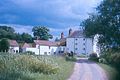
English: Bintree is a village and civil parish in the Breckland district of Norfolk, England, about nine miles south-east of Fakenham. According to the 2001 census it had a population of 300.
localité britannique du comté anglais de Norfolk  | |||||
| Téléverser des médias | |||||
| Nature de l’élément | |||||
|---|---|---|---|---|---|
| Lieu | Breckland, Norfolk, Angleterre de l'Est, Angleterre | ||||
| Superficie |
| ||||
 | |||||
Sous-catégories
Cette catégorie comprend 3 sous-catégories, dont les 3 ci-dessous.
B
- Bintree War Memorial (2 F)
- Bintree Watermill (7 F)
S
Média dans la catégorie « Bintree »
Cette catégorie comprend 119 fichiers, dont les 119 ci-dessous.
-
 A crop of oats - geograph.org.uk - 896255.jpg 480 × 640 ; 188 kio
-
 A lone willow tree - geograph.org.uk - 894028.jpg 480 × 640 ; 184 kio
-
 A meander of the River Wensum - geograph.org.uk - 894026.jpg 640 × 480 ; 188 kio
-
 A meandering access road - geograph.org.uk - 893259.jpg 480 × 640 ; 137 kio
-
 A very bent street sign - geograph.org.uk - 893280.jpg 480 × 640 ; 154 kio
-
 A winding river - geograph.org.uk - 894014.jpg 640 × 480 ; 176 kio
-
 A yellow skip - geograph.org.uk - 893173.jpg 480 × 640 ; 169 kio
-
 A1067 Hagg Lane junction and water tower - geograph.org.uk - 3843533.jpg 1 600 × 1 110 ; 403 kio
-
 A1067 south of Bintree - geograph.org.uk - 3841448.jpg 800 × 530 ; 61 kio
-
 A1067 towards Twyford - geograph.org.uk - 3842334.jpg 1 024 × 699 ; 178 kio
-
 Access track to Ash Farm and Organic Shop - geograph.org.uk - 893668.jpg 480 × 640 ; 188 kio
-
 Barn Owl Hunting - geograph.org.uk - 1892957.jpg 800 × 531 ; 149 kio
-
 Bicolour hedge - geograph.org.uk - 893251.jpg 640 × 480 ; 192 kio
-
 Billingford Road, Bintree - geograph.org.uk - 2685164.jpg 1 280 × 856 ; 116 kio
-
 Bintree Mill - geograph.org.uk - 6092164.jpg 6 366 × 4 244 ; 6,51 Mio
-
 Bintree Mill - geograph.org.uk - 6092168.jpg 6 108 × 4 071 ; 7,43 Mio
-
 Bintree Mill near Bintree - geograph.org.uk - 5300400.jpg 523 × 640 ; 188 kio
-
 Bintree Watermill - geograph.org.uk - 1893374.jpg 800 × 531 ; 141 kio
-
 Bintree ^ Twyford Village Hall, boarded up - geograph.org.uk - 4956060.jpg 1 600 × 1 200 ; 718 kio
-
 Bintry (or Bintree) Mill, Norfolk - geograph.org.uk - 46615.jpg 562 × 377 ; 77 kio
-
 Bintry Mill on the River Wensum - geograph.org.uk - 3625007.jpg 640 × 432 ; 62 kio
-
 Bridge over the River Wensum - geograph.org.uk - 894114.jpg 480 × 640 ; 194 kio
-
 Bringing in the first load - geograph.org.uk - 896300.jpg 480 × 640 ; 199 kio
-
 Building site by Foulsham Road - geograph.org.uk - 4956063.jpg 1 600 × 1 200 ; 924 kio
-
 Church Lane meets Church Road - geograph.org.uk - 893321.jpg 640 × 442 ; 90 kio
-
 Cottages by the River Wensum - geograph.org.uk - 894109.jpg 640 × 480 ; 161 kio
-
 Country road near Bintree - geograph.org.uk - 5300733.jpg 513 × 640 ; 238 kio
-
 Farm track leading north - geograph.org.uk - 893686.jpg 480 × 640 ; 158 kio
-
 Field by Foulsham Road - geograph.org.uk - 4956065.jpg 1 600 × 1 200 ; 683 kio
-
 Floodplain by the River Wensum - geograph.org.uk - 893977.jpg 640 × 480 ; 146 kio
-
 Following the road - geograph.org.uk - 893986.jpg 480 × 640 ; 196 kio
-
 Footpath by access track to Ash Farm - geograph.org.uk - 893670.jpg 480 × 640 ; 181 kio
-
 Foulsham Road - geograph.org.uk - 4956067.jpg 1 600 × 1 200 ; 595 kio
-
 Good reception - Flickr - Jon Bunting.jpg 4 154 × 2 802 ; 8,46 Mio
-
 Harvesting the barley - geograph.org.uk - 896283.jpg 480 × 640 ; 185 kio
-
 Hogweed and Great Willowherb - geograph.org.uk - 894018.jpg 480 × 640 ; 202 kio
-
 House beside Stone Lane - geograph.org.uk - 893693.jpg 480 × 640 ; 171 kio
-
 House in Bintree - geograph.org.uk - 4955695.jpg 1 600 × 1 200 ; 528 kio
-
 Houses and gardens - geograph.org.uk - 893287.jpg 640 × 480 ; 149 kio
-
 Houses and surrounding brick walls - geograph.org.uk - 893242.jpg 480 × 640 ; 198 kio
-
 Houses on Church Lane - geograph.org.uk - 893560.jpg 640 × 480 ; 125 kio
-
 In a large lay-by on the A1067 - geograph.org.uk - 5934976.jpg 3 456 × 2 592 ; 3,83 Mio
-
 Interesting gables above hedgerow - geograph.org.uk - 893691.jpg 640 × 480 ; 197 kio
-
 Landscaped verge - geograph.org.uk - 894137.jpg 640 × 480 ; 181 kio
-
 Meandering leisurely - geograph.org.uk - 893972.jpg 480 × 640 ; 171 kio
-
 Mill Road near Bintree - geograph.org.uk - 5300719.jpg 480 × 640 ; 260 kio
-
 Multiple Warnings - geograph.org.uk - 893958.jpg 632 × 447 ; 130 kio
-
 New Houses on The Street - geograph.org.uk - 893223.jpg 640 × 462 ; 134 kio
-
 New jetty by the River Wensum - geograph.org.uk - 894069.jpg 480 × 640 ; 174 kio
-
 Oak House - geograph.org.uk - 893218.jpg 640 × 468 ; 146 kio
-
 Old Ash Farmhouse - geograph.org.uk - 893682.jpg 640 × 480 ; 137 kio
-
 Old Ash Farmhouse - geograph.org.uk - 893683.jpg 640 × 480 ; 139 kio
-
 Primitive Methodist Chapel - geograph.org.uk - 893633.jpg 480 × 640 ; 192 kio
-
 Primitive Methodist Chapel - geograph.org.uk - 893634.jpg 480 × 640 ; 181 kio
-
 Private - Legal action may be taken - geograph.org.uk - 893559.jpg 480 × 640 ; 187 kio
-
 Recycling containers - geograph.org.uk - 893295.jpg 640 × 480 ; 151 kio
-
 Red telephone box - geograph.org.uk - 893232.jpg 480 × 640 ; 138 kio
-
 Ripening wheat - geograph.org.uk - 893662.jpg 640 × 480 ; 162 kio
-
 River Wensum - geograph.org.uk - 1176862.jpg 640 × 480 ; 82 kio
-
 River Wensum - geograph.org.uk - 1176863.jpg 640 × 480 ; 49 kio
-
 River Wensum - geograph.org.uk - 1176864.jpg 640 × 480 ; 65 kio
-

-
 River, Bintree Mill - geograph.org.uk - 1176861.jpg 640 × 480 ; 80 kio
-
 Small stream or drain - geograph.org.uk - 893998.jpg 480 × 640 ; 195 kio
-
 Stile into a sheep pasture - geograph.org.uk - 894001.jpg 480 × 640 ; 189 kio
-
 Still water on the hard standing - geograph.org.uk - 4955692.jpg 1 600 × 1 200 ; 355 kio
-
 Stone Lane near Bintree - geograph.org.uk - 5300737.jpg 640 × 480 ; 218 kio
-
 Stone Lane past Ash Barn - geograph.org.uk - 893681.jpg 640 × 453 ; 135 kio
-
 Stone Lane past Old Ash Farm - geograph.org.uk - 893666.jpg 640 × 480 ; 158 kio
-
 Stream traversing meadow - geograph.org.uk - 893993.jpg 480 × 640 ; 192 kio
-
 Tall poplars - geograph.org.uk - 893968.jpg 480 × 640 ; 179 kio
-
 Terraced cottages on The Street - geograph.org.uk - 893237.jpg 640 × 480 ; 141 kio
-
 The Bintree and Twyford village hall - geograph.org.uk - 893158.jpg 640 × 480 ; 122 kio
-
 The Bintree Mill Bypass Sluice - geograph.org.uk - 893951.jpg 640 × 480 ; 183 kio
-
 The harvest has begun - geograph.org.uk - 896294.jpg 480 × 640 ; 185 kio
-
 The Old Forge - geograph.org.uk - 893267.jpg 640 × 480 ; 126 kio
-
 The Post Office - geograph.org.uk - 893194.jpg 640 × 480 ; 132 kio
-
 The River Wensum - geograph.org.uk - 893963.jpg 480 × 640 ; 187 kio
-
 The Royal Oak - geograph.org.uk - 893226.jpg 640 × 480 ; 158 kio
-
 The Royal Oak - geograph.org.uk - 893228.jpg 640 × 480 ; 160 kio
-
 The start of a footpath but where is it^ - geograph.org.uk - 893677.jpg 480 × 640 ; 185 kio
-
 The water tower by Bintree - geograph.org.uk - 896252.jpg 480 × 640 ; 201 kio
-
 The way to Bintree church - geograph.org.uk - 893695.jpg 480 × 640 ; 200 kio
-
 Tractor marks in oats crop - geograph.org.uk - 896269.jpg 480 × 640 ; 184 kio
-
 Unsurfaced road to Pine Wood - geograph.org.uk - 574599.jpg 640 × 480 ; 43 kio
-
 View across the flood plain of the River Wensum - geograph.org.uk - 894007.jpg 640 × 480 ; 138 kio
-
 View across the River Wensum - geograph.org.uk - 894072.jpg 640 × 480 ; 178 kio
-
 View along the A1067 (Fakenham Road) - geograph.org.uk - 893164.jpg 480 × 640 ; 135 kio
-
 View along The Street - geograph.org.uk - 893187.jpg 640 × 456 ; 126 kio
-
 View downstream - geograph.org.uk - 894118.jpg 480 × 640 ; 160 kio
-
 View downstream the River Wensum - geograph.org.uk - 894022.jpg 480 × 640 ; 206 kio
-
 View east across ploughed field - geograph.org.uk - 574688.jpg 640 × 480 ; 95 kio
-
 View east along Mill Road - geograph.org.uk - 894080.jpg 480 × 640 ; 154 kio
-
 View north along The Street - geograph.org.uk - 893271.jpg 631 × 480 ; 121 kio
-
 View northwest along Mill Road - geograph.org.uk - 893982.jpg 480 × 640 ; 168 kio
-
 View northwest along the A1067 (Fakenham Road) - geograph.org.uk - 896278.jpg 640 × 457 ; 128 kio
-
 View of the water tower from Foxley Road - geograph.org.uk - 896254.jpg 480 × 640 ; 165 kio
-
 View towards Bintree Mill - geograph.org.uk - 893975.jpg 480 × 640 ; 193 kio
-
 View west from start of private road - geograph.org.uk - 574676.jpg 480 × 640 ; 78 kio
-
 Village Sign - geograph.org.uk - 1244174.jpg 480 × 640 ; 75 kio
-
 Village sign - geograph.org.uk - 893182.jpg 480 × 640 ; 204 kio
-
 Water Tower - geograph.org.uk - 1244177.jpg 480 × 640 ; 59 kio
-
 Water tower near Foulsham - geograph.org.uk - 5300703.jpg 496 × 640 ; 126 kio
-

-
 Where Church Road changes name - geograph.org.uk - 893310.jpg 640 × 432 ; 142 kio
-
 Wild flowers growing by the roadside - geograph.org.uk - 893990.jpg 480 × 640 ; 219 kio
-
 Wooden bus shelter - geograph.org.uk - 893301.jpg 480 × 640 ; 104 kio
-
 Yellow Iris - geograph.org.uk - 1893366.jpg 531 × 800 ; 193 kio
-
 A closer view - geograph.org.uk - 893649.jpg 480 × 640 ; 193 kio
-
 Barred track near Bintree - geograph.org.uk - 557769.jpg 640 × 480 ; 122 kio
-
 Cul-de-Sac to Field Barn Buildings - geograph.org.uk - 574670.jpg 640 × 480 ; 68 kio
-
 Farm implement parked on track - geograph.org.uk - 574685.jpg 640 × 480 ; 97 kio
-
 Junction of Stone Lane with Mill Road - geograph.org.uk - 574681.jpg 640 × 480 ; 70 kio
-
 Lay-by off the A1067 Fakenham Road - geograph.org.uk - 528041.jpg 640 × 480 ; 92 kio
-
 Looking down towards Westfield Farm - geograph.org.uk - 557778.jpg 480 × 640 ; 106 kio
-
 Looking north on Bintree Road - geograph.org.uk - 574597.jpg 480 × 640 ; 103 kio
-
 Paddock in the hollow on Hagg Lane, Bintree - geograph.org.uk - 528008.jpg 640 × 480 ; 172 kio
-
 Track through Bintree Woods. - geograph.org.uk - 396532.jpg 600 × 547 ; 97 kio
-
 Trees and Reflection in River - geograph.org.uk - 70008.jpg 640 × 480 ; 193 kio


_Mill,_Norfolk_-_geograph.org.uk_-_46615.jpg)


_-_geograph.org.uk_-_893164.jpg)


_-_geograph.org.uk_-_896278.jpg)


