Category:Bird's eye view maps
Zur Navigation springen
Zur Suche springen
Deutsch: Kartenwerke in Vogelschauansicht / Bildkarten
English: Bird's eye view maps
Plan einer Örtlichkeit in der Vogelperspektive | |||||
| Medium hochladen | |||||
| Unterklasse von |
| ||||
|---|---|---|---|---|---|
| Zentrales Thema |
| ||||
| Verwendung |
| ||||
| Datum der Gründung, Erstellung, Entstehung, Erbauung |
| ||||
| |||||
Unterkategorien
Es werden 15 von insgesamt 15 Unterkategorien in dieser Kategorie angezeigt:
In Klammern die Anzahl der enthaltenen Kategorien (K), Seiten (S), Dateien (D)
Medien in der Kategorie „Bird's eye view maps“
Folgende 54 Dateien sind in dieser Kategorie, von 54 insgesamt.
-
 10 of 'A visit to the Camp before Sebastopol' (11045865226).jpg 2.624 × 2.010; 1,13 MB
-
 1855 bird's eye view of Heligoland by the British War Department.jpg 6.750 × 6.078; 5,57 MB
-

-
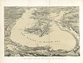
 1878 Sketch Map From the Dardanelles To the Bosphorus.jpg 4.114 × 3.094; 2,09 MB
-
 1882 Maclure and Macdonald Bird's-Eye View Map of Cairo.jpg 4.000 × 2.835; 4,01 MB
-
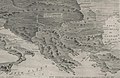
 1915 bird's eye view map - Carte panoramique en relief des Balkans.jpg 7.024 × 4.784; 4,97 MB
-
 1915 bird's eye view map - Carte panoramique à vol d'oiseau du front russe.jpg 10.712 × 2.560; 3,96 MB
-
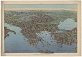
 1915 bird's eye view map - La Grèce et les Balkans.jpg 6.752 × 5.376; 5,23 MB
-
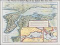
 1915 bird's eye view map of the Middle Eastern theatre of World War I.jpg 6.440 × 5.240; 5,28 MB
-
 1916 bird's eye view map - Dall'Adriatico al Mar Nero.jpg 11.886 × 8.284; 13,98 MB
-
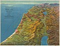 1931 Bird's Eye View Map of Palestine.jpg 5.000 × 3.878; 4,63 MB
-
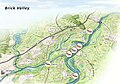 201026 definitieve versie brick valley met titel.jpg 5.803 × 4.064; 1,27 MB
-

-
 Wien aus der Vogelschau - btv1b53025172q.jpg 13.889 × 8.046; 17,86 MB
-
-
 Bacon's picture-map of the war area (5008058).jpg 5.000 × 4.142; 2,42 MB
-
 Bacon's picture-map of the Western war area (5008053).jpg 3.564 × 5.000; 2,37 MB
-
 Weltchronik 1493 (3) כרוניקה של העולם מאת שדל.jpg 3.264 × 2.448; 2,49 MB
-
 Folio 141v - A Plan of Rome.jpg 1.684 × 1.774; 404 KB
-
 FuchuTokyoJapan006.jpg 1.600 × 1.200; 200 KB
-

-

-
 Historische Karte von Zutphen - Niederlande.jpg 2.458 × 1.920; 1,14 MB
-
 Ichikawa Bridge+Ichikawa Kwan.jpg 3.079 × 2.175; 7,63 MB
-
 Ichikawa Mama 1928.jpg 718 × 657; 361 KB
-
 Ichikawa station+Sanbon-matsu.jpg 2.989 × 2.001; 7,89 MB
-
 Ichikawa-Bridge Ichikawa-Kwan.jpg 1.327 × 925; 736 KB
-
 Japan- Nagasaki en Deshima (3382030036).jpg 2.000 × 1.456; 744 KB
-
 Joetsu Line full open commemoration Exhibition.jpg 3.255 × 2.345; 6,09 MB
-
 Kaart van Europa in vogelvucht A bird's eye view (titel op object), RP-P-1954-549.jpg 7.918 × 5.236; 5,69 MB
-
 Kasteel Persijn in vogelvlucht, circa 1700.png 6.670 × 4.185; 30,23 MB
-
 Miyako-Meisho-Zue-Kontaiji.jpg 1.928 × 1.277; 403 KB
-
 Okayamashigaichokanzu.JPG 1.024 × 209; 69 KB
-
 Panorama Van Het Tooneel Des Oorlogs In Het Noorden Van Europa.jpg 16.162 × 11.757; 59,51 MB
-
 Panorama Van Het Tooneel Des Oorlogs In Het Oosten Van Europa.jpg 16.475 × 11.914; 58,2 MB
-
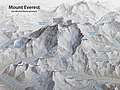 Panoramakarte Mount Everest.jpg 5.000 × 3.750; 6,39 MB
-

-
 Philips' photo-relief model war map of Central Europe (5008462).jpg 5.000 × 2.802; 2,21 MB
-
 Religieuze plekken en objecten uit Siam, RP-P-1911-3260.jpg 3.546 × 5.526; 4,48 MB
-
 Sansho-kwan.jpg 757 × 701; 419 KB
-
 The "Farmer & Settler" map of Gallipoli War area - 1915.tif 11.792 × 8.829; 297,89 MB
-
 The Balkans - The Graphic war map (5003846) (cropped).jpg 2.421 × 1.583; 943 KB
-
 The Graphic war map (5003846).jpg 5.000 × 3.714; 3,09 MB
-
 The Strand coloured detail map of the Balkan states (5003785).jpg 4.101 × 5.000; 3,8 MB
-
 The Strand coloured detail map of the Dardanelles, Constantinople (5003782).jpg 5.000 × 4.185; 2,74 MB
-
 Vogelschauplan Basel 1847 Johann Friedrich Mähly HMB 1901-108 C110.jpg 3.606 × 2.742; 13,07 MB
-
 Voyage pittoresque en Asie et en Afrique (11874669205).jpg 2.011 × 1.264; 544 KB
-
 Yoshida Hatsusaburō's work of Alisan (cropped).jpg 588 × 785; 469 KB
-
 Yoshida Hatsusaburō's work of Alisan and southern Takao County.jpg 1.200 × 786; 709 KB
-
-
 但馬名勝鳥瞰絵図下書き3.jpg 3.496 × 2.116; 6,58 MB
-
 但馬名勝鳥瞰絵図下書き2.jpg 3.496 × 2.128; 5,78 MB
-
 新工場鳥瞰図.png 2.078 × 1.281; 4,3 MB
-
 黒羽城鳥瞰図.jpg 2.271 × 4.665; 5,26 MB
.jpg)


.jpg)
.jpg)
.jpg)
_%D7%9B%D7%A8%D7%95%D7%A0%D7%99%D7%A7%D7%94_%D7%A9%D7%9C_%D7%94%D7%A2%D7%95%D7%9C%D7%9D_%D7%9E%D7%90%D7%AA_%D7%A9%D7%93%D7%9C.jpg)


_%E2%80%94_Barbari,_Jacopo_de%27_%E2%80%94_Vogelschaukarte_von_Venedig_%E2%80%94_1500_%E2%80%94_Mattes_2022-02-05.jpg)
_(14760902586).jpg)


,_RP-P-1954-549.jpg)


.jpg)


_(cropped).jpg)
.jpg)
.jpg)
.jpg)

.jpg)
.jpg)


.jpg)