Category:Blackawton
Aller à la navigation
Aller à la recherche
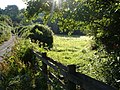
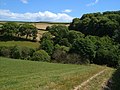
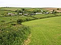
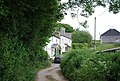
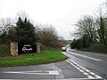
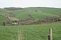
English: Blackawton is a village and civil parish in the South Hams district of Devon, England. According to the 2001 census it had a population of 647. The village is about six miles west of Dartmouth.
village britannique  | |||||
| Téléverser des médias | |||||
| Nature de l’élément | |||||
|---|---|---|---|---|---|
| Lieu | South Hams, Devon, Angleterre du Sud-Ouest, Angleterre | ||||
| Réputé identique à | Blackawton (page en doublon, paroisse civile) | ||||
 | |||||
Sous-catégories
Cette catégorie comprend 3 sous-catégories, dont les 3 ci-dessous.
Média dans la catégorie « Blackawton »
Cette catégorie comprend 503 fichiers, dont les 200 ci-dessous.
(page précédente) (page suivante)-
 A brook past Collaford Wood - geograph.org.uk - 5688624.jpg 480 × 640 ; 170 kio
-
 A fold of the hillside - geograph.org.uk - 2343789.jpg 1 280 × 960 ; 316 kio
-
 A glimpse of Wadstray House - geograph.org.uk - 2670100.jpg 640 × 480 ; 174 kio
-
 A narrow Devon lane - geograph.org.uk - 3031266.jpg 640 × 430 ; 95 kio
-
 A small valley - geograph.org.uk - 3100603.jpg 640 × 430 ; 55 kio
-

-
 A view to Quarryhead Wood - geograph.org.uk - 2642793.jpg 640 × 384 ; 69 kio
-
 A3122 at Dreyton Cross - geograph.org.uk - 3314893.jpg 640 × 408 ; 60 kio
-
 A3122 at Woodlands Park - geograph.org.uk - 3314869.jpg 640 × 480 ; 79 kio
-
 Abbotsleigh Farm - geograph.org.uk - 3028813.jpg 640 × 430 ; 78 kio
-
 Abbotsleigh Farmhouse - geograph.org.uk - 3028817.jpg 640 × 430 ; 79 kio
-
 Across the Gara valley from Blackawton Footpath 7 - geograph.org.uk - 210602.jpg 640 × 480 ; 129 kio
-
 Alleyway in Blackawton - geograph.org.uk - 3039689.jpg 640 × 430 ; 97 kio
-
 Approaching Millcombe - geograph.org.uk - 3031281.jpg 640 × 430 ; 107 kio
-
 Approaching Seven Gates on a misty October evening - geograph.org.uk - 4002172.jpg 3 140 × 2 415 ; 1,07 Mio
-
 Approaching Wood Farm - geograph.org.uk - 210835.jpg 640 × 480 ; 151 kio
-
 Arable field, Wallaton Cross - geograph.org.uk - 6025999.jpg 4 271 × 2 211 ; 973 kio
-
 Back Lane - geograph.org.uk - 3036644.jpg 640 × 430 ; 69 kio
-
 Barn at Higher Cotterbury - geograph.org.uk - 2643363.jpg 640 × 427 ; 84 kio
-
 Barn near Woodford - geograph.org.uk - 3036587.jpg 640 × 430 ; 51 kio
-
 Barn, Broadley Farm - geograph.org.uk - 3094632.jpg 640 × 430 ; 65 kio
-
 Barn, Woodford - geograph.org.uk - 3034582.jpg 640 × 430 ; 74 kio
-
 Bend in the lane at Collaford Bridge - geograph.org.uk - 5688611.jpg 640 × 800 ; 813 kio
-
 Blackawton - geograph.org.uk - 3039762.jpg 640 × 430 ; 66 kio
-
 Blackawton Community Shop, Millcombe Corner - geograph.org.uk - 4210535.jpg 640 × 427 ; 82 kio
-
 Blackawton Primary School - geograph.org.uk - 208648.jpg 480 × 640 ; 92 kio
-
 Blackawton Village Hall, Vicarage Road - geograph.org.uk - 4210519.jpg 640 × 427 ; 56 kio
-
 Blackawton Village stores and Post Office - geograph.org.uk - 5667693.jpg 1 280 × 960 ; 318 kio
-
-
 Blackawton, 'Main Street' - geograph.org.uk - 2365555.jpg 640 × 427 ; 292 kio
-
 Blackawton, at 'Cousins' - geograph.org.uk - 2365575.jpg 640 × 427 ; 250 kio
-
 Blackawton, Blackawton General Stores - geograph.org.uk - 2365565.jpg 640 × 427 ; 174 kio
-
 Blackawton, by the churchyard - geograph.org.uk - 2365571.jpg 640 × 427 ; 207 kio
-
 Blackawton, Chapel Street - geograph.org.uk - 2365641.jpg 640 × 427 ; 169 kio
-
 Blackawton, churchyard path - geograph.org.uk - 2365590.jpg 640 × 427 ; 273 kio
-
 Blackawton, Lane to Forces Tavern - geograph.org.uk - 2365520.jpg 640 × 427 ; 222 kio
-
 Blackawton, lane to Strete - geograph.org.uk - 2365648.jpg 640 × 427 ; 174 kio
-
 Blackawton, Main Street - geograph.org.uk - 2365540.jpg 640 × 427 ; 170 kio
-
 Blackawton, Main Street detail - geograph.org.uk - 2365624.jpg 640 × 427 ; 256 kio
-
 Blackawton, near Millcombe - geograph.org.uk - 112880.jpg 640 × 430 ; 150 kio
-
 Blackawton, nearing Collaford Wood - geograph.org.uk - 2365657.jpg 640 × 427 ; 231 kio
-
 Blackawton, Normandy Arms - geograph.org.uk - 2365632.jpg 640 × 425 ; 145 kio
-
 Blackawton, Redhill Barn - geograph.org.uk - 2365662.jpg 640 × 427 ; 161 kio
-
 Blackawton, towards Cotterbury Green - geograph.org.uk - 2365728.jpg 640 × 427 ; 214 kio
-
 Blackawton, towards Langstone - geograph.org.uk - 2365525.jpg 640 × 427 ; 204 kio
-
 Blackawton, towards West Hartley - geograph.org.uk - 2365533.jpg 640 × 427 ; 151 kio
-
 Blackawton, track to Lower Wadstray - geograph.org.uk - 2365719.jpg 640 × 427 ; 237 kio
-
 Blackawton, Vicarage Road - geograph.org.uk - 2365560.jpg 640 × 427 ; 165 kio
-
 Blackawton, Village from churchyard - geograph.org.uk - 2365600.jpg 640 × 427 ; 212 kio
-
 Blackawton, yard in Chapel Street - geograph.org.uk - 2365652.jpg 640 × 427 ; 216 kio
-
 Bluebells in Coleshill Copse - geograph.org.uk - 1323279.jpg 640 × 480 ; 160 kio
-
 Bow Cross - geograph.org.uk - 3028827.jpg 640 × 430 ; 71 kio
-
 Bowden - geograph.org.uk - 210693.jpg 640 × 480 ; 108 kio
-
 Bridge across The Gara - geograph.org.uk - 1323719.jpg 480 × 640 ; 141 kio
-
 Bridge over The Gara - geograph.org.uk - 5434588.jpg 3 072 × 2 048 ; 1,23 Mio
-
 Bridleway approaching Coleshill Copse - geograph.org.uk - 3094648.jpg 640 × 430 ; 116 kio
-
 Bridleway in the Gara Valley - geograph.org.uk - 3036616.jpg 640 × 430 ; 86 kio
-
 Bridleway junction - geograph.org.uk - 3097322.jpg 640 × 430 ; 57 kio
-
 Bridleway junction - geograph.org.uk - 3097341.jpg 640 × 430 ; 95 kio
-
 Bridleway junction, Coleshill Copse - geograph.org.uk - 3094656.jpg 640 × 430 ; 126 kio
-
 Bridleway near Pruston Barton - geograph.org.uk - 1323358.jpg 480 × 640 ; 134 kio
-
 Bridleway near Waterslade - geograph.org.uk - 3041955.jpg 640 × 430 ; 82 kio
-
 Bridleway to Eastdown - geograph.org.uk - 3097333.jpg 640 × 430 ; 104 kio
-
 Bridleway to Pruston Barton - geograph.org.uk - 3041957.jpg 640 × 430 ; 79 kio
-
 Bridleway, Coleshill Copse - geograph.org.uk - 3094657.jpg 640 × 430 ; 139 kio
-
 Bridleway, Coleshill Copse - geograph.org.uk - 3097307.jpg 640 × 430 ; 131 kio
-
 Broadley Farm - geograph.org.uk - 3094630.jpg 640 × 430 ; 66 kio
-
 Bus stop, Blackawton - geograph.org.uk - 3039732.jpg 640 × 430 ; 75 kio
-
 By Woodford Bridge - geograph.org.uk - 210595.jpg 640 × 480 ; 155 kio
-
 Byway to Burlestone - geograph.org.uk - 3100632.jpg 640 × 430 ; 70 kio
-
 Byway to Burlestone - geograph.org.uk - 3104355.jpg 640 × 430 ; 95 kio
-
 Car park exit at Garden Time garden centre - geograph.org.uk - 5316310.jpg 640 × 480 ; 165 kio
-
 Cattle grazing , Gara Valley - geograph.org.uk - 3034576.jpg 640 × 430 ; 68 kio
-
 Cattle near Eastdown - geograph.org.uk - 3097343.jpg 640 × 430 ; 80 kio
-
 Cattle, Abbotsleigh - geograph.org.uk - 6024732.jpg 4 288 × 2 848 ; 2,77 Mio
-
 Cattle, Eastdown Farm - geograph.org.uk - 3100596.jpg 640 × 430 ; 73 kio
-
 Chapel Street meets Main Street, Blackawton - geograph.org.uk - 5583270.jpg 640 × 400 ; 304 kio
-
 Church gate and piers - geograph.org.uk - 3036658.jpg 640 × 430 ; 83 kio
-
 Church of St Michael - geograph.org.uk - 3036681.jpg 640 × 430 ; 70 kio
-
 Church Quillet - geograph.org.uk - 3036646.jpg 640 × 430 ; 66 kio
-
 Churchyard steps, Blackawton (geograph 7273305).jpg 2 828 × 4 051 ; 1,69 Mio
-
 Cliston - geograph.org.uk - 4210820.jpg 640 × 427 ; 78 kio
-
 Cliston Cross - geograph.org.uk - 5988581.jpg 4 288 × 2 848 ; 2,19 Mio
-
 Coleshill Copse - geograph.org.uk - 207513.jpg 640 × 480 ; 103 kio
-
 Coleshill Copse - geograph.org.uk - 3094654.jpg 640 × 430 ; 121 kio
-
 Coleshill Copse - geograph.org.uk - 3097306.jpg 640 × 430 ; 122 kio
-
 Coleshill Copse - geograph.org.uk - 3097309.jpg 640 × 430 ; 140 kio
-
 Collaford Wood, east of Blackawton - geograph.org.uk - 5614935.jpg 640 × 400 ; 66 kio
-
 Combe Farm - geograph.org.uk - 3100622.jpg 640 × 430 ; 52 kio
-
 Conversions, Lower Abbotsleigh - geograph.org.uk - 2344670.jpg 1 280 × 960 ; 347 kio
-
 Converted barn, Woodford - geograph.org.uk - 3034585.jpg 640 × 430 ; 70 kio
-
 Converted Chapel - geograph.org.uk - 3041916.jpg 640 × 430 ; 84 kio
-
 Copse near Lower Wadstray - geograph.org.uk - 2643331.jpg 640 × 427 ; 104 kio
-
 Cornish Wood - geograph.org.uk - 3100609.jpg 640 × 430 ; 54 kio
-
 Cornish Wood - geograph.org.uk - 3100624.jpg 640 × 430 ; 45 kio
-
 Cornish Wood - geograph.org.uk - 3100636.jpg 640 × 430 ; 54 kio
-
 Cornish Wood - geograph.org.uk - 3346709.jpg 768 × 1 024 ; 292 kio
-
 Cottage and farm buildings at Lower Wadstray - geograph.org.uk - 2643334.jpg 640 × 427 ; 87 kio
-
 Cottage, Blackawton - geograph.org.uk - 3036661.jpg 640 × 399 ; 46 kio
-
 Cottages and church, Blackawton - geograph.org.uk - 3315187.jpg 468 × 640 ; 69 kio
-
 Cottages at Bow - geograph.org.uk - 207531.jpg 480 × 640 ; 108 kio
-
 Cottages on the edge of Blackawton - geograph.org.uk - 3036639.jpg 640 × 430 ; 60 kio
-
 Cottages, Blackawton - geograph.org.uk - 3039643.jpg 640 × 430 ; 65 kio
-
 Cotterbury Forge - geograph.org.uk - 2643349.jpg 640 × 480 ; 60 kio
-
 Cotterbury Green - geograph.org.uk - 3346713.jpg 1 024 × 512 ; 53 kio
-
 Cotterbury Green - geograph.org.uk - 5953364.jpg 4 288 × 2 848 ; 1,83 Mio
-
 Cotterbury Green and Cross - geograph.org.uk - 207494.jpg 640 × 480 ; 90 kio
-
 Countryside in the Gara Valley - geograph.org.uk - 3033023.jpg 640 × 430 ; 71 kio
-
 Cousins Cross Signpost, Blackawton.jpg 3 864 × 5 152 ; 8,49 Mio
-
 Cousins Cross, Blackawton - geograph.org.uk - 3315166.jpg 640 × 467 ; 101 kio
-
 Crossroads, Bow Bridge - geograph.org.uk - 6024545.jpg 4 288 × 2 848 ; 2,51 Mio
-
 Damaged hedgebank below Stanborough - geograph.org.uk - 2341198.jpg 640 × 480 ; 128 kio
-
 Damaged waymark post, Washwalk - geograph.org.uk - 1323619.jpg 480 × 640 ; 104 kio
-
 Daphne flowering in a front garden, Blackawton - geograph.org.uk - 5582927.jpg 640 × 640 ; 724 kio
-
 Dartmouth , Woodlands Theme Park - geograph.org.uk - 1217509.jpg 640 × 480 ; 133 kio
-
 Dartmouth , Woodlands Theme Park - geograph.org.uk - 1217520.jpg 640 × 480 ; 112 kio
-
 Dartmouth , Woodlands Theme Park - geograph.org.uk - 1217540.jpg 640 × 480 ; 100 kio
-
 Dartmouth , Woodlands Theme Park, Toboggan Runs - geograph.org.uk - 1217533.jpg 640 × 480 ; 118 kio
-
 Dartmouth Golf and Country Club - geograph.org.uk - 207368.jpg 640 × 480 ; 118 kio
-
 Dartmouth Golf and Country Club - geograph.org.uk - 4308567.jpg 640 × 480 ; 54 kio
-
 Dead wood above Coleshill Copse - geograph.org.uk - 1323265.jpg 640 × 480 ; 117 kio
-
 Deplorable gardenizing - geograph.org.uk - 2343745.jpg 1 280 × 960 ; 372 kio
-
 Descending to Millcombe - geograph.org.uk - 3031277.jpg 640 × 430 ; 111 kio
-
 Detail of old roadsign, Blackawton - geograph.org.uk - 3315159.jpg 640 × 461 ; 40 kio
-
 Devon beef^ - geograph.org.uk - 3031274.jpg 640 × 430 ; 61 kio
-
 Devon byway, Seven Gates - geograph.org.uk - 3094627.jpg 640 × 430 ; 82 kio
-
 Devon byway, Seven Gates - geograph.org.uk - 3094628.jpg 640 × 430 ; 72 kio
-
 Devon Countryside - geograph.org.uk - 3097329.jpg 640 × 430 ; 46 kio
-
 Devon countryside south of Blackawton - geograph.org.uk - 3041958.jpg 640 × 430 ; 64 kio
-
 Devon countryside, Westdown - geograph.org.uk - 3094643.jpg 640 × 430 ; 58 kio
-
 Devon farm gate - geograph.org.uk - 3094619.jpg 640 × 430 ; 82 kio
-
 Devon Red - geograph.org.uk - 3028832.jpg 640 × 430 ; 67 kio
-
 Devon small road - geograph.org.uk - 24237.jpg 640 × 480 ; 70 kio
-
 Downhill to Bow from Bow Cross - geograph.org.uk - 2344655.jpg 960 × 1 280 ; 576 kio
-
 Drainage and gullies, Main Street, Blackawton - geograph.org.uk - 5583134.jpg 480 × 640 ; 547 kio
-
 Dropping to Millcombe - geograph.org.uk - 3031279.jpg 640 × 430 ; 111 kio
-
 East Hartley Farm - geograph.org.uk - 191113.jpg 640 × 480 ; 125 kio
-

-
 Eastdown - geograph.org.uk - 1323232.jpg 640 × 480 ; 94 kio
-
 Eastdown - geograph.org.uk - 3097346.jpg 640 × 430 ; 86 kio
-
 Eastdown - geograph.org.uk - 3100594.jpg 640 × 430 ; 98 kio
-
 Eastdown - geograph.org.uk - 3100599.jpg 640 × 430 ; 71 kio
-
 Eastdown Farm - geograph.org.uk - 3097353.jpg 640 × 430 ; 55 kio
-
 Eastdown Farm - geograph.org.uk - 3100590.jpg 640 × 430 ; 63 kio
-
 Eastern side of America Wood - geograph.org.uk - 2343792.jpg 1 280 × 960 ; 303 kio
-
 Entering Millcombe - geograph.org.uk - 3031282.jpg 640 × 430 ; 107 kio
-
 Entrance drive, Clovelly - geograph.org.uk - 5434527.jpg 1 989 × 2 683 ; 1,47 Mio
-
 Entrance road to Lower Wadstray - geograph.org.uk - 6024362.jpg 4 254 × 2 523 ; 1,74 Mio
-
 Entrance to Combe Farm - geograph.org.uk - 3100629.jpg 640 × 430 ; 51 kio
-
 Entrance to Higher Dreyton - geograph.org.uk - 3314902.jpg 640 × 358 ; 45 kio
-
 Entrance to The Dartmouth - geograph.org.uk - 4309277.jpg 640 × 480 ; 69 kio
-
 Entrance to The Dartmouth - geograph.org.uk - 4309281.jpg 640 × 480 ; 104 kio
-
 Entrance to The Dartmouth - geograph.org.uk - 4309282.jpg 640 × 480 ; 78 kio
-
 Farm implement park - geograph.org.uk - 2343784.jpg 1 280 × 960 ; 538 kio
-
 Farm road to Bowden - geograph.org.uk - 3148906.jpg 640 × 480 ; 63 kio
-
 Farm road to Stone Farm - geograph.org.uk - 192537.jpg 640 × 480 ; 125 kio
-
 Farm track - geograph.org.uk - 3036590.jpg 640 × 430 ; 91 kio
-
 Farm track to Abbotsleigh - geograph.org.uk - 3028842.jpg 640 × 430 ; 90 kio
-
 Farmland and Cornish Wood - geograph.org.uk - 3100597.jpg 640 × 430 ; 62 kio
-
 Farmland south of Eastdown - geograph.org.uk - 3100605.jpg 640 × 430 ; 45 kio
-
 Farmland west of Bugford - geograph.org.uk - 6024228.jpg 4 288 × 2 848 ; 2,6 Mio
-
 Farmland, Gara Valley - geograph.org.uk - 3034574.jpg 640 × 430 ; 61 kio
-
 Field above Bow Wood - geograph.org.uk - 5953383.jpg 4 288 × 2 848 ; 1,86 Mio
-
 Field above Seccombe Farm - geograph.org.uk - 5434432.jpg 3 068 × 1 891 ; 1,69 Mio
-
 Field and hedge - geograph.org.uk - 3097318.jpg 640 × 430 ; 51 kio
-
 Field beside Coleshill Copse - geograph.org.uk - 208664.jpg 640 × 480 ; 93 kio
-
 Field by Pasture Cross - geograph.org.uk - 5433947.jpg 3 072 × 2 048 ; 1,42 Mio
-
 Field by Pasture Cross - geograph.org.uk - 5433971.jpg 3 032 × 1 682 ; 1,36 Mio
-
 Field by Pasture Cross - geograph.org.uk - 5434181.jpg 3 072 × 2 048 ; 1,5 Mio
-
 Field east of Bow Cross - geograph.org.uk - 2344641.jpg 1 280 × 853 ; 262 kio
-
 Field edge path above Larcombe Farm - geograph.org.uk - 1323981.jpg 640 × 457 ; 100 kio
-
 Field entrance near Pruston Barton - geograph.org.uk - 3041965.jpg 640 × 430 ; 79 kio
-
 Field near Blackawton - geograph.org.uk - 3314952.jpg 640 × 410 ; 73 kio
-
 Field near Bow - geograph.org.uk - 6024489.jpg 4 288 × 2 848 ; 3,1 Mio
-
 Field near Bow - geograph.org.uk - 6024496.jpg 4 288 × 2 848 ; 2,71 Mio
-
 Field near Cotterbury Green - geograph.org.uk - 6024385.jpg 4 278 × 2 418 ; 1,72 Mio
-
 Field near Pasture Farm - geograph.org.uk - 5434375.jpg 2 537 × 1 424 ; 1 006 kio
-
 Field near Pasture Farm - geograph.org.uk - 5434376.jpg 2 867 × 1 762 ; 1,38 Mio
-
 Field near Wadstray House - geograph.org.uk - 191034.jpg 640 × 480 ; 112 kio
-
 Field of barley at Green Lane End - geograph.org.uk - 207608.jpg 640 × 480 ; 138 kio
-
 Field of maize, Lower Wadstray - geograph.org.uk - 2643157.jpg 640 × 427 ; 111 kio
-
 Field, Broadley Farm - geograph.org.uk - 3094637.jpg 640 × 430 ; 63 kio
-
 Field, Cliston - geograph.org.uk - 5988598.jpg 4 288 × 2 848 ; 2,31 Mio
-
 Field, Lower Wadstray - geograph.org.uk - 6024219.jpg 4 288 × 2 848 ; 1,88 Mio
-
 Fields above the Gara valley - geograph.org.uk - 6024599.jpg 4 288 × 2 640 ; 1,87 Mio
-
 Fields northwest of Lower Wadstray - geograph.org.uk - 2670041.jpg 640 × 427 ; 67 kio
-
 Fields west of Blackawton - geograph.org.uk - 4210667.jpg 640 × 427 ; 80 kio
-
 Footbridge over the Gara - geograph.org.uk - 3034579.jpg 640 × 430 ; 148 kio
-
 Footbridge over the River Gara - geograph.org.uk - 3032897.jpg 640 × 430 ; 128 kio
-
 Footpath - bridleway junction - geograph.org.uk - 3041964.jpg 640 × 430 ; 125 kio
-
 Footpath - geograph.org.uk - 5988743.jpg 4 288 × 2 848 ; 2,23 Mio
-
 Footpath beside Wadstray House - geograph.org.uk - 192540.jpg 480 × 640 ; 154 kio
-
 Footpath from Woodford - geograph.org.uk - 210599.jpg 640 × 480 ; 154 kio
-
 Footpath in the Gara Valley - geograph.org.uk - 3032900.jpg 640 × 430 ; 135 kio
-
 Footpath in the Gara Valley - geograph.org.uk - 3034566.jpg 640 × 430 ; 75 kio
-
 Footpath in the Gara Valley - geograph.org.uk - 3034573.jpg 640 × 430 ; 80 kio
-
 Footpath near Washwalk Mill - geograph.org.uk - 1323650.jpg 480 × 640 ; 150 kio
-
 Footpath near Washwalk Mill - geograph.org.uk - 3033021.jpg 640 × 430 ; 120 kio
-
 Footpath to Hutcherleigh - geograph.org.uk - 5988589.jpg 2 842 × 3 952 ; 1,9 Mio
-
 Footpath to Newton - geograph.org.uk - 5433017.jpg 1 663 × 2 323 ; 1,19 Mio


.jpg)


