Category:Blackthorn, Oxfordshire
Aller à la navigation
Aller à la recherche
localité britannique du comté anglais d'Oxfordshire  | |||||
| Téléverser des médias | |||||
| Nature de l’élément | |||||
|---|---|---|---|---|---|
| Lieu | Cherwell, Oxfordshire, Angleterre du Sud-Est, Angleterre | ||||
| Population |
| ||||
| Superficie |
| ||||
| site officiel | |||||
 | |||||

English: Images relating to Blackthorn, Oxfordshire, England. For more information see the Wikipedia article Blackthorn, Oxfordshire.
Sous-catégories
Cette catégorie comprend seulement la sous-catégorie ci-dessous.
B
- Blackthorn railway station (2 F)
Média dans la catégorie « Blackthorn, Oxfordshire »
Cette catégorie comprend 80 fichiers, dont les 80 ci-dessous.
-
 A41 crossed by railway near Blackthorn - geograph.org.uk - 2836055.jpg 640 × 481 ; 40 kio
-
 A41 near Stone Pits Farm - geograph.org.uk - 2836068.jpg 640 × 481 ; 56 kio
-
 A41 towards Aylesbury - geograph.org.uk - 5638016.jpg 640 × 428 ; 114 kio
-
 A41 towards Aylesbury - geograph.org.uk - 5638104.jpg 640 × 428 ; 95 kio
-
 Bentley Design at Symmetry Park, Bicester - geograph.org.uk - 6057367.jpg 1 920 × 1 280 ; 1 015 kio
-
 Bentley Design at Symmetry Park, Bicester - geograph.org.uk - 6177207.jpg 1 866 × 1 192 ; 1,3 Mio
-
 Blackthorn Bridge over the A41 - geograph.org.uk - 3389611.jpg 1 500 × 1 000 ; 144 kio
-
 Blackthorn East Mill (geograph 4112372).jpg 472 × 640 ; 84 kio
-
 Blackthorn Hill - geograph.org.uk - 6271458.jpg 5 388 × 3 531 ; 2,31 Mio
-
 Blackthorn map.png 640 × 660 ; 89 kio
-
 Blackthorn map.svg 848 × 805 ; 306 kio
-
 Blackthorn railway bridge from A41 - geograph.org.uk - 2214258.jpg 640 × 449 ; 53 kio
-
 Blackthorn Road - geograph.org.uk - 4873217.jpg 2 048 × 1 536 ; 1,42 Mio
-
 Blackthorn Road - geograph.org.uk - 4873219.jpg 2 048 × 1 536 ; 1,41 Mio
-
 Blackthorn Road crossing a stream - geograph.org.uk - 4873221.jpg 2 046 × 1 534 ; 1,22 Mio
-
 Blackthorn Road south of Launton - geograph.org.uk - 4873220.jpg 2 048 × 1 536 ; 888 kio
-
 Blackthorn Village Sign - geograph.org.uk - 6271472.jpg 5 173 × 3 181 ; 1,97 Mio
-
 Blackthorn.jpg 640 × 427 ; 125 kio
-
 Bridleway to Ploughley Road - geograph.org.uk - 2177540.jpg 640 × 480 ; 74 kio
-
 Car boot sale at Peter's Paddock - geograph.org.uk - 1912403.jpg 1 600 × 1 200 ; 955 kio
-
 Church Leys Field - geograph.org.uk - 6272681.jpg 5 146 × 3 441 ; 1,46 Mio
-
 Crossing A41 - geograph.org.uk - 2737825.jpg 640 × 480 ; 105 kio
-
 Cutter's Bridge - geograph.org.uk - 2181213.jpg 640 × 480 ; 74 kio
-
 Elm Tree Close, Blackthorn - geograph.org.uk - 5215645.jpg 640 × 480 ; 146 kio
-
 Field and tree near Blackthorn - geograph.org.uk - 5215636.jpg 640 × 480 ; 165 kio
-
 Field by the Chiltern Main Line - geograph.org.uk - 4521014.jpg 640 × 426 ; 35 kio
-
 Field next to Peter's Paddock - geograph.org.uk - 2449110.jpg 1 500 × 1 000 ; 153 kio
-
 Flooding by the River Ray - geograph.org.uk - 3372470.jpg 640 × 430 ; 36 kio
-
 Footpath to Station Road - geograph.org.uk - 2177555.jpg 640 × 480 ; 73 kio
-
 House Building, Ambrosden - geograph.org.uk - 6272700.jpg 4 798 × 3 487 ; 1,9 Mio
-
 Inquisitive sheep - geograph.org.uk - 254931.jpg 639 × 428 ; 156 kio
-
 Leaving Blackthorn through White Gates - geograph.org.uk - 6282385.jpg 5 307 × 3 321 ; 2,63 Mio
-
 Line to Bicester - geograph.org.uk - 2177584.jpg 640 × 480 ; 89 kio
-
 Looking across a field towards Arncott - geograph.org.uk - 2449099.jpg 1 500 × 1 000 ; 140 kio
-
 Looking across a field towards Arncott - geograph.org.uk - 2449104.jpg 1 500 × 1 000 ; 210 kio
-
 Looking across the River Ray - geograph.org.uk - 2492820.jpg 1 500 × 984 ; 330 kio
-
 Low bridge on A41 - geograph.org.uk - 5215649.jpg 640 × 428 ; 141 kio
-
 Mill House Farm - geograph.org.uk - 4112379.jpg 640 × 480 ; 89 kio
-
 Mill House Farm on the A41 - geograph.org.uk - 4873223.jpg 2 008 × 1 480 ; 845 kio
-
 Railway bridge on the A41, Blackthorn - geograph.org.uk - 6176450.jpg 1 836 × 1 138 ; 1,11 Mio
-
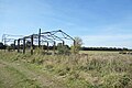 Remains of a Barn - geograph.org.uk - 6271451.jpg 5 472 × 3 648 ; 3,02 Mio
-
 Road to Launton - geograph.org.uk - 2177578.jpg 640 × 480 ; 74 kio
-
 Sheep grazing - geograph.org.uk - 3372453.jpg 640 × 335 ; 29 kio
-
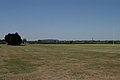 Sports Ground - geograph.org.uk - 204261.jpg 640 × 427 ; 97 kio
-
 Station Road, Blackthorn - geograph.org.uk - 6271493.jpg 4 897 × 2 868 ; 1,65 Mio
-
 Thame Road at the junction of the B4011 - geograph.org.uk - 4871747.jpg 2 048 × 1 536 ; 1,5 Mio
-
 Thame Road, Blackthorn - geograph.org.uk - 6271497.jpg 4 216 × 2 830 ; 1,41 Mio
-
 The A41 - geograph.org.uk - 3372455.jpg 640 × 531 ; 43 kio
-
 The A41 at the junction of Blackthorn Road - geograph.org.uk - 4872434.jpg 2 048 × 1 536 ; 1,41 Mio
-
 The A41 at the junction of Blackthorn Road - geograph.org.uk - 4872436.jpg 2 048 × 1 536 ; 1,51 Mio
-
 The A41 between Ambrosden and Blackthorn - geograph.org.uk - 6183156.jpg 1 887 × 1 257 ; 1,17 Mio
-
 The A41 near Stone Pits Farm - geograph.org.uk - 3965909.jpg 1 500 × 790 ; 129 kio
-
 The A41 to Aylesbury - geograph.org.uk - 3389613.jpg 1 500 × 1 000 ; 175 kio
-
 The A41 to Aylesbury - geograph.org.uk - 3965916.jpg 1 500 × 999 ; 173 kio
-
 The B4011 at the turnoff to Ambrosden - geograph.org.uk - 4871735.jpg 2 048 × 1 536 ; 1,48 Mio
-
 The Corner of Bluebell Road - geograph.org.uk - 6272708.jpg 5 230 × 3 275 ; 1,82 Mio
-
 The entrance to Symmetry Park Bicester - geograph.org.uk - 6177216.jpg 1 920 × 1 280 ; 1,1 Mio
-
 The former Rose ^ Crown - geograph.org.uk - 3447617.jpg 1 500 × 1 000 ; 296 kio
-
 The lane from Piddington to the A41 - geograph.org.uk - 715744.jpg 640 × 480 ; 122 kio
-
 The River Ray at Blackthorn - geograph.org.uk - 2492828.jpg 1 500 × 1 000 ; 262 kio
-
 The road to Marsh Gibbon - geograph.org.uk - 4186096.jpg 1 500 × 999 ; 133 kio
-
 The road to Marsh Gibbon passes Essex Cottages - geograph.org.uk - 4186094.jpg 1 500 × 999 ; 138 kio
-
 Track off Blackthorn Road - geograph.org.uk - 4873218.jpg 1 982 × 1 444 ; 1,51 Mio
-
 Trees by the River Ray - geograph.org.uk - 2449102.jpg 1 500 × 1 000 ; 160 kio
-
 Trees by the River Ray in Peter's Paddock - geograph.org.uk - 2449111.jpg 1 500 × 1 000 ; 160 kio
-
 Weir Pond - geograph.org.uk - 2177560.jpg 640 × 480 ; 91 kio
-
 Weir Pond in a Dry Summer - geograph.org.uk - 6271478.jpg 4 842 × 3 648 ; 3,16 Mio
-
 Bridge and boundary post - geograph.org.uk - 468867.jpg 640 × 480 ; 140 kio
-
 Busy lane, winter evening - geograph.org.uk - 303823.jpg 640 × 367 ; 45 kio
-
 Chiltern Line Train - geograph.org.uk - 254925.jpg 639 × 428 ; 156 kio
-
 County boundary - geograph.org.uk - 468869.jpg 480 × 640 ; 122 kio
-
 Cows after Milking - geograph.org.uk - 255642.jpg 640 × 421 ; 124 kio
-
 Farm Buildings - geograph.org.uk - 255626.jpg 639 × 428 ; 161 kio
-
 Farm buildings at sunset - geograph.org.uk - 303794.jpg 640 × 301 ; 41 kio
-
 Feeding Trough - geograph.org.uk - 255636.jpg 639 × 428 ; 180 kio
-
 Field next to Furze Grounds Farm - geograph.org.uk - 303814.jpg 640 × 333 ; 55 kio
-

-
 Manor Barn Blackthorn - geograph.org.uk - 204230.jpg 640 × 427 ; 136 kio
-
 New farmhouse - geograph.org.uk - 303785.jpg 640 × 480 ; 70 kio
-
 The Road to Piddington - geograph.org.uk - 254934.jpg 639 × 428 ; 191 kio


.jpg)


