Category:Blairlogie
Zur Navigation springen
Zur Suche springen
village in Stirling, Scotland, UK  | |||||
| Medium hochladen | |||||
| Ist ein(e) | |||||
|---|---|---|---|---|---|
| Ort |
| ||||
 | |||||
English: Blairlogie, situated at the base of the great cliff of Dumyat between Stirling and Menstrie was one of central Scotland's earliest Conservation Villages. Blairlogie mainly comprises 17th-19th-century cottages.
Simple English: Blairlogie is located at the base of the great cliff of Dumyat between Stirling and Menstrie was one of central Scotland's earliest Conservation Villages. Blairlogie mainly comprises 17th-19th-century cottages.
Unterkategorien
Es werden 2 von insgesamt 2 Unterkategorien in dieser Kategorie angezeigt:
In Klammern die Anzahl der enthaltenen Kategorien (K), Seiten (S), Dateien (D)
L
Medien in der Kategorie „Blairlogie“
Folgende 14 Dateien sind in dieser Kategorie, von 14 insgesamt.
-
 Below Big Hunt Hill towards Cauldhame - geograph.org.uk - 271304.jpg 640 × 480; 217 KB
-
 Old Drovers Path at Cotkerse.jpg 640 × 480; 183 KB
-
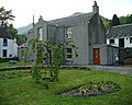 Oldest House in Blairlogie - geograph.org.uk - 47290.jpg 640 × 512; 139 KB
-
-
 Special reports on the mineral resources of Great Britain (1915) (14770745321).jpg 1.850 × 2.546; 726 KB
-

-
 Turn for Blackgrange - geograph.org.uk - 1756568.jpg 640 × 480; 83 KB
-
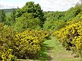
 Above Blairlogie - geograph.org.uk - 505296.jpg 640 × 480; 142 KB
-
 Blairlogie House - geograph.org.uk - 321333.jpg 637 × 432; 177 KB
-
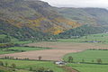
 Castle Law from Dumyat - geograph.org.uk - 373894.jpg 640 × 480; 136 KB
-
 Cocksburn Reservoir - geograph.org.uk - 352377.jpg 640 × 480; 63 KB
-
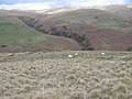
 From NW ridge of Dumyat - geograph.org.uk - 373884.jpg 640 × 480; 130 KB
-
 Hillside towards Third Inchna Burn - geograph.org.uk - 767866.jpg 640 × 480; 114 KB
-
 Old wooden trackway, Jerah - geograph.org.uk - 25768.jpg 640 × 480; 102 KB


_(14770745321).jpg)


