Category:Blatherwycke
Aller à la navigation
Aller à la recherche
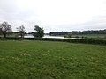
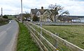
English: Blatherwycke is a village and civil parish in the East Northamptonshire district of Northamptonshire, England, with a population of 55 according to the 2001 census. It is about seven miles north-east of Corby. It is near Blatherwycke Lake, on the Willow Brook.
village britannique  | |||||
| Téléverser des médias | |||||
| Nature de l’élément | |||||
|---|---|---|---|---|---|
| Lieu | North Northamptonshire, Northamptonshire, Midlands de l'Est, Angleterre | ||||
 | |||||
Sous-catégories
Cette catégorie comprend seulement la sous-catégorie ci-dessous.
H
Média dans la catégorie « Blatherwycke »
Cette catégorie comprend 144 fichiers, dont les 144 ci-dessous.
-
 A tunnel of trees on the road to Blatherwycke - geograph.org.uk - 3083892.jpg 1 024 × 768 ; 220 kio
-
 A view from Cadge Wood - geograph.org.uk - 1858524.jpg 3 648 × 2 736 ; 2,18 Mio
-
 A43 heading south west - geograph.org.uk - 4136581.jpg 640 × 480 ; 68 kio
-
 A43 northbound - geograph.org.uk - 6225428.jpg 640 × 480 ; 60 kio
-
 Approaching Briary Wood - geograph.org.uk - 6326143.jpg 1 024 × 768 ; 246 kio
-
 Approaching the corner of Hostage Wood - geograph.org.uk - 6323950.jpg 1 024 × 768 ; 212 kio
-
 Away from Lynn Wood - geograph.org.uk - 4447425.jpg 640 × 480 ; 70 kio
-
 Barley field and farm track - geograph.org.uk - 6323926.jpg 1 024 × 768 ; 176 kio
-
 Birds by the brook, Blatherwycke - geograph.org.uk - 2122896.jpg 640 × 480 ; 105 kio
-
 Blatherwycke Church Yard - geograph.org.uk - 1858537.jpg 3 648 × 2 736 ; 2,22 Mio
-
 Blatherwycke lake - geograph.org.uk - 1858523.jpg 3 648 × 2 736 ; 2,1 Mio
-
 Blatherwycke Lake - geograph.org.uk - 2123462.jpg 640 × 481 ; 73 kio
-
 Blatherwycke Lake - geograph.org.uk - 3084409.jpg 1 024 × 768 ; 151 kio
-
 Blatherwycke Lake - geograph.org.uk - 4136600.jpg 640 × 480 ; 65 kio
-
 Blatherwycke Lake - geograph.org.uk - 4136601.jpg 640 × 480 ; 64 kio
-
 Blatherwycke Lake - geograph.org.uk - 4447377.jpg 480 × 640 ; 138 kio
-
 Blatherwycke Lake - geograph.org.uk - 4447379.jpg 640 × 480 ; 51 kio
-
 Blatherwycke Lake in the distance - geograph.org.uk - 4447397.jpg 640 × 480 ; 52 kio
-
 Blatherwycke Lake in the distance - geograph.org.uk - 4447399.jpg 480 × 640 ; 59 kio
-
 Blatherwycke Lake in the distance - geograph.org.uk - 4447402.jpg 640 × 480 ; 65 kio
-
 Blatherwycke Lake viewed from King's Cliffe Road - geograph.org.uk - 4875996.jpg 800 × 522 ; 182 kio
-
 Blatherwycke Mill (geograph 6593603).jpg 1 024 × 768 ; 216 kio
-
 Blatherwycke Mill - geograph.org.uk - 4875932.jpg 800 × 524 ; 107 kio
-
 Blatherwycke Park Farm - geograph.org.uk - 4876023.jpg 800 × 488 ; 102 kio
-
 Blatherwycke Road - geograph.org.uk - 2878783.jpg 640 × 427 ; 158 kio
-
 Blatherwycke Road - geograph.org.uk - 2878789.jpg 640 × 427 ; 147 kio
-
 Blatherwycke village bridge - geograph.org.uk - 4447364.jpg 640 × 480 ; 69 kio
-
 Blatherwycke, aerial 2015 - geograph.org.uk - 4498922.jpg 640 × 427 ; 59 kio
-
 Blatherwycke, looking to the lake - geograph.org.uk - 5786568.jpg 2 592 × 1 944 ; 1,23 Mio
-
 Blatherwyke village sign - geograph.org.uk - 1301577.jpg 640 × 480 ; 66 kio
-
 Blathwicke Lake - geograph.org.uk - 1530253.jpg 640 × 427 ; 71 kio
-
 Boundary hedge along stubble field - geograph.org.uk - 3084408.jpg 1 024 × 768 ; 130 kio
-
 Bridge - geograph.org.uk - 4447435.jpg 480 × 640 ; 129 kio
-
 Bridge remains in Westhay Wood - geograph.org.uk - 3150038.jpg 2 560 × 1 920 ; 959 kio
-
 Bridge remains in Westhay Wood - geograph.org.uk - 3150042.jpg 1 920 × 2 560 ; 922 kio
-
 Bridleway to Blatherwycke - geograph.org.uk - 6323912.jpg 1 024 × 768 ; 192 kio
-
 Bridleway to Hostage Wood - geograph.org.uk - 4794098.jpg 480 × 640 ; 95 kio
-
 Bridleway to Hostage Wood - geograph.org.uk - 4794101.jpg 480 × 640 ; 51 kio
-
 Bridleway to Hostage Wood - geograph.org.uk - 4794102.jpg 640 × 480 ; 63 kio
-
 Bridleway to Hostage Wood - geograph.org.uk - 4794103.jpg 480 × 640 ; 140 kio
-
 Bridleway to Hostage Wood - geograph.org.uk - 4794104.jpg 480 × 640 ; 144 kio
-
 Bridleway to Hostage Wood - geograph.org.uk - 4794106.jpg 480 × 640 ; 117 kio
-
 Bridleway to Hostage Wood - geograph.org.uk - 4794107.jpg 640 × 480 ; 95 kio
-
 Bridleway to Hostage Wood - geograph.org.uk - 4794109.jpg 480 × 640 ; 55 kio
-
 Bridleway to Hostage Wood - geograph.org.uk - 4794111.jpg 640 × 480 ; 46 kio
-
 Bridleway to Hostage Wood - geograph.org.uk - 4794113.jpg 480 × 640 ; 26 kio
-
 Bridleway to Hostage Wood - geograph.org.uk - 4794114.jpg 480 × 640 ; 55 kio
-
 Bridleway to Hostage Wood - geograph.org.uk - 4794115.jpg 480 × 640 ; 73 kio
-
 Bridleway to Hostage Wood - geograph.org.uk - 4794117.jpg 480 × 640 ; 90 kio
-
 Buildings near Blatherwycke church - geograph.org.uk - 4447370.jpg 640 × 480 ; 68 kio
-
 Causewayed island, Blatherwycke Lake - geograph.org.uk - 3084411.jpg 1 024 × 768 ; 136 kio
-
 Corner house, Blatherwycke - geograph.org.uk - 1858502.jpg 3 648 × 2 736 ; 2,16 Mio
-
 Daffodils at the junction with the A43 - geograph.org.uk - 4877199.jpg 800 × 556 ; 161 kio
-
 Daffodils on the lane to Blatherwycke - geograph.org.uk - 4877183.jpg 800 × 573 ; 173 kio
-
 Damaged field entrance near Blatherwycke Lake - geograph.org.uk - 3084413.jpg 1 024 × 768 ; 194 kio
-
 Date stone, Blatherwycke - geograph.org.uk - 2123439.jpg 480 × 640 ; 62 kio
-
 Edge of Hostage Wood - geograph.org.uk - 4794119.jpg 480 × 640 ; 70 kio
-
 Estate Gate - Blatherwycke - geograph.org.uk - 5362359.jpg 494 × 640 ; 98 kio
-
 Farm Buildings - geograph.org.uk - 4447427.jpg 480 × 640 ; 86 kio
-
 Farm buildings along Blatherwycke Road - geograph.org.uk - 4875924.jpg 800 × 506 ; 155 kio
-
 Farm track off the A43 - geograph.org.uk - 4136577.jpg 640 × 480 ; 96 kio
-
 Farmland near Blatherwycke - geograph.org.uk - 4447390.jpg 480 × 640 ; 58 kio
-
 Field edge and Briary Wood - geograph.org.uk - 6323959.jpg 1 024 × 768 ; 231 kio
-
 Field edge and Crayley Wood - geograph.org.uk - 6323915.jpg 1 024 × 768 ; 192 kio
-
 Field entrance to farm buildings - geograph.org.uk - 4447372.jpg 640 × 480 ; 102 kio
-
 Footpath bridge near Cadge Wood - geograph.org.uk - 1858474.jpg 3 648 × 2 736 ; 1,98 Mio
-
 Footpath from Spa Farm - geograph.org.uk - 6323918.jpg 1 024 × 768 ; 264 kio
-
 Footpath near Laxton - geograph.org.uk - 5980230.jpg 1 024 × 768 ; 198 kio
-
 Footpath through a field of cut barley - geograph.org.uk - 6323964.jpg 1 024 × 768 ; 250 kio
-
 Footpath through barley - geograph.org.uk - 6226957.jpg 1 024 × 768 ; 163 kio
-
 Footpath to an abandoned cottage - geograph.org.uk - 6323920.jpg 1 024 × 768 ; 168 kio
-
 Footpath to an abandoned cottage - geograph.org.uk - 6323923.jpg 1 024 × 768 ; 206 kio
-
 Footpath to Blatherwycke - geograph.org.uk - 4136711.jpg 640 × 480 ; 85 kio
-
 Footpath to Spa Farm - geograph.org.uk - 6323916.jpg 1 024 × 768 ; 203 kio
-
 Footpath to Spa Farm - geograph.org.uk - 6323956.jpg 1 024 × 768 ; 278 kio
-
 Gatehouse, Blatherwycke - geograph.org.uk - 2123432.jpg 640 × 480 ; 75 kio
-
 Gates and abandoned cottage - geograph.org.uk - 6226961.jpg 1 024 × 768 ; 176 kio
-
 Gateway and pasture near Blatherwycke Lake - geograph.org.uk - 3124426.jpg 4 320 × 3 240 ; 5,96 Mio
-
 Geese in a harvested field near Blatherwycke - geograph.org.uk - 6224425.jpg 1 024 × 768 ; 216 kio
-
 Grassland with bales - geograph.org.uk - 4136610.jpg 640 × 480 ; 73 kio
-
 Grazing beside Blatherwycke Lake - geograph.org.uk - 4136604.jpg 640 × 480 ; 76 kio
-
 Grazing off the Blatherwycke road - geograph.org.uk - 4136584.jpg 640 × 480 ; 59 kio
-
 Ha Ha, Blatherwycke - geograph.org.uk - 3150098.jpg 2 560 × 1 920 ; 1,01 Mio
-
 Harvested field and shooting box - geograph.org.uk - 6226954.jpg 1 024 × 768 ; 252 kio
-
 Harvested field at Blatherwycke - geograph.org.uk - 6224427.jpg 1 024 × 768 ; 246 kio
-
 Heading towards King's Cliffe - geograph.org.uk - 3083901.jpg 1 024 × 768 ; 217 kio
-
 Heading towards King's Cliffe - geograph.org.uk - 4136715.jpg 640 × 480 ; 78 kio
-
 Horses in a field near Blatherwycke - geograph.org.uk - 4877194.jpg 800 × 510 ; 71 kio
-
 Hostage Wood - geograph.org.uk - 1858541.jpg 2 736 × 3 648 ; 2,22 Mio
-
 Hostage Wood - geograph.org.uk - 4794116.jpg 480 × 640 ; 131 kio
-
 Isolated Tree - geograph.org.uk - 4447405.jpg 480 × 640 ; 119 kio
-

-
 Junction on the A43 - geograph.org.uk - 4136586.jpg 640 × 480 ; 77 kio
-
 Jurassic Way to Fineshade Wood - geograph.org.uk - 262021.jpg 640 × 480 ; 65 kio
-
 Keeper's Cottage - geograph.org.uk - 4794099.jpg 480 × 640 ; 95 kio
-
 King's Cliffe Road in Blatherwycke - geograph.org.uk - 4876031.jpg 800 × 575 ; 131 kio
-
 Large tree alongside Blatherwycke Lake - geograph.org.uk - 3084412.jpg 1 024 × 768 ; 187 kio
-
 Large tree in a large stubble field - geograph.org.uk - 3084403.jpg 1 024 × 768 ; 152 kio
-
 Leaving Blatherwycke - geograph.org.uk - 4136606.jpg 640 × 480 ; 62 kio
-
 Leaving Blatherwycke - geograph.org.uk - 4447385.jpg 640 × 480 ; 48 kio
-
 Leaving Blatherwycke - geograph.org.uk - 4447387.jpg 640 × 480 ; 45 kio
-
 Lynn Wood - geograph.org.uk - 4447423.jpg 480 × 640 ; 118 kio
-
 Mill buildings - geograph.org.uk - 4447429.jpg 480 × 640 ; 61 kio
-
 Narrow hedge lined lane to Blatherwycke - geograph.org.uk - 1301573.jpg 640 × 283 ; 43 kio
-
 Neatly cut hedge beside Hostage Wood - geograph.org.uk - 1858456.jpg 3 648 × 2 736 ; 2,27 Mio
-
 Oak trees and wheat - geograph.org.uk - 2477749.jpg 640 × 480 ; 69 kio
-
 Old Fence - geograph.org.uk - 4447438.jpg 640 × 480 ; 148 kio
-
 Pole barn - geograph.org.uk - 1740849.jpg 3 648 × 2 736 ; 2 Mio
-
 Pond instead of Cage Wood - geograph.org.uk - 1858624.jpg 3 648 × 2 736 ; 2,05 Mio
-
 Rural road towards Blatherwycke - geograph.org.uk - 4136590.jpg 640 × 480 ; 90 kio
-
 Rural road towards King's Cliffe - geograph.org.uk - 4136598.jpg 640 × 385 ; 55 kio
-
 Rural road towards King's Cliffe - geograph.org.uk - 4136608.jpg 640 × 480 ; 84 kio
-
 Rural road towards King's Cliffe - geograph.org.uk - 4136707.jpg 640 × 480 ; 64 kio
-
 Smelters walk information board - geograph.org.uk - 1739116.jpg 2 736 × 3 648 ; 2,08 Mio
-
 Stable block at Blatherwycke - geograph.org.uk - 3150099.jpg 2 560 × 1 920 ; 1,02 Mio
-
 The edge of Hostage Wood - geograph.org.uk - 6323946.jpg 1 024 × 768 ; 151 kio
-
 The Old Mill at Blatherwycke Lake - geograph.org.uk - 3124283.jpg 4 320 × 3 240 ; 5,4 Mio
-
 The Willow Brook, Blatherwycke - geograph.org.uk - 2122914.jpg 480 × 640 ; 99 kio
-
 Towards Blatherwycke - geograph.org.uk - 5199794.jpg 480 × 640 ; 119 kio
-
 Track into Briary Wood - geograph.org.uk - 6326152.jpg 1 024 × 768 ; 343 kio
-
 Track through Briary Wood - geograph.org.uk - 6326147.jpg 1 024 × 768 ; 324 kio
-
 Tree - geograph.org.uk - 4447433.jpg 480 × 640 ; 135 kio
-
 Tree Felling operations in Fineshade Woodland complex - geograph.org.uk - 3150046.jpg 2 560 × 1 920 ; 992 kio
-
 Tree next to Blatherwycke Lake - geograph.org.uk - 4876004.jpg 800 × 540 ; 115 kio
-
 Tree planting - geograph.org.uk - 4447383.jpg 480 × 640 ; 124 kio
-
 Tree with a shooting platform - geograph.org.uk - 6226947.jpg 1 024 × 768 ; 216 kio
-
 Trees colonising a disused pit - geograph.org.uk - 3083896.jpg 1 024 × 768 ; 220 kio
-
 Village sign, Blatherwycke - geograph.org.uk - 2122933.jpg 480 × 640 ; 87 kio
-
 Wall along King's Cliffe Road - geograph.org.uk - 4875949.jpg 800 × 566 ; 145 kio
-
 Wheat field and track alongside Briary Wood - geograph.org.uk - 6326157.jpg 1 024 × 768 ; 166 kio
-
 Willow Brook - geograph.org.uk - 4447437.jpg 480 × 640 ; 122 kio
-
 Woodland next to Blatherwycke Lake - geograph.org.uk - 4875937.jpg 800 × 564 ; 182 kio
-
 Blatherwycke Lake - geograph.org.uk - 261649.jpg 640 × 480 ; 58 kio
-
 Blatherwycke to Laxton road crossing the A43 - geograph.org.uk - 262056.jpg 640 × 480 ; 80 kio
-
 Bridge at Blatherwycke - geograph.org.uk - 261642.jpg 640 × 480 ; 54 kio
-
 Bridleway leaving the Blatherwycke-Bulwick road - geograph.org.uk - 269096.jpg 640 × 480 ; 110 kio
-
 Fishing lake on A43 - geograph.org.uk - 262025.jpg 640 × 480 ; 101 kio
-
 Looking towards Wakerley Great Wood - geograph.org.uk - 261663.jpg 640 × 480 ; 51 kio
-
 Mineral Spa - geograph.org.uk - 45098.jpg 640 × 480 ; 171 kio
-
 Morehay Lane - geograph.org.uk - 45097.jpg 480 × 640 ; 106 kio
-
 Old Mill, Blatherwycke Lake - geograph.org.uk - 261657.jpg 640 × 480 ; 64 kio
-
 Track north-east toward Spa Farm - geograph.org.uk - 269128.jpg 640 × 480 ; 61 kio
-
 Trig Point No. S6789 - geograph.org.uk - 45102.jpg 480 × 640 ; 113 kio
-


.jpg)


