Category:Bleasby, Nottinghamshire
Aller à la navigation
Aller à la recherche
English: Bleasby is a village and civil parish in Nottinghamshire, England, located fifteen miles North East of Nottingham. It has a population of 804.
village britannique  | |||||
| Téléverser des médias | |||||
| Nature de l’élément | |||||
|---|---|---|---|---|---|
| Lieu | Newark and Sherwood, Nottinghamshire, Midlands de l'Est, Angleterre | ||||
| À ne pas confondre avec | |||||
 | |||||
Sous-catégories
Cette catégorie comprend 3 sous-catégories, dont les 3 ci-dessous.
B
- Bleasby railway station (6 F)
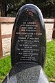
- Bleasby War Memorial (4 F)
M
Média dans la catégorie « Bleasby, Nottinghamshire »
Cette catégorie comprend 195 fichiers, dont les 195 ci-dessous.
-
 A row of pine trees near High Cross Farm - geograph.org.uk - 6330684.jpg 1 024 × 768 ; 134 kio
-
 A splash of colour - geograph.org.uk - 1535931.jpg 640 × 479 ; 125 kio
-
 Across the fields north of Thurgarton - geograph.org.uk - 3974564.jpg 1 024 × 768 ; 97 kio
-
 Across the Trent - geograph.org.uk - 1030269.jpg 640 × 480 ; 106 kio
-
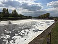
 Advance warning of Hazelford Lock and weir - geograph.org.uk - 2669519.jpg 1 024 × 768 ; 138 kio
-
 Approaching Hazelford Lock on the River Trent - geograph.org.uk - 4909937.jpg 3 309 × 2 480 ; 2,32 Mio
-
 Arable land east of Bleasby - geograph.org.uk - 1843682.jpg 640 × 466 ; 106 kio
-
 Autumn landscape - geograph.org.uk - 1535907.jpg 640 × 479 ; 123 kio
-
 Autumn sown field, High Cross - geograph.org.uk - 6330686.jpg 1 024 × 768 ; 217 kio
-
 Back footpath - geograph.org.uk - 1535961.jpg 640 × 479 ; 202 kio
-
 Bailey Crossing - geograph.org.uk - 50238.jpg 640 × 480 ; 96 kio
-
 Bird boxes - geograph.org.uk - 1536106.jpg 479 × 640 ; 91 kio
-
 Bleasby crossing keepers cottage - geograph.org.uk - 5353984.jpg 3 264 × 2 448 ; 2,63 Mio
-
 Bleasby Glebe Field information board - geograph.org.uk - 6411807.jpg 4 608 × 3 072 ; 3,32 Mio
-
 Bleasby Lancaster memorial, Lancaster R5703 - geograph.org.uk - 6412657.jpg 3 072 × 4 608 ; 5,97 Mio
-
 Bleasby Lancaster R5698 memorial - geograph.org.uk - 6412529.jpg 4 608 × 3 072 ; 6,1 Mio
-
 Bleasby Level Crossing - geograph.org.uk - 1004433.jpg 640 × 480 ; 71 kio
-
 Bleasby Level Crossing - geograph.org.uk - 1535888.jpg 632 × 468 ; 105 kio
-
 Bleasby non mobile phone - geograph.org.uk - 1043263.jpg 640 × 480 ; 163 kio
-
 Bleasby Parish Millennium Stone - geograph.org.uk - 40828.jpg 480 × 640 ; 140 kio
-
 Bleasby Parish Millennium Stone - geograph.org.uk - 40835.jpg 480 × 640 ; 142 kio
-
 Bleasby railway station - geograph.org.uk - 5353985.jpg 3 264 × 2 448 ; 2,69 Mio
-
 Bleasby railway station - geograph.org.uk - 5353988.jpg 3 264 × 2 448 ; 2,93 Mio
-
 Bleasby railway station, Nottinghamshire - geograph.org.uk - 3389936.jpg 1 024 × 768 ; 172 kio
-
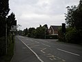
 Bleasby Road in Goverton - geograph.org.uk - 4879872.jpg 800 × 580 ; 160 kio
-
 Bleasby station - geograph.org.uk - 5052995.jpg 3 072 × 1 728 ; 1,83 Mio
-
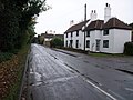
 Bleasby Stores and Post Office - geograph.org.uk - 4214100.jpg 640 × 427 ; 74 kio
-
 Bleasby War Memorial in the churchyard - geograph.org.uk - 6411810.jpg 4 608 × 3 072 ; 5,69 Mio
-
 Boat moored on River Trent near Bleasby - geograph.org.uk - 1051749.jpg 640 × 480 ; 151 kio
-
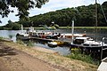
 Boats moored on the Trent at Hazelford Ferry - geograph.org.uk - 4885115.jpg 800 × 587 ; 121 kio
-
 Borrow Bread Lane - geograph.org.uk - 1535950.jpg 640 × 479 ; 132 kio
-
 Borrow Bread Lane, Bleasby - geograph.org.uk - 4213545.jpg 640 × 427 ; 87 kio
-
 Bound for Lincoln - geograph.org.uk - 1535893.jpg 640 × 479 ; 121 kio
-
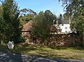
 Brickyard Farm - geograph.org.uk - 1535911.jpg 640 × 479 ; 91 kio
-
 Bridleway to the Trent at Gibsmere - geograph.org.uk - 6330670.jpg 1 024 × 768 ; 201 kio
-

-
 Causeway Dyke sluice - geograph.org.uk - 1978784.jpg 640 × 426 ; 107 kio
-
 Chapel conversion on Station Road, Bleasby - geograph.org.uk - 4213524.jpg 640 × 427 ; 85 kio
-
-
 Cornfield footpath - geograph.org.uk - 1535940.jpg 479 × 640 ; 166 kio
-
 Cottage(s) in Main Street, Bleasby - geograph.org.uk - 4213532.jpg 640 × 427 ; 54 kio
-
 Cottages in Bleasby - geograph.org.uk - 5353964.jpg 3 264 × 2 448 ; 2,3 Mio
-
 Country Bus Shelter - geograph.org.uk - 50208.jpg 640 × 480 ; 74 kio
-
 Crossroads at Gibsmere - geograph.org.uk - 5055656.jpg 3 072 × 1 728 ; 3,62 Mio
-
 Delivering the mails - geograph.org.uk - 1535879.jpg 640 × 479 ; 181 kio
-
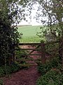
 Disused gate - geograph.org.uk - 1535834.jpg 640 × 479 ; 174 kio
-
 Dumped and stumped - geograph.org.uk - 5054285.jpg 3 072 × 1 728 ; 1,75 Mio
-
 Elmores Meadow - geograph.org.uk - 5353973.jpg 3 264 × 2 448 ; 2,53 Mio
-
 Entering Goverton from the north - geograph.org.uk - 4147295.jpg 1 024 × 768 ; 163 kio
-

-
 Field footpath - geograph.org.uk - 1535908.jpg 640 × 479 ; 144 kio
-
 Field of oilseed rape and trees along Halloughton Dumble - geograph.org.uk - 5473549.jpg 1 024 × 768 ; 234 kio
-
 Field path near Glebe Farm - geograph.org.uk - 5057709.jpg 800 × 600 ; 175 kio
-
 Fishermans, Bleasby.jpg 800 × 600 ; 93 kio
-
 Fishing on the Trent Near Bleasby - geograph.org.uk - 1051760.jpg 640 × 480 ; 86 kio
-
 Flintham Wood along the River Trent - geograph.org.uk - 4885142.jpg 800 × 640 ; 168 kio
-
 Flintham Woods - geograph.org.uk - 1536021.jpg 474 × 640 ; 166 kio
-
 Flying the flag at Gibsmere - geograph.org.uk - 5055662.jpg 3 072 × 1 728 ; 3,63 Mio
-
 Follow my leader - geograph.org.uk - 1535997.jpg 640 × 415 ; 97 kio
-
 Foot crossing south west of Bleasby - geograph.org.uk - 4149982.jpg 1 024 × 768 ; 154 kio
-
 Footbridges - geograph.org.uk - 1535917.jpg 475 × 640 ; 153 kio
-
 Footpath near Goverton - geograph.org.uk - 1535850.jpg 640 × 402 ; 137 kio
-
 Footpath south west of Bleasby (1) - geograph.org.uk - 4149980.jpg 1 024 × 768 ; 141 kio
-
 Footpath south west of Bleasby (2) - geograph.org.uk - 4149983.jpg 1 024 × 768 ; 201 kio
-
 Footpath to Hazelford - geograph.org.uk - 1535982.jpg 640 × 479 ; 135 kio
-
 Former farm building - geograph.org.uk - 1535890.jpg 640 × 479 ; 128 kio
-
 Freight across the countryside - geograph.org.uk - 1535929.jpg 640 × 479 ; 117 kio
-
 Gate along the Trent Valley Way - geograph.org.uk - 4885127.jpg 800 × 625 ; 188 kio
-
 Gated path near Gibsmere and river trent - geograph.org.uk - 1043246.jpg 640 × 480 ; 135 kio
-
 Gibsmere - geograph.org.uk - 1979809.jpg 640 × 426 ; 76 kio
-
 Gibsmere - geograph.org.uk - 5057713.jpg 800 × 600 ; 114 kio
-
 Gibsmere hamlet - geograph.org.uk - 1536013.jpg 640 × 479 ; 103 kio
-
 Gibsmere hamlet - geograph.org.uk - 1536088.jpg 640 × 479 ; 76 kio
-
 Glebe Farm - geograph.org.uk - 1536110.jpg 640 × 479 ; 85 kio
-
 Glebe Farm on the road from Gibsmere - geograph.org.uk - 1030426.jpg 640 × 480 ; 63 kio
-
 Grassland by the road into Goverton - geograph.org.uk - 4213497.jpg 640 × 427 ; 63 kio
-
 Gypsy Lane in Bleasby - geograph.org.uk - 4880321.jpg 800 × 581 ; 212 kio
-
 Hard surfaced footpath - geograph.org.uk - 1535934.jpg 640 × 479 ; 220 kio
-
 Hay baling near Glebe Farm - geograph.org.uk - 5057712.jpg 800 × 600 ; 136 kio
-
 Hazelford Ferry - geograph.org.uk - 1979803.jpg 426 × 640 ; 127 kio
-
 Hazelford Ferry moorings - geograph.org.uk - 1979785.jpg 640 × 426 ; 117 kio
-
 Hazelford Ferry Residential Home - geograph.org.uk - 1979821.jpg 640 × 426 ; 84 kio
-
 Hazelford Lock - geograph.org.uk - 1980025.jpg 640 × 426 ; 108 kio
-
 Hazelford moorings - geograph.org.uk - 1536001.jpg 524 × 640 ; 136 kio
-

-
 Hazelford Weir - geograph.org.uk - 1979996.jpg 640 × 426 ; 83 kio
-
 Hazelford Weir - geograph.org.uk - 1980013.jpg 640 × 426 ; 98 kio
-
 Hazelford Weir - geograph.org.uk - 5353946.jpg 3 264 × 2 448 ; 2,75 Mio
-
 High Cross north of Thurgarton (1) - geograph.org.uk - 3974568.jpg 1 024 × 768 ; 94 kio
-
 High Cross north of Thurgarton (2) - geograph.org.uk - 3974575.jpg 1 024 × 768 ; 152 kio
-
 Houses on the hillside, Goverton - geograph.org.uk - 1535840.jpg 640 × 479 ; 114 kio
-
 Isolated bench north of Goverton - geograph.org.uk - 4147283.jpg 1 024 × 768 ; 164 kio
-
 Junction of Main Street and Gypsy Lane - geograph.org.uk - 4213550.jpg 640 × 427 ; 103 kio
-
 Lancaster I, W4232, RC-Y, crash at Hazelford Lock - geograph.org.uk - 6412660.jpg 3 072 × 4 608 ; 5,88 Mio
-
 Lancaster JB132 crash memorial - geograph.org.uk - 6412526.jpg 4 608 × 3 072 ; 6,36 Mio
-
 Lancaster memorial at Bleasby - geograph.org.uk - 6411799.jpg 4 608 × 3 072 ; 5,66 Mio
-
 Lane passing High Cross Farm - geograph.org.uk - 4147269.jpg 1 024 × 768 ; 150 kio
-
 Lane to Glebe Farm - geograph.org.uk - 1536097.jpg 640 × 479 ; 137 kio
-
 Level crossing, Bleasby - geograph.org.uk - 4149961.jpg 1 024 × 768 ; 134 kio
-

-

-
 Looking towards Goverton - geograph.org.uk - 5052989.jpg 2 428 × 1 445 ; 1,06 Mio
-
 Main Street, Bleasby - geograph.org.uk - 1030418.jpg 640 × 480 ; 75 kio
-
 Manor Farm, Bleasby - geograph.org.uk - 1535882.jpg 640 × 473 ; 141 kio
-
 Manor Farm, Bleasby - geograph.org.uk - 1535885.jpg 640 × 479 ; 145 kio
-
 Memorial to Lancaster W4258 and personnel at Syderston - geograph.org.uk - 6412543.jpg 3 072 × 4 608 ; 5,76 Mio
-
 Morton Crossing distant signal - geograph.org.uk - 1535920.jpg 481 × 640 ; 102 kio
-
 Navigation signs - geograph.org.uk - 5353949.jpg 3 264 × 2 448 ; 2,67 Mio
-
 Newly cut - geograph.org.uk - 1535900.jpg 479 × 640 ; 179 kio
-
 Newly ploughed field near Gibsmere - geograph.org.uk - 5055664.jpg 3 034 × 1 658 ; 3,76 Mio
-
 Northbound platform at Bleasby railway station - geograph.org.uk - 5057722.jpg 800 × 600 ; 121 kio
-
 Not stopping here - geograph.org.uk - 1535897.jpg 640 × 479 ; 129 kio
-
 Nottingham bound - geograph.org.uk - 1535846.jpg 640 × 479 ; 97 kio
-
 Oilseed rape and two trees near Rudsey Farm - geograph.org.uk - 5473551.jpg 1 024 × 768 ; 220 kio
-
 Old tractor and baler at work in small paddocks - geograph.org.uk - 5055663.jpg 3 072 × 1 728 ; 3,4 Mio
-
 Orchard Close, Bleasby - geograph.org.uk - 5353992.jpg 3 264 × 2 448 ; 2,34 Mio
-
 Parish enclave - geograph.org.uk - 1535991.jpg 640 × 479 ; 146 kio
-

-
 Path and ditch - geograph.org.uk - 1535843.jpg 640 × 479 ; 87 kio
-
 Path to Manor Farm Tea Shoppe - geograph.org.uk - 5057724.jpg 800 × 600 ; 202 kio
-
 Platform at Bleasby railway station - geograph.org.uk - 4879888.jpg 800 × 628 ; 163 kio
-
 Private footbridge across the River Trent - geograph.org.uk - 4884686.jpg 800 × 580 ; 122 kio
-
 Private moorings along the River Trent - geograph.org.uk - 4884740.jpg 800 × 637 ; 185 kio
-
 Private moorings along the River Trent - geograph.org.uk - 4884750.jpg 800 × 555 ; 141 kio
-
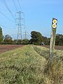
 Pylons passing Goverton - geograph.org.uk - 4147300.jpg 1 024 × 768 ; 94 kio
-
 Recycled Goods Carriages - geograph.org.uk - 1071717.jpg 640 × 289 ; 78 kio
-
 River Trent - geograph.org.uk - 1978780.jpg 426 × 640 ; 111 kio
-
 River Trent - Hazelford Weir - geograph.org.uk - 5122639.jpg 1 600 × 1 064 ; 301 kio
-
 River Trent near Bleasby - geograph.org.uk - 502512.jpg 640 × 449 ; 64 kio
-
 Road junction approaching Bleasby - geograph.org.uk - 1030413.jpg 640 × 480 ; 60 kio
-
 Road north of Goverton (1) - geograph.org.uk - 4147277.jpg 1 024 × 768 ; 107 kio
-
 Road north of Goverton (2) - geograph.org.uk - 4147291.jpg 1 024 × 768 ; 159 kio
-
 Road to Gibsmere - geograph.org.uk - 4213622.jpg 640 × 427 ; 64 kio
-
 Rolling and sowing - geograph.org.uk - 1535857.jpg 640 × 447 ; 83 kio
-
 Rolling the field - geograph.org.uk - 1535848.jpg 640 × 398 ; 141 kio
-

-
 Rowers on the River Trent - geograph.org.uk - 4885138.jpg 800 × 644 ; 158 kio
-
 Sign for the Waggon and Horses pub - geograph.org.uk - 6411804.jpg 4 608 × 3 072 ; 6,02 Mio
-
 Site of Hazelford - geograph.org.uk - 1030357.jpg 640 × 480 ; 79 kio
-
 SK70384923 - geograph.org.uk - 1535830.jpg 640 × 479 ; 156 kio
-
 Slipway at Hazelford - geograph.org.uk - 4795632.jpg 4 608 × 3 456 ; 4,62 Mio
-
 Slipway at Hazelford Ferry - geograph.org.uk - 4909953.jpg 2 976 × 2 233 ; 2,32 Mio
-
 Sluice drain from sandpits - geograph.org.uk - 1030262.jpg 640 × 480 ; 89 kio
-
 So how exactly does this work^ - geograph.org.uk - 5056183.jpg 800 × 600 ; 136 kio
-
 Southbound platform at Bleasby railway station - geograph.org.uk - 5057723.jpg 800 × 600 ; 180 kio
-
 Special harvest - geograph.org.uk - 1535925.jpg 640 × 443 ; 164 kio
-
 St Mary's Church - geograph.org.uk - 5057717.jpg 800 × 600 ; 141 kio
-
 Staggered platforms at Bleasby station - geograph.org.uk - 4149967.jpg 1 024 × 768 ; 153 kio
-
 Station Road, Bleasby (1) - geograph.org.uk - 4149971.jpg 1 024 × 768 ; 117 kio
-
 Station Road, Bleasby (2) - geograph.org.uk - 4149974.jpg 1 024 × 768 ; 126 kio
-
 Teas at Manor Farm, Bleasby - geograph.org.uk - 4213516.jpg 640 × 427 ; 107 kio
-
 The end of Boat Lane at Hazelford Ferry - geograph.org.uk - 4884755.jpg 800 × 561 ; 184 kio
-
 The end of the road^ - geograph.org.uk - 1536093.jpg 640 × 479 ; 105 kio
-
 The Glebe Field, Bleasby - geograph.org.uk - 6330675.jpg 1 024 × 768 ; 170 kio
-
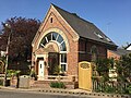 The old chapel - geograph.org.uk - 5353979.jpg 3 264 × 2 448 ; 3,02 Mio
-
 The River Trent - geograph.org.uk - 5056178.jpg 800 × 600 ; 151 kio
-
 The River Trent at the end of Boat Lane Bleasby - geograph.org.uk - 1051738.jpg 640 × 480 ; 138 kio
-
 The Trent at Hazelford - geograph.org.uk - 2669515.jpg 1 024 × 768 ; 129 kio
-
 The Trent at Hazelford - geograph.org.uk - 2669526.jpg 1 024 × 768 ; 167 kio
-
 The Waggon and Horses public house, Bleasby - geograph.org.uk - 6411802.jpg 4 491 × 2 889 ; 3,54 Mio
-
 The Waggon and Horses, Bleasby - geograph.org.uk - 5054758.jpg 3 056 × 1 700 ; 3,81 Mio
-
 The Waggon ^ Horses - geograph.org.uk - 5057718.jpg 800 × 600 ; 105 kio
-
 The Waggon ^ Horses in Bleasby - geograph.org.uk - 4880314.jpg 800 × 544 ; 155 kio
-
 The White House - geograph.org.uk - 5057725.jpg 800 × 596 ; 140 kio
-
 Thistles by a barley field - geograph.org.uk - 5057719.jpg 600 × 800 ; 132 kio
-
 Trent Moorings, Hazelford Ferry - geograph.org.uk - 4213692.jpg 640 × 427 ; 88 kio
-
 Trent Valley Way - geograph.org.uk - 1978789.jpg 426 × 640 ; 111 kio
-
 Trent Valley Way - geograph.org.uk - 1979813.jpg 426 × 640 ; 132 kio
-
 Trent Valley Way - geograph.org.uk - 1979955.jpg 426 × 640 ; 110 kio
-
 Tugboat Exeter upstream of Hazelford Lock on the River Trent - geograph.org.uk - 5122654.jpg 1 600 × 1 200 ; 231 kio
-
 Vapour trails - geograph.org.uk - 1535875.jpg 479 × 640 ; 79 kio
-
 View across the Trent - geograph.org.uk - 2669522.jpg 1 024 × 768 ; 179 kio
-

-
 View of the River Trent - geograph.org.uk - 50212.jpg 640 × 480 ; 142 kio
-
 View towards Hazelford Lock - geograph.org.uk - 2669529.jpg 1 024 × 768 ; 148 kio
-
 View towards Wadham Cottage - geograph.org.uk - 2669534.jpg 1 024 × 768 ; 204 kio
-

-
 Waggon and Horses, Bleasby - geograph.org.uk - 1535946.jpg 640 × 479 ; 141 kio
-
 Warning sign on the Trent river bank - geograph.org.uk - 4884744.jpg 800 × 536 ; 102 kio
-
 Way to the Traditional Village Pub - geograph.org.uk - 4213540.jpg 640 × 427 ; 71 kio
-
 Waymark and ditch - geograph.org.uk - 1535854.jpg 480 × 640 ; 129 kio
-
 Wayward waymark - geograph.org.uk - 1535964.jpg 479 × 640 ; 187 kio
-
 Welcome to Paradise - geograph.org.uk - 1535975.jpg 640 × 479 ; 116 kio
-
 Welcome to Paradise - geograph.org.uk - 5057714.jpg 800 × 600 ; 128 kio
-
 Wellington R1014 and R1212, 304 Polish Sqdn., RAF Syerston - geograph.org.uk - 6412685.jpg 4 608 × 3 072 ; 6,04 Mio
-
 Wheatfield and Brickyard Farm - geograph.org.uk - 5473452.jpg 1 024 × 768 ; 179 kio
-
 Wild privet in a hedge in Station Road, Bleasby - geograph.org.uk - 4214104.jpg 640 × 427 ; 124 kio
-
 Approaching Bleasby from the river Trent side - geograph.org.uk - 1051726.jpg 640 × 480 ; 117 kio
-
 Gate by opposite the Dumble - geograph.org.uk - 775597.jpg 480 × 640 ; 130 kio
-
 Gibsmere Village - geograph.org.uk - 50209.jpg 640 × 480 ; 102 kio
-
 Glebe Farm Dairy Herd - geograph.org.uk - 50213.jpg 640 × 480 ; 77 kio
-
 Glebe Farm, Gibsmere - geograph.org.uk - 50210.jpg 640 × 480 ; 95 kio
-
 Main Street and Church Tower, Bleasby - geograph.org.uk - 50205.jpg 640 × 480 ; 124 kio
-
 Manor Farm - geograph.org.uk - 452919.jpg 640 × 408 ; 53 kio
-
 Waggon and Horses, Gipsy Lane, Bleasby - geograph.org.uk - 50207.jpg 640 × 480 ; 144 kio


_in_Main_Street,_Bleasby_-_geograph.org.uk_-_4213532.jpg)


_-_geograph.org.uk_-_4149980.jpg)
_-_geograph.org.uk_-_4149983.jpg)


_-_geograph.org.uk_-_1030392.jpg)


_-_geograph.org.uk_-_3974568.jpg)
_-_geograph.org.uk_-_3974575.jpg)


_-_geograph.org.uk_-_4147277.jpg)
_-_geograph.org.uk_-_4147291.jpg)


_-_geograph.org.uk_-_4149971.jpg)
_-_geograph.org.uk_-_4149974.jpg)


