Category:Blickling
Aller à la navigation
Aller à la recherche

English: Blickling is a village and civil parish in the Broadland district of Norfolk, England, about . Since the 17th century the village has been concentrated in two areas, around the church and also at the park gates of Blickling Hall. Most of the village is contained in the Blickling Estate, which has been owned by the National Trust since 1940.
Norsk bokmål: befolkning= 136
localité britannique du comté anglais de Norfolk  | |||||
| Téléverser des médias | |||||
| Nature de l’élément | |||||
|---|---|---|---|---|---|
| Lieu | Broadland, Norfolk, Angleterre de l'Est, Angleterre | ||||
| Superficie |
| ||||
| Réputé identique à | Blickling (page en doublon, paroisse civile) | ||||
 | |||||
Sous-catégories
Cette catégorie comprend 7 sous-catégories, dont les 7 ci-dessous.
Média dans la catégorie « Blickling »
Cette catégorie comprend 178 fichiers, dont les 178 ci-dessous.
-
 1 - 4 Park Gates - geograph.org.uk - 5674014.jpg 1 000 × 662 ; 717 kio
-

-
 A fruitful project - geograph.org.uk - 4468483.jpg 4 912 × 3 264 ; 6,88 Mio
-
 A narrow path - geograph.org.uk - 989888.jpg 480 × 640 ; 232 kio
-
 A sunken path - geograph.org.uk - 989893.jpg 480 × 640 ; 170 kio
-
 A walk in the park - geograph.org.uk - 4465809.jpg 4 912 × 3 264 ; 3,8 Mio
-
 Agricultural sheds - geograph.org.uk - 687161.jpg 640 × 451 ; 105 kio
-
 An Aga - geograph.org.uk - 3552195.jpg 424 × 640 ; 163 kio
-
 Attempted avenue of trees - geograph.org.uk - 6433402.jpg 1 600 × 1 067 ; 336 kio
-
 Autumnal colours - geograph.org.uk - 989891.jpg 480 × 640 ; 194 kio
-
 Beech tree 00540 - geograph.org.uk - 1088219.jpg 640 × 480 ; 155 kio
-
 Bicycle trail - geograph.org.uk - 989880.jpg 480 × 640 ; 163 kio
-
 A beech woodland - geograph.org.uk - 1088261.jpg 640 × 480 ; 163 kio
-
 Blickling Hall - geograph.org.uk - 5674320.jpg 1 000 × 662 ; 874 kio
-
 Blickling Hall - geograph.org.uk - 5674321.jpg 1 000 × 662 ; 765 kio
-
 Blickling Hall - geograph.org.uk - 6433392.jpg 1 600 × 1 067 ; 376 kio
-
 Blickling Hall Estate, Norfolk - geograph.org.uk - 5879782.jpg 3 508 × 2 488 ; 2,69 Mio
-
 Blickling Hall NT near Aylsham - geograph.org.uk - 6480429.jpg 1 799 × 1 199 ; 404 kio
-
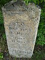 Blickling Milestone.JPG 1 728 × 2 304 ; 1,73 Mio
-
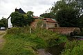 Blickling Mill on the River Bure - geograph.org.uk - 4134584.jpg 1 600 × 1 064 ; 522 kio
-
 Blickling Park, Autumn colours - geograph.org.uk - 6318311.jpg 7 086 × 4 723 ; 7,61 Mio
-
 Blickling Park, The Temple, Display of seasonal vegetables - geograph.org.uk - 6317832.jpg 6 162 × 4 108 ; 3,98 Mio
-
 Blickling Road with the entrance to the Hall on the left - geograph.org.uk - 6317799.jpg 6 309 × 4 206 ; 7,62 Mio
-
 Blickling woods - geograph.org.uk - 6354602.jpg 1 024 × 693 ; 229 kio
-
 Blickling's Old School.jpg 4 160 × 3 120 ; 4 Mio
-
 Blickling, Pathway to Blickling Hall - geograph.org.uk - 6317804.jpg 5 795 × 3 863 ; 7,78 Mio
-
 Blickling, The Buckinghamshire Arms Car Park - geograph.org.uk - 6317789.jpg 6 201 × 4 134 ; 7,38 Mio
-
 Blickling1.JPG 2 304 × 1 728 ; 1,71 Mio
-
 Cattle sheds at Hall Farm - geograph.org.uk - 553887.jpg 640 × 480 ; 99 kio
-
 Cottage near Blickling Hall, Norfolk - geograph.org.uk - 4177457.jpg 4 320 × 3 240 ; 5,74 Mio
-
 Cycle trail through Long Plantation - geograph.org.uk - 618441.jpg 480 × 640 ; 113 kio
-
 Cycleway through Hercules Wood - geograph.org.uk - 618446.jpg 480 × 640 ; 129 kio
-
 Deckchairs on the lawn, Blickling Hall - geograph.org.uk - 4178311.jpg 4 320 × 3 240 ; 5,85 Mio
-
 Dog walkers in The Great Wood, Blickling Park - geograph.org.uk - 4177910.jpg 4 320 × 3 240 ; 5,72 Mio
-
 Dog-walking at Blickling - geograph.org.uk - 3657929.jpg 800 × 600 ; 331 kio
-
 Double Border - geograph.org.uk - 5674440.jpg 1 000 × 662 ; 828 kio
-
 Driveway to Flash Farm - geograph.org.uk - 653344.jpg 640 × 480 ; 60 kio
-
 Dust cloud behind the combined harvester - geograph.org.uk - 4600334.jpg 640 × 480 ; 150 kio
-
 Evening light in Blickling Park - geograph.org.uk - 4465812.jpg 4 912 × 3 264 ; 5,69 Mio
-
 Fallen tree Blickling Hall Estate - geograph.org.uk - 6433389.jpg 1 600 × 1 067 ; 325 kio
-
 Farmland - geograph.org.uk - 5672679.jpg 1 000 × 662 ; 838 kio
-
 Field edge - geograph.org.uk - 1088333.jpg 480 × 640 ; 126 kio
-
 Field, Blickling - geograph.org.uk - 2527049.jpg 640 × 480 ; 116 kio
-
 Flashpits Farm Blickling.JPG 2 304 × 1 728 ; 1,79 Mio
-
 Following the fence - geograph.org.uk - 1088236.jpg 480 × 640 ; 145 kio
-
 Footbridge over drain - geograph.org.uk - 1128550.jpg 640 × 480 ; 137 kio
-
 Footbridge over River Bure - geograph.org.uk - 4465816.jpg 4 912 × 3 264 ; 7,69 Mio
-
 Footpath along woodland edge - geograph.org.uk - 989902.jpg 480 × 640 ; 112 kio
-
 Footpath from the fishermen's car park, Blickling - geograph.org.uk - 4178198.jpg 4 320 × 3 240 ; 5,64 Mio
-
 Footpath in The Great Wood, Blickling Park - geograph.org.uk - 4177879.jpg 3 240 × 4 320 ; 5,23 Mio
-
 Footpath marker - geograph.org.uk - 1088355.jpg 640 × 480 ; 120 kio
-
 Footpath marker in pasture - geograph.org.uk - 1128548.jpg 640 × 450 ; 151 kio
-
 Footpath meets cycle trail - geograph.org.uk - 989887.jpg 480 × 640 ; 170 kio
-
 Former School, Blickling Estate, Norfolk - geograph.org.uk - 5879768.jpg 2 384 × 1 825 ; 1,51 Mio
-
 Gardens at Blickling Hall NT near Aylsham - geograph.org.uk - 6480431.jpg 1 799 × 1 199 ; 422 kio
-
 Golf Cottage - geograph.org.uk - 5674022.jpg 662 × 1 000 ; 912 kio
-
 Grand staircase, Blickling Hall - geograph.org.uk - 3657951.jpg 800 × 600 ; 287 kio
-
 Ha-ha - geograph.org.uk - 5674437.jpg 1 000 × 662 ; 768 kio
-
 Hercules with a Lions skin robe - geograph.org.uk - 3552302.jpg 403 × 640 ; 163 kio
-
 Holly (Ilex spec) - geograph.org.uk - 1088298.jpg 480 × 640 ; 142 kio
-
 Hyde Park - geograph.org.uk - 989903.jpg 640 × 459 ; 95 kio
-
 In Blickling Park - geograph.org.uk - 5210553.jpg 480 × 640 ; 131 kio
-
 Information board - detail - geograph.org.uk - 989878.jpg 640 × 480 ; 95 kio
-
 Ivy-clad tree - geograph.org.uk - 1088359.jpg 480 × 640 ; 115 kio
-
 Junction of lanes south-west of Ingworth Bridge - geograph.org.uk - 4134843.jpg 1 600 × 1 064 ; 646 kio
-
 K6 telephone box at Blickling - geograph.org.uk - 2070338.jpg 525 × 640 ; 202 kio
-
 Lane through Moorgate - geograph.org.uk - 4134604.jpg 1 600 × 1 153 ; 648 kio
-
 Lawn in the moat - geograph.org.uk - 4178294.jpg 4 320 × 3 240 ; 5,95 Mio
-
 Leaving Hercules Wood - geograph.org.uk - 1088290.jpg 640 × 480 ; 102 kio
-
 Line of oaks - geograph.org.uk - 5672677.jpg 662 × 1 000 ; 760 kio
-
 Line of trees - geograph.org.uk - 5672678.jpg 1 000 × 662 ; 710 kio
-
 Not much of a path - geograph.org.uk - 1088161.jpg 640 × 577 ; 197 kio
-
 Oak tree and bluebells, Great Wood - geograph.org.uk - 4465803.jpg 4 912 × 3 264 ; 6,72 Mio
-
 Oil seed rape crop and oak tree - geograph.org.uk - 4465814.jpg 4 912 × 3 264 ; 5,63 Mio
-

-
 On Weaver's Way - geograph.org.uk - 5210551.jpg 480 × 640 ; 140 kio
-
 On Weaver's Way - geograph.org.uk - 5210552.jpg 480 × 640 ; 131 kio
-
 Parkland - geograph.org.uk - 5673547.jpg 1 000 × 662 ; 682 kio
-
 Parkland - geograph.org.uk - 5673548.jpg 1 000 × 662 ; 615 kio
-
 Parkland - geograph.org.uk - 5673550.jpg 1 000 × 662 ; 734 kio
-
 Path around Blickling Hall - geograph.org.uk - 6433399.jpg 1 600 × 1 067 ; 488 kio
-
 Path beside the River Bure - geograph.org.uk - 1128542.jpg 640 × 480 ; 132 kio
-
 Path to Priory Lane - geograph.org.uk - 1128544.jpg 640 × 480 ; 141 kio
-

-
 RAF Oulton Museum - geograph.org.uk - 4050296.jpg 640 × 480 ; 161 kio
-
 RAF Oulton Museum - geograph.org.uk - 4050298.jpg 640 × 480 ; 173 kio
-
 RAF Oulton Museum - geograph.org.uk - 4050301.jpg 480 × 640 ; 113 kio
-
 RAF Oulton Museum - geograph.org.uk - 4050305.jpg 640 × 480 ; 140 kio
-
 River Bure - geograph.org.uk - 4465820.jpg 4 912 × 3 264 ; 7,47 Mio
-
 River Bure downstream of Blickling Mill - geograph.org.uk - 4134587.jpg 1 600 × 1 064 ; 709 kio
-
 Sheep pens - geograph.org.uk - 989905.jpg 640 × 480 ; 117 kio
-
 Sign on the other side of the fence - geograph.org.uk - 1088242.jpg 480 × 640 ; 157 kio
-
 Skirting the edge - geograph.org.uk - 989900.jpg 480 × 640 ; 118 kio
-
 Snowdrops - geograph.org.uk - 5674439.jpg 662 × 1 000 ; 894 kio
-
 Stile into Hercules Wood - geograph.org.uk - 1088292.jpg 480 × 640 ; 162 kio
-
 The Lake - geograph.org.uk - 5674026.jpg 1 000 × 662 ; 593 kio
-
 The Lake, Blickling Hall - geograph.org.uk - 6433391.jpg 1 600 × 1 067 ; 414 kio
-
 The Mausoleum - geograph.org.uk - 5673544.jpg 1 000 × 662 ; 728 kio
-
 The quiet lane past Hall Farm - geograph.org.uk - 553884.jpg 640 × 480 ; 81 kio
-
 The southern edge of West End Plantation - geograph.org.uk - 1128571.jpg 640 × 480 ; 138 kio
-
 The Temple - geograph.org.uk - 5674329.jpg 1 000 × 662 ; 896 kio
-
 The Tower gates at Blickling - geograph.org.uk - 4177970.jpg 4 320 × 3 240 ; 6,08 Mio
-
 The woodland edge - geograph.org.uk - 1088285.jpg 640 × 480 ; 150 kio
-
 Three chimneys, The Tower - geograph.org.uk - 4465799.jpg 4 912 × 3 264 ; 4,38 Mio
-
 Tiny cottage near Blickling Hall - geograph.org.uk - 4177985.jpg 4 320 × 3 240 ; 5,61 Mio
-
 Track into Hercules Wood - geograph.org.uk - 1088239.jpg 640 × 480 ; 123 kio
-
 Track into Hercules Wood from the main road - geograph.org.uk - 4134096.jpg 1 600 × 1 064 ; 597 kio
-
 Track to farmland west of Aylsham - geograph.org.uk - 4177816.jpg 4 320 × 3 240 ; 5,58 Mio
-
 Tree growing in field boundary hedge - geograph.org.uk - 1088348.jpg 579 × 606 ; 107 kio
-
 Trees marking an old field boundary - geograph.org.uk - 1088364.jpg 480 × 640 ; 123 kio
-
 Unclassified road at Blickling - geograph.org.uk - 6120461.jpg 3 456 × 2 592 ; 2,45 Mio
-
 Up and up - geograph.org.uk - 653409.jpg 480 × 640 ; 132 kio
-
 View across a bend in the lane, north of Blickling Park - geograph.org.uk - 4134820.jpg 1 600 × 1 064 ; 370 kio
-
 View across pasture - geograph.org.uk - 653353.jpg 480 × 640 ; 93 kio
-
 View across pastureland - geograph.org.uk - 1290680.jpg 640 × 535 ; 114 kio
-
 View across the ha-ha - geograph.org.uk - 774984.jpg 640 × 480 ; 173 kio
-
 View east across Squirrel's Carr - geograph.org.uk - 653358.jpg 640 × 480 ; 104 kio
-
 View east down the Bure valley - geograph.org.uk - 4134834.jpg 1 600 × 1 064 ; 373 kio
-
 View from the path - geograph.org.uk - 1088214.jpg 480 × 640 ; 138 kio
-
 View northwest from Ingworth Bridge - geograph.org.uk - 539725.jpg 640 × 480 ; 111 kio
-
 View west across fields - geograph.org.uk - 653391.jpg 480 × 640 ; 46 kio
-
 Washing up - Blickling Hall kitchen - geograph.org.uk - 3657956.jpg 800 × 450 ; 233 kio
-
 Water level gaugeboard - geograph.org.uk - 653427.jpg 480 × 640 ; 111 kio
-
 Wheat field west of Cromer Road - geograph.org.uk - 4134857.jpg 1 600 × 1 064 ; 348 kio
-
 Wintry sunshine - geograph.org.uk - 1088294.jpg 640 × 440 ; 81 kio
-
 Wintry sunshine - geograph.org.uk - 618458.jpg 640 × 480 ; 107 kio
-
 Wooded lane east of Blickling Park - geograph.org.uk - 4134870.jpg 1 600 × 1 064 ; 655 kio
-
 Woodgate Carr and the edge of Blickling Great Wood - geograph.org.uk - 4134602.jpg 1 600 × 1 064 ; 323 kio
-
 Woodland beside Blickling Road - geograph.org.uk - 989884.jpg 480 × 640 ; 169 kio
-
 A bizarrely bent and twisted old tree - geograph.org.uk - 653408.jpg 480 × 640 ; 129 kio
-
 A circular dip in the ground - geograph.org.uk - 1088282.jpg 640 × 480 ; 108 kio
-
 A farm track near Silvergate - geograph.org.uk - 553890.jpg 640 × 480 ; 82 kio
-
 A field boundary hedge - geograph.org.uk - 1088345.jpg 640 × 480 ; 126 kio
-
 A natural arch - geograph.org.uk - 1088279.jpg 640 × 480 ; 160 kio
-
 A section of Marriott's Way leading SW - geograph.org.uk - 553544.jpg 480 × 640 ; 79 kio
-
 A section of the Weaver's Way - geograph.org.uk - 553911.jpg 640 × 480 ; 67 kio
-
 A shady path in Great Wood - geograph.org.uk - 554103.jpg 640 × 480 ; 123 kio
-
 A spindle tree ( Euonymus europaeus) - geograph.org.uk - 1088306.jpg 480 × 640 ; 194 kio
-
 Abel Heath - geograph.org.uk - 553932.jpg 640 × 480 ; 96 kio
-
 Abel Heath - sign - geograph.org.uk - 553962.jpg 480 × 640 ; 69 kio
-
 Abel Heath Farm - geograph.org.uk - 553923.jpg 640 × 480 ; 73 kio
-
 An elbow-shaped tree - geograph.org.uk - 1088325.jpg 480 × 640 ; 156 kio
-
 Aylsham Road - geograph.org.uk - 687202.jpg 640 × 480 ; 185 kio
-
 Boardwalk across swampy ground - geograph.org.uk - 653406.jpg 480 × 640 ; 102 kio
-
 Cottages beside Aylsham Road - geograph.org.uk - 687256.jpg 640 × 445 ; 132 kio
-
 Derelict shed at woodland edge - geograph.org.uk - 687251.jpg 480 × 640 ; 166 kio
-
 Farm barns - geograph.org.uk - 687253.jpg 640 × 439 ; 107 kio
-
 Farmland, Blickling Road - geograph.org.uk - 512445.jpg 640 × 480 ; 140 kio
-
 Footbridge at the end of boardwalk - geograph.org.uk - 653405.jpg 480 × 640 ; 93 kio
-
 Footpath leading to High Plantation - geograph.org.uk - 553535.jpg 640 × 480 ; 60 kio
-
 Gap in the hedgerow - geograph.org.uk - 687217.jpg 640 × 454 ; 114 kio
-
 Gate into a field - geograph.org.uk - 687164.jpg 640 × 436 ; 131 kio
-
 Glimpse at Aylsham Road - geograph.org.uk - 687200.jpg 480 × 640 ; 217 kio
-
 Ha-ha, Blickling Hall - geograph.org.uk - 745707.jpg 640 × 455 ; 63 kio
-
 Hercules Wood - geograph.org.uk - 687192.jpg 640 × 480 ; 134 kio
-
 Impenetrable thicket of gorse and ferns - geograph.org.uk - 553936.jpg 640 × 480 ; 91 kio
-
 Looking towards Blickling Park - geograph.org.uk - 653396.jpg 480 × 640 ; 54 kio
-
 Mist on shaded woodland edge - geograph.org.uk - 687181.jpg 640 × 480 ; 170 kio
-
 New cereal crop - geograph.org.uk - 687232.jpg 640 × 480 ; 140 kio
-
 New hedge - geograph.org.uk - 687239.jpg 480 × 640 ; 158 kio
-
 New trees - geograph.org.uk - 687176.jpg 480 × 640 ; 189 kio
-
 Northwest on Aylsham Road - geograph.org.uk - 553969.jpg 640 × 480 ; 112 kio
-
 Old trees line the road to Ingworth - geograph.org.uk - 653355.jpg 480 × 640 ; 121 kio
-
 One of the many paths through Great Wood - geograph.org.uk - 554101.jpg 480 × 640 ; 94 kio
-
 Path leading north - geograph.org.uk - 687196.jpg 480 × 640 ; 141 kio
-
 Path through Abel Heath - geograph.org.uk - 553938.jpg 480 × 640 ; 107 kio
-
 Perfect camouflage - geograph.org.uk - 687213.jpg 640 × 480 ; 132 kio
-
 Ploughed field in January sunshine - geograph.org.uk - 653397.jpg 480 × 640 ; 92 kio
-
 Pond reflections - geograph.org.uk - 687259.jpg 480 × 640 ; 205 kio
-

-
 Sugar beet field - geograph.org.uk - 618453.jpg 640 × 480 ; 74 kio
-
 The former Blickling Watermill - geograph.org.uk - 653425.jpg 640 × 480 ; 80 kio
-
 The other end of Green Lane - geograph.org.uk - 553557.jpg 640 × 480 ; 73 kio
-

-
 To Rough Pasture Carr on the Weaver's Way - geograph.org.uk - 653403.jpg 480 × 640 ; 127 kio
-

-
 Track northeast - geograph.org.uk - 687293.jpg 640 × 443 ; 95 kio
-
 View east along Heydon Road - geograph.org.uk - 687298.jpg 640 × 480 ; 145 kio


_-_geograph.org.uk_-_1088298.jpg)


_-_geograph.org.uk_-_1088306.jpg)


