Category:Bliesdorf

Wikimedia Commonsdan olingan
Navigatsiya qismiga oʻtish Qidirish qismiga oʻtish
<nowiki>Bliesdorf; Bliesdorf; Bliesdorf; Bliesdorf; Bliesdorf; Блисдорф; Բլիսդորֆ; 布利斯多夫; Bliesdorf; Bliesdorf; 布利斯多夫; Bliesdorf; Bliesdorf; Блісдорф; Блисдорф; 布利斯多夫; Bliesdorf; Bliesdorf; Блисдорф; Bliesdorf; Bliesdorf; Bliesdorf; Bliesdorf; Блисдорф; Блисдорф; Bliesdorf; Blisdorf; בליסדורף; ブリースドルフ; Bliesdorf; Bliesdorf; Bliesdorf; Bliesdorf; Блисдорф; بلیسدورف; Bliesdorf; Bliesdorf; Bliesdorf; Bliesdorf; 布利斯多夫; Bliesdorf; comune tedesco; település Németországban; gmejna w Braniborskej; komunë në Gjermani; 德国勃兰登堡州市镇; Şaredariyeke Almanyayê; kumun alaman; kommun och ort i Landkreis Märkisch-Oderland i Tyskland; громада в Німеччині, федеральна земля Бранденбург; kommune i Brandenburg i Tyskland; gemeente in Brandenburg; بلدية في ألمانيا; Gemeinde in Brandenburg, Deutschland; commune allemande; Municipality in Brandenburg state, Germany; Municipality in Brandenburg state, Germany; komunumo en Brandenburgio, Germanio; obec v zemském okresu Märkisch-Oderland v Německu; עיירה במחוז ברנדנבורג, גרמניה; Блиесдорф; Blisdorf; Блисдорф; 布利斯多尔夫; Bliesdorf</nowiki>
Bliesdorf 
Municipality in Brandenburg state, Germany
Fayl yuklash
Bu konsepsiyaning alohida holati
  • non-urban municipality in Germany
Location
Aholisi
  • 1 411 (2022)
Hudud
  • 34,97 km² (2017)
Dengiz sathidan balandligi
  • 7 m
  • 6 m
rasmiy vebsayti
Map52° 41′ 35,8″ N, 14° 09′ 41,19″ E
Hokimiyat nazorati
Vikima'lumot Q589608
VIAF identifikatori: 248288747
GND identifikatori: 4676680-7
NL CR AUT ID: ge1082948
OpenStreetMap relation ID: 1332947
Edit infobox data on Wikidata

Ostturkumlar

Quyida ushbu turkumga kiruvchi 4 ta ostturkumdan 4 tasi koʻrsatilgan.

K

V

„Bliesdorf“ turkumidagi fayllar

Quyida ushbu turkumga kiruvchi 3 ta fayldan 3 tasi koʻrsatilgan.
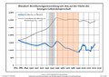