Category:Bodies of water in the Orkney Islands
Zur Navigation springen
Zur Suche springen
Council areas (municipalities) of Scotland: Aberdeen · Aberdeenshire · Angus · Argyll and Bute · Clackmannanshire · Dumfries and Galloway · Dundee · East Ayrshire · East Dunbartonshire · East Lothian · East Renfrewshire · Edinburgh · Falkirk · Fife · Glasgow · Highland · Inverclyde · Midlothian · Moray · North Ayrshire · North Lanarkshire · Outer Hebrides · Orkney Islands · Perth and Kinross · Renfrewshire · Scottish Borders · Shetland Islands · South Ayrshire · South Lanarkshire · Stirling · West Dunbartonshire · West Lothian
Wikimedia-Kategorie | |||||
| Medium hochladen | |||||
| Ist ein(e) | |||||
|---|---|---|---|---|---|
| |||||
Unterkategorien
Es werden 8 von insgesamt 8 Unterkategorien in dieser Kategorie angezeigt:
In Klammern die Anzahl der enthaltenen Kategorien (K), Seiten (S), Dateien (D)
Medien in der Kategorie „Bodies of water in the Orkney Islands“
Folgende 19 Dateien sind in dieser Kategorie, von 19 insgesamt.
-
 Burn at Quanter Ness - geograph.org.uk - 1130939.jpg 640 × 398; 103 KB
-
 Burn entering the sea - geograph.org.uk - 1222264.jpg 640 × 411; 100 KB
-
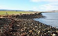
 Burn flowing into Wide Firth - geograph.org.uk - 1130945.jpg 640 × 464; 125 KB
-
 Burn near Hobbister - geograph.org.uk - 1077202.jpg 640 × 426; 70 KB
-
 Burn near Skaill - geograph.org.uk - 1188449.jpg 640 × 382; 136 KB
-
 Burn near the Tongue of Gangsta - geograph.org.uk - 1127329.jpg 640 × 425; 116 KB
-
 Burn of Lerquoy - geograph.org.uk - 1077020.jpg 640 × 426; 96 KB
-
 Burn of Netherbrough - geograph.org.uk - 1083924.jpg 640 × 426; 98 KB
-
 Burn of Nettleton - geograph.org.uk - 1085009.jpg 640 × 425; 94 KB
-
 Burn of Voy - geograph.org.uk - 1320904.jpg 640 × 427; 88 KB
-
 Garso, North Ronaldsay - geograph.org.uk - 341429.jpg 640 × 415; 50 KB
-
 Heldale Water - geograph.org.uk - 1498919.jpg 640 × 480; 79 KB
-
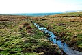
 Just follow the fence - geograph.org.uk - 1134235.jpg 640 × 411; 70 KB
-
 Mill Burn, Westray - geograph.org.uk - 493518.jpg 473 × 640; 81 KB
-
 Muckle Water, Westside, Westray - geograph.org.uk - 521704.jpg 640 × 473; 78 KB
-
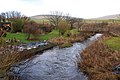
 South Burn on Hoy - geograph.org.uk - 1533693.jpg 640 × 427; 102 KB
-
 Water of Hoy - geograph.org.uk - 1432224.jpg 640 × 480; 144 KB
-
 Hamnavoe - geograph.org.uk - 485226.jpg 640 × 480; 120 KB
-
 View from the RSPB hide - geograph.org.uk - 180972.jpg 640 × 480; 113 KB


