Category:Boncath
Vai alla navigazione
Vai alla ricerca
village and community in Pembrokeshire, Wales, UK   | |||||
| Carica un file multimediale | |||||
| Audio della pronuncia | |||||
|---|---|---|---|---|---|
| Istanza di | |||||
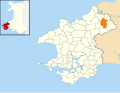
| Luogo | Pembrokeshire, Galles | ||||
| Popolazione |
| ||||
| Superficie |
| ||||
 | |||||
Cymraeg: Pentref yng ngogledd Sir Benfro yw Boncath. Mae'n gorwedd ychydig i'r dwyrain o'r briffordd A478 rhwng Aberteifi a Crymych.
Sottocategorie
Questa categoria contiene un'unica sottocategoria, indicata di seguito.
B
- Blaenffos (10 F)
File nella categoria "Boncath"
Questa categoria contiene 81 file, indicati di seguito, su un totale di 81.
-
 2010 Wales Pembrokeshire Community Boncath map.svg 512 × 393; 1 018 KB
-
 2024 Wales Pembrokeshire Community Boncath map.svg 512 × 393; 1,19 MB
-
 A478 northbound - geograph.org.uk - 3052068.jpg 640 × 480; 64 KB
-
 Afon Dulais Ford - geograph.org.uk - 6135422.jpg 3 000 × 2 000; 7,64 MB
-
 Arleth - geograph.org.uk - 571958.jpg 640 × 480; 114 KB
-
 Around Frenni Fawr Footpath - geograph.org.uk - 1280165.jpg 640 × 480; 94 KB
-
 B4332 heading for Boncath - geograph.org.uk - 3748125.jpg 640 × 480; 67 KB
-
 B4332 in the snow - geograph.org.uk - 3877646.jpg 4 000 × 3 000; 3,13 MB
-
 B4332 junction with A478 - geograph.org.uk - 2646617.jpg 3 601 × 2 522; 1,06 MB
-
 Bales in a field, Tynewydd, Castellan - geograph.org.uk - 925536.jpg 640 × 480; 90 KB
-
 Bend in track to Blaencwm - geograph.org.uk - 6305341.jpg 5 184 × 3 888; 5,13 MB
-
 Blaenffos Baptist Church - geograph.org.uk - 3470219.jpg 4 000 × 3 000; 2,07 MB
-
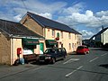
 Boncath Community Hall - geograph.org.uk - 3133840.jpg 3 264 × 2 448; 3,71 MB
-
 Boncath Community Hall - geograph.org.uk - 3133854.jpg 3 179 × 1 894; 1,14 MB
-
 Boncath Community Hall - geograph.org.uk - 3133860.jpg 3 264 × 2 448; 3,24 MB
-
 Boncath Community Hall plaque - geograph.org.uk - 3133881.jpg 3 264 × 2 448; 3 MB
-
 Boncath from Frenni - geograph.org.uk - 1240132.jpg 640 × 480; 55 KB
-
 Boncath Inn - geograph.org.uk - 3817367.jpg 2 693 × 1 473; 490 KB
-
 Boncath railway station 1849673 12a2910c.jpg 640 × 390; 106 KB
-
 Boncath1.jpg 640 × 480; 81 KB
-

-
 Capel Colman - geograph.org.uk - 572018.jpg 480 × 640; 98 KB
-
 Capel y Bedyddwyr, Blaenffos - geograph.org.uk - 3222775.jpg 3 264 × 2 448; 3,7 MB
-
 Church of St. Michael - geograph.org.uk - 572000.jpg 1 600 × 1 200; 476 KB
-
 Cilwendeg Mansion - geograph.org.uk - 1996334.jpg 1 600 × 1 200; 548 KB
-
 Cilwendeg Shell House Hermitage - geograph.org.uk - 572020.jpg 640 × 480; 166 KB
-
 Colomendy, Cilwendeg - front elevation - geograph.org.uk - 6351604.jpg 800 × 562; 159 KB
-
 Colomendy, Cilwendeg - geograph.org.uk - 6351457.jpg 800 × 534; 249 KB
-
 Colomendy, Cilwendeg - side elevation - geograph.org.uk - 6351682.jpg 800 × 556; 185 KB
-
 Copse near Castellan Chapel - geograph.org.uk - 925533.jpg 640 × 480; 102 KB
-
 Cottages, Blaenffos - geograph.org.uk - 3052060.jpg 640 × 480; 85 KB
-
 Crymych from Frenni fawr - geograph.org.uk - 3876571.jpg 2 816 × 2 112; 3,12 MB
-
 Crymych, Pembrokeshire - geograph.org.uk - 3982184.jpg 2 491 × 1 851; 1,62 MB
-
 Distant Ffrenni Fawr - geograph.org.uk - 3056827.jpg 3 264 × 2 448; 2,99 MB
-
 Dwelling beside the B4332 - geograph.org.uk - 2646614.jpg 3 648 × 2 736; 1,55 MB
-
 Eisteddfod security - geograph.org.uk - 3817346.jpg 3 264 × 2 448; 2,97 MB
-
 Eisteddfod yr Urdd - geograph.org.uk - 3817357.jpg 3 264 × 2 448; 3,41 MB
-

-
 Farm building at Blaen-nos - geograph.org.uk - 6305348.jpg 5 184 × 3 888; 3,75 MB
-
 Farmland - geograph.org.uk - 1280166.jpg 640 × 480; 47 KB
-
 Field bank near Castellan - geograph.org.uk - 925538.jpg 640 × 466; 85 KB
-
 Field, Castellan - geograph.org.uk - 925530.jpg 640 × 480; 118 KB
-
 Fields near Penlan-uchaf, Penrydd - geograph.org.uk - 2384074.jpg 1 742 × 1 256; 717 KB
-
 Frenni Fawr - geograph.org.uk - 3310239.jpg 1 600 × 1 200; 757 KB
-
 Frenni Fawr from the southeast - geograph.org.uk - 191718.jpg 640 × 480; 75 KB
-
 Frenni Fawr trig pillar - geograph.org.uk - 191714.jpg 640 × 480; 95 KB
-
 Heather moorland north of Frenni Fawr - geograph.org.uk - 6305356.jpg 5 184 × 3 888; 5,61 MB
-
 Japan^ No, it's Blaenffos - geograph.org.uk - 925542.jpg 640 × 480; 125 KB
-
 Junction of bridleway with minor road near Penlan-uchaf - geograph.org.uk - 6305362.jpg 5 184 × 3 888; 3,77 MB
-
 Laburnum blossom on the B4332 - geograph.org.uk - 4003541.jpg 1 024 × 768; 209 KB
-
 Ordnance Survey Cut Mark - geograph.org.uk - 6395330.jpg 1 024 × 808; 184 KB
-
 Ordnance Survey Cut Mark - geograph.org.uk - 6403535.jpg 1 024 × 790; 194 KB
-
 Ordnance Survey Cut Mark - geograph.org.uk - 6403542.jpg 1 024 × 659; 235 KB
-
 Ordnance Survey Cut Mark - geograph.org.uk - 6403543.jpg 1 024 × 739; 124 KB
-
 Ordnance Survey Cut Mark - geograph.org.uk - 6403544.jpg 1 024 × 695; 280 KB
-
 Ordnance Survey Cut Mark - geograph.org.uk - 6403545.jpg 1 024 × 785; 214 KB
-
 Ordnance Survey Cut Mark - geograph.org.uk - 6403546.jpg 1 024 × 724; 252 KB
-
 Ordnance Survey Flush Bracket (11879) - geograph.org.uk - 6393445.jpg 794 × 1 024; 342 KB
-
 Ordnance Survey Flush Bracket 11879 - geograph.org.uk - 3482844.jpg 4 000 × 3 000; 2,98 MB
-

-
 Rhyd Afon Dulais - Afon Dulais ford - geograph.org.uk - 5723442.jpg 640 × 480; 131 KB
-
 School playground^ - geograph.org.uk - 3222791.jpg 3 264 × 2 448; 3,84 MB
-

-
 Slopes of Frenni Fawr - geograph.org.uk - 4884269.jpg 640 × 426; 61 KB
-
 Staggered Road Junction near Boncath - geograph.org.uk - 3748123.jpg 640 × 480; 67 KB
-

-
 The B4332 through Boncath - geograph.org.uk - 4444134.jpg 3 251 × 2 257; 1,91 MB
-
 The Boncath Inn - geograph.org.uk - 2646611.jpg 3 648 × 2 736; 1,37 MB
-
 The Boncath Inn - geograph.org.uk - 3447466.jpg 640 × 480; 99 KB
-
 The centre of Boncath - geograph.org.uk - 4444116.jpg 3 264 × 2 448; 1,9 MB
-
 The Cilwendeg Shell House - geograph.org.uk - 942438.jpg 640 × 480; 125 KB
-
 The road from Boncath to Bwlchygroes - geograph.org.uk - 6283731.jpg 2 592 × 1 944; 2,16 MB
-
 Through a sylvan arch - geograph.org.uk - 6305346.jpg 5 184 × 3 888; 3,88 MB
-
 Trig point on Frenni Fawr - geograph.org.uk - 1637408.jpg 640 × 480; 89 KB
-
 Trig point on Frenni Fawr 1297' - 395m - geograph.org.uk - 6305358.jpg 4 032 × 3 024; 2,45 MB
-
 Trwn Hwch - geograph.org.uk - 1240143.jpg 640 × 480; 76 KB
-
 Tumulus north-west of Frenni Fawr - geograph.org.uk - 6305351.jpg 5 184 × 3 888; 3,81 MB
-
 Village pump - geograph.org.uk - 3817373.jpg 3 264 × 2 448; 4,51 MB
-
 Capel y Bedyddwyr Blaenffos - geograph.org.uk - 473233.jpg 640 × 480; 83 KB
-
 End House - geograph.org.uk - 466444.jpg 640 × 480; 107 KB
-
 Postgwyn, near Boncath - geograph.org.uk - 651666.jpg 640 × 480; 110 KB


_-_geograph.org.uk_-_6393445.jpg)


