Category:Borden, Kent
Vai alla navigazione
Vai alla ricerca
English: Borden is a village situated immediately south west of Sittingbourne, Kent, from which it is separated by a small area of rural land. The history of the name is questioned. It may be derived from bor (hill) and then either from denu (valley) or denn (woodland pasture). It may also derive from "boar" "den", as it was known that the wild animals were found in the surrounding areas. Borden was first recorded in the twelfth century as Bordena. It may also stem from the settlement there of the de Bourdon (now Borden) family which came from Bourdannay, in Normandy, France with William the Conqueror in 1066. A similar contention surrounds the origin of the surname, so perhaps there lies the connection.
village and civil parish in Kent, United Kingdom  | |||||
| Carica un file multimediale | |||||
| Istanza di | |||||
|---|---|---|---|---|---|
| Luogo | Swale, Kent, Sud Est dell'Inghilterra, Inghilterra | ||||
| Popolazione |
| ||||
| Considerato essere uguale a | Borden (pagina Wikimedia duplicata, parrocchia civile dell'Inghilterra) | ||||
 | |||||
Sottocategorie
Questa categoria contiene le 5 sottocategorie indicate di seguito, su un totale di 5.
File nella categoria "Borden, Kent"
Questa categoria contiene 200 file, indicati di seguito, su un totale di 266.
(pagina precedente) (pagina successiva)-
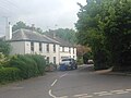
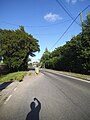
 243-247 Borden Lane - geograph.org.uk - 4869931.jpg 5 184 × 3 456; 7,41 MB
-
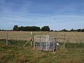
 A field of maize - geograph.org.uk - 2187714.jpg 640 × 430; 138 KB
-
 A field of ripe barley, Oad Street - geograph.org.uk - 5050826.jpg 640 × 480; 112 KB
-
 A2 Key Street, Sittingbourne - geograph.org.uk - 2001737.jpg 3 072 × 2 304; 2,36 MB
-
 A2 Key Street, Sittingbourne - geograph.org.uk - 2001742.jpg 3 072 × 2 304; 2,75 MB
-
 A249 dual carriageway - geograph.org.uk - 2184773.jpg 640 × 430; 143 KB
-
 A249 near Key Street - geograph.org.uk - 3728725.jpg 3 488 × 2 616; 2,03 MB
-
 A249, Maidstone Rd - geograph.org.uk - 2187713.jpg 640 × 430; 175 KB
-
 A249, south west - geograph.org.uk - 2184745.jpg 640 × 430; 140 KB
-
 Another one bites the dust - geograph.org.uk - 903211.jpg 640 × 480; 63 KB
-
 Apple Tree Cottage, Borden - geograph.org.uk - 3123851.jpg 4 288 × 3 216; 3,38 MB
-

-
 Auckland Drive - geograph.org.uk - 2070873.jpg 640 × 480; 70 KB
-
 Bannister Hill, Borden - geograph.org.uk - 4948992.jpg 3 264 × 2 448; 1,25 MB
-
 Barn at Hook's Hole - geograph.org.uk - 2347824.jpg 640 × 480; 68 KB
-
 Barn, Hook's Hole - geograph.org.uk - 2184628.jpg 640 × 430; 139 KB
-
 Barrow House, Borden - geograph.org.uk - 656038.jpg 640 × 439; 78 KB
-

-
 Borden church - geograph.org.uk - 5319371.jpg 640 × 480; 150 KB
-
 Borden church from The Street - geograph.org.uk - 5867303.jpg 749 × 1 024; 180 KB
-

-
-
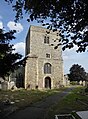 Borden church, the west tower - geograph.org.uk - 5866931.jpg 755 × 1 024; 236 KB
-
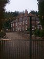
 Borden Hall - geograph.org.uk - 5865402.jpg 1 024 × 799; 222 KB
-
 Borden Lane, Borden - geograph.org.uk - 4948985.jpg 3 264 × 2 448; 1,68 MB
-
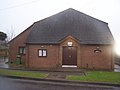 Borden Parish Hall - geograph.org.uk - 1128821.jpg 640 × 481; 57 KB
-
 Borden Parish Hall - geograph.org.uk - 5319396.jpg 640 × 428; 125 KB
-
 Borden Post Office Stores - geograph.org.uk - 656054.jpg 640 × 478; 97 KB
-

-
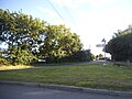
 Borden Village Sign - geograph.org.uk - 2089701.jpg 2 304 × 3 072; 1,96 MB
-
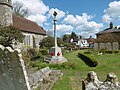 Borden War Memorial - geograph.org.uk - 4912078.jpg 4 608 × 3 456; 3,38 MB
-

-
 Borden, The Street, seen from the churchyard - geograph.org.uk - 5865493.jpg 1 024 × 814; 186 KB
-
 Bridge over M2 at Church Wood - geograph.org.uk - 5969793.jpg 1 024 × 576; 88 KB
-
 Bridle bridge across A249 - geograph.org.uk - 2184735.jpg 640 × 430; 144 KB
-
 Bridleway by the A249 - geograph.org.uk - 2184733.jpg 640 × 430; 155 KB
-
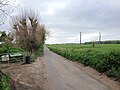
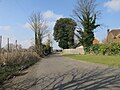
 Bridleway to Borden - geograph.org.uk - 4413818.jpg 640 × 480; 163 KB
-
 Brier Road, Chalkwell - geograph.org.uk - 3756651.jpg 3 488 × 2 616; 2,11 MB
-
 Brier Road, Chalkwell - geograph.org.uk - 3756657.jpg 3 488 × 2 616; 2,18 MB
-
 Bungalow on Oad Street - geograph.org.uk - 5038597.jpg 2 304 × 1 728; 827 KB
-
 Bungalows on Wrens Road, Hearts Delight - geograph.org.uk - 5319800.jpg 1 972 × 1 430; 995 KB
-
 Cherry Fields, Chalkwell - geograph.org.uk - 3756647.jpg 3 488 × 2 616; 2,2 MB
-
 Chestnut St - geograph.org.uk - 2182370.jpg 640 × 430; 139 KB
-
 Chestnut Street - geograph.org.uk - 2184680.jpg 640 × 430; 140 KB
-
 Chestnut Street - geograph.org.uk - 2184701.jpg 640 × 430; 122 KB
-
 Chestnut Street - geograph.org.uk - 2184705.jpg 640 × 430; 148 KB
-
 Chestnut Street - geograph.org.uk - 2184709.jpg 640 × 430; 160 KB
-
 Chestnut street - geograph.org.uk - 2184717.jpg 640 × 430; 158 KB
-
 Chestnut Street - geograph.org.uk - 3728696.jpg 3 488 × 2 616; 2,14 MB
-
 Chestnut Street - geograph.org.uk - 3728707.jpg 3 488 × 2 616; 1,91 MB
-
 Chestnut Street - geograph.org.uk - 3728711.jpg 3 488 × 2 616; 1,96 MB
-
 Chestnut Street - geograph.org.uk - 4950079.jpg 3 264 × 2 448; 1,48 MB
-
 Chestnut Street Coachworks - geograph.org.uk - 2184706.jpg 640 × 430; 126 KB
-
 Chestnut Street Farmhouse - geograph.org.uk - 3123929.jpg 4 288 × 3 216; 3,54 MB
-

-
 Chestnut Street, village and street - geograph.org.uk - 3123878.jpg 4 288 × 3 216; 3,71 MB
-
 Chestnut Wood Lane, Chestnut Street - geograph.org.uk - 3728686.jpg 3 488 × 2 616; 2,22 MB
-
 Close-up of Borden Village Sign - geograph.org.uk - 2089703.jpg 2 422 × 1 688; 988 KB
-
 Coppiced fence, Tudor Rose Cottage - geograph.org.uk - 2184684.jpg 640 × 430; 156 KB
-
 Coppins Lane, Borden - geograph.org.uk - 4948993.jpg 3 264 × 2 448; 1,46 MB
-
 Cottage, Chestnut Street - geograph.org.uk - 2184675.jpg 640 × 430; 140 KB
-
 Cottage, Chestnut Street - geograph.org.uk - 2184689.jpg 640 × 430; 180 KB
-
 Cottage, School Lane - geograph.org.uk - 2184637.jpg 640 × 430; 136 KB
-
 Cryalls Lane, near Borden - geograph.org.uk - 4949009.jpg 3 264 × 2 448; 1,81 MB
-
 Cryalls Lane, near Borden - geograph.org.uk - 4949010.jpg 3 264 × 2 448; 1,88 MB
-
 Cryalls Lane, Sittingbourne - geograph.org.uk - 4949012.jpg 3 264 × 2 448; 1,72 MB
-
 Danaway Cottages, Maidstone Road, Danaway - geograph.org.uk - 3728679.jpg 3 488 × 2 616; 1,67 MB
-
 Danaway Village Sign - geograph.org.uk - 3728658.jpg 2 808 × 2 581; 1,91 MB
-
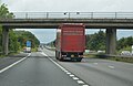
 Eastbound M2 - geograph.org.uk - 5828007.jpg 1 024 × 684; 229 KB
-
 Eastbound M2 - geograph.org.uk - 5828013.jpg 1 024 × 684; 227 KB
-
 Electrical sub station - geograph.org.uk - 2182403.jpg 640 × 430; 136 KB
-
 Eyehorn Hatch Farmhouse, Borden - geograph.org.uk - 5050845.jpg 640 × 480; 82 KB
-
 Farm pond, Hook's Hole - geograph.org.uk - 2184651.jpg 640 × 430; 137 KB
-
 Farmland north of Borden Hall - geograph.org.uk - 5865409.jpg 1 024 × 768; 191 KB
-
 Farmyard, Hook's Hole - geograph.org.uk - 2184649.jpg 640 × 385; 81 KB
-
 Field beside M2 - geograph.org.uk - 4869988.jpg 5 100 × 3 400; 6,97 MB
-
 Field by Sutton Baron Road - geograph.org.uk - 4869921.jpg 4 000 × 3 000; 3,87 MB
-
 Field entrance on Oad Street - geograph.org.uk - 5237064.jpg 2 304 × 1 728; 1,17 MB
-
 Fields by Wrens Road, Hearts Delight - geograph.org.uk - 5319801.jpg 2 048 × 1 536; 1,1 MB
-
 Fields off Chestnut Street - geograph.org.uk - 2347843.jpg 640 × 480; 92 KB
-
 Footpath along the hedge - geograph.org.uk - 2184579.jpg 640 × 430; 203 KB
-
 Footpath and thistles, Oad Street - geograph.org.uk - 5050798.jpg 640 × 480; 97 KB
-
 Footpath from Munsgore Farm - geograph.org.uk - 4912178.jpg 4 608 × 3 456; 3,39 MB
-
 Footpath gate near M2 - geograph.org.uk - 4869986.jpg 3 600 × 2 400; 5,97 MB
-
 Footpath junction near Chestnut Wood - geograph.org.uk - 3123886.jpg 4 288 × 3 216; 3,72 MB
-
 Footpath junction on Starveacre Lane - geograph.org.uk - 3123825.jpg 4 288 × 3 216; 3,26 MB
-
 Footpath near Borden - geograph.org.uk - 4911979.jpg 4 608 × 3 456; 3,43 MB
-
 Footpath near Borden - geograph.org.uk - 4912169.jpg 4 608 × 3 456; 3,44 MB
-
 Footpath near Borden - geograph.org.uk - 5050577.jpg 480 × 640; 63 KB
-
 Footpath off Chestnut St - geograph.org.uk - 2182373.jpg 640 × 430; 161 KB
-
 Footpath off Chestnut Street - geograph.org.uk - 2184711.jpg 640 × 430; 128 KB
-
 Footpath on Pond Farm Road - geograph.org.uk - 1128813.jpg 481 × 640; 48 KB
-
 Footpath signs near Chestnut Street - geograph.org.uk - 4912142.jpg 4 608 × 3 456; 3,4 MB
-
 Footpath signs near Chestnut Street - geograph.org.uk - 4912146.jpg 4 608 × 3 456; 3,39 MB
-

-
 Footpath to Munsgore Farm - geograph.org.uk - 4912158.jpg 4 608 × 3 456; 3,4 MB
-
 Footpath to Oad Street - geograph.org.uk - 4912001.jpg 4 608 × 3 456; 3,39 MB
-
 Footpath towards Borden - geograph.org.uk - 5867571.jpg 771 × 1 024; 306 KB
-
 Geese by Chestnut St - geograph.org.uk - 2182389.jpg 640 × 430; 188 KB
-
 Geneagles Service Station, Danaway - geograph.org.uk - 3728664.jpg 3 488 × 2 616; 2,36 MB
-
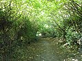 Green tunnel on Starveacre Lane - geograph.org.uk - 3123818.jpg 4 288 × 3 216; 3,43 MB
-
 Hearts Delight, Borden - geograph.org.uk - 4948978.jpg 3 264 × 2 448; 2,06 MB
-
 Hearts Delight, Borden - geograph.org.uk - 4948979.jpg 3 264 × 2 448; 1,82 MB
-
 Hook's Hole - geograph.org.uk - 2184635.jpg 640 × 430; 142 KB
-
 Hook's Hole - geograph.org.uk - 2184653.jpg 640 × 430; 126 KB
-
 Hook's Hole, Chestnut Street, Borden - geograph.org.uk - 2347821.jpg 640 × 480; 112 KB
-
 Horses alongside School Lane - geograph.org.uk - 4912163.jpg 4 608 × 3 456; 3,34 MB
-
 House at Oad Street - geograph.org.uk - 2419775.jpg 640 × 480; 112 KB
-
 House, ChestnutStreet - geograph.org.uk - 2184668.jpg 640 × 430; 119 KB
-
 Houses on Chestnut Street - geograph.org.uk - 5319440.jpg 640 × 428; 106 KB
-
 Houses on Oad Street - geograph.org.uk - 5038591.jpg 2 304 × 1 728; 814 KB
-
 Houses on Vigo Lane - geograph.org.uk - 5237019.jpg 2 304 × 1 728; 830 KB
-
 Houses on Wrens Road, Hearts Delight - geograph.org.uk - 5237093.jpg 2 304 × 1 728; 832 KB
-
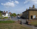
 Key Street - geograph.org.uk - 4949048.jpg 3 264 × 2 448; 1,5 MB
-
 Keycol junction (A2 ^ A249) - geograph.org.uk - 2182367.jpg 640 × 430; 134 KB
-
 Kissing Gate on Starveacre Lane - geograph.org.uk - 3123832.jpg 4 288 × 3 216; 3,49 MB
-
 Large barn at Vinson Farm - geograph.org.uk - 4869992.jpg 5 184 × 3 456; 7,29 MB
-
 Looking across the A249 Maidstone Road - geograph.org.uk - 4969699.jpg 4 608 × 3 456; 3,55 MB
-

-
 Lozenge graves at St Peter and St Paul Church, Borden - geograph.org.uk - 4912089.jpg 4 608 × 3 456; 3,38 MB
-
 M2 approaching J5 - geograph.org.uk - 5208041.jpg 640 × 426; 42 KB
-
 M2 looking west - geograph.org.uk - 6169310.jpg 1 024 × 768; 360 KB
-
 M2 Motorway - geograph.org.uk - 5014548.jpg 3 264 × 2 448; 1,73 MB
-
 M2, approaching Vigo Lane Bridge - geograph.org.uk - 2490098.jpg 640 × 430; 48 KB
-
 M2, approaching Wrens Road Bridge - geograph.org.uk - 2490110.jpg 640 × 370; 42 KB
-
 M2, between J5 and 6 - geograph.org.uk - 2490086.jpg 640 × 430; 44 KB
-
 M2, between Vigo Lane and Wrens Road - geograph.org.uk - 2490105.jpg 640 × 430; 46 KB
-
 M2, J5 - geograph.org.uk - 5208043.jpg 640 × 426; 49 KB
-
 M2, J5 - geograph.org.uk - 5208045.jpg 640 × 418; 51 KB
-
 M2, Junction 5 - geograph.org.uk - 2490060.jpg 640 × 430; 47 KB
-
 M2, Wrens Road Bridge - geograph.org.uk - 3721273.jpg 640 × 480; 287 KB
-
 Magnolia Tree - geograph.org.uk - 2347899.jpg 640 × 480; 110 KB
-
 Maidstone Road, Chestnut Street - geograph.org.uk - 5321977.jpg 2 048 × 1 536; 819 KB
-
 Maidstone Road, Danaway - geograph.org.uk - 3728668.jpg 3 488 × 2 616; 2,58 MB
-
 Maidstone Road, Danaway - geograph.org.uk - 3728675.jpg 3 488 × 2 616; 1,83 MB
-
 Maidstone Road, Danaway - geograph.org.uk - 5012639.jpg 2 048 × 1 536; 877 KB
-
 Maidstone Road, near Chestnut Street - geograph.org.uk - 3728681.jpg 3 488 × 2 616; 2,2 MB
-
 Maidstone Road, near Chestnut Street - geograph.org.uk - 3728683.jpg 3 488 × 2 616; 2,14 MB
-
 Meeting of paths at Chestnut Wood - geograph.org.uk - 4912149.jpg 4 608 × 3 456; 3,44 MB
-
 Milestone, Chestnut Street - geograph.org.uk - 2184693.jpg 640 × 430; 152 KB
-
 Mount View, Borden - geograph.org.uk - 4948994.jpg 3 264 × 2 448; 1,64 MB
-
 Munsgore Lane, Oad Street - geograph.org.uk - 5014463.jpg 3 264 × 2 448; 3,15 MB
-
 Munsgrove House - geograph.org.uk - 1128789.jpg 481 × 640; 49 KB
-
 New Woodland - geograph.org.uk - 1121910.jpg 640 × 481; 102 KB
-
 Nissen Hut, Chestnut Street - geograph.org.uk - 3123917.jpg 4 288 × 3 216; 3,75 MB
-
 No 241, Borden Lane - geograph.org.uk - 3123839.jpg 4 288 × 3 216; 3,56 MB
-
 Oad Irons, Oad Street - geograph.org.uk - 5050754.jpg 640 × 480; 78 KB
-
 Oad Street - geograph.org.uk - 5014432.jpg 3 264 × 2 448; 1,78 MB
-
 Oad Street - geograph.org.uk - 5014440.jpg 3 264 × 2 448; 1,58 MB
-
 Oad Street - geograph.org.uk - 5014477.jpg 3 264 × 2 448; 1,7 MB
-
 Oad Street - geograph.org.uk - 5014485.jpg 3 264 × 2 448; 1,75 MB
-
 Oad Street - geograph.org.uk - 5237005.jpg 1 728 × 2 304; 827 KB
-

-
 Oast House on Sutton Baron Road - geograph.org.uk - 5237071.jpg 2 304 × 1 728; 857 KB
-
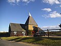
 Oast-house at Wrens Farm, south of Borden - geograph.org.uk - 5865277.jpg 916 × 1 024; 182 KB
-

-

-
 Panorama of Chestnut Street, Borden - geograph.org.uk - 3123870.jpg 4 576 × 1 312; 2,37 MB
-
 Parking area on Maidstone Road, Danaway - geograph.org.uk - 5012607.jpg 1 996 × 1 464; 657 KB
-

-
 Path through field of oilseed rape - geograph.org.uk - 4911994.jpg 4 608 × 3 456; 3,39 MB
-
 Plaque on rear of Barrow House, Borden - geograph.org.uk - 656046.jpg 640 × 640; 129 KB
-
 Plough ^ Harrow, Oad Street - geograph.org.uk - 1906956.jpg 1 516 × 960; 577 KB
-
 Pond Farm Road - geograph.org.uk - 4913037.jpg 4 608 × 3 456; 3,37 MB
-
 Pond Farm Road at the junction of Sutton Baron Road - geograph.org.uk - 5038610.jpg 2 304 × 1 728; 822 KB
-
 Pond Farm Road, Borden - geograph.org.uk - 4949004.jpg 3 264 × 2 448; 1,75 MB
-
 Pond Farm Road, Borden - geograph.org.uk - 5050619.jpg 640 × 480; 63 KB
-
 Pond Farm Road, Oad Street - geograph.org.uk - 1354284.jpg 640 × 480; 93 KB
-
 Posiers, Borden Lane - geograph.org.uk - 2070861.jpg 640 × 480; 95 KB
-
 Providene Cottages, Borden Lane - geograph.org.uk - 2070860.jpg 640 × 480; 90 KB
-
 Pylon by School Lane - geograph.org.uk - 2184640.jpg 430 × 640; 90 KB
-
 Pylon near Chestnut St - geograph.org.uk - 2182397.jpg 640 × 430; 121 KB
-
 Pylon near Oad Street - geograph.org.uk - 5319328.jpg 640 × 480; 93 KB
-
 Pylons off Wises Lane - geograph.org.uk - 2070886.jpg 640 × 480; 58 KB
-
 Riddles Road - geograph.org.uk - 4869964.jpg 4 000 × 3 000; 4,01 MB
-
 Riddles Road Allotments, Borden - geograph.org.uk - 5232169.jpg 640 × 464; 87 KB
-

-
 School Lane - geograph.org.uk - 2184645.jpg 640 × 430; 173 KB
-
 School Lane - geograph.org.uk - 2347834.jpg 640 × 480; 68 KB
-
 School Lane - geograph.org.uk - 4911985.jpg 4 608 × 3 456; 3,48 MB
-
 School Lane - geograph.org.uk - 4912160.jpg 4 608 × 3 456; 3,36 MB
-
 School Lane near Chestnut Street - geograph.org.uk - 1359321.jpg 640 × 480; 82 KB
-
 Shillinghurst Nursery, Oad Street - geograph.org.uk - 5050784.jpg 640 × 480; 73 KB
-
 Sliproad onto the A249, Keycol - geograph.org.uk - 5012581.jpg 2 048 × 1 536; 1,03 MB
-
 Southbound M2 near Oad Street - geograph.org.uk - 3721236.jpg 640 × 480; 239 KB
-
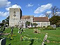
 St Peter and St Paul Church, Borden - geograph.org.uk - 4911974.jpg 4 608 × 3 456; 3,37 MB
-
 St Peter and St Paul Church, Borden and the war memorial - geograph.org.uk - 4912080.jpg 4 608 × 3 456; 3,35 MB
-
 Stable block^ - No, Blacksmith's forge - geograph.org.uk - 656067.jpg 640 × 501; 106 KB
-

-
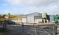
 Steel fabricators on Cryalls Lane - geograph.org.uk - 179278.jpg 640 × 414; 92 KB
-
 Steps to footbridge - geograph.org.uk - 2184714.jpg 640 × 430; 214 KB
-
 Steps to The Playstool and footpath - geograph.org.uk - 1125956.jpg 640 × 481; 102 KB
-
 Stile amongst Autumnal colours - geograph.org.uk - 2182385.jpg 640 × 430; 216 KB
-
 Stile and footpaths - geograph.org.uk - 1128784.jpg 481 × 640; 109 KB
-
 Stile south of Chestnut St - geograph.org.uk - 2182409.jpg 640 × 430; 191 KB
-
 Stockbury Valley - geograph.org.uk - 4401843.jpg 1 600 × 1 029; 146 KB
-
 Straw bale near Hook's Hole - geograph.org.uk - 2184633.jpg 640 × 430; 184 KB
-
 Street Farmhouse - geograph.org.uk - 2089705.jpg 3 072 × 2 304; 1,54 MB
-
 Sunnyhill Road - geograph.org.uk - 4912155.jpg 4 608 × 3 456; 3,37 MB
-
 Sunrise - geograph.org.uk - 3360477.jpg 640 × 430; 35 KB


_from_the_south_-_geograph.org.uk_-_5866932.jpg)


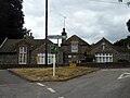
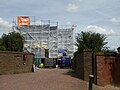
_Primary_School_-_geograph.org.uk_-_903253.jpg)


_-_geograph.org.uk_-_2182367.jpg)


