Category:Borough of Hartlepool
Zur Navigation springen
Zur Suche springen
unitary authority area in County Durham, north east England Nov2007.jpg)  | |||||
| Medium hochladen | |||||
| As en | |||||
|---|---|---|---|---|---|
| Steed |
| ||||
| Legislatiif |
| ||||
| Grünjlaanj |
| ||||
| Iinwenertaal |
| ||||
| Grate |
| ||||
| amtelk wääbsteed | |||||
 | |||||
Onerkategoriin
Uun detdiar kategorii stun 11 onerkategoriin faan 11 uun't gehial.
B
- Brierton (15 D)
C
- Claxton, County Durham (20 D)
D
- Dalton Piercy (43 D)
E
- Elwick, County Durham (96 D)
G
H
N
- Newton Bewley (23 D)
W
Meedien uun kategorii "Borough of Hartlepool"
Uun detdiar kategorii stun jodiar 200 datein faan 558 uun't gehial.
(leetst sidj (turag)) (naist sidj)-
 "What is it" - geograph.org.uk - 2606006.jpg 640 × 480; 168 KB
-

-

-
 A path leading to North Sands - geograph.org.uk - 3330489.jpg 800 × 600; 99 KB
-
 A pebbly section of North Sands - geograph.org.uk - 4687594.jpg 640 × 480; 108 KB
-
 A ship in Victoria Harbour - geograph.org.uk - 2013409.jpg 640 × 480; 216 KB
-
 A1048 Cleveland Road - geograph.org.uk - 4738613.jpg 640 × 481; 45 KB
-
 A1049 towards The Headland - geograph.org.uk - 2820822.jpg 640 × 480; 43 KB
-
 A178 northbound at Seaton Snook - geograph.org.uk - 4738588.jpg 640 × 480; 19 KB
-
 A178 Tees Road at The Tioxide Works - geograph.org.uk - 4737143.jpg 640 × 481; 24 KB
-
 A178 towards Hartlepool - geograph.org.uk - 2820429.jpg 640 × 480; 46 KB
-
 A178 towards Hartlepool - geograph.org.uk - 2820435.jpg 640 × 480; 51 KB
-
 A179 Marina Way northbound - geograph.org.uk - 4738609.jpg 640 × 481; 34 KB
-
 Abandoned factory site - geograph.org.uk - 3242918.jpg 1.024 × 768; 168 KB
-
 Abdiel House - geograph.org.uk - 2016990.jpg 640 × 481; 278 KB
-

-
 Access road to the beach - geograph.org.uk - 2820703.jpg 640 × 480; 72 KB
-

-

-
 Applewood Close - geograph.org.uk - 2822273.jpg 640 × 480; 70 KB
-
 Bandstand at Hartlepool Marina - geograph.org.uk - 3313335.jpg 3.648 × 2.736; 2 MB
-
 Banner of Cleveland County Council.jpg 1.125 × 675; 98 KB
-

-
 Beach near North Gare Breakwater - geograph.org.uk - 2820490.jpg 640 × 480; 60 KB
-

-

-

-
 Bell Buoy, West View Road - geograph.org.uk - 4745837.jpg 480 × 640; 542 KB
-

-
 Bingo Hall, Hartlepool. - geograph.org.uk - 5764915.jpg 640 × 510; 88 KB
-
 Bits of Old Pier - geograph.org.uk - 4819911.jpg 640 × 480; 115 KB
-

-

-
 Boats at Hartlepool Marina - geograph.org.uk - 5658183.jpg 800 × 477; 103 KB
-
 Boats at Hartlepool Marina - geograph.org.uk - 5680742.jpg 800 × 534; 98 KB
-
 Boats in Hartlepool Marina - geograph.org.uk - 5432492.jpg 4.605 × 3.649; 2,59 MB
-
 Boats moored at Hartlepool Marina - geograph.org.uk - 5658166.jpg 800 × 486; 86 KB
-
 Breakwater at Victoria Harbour - geograph.org.uk - 2006698.jpg 640 × 480; 208 KB
-
 Bridge carrying A178 over East Coast Railway - geograph.org.uk - 2542198.jpg 3.648 × 2.736; 2,18 MB
-
 Bridge over The East Coast Line - geograph.org.uk - 2801509.jpg 1.868 × 1.330; 512 KB
-
 Bridleway towards Hart - geograph.org.uk - 2822274.jpg 640 × 480; 70 KB
-
 Bridleway towards Seaton Carew - geograph.org.uk - 2820507.jpg 640 × 480; 61 KB
-
 Brierton Community Sports Centre - geograph.org.uk - 1882808.jpg 3.088 × 2.056; 2,39 MB
-
 Brierton Lane - geograph.org.uk - 1882775.jpg 3.088 × 2.056; 2,37 MB
-
 Broken pier - geograph.org.uk - 3242875.jpg 1.024 × 768; 145 KB
-
 Bubble Seller - geograph.org.uk - 2003265.jpg 640 × 427; 249 KB
-
 Bulmer Place in the fog - geograph.org.uk - 3191682.jpg 640 × 480; 42 KB
-
 Byway towards North Gare Sands - geograph.org.uk - 2820456.jpg 640 × 480; 37 KB
-
 Cafe at Ward Jackson Park Hartlepool - geograph.org.uk - 1887353.jpg 2.048 × 1.536; 831 KB
-
 Call centres beside Hartlepool Marina - geograph.org.uk - 2006889.jpg 640 × 480; 245 KB
-

-
 Car park for North Gare - geograph.org.uk - 2643047.jpg 640 × 480; 67 KB
-
 Casebourne Road, Hartlepool - geograph.org.uk - 4065957.jpg 640 × 480; 156 KB
-
 Casebourne Road, Longhill, Hartlepool - geograph.org.uk - 4065975.jpg 640 × 480; 236 KB
-
 Catcote Road - geograph.org.uk - 3836199.jpg 640 × 480; 106 KB
-

-
 Chaffinch Close - geograph.org.uk - 3190028.jpg 640 × 480; 77 KB
-
 Chandler's shop - geograph.org.uk - 2938603.jpg 1.200 × 1.600; 380 KB
-
 Chemical works, Seal Sands - geograph.org.uk - 2820432.jpg 640 × 480; 39 KB
-
 Church Square, Hartlepool - geograph.org.uk - 5953657.jpg 2.000 × 1.500; 380 KB
-
 Church Street looking east - geograph.org.uk - 3257422.jpg 1.024 × 768; 148 KB
-
 Church Street, Hartlepool - geograph.org.uk - 5989542.jpg 2.000 × 1.500; 450 KB
-
 Cinema, Hartlepool - geograph.org.uk - 5989551.jpg 2.000 × 1.500; 227 KB
-
 Cleveland Road, Hartlepool - geograph.org.uk - 4745828.jpg 640 × 480; 460 KB
-
 Cliff top and demolition - geograph.org.uk - 3247277.jpg 1.024 × 768; 164 KB
-
 Closed public toilets, Hartlepool - geograph.org.uk - 5989571.jpg 2.000 × 1.500; 455 KB
-
 Coastal grazing land - geograph.org.uk - 2820453.jpg 640 × 480; 50 KB
-
 Coatham Drive, Hartlepool - geograph.org.uk - 2099045.jpg 640 × 480; 123 KB
-
 Concrete works, - geograph.org.uk - 4065946.jpg 640 × 480; 172 KB
-
 Construction site off Elwick Road, Hartlepool - geograph.org.uk - 5953628.jpg 2.000 × 1.500; 408 KB
-
 Cote Hill - geograph.org.uk - 3206959.jpg 4.608 × 3.456; 5,27 MB
-
 Cowper Grove, Hartlepool - geograph.org.uk - 2098058.jpg 640 × 480; 73 KB
-
 Crimdon Beck (2) - geograph.org.uk - 4687583.jpg 640 × 480; 81 KB
-
 Crimdon Beck (3) - geograph.org.uk - 4687587.jpg 640 × 480; 81 KB
-
 Crimdon Beck - geograph.org.uk - 3032726.jpg 2.848 × 2.144; 1,5 MB
-
 Crimdon Beck - geograph.org.uk - 4687580.jpg 640 × 480; 81 KB
-
 Crimdon Beck - geograph.org.uk - 4744870.jpg 640 × 480; 436 KB
-
 Crossing on Marina Way - geograph.org.uk - 4745765.jpg 640 × 480; 388 KB
-
 Cycle route 14 in Hartlepool - geograph.org.uk - 4065894.jpg 640 × 480; 150 KB
-
 Ditch on Seaton Common - geograph.org.uk - 3226302.jpg 4.608 × 3.456; 4,77 MB
-
 Dock side at dusk - geograph.org.uk - 5593303.jpg 5.320 × 2.922; 1,8 MB
-
 Dockyard crane and hardstanding - geograph.org.uk - 2015475.jpg 480 × 640; 180 KB
-
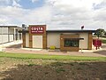 Drive through Costa Coffee, Hartlepool - geograph.org.uk - 6027701.jpg 2.000 × 1.500; 403 KB
-
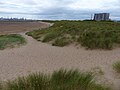
 Dunes and beach south of Crimdon Park - geograph.org.uk - 4687570.jpg 640 × 480; 103 KB
-
 Dunes and Beach, North Gare - geograph.org.uk - 4259050.jpg 640 × 480; 86 KB
-
 Dunes and North Sands - geograph.org.uk - 4686693.jpg 640 × 480; 86 KB
-

-
 Dunes at North Gare Sands - geograph.org.uk - 5683981.jpg 800 × 600; 93 KB
-
 Dunes next to North Gare Sands - geograph.org.uk - 5683835.jpg 800 × 539; 117 KB
-

-
 Elwick Palace, Elwick Road, Stranton - geograph.org.uk - 4065994.jpg 640 × 480; 178 KB
-
 Elwick Road - geograph.org.uk - 3836186.jpg 640 × 480; 110 KB
-
 Elwick Road, Stranton, Hartlepool - geograph.org.uk - 4065981.jpg 640 × 480; 221 KB
-

-
 End of the South Pier, Hartlepool - geograph.org.uk - 2820715.jpg 640 × 480; 39 KB
-
-
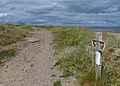
 England Coast Path at Seaton Snook - geograph.org.uk - 5682470.jpg 800 × 600; 134 KB
-
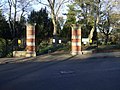 Entrance gates, Ward Jackson Park - geograph.org.uk - 3836184.jpg 640 × 480; 98 KB
-
 Entrance to Corus Steelworks - geograph.org.uk - 2096258.jpg 640 × 480; 55 KB
-
 Entrance to Hartlepool Dock Main Offices - geograph.org.uk - 4745834.jpg 640 × 480; 426 KB
-

-
 Entrance to North Gare Road - geograph.org.uk - 3226354.jpg 4.608 × 3.456; 4,39 MB
-
 Entrance to nurseries - geograph.org.uk - 1882724.jpg 3.088 × 2.056; 3,01 MB
-
 Entrance to Spion Kop Cemetery Hartlepool - geograph.org.uk - 2149683.jpg 2.048 × 1.536; 553 KB
-

-

-
 Entrance to Victoria Harbour - geograph.org.uk - 2013403.jpg 640 × 480; 207 KB
-
 Entrance to Ward Jackson Park - geograph.org.uk - 1883970.jpg 3.088 × 2.056; 3,05 MB
-
 Entrances to Victoria Park in Hartlepool - geograph.org.uk - 3443430.jpg 3.648 × 2.736; 1,86 MB
-
 Exhibit at the Museum of Hartlepool - geograph.org.uk - 2938472.jpg 1.600 × 1.200; 520 KB
-
 Fabrication Shed - geograph.org.uk - 2003259.jpg 640 × 427; 257 KB
-
 Farmland towards the sea - geograph.org.uk - 2821012.jpg 640 × 480; 52 KB
-
 Fenton Road, Hartlepool - geograph.org.uk - 2098112.jpg 640 × 480; 118 KB
-
 Field drain looking north - geograph.org.uk - 2820462.jpg 640 × 480; 58 KB
-
 Fish Sands at the Headland in Hartlepool - geograph.org.uk - 5658487.jpg 800 × 645; 127 KB
-
-

-
 Footbridge at Hart Station - geograph.org.uk - 4744867.jpg 480 × 640; 438 KB
-
 Footbridge over lock gates at Hartlepool Marina - geograph.org.uk - 3311584.jpg 2.667 × 1.912; 2,07 MB
-

-
 Footpath across Seaton Snook - geograph.org.uk - 4064718.jpg 640 × 480; 171 KB
-
 Footpath from North Gare Breakwater - geograph.org.uk - 2643034.jpg 640 × 480; 104 KB
-
 Footpath parallel to Old Cemetery Road - geograph.org.uk - 3247375.jpg 1.024 × 768; 147 KB
-
 Footpath to North Gare - geograph.org.uk - 2642848.jpg 640 × 480; 93 KB
-
 Footpath to Seaton Carew from Brenda Road (B1277) - geograph.org.uk - 2998344.jpg 3.648 × 2.736; 1,75 MB
-
 Footpath, Seaton Carew Golf Course - geograph.org.uk - 2642846.jpg 640 × 480; 98 KB
-
 Footpath, Seaton Carew Golf Course - geograph.org.uk - 2643038.jpg 640 × 480; 107 KB
-
 Foreshore at Seaton Sands - geograph.org.uk - 3344960.jpg 3.648 × 2.736; 3,17 MB
-
 Former Co-op store - geograph.org.uk - 3257415.jpg 1.024 × 768; 125 KB
-
 Former Methodist church, facade - geograph.org.uk - 3257436.jpg 1.024 × 801; 159 KB
-
 Freville Street, Hartlepool - geograph.org.uk - 2096135.jpg 640 × 480; 105 KB
-
 Frutarom premises at Teesmouth - geograph.org.uk - 2222973.jpg 2.048 × 1.536; 642 KB
-

-
 Gathering sea coal, Hartlepool Beach - geograph.org.uk - 2820701.jpg 640 × 471; 54 KB
-
 Giant cable reels - geograph.org.uk - 2017715.jpg 640 × 480; 238 KB
-
 Golfdome on Tees Road Seaton Carew - geograph.org.uk - 3245833.jpg 2.434 × 1.824; 2,01 MB
-
 Grand Hotel, Hartlepool - geograph.org.uk - 2096325.jpg 640 × 480; 104 KB
-
-
 Grazing land, Dunn's Hill - geograph.org.uk - 2820509.jpg 640 × 480; 80 KB
-
 Grazing west of Catcote Road - geograph.org.uk - 3836197.jpg 640 × 480; 107 KB
-
 Greatham Creek - geograph.org.uk - 2667171.jpg 640 × 427; 219 KB
-
 Greatham Creek and Cowpen Landfill Site - geograph.org.uk - 3206949.jpg 4.608 × 3.456; 4,99 MB
-
 Greatham Tank Farm from the air - geograph.org.uk - 6051731.jpg 1.024 × 768; 339 KB
-
 Green space off Clarence Road - geograph.org.uk - 3257446.jpg 1.024 × 768; 141 KB
-
 Greenabella Marsh - geograph.org.uk - 3224945.jpg 4.608 × 3.456; 4,65 MB
-
 Greenabella Marsh - geograph.org.uk - 5517542.jpg 640 × 480; 64 KB
-
 Gulls on North Sands - geograph.org.uk - 4744872.jpg 640 × 480; 375 KB
-

-
 Halfords store in Tees Bay Retail Park - geograph.org.uk - 3549249.jpg 3.550 × 2.600; 2,86 MB
-
 Harbour Lights opposite The Headland - geograph.org.uk - 2006714.jpg 480 × 640; 195 KB
-
 Harbour Walk - geograph.org.uk - 4745772.jpg 640 × 480; 421 KB
-
 Hart sculpture at the Hartlepool Marina car park (geograph 4745816).jpg 480 × 640; 168 KB
-
 Hartlepool (41232638170).png 2.166 × 1.232; 112 KB
-
 Hartlepool - Art Gallery - tower - geograph.org.uk - 4180529.jpg 1.170 × 1.600; 509 KB
-
 Hartlepool - betting shop at Station Approach - geograph.org.uk - 4173663.jpg 1.600 × 1.228; 503 KB
-

-
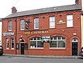
 Hartlepool - Cameron's Lion Brewery - lorry entrance - geograph.org.uk - 4173683.jpg 1.600 × 1.198; 531 KB
-
 Hartlepool - Design College - from east - geograph.org.uk - 4180525.jpg 1.600 × 1.215; 617 KB
-
 Hartlepool - Design College - from south - geograph.org.uk - 4180516.jpg 1.600 × 1.265; 526 KB
-
 Hartlepool - Design College - Stockton Street frontage - geograph.org.uk - 4180512.jpg 1.600 × 1.213; 455 KB
-
 Hartlepool - Exchange Buildings - geograph.org.uk - 4180536.jpg 1.600 × 1.217; 496 KB
-
 Hartlepool - former Co-op store - geograph.org.uk - 4011351.jpg 1.600 × 1.149; 466 KB
-
 Hartlepool - former Co-op store entrance - geograph.org.uk - 4011360.jpg 1.600 × 1.205; 501 KB
-

-
 Hartlepool - Grand Hotel - brickwork detail - geograph.org.uk - 4011987.jpg 1.600 × 1.239; 688 KB
-
 Hartlepool - Grand Hotel - Swainson Street frontage - geograph.org.uk - 4011984.jpg 1.600 × 1.183; 635 KB
-
 Hartlepool - house at corner of Scarborough Street - geograph.org.uk - 4173667.jpg 1.600 × 1.232; 536 KB
-
 Hartlepool - ornamental gate on Raby Road - geograph.org.uk - 4180055.jpg 1.600 × 1.166; 792 KB
-
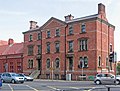
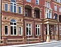
 Hartlepool - public buildings on west side of Raby Road - geograph.org.uk - 4180050.jpg 1.326 × 1.600; 678 KB
-
 Hartlepool - Strathmore House - geograph.org.uk - 4174773.jpg 1.600 × 1.183; 703 KB
-
 Hartlepool - terrace on Scarborough Street - geograph.org.uk - 4173670.jpg 1.600 × 1.200; 583 KB
-
 Hartlepool - terrace on south side of Stockton Road - geograph.org.uk - 4174762.jpg 1.600 × 1.200; 548 KB
-
 Hartlepool - The Causeway on Elwick Road - geograph.org.uk - 4174760.jpg 1.600 × 1.220; 546 KB
-

-

-

-
 Hartlepool Borough Council composition.svg 360 × 185; 3 KB
-
 Hartlepool Docks - geograph.org.uk - 2607073.jpg 640 × 480; 114 KB
-
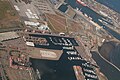
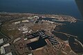 Hartlepool Docks and Marina, aerial 2018 - geograph.org.uk - 5908391.jpg 800 × 533; 102 KB
-
 Hartlepool from the air - geograph.org.uk - 5629885.jpg 640 × 407; 186 KB
-
 Hartlepool Historic Quay - geograph.org.uk - 2508618.jpg 1.880 × 2.816; 2,02 MB
-
 Hartlepool Lifeboat Station - geograph.org.uk - 6099921.jpg 2.000 × 1.500; 334 KB
-
 Hartlepool Marina - geograph.org.uk - 2015584.jpg 480 × 640; 213 KB
-
 Hartlepool Marina - geograph.org.uk - 2016977.jpg 640 × 480; 314 KB
-
 Hartlepool Marina - geograph.org.uk - 2566015.jpg 4.000 × 3.000; 3,07 MB
-
 Hartlepool Marina - geograph.org.uk - 2607053.jpg 640 × 480; 120 KB
-
 Hartlepool Marina - geograph.org.uk - 3216686.jpg 640 × 410; 33 KB
-
 Hartlepool Marina - geograph.org.uk - 4242428.jpg 800 × 290; 58 KB
-
 Hartlepool Marina - geograph.org.uk - 4428329.jpg 274 × 206; 8 KB
-
 Hartlepool Marina - geograph.org.uk - 4745817.jpg 640 × 480; 396 KB
-
 Hartlepool Marina - geograph.org.uk - 5989565.jpg 2.000 × 1.500; 413 KB
-
 Hartlepool Marina at night - geograph.org.uk - 5517153.jpg 800 × 569; 79 KB
-
 Hartlepool Marina at night - geograph.org.uk - 5517216.jpg 800 × 530; 98 KB
-
 Hartlepool Marina Travelodge - geograph.org.uk - 4186292.jpg 640 × 480; 57 KB
-
 Hartlepool Marina, aerial 2018 - geograph.org.uk - 5908387.jpg 800 × 533; 133 KB
-
 Hartlepool Marina, the Lanyard, KFC - geograph.org.uk - 5038503.jpg 3.678 × 2.456; 3,7 MB
-
 Hartlepool Marina, the Lanyard, Travelodge - geograph.org.uk - 5038508.jpg 3.618 × 2.353; 3,24 MB
-
 Hartlepool Marina, the Lanyard, Travelodge - geograph.org.uk - 5038511.jpg 3.679 × 2.456; 3,67 MB
-
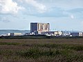 Hartlepool Nuclear Power Station - geograph.org.uk - 4064709.jpg 640 × 480; 140 KB
-
 Hartlepool Nuclear Power Station across North Gare Sands - geograph.org.uk - 4571103.jpg 1.064 × 1.600; 258 KB


_the_former_Steetley_Magnesite_pier_-_geograph.org.uk_-_4685324.jpg)


_-_geograph.org.uk_-_4687583.jpg)
_-_geograph.org.uk_-_4687587.jpg)


_-_geograph.org.uk_-_2998344.jpg)


.jpg)
.png)


