Category:Bottisham
Aller à la navigation
Aller à la recherche

localité britannique du comté anglais de Cambridgeshire  | |||||
| Téléverser des médias | |||||
| Nature de l’élément | |||||
|---|---|---|---|---|---|
| Lieu | East Cambridgeshire, Cambridgeshire, Angleterre de l'Est, Angleterre | ||||
| Réputé identique à | Bottisham (page en doublon, paroisse civile) | ||||
| site officiel | |||||
 | |||||
English: Bottisham is a village and civil parish in the East Cambridgeshire district of Cambridgeshire, England, about east of Cambridge, halfway to Newmarket. According to the 2001 census it had a population of 1,983.
Nederlands: Bottisham is een dorp (village en civil parish) in het Engelse graafschap Cambridgeshire. Het dorp ligt in het district East Cambridgeshire en telt 1983 inwoners.
Sous-catégories
Cette catégorie comprend 3 sous-catégories, dont les 3 ci-dessous.
Média dans la catégorie « Bottisham »
Cette catégorie comprend 247 fichiers, dont les 200 ci-dessous.
(page précédente) (page suivante)-
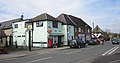
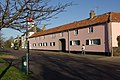
 55 Bottisham High Street - geograph.org.uk - 4140671.jpg 1 600 × 1 067 ; 354 kio
-
 A 1303 - geograph.org.uk - 53027.jpg 640 × 480 ; 96 kio
-
 A bend in the bridle path - geograph.org.uk - 3005220.jpg 1 024 × 768 ; 888 kio
-
 A bend in the byway - geograph.org.uk - 3299711.jpg 1 024 × 768 ; 274 kio
-
 A dip in the byway - geograph.org.uk - 3299707.jpg 1 024 × 768 ; 287 kio
-
 A gateway to Anglesey Abbey - geograph.org.uk - 3213218.jpg 995 × 1 024 ; 1,6 Mio
-
 A11 heading north - geograph.org.uk - 2588223.jpg 640 × 430 ; 70 kio
-
 A11 heading north-east - geograph.org.uk - 5683754.jpg 640 × 428 ; 85 kio
-
 A11 southbound - geograph.org.uk - 2718793.jpg 640 × 430 ; 64 kio
-
 A11 southbound - geograph.org.uk - 3564037.jpg 1 950 × 1 293 ; 1,59 Mio
-
 A11, Heath Rd Bridge - geograph.org.uk - 3331145.jpg 640 × 458 ; 60 kio
-
 A11, Heath Road Bridge - geograph.org.uk - 3819327.jpg 640 × 430 ; 44 kio
-
 A11, Newmarket Bypass - geograph.org.uk - 3819324.jpg 640 × 445 ; 43 kio
-
 A11, Newmarket Bypass - geograph.org.uk - 3819325.jpg 640 × 430 ; 52 kio
-
 A11, northbound - geograph.org.uk - 3331144.jpg 640 × 448 ; 49 kio
-
 A1303 - geograph.org.uk - 6032910.jpg 1 024 × 681 ; 164 kio
-
 A1303 - geograph.org.uk - 6032921.jpg 1 024 × 795 ; 223 kio
-
 A1303 at High Street junction - geograph.org.uk - 5086638.jpg 640 × 480 ; 47 kio
-
 A1303 heading east - geograph.org.uk - 4853516.jpg 640 × 480 ; 68 kio
-
 A1303 heading east - geograph.org.uk - 4853548.jpg 640 × 480 ; 69 kio
-
 A1303 near Bottisham turn - geograph.org.uk - 5086631.jpg 640 × 480 ; 87 kio
-
 A1303 Newmarket Road - geograph.org.uk - 5086648.jpg 640 × 481 ; 69 kio
-
 A1303 towards Newmarket - geograph.org.uk - 4853512.jpg 640 × 480 ; 52 kio
-
 A1303 towards Newnarket - geograph.org.uk - 4853538.jpg 640 × 480 ; 63 kio
-
 A1303, Newmarket Rd - geograph.org.uk - 6032915.jpg 1 024 × 900 ; 186 kio
-
 A14 looking east - geograph.org.uk - 1113779.jpg 640 × 480 ; 84 kio
-
 A14 Looking East - geograph.org.uk - 5619468.jpg 1 024 × 768 ; 171 kio
-
 A14 looking west - geograph.org.uk - 1113784.jpg 640 × 480 ; 99 kio
-
 A14 West - geograph.org.uk - 53022.jpg 640 × 480 ; 88 kio
-
 Alington Hill - geograph.org.uk - 2155847.jpg 1 600 × 1 200 ; 1,11 Mio
-
 Allington Hill - geograph.org.uk - 1320815.jpg 640 × 480 ; 128 kio
-
 Ancient Key housing development, Bottisham - geograph.org.uk - 3186197.jpg 1 600 × 1 200 ; 613 kio
-
 Beech Trees - geograph.org.uk - 5619477.jpg 768 × 1 024 ; 365 kio
-
 Beechwood Avenue, Bottisham - geograph.org.uk - 1629107.jpg 640 × 428 ; 69 kio
-
 Beechwood Avenue, Bottisham - geograph.org.uk - 303399.jpg 640 × 428 ; 119 kio
-
 Bell Road - geograph.org.uk - 1061363.jpg 640 × 480 ; 91 kio
-
 Bell Road, Bottisham - geograph.org.uk - 2738646.jpg 1 280 × 856 ; 153 kio
-
 Bell Road, Bottisham - geograph.org.uk - 2738652.jpg 1 280 × 856 ; 140 kio
-
 Bell Road, Bottisham - geograph.org.uk - 2738731.jpg 1 280 × 856 ; 188 kio
-
 Bend In Track - geograph.org.uk - 5619486.jpg 1 024 × 768 ; 230 kio
-
 Bottisham - geograph.org.uk - 303322.jpg 640 × 428 ; 159 kio
-
 Bottisham Cemetery - geograph.org.uk - 4140663.jpg 1 600 × 1 067 ; 657 kio
-
 Bottisham High Street - geograph.org.uk - 1061498.jpg 640 × 480 ; 61 kio
-
 Bottisham High Street - geograph.org.uk - 4111809.jpg 1 024 × 768 ; 1,03 Mio
-
 Bottisham High Street - geograph.org.uk - 5416171.jpg 1 600 × 1 200 ; 258 kio
-
 Bottisham High Street - geograph.org.uk - 5416175.jpg 1 600 × 1 244 ; 404 kio
-
 Bottisham High Street by the church - geograph.org.uk - 1061475.jpg 640 × 480 ; 55 kio
-
 Bottisham High Street in November - geograph.org.uk - 5611388.jpg 1 024 × 819 ; 1 023 kio
-
 Bottisham High Street, cottages and bus stop - geograph.org.uk - 5611015.jpg 1 024 × 683 ; 958 kio
-
 Bottisham High Street, sunlight and shadow - geograph.org.uk - 5611378.jpg 1 024 × 1 024 ; 1,6 Mio
-
 Bottisham Park - geograph.org.uk - 1181250.jpg 640 × 480 ; 122 kio
-
 Bottisham Park - geograph.org.uk - 1181342.jpg 640 × 480 ; 95 kio
-
 Bottisham Park Gateway detail - geograph.org.uk - 1181327.jpg 640 × 480 ; 107 kio
-
 Bottisham Post Office - geograph.org.uk - 1061517.jpg 640 × 480 ; 64 kio
-
 Bottisham Primary School - geograph.org.uk - 2968530.jpg 1 280 × 856 ; 281 kio
-
 Bottisham Scout Headquarters - geograph.org.uk - 2969501.jpg 1 280 × 856 ; 434 kio
-
 Bottisham Village College - geograph.org.uk - 5934507.jpg 2 000 × 1 500 ; 826 kio
-
 Bottisham village sign - geograph.org.uk - 1061420.jpg 480 × 640 ; 76 kio
-
 Bottisham Youth and Community Centre - geograph.org.uk - 1061506.jpg 640 × 480 ; 75 kio
-
 Bottisham, a bend in the High Street - geograph.org.uk - 4111848.jpg 1 024 × 573 ; 814 kio
-
 Bottisham, a Victorian terrace - geograph.org.uk - 4112508.jpg 1 024 × 905 ; 1,15 Mio
-
 Bottisham, Elston Interiors - geograph.org.uk - 5611554.jpg 1 024 × 683 ; 764 kio
-
 Bottisham, footpath footbridge - geograph.org.uk - 2748104.jpg 800 × 600 ; 898 kio
-
 Bottisham, High Street - geograph.org.uk - 2747995.jpg 1 024 × 736 ; 930 kio
-
 Bottisham, High Street in January - geograph.org.uk - 2748039.jpg 1 024 × 769 ; 1,11 Mio
-
 Bottisham, Holy Trinity - geograph.org.uk - 5611394.jpg 1 024 × 1 024 ; 1,1 Mio
-
 Bottisham, houses near the church - geograph.org.uk - 4112429.jpg 1 024 × 1 024 ; 1,29 Mio
-
 Bottisham, large house and grand trees - geograph.org.uk - 5689888.jpg 1 024 × 1 024 ; 1,56 Mio
-
 Bottisham, Lode Road - geograph.org.uk - 3597492.jpg 1 200 × 868 ; 1,25 Mio
-
 Bottisham, Lysander Close - geograph.org.uk - 5689894.jpg 1 024 × 819 ; 904 kio
-
 Bottisham, November sunlight - geograph.org.uk - 5611557.jpg 1 024 × 768 ; 810 kio
-
 Bottisham, on the High Street in November - geograph.org.uk - 5611551.jpg 819 × 1 024 ; 872 kio
-
 Bottisham, painted brick - geograph.org.uk - 4111839.jpg 1 024 × 909 ; 1,03 Mio
-
 Bottisham, path and plantation - geograph.org.uk - 2749271.jpg 1 024 × 740 ; 1 007 kio
-
 Bottisham, pink cottages and Holy Trinity tower - geograph.org.uk - 6347779.jpg 1 024 × 1 024 ; 1 Mio
-
 Bottisham, plantation, path, man and dog - geograph.org.uk - 2749255.jpg 1 024 × 769 ; 951 kio
-
 Bottisham, please drive carefully - geograph.org.uk - 4269447.jpg 1 024 × 1 024 ; 1,46 Mio
-
 Bottisham, pub and post office - geograph.org.uk - 4112515.jpg 1 024 × 589 ; 759 kio
-
 Bottisham, tall parkland trees - geograph.org.uk - 5689901.jpg 1 024 × 1 024 ; 1,47 Mio
-
 Bottisham, The Arch and the tower of Holy Trinity Church - geograph.org.uk - 2748006.jpg 1 024 × 768 ; 997 kio
-
 Bottisham, The Old Courthouse - geograph.org.uk - 5611027.jpg 819 × 1 024 ; 1,12 Mio
-
 Bottisham, The village pump - geograph.org.uk - 5989600.jpg 4 438 × 2 959 ; 4,23 Mio
-
 Bottisham, The village sign - geograph.org.uk - 5989601.jpg 7 058 × 4 705 ; 5,48 Mio
-
 Bottisham, through The Arch - geograph.org.uk - 5611408.jpg 819 × 1 024 ; 999 kio
-
 Bottisham, tower and timber-framed house - geograph.org.uk - 2748018.jpg 800 × 564 ; 610 kio
-
 Bottisham, Tudor House, High Street - geograph.org.uk - 5611390.jpg 732 × 1 024 ; 866 kio
-
 Bottisham.JPG 4 608 × 2 408 ; 1,12 Mio
-
 Bottisham1.JPG 2 816 × 2 112 ; 3,67 Mio
-
 Bottisham2.JPG 2 816 × 2 112 ; 3,55 Mio
-
 Brian McKay garage - geograph.org.uk - 1114590.jpg 640 × 480 ; 86 kio
-
 Brian McKay Sales Service MOT - geograph.org.uk - 1061358.jpg 640 × 480 ; 69 kio
-
 Bridge Across The A11 - geograph.org.uk - 5619481.jpg 768 × 1 024 ; 161 kio
-
 Bridge carrying a byway across the A11 - geograph.org.uk - 1961236.jpg 640 × 430 ; 124 kio
-
 Bridge over the A14 - geograph.org.uk - 4131244.jpg 640 × 441 ; 48 kio
-
 Bridge over the A14 - geograph.org.uk - 4790959.jpg 640 × 426 ; 37 kio
-
 Bridle path and the A1303 - geograph.org.uk - 3005246.jpg 1 024 × 768 ; 825 kio
-
 Bridle path, electricity wires and dog roses - geograph.org.uk - 3005235.jpg 1 024 × 766 ; 924 kio
-
 British Legion Social Club - geograph.org.uk - 4140662.jpg 1 600 × 1 067 ; 453 kio
-
 Bus stop and shelter on the A1303, Bottisham - geograph.org.uk - 4853533.jpg 640 × 480 ; 49 kio
-
 Byway alongside the A11 - geograph.org.uk - 970709.jpg 640 × 480 ; 114 kio
-
 Byway and low-voltage power lines - geograph.org.uk - 970680.jpg 640 × 480 ; 57 kio
-
 Byway bridge over A14 - geograph.org.uk - 1320844.jpg 640 × 480 ; 160 kio
-
 Byway by the A11 - geograph.org.uk - 4309643.jpg 1 024 × 1 024 ; 1,34 Mio
-
 Byway off London Road (A1304) - geograph.org.uk - 4873722.jpg 640 × 480 ; 86 kio
-
 Byway over A11 - geograph.org.uk - 1320821.jpg 640 × 480 ; 154 kio
-
 Byway to Great Wilbraham - geograph.org.uk - 1320832.jpg 640 × 480 ; 143 kio
-
 Byway to Newmarket Road - geograph.org.uk - 1320817.jpg 640 × 480 ; 141 kio
-
 Byway to Newmarket Road - geograph.org.uk - 1320834.jpg 640 × 480 ; 126 kio
-
 Byway to Newmarket Road - geograph.org.uk - 2155859.jpg 1 600 × 1 200 ; 1,23 Mio
-
 Cambridge or Newmarket^ - geograph.org.uk - 1114575.jpg 640 × 480 ; 115 kio
-
 Cattle grid at Bottisham Park - geograph.org.uk - 3895676.jpg 4 320 × 3 240 ; 5,88 Mio
-
 Cottage in Bottisham High Street - geograph.org.uk - 303391.jpg 640 × 428 ; 114 kio
-
 Crop field near Chalk Farm - geograph.org.uk - 4853661.jpg 640 × 480 ; 63 kio
-
 Crossing the A11 - geograph.org.uk - 4309640.jpg 1 024 × 1 024 ; 1,24 Mio
-
 Crossing the A14 - geograph.org.uk - 3299046.jpg 1 024 × 750 ; 240 kio
-
 Cycle track to Lode - geograph.org.uk - 5690872.jpg 1 024 × 768 ; 905 kio
-
 Dead tree and hard-pruned hedge by the byway - geograph.org.uk - 970647.jpg 640 × 480 ; 79 kio
-
 East from the bridle path - geograph.org.uk - 3005226.jpg 1 024 × 768 ; 951 kio
-
 Eden View, Bottisham - geograph.org.uk - 1481626.jpg 640 × 480 ; 69 kio
-
 Elston Interiors - geograph.org.uk - 4140678.jpg 1 600 × 1 067 ; 429 kio
-
 Entering Bottisham - geograph.org.uk - 2969057.jpg 1 280 × 855 ; 223 kio
-
 Entering Lode - geograph.org.uk - 4706368.jpg 640 × 480 ; 68 kio
-
 Entrance to Bottisham - geograph.org.uk - 5955791.jpg 1 024 × 768 ; 231 kio
-
 Farmland off the A1303 near Bottisham - geograph.org.uk - 4853541.jpg 640 × 480 ; 53 kio
-
 Field by Bell Road, Bottisham - geograph.org.uk - 2738722.jpg 1 280 × 856 ; 176 kio
-
 Field north of Bottisham - geograph.org.uk - 155714.jpg 640 × 427 ; 146 kio
-
 First Copy sign, Bottisham - geograph.org.uk - 4853530.jpg 434 × 640 ; 44 kio
-
 First Copy, Bottisham - geograph.org.uk - 1481555.jpg 640 × 480 ; 78 kio
-
 Flat farmland towards Bottisham - geograph.org.uk - 4853511.jpg 640 × 480 ; 74 kio
-
 Flat farmland towards the A14 - geograph.org.uk - 4853544.jpg 640 × 480 ; 87 kio
-
 Flowery verge and Bottisham tower - geograph.org.uk - 3004321.jpg 1 024 × 768 ; 1,18 Mio
-
 Footbridge at Stone Bridge - geograph.org.uk - 2754707.jpg 1 024 × 768 ; 1,39 Mio
-
 Footpath to Bottisham - geograph.org.uk - 2748116.jpg 800 × 744 ; 843 kio
-
 Footpath to Bottisham in June - geograph.org.uk - 3004309.jpg 1 024 × 768 ; 1,19 Mio
-
 Former White Swan public house, Bottisham - geograph.org.uk - 4853525.jpg 640 × 480 ; 64 kio
-
 Formerly the White Swan, Bottisham - geograph.org.uk - 5064427.jpg 640 × 428 ; 82 kio
-
 Frosty byway - geograph.org.uk - 3299036.jpg 1 024 × 768 ; 364 kio
-

-
 Gates to Bottisham Park - geograph.org.uk - 3895661.jpg 4 320 × 3 240 ; 5,64 Mio
-
 Gateway to Bottisham Park - geograph.org.uk - 1181306.jpg 640 × 480 ; 137 kio
-
 Going underground - geograph.org.uk - 970662.jpg 640 × 480 ; 76 kio
-
 Goose Green, Bottisham - geograph.org.uk - 1181336.jpg 640 × 480 ; 69 kio
-
 Harvest time by the A14 - geograph.org.uk - 4110995.jpg 1 024 × 768 ; 1,04 Mio
-
 Heading north east on Quy Road (B1102) - geograph.org.uk - 4706369.jpg 640 × 480 ; 65 kio
-
 Heath Rd Bridge, A11 - geograph.org.uk - 2718788.jpg 640 × 461 ; 71 kio
-
 Heath Road and the last of the sun - geograph.org.uk - 4309626.jpg 1 024 × 732 ; 960 kio
-
 Heath Road and the power line in January - geograph.org.uk - 3299377.jpg 1 024 × 747 ; 256 kio
-
 Heath Road at Six Mile Bottom - geograph.org.uk - 4309738.jpg 1 024 × 732 ; 977 kio
-
 Heath Road bridge over A14 - geograph.org.uk - 5976945.jpg 1 600 × 1 069 ; 646 kio
-
 Heath Road bridge over the A11 - geograph.org.uk - 2588219.jpg 640 × 493 ; 75 kio
-
 Heath Road in January - geograph.org.uk - 3299052.jpg 1 024 × 759 ; 245 kio
-
 Hedgerow beside the A1303 - geograph.org.uk - 4853546.jpg 640 × 480 ; 94 kio
-
 High Street, Bottisham - geograph.org.uk - 1481598.jpg 640 × 480 ; 89 kio
-
 High Street, Bottisham - geograph.org.uk - 303324.jpg 640 × 428 ; 104 kio
-
 Hilton Park care centre, Bottisham - geograph.org.uk - 1481641.jpg 640 × 480 ; 79 kio
-
 Holly Cottage, Bottisham High Street - geograph.org.uk - 1061409.jpg 640 × 480 ; 59 kio
-
 Holly Cottage, Bottisham High Street - geograph.org.uk - 4140675.jpg 1 600 × 1 200 ; 482 kio
-
 House near Long Meadow - geograph.org.uk - 4043082.jpg 4 320 × 3 240 ; 3,95 Mio
-
 House near Long Meadow - geograph.org.uk - 4140570.jpg 1 600 × 1 067 ; 335 kio
-
 Insulators and conductors - geograph.org.uk - 970671.jpg 588 × 640 ; 61 kio
-
 Layby on Westbound A14 near Bottisham - geograph.org.uk - 3874617.jpg 640 × 480 ; 238 kio
-
 Little-used byway - geograph.org.uk - 1320841.jpg 640 × 480 ; 161 kio
-
 Lode Road - geograph.org.uk - 3186130.jpg 1 600 × 1 200 ; 700 kio
-
 Lorries on the A14 - geograph.org.uk - 970775.jpg 640 × 480 ; 62 kio
-
 Memorial on the corner of Tunbridge Lane - geograph.org.uk - 6420807.jpg 4 608 × 3 072 ; 5,53 Mio
-
 Memorial to 361st Fighter Group - geograph.org.uk - 327204.jpg 640 × 480 ; 110 kio
-
 Memorial to 361st Fighter Group - geograph.org.uk - 327205.jpg 640 × 480 ; 111 kio
-
 Nearing Bottisham - geograph.org.uk - 3004292.jpg 1 024 × 692 ; 899 kio
-
 Newmarket Rd - geograph.org.uk - 6032904.jpg 1 024 × 681 ; 224 kio
-
 November ploughing - geograph.org.uk - 5610844.jpg 1 024 × 768 ; 918 kio
-
 Old Milestone - geograph.org.uk - 1211462.jpg 480 × 640 ; 125 kio
-

-

-
 On Bottisham High Street - geograph.org.uk - 4111826.jpg 1 024 × 862 ; 1,1 Mio
-
 On Heath Road in January - geograph.org.uk - 3299425.jpg 1 024 × 777 ; 213 kio
-
 Open fields, distant power lines - geograph.org.uk - 970582.jpg 640 × 480 ; 61 kio
-
 Over a field to Long Meadow - geograph.org.uk - 2749212.jpg 1 024 × 768 ; 1,32 Mio
-
 Over fields to Lode - geograph.org.uk - 2749230.jpg 1 024 × 768 ; 1,22 Mio
-
 Path beside the A1303 - geograph.org.uk - 4853514.jpg 640 × 480 ; 108 kio
-
 Path from Bottisham to Lode and Long Meadow - geograph.org.uk - 2749221.jpg 1 024 × 734 ; 1,02 Mio
-
 Path meets road - geograph.org.uk - 2749202.jpg 1 025 × 769 ; 1,05 Mio
-
 Pheasant (Phasianus colchicus) - geograph.org.uk - 1207833.jpg 640 × 480 ; 118 kio
-
 Plantation on Allington Hill - geograph.org.uk - 4309689.jpg 1 024 × 768 ; 1,01 Mio
-
 Pylon and wind-pump tower - geograph.org.uk - 970613.jpg 640 × 480 ; 56 kio
-
 Pylon by the A14 - geograph.org.uk - 4131225.jpg 430 × 640 ; 39 kio
-
 Pylons And Warning Sign - geograph.org.uk - 5619470.jpg 1 024 × 768 ; 218 kio
-
 Pylons near Chalk Farm - geograph.org.uk - 1481743.jpg 640 × 480 ; 62 kio
-
 Queens Court Care Home - geograph.org.uk - 4140666.jpg 1 600 × 1 067 ; 508 kio
-
 Restored buildings at Bottisham Airfield Museum - geograph.org.uk - 5610857.jpg 1 024 × 732 ; 768 kio
-
 Restricted byway - geograph.org.uk - 1320839.jpg 640 × 480 ; 159 kio
-
 Ristorante Il Piccolo Mondo - geograph.org.uk - 4140656.jpg 1 600 × 1 200 ; 450 kio
-
 Road around Bottisham Park - geograph.org.uk - 3186117.jpg 1 600 × 1 200 ; 916 kio
-
 Road to Hall Farm Bottisham - geograph.org.uk - 3895684.jpg 4 320 × 3 240 ; 5,55 Mio
-
 Snowy fields and the A11 - geograph.org.uk - 3299496.jpg 1 024 × 768 ; 241 kio
-
 Snowy Heath Road - geograph.org.uk - 3299507.jpg 1 024 × 730 ; 245 kio
-
 Spring Hall farm track in winter - geograph.org.uk - 3299390.jpg 1 024 × 713 ; 229 kio
-
 Springtime on Tunbridge Close - geograph.org.uk - 1207739.jpg 640 × 480 ; 96 kio
-
 Stone Bridge, Bottisham - geograph.org.uk - 1181387.jpg 640 × 480 ; 140 kio
-
 Sunlit bridle path - geograph.org.uk - 3005224.jpg 1 024 × 775 ; 871 kio
-
 Sunny side and shadowed side - geograph.org.uk - 3299520.jpg 1 024 × 753 ; 309 kio


_-_geograph.org.uk_-_4873722.jpg)


_-_geograph.org.uk_-_4706369.jpg)


_-_geograph.org.uk_-_1207833.jpg)


