Category:Boughton, Northamptonshire
Vai alla navigazione
Vai alla ricerca
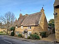
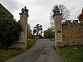
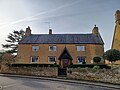
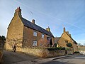
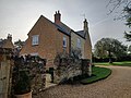
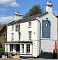
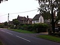
English: Boughton is a village and civil parish in the Daventry district of Northamptonshire, England. According to the 2001 census it had a population of 951. It is on the northern fringe of the Northampton urban area, about four miles north of the town centre.
village and civil parish in Northamptonshire, UK  | |||||
| Carica un file multimediale | |||||
| Istanza di | |||||
|---|---|---|---|---|---|
| Luogo | West Northamptonshire, Northamptonshire, Midlands Orientali, Inghilterra | ||||
| Popolazione |
| ||||
| Superficie |
| ||||
| Considerato essere uguale a | Boughton (pagina Wikimedia duplicata, parrocchia civile dell'Inghilterra) | ||||
 | |||||
Sottocategorie
Questa categoria contiene un'unica sottocategoria, indicata di seguito.
File nella categoria "Boughton, Northamptonshire"
Questa categoria contiene 173 file, indicati di seguito, su un totale di 173.
-
 12 Church Street, Boughton, Northamptonshire.jpg 4 000 × 3 000; 4,03 MB
-
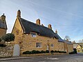
 13 and 14 Church Street, Boughton, Northamptonshire.jpg 4 000 × 3 000; 3,65 MB
-
 15 Church Street, Boughton Northamptonshire.jpg 4 000 × 3 000; 3,31 MB
-
 46 Church Street, Boughton, Northamptonshire.jpg 4 000 × 3 000; 3,48 MB
-
 7 Butchers Lane, Boughton, Northamptonshire.jpg 4 000 × 3 000; 4,75 MB
-
 8 Butchers Lane, Boughton, Northamptonshire.jpg 4 000 × 3 000; 4,38 MB
-
 A cute cow - geograph.org.uk - 1953694.jpg 533 × 800; 97 KB
-
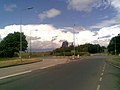
 A508 Harborough Road North - geograph.org.uk - 6192401.jpg 1 024 × 684; 407 KB
-
 A508 Harborough Road North, Northampton - geograph.org.uk - 6192395.jpg 1 024 × 684; 355 KB
-
 A5199 Northampton Road, near Northampton - geograph.org.uk - 5858321.jpg 1 024 × 768; 224 KB
-
 Alcove by the window. - geograph.org.uk - 1980173.jpg 533 × 800; 134 KB
-
 All along the fence - geograph.org.uk - 1980412.jpg 1 024 × 683; 308 KB
-
 Along the chancel end - geograph.org.uk - 1980138.jpg 533 × 800; 111 KB
-
 Ash Rise - geograph.org.uk - 3638849.jpg 640 × 478; 51 KB
-
 Bench mark on St John's - geograph.org.uk - 1973596.jpg 533 × 800; 157 KB
-
 Bend in the road - geograph.org.uk - 1976219.jpg 533 × 800; 113 KB
-
 Old St John's - geograph.org.uk - 297106.jpg 640 × 480; 127 KB
-
 Boughton - geograph.org.uk - 3635818.jpg 640 × 478; 59 KB
-
 Boughton -Saint John's Church Ruin - geograph.org.uk - 3209620.jpg 640 × 480; 120 KB
-
 Boughton Bowl Barrow.jpg 4 000 × 3 000; 4,52 MB
-
 Boughton Crossing - geograph.org.uk - 3931064.jpg 640 × 480; 65 KB
-
 Boughton Green - geograph.org.uk - 1976258.jpg 1 024 × 683; 102 KB
-
 Boughton Green - geograph.org.uk - 2006490.jpg 640 × 480; 60 KB
-
 Boughton Green - geograph.org.uk - 2546289.jpg 640 × 427; 86 KB
-
 Boughton Grotto - geograph.org.uk - 3836872.jpg 800 × 663; 136 KB
-
 Boughton Hall - geograph.org.uk - 3197916.jpg 640 × 480; 80 KB
-
 Boughton House, Northamptonshire - geograph.org.uk - 151240.jpg 640 × 490; 123 KB
-
 Boughton Park - geograph.org.uk - 2006253.jpg 640 × 480; 61 KB
-
 Boughton Park - geograph.org.uk - 2006258.jpg 640 × 480; 65 KB
-
 Boughton Park - geograph.org.uk - 2006266.jpg 640 × 480; 65 KB
-
 Boughton Park - geograph.org.uk - 2006278.jpg 640 × 480; 100 KB
-
 Boughton Park - geograph.org.uk - 3634683.jpg 640 × 478; 64 KB
-
 Boughton Park - geograph.org.uk - 3647628.jpg 640 × 480; 68 KB
-
 Boughton Park - geograph.org.uk - 3647934.jpg 640 × 480; 142 KB
-
 Boughton Park - geograph.org.uk - 3648088.jpg 640 × 480; 87 KB
-
 Boughton Pocket Park - geograph.org.uk - 2875590.jpg 480 × 640; 109 KB
-
 Boughton Primary School - geograph.org.uk - 2006481.jpg 640 × 480; 72 KB
-
 Boughton Village Church.jpg 2 621 × 3 466; 2,75 MB
-
 Boughton Village Hall - geograph.org.uk - 3209645.jpg 640 × 495; 62 KB
-
 Boughton village sign, Northamptonshire.jpg 3 000 × 4 000; 4,58 MB
-
 Boughton Village Sign.jpg 1 865 × 1 865; 1,5 MB
-
 Boughton-Butchers Lane - geograph.org.uk - 3197928.jpg 640 × 480; 103 KB
-
 Boughton-Butchers Lane - geograph.org.uk - 3209655.jpg 640 × 480; 76 KB
-
 Brampton ponies - geograph.org.uk - 2665307.jpg 640 × 427; 89 KB
-
 Brampton Valley Way - geograph.org.uk - 2665303.jpg 640 × 427; 104 KB
-
 Brampton Valley Way - geograph.org.uk - 2666382.jpg 640 × 427; 113 KB
-
 Brampton Valley Way - geograph.org.uk - 3197954.jpg 640 × 480; 79 KB
-
 Brampton Valley Way at Boughton Mill - geograph.org.uk - 5858366.jpg 1 024 × 768; 238 KB
-
 Brampton Valley Way near Boughton - geograph.org.uk - 5858411.jpg 1 024 × 768; 273 KB
-
 Brampton Valley Way near Northampton - geograph.org.uk - 5858314.jpg 1 024 × 768; 222 KB
-
 Brampton Valley Way near Northampton - geograph.org.uk - 5858345.jpg 1 024 × 768; 344 KB
-
 Brampton Valley Way passing Pitsford Sidings - geograph.org.uk - 5858444.jpg 1 024 × 768; 253 KB
-
 Butchers Lane - geograph.org.uk - 1973563.jpg 1 024 × 683; 172 KB
-
 Butchers Lane - geograph.org.uk - 2006237.jpg 640 × 480; 112 KB
-
 Butchers Lane - geograph.org.uk - 2006262.jpg 640 × 480; 92 KB
-
 Butchers Lane - geograph.org.uk - 2006272.jpg 640 × 480; 80 KB
-
 Butchers Lane - geograph.org.uk - 2006275.jpg 480 × 640; 98 KB
-
 Butchers Lane - geograph.org.uk - 2006284.jpg 640 × 480; 91 KB
-
 Butchers Lane - geograph.org.uk - 3647704.jpg 640 × 480; 107 KB
-
 Butchers Lane, Boughton - geograph.org.uk - 2577571.jpg 2 000 × 1 500; 886 KB
-
 Cedars near Boughton - geograph.org.uk - 4160173.jpg 640 × 480; 197 KB
-
 Church Furlong Farm - geograph.org.uk - 3649030.jpg 640 × 480; 72 KB
-
 Church on the hill - geograph.org.uk - 1976228.jpg 1 024 × 683; 147 KB
-
 Church past the graves - geograph.org.uk - 1980423.jpg 1 024 × 683; 273 KB
-
 Church Street, Boughton - geograph.org.uk - 2577582.jpg 2 000 × 1 383; 697 KB
-
 Cottages along the lane - geograph.org.uk - 1973587.jpg 1 024 × 683; 153 KB
-
 Cottages, Church Street, Boughton - geograph.org.uk - 2577600.jpg 2 000 × 1 500; 856 KB
-
 Covered in brambles - geograph.org.uk - 1980367.jpg 1 024 × 683; 267 KB
-
 Cow in the field - geograph.org.uk - 1953699.jpg 533 × 800; 104 KB
-
 End of the nave - geograph.org.uk - 1976340.jpg 1 024 × 683; 251 KB
-
 Entrance to Brickhill Kennels - geograph.org.uk - 389137.jpg 640 × 480; 141 KB
-
 Farmland near Boughton - geograph.org.uk - 2875572.jpg 640 × 480; 63 KB
-
 Farmland near Boughton - geograph.org.uk - 3452651.jpg 640 × 478; 59 KB
-
 Farmland near Boughton - geograph.org.uk - 3452657.jpg 640 × 478; 55 KB
-
 Farmland near Boughton - geograph.org.uk - 3649140.jpg 640 × 480; 64 KB
-
 Fields off Moulton Lane - geograph.org.uk - 2492186.jpg 640 × 480; 88 KB
-
 Ford at the Bottom of Spectacle Lane - geograph.org.uk - 250951.jpg 640 × 480; 109 KB
-
 Garden in Boughton - geograph.org.uk - 3635896.jpg 640 × 478; 98 KB
-
 Gates at the top - geograph.org.uk - 1980319.jpg 1 024 × 683; 205 KB
-
 Gates to the churchyard - geograph.org.uk - 1976277.jpg 1 024 × 683; 266 KB
-
 Gates to the hall - geograph.org.uk - 1976242.jpg 533 × 800; 148 KB
-
 Graves in the nettles - geograph.org.uk - 1980293.jpg 1 024 × 683; 249 KB
-
 Graves uphill - geograph.org.uk - 1980395.jpg 533 × 800; 144 KB
-
 Griffin Cottage, Boughton, Northamptonshire.jpg 4 000 × 3 000; 3,53 MB
-
 Harborough Road at the junction of Vyse Road - geograph.org.uk - 6614942.jpg 1 872 × 1 204; 1,61 MB
-
 Harborough Road North - geograph.org.uk - 1963142.jpg 640 × 480; 55 KB
-
 Harborough Road North - geograph.org.uk - 3634548.jpg 640 × 478; 49 KB
-
 Headstone in the nettles - geograph.org.uk - 1980050.jpg 533 × 800; 160 KB
-
 Headstones in the nettles - geograph.org.uk - 1976350.jpg 1 024 × 683; 291 KB
-
 Holes in the window - geograph.org.uk - 1980310.jpg 533 × 800; 144 KB
-
 Holly Lodge, Moulton - geograph.org.uk - 2577740.jpg 2 000 × 1 475; 1 016 KB
-
 Howard Lane - geograph.org.uk - 3635955.jpg 640 × 478; 48 KB
-
 In brambles and ivy - geograph.org.uk - 1980404.jpg 533 × 800; 149 KB
-
 Information on the church - geograph.org.uk - 1976305.jpg 1 024 × 683; 126 KB
-
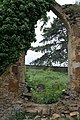
 Inside the ruins - geograph.org.uk - 1976334.jpg 1 024 × 683; 246 KB
-
 Ivor the Engine - geograph.org.uk - 1889596.jpg 640 × 480; 65 KB
-
 K6 Telephone Kiosk, Boughton, Northamptonshire.jpg 3 000 × 4 000; 3,03 MB
-
 Keep Out - geograph.org.uk - 1995073.jpg 640 × 480; 64 KB
-
 Looking out of the window - geograph.org.uk - 1980278.jpg 533 × 800; 157 KB
-
 Looking through a window - geograph.org.uk - 1980045.jpg 1 024 × 683; 153 KB
-
 Looking through the arch - geograph.org.uk - 1976344.jpg 533 × 800; 168 KB
-
 Looking up at a window - geograph.org.uk - 1980084.jpg 533 × 800; 119 KB
-
 Lost in nettles - geograph.org.uk - 1980069.jpg 1 024 × 683; 282 KB
-
 Merewater, Boughton, Northamptonshire.jpg 4 000 × 3 000; 2,89 MB
-
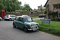
 Mini across the road - geograph.org.uk - 1976234.jpg 1 024 × 683; 181 KB
-
 Mini on Butchers Lane - geograph.org.uk - 1973554.jpg 1 024 × 683; 192 KB
-
 Moulton Lane - geograph.org.uk - 2006299.jpg 640 × 480; 76 KB
-
 Moulton Lane - geograph.org.uk - 2006486.jpg 640 × 480; 80 KB
-
 Moulton Lane - geograph.org.uk - 2492180.jpg 640 × 480; 72 KB
-
 Moulton Lane - geograph.org.uk - 3647574.jpg 640 × 480; 93 KB
-
 Moulton Lane - geograph.org.uk - 3647587.jpg 640 × 480; 114 KB
-
 Moulton Lane - geograph.org.uk - 3649067.jpg 640 × 480; 64 KB
-
 Moulton Lane - geograph.org.uk - 3649125.jpg 640 × 480; 94 KB
-
 Moulton Lane Boughton - geograph.org.uk - 1973581.jpg 1 024 × 683; 159 KB
-
 Moulton-Holly Lodge - geograph.org.uk - 3197766.jpg 640 × 480; 78 KB
-
 Moulton-Spectacle Lane - geograph.org.uk - 3197749.jpg 480 × 640; 93 KB
-
 Moulton-Spectacle Lodge - geograph.org.uk - 3213727.jpg 640 × 480; 85 KB
-
 Nettles round the church - geograph.org.uk - 1980064.jpg 1 024 × 683; 221 KB
-
 Northampton - geograph.org.uk - 3634536.jpg 640 × 478; 53 KB
-
 Notice past the gate - geograph.org.uk - 1976282.jpg 1 024 × 683; 243 KB
-
 Obelisk Farm, Boughton, Northamptonshire 01.jpg 4 000 × 3 000; 3,12 MB
-
 Obelisk Farm, Boughton, Northamptonshire.jpg 4 000 × 3 000; 3,28 MB
-
 Obelisk Spinney - geograph.org.uk - 2875562.jpg 480 × 640; 133 KB
-
 Obelisk Spinney Pocket Park - geograph.org.uk - 3638018.jpg 640 × 478; 130 KB
-
 Old St John's Church, Boughton - geograph.org.uk - 2577702.jpg 3 072 × 2 304; 3,56 MB
-
 Old St Johns Church - geograph.org.uk - 1976326.jpg 1 024 × 683; 283 KB
-
 Old St.John's - geograph.org.uk - 2546052.jpg 640 × 427; 141 KB
-
 Old St.John's - geograph.org.uk - 2546062.jpg 640 × 427; 140 KB
-
 Path to the entrance - geograph.org.uk - 1980435.jpg 533 × 800; 115 KB
-
 Peckett 2104 at Boughton railway station May 2012.jpg 4 320 × 3 240; 1,44 MB
-
 Pitsford Sidings - geograph.org.uk - 2666380.jpg 640 × 427; 80 KB
-
 Pub by the church - geograph.org.uk - 1975159.jpg 1 024 × 683; 119 KB
-
 Public footpath to Boughton - geograph.org.uk - 3647778.jpg 640 × 480; 131 KB
-
 Public footpath to Boughton Green - geograph.org.uk - 3648800.jpg 640 × 480; 83 KB
-
 Public footpath to Boughton Green - geograph.org.uk - 3648926.jpg 640 × 480; 96 KB
-
 Public footpath to Howard Lane - geograph.org.uk - 3635868.jpg 640 × 478; 110 KB
-
 Public footpath to Northampton - geograph.org.uk - 3638112.jpg 640 × 478; 117 KB
-
 Public footpath towards Pitsford - geograph.org.uk - 3648097.jpg 640 × 480; 76 KB
-
 Road to Moulton - geograph.org.uk - 1975029.jpg 1 024 × 683; 183 KB
-
 Rose in the churchyard - geograph.org.uk - 1975133.jpg 533 × 800; 139 KB
-
 Sign by the hall - geograph.org.uk - 1975170.jpg 533 × 800; 92 KB
-
 Sign on a gate - geograph.org.uk - 1953701.jpg 1 024 × 683; 211 KB
-
 Spectacle Lane near Moulton - geograph.org.uk - 5509861.jpg 480 × 640; 75 KB
-
 Spinney Close - geograph.org.uk - 3637973.jpg 640 × 478; 51 KB
-
 St Johns Spring - geograph.org.uk - 1980107.jpg 533 × 800; 192 KB
-
 Stonework in the wall - geograph.org.uk - 1980269.jpg 1 024 × 683; 264 KB
-
 Stream near Boughton - geograph.org.uk - 3648818.jpg 640 × 480; 139 KB
-
 The Brampton Valley Way - geograph.org.uk - 6293917.jpg 1 024 × 768; 184 KB
-
 The Chancel window - geograph.org.uk - 1980094.jpg 1 024 × 683; 139 KB
-
 The chancel window - geograph.org.uk - 1980144.jpg 1 024 × 683; 269 KB
-
 The new part - geograph.org.uk - 1980376.jpg 1 024 × 683; 174 KB
-
 The Rectory, Boughton, Northamptonshire.jpg 4 000 × 3 000; 3,44 MB
-
 The sign on the gate - geograph.org.uk - 1953717.jpg 533 × 800; 102 KB
-
 The south side - geograph.org.uk - 1980125.jpg 1 024 × 683; 211 KB
-
 The Whyte Melville, Boughton - geograph.org.uk - 2577657.jpg 2 000 × 1 504; 617 KB
-
 The Whyte Melville.jpg 1 202 × 1 246; 522 KB
-

-
 Three headstones by the church - geograph.org.uk - 1980327.jpg 1 024 × 683; 272 KB
-
 Three headstones on the east end - geograph.org.uk - 1975101.jpg 1 024 × 683; 228 KB
-
 Top of the alcove - geograph.org.uk - 1980189.jpg 533 × 800; 118 KB
-
 Top of the graveyard - geograph.org.uk - 1976287.jpg 1 024 × 683; 213 KB
-
 Tree by Moulton Lane - geograph.org.uk - 2488626.jpg 640 × 480; 90 KB
-
 Tumulus near Boughton Grange - geograph.org.uk - 530638.jpg 640 × 480; 67 KB
-
 Village sign on the green - geograph.org.uk - 1973574.jpg 533 × 800; 141 KB
-
 Vyse Road - geograph.org.uk - 3635752.jpg 640 × 478; 68 KB
-
 Vyse Road - geograph.org.uk - 3635765.jpg 640 × 478; 67 KB
-
 Vyse Road - geograph.org.uk - 3635787.jpg 640 × 478; 107 KB
-
 Water and Comms - geograph.org.uk - 297105.jpg 480 × 640; 63 KB
-
 Where the spire was - geograph.org.uk - 1980202.jpg 1 024 × 683; 238 KB
-
 Willow trees, Boughton - geograph.org.uk - 2577673.jpg 2 000 × 1 500; 909 KB
-
 Wooden lintel - geograph.org.uk - 1980241.jpg 1 024 × 683; 224 KB
-
 Glebe Farm - geograph.org.uk - 389130.jpg 640 × 480; 73 KB
-
 Willows in Boughton village - geograph.org.uk - 389134.jpg 640 × 480; 108 KB


