Category:Bourton-on-the-Hill
Aller à la navigation
Aller à la recherche
localité britannique du comté anglais de Gloucestershire  | |||||
| Téléverser des médias | |||||
| Nature de l’élément | |||||
|---|---|---|---|---|---|
| Lieu | Cotswold, Gloucestershire, Angleterre du Sud-Ouest, Angleterre | ||||
 | |||||
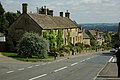
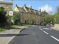
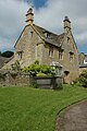
English: Bourton-on-the-Hill is a village and civil parish in the Cotswold district of Gloucestershire, England, about two miles west of Moreton-in-Marsh. According to the 2001 Census it had a population of 309.
Sous-catégories
Cette catégorie comprend 7 sous-catégories, dont les 7 ci-dessous.
Média dans la catégorie « Bourton-on-the-Hill »
Cette catégorie comprend 276 fichiers, dont les 200 ci-dessous.
(page précédente) (page suivante)-
 A choice of roads to Oxford - geograph.org.uk - 633566.jpg 640 × 480 ; 87 kio
-
 A muddy Monarch's Way - geograph.org.uk - 1590338.jpg 640 × 480 ; 103 kio
-
 A wet Monarch's Way - geograph.org.uk - 1590327.jpg 640 × 480 ; 128 kio
-
 A424 at Five Mile Drive - geograph.org.uk - 3132681.jpg 640 × 480 ; 52 kio
-
 A424 east of Slade Farm House - geograph.org.uk - 3132670.jpg 640 × 480 ; 65 kio
-
 A44 - junction for Stow near Bourton Woods - geograph.org.uk - 2381132.jpg 640 × 480 ; 81 kio
-

-
 A44 at the junction for Blockley - geograph.org.uk - 2381127.jpg 640 × 480 ; 95 kio
-
 A44 east of Slade Farm - geograph.org.uk - 3471677.jpg 3 533 × 2 620 ; 1,2 Mio
-
 A44 Five Mile Drive Heading Towards Broadway - geograph.org.uk - 5330305.jpg 640 × 428 ; 120 kio
-
 A44 heading out of Bourton-on-the-Hill - geograph.org.uk - 6407277.jpg 800 × 450 ; 77 kio
-
 A44 leaves Bourton on the Hill - geograph.org.uk - 3472514.jpg 3 648 × 2 736 ; 1,74 Mio
-
 A44 meets the A424 - geograph.org.uk - 2381141.jpg 640 × 480 ; 67 kio
-
 A44 near Upper Fields Farm - geograph.org.uk - 2381110.jpg 640 × 480 ; 36 kio
-
 A44 south of Bourton Woods - geograph.org.uk - 3471805.jpg 3 440 × 2 592 ; 1,44 Mio
-
 A44 south of Larkstoke Cottage - geograph.org.uk - 3473300.jpg 3 207 × 2 452 ; 1,01 Mio
-
 A44 south of Manor Farm - geograph.org.uk - 3471818.jpg 3 648 × 2 736 ; 1,34 Mio
-
 Across the field - geograph.org.uk - 1579661.jpg 640 × 480 ; 90 kio
-
 Across the road - geograph.org.uk - 1819463.jpg 4 000 × 3 000 ; 3,74 Mio
-

-
 Alongside Century Plantation - geograph.org.uk - 1591004.jpg 640 × 480 ; 133 kio
-
 Alongside the A44 - geograph.org.uk - 1819478.jpg 4 000 × 3 000 ; 2,63 Mio
-
 Approaching Bourton-on-the-Hill - geograph.org.uk - 407542.jpg 640 × 480 ; 99 kio
-
 Arable land at the A424 junction - geograph.org.uk - 3192007.jpg 640 × 479 ; 166 kio
-
 Autumn colour along the Monarch's Way - geograph.org.uk - 1590364.jpg 640 × 480 ; 114 kio
-
 Autumn colours - Batsford Arboretum - geograph.org.uk - 4718063.jpg 640 × 480 ; 180 kio
-
 Autumn colours, Batsford Arboretum - geograph.org.uk - 4219783.jpg 2 000 × 1 689 ; 1,09 Mio
-
 Autumn Hedgerow - geograph.org.uk - 4715193.jpg 2 000 × 1 333 ; 1,23 Mio
-
 Autumn leaves - geograph.org.uk - 3735420.jpg 1 024 × 680 ; 219 kio
-
 Autumn leaves, Batsford Arboretum - geograph.org.uk - 3735435.jpg 1 024 × 680 ; 223 kio
-
 B4479 Junction - geograph.org.uk - 5151030.jpg 800 × 600 ; 173 kio
-
 Back garden quarry - geograph.org.uk - 1819473.jpg 4 000 × 3 000 ; 3,29 Mio
-
 Barley near Bourton-on-the-Hill - geograph.org.uk - 31464.jpg 640 × 480 ; 522 kio
-
 Batsford Arboretum (01) - entrance, Batsford, Glos - geograph.org.uk - 3729203.jpg 1 024 × 652 ; 211 kio
-
 Batsford Arboretum (02) - Applestore, Batsford, Glos - geograph.org.uk - 3729337.jpg 1 024 × 624 ; 221 kio
-
 Batsford Arboretum (03) - wooded path, Batsford, Glos - geograph.org.uk - 3729350.jpg 677 × 1 024 ; 313 kio
-
 Batsford Arboretum (04) - Foo Dog statue, Batsford, Glos - geograph.org.uk - 3729418.jpg 1 024 × 768 ; 357 kio
-

-
 Batsford Arboretum (06) - entrance gates, Batsford, Glos - geograph.org.uk - 3731445.jpg 1 024 × 651 ; 273 kio
-
 Batsford Arboretum (09) - trees, Batsford, Glos - geograph.org.uk - 3731529.jpg 703 × 1 024 ; 300 kio
-

-
 Batsford Arboretum - autumnal - geograph.org.uk - 4719506.jpg 640 × 480 ; 120 kio
-
 Batsford Arboretum - geograph.org.uk - 3736526.jpg 680 × 1 024 ; 352 kio
-
 Batsford Arboretum - geograph.org.uk - 3736528.jpg 680 × 1 024 ; 385 kio
-
 Batsford Arboretum - geograph.org.uk - 3736549.jpg 1 024 × 680 ; 338 kio
-
 Batsford arboretum - geograph.org.uk - 4732153.jpg 3 264 × 2 448 ; 2,2 Mio
-
 Batsford Arboretum - geograph.org.uk - 5617663.jpg 640 × 480 ; 108 kio
-
 Batsford Arboretum - viewpoint - geograph.org.uk - 4718050.jpg 640 × 480 ; 82 kio
-
 Batsford Arboretum - viewpoint - geograph.org.uk - 5617684.jpg 640 × 480 ; 105 kio
-
 Batsford House - geograph.org.uk - 3736597.jpg 1 024 × 680 ; 288 kio
-

-
 Batsford Park and Arboretum, aerial 2019 - geograph.org.uk - 6238917.jpg 800 × 533 ; 96 kio
-
 Beech trees in Century Plantation - geograph.org.uk - 891894.jpg 426 × 640 ; 116 kio
-
 Beech trees, Batsford - geograph.org.uk - 891887.jpg 426 × 640 ; 104 kio
-
 Bench, Batsford Arboretum - geograph.org.uk - 6150081.jpg 3 958 × 2 969 ; 1,58 Mio
-
 Benchmark on St Lawrence Church's tower - geograph.org.uk - 4102650.jpg 686 × 1 024 ; 299 kio
-
 Beside the Millennium Plantation - geograph.org.uk - 1579476.jpg 640 × 480 ; 132 kio
-
 Between the woods - geograph.org.uk - 1605278.jpg 640 × 480 ; 125 kio
-
 Blossom on Five Mile Drive (A424) - geograph.org.uk - 4959213.jpg 1 600 × 1 200 ; 729 kio
-
 Bluebells in Bourton Woods - geograph.org.uk - 4478508.jpg 680 × 1 024 ; 233 kio
-
 Bluebells in Pebble Grove (1) - geograph.org.uk - 1828684.jpg 4 000 × 3 000 ; 3,84 Mio
-
 Bluebells in Pebble Grove (2) - geograph.org.uk - 1828686.jpg 4 000 × 3 000 ; 3,07 Mio
-
 Bourton Far Hill Farm - geograph.org.uk - 1589812.jpg 640 × 480 ; 78 kio
-
 Bourton House - geograph.org.uk - 5865638.jpg 1 024 × 680 ; 277 kio
-
 Bourton House - geograph.org.uk - 5865648.jpg 1 024 × 680 ; 278 kio
-
 Bourton House - geograph.org.uk - 5865652.jpg 1 024 × 680 ; 355 kio
-
 Bourton on the Hill - geograph.org.uk - 1280265.jpg 640 × 457 ; 368 kio
-
 Bourton On The Hill - geograph.org.uk - 6093040.jpg 1 600 × 1 200 ; 347 kio
-

-
 Bourton on the Hill, The Diamond Way - geograph.org.uk - 4502782.jpg 640 × 480 ; 53 kio
-
 Bourton on the Hill, The Diamond Way - geograph.org.uk - 4502815.jpg 640 × 480 ; 117 kio
-
 Bourton on the Hill, The Diamond Way - geograph.org.uk - 4502831.jpg 640 × 480 ; 110 kio
-

-
 Bourton On The Hill-Batsford Arboretum - geograph.org.uk - 6095091.jpg 1 600 × 1 200 ; 605 kio
-
 Bourton On The Hill-Sunday School Building - geograph.org.uk - 6093044.jpg 1 600 × 1 200 ; 345 kio
-
 Bourton Woods - geograph.org.uk - 1819469.jpg 4 000 × 3 000 ; 4,34 Mio
-

-
 Bourton-on-the-Hill - geograph.org.uk - 1448992.jpg 640 × 426 ; 111 kio
-
 Bourton-on-the-Hill - geograph.org.uk - 1449672.jpg 640 × 426 ; 70 kio
-
 Bourton-on-the-Hill - geograph.org.uk - 1819531.jpg 4 000 × 3 000 ; 2,24 Mio
-
 Bourton-on-the-Hill - geograph.org.uk - 246898.jpg 640 × 480 ; 52 kio
-
 Bourton-on-the-Hill - geograph.org.uk - 4091641.jpg 1 600 × 1 064 ; 565 kio
-
 Bourton-on-the-Hill village - geograph.org.uk - 2381115.jpg 640 × 480 ; 79 kio
-
 Bourton-on-the-Hill, the A44 facing east. - geograph.org.uk - 374457.jpg 640 × 480 ; 70 kio
-
 Bridge at the southern end of The Dingles wood - geograph.org.uk - 4959211.jpg 1 600 × 1 200 ; 794 kio
-
 Bridleway heading towards Tower View Cottage - geograph.org.uk - 6397422.jpg 800 × 450 ; 156 kio
-
 Bridleway in a hollow way - geograph.org.uk - 1819500.jpg 4 000 × 3 000 ; 6,14 Mio
-
 Bridleway to the woods - geograph.org.uk - 1819455.jpg 4 000 × 3 000 ; 4,93 Mio
-
 Bridleway to the woods - geograph.org.uk - 1819460.jpg 4 000 × 3 000 ; 3,61 Mio
-
 Bronze Foo Dog, Batsford Arboretum - geograph.org.uk - 2129807.jpg 640 × 427 ; 188 kio
-
 Bull^ - geograph.org.uk - 240808.jpg 640 × 480 ; 103 kio
-
 Clump of conifers between Bourton Woods and A44 - geograph.org.uk - 2842851.jpg 640 × 480 ; 118 kio
-
 Cold Well Lake - Batsford Arboretum - geograph.org.uk - 4719516.jpg 640 × 480 ; 140 kio
-
 Cotswold earth - geograph.org.uk - 4482320.jpg 1 024 × 680 ; 288 kio
-
 Cotswold fields, Bourton On the Hill - geograph.org.uk - 2465405.jpg 640 × 480 ; 64 kio
-
 Cotswold stone buildings on the A44, Bourton on the Hill - geograph.org.uk - 3093355.jpg 1 600 × 1 200 ; 586 kio
-
 Cottages in Bourton-on-the-Hill - geograph.org.uk - 1448998.jpg 640 × 426 ; 80 kio
-
 Cottages in Bourton-on-the-Hill - geograph.org.uk - 1449695.jpg 640 × 426 ; 71 kio
-
 Country junction - geograph.org.uk - 1983692.jpg 4 000 × 3 000 ; 2,98 Mio
-
 Country road passing below Slade Farm House - geograph.org.uk - 4482341.jpg 800 × 531 ; 127 kio
-
 Daphne at Batsford - geograph.org.uk - 3467728.jpg 480 × 640 ; 381 kio
-
 Davidia at Batsford Arboretum - geograph.org.uk - 4480482.jpg 451 × 640 ; 200 kio
-
 Diamond Way - geograph.org.uk - 6406587.jpg 800 × 450 ; 105 kio
-
 Diamond Way - geograph.org.uk - 6406592.jpg 800 × 450 ; 135 kio
-
 Diamond Way - geograph.org.uk - 6406601.jpg 800 × 450 ; 127 kio
-
 Disused quarry - geograph.org.uk - 1589804.jpg 640 × 480 ; 105 kio
-
 Drive to Batsford Arboretum 2 - geograph.org.uk - 1700766.jpg 640 × 480 ; 237 kio
-
 Drive to Bourton Hill House - geograph.org.uk - 4482337.jpg 1 024 × 680 ; 220 kio
-
 Drive to Sezincote - geograph.org.uk - 1579646.jpg 640 × 480 ; 126 kio
-
 Driveway to Sezincote - geograph.org.uk - 1821460.jpg 4 000 × 3 000 ; 3,71 Mio
-
 Duck Island, Batsford Arboretum - geograph.org.uk - 4219956.jpg 1 500 × 2 142 ; 937 kio
-
 Entrance to Batsford Arboretum - geograph.org.uk - 5863128.jpg 1 024 × 680 ; 269 kio
-
 Falcon ready to fly - geograph.org.uk - 4814381.jpg 856 × 924 ; 222 kio
-
 Falconry Display - geograph.org.uk - 4595119.jpg 1 078 × 1 612 ; 765 kio
-
 Far Upton Wold Farm - geograph.org.uk - 1605282.jpg 640 × 480 ; 111 kio
-
 Farm buildings and cottage - geograph.org.uk - 1821444.jpg 4 000 × 3 000 ; 3,48 Mio
-
 Field by Five Mile Drive - geograph.org.uk - 6249244.jpg 1 876 × 1 212 ; 1,4 Mio
-
 Field by Five Mile Drive - geograph.org.uk - 6249245.jpg 1 872 × 1 204 ; 1,04 Mio
-
 Field in Bourton-on-the-Hill - geograph.org.uk - 6267935.jpg 1 898 × 1 246 ; 1,28 Mio
-
 Field in Sezincote Warren - geograph.org.uk - 6268362.jpg 1 920 × 1 280 ; 1,34 Mio
-
 Field in Sezincote Warren - geograph.org.uk - 6268363.jpg 1 878 × 1 214 ; 1,18 Mio
-
 Field near Batsford - geograph.org.uk - 6250951.jpg 1 920 × 1 280 ; 1,23 Mio
-
 Fields near Diamond Lodge - geograph.org.uk - 2655601.jpg 3 648 × 2 736 ; 2,14 Mio
-
 Five Mile Drive - geograph.org.uk - 4478475.jpg 800 × 531 ; 219 kio
-
 Five Mile Drive, Bourton-on-the-Hill - geograph.org.uk - 6267903.jpg 1 872 × 1 204 ; 1,18 Mio
-
 Flowerbed by the path - geograph.org.uk - 3507939.jpg 1 500 × 1 000 ; 231 kio
-
 Footpath linking two bridleways - geograph.org.uk - 3410475.jpg 640 × 480 ; 102 kio
-
 Footpath to Batsford - geograph.org.uk - 4229511.jpg 2 000 × 1 333 ; 1,05 Mio
-
 Footpath to Bourton on the Hill - geograph.org.uk - 4229494.jpg 1 500 × 2 250 ; 1,05 Mio
-
 Footpath to Longborough - geograph.org.uk - 1579462.jpg 640 × 480 ; 87 kio
-
 Garden centre at Batsford Arboretum - geograph.org.uk - 3735430.jpg 1 024 × 680 ; 275 kio
-
 Garden centre, Batsford Arboretum - geograph.org.uk - 3735428.jpg 1 024 × 680 ; 289 kio
-
 Gate to Batsford Arboretum - geograph.org.uk - 6251003.jpg 1 920 × 1 280 ; 1,78 Mio
-
 Gloucestershire view - geograph.org.uk - 1819512.jpg 4 000 × 3 000 ; 2,76 Mio
-
 Heart of England Way - geograph.org.uk - 1579440.jpg 640 × 480 ; 101 kio
-
 Hill Barn - geograph.org.uk - 1591013.jpg 640 × 480 ; 76 kio
-
 Hill Barn viewed across a barley field - geograph.org.uk - 889326.jpg 640 × 426 ; 104 kio
-
 Horse and Groom pub, Bourton-on-the-Hill - geograph.org.uk - 2381119.jpg 640 × 480 ; 79 kio
-
 Horse ^ Groom - geograph.org.uk - 1819451.jpg 4 000 × 3 000 ; 3,07 Mio
-
 House in Bourton-on-the-Hill - geograph.org.uk - 1449687.jpg 426 × 640 ; 76 kio
-
 Hunt jump between bridleway and former quarry - geograph.org.uk - 3410479.jpg 640 × 480 ; 141 kio
-
 Indian lilies at Batsford Arboretum - geograph.org.uk - 4480380.jpg 640 × 427 ; 214 kio
-
 Inside the edge of Bourton Woods - geograph.org.uk - 2842848.jpg 640 × 480 ; 133 kio
-
 Into the woods - geograph.org.uk - 1590983.jpg 640 × 480 ; 130 kio
-
 Into the woods - geograph.org.uk - 1700010.jpg 4 000 × 3 000 ; 4,58 Mio
-
 Jockey Stable Cottages - geograph.org.uk - 1605285.jpg 640 × 480 ; 80 kio
-
 Junction for Far Upton Wold Farm - geograph.org.uk - 5325097.jpg 640 × 480 ; 183 kio
-
 Lake at Batsford Park - geograph.org.uk - 5617691.jpg 640 × 480 ; 104 kio
-
 Lane in Bourton-on-the-Hill - geograph.org.uk - 6267910.jpg 1 892 × 1 236 ; 1,14 Mio
-
 Lane near Snowshill - geograph.org.uk - 6268373.jpg 1 920 × 1 280 ; 1,79 Mio
-
 Lane to Batsford - geograph.org.uk - 6257161.jpg 1 920 × 1 280 ; 1,79 Mio
-
 Lodge to Sezincote House (geograph 5863123).jpg 1 024 × 680 ; 258 kio
-
 Long Distance Footpath near Moreton-in-Marsh - geograph.org.uk - 891921.jpg 640 × 426 ; 90 kio
-
 Long narrow field - geograph.org.uk - 1671671.jpg 4 000 × 3 000 ; 4,77 Mio
-
 Long, narrow field below Sezincote Brake - geograph.org.uk - 2877330.jpg 640 × 480 ; 108 kio
-
 Millennium Plantation - geograph.org.uk - 1579632.jpg 640 × 480 ; 95 kio
-
 Minor road east of Smallthorns Cottage - geograph.org.uk - 4959207.jpg 1 600 × 1 200 ; 776 kio
-
 Minor road off A424 - geograph.org.uk - 4249345.jpg 2 048 × 1 536 ; 1,56 Mio
-
 Monarch's Way footpath - geograph.org.uk - 4229476.jpg 2 000 × 1 384 ; 1 004 kio
-
 Moreton In The Marsh-A44 - geograph.org.uk - 6102974.jpg 1 600 × 1 100 ; 300 kio
-
 North Lodge, Sezincote - geograph.org.uk - 2655595.jpg 3 520 × 2 520 ; 1,9 Mio
-

-
 Oil seed rape, Bourton Hill - geograph.org.uk - 4482323.jpg 1 024 × 680 ; 241 kio
-
 Old and New Trees in Sezincote Park - geograph.org.uk - 2655598.jpg 3 440 × 2 468 ; 2,03 Mio
-
 Ordnance Survey Sheet SP 13 Chipping Campden, Published 1952.tif 7 409 × 7 510 ; 93,88 Mio
-
 Ornamental dragon, Batsford Arboretum - geograph.org.uk - 3735458.jpg 1 024 × 680 ; 283 kio
-
 Over the brook into another field - geograph.org.uk - 1579670.jpg 640 × 480 ; 112 kio
-
 Parish Church - geograph.org.uk - 34920.jpg 426 × 640 ; 116 kio
-
 Pasture land at Bourton-on-the-Hill - geograph.org.uk - 1449004.jpg 640 × 426 ; 85 kio
-
 Path in the wood - geograph.org.uk - 1671668.jpg 4 000 × 3 000 ; 3,9 Mio
-
 Path in the woods - geograph.org.uk - 1590987.jpg 640 × 480 ; 143 kio
-
 Path into Park Plantation. - geograph.org.uk - 1591008.jpg 640 × 480 ; 134 kio
-
 Path to Warren Farm - geograph.org.uk - 1605420.jpg 640 × 480 ; 122 kio
-
 Path towards Blockley - geograph.org.uk - 1591010.jpg 640 × 480 ; 121 kio
-
 Paths cross - geograph.org.uk - 1590377.jpg 640 × 480 ; 90 kio
-
 Pathways and sculptures in Batsford Arboretum - geograph.org.uk - 4863931.jpg 800 × 600 ; 189 kio
-

-
 Pine plantation by five mile drive - geograph.org.uk - 4446715.jpg 1 600 × 1 066 ; 536 kio
-
 Posh wall - geograph.org.uk - 1819484.jpg 4 000 × 3 000 ; 4,2 Mio
-
 Private Road - geograph.org.uk - 6407283.jpg 800 × 450 ; 84 kio
-
 Redwood trees - geograph.org.uk - 3735426.jpg 680 × 1 024 ; 314 kio
-
 Restored trough - geograph.org.uk - 1819450.jpg 4 000 × 3 000 ; 2,86 Mio
-
 Ridge and Furrow near Batsford - geograph.org.uk - 2642570.jpg 3 648 × 2 736 ; 1,95 Mio
-
 Ridge ^ Furrow, Monarch's Way - geograph.org.uk - 2661059.jpg 3 468 × 2 432 ; 1,85 Mio
-
 Road junction - geograph.org.uk - 1605346.jpg 640 × 480 ; 104 kio
-
 Road junction - geograph.org.uk - 1605351.jpg 640 × 480 ; 97 kio
-
 Road junction at Smallthorns Cottage - geograph.org.uk - 4959206.jpg 1 600 × 1 200 ; 837 kio
-
 Road passing Tuckwell Lodge - geograph.org.uk - 6397449.jpg 800 × 450 ; 111 kio
-
 Road to Far Upton Wold farm - geograph.org.uk - 4959212.jpg 1 600 × 1 200 ; 730 kio
-
 Road to Upper Rye Farm Buildings - geograph.org.uk - 1449708.jpg 640 × 426 ; 81 kio
-
 Roads meet - geograph.org.uk - 1605287.jpg 640 × 480 ; 127 kio
-
 S-bend on the A44 west of Moreton-in-Marsh - geograph.org.uk - 2380823.jpg 640 × 480 ; 79 kio
-
 Sezincote Signs and the A44 - geograph.org.uk - 2661082.jpg 3 556 × 2 568 ; 1,54 Mio
-
 Slade Farm seen down the track - geograph.org.uk - 2842859.jpg 640 × 480 ; 156 kio
-
 Small field near Highland Lodge - geograph.org.uk - 6167645.jpg 1 600 × 898 ; 748 kio
-
 Smallthorns Cottage, Snowshill - geograph.org.uk - 6263579.jpg 1 920 × 1 280 ; 1,77 Mio
-

-
 Spring at Bourton-on-the-Hill - geograph.org.uk - 1449003.jpg 426 × 640 ; 99 kio
-
 Square copse - geograph.org.uk - 407539.jpg 640 × 426 ; 116 kio
-
 St Lawrence's Church - geograph.org.uk - 4022614.jpg 1 024 × 705 ; 145 kio


_-_entrance,_Batsford,_Glos_-_geograph.org.uk_-_3729203.jpg)
_-_Applestore,_Batsford,_Glos_-_geograph.org.uk_-_3729337.jpg)
_-_wooded_path,_Batsford,_Glos_-_geograph.org.uk_-_3729350.jpg)
_-_Foo_Dog_statue,_Batsford,_Glos_-_geograph.org.uk_-_3729418.jpg)
_-_footpath_and_seat,_Batsford,_Glos_-_geograph.org.uk_-_3731393.jpg)
_-_entrance_gates,_Batsford,_Glos_-_geograph.org.uk_-_3731445.jpg)
_-_trees,_Batsford,_Glos_-_geograph.org.uk_-_3731529.jpg)
_-_footpath_and_trees,_Batsford,_Glos_-_geograph.org.uk_-_3732417.jpg)


_-_geograph.org.uk_-_4959213.jpg)

_-_geograph.org.uk_-_1828684.jpg)
_-_geograph.org.uk_-_1828686.jpg)


.jpg)


