Category:Bovingdon
Aller à la navigation
Aller à la recherche
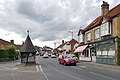
English: Bovingdon is a large village in the Chiltern Hills, in Hertfordshire, England, four miles south-west of Hemel Hempstead and within the local authority area of Dacorum. It forms the largest part of the ward of Bovingdon, Flaunden and Chipperfield, which had a population of 8,819 at the 2001 census.
village britannique  | |||||
| Téléverser des médias | |||||
| Nature de l’élément | |||||
|---|---|---|---|---|---|
| Lieu | Dacorum, Hertfordshire, Angleterre de l'Est, Angleterre | ||||
| Population |
| ||||
| À ne pas confondre avec | |||||
| Réputé identique à | Bovingdon (page en doublon, paroisse civile) | ||||
 | |||||
Sous-catégories
Cette catégorie comprend 4 sous-catégories, dont les 4 ci-dessous.
Média dans la catégorie « Bovingdon »
Cette catégorie comprend 126 fichiers, dont les 126 ci-dessous.
-
 "Welcome to Bovingdon Airfield Site" Information Notice - geograph.org.uk - 6582905.jpg 2 592 × 1 944 ; 1,4 Mio
-
 'Welcome to Bovingdon Green' Information Board - geograph.org.uk - 6413820.jpg 2 592 × 1 944 ; 1,39 Mio
-
 'Welcome to Bovingdon Village' Information Board (1) - geograph.org.uk - 6587859.jpg 2 592 × 1 944 ; 1,39 Mio
-
 'Welcome to Bovingdon Village' Information Board (2) - geograph.org.uk - 6587874.jpg 2 592 × 1 944 ; 1,39 Mio
-
 A41 cutting and service station - geograph.org.uk - 2372785.jpg 3 192 × 2 056 ; 1,44 Mio
-
 A41 from Chiltern way footbridge - geograph.org.uk - 2162669.jpg 3 248 × 2 336 ; 1,31 Mio
-
 A41 near Little Hey - geograph.org.uk - 3008753.jpg 640 × 480 ; 48 kio
-
 A41 near Vale Farm - geograph.org.uk - 3008754.jpg 640 × 480 ; 59 kio
-
 Approach to St Lawrence, Bovingdon - geograph.org.uk - 5746207.jpg 640 × 360 ; 47 kio
-
 Austins Mead from Chipperfield Road, Bovingdon - geograph.org.uk - 2935273.jpg 1 600 × 1 200 ; 603 kio
-
 Barns at Chiltern Farm, Shantock Lane - geograph.org.uk - 3389608.jpg 4 270 × 2 847 ; 3,42 Mio
-
 Bovingdon Airfield - geograph.org.uk - 6597388.jpg 1 024 × 576 ; 156 kio
-
 Bovingdon Airfield from the air - geograph.org.uk - 4266908.jpg 640 × 480 ; 112 kio
-
 Bovingdon Brickworks - geograph.org.uk - 2460223.jpg 800 × 618 ; 225 kio
-
 Bovingdon Brickworks clay quarry - geograph.org.uk - 1939942.jpg 3 056 × 1 904 ; 840 kio
-
 Bovingdon Brickworks Yard - geograph.org.uk - 1939937.jpg 3 456 × 2 304 ; 2,95 Mio
-
 Bovingdon Church - geograph.org.uk - 5265381.jpg 2 560 × 1 920 ; 2,83 Mio
-
 Bovingdon Memorial Hall - geograph.org.uk - 6593486.jpg 2 592 × 1 944 ; 1,39 Mio
-
 Bovingdon Raceway - geograph.org.uk - 109250.jpg 640 × 480 ; 89 kio
-
 Bovingdon Reservoir and radio masts - geograph.org.uk - 175812.jpg 480 × 640 ; 93 kio
-
 Bovingdon the bell.JPG 2 048 × 1 536 ; 527 kio
-
 Bovingdon, Boundary Cottages - geograph.org.uk - 109280.jpg 640 × 480 ; 79 kio
-
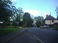
 Bovingdon, Bourne End Lane - geograph.org.uk - 175830.jpg 640 × 480 ; 118 kio
-
 Bovingdon, Bovingdon Green - geograph.org.uk - 132226.jpg 640 × 480 ; 96 kio
-
 Bovingdon, Farmland off Bulstrode Lane - geograph.org.uk - 1340198.jpg 640 × 480 ; 77 kio
-

-
 Bovingdon, Holly Hedges Lane - geograph.org.uk - 132218.jpg 640 × 480 ; 152 kio
-
 Bovingdon, Little Hay Golf Club - geograph.org.uk - 175789.jpg 640 × 480 ; 86 kio
-
 Bovingdon, Long Lane Mast - geograph.org.uk - 132234.jpg 640 × 480 ; 84 kio
-
 Bovingdon, Longcroft Lane - geograph.org.uk - 109274.jpg 640 × 480 ; 119 kio
-
 Bovingdon, Millennium Village Sign - geograph.org.uk - 175838.jpg 640 × 480 ; 68 kio
-
 Bovingdon, Shantock Lane - geograph.org.uk - 132241.jpg 640 × 480 ; 154 kio
-
 Bovingdon, Shothanger Way - geograph.org.uk - 175796.jpg 640 × 480 ; 151 kio
-
 Bovingdon, Stoney Lane - geograph.org.uk - 175857.jpg 640 × 480 ; 165 kio
-

-
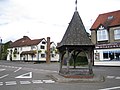 Bovingdon, The Old Well and The Bell Inn - geograph.org.uk - 175835.jpg 640 × 480 ; 80 kio
-
 Bridleway and footpath near Lower Farm - geograph.org.uk - 220830.jpg 480 × 640 ; 80 kio
-
 Bridleway heading down to Lower Farm - geograph.org.uk - 6620714.jpg 1 024 × 576 ; 257 kio
-
 Bridleway passing Lower Farm - geograph.org.uk - 6620709.jpg 1 024 × 576 ; 210 kio
-
 Bulstrode Lane south of Felden - geograph.org.uk - 4431892.jpg 1 280 × 960 ; 466 kio
-
 Bulstrode Lane south of Felden - geograph.org.uk - 4431897.jpg 1 280 × 960 ; 397 kio
-
 Chancel of St Lawrence, Bovingdon - geograph.org.uk - 5746196.jpg 640 × 360 ; 57 kio
-
 Chesham Road, Bovingdon - geograph.org.uk - 2935290.jpg 1 600 × 1 200 ; 537 kio
-
 Chiltern Way - geograph.org.uk - 2172316.jpg 640 × 480 ; 84 kio
-
 Chiltern Way - geograph.org.uk - 2172325.jpg 640 × 480 ; 113 kio
-
 Chiltern Way - geograph.org.uk - 2172332.jpg 640 × 480 ; 98 kio
-
 Chiltern Way - geograph.org.uk - 2172343.jpg 640 × 480 ; 95 kio
-
 Chiltern Way - geograph.org.uk - 2172356.jpg 640 × 480 ; 97 kio
-
 Chiltern Way footbridge over A41 - geograph.org.uk - 2161562.jpg 2 387 × 1 585 ; 918 kio
-
 Chipperfield Road at the junction of Flaunden Lane - geograph.org.uk - 2935313.jpg 1 600 × 1 200 ; 632 kio
-
 Chipperfield Road, Bovingdon - geograph.org.uk - 2935458.jpg 1 600 × 1 200 ; 494 kio
-
 Chipperfield Road, Bovingdon - geograph.org.uk - 2936723.jpg 1 600 × 1 200 ; 629 kio
-
 Clouds above the horizon near to Ashridge Farm - geograph.org.uk - 4522731.jpg 2 048 × 1 536 ; 460 kio
-
 Crumbling Farm - geograph.org.uk - 3389641.jpg 4 289 × 3 056 ; 3,54 Mio
-
 Entrance to Bovingdon Memorial Hall - geograph.org.uk - 6593503.jpg 2 592 × 1 944 ; 1,39 Mio
-
 Farmland, Bovingdon - geograph.org.uk - 2814672.jpg 640 × 480 ; 164 kio
-
 Farmland, Bovingdon - geograph.org.uk - 2814765.jpg 640 × 480 ; 197 kio
-
 Field by Holly Hedges Lane, Hogpits Bottom - geograph.org.uk - 5091379.jpg 2 304 × 1 728 ; 822 kio
-
 Field Way, Bovingdon - geograph.org.uk - 2934886.jpg 1 600 × 1 200 ; 382 kio
-
 Fields adjacent to Bovingdon Brickworks - geograph.org.uk - 3385836.jpg 4 592 × 3 056 ; 4,57 Mio
-
 Flaunden Lane near Felden - geograph.org.uk - 6316872.jpg 1 920 × 1 280 ; 1,62 Mio
-
 Flaunden Lane, Bovingdon - geograph.org.uk - 6242292.jpg 1 920 × 1 280 ; 1,3 Mio
-
 Flaunden Lane, Bovingdon - geograph.org.uk - 6316877.jpg 1 920 × 1 280 ; 1,45 Mio
-
 Flaunden Lane, Bulstrode - geograph.org.uk - 6316873.jpg 1 920 × 1 280 ; 1,96 Mio
-
 Flaunden Lane, Bulstrode - geograph.org.uk - 6316876.jpg 1 920 × 1 280 ; 1,79 Mio
-
 Footpath junction and bridge over A41 - geograph.org.uk - 2162686.jpg 3 648 × 2 736 ; 4,81 Mio
-
 Former car sales lot - geograph.org.uk - 4228943.jpg 4 320 × 3 240 ; 3,91 Mio
-
 Hay baling at Lower Farm - geograph.org.uk - 191924.jpg 640 × 480 ; 75 kio
-
 Hertfordshire Way - geograph.org.uk - 2172368.jpg 640 × 480 ; 128 kio
-
 High St, Bovingdon 2020-07-24.jpg 3 288 × 2 192 ; 2,54 Mio
-
 High Street Bovingdon - geograph.org.uk - 2935311.jpg 1 600 × 1 200 ; 577 kio
-
 High Street, Bovingdon - geograph.org.uk - 5746210.jpg 640 × 360 ; 51 kio
-
 High Street, Bovingdon - geograph.org.uk - 5746220.jpg 640 × 360 ; 53 kio
-
 History Information Board at Bovingdon Green - geograph.org.uk - 6406317.jpg 2 592 × 1 944 ; 1,4 Mio
-
 Holly Hedges Lane, Hogpits Bottom - geograph.org.uk - 5091372.jpg 2 304 × 1 728 ; 827 kio
-
 Holly Hedges Lane, Hogpits Bottom - geograph.org.uk - 5091375.jpg 2 304 × 1 728 ; 818 kio
-
 Horses grazing near Rose Farm - geograph.org.uk - 3389622.jpg 4 592 × 3 056 ; 4,51 Mio
-
 House on Bovingdon Green - geograph.org.uk - 4657052.jpg 2 304 × 1 728 ; 826 kio
-
 House on Leyhill Road, Bovingdon - geograph.org.uk - 4662690.jpg 2 304 × 1 728 ; 821 kio
-
 House on Long Lane near Bovingdon - geograph.org.uk - 4657019.jpg 2 304 × 1 728 ; 837 kio
-
 Houses on Bovingdon Green - geograph.org.uk - 4657046.jpg 2 200 × 1 580 ; 1,02 Mio
-
 Houses on Flaunden Lane, Bovingdon - geograph.org.uk - 6242241.jpg 1 920 × 1 280 ; 1,57 Mio
-
 Houses on Long Lane, Bovingdon - geograph.org.uk - 4657038.jpg 2 180 × 1 548 ; 1,7 Mio
-
 Houses on Private Road from Bridleway - geograph.org.uk - 2173196.jpg 3 456 × 2 532 ; 1,81 Mio
-
 Information Board in Bovingdon - geograph.org.uk - 6188234.jpg 2 592 × 1 944 ; 1,4 Mio
-
 Information Board in Chipperfield Road - geograph.org.uk - 6595997.jpg 2 592 × 1 944 ; 1,37 Mio
-
 Jammed Kissing gate on Chiltern Way - geograph.org.uk - 3021144.jpg 2 816 × 2 112 ; 4,73 Mio
-
 Ley Hill and Botley from the air - geograph.org.uk - 4266849.jpg 480 × 640 ; 112 kio
-
 Leyhill Road - geograph.org.uk - 6597399.jpg 1 024 × 576 ; 165 kio
-
 Little Hay Golf Course - geograph.org.uk - 2161584.jpg 2 799 × 1 863 ; 1,54 Mio
-
 Little Hey Golf Complex clubhouse - geograph.org.uk - 2164776.jpg 3 152 × 2 040 ; 1,2 Mio
-
 Long Lane south of Bovingdon - geograph.org.uk - 4657015.jpg 2 304 × 1 728 ; 857 kio
-
 Longcroft Farm - geograph.org.uk - 152876.jpg 640 × 480 ; 102 kio
-
 Looking to the two Radio Masts - geograph.org.uk - 6597366.jpg 1 024 × 576 ; 145 kio
-
 Lower Farm - geograph.org.uk - 135800.jpg 640 × 480 ; 73 kio
-
 Lower Farm - geograph.org.uk - 220837.jpg 640 × 350 ; 69 kio
-
 Lower Farm and pretend tree - geograph.org.uk - 220840.jpg 640 × 239 ; 39 kio
-
 Lower Farm with Great Wood - geograph.org.uk - 220126.jpg 640 × 480 ; 97 kio
-
 Meadhams Farm Brickworks from the air - geograph.org.uk - 4266892.jpg 480 × 640 ; 105 kio
-
 Millennium Village Sign, Bovingdon - geograph.org.uk - 6587885.jpg 1 944 × 2 592 ; 904 kio
-
 National Air Traffic Service radar dome at Bovingdon - geograph.org.uk - 3389301.jpg 4 276 × 2 851 ; 3,07 Mio
-
 Pasture near Crumbling Farm - geograph.org.uk - 3389618.jpg 4 592 × 3 056 ; 4,52 Mio
-
 Path heading to the B4505 - geograph.org.uk - 6597336.jpg 1 024 × 576 ; 120 kio
-
 Plaque outside Bovingdon Memorial Hall - geograph.org.uk - 6593464.jpg 2 592 × 1 944 ; 1,3 Mio
-
 Pocketsdell Lane Byway - geograph.org.uk - 6597414.jpg 1 024 × 576 ; 247 kio
-
 Public footpath off Chipperfield Road, Bovingdon - geograph.org.uk - 2936728.jpg 1 600 × 1 200 ; 657 kio
-
 Quarry entrance on Leyhill Road - geograph.org.uk - 4662691.jpg 2 304 × 1 728 ; 831 kio
-
 Queen Elizabeth II Field Plaque on Bovingdon Green - geograph.org.uk - 6395503.jpg 2 592 × 1 944 ; 1,37 Mio
-
 Roundabout on Chesham Road, Bovingdon - geograph.org.uk - 2934876.jpg 1 600 × 1 200 ; 584 kio
-
 Shops on High Street Bovingdon - geograph.org.uk - 2936701.jpg 1 600 × 1 200 ; 534 kio
-
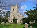
 St Lawrence, Bovingdon - geograph.org.uk - 5746166.jpg 640 × 360 ; 66 kio
-
 St Lawrence, Bovingdon - geograph.org.uk - 5746178.jpg 640 × 360 ; 63 kio
-
 St Lawrence, Bovingdon - geograph.org.uk - 5746205.jpg 640 × 360 ; 55 kio
-
 Take off from Bovingdon Airstrip - geograph.org.uk - 1931830.jpg 2 004 × 1 128 ; 341 kio
-
 Telegraph pole on Bulstrode Lane, Felden - geograph.org.uk - 4432508.jpg 1 280 × 960 ; 576 kio
-
 Telephone Exchange, Bovingdon, Herts - geograph.org.uk - 1190073.jpg 640 × 480 ; 99 kio
-
 Ten Oaks, Bulstrode - geograph.org.uk - 6316875.jpg 1 858 × 1 180 ; 1,09 Mio
-
 The Halfway House pub, Bovingdon - geograph.org.uk - 4228938.jpg 4 320 × 3 240 ; 3,88 Mio
-
 Track to Cottingham Farm, Bovingdon - geograph.org.uk - 6242248.jpg 1 920 × 1 280 ; 1,15 Mio
-
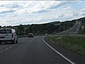
 Traffic on the A41 - geograph.org.uk - 2161612.jpg 3 456 × 2 304 ; 1,27 Mio
-
 Upper Bourne End Lane - geograph.org.uk - 6597344.jpg 1 024 × 576 ; 190 kio
-
 Venus Hill Dairy Farm - geograph.org.uk - 3389614.jpg 4 592 × 3 056 ; 6,23 Mio
-
 View across Bulstrode Lane, Felden - geograph.org.uk - 4432511.jpg 1 280 × 960 ; 460 kio
-
 View from Private Road - geograph.org.uk - 2173189.jpg 3 446 × 2 243 ; 1,4 Mio
-
 Wildlife Information Board at Bovingdon Green - geograph.org.uk - 6406449.jpg 2 592 × 1 944 ; 1,42 Mio
-
 Winter landscape near Holly Hedges Lane - geograph.org.uk - 3389635.jpg 4 057 × 2 705 ; 3,36 Mio


_-_geograph.org.uk_-_6587859.jpg)
_-_geograph.org.uk_-_6587874.jpg)


