Category:Bradwell, Derbyshire
Naar navigatie springen
Naar zoeken springen
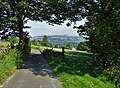
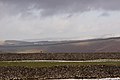
English: Bradwell is a village in the Derbyshire Peak District of England. It lies south of the main body of the Hope Valley, but is usually included among its settlements.
Derbyshire  | |||||
| Media uploaden | |||||
| Is een | |||||
|---|---|---|---|---|---|
| Locatie | Derbyshire Dales, Derbyshire, East Midlands, Engeland | ||||
| Inwonertal |
| ||||
 | |||||
Ondercategorieën
Deze categorie bevat de volgende 6 subcategorieën, van de 6 in totaal.
B
G
- The Grey Ditch (4 B)
P
- Pin Dale (26 B)
S
- Sydney Cottage, Bradwell (2 B)
W
- The White Hart, Bradwell (3 B)
Media in categorie "Bradwell, Derbyshire"
Deze categorie bevat de volgende 200 bestanden, van in totaal 244.
(vorige pagina) (volgende pagina)-
 "Chime Cottage", Hill Head, Bradwell - geograph.org.uk - 3095726.jpg 4.339 × 2.893; 3 MB
-
 "Public Footpath" - geograph.org.uk - 5922978.jpg 3.708 × 4.968; 4,56 MB
-
 "The White Hart" in Bradwell - geograph.org.uk - 5921592.jpg 4.994 × 3.578; 3,33 MB
-
 A Bradwell view - geograph.org.uk - 2873138.jpg 1.024 × 815; 215 kB
-
 A clump of oxeye daisies by the laneside on Bradwell Moor - geograph.org.uk - 3095684.jpg 3.072 × 4.608; 3,21 MB
-
 A corner of Bradwell, Smithy Hill - geograph.org.uk - 2873113.jpg 1.024 × 768; 240 kB
-
 A motorcyclist approaches on Batham Gate Roman Road - geograph.org.uk - 3091475.jpg 4.410 × 2.940; 2,6 MB
-
 A view from Bradwell Edge - geograph.org.uk - 3445095.jpg 600 × 800; 110 kB
-
 A view from Smalldale Head - geograph.org.uk - 1963709.jpg 640 × 480; 58 kB
-
 A view of Bradwell - geograph.org.uk - 2873088.jpg 1.024 × 745; 233 kB
-
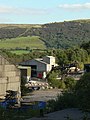
 A view of Hope Cement Works - geograph.org.uk - 6131998.jpg 4.894 × 3.740; 3 MB
-
 A welcome at the gate on Bradwell Moor - geograph.org.uk - 3452220.jpg 2.048 × 1.536; 428 kB
-
 Abandoned Dwelling near Smalldale Head - geograph.org.uk - 2093952.jpg 3.296 × 2.472; 1,01 MB
-
 Abandoned machinery - geograph.org.uk - 1485294.jpg 640 × 479; 116 kB
-
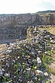
 Abandoned quarry on Bradwell Moor - geograph.org.uk - 3526666.jpg 800 × 533; 132 kB
-
 Abney Moor - geograph.org.uk - 177326.jpg 640 × 480; 112 kB
-
 Above Overdale Brook - geograph.org.uk - 2873508.jpg 1.024 × 752; 157 kB
-
 Above Smalldale Head - geograph.org.uk - 3169343.jpg 3.456 × 2.304; 1,67 MB
-
 Above Starvehouse Mine - geograph.org.uk - 3235531.jpg 4.000 × 2.248; 1,67 MB
-
 Another picture of a ruin on Bradwell Moor - geograph.org.uk - 5921243.jpg 4.989 × 3.709; 5 MB
-
 Autumn arrives in the Hope Valley - geograph.org.uk - 2093958.jpg 3.296 × 2.472; 1,02 MB
-
 Back Lane or Little Lane off Smalldale - geograph.org.uk - 3169148.jpg 3.456 × 2.304; 2,91 MB
-
 Back of Hill Head - geograph.org.uk - 1963679.jpg 640 × 480; 68 kB
-
 Barn at junction of two lanes - geograph.org.uk - 1963455.jpg 640 × 480; 123 kB
-
 Barn near Wheston House Farm - geograph.org.uk - 5921800.jpg 4.893 × 3.229; 3,8 MB
-
 Bath tubs and Hope Cement Works - geograph.org.uk - 2002391.jpg 640 × 480; 68 kB
-
 Batham Gate - geograph.org.uk - 2093353.jpg 3.296 × 2.130; 923 kB
-
 Batham Gate - geograph.org.uk - 2093472.jpg 3.296 × 2.472; 1,08 MB
-
 Batham Gate on Bradwell Moor - geograph.org.uk - 3526671.jpg 800 × 533; 72 kB
-
 Botham's Farm - geograph.org.uk - 3520466.jpg 1.024 × 768; 232 kB
-
 'Keep clear' road marking at Bradwell, Derbyshire.jpg 480 × 640; 128 kB
-

-

-
 Bradwell and the Hope Valley - geograph.org.uk - 3334532.jpg 3.648 × 2.736; 4,68 MB
-
 Bradwell Brook, Bradwell - geograph.org.uk - 3520458.jpg 1.024 × 987; 357 kB
-
 Bradwell Brook.JPG 1.280 × 960; 320 kB
-
 Bradwell Edge - geograph.org.uk - 2329005.jpg 1.024 × 768; 213 kB
-
 Bradwell Edge, Derbyshire - geograph.org.uk - 2092517.jpg 1.024 × 768; 133 kB
-
 Bradwell fire station - geograph.org.uk - 1448084.jpg 640 × 480; 100 kB
-
 Bradwell Moor - geograph.org.uk - 1485289.jpg 640 × 479; 82 kB
-
 Bradwell Moor - geograph.org.uk - 2685839.jpg 640 × 427; 258 kB
-
 Bradwell pony - geograph.org.uk - 1963670.jpg 640 × 497; 92 kB
-
 Bradwell well-dressing 2007.JPG 1.704 × 2.272; 1,43 MB
-
 Bradwell, from Bradwell Edge - geograph.org.uk - 3334526.jpg 2.734 × 2.736; 3,29 MB
-
 Bridge with village names - geograph.org.uk - 1973523.jpg 640 × 480; 107 kB
-
 Bridleway off Brough Lane - geograph.org.uk - 1448067.jpg 640 × 480; 66 kB
-
 Brook beside the recreation ground, Bradwell - geograph.org.uk - 6132756.jpg 1.024 × 683; 268 kB
-
 Brook House Bradwell-1.jpg 3.000 × 2.000; 1,93 MB
-
 Brook House Bradwell-2.jpg 2.462 × 1.669; 1,31 MB
-
 Brookside and brook, Bradwell - geograph.org.uk - 6132755.jpg 1.024 × 683; 290 kB
-
 Brough Lane - geograph.org.uk - 1729873.jpg 3.872 × 2.592; 5,76 MB
-
 Brough Lane - geograph.org.uk - 2511933.jpg 640 × 480; 59 kB
-
 Brough Lane - geograph.org.uk - 5350517.jpg 1.600 × 1.200; 638 kB
-
 Brough Lane, looking south - geograph.org.uk - 2873512.jpg 1.024 × 650; 206 kB
-
 Burr Tor - geograph.org.uk - 6214686.jpg 800 × 533; 121 kB
-
 Church Street, Bradwell - geograph.org.uk - 2873101.jpg 1.024 × 736; 230 kB
-
 Church Street, Bradwell - geograph.org.uk - 6132761.jpg 1.024 × 683; 218 kB
-
 Clouds over a ruin on Bradwell Moor - geograph.org.uk - 5922969.jpg 4.463 × 3.314; 2,64 MB
-
 Coal reception - geograph.org.uk - 1485375.jpg 640 × 479; 67 kB
-
 Contented cows above Hartle Dale - geograph.org.uk - 3172733.jpg 3.456 × 2.304; 2,48 MB
-
 Cop Round - geograph.org.uk - 4456371.jpg 5.184 × 3.150; 1,72 MB
-
-
 Crinoids in barn wall - geograph.org.uk - 219179.jpg 640 × 480; 203 kB
-
 Cut Mark Brough Lane Hope Valley - geograph.org.uk - 4734885.jpg 640 × 480; 130 kB
-
 Danger, quarry workings - geograph.org.uk - 1944475.jpg 640 × 480; 66 kB
-
 Derbyshire UK parish map highlighting Bradwell.svg 888 × 1.308; 2,34 MB
-
 Dewpond near Potter Barn - geograph.org.uk - 215070.jpg 640 × 480; 135 kB
-
 Dialstone, Bradwell - geograph.org.uk - 5921595.jpg 3.608 × 4.866; 4,67 MB
-
 Disused Barn near Newwall Nook - geograph.org.uk - 3962167.jpg 3.647 × 2.355; 1,19 MB
-
 Disused Mine Workings on Bradwell Moor - geograph.org.uk - 4468730.jpg 4.000 × 3.000; 2,36 MB
-
 Downhill all the way - geograph.org.uk - 1485327.jpg 479 × 640; 114 kB
-
 Driving the snowy lanes near Castleton - geograph.org.uk - 5673683.jpg 960 × 720; 421 kB
-
 Drystone wall and barn - geograph.org.uk - 2942068.jpg 768 × 1.024; 216 kB
-
 Face in the wall - on Brough Lane - geograph.org.uk - 6131992.jpg 5.044 × 3.799; 5,01 MB
-
 Farm track near Bradwell - geograph.org.uk - 2873132.jpg 1.024 × 768; 250 kB
-
 Field and houses, Bradwell - geograph.org.uk - 6132763.jpg 1.024 × 683; 224 kB
-
 Field barn above The Hope Valley - geograph.org.uk - 5921614.jpg 5.079 × 3.724; 4,96 MB
-
 Field Barn near Bradwell - geograph.org.uk - 4468741.jpg 3.191 × 2.185; 1,53 MB
-
 Field barn on the edge of Bradwell Moor - geograph.org.uk - 5921605.jpg 5.183 × 3.742; 5,75 MB
-
-
 Fields between Bradwell and Hope - geograph.org.uk - 2873297.jpg 1.024 × 740; 126 kB
-
 Fields near Bradwell - geograph.org.uk - 1738754.jpg 640 × 441; 76 kB
-
 Foals on Bradwell Moor - geograph.org.uk - 1944441.jpg 640 × 480; 109 kB
-
 Former Pindale Quarry - geograph.org.uk - 2368683.jpg 800 × 531; 107 kB
-
 Former Quarry Buildings - geograph.org.uk - 2368684.jpg 800 × 531; 190 kB
-
 Gaping hole in the land west of Potter Barn - geograph.org.uk - 5921645.jpg 3.888 × 5.184; 5,73 MB
-
 Garden below Church Street, Bradwell - geograph.org.uk - 6132751.jpg 1.024 × 683; 269 kB
-
 Gate and ladder stile, Bradwell Moor - geograph.org.uk - 1944383.jpg 640 × 480; 56 kB
-
 Gates on Tideswell Moor - geograph.org.uk - 1944358.jpg 640 × 480; 82 kB
-
 Graveyard in Bradwell.jpg 3.357 × 2.668; 3,03 MB
-
 Green Dale - geograph.org.uk - 2942075.jpg 1.024 × 768; 167 kB
-
 Green Dale from Batham Gate - geograph.org.uk - 4468716.jpg 4.000 × 3.000; 2,78 MB
-
 Green Dale in winter - geograph.org.uk - 4322751.jpg 4.912 × 3.264; 4,22 MB
-
 Grey Ditch from Smalldale - geograph.org.uk - 210536.jpg 640 × 480; 158 kB
-
 Hill Rake - geograph.org.uk - 1963338.jpg 640 × 480; 88 kB
-
 Hill, walls and barn - geograph.org.uk - 2513100.jpg 3.648 × 2.736; 5,67 MB
-
 Hillside by The Cop - geograph.org.uk - 3235539.jpg 4.000 × 2.248; 1,54 MB
-
 Hope - view to Bradwell Edge - geograph.org.uk - 3647767.jpg 1.600 × 1.200; 582 kB
-
 Hope cement works - geograph.org.uk - 1485373.jpg 479 × 640; 89 kB
-
 Hope Cement Works - geograph.org.uk - 3014303.jpg 3.700 × 2.806; 1,26 MB
-
 House at the top of Brookside, Bradwell - geograph.org.uk - 6132748.jpg 1.024 × 683; 312 kB
-
 Hungry Lane, Bradwell - geograph.org.uk - 6131950.jpg 1.600 × 1.200; 1,02 MB
-
 In a field north of Greendale - geograph.org.uk - 5921772.jpg 4.908 × 3.663; 5,03 MB
-
 Intake Farm - geograph.org.uk - 6426628.jpg 800 × 533; 137 kB
-
 Is this a purposeless post^ - geograph.org.uk - 3172684.jpg 3.456 × 2.304; 2,81 MB
-
 Jacob sheep above Bradwell Dale - geograph.org.uk - 6248950.jpg 4.476 × 3.212; 5,45 MB
-
 Jeffrey Lane towards Bradwell - geograph.org.uk - 2873080.jpg 1.024 × 768; 212 kB
-
 Jeffrey Lane, Bradwell - geograph.org.uk - 6248958.jpg 4.924 × 3.630; 5,09 MB
-
 Joiners Cottage, Bradwell.jpg 4.000 × 3.000; 933 kB
-
 Junction of Jeffrey Lane and Hungry Lane with Tophole Road - geograph.org.uk - 3172801.jpg 3.456 × 2.304; 4,58 MB
-
 Lane to Bradwell Sports Club - geograph.org.uk - 1278057.jpg 640 × 480; 87 kB
-
 Lane towards Hope from Bradwell - geograph.org.uk - 2873290.jpg 1.024 × 768; 295 kB
-
 Lichen on the inner wall of a moorland ruin - geograph.org.uk - 5921227.jpg 5.043 × 3.789; 6,59 MB
-
 Limestone quarry - geograph.org.uk - 3169372.jpg 2.304 × 3.456; 2,49 MB
-
 Limestone Way above The Cop farm - geograph.org.uk - 2859923.jpg 1.024 × 739; 212 kB
-
 Lone jogger, west of Bradwell - geograph.org.uk - 4322758.jpg 4.912 × 3.264; 5,38 MB
-
 Looking south along Jeffrey Lane, Bradwell - geograph.org.uk - 3095711.jpg 4.408 × 2.939; 2,84 MB
-
 Main Road, Bradwell - geograph.org.uk - 2873127.jpg 808 × 1.024; 299 kB
-
 Meadow above Smalldale - geograph.org.uk - 1963720.jpg 640 × 480; 70 kB
-
 Methodist Chapel, Bradwell.jpg 4.966 × 3.514; 4,56 MB
-
 Misty view over the Hope Valley - geograph.org.uk - 6289711.jpg 480 × 640; 51 kB
-
 Moorland Road to Bradwell - geograph.org.uk - 3095657.jpg 4.608 × 3.072; 3,11 MB
-
 Moss Rake - geograph.org.uk - 1944865.jpg 640 × 480; 66 kB
-
 Moss Rake quarry - geograph.org.uk - 1485300.jpg 640 × 479; 88 kB
-
 Moss Rake quarry - geograph.org.uk - 1485309.jpg 640 × 479; 98 kB
-
 Moss Rake Quarry on Bradwell Moor - geograph.org.uk - 5921258.jpg 5.184 × 3.733; 5,25 MB
-
 Moss-covered wall and path - geograph.org.uk - 6133041.jpg 1.024 × 683; 290 kB
-
 Mushrooms in moss - geograph.org.uk - 3172808.jpg 2.304 × 3.456; 2,45 MB
-
 Nature reclaims spoil heaps - geograph.org.uk - 1944452.jpg 640 × 480; 80 kB
-
 Near Smalldale - geograph.org.uk - 1520091.jpg 640 × 480; 175 kB
-
 New build at Bradwell - geograph.org.uk - 3542996.jpg 4.608 × 3.072; 5,39 MB
-
 New Venture Mine - geograph.org.uk - 1485283.jpg 640 × 479; 130 kB
-
 Old barn north of Bradwell - geograph.org.uk - 5921564.jpg 4.983 × 3.485; 4,44 MB
-
 Old barn on Hill Head, Bradwell - geograph.org.uk - 5921587.jpg 5.017 × 3.643; 5,28 MB
-
 Old barn on Smalldale Head Road, Bradwell - geograph.org.uk - 3095705.jpg 4.608 × 3.072; 3,07 MB
-
 Old limestone barn, New Lane, Bradwell - geograph.org.uk - 3095698.jpg 4.464 × 2.976; 3,07 MB
-

-
 Old road - geograph.org.uk - 1485324.jpg 640 × 479; 79 kB
-
 Old squeeze stile north of Potter Barn - geograph.org.uk - 5921639.jpg 3.775 × 4.944; 5,61 MB
-
 On Bradwell Moor - geograph.org.uk - 1485307.jpg 640 × 479; 86 kB
-
 On Far Hill looking to Hill Head, Bradwell - geograph.org.uk - 5921594.jpg 4.989 × 3.615; 4,21 MB
-
 Over Dale - geograph.org.uk - 177322.jpg 640 × 480; 113 kB
-
 Ovine gathering - geograph.org.uk - 3172711.jpg 3.456 × 2.304; 3,39 MB
-
 Paradise Farm - geograph.org.uk - 1485325.jpg 640 × 479; 124 kB
-
 Paragliding Over Bradwell Edge - geograph.org.uk - 1293206.jpg 640 × 426; 95 kB
-
 Part of Bradwell village - geograph.org.uk - 2873090.jpg 773 × 1.024; 297 kB
-
 Pasture near The Cop - geograph.org.uk - 2684474.jpg 640 × 427; 249 kB
-
 Path to the north of Bradwell Moor - geograph.org.uk - 3095640.jpg 4.608 × 3.072; 3,2 MB
-
 Pin Dale quarry - geograph.org.uk - 1485250.jpg 479 × 640; 91 kB
-
 Pin Dale quarry - geograph.org.uk - 1485257.jpg 479 × 640; 84 kB
-
 Pin Dale Quarry - geograph.org.uk - 4022612.jpg 4.000 × 2.666; 7,03 MB
-
 Post Office,Bradwell - geograph.org.uk - 2686301.jpg 640 × 427; 246 kB
-
 Public footpath on Bradwell Moor - geograph.org.uk - 5921619.jpg 3.813 × 5.077; 5,38 MB
-
 Quarry face - geograph.org.uk - 1485297.jpg 640 × 479; 138 kB
-
 Quarry improvement - geograph.org.uk - 1485230.jpg 640 × 479; 86 kB
-
 Quarry marshalling area - geograph.org.uk - 3169382.jpg 3.456 × 2.304; 2,01 MB
-

-
 Reclaimed quarry workings - geograph.org.uk - 2942054.jpg 1.024 × 768; 135 kB
-
 Remains of Moss Rake quarry - geograph.org.uk - 1485292.jpg 640 × 479; 108 kB
-
 Remains of Moss Rake quarry - geograph.org.uk - 1485293.jpg 640 × 479; 117 kB
-
 Ridge and furrow system - geograph.org.uk - 6713012.jpg 3.183 × 1.543; 1,56 MB
-
 Roadside flowers, Greendale - geograph.org.uk - 1944873.jpg 640 × 480; 79 kB
-
 Rough Brough Lane - geograph.org.uk - 1293213.jpg 640 × 426; 178 kB
-
 Ruin on Bradwell Moor - geograph.org.uk - 5921208.jpg 4.988 × 3.632; 5,24 MB
-
 Rural Lane and Bridge near Hope Quarry - geograph.org.uk - 2697334.jpg 3.296 × 2.472; 1,1 MB
-
 Shadow of the Number 272 bus - geograph.org.uk - 5905312.jpg 5.184 × 3.596; 4,48 MB
-
 Sheep in their pasture - geograph.org.uk - 5922959.jpg 5.127 × 3.602; 5,54 MB
-
 Sheep on Bradwell Moor with Win Hill beyond - geograph.org.uk - 3091479.jpg 4.344 × 2.896; 2,57 MB
-
 Sheep on old mine workings - geograph.org.uk - 5921794.jpg 4.839 × 3.451; 4,35 MB
-
-
 Sheltered sheep pens - geograph.org.uk - 3172704.jpg 3.456 × 2.304; 2,4 MB
-
 Short Alleyway in Bradwell - geograph.org.uk - 2248208.jpg 3.296 × 2.472; 1,06 MB
-
 Shoulder of Mutton, Bradwell - geograph.org.uk - 2873097.jpg 1.024 × 768; 207 kB
-
 Shuttle Rake in summer - geograph.org.uk - 1945983.jpg 640 × 480; 96 kB
-
 Smalldale Hall and kitchen garden - geograph.org.uk - 1963700.jpg 640 × 480; 81 kB
-
 Smalldale junction Granby Road - geograph.org.uk - 3169320.jpg 3.456 × 2.304; 3,4 MB
-
 Smalldale Old Hall - geograph.org.uk - 3169204.jpg 3.456 × 2.304; 2,44 MB
-
 Soft Water Lane, Bradwell - geograph.org.uk - 1213367.jpg 480 × 640; 219 kB
-
 Soft Water Lane, Bradwell - geograph.org.uk - 4102622.jpg 4.912 × 3.264; 6,02 MB
-
 Spoil from The Moss Rake Calcite Quarry - geograph.org.uk - 2093396.jpg 3.296 × 2.472; 1,11 MB
-
 St Barnabas Church, Bradwell - geograph.org.uk - 6131944.jpg 1.600 × 1.200; 339 kB
-
 Stanley House Bradwell-1.jpg 2.689 × 1.793; 1,29 MB
-
 Stanley House Bradwell-3.jpg 3.000 × 2.000; 1,31 MB
-
 Stile on Bradwell Moor with Mam Tor beyond - geograph.org.uk - 3091484.jpg 3.070 × 4.298; 2,84 MB
-
 Stile on Footpath to Bradwell Moor - geograph.org.uk - 2685979.jpg 640 × 427; 262 kB
-
 Stone Barn near Rake Mine - geograph.org.uk - 1350269.jpg 640 × 480; 75 kB
-
 Stone walls ^ barn - view N from Outlands Rd, Bradwell - geograph.org.uk - 6084181.jpg 5.184 × 2.920; 7,13 MB
-
 Strawberry Fayre - geograph.org.uk - 499854.jpg 640 × 480; 141 kB
-
 Street name sign, in need of attention - geograph.org.uk - 2513103.jpg 2.484 × 1.824; 984 kB
-
 Sunlight through clouds - geograph.org.uk - 4322038.jpg 4.912 × 3.264; 3,91 MB
-
 The bridleway from Bradwell Edge - geograph.org.uk - 1448078.jpg 640 × 480; 114 kB
-
 The edge of Bradwell and Bradwell Hills - geograph.org.uk - 6137226.jpg 1.024 × 683; 228 kB
-
 The foot of Green Dale - geograph.org.uk - 3172716.jpg 3.456 × 2.304; 2,66 MB
-
 The graveyard below Hungry Lane - geograph.org.uk - 3169173.jpg 3.456 × 2.304; 1,91 MB
-
 The Grey Ditch near Bradwell - geograph.org.uk - 3996147.jpg 5.184 × 3.888; 4,95 MB
-
 The narrow entry to Smalldale - geograph.org.uk - 3169139.jpg 3.456 × 2.304; 2,26 MB
-
 The quarry mouth - geograph.org.uk - 3169400.jpg 3.456 × 2.304; 2,33 MB
-
 The Samuel Fox Inn, Bradwell - geograph.org.uk - 2697323.jpg 3.238 × 2.375; 1,07 MB
-
 The track from Berrystall Lodge - geograph.org.uk - 3186594.jpg 3.072 × 4.608; 3,33 MB
-
 The view from Bradwell Edge - geograph.org.uk - 3445090.jpg 800 × 600; 89 kB


