Category:Bramshott
Aller à la navigation
Aller à la recherche

village britannique  | |||||
| Téléverser des médias | |||||
| Nature de l’élément | |||||
|---|---|---|---|---|---|
| Lieu | Bramshott, East Hampshire, Hampshire, Angleterre du Sud-Est, Angleterre | ||||
 | |||||
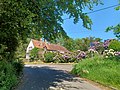
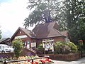
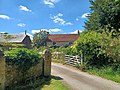
English: Bramshott is a village in the East Hampshire district of Hampshire, England, about 1 mile (1.4 km) north of Liphook.
Sous-catégories
Cette catégorie comprend 6 sous-catégories, dont les 6 ci-dessous.
Média dans la catégorie « Bramshott »
Cette catégorie comprend 61 fichiers, dont les 61 ci-dessous.
-
 "Blue Vines" near Bramshott - geograph.org.uk - 1115486.jpg 640 × 480 ; 103 kio
-
 "Summerden" on Waggoners Wells - geograph.org.uk - 1160317.jpg 640 × 360 ; 83 kio
-
 A3, Bramshott - geograph.org.uk - 21557.jpg 640 × 480 ; 99 kio
-
 Adams Cottage, Bramshott - geograph.org.uk - 3808645.jpg 1 672 × 1 379 ; 706 kio
-
 Adams Cottage, Bramshott 01.jpg 4 000 × 3 000 ; 4,78 Mio
-
 Adams Cottage, Bramshott 02.jpg 4 000 × 3 000 ; 5,17 Mio
-
 Adams Cottage, Bramshott 03.jpg 4 000 × 3 000 ; 5,17 Mio
-
 Adams Cottage, Bramshott 04.jpg 4 000 × 3 000 ; 5,15 Mio
-
 Adams Cottage, Bramshott 05.jpg 4 000 × 3 000 ; 5,19 Mio
-
 Bank by Woolmer Lane - geograph.org.uk - 1298262.jpg 640 × 480 ; 163 kio
-
 Boriss House (geograph 3446546).jpg 640 × 480 ; 121 kio
-
 Bramshott - geograph.org.uk - 1298193.jpg 640 × 480 ; 133 kio
-
 Bramshott Common - geograph.org.uk - 2793204.jpg 640 × 427 ; 195 kio
-
 Bramshott Common at Kent's Hill - geograph.org.uk - 2793199.jpg 640 × 435 ; 255 kio
-
 Bramshott Manor from Bramshott churchyard.jpg 4 000 × 3 000 ; 4,08 Mio
-
 Bramshott Vale Farm (geograph 3907705).jpg 2 176 × 1 632 ; 850 kio
-
 Bramshott Village - geograph.org.uk - 1298176.jpg 480 × 640 ; 122 kio
-
 Bramshott, Citizens advice bureau.jpg 3 072 × 2 304 ; 2,98 Mio
-
 Bramshott, Hampshire - geograph.org.uk - 3446464.jpg 640 × 480 ; 125 kio
-
 Bramshott, Hampshire - geograph.org.uk - 3446472.jpg 640 × 480 ; 175 kio
-
 Bramshott, Hampshire - geograph.org.uk - 3446474.jpg 640 × 480 ; 164 kio
-
 Bramshott, Hampshire - geograph.org.uk - 3446476.jpg 480 × 640 ; 167 kio
-
 Bramshott, Hampshire - geograph.org.uk - 3446556.jpg 640 × 480 ; 123 kio
-
 Bridge near Bramshott (geograph 1995247).jpg 640 × 480 ; 179 kio
-
 Church Lane, Bramshott (geograph 3446550).jpg 640 × 480 ; 132 kio
-
 Church Road, Bramshott - geograph.org.uk - 3446553.jpg 640 × 480 ; 106 kio
-
 Coopers Bridge, Tunbridge Lane, Bramshott - geograph.org.uk - 3909652.jpg 2 178 × 1 632 ; 1,13 Mio
-
 Cottages at Bramshott - geograph.org.uk - 1115505.jpg 640 × 464 ; 90 kio
-
 Cottages, Bramshott (geograph 3742054).jpg 640 × 428 ; 130 kio
-
 Covers Farmhouse, Bramshott 01.jpg 4 000 × 3 000 ; 4,5 Mio
-
 Covers Farmhouse, Bramshott 02.jpg 4 000 × 3 000 ; 4,47 Mio
-
 Covers Farmhouse, Bramshott 03.jpg 4 000 × 3 000 ; 3,42 Mio
-
 Dwelling in grounds of "Blue Vines" - geograph.org.uk - 1115494.jpg 640 × 480 ; 117 kio
-
 Former Little Chef, Bramshott - geograph.org.uk - 3800018.jpg 3 264 × 2 448 ; 2,11 Mio
-
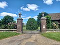
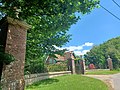
 Gateway to Downlands, Bramshott 01.jpg 4 000 × 3 000 ; 4,7 Mio
-
 Gateway to Downlands, Bramshott 02.jpg 4 000 × 3 000 ; 4,56 Mio
-
 Gateway to Downlands, Bramshott 03.jpg 4 000 × 3 000 ; 4,61 Mio
-
 Gateway to Downlands, Bramshott 04.jpg 4 000 × 3 000 ; 4,7 Mio
-
 Gateway to Downlands, Bramshott 05.jpg 4 000 × 3 000 ; 4,08 Mio
-
 Gateway to Downlands, Bramshott 06.jpg 4 000 × 3 000 ; 4,65 Mio
-
 Gateway to Downlands, Bramshott 07.jpg 3 000 × 4 000 ; 4,27 Mio
-
 Gateway to Downlands, Bramshott 08.jpg 3 000 × 4 000 ; 4,62 Mio
-
 Gateway to Downlands, Bramshott 09.jpg 3 000 × 4 000 ; 5,2 Mio
-
 Gateway to Downlands, Bramshott 10.jpg 3 000 × 4 000 ; 5,31 Mio
-
 Gateway to Downlands, Bramshott 11.jpg 4 000 × 3 000 ; 4,53 Mio
-
 Gateway to Downlands, Bramshott 12.jpg 4 000 × 3 000 ; 4,52 Mio
-
 Hooke (of Bramshott, Hampshire) arms.svg 578 × 666 ; 168 kio
-
 House at Bramshott Vale Farm (geograph 3907711).jpg 1 632 × 1 356 ; 854 kio
-
 House next to Bramshott Vale (geograph 3907700).jpg 1 569 × 1 073 ; 534 kio
-
 Monk House, Old School House and Salters Cottage, Bramshott 01.jpg 4 000 × 3 000 ; 4,25 Mio
-
 Monk House, Old School House and Salters Cottage, Bramshott 02.jpg 4 000 × 3 000 ; 5,09 Mio
-
 Rectory Lane, Bramshott - geograph.org.uk - 1298121.jpg 640 × 480 ; 131 kio
-
 Rectory Lane, Bramshott - geograph.org.uk - 3454898.jpg 3 264 × 2 448 ; 2,81 Mio
-
 Rectory Lane, Bramshott - geograph.org.uk - 3478521.jpg 640 × 480 ; 124 kio
-
 River Wey at Bramshott - geograph.org.uk - 3909644.jpg 2 179 × 1 632 ; 1,29 Mio
-
 Sunken lane at Bramshott - geograph.org.uk - 1115509.jpg 480 × 640 ; 144 kio
-
 Sunken Trackway, Bramshott - geograph.org.uk - 1298215.jpg 480 × 640 ; 154 kio
-
 Tunbridge Lane, Bramshott (geograph 3446548).jpg 640 × 480 ; 108 kio
-
 Unnamed lane meets the A3 near Bramshott - geograph.org.uk - 1622023.jpg 640 × 360 ; 61 kio
-
 V-Shaped Valley, Bramshott - geograph.org.uk - 1298232.jpg 480 × 640 ; 150 kio
-
 Wheelers, Bramshott - geograph.org.uk - 3909623.jpg 1 367 × 1 024 ; 637 kio


.jpg)


.jpg)


.jpg)
.jpg)


.jpg)


_arms.svg)
.jpg)
.jpg)


.jpg)


