Category:Bretherton
Zur Navigation springen
Zur Suche springen
English: Bretherton is a small village and civil parish of the Borough of Chorley, Lancashire, England. It is situated to the south west of Leyland and east of Tarleton.
Gemeinde in der englischen Grafschaft Lancashire  | |||||
| Medium hochladen | |||||
| Ist ein(e) | |||||
|---|---|---|---|---|---|
| Ort | Borough of Chorley, Lancashire, North West England, England | ||||
| Eventuell gleichwertig | Bretherton (Wikimedia-Dublette, Civil Parish in England) | ||||
 | |||||
Unterkategorien
Es werden 5 von insgesamt 5 Unterkategorien in dieser Kategorie angezeigt:
In Klammern die Anzahl der enthaltenen Kategorien (K), Seiten (S), Dateien (D)
Medien in der Kategorie „Bretherton“
Folgende 184 Dateien sind in dieser Kategorie, von 184 insgesamt.
-
 A bend in Carr House Lane (B5247) - geograph.org.uk - 4255110.jpg 640 × 480; 96 KB
-
 A bend in Cocker Bar Road (B5248) - geograph.org.uk - 4254816.jpg 640 × 480; 75 KB
-
 A bend in Eyes Lane - geograph.org.uk - 4202305.jpg 640 × 480; 78 KB
-
 A farm track to Long Fold - geograph.org.uk - 3371588.jpg 4.592 × 3.056; 6,47 MB
-
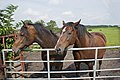
 A field with horses - geograph.org.uk - 3097221.jpg 4.516 × 2.010; 4,22 MB
-
 A footbridge on the path to Carrs - geograph.org.uk - 3371560.jpg 4.087 × 3.043; 7,16 MB
-
 A footbridge with another just beyond - geograph.org.uk - 3371525.jpg 4.389 × 3.053; 6,41 MB
-
 A horse in a field - geograph.org.uk - 3371660.jpg 4.043 × 3.056; 7,04 MB
-
 A pheasant in Eyes Lane, Bretherton - geograph.org.uk - 3371476.jpg 1.483 × 2.081; 3,7 MB
-
 A59 at Tarlton Bridge crossing the River Douglas - geograph.org.uk - 2972974.jpg 1.024 × 742; 149 KB
-

-
 Approaching Liverpool Road from Carr House Lane - geograph.org.uk - 3778095.jpg 2.811 × 2.359; 1,24 MB
-
 Ascroft's Farm - geograph.org.uk - 138545.jpg 640 × 426; 178 KB
-
 B5248 Cocker Bar Road - geograph.org.uk - 4532246.jpg 640 × 481; 548 KB
-
 Back Lane - geograph.org.uk - 4202258.jpg 640 × 480; 86 KB
-
 Back Lane - geograph.org.uk - 4202274.jpg 640 × 480; 62 KB
-
 Back Lane looking east - geograph.org.uk - 3697776.jpg 640 × 480; 57 KB
-
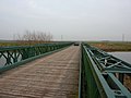
 Bank Bridge and Warehouse.JPG 3.872 × 2.592; 2,39 MB
-
 Bank Hall - geograph.org.uk - 2281837.jpg 640 × 480; 163 KB
-
 Bank Hall Carriage Drive Sept 2010.JPG 2.592 × 3.872; 2,31 MB
-
 Barn and Cottage - geograph.org.uk - 138540.jpg 640 × 426; 158 KB
-
 Barrowford House near Sollom Lock - geograph.org.uk - 2281700.jpg 480 × 640; 141 KB
-
 Blue Anchor Inn, Bretherton - geograph.org.uk - 1371261.jpg 640 × 480; 62 KB
-
 Bretherton Congregational Church - geograph.org.uk - 3525656.jpg 1.024 × 768; 455 KB
-
 Bretherton Congregational Church - geograph.org.uk - 3778032.jpg 4.115 × 2.714; 2,11 MB
-
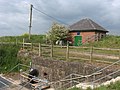
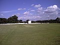 Bretherton Cricket Club - geograph.org.uk - 3077351.jpg 1.600 × 1.200; 215 KB
-
 Bretherton Cricket Club - Pavilion - geograph.org.uk - 3077353.jpg 1.600 × 1.200; 469 KB
-
 Bretherton, Doles Lane - geograph.org.uk - 5711324.jpg 640 × 480; 369 KB
-

-
 Carr House Lane - geograph.org.uk - 3778048.jpg 3.851 × 2.902; 2,15 MB
-
 Cocker Bar Road (B5248) - geograph.org.uk - 4254803.jpg 640 × 480; 66 KB
-
 Cocker Bar Road (B5248) - geograph.org.uk - 4254814.jpg 640 × 480; 69 KB
-
 Cocker Bar Road - geograph.org.uk - 2280691.jpg 640 × 480; 97 KB
-
 Cocker Bar Road - geograph.org.uk - 2845584.jpg 640 × 480; 48 KB
-
 Cocker Bar Road - geograph.org.uk - 4532051.jpg 640 × 480; 455 KB
-
 Cocker Bar Road B5248 - geograph.org.uk - 1165965.jpg 640 × 480; 58 KB
-
 Cocker Bar Road B5248 - geograph.org.uk - 1165967.jpg 640 × 308; 36 KB
-

-
 Confluence - geograph.org.uk - 3466676.jpg 3.264 × 2.448; 1,5 MB
-

-

-

-
 Crop field north of Cocker Bar Road - geograph.org.uk - 4254812.jpg 640 × 480; 105 KB
-
 Crop field, Bretherton Moss - geograph.org.uk - 4254819.jpg 640 × 480; 95 KB
-
 Crop field, Cocker Bar - geograph.org.uk - 4254802.jpg 640 × 480; 84 KB
-

-
 Diaper Flushwork (1608) at Bank Hall, Bretherton.jpg 2.592 × 3.872; 2,32 MB
-
 Ditch Beside Eyes Lane - geograph.org.uk - 4394804.jpg 3.072 × 2.304; 4,11 MB
-
 Doles Lane - geograph.org.uk - 1165963.jpg 640 × 480; 72 KB
-
 Doles Lane - geograph.org.uk - 3371600.jpg 4.592 × 3.056; 5,32 MB
-
 Doles Lane - geograph.org.uk - 3371613.jpg 4.592 × 3.056; 6,38 MB
-
 Doles Lane - geograph.org.uk - 5711321.jpg 640 × 480; 409 KB
-
 Entering Bretherton via Carr House Lane - geograph.org.uk - 4532329.jpg 640 × 480; 429 KB
-
 Eyes Lane - geograph.org.uk - 2280777.jpg 640 × 480; 124 KB
-
 Eyes Lane - geograph.org.uk - 2280786.jpg 640 × 480; 99 KB
-
 Eyes Lane - geograph.org.uk - 2281712.jpg 640 × 480; 113 KB
-
 Eyes Lane - geograph.org.uk - 2281713.jpg 640 × 480; 137 KB
-
 Eyes Lane - geograph.org.uk - 2281718.jpg 640 × 480; 200 KB
-
 Eyes Lane - geograph.org.uk - 3371376.jpg 4.264 × 2.838; 6,1 MB
-
 Eyes Lane - geograph.org.uk - 3371394.jpg 4.335 × 2.770; 7,76 MB
-
 Eyes Lane - geograph.org.uk - 3371419.jpg 4.592 × 2.649; 6,53 MB
-
 Eyes Lane - geograph.org.uk - 3371440.jpg 4.592 × 2.697; 5,31 MB
-
 Eyes Lane - geograph.org.uk - 4202284.jpg 640 × 480; 94 KB
-
 Eyes Lane - geograph.org.uk - 4202289.jpg 640 × 480; 138 KB
-
 Eyes Lane - geograph.org.uk - 4202299.jpg 640 × 480; 144 KB
-
 Eyes Lane - geograph.org.uk - 4202310.jpg 640 × 524; 99 KB
-
 Eyes Lane - geograph.org.uk - 4202326.jpg 640 × 480; 96 KB
-
 Eyes Lane - geograph.org.uk - 4954013.jpg 1.280 × 960; 1,13 MB
-
 Eyes Lane nearing Red Bridge - geograph.org.uk - 3697782.jpg 640 × 480; 56 KB
-
 Farm building near Bretherton - geograph.org.uk - 4202272.jpg 640 × 480; 68 KB
-

-
 Farmland north of Back Lane - geograph.org.uk - 4202266.jpg 640 × 480; 63 KB
-
 Farmland off Back Lane - geograph.org.uk - 4202260.jpg 640 × 480; 71 KB
-
 Farmland off Carr House Lane - geograph.org.uk - 4255105.jpg 640 × 480; 52 KB
-
 Farmland off Flag Lane - geograph.org.uk - 4202248.jpg 640 × 480; 56 KB
-
 Farmland, Bretherton Moss - geograph.org.uk - 4254809.jpg 640 × 480; 54 KB
-
 Farmland, Cocker Bar - geograph.org.uk - 4532048.jpg 640 × 480; 452 KB
-
 Field entrance off Eyes Lane - geograph.org.uk - 4202292.jpg 640 × 480; 118 KB
-
 Flag Lane (B5247) - geograph.org.uk - 4202252.jpg 640 × 480; 82 KB
-
 Flag Lane - geograph.org.uk - 3778288.jpg 4.145 × 2.247; 1,7 MB
-
 Fork into Back Lane from Flag Lane - geograph.org.uk - 3778027.jpg 3.531 × 2.159; 1,48 MB
-
 Friendly horses - geograph.org.uk - 3097257.jpg 4.592 × 3.056; 7,5 MB
-
 Gas Valve Compound - Eyes Lane - geograph.org.uk - 3832374.jpg 3.920 × 2.969; 4,89 MB
-
 Gate to compound - geograph.org.uk - 2281716.jpg 640 × 480; 159 KB
-
 Hedge, tree and three geese - geograph.org.uk - 4954010.jpg 1.280 × 958; 960 KB
-
 Island view - geograph.org.uk - 138562.jpg 640 × 426; 84 KB
-
 It would be hard to ignore a footpath more blatantly - geograph.org.uk - 3371776.jpg 4.428 × 2.947; 6,89 MB
-
 Jeremiah Horrocks Commemorative Stone - geograph.org.uk - 3778042.jpg 4.608 × 3.456; 3,52 MB
-

-
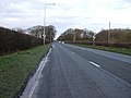
 Liverpool Road (A59) - geograph.org.uk - 2092317.jpg 800 × 480; 233 KB
-
 Liverpool Road (A59) - geograph.org.uk - 4255115.jpg 640 × 462; 70 KB
-
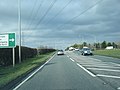
 Liverpool Road (A59) - geograph.org.uk - 4256210.jpg 640 × 480; 55 KB
-
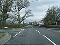
 Liverpool Road (A59) heading north - geograph.org.uk - 4256213.jpg 640 × 480; 58 KB
-
 Liverpool Road looking north - geograph.org.uk - 2845531.jpg 640 × 480; 52 KB
-
 Long Fold Farm - geograph.org.uk - 3848307.jpg 1.598 × 1.511; 1,24 MB
-
 Long Fold Woodland - geograph.org.uk - 4255088.jpg 640 × 480; 84 KB
-
 Long straight track that runs parallel to the railway line - geograph.org.uk - 3778253.jpg 4.283 × 2.376; 2,08 MB
-
 Lostock Bridge - geograph.org.uk - 2092332.jpg 800 × 480; 325 KB
-
 Maize crop off Back Lane - geograph.org.uk - 4202254.jpg 640 × 480; 96 KB
-
 Marl Cop - geograph.org.uk - 1165956.jpg 640 × 480; 48 KB
-
 Marl Cop - geograph.org.uk - 2280771.jpg 640 × 480; 123 KB
-
 Moss Lane off North Road - geograph.org.uk - 2280770.jpg 602 × 450; 101 KB
-
 National Cycle Route 62 - geograph.org.uk - 4202314.jpg 640 × 480; 110 KB
-
 No1 Back Lane, Bretherton - geograph.org.uk - 2281722.jpg 640 × 480; 110 KB
-
 North Road at Four Lane Ends - geograph.org.uk - 2845565.jpg 640 × 481; 86 KB
-
 North Road B5248 - geograph.org.uk - 1165961.jpg 640 × 480; 65 KB
-
 North Road East of Four Lane Ends - geograph.org.uk - 3778264.jpg 3.619 × 2.145; 1,37 MB
-
 North Road looking east - geograph.org.uk - 2845551.jpg 640 × 480; 62 KB
-
 North Road near Norris's Farm - geograph.org.uk - 2845572.jpg 640 × 480; 40 KB
-
 North Road, Bretherton (B5248) - geograph.org.uk - 4255097.jpg 640 × 480; 103 KB
-
 North Road.(B5248) - geograph.org.uk - 4255078.jpg 640 × 480; 82 KB
-
 North Road.(B5248) - geograph.org.uk - 4255104.jpg 640 × 480; 93 KB
-

-
 Old Wayside Cross (geograph 6591316).jpg 768 × 1.024; 387 KB
-
 One time gate house to Bank Hall - geograph.org.uk - 4954030.jpg 1.280 × 960; 1,4 MB
-
 Path beside the River Lostock - geograph.org.uk - 4202241.jpg 640 × 480; 92 KB
-
 Path through a field - geograph.org.uk - 4954020.jpg 1.280 × 960; 1,4 MB
-
 Pedestrian gate across railway - geograph.org.uk - 2280759.jpg 640 × 480; 142 KB
-
 Plant nursery on North Road - geograph.org.uk - 4255081.jpg 640 × 480; 50 KB
-
 Ploughed Field off North Road - geograph.org.uk - 1165960.jpg 640 × 265; 42 KB
-
 Power lines cross Eyes Lane - geograph.org.uk - 3832377.jpg 4.335 × 2.685; 4,64 MB
-
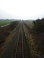
 Preston to Ormskirk Railway - geograph.org.uk - 2280686.jpg 640 × 480; 127 KB
-
 Preston to Ormskirk Railway - geograph.org.uk - 2280689.jpg 480 × 640; 54 KB
-
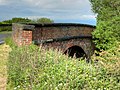 Railway Bridge at Cocker Bar Road - geograph.org.uk - 4532243.jpg 640 × 481; 625 KB
-
 Railway Pedestrian Crossing - geograph.org.uk - 3778258.jpg 3.456 × 4.608; 3,05 MB
-
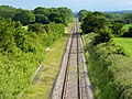
 Railway towards Preston - geograph.org.uk - 4254806.jpg 640 × 480; 62 KB
-

-
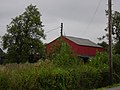 Red Barn, North Road, B5248 - geograph.org.uk - 942022.jpg 640 × 480; 86 KB
-
 Red Bridge - geograph.org.uk - 2280773.jpg 640 × 480; 113 KB
-
 Red Bridge - geograph.org.uk - 2280774.jpg 640 × 480; 113 KB
-
 Red Bridge - geograph.org.uk - 2280783.jpg 640 × 480; 112 KB
-
 Red Bridge - geograph.org.uk - 2280785.jpg 640 × 480; 105 KB
-
 Red Bridge - geograph.org.uk - 3097286.jpg 4.477 × 2.979; 5,85 MB
-
 Red Bridge - geograph.org.uk - 4394794.jpg 3.072 × 2.304; 3,6 MB
-
 Red Bridge near Sollom - geograph.org.uk - 4954066.jpg 1.280 × 960; 1.021 KB
-
 River Asland or Douglas - geograph.org.uk - 2280779.jpg 640 × 480; 92 KB
-
 River Asland or Douglas - geograph.org.uk - 2280781.jpg 640 × 480; 105 KB
-
 River Asland Or Douglas - geograph.org.uk - 4394839.jpg 3.072 × 2.304; 3,93 MB
-
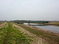
 River Douglas - geograph.org.uk - 4394815.jpg 3.072 × 2.304; 3,1 MB
-
 River Douglas, Bretherton Feb 2010.JPG 3.872 × 2.592; 2,4 MB
-
 River Lostock, Lostock Bridge - geograph.org.uk - 4202239.jpg 640 × 480; 102 KB
-
 Road at Bank Hall - geograph.org.uk - 2281833.jpg 640 × 480; 116 KB
-
 Road sign at Red Bridge - geograph.org.uk - 2280787.jpg 480 × 640; 44 KB
-
 Road Sign, Doles Lane - geograph.org.uk - 1165958.jpg 640 × 480; 74 KB
-
 Road to Long Fold - geograph.org.uk - 2281726.jpg 640 × 480; 101 KB
-
 Roundabout on A59 at Carr House - geograph.org.uk - 3076864.jpg 1.600 × 1.198; 282 KB
-
 Sarah Lane - geograph.org.uk - 3832369.jpg 3.938 × 3.174; 5,66 MB
-
 Sarah Lane, Bretherton - geograph.org.uk - 3525639.jpg 1.024 × 768; 524 KB
-
 Sarah Lane, Bretherton - geograph.org.uk - 3525647.jpg 1.024 × 768; 531 KB
-
 Seasonal flooding - geograph.org.uk - 2280778.jpg 640 × 480; 116 KB
-
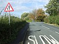 Sharp bend in the B5247 - geograph.org.uk - 4202242.jpg 640 × 480; 88 KB
-
 Single Track Railway, Bretherton Moss - geograph.org.uk - 4532066.jpg 640 × 480; 633 KB
-
 Sleeping Cows - geograph.org.uk - 3888603.jpg 1.000 × 1.000; 424 KB
-
 Snowdrops at Bank Hall - geograph.org.uk - 2281836.jpg 640 × 480; 208 KB
-
 Sollom Pumping Station - geograph.org.uk - 1888936.jpg 1.600 × 1.200; 3,47 MB
-
 South Road (B5247), Bretherton - geograph.org.uk - 2092328.jpg 800 × 480; 385 KB
-
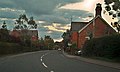 South Road, Bretherton - geograph.org.uk - 2092323.jpg 799 × 480; 316 KB
-
 St. John the Baptist, Bretherton - geograph.org.uk - 3525637.jpg 1.024 × 768; 474 KB
-
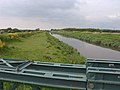
 Tarleton Bridge - geograph.org.uk - 2092310.jpg 800 × 480; 188 KB
-
 The "S" bend at Norris's Farm - geograph.org.uk - 3371742.jpg 4.174 × 2.778; 7,09 MB
-
 The Old Corn Mill Antiques Centre - geograph.org.uk - 3371707.jpg 4.353 × 2.897; 7,91 MB
-
 The Old Corn Mill, Bretherton - geograph.org.uk - 3525650.jpg 1.024 × 767; 482 KB
-
 The pavilion, Bretherton cricket ground - geograph.org.uk - 3525654.jpg 1.024 × 768; 558 KB
-
 The River Douglas from Great Hanging Bridge - geograph.org.uk - 3761763.jpg 2.667 × 1.494; 839 KB
-
 Track into field - geograph.org.uk - 4202302.jpg 640 × 480; 93 KB
-
 Track off Eyes Lane - geograph.org.uk - 2281717.jpg 640 × 480; 184 KB
-
 Track to Long Fold - geograph.org.uk - 4255092.jpg 640 × 428; 58 KB
-
 Trees, shrubs and grassland - geograph.org.uk - 4954024.jpg 1.280 × 856; 1,09 MB
-
 View north from Red Bridge - geograph.org.uk - 1888948.jpg 1.600 × 1.200; 3,28 MB
-
 Welcome to Bretherton - geograph.org.uk - 4432456.jpg 1.600 × 1.200; 604 KB
-
 Woodland off Eyes Lane - geograph.org.uk - 4202286.jpg 478 × 640; 151 KB
-
 Woodland off Eyes Lane - geograph.org.uk - 4202295.jpg 478 × 640; 152 KB
-
 Young winter crop - geograph.org.uk - 4202323.jpg 640 × 394; 61 KB
-
 Blue Anchor Inn, Bretherton - geograph.org.uk - 158145.jpg 640 × 480; 72 KB
-
 Crossroads at Four Lane Ends - geograph.org.uk - 158140.jpg 640 × 480; 82 KB
-
 De pub by the station - geograph.org.uk - 107334.jpg 640 × 426; 94 KB
-
 Great Hanging Bridge from the north - geograph.org.uk - 138528.jpg 640 × 426; 107 KB
-
 Grid lines - geograph.org.uk - 138527.jpg 640 × 426; 79 KB
-
 Littlewood Hall Farm - geograph.org.uk - 107338.jpg 640 × 429; 83 KB
-
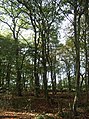
 No trouble seeing the trees here - geograph.org.uk - 138554.jpg 640 × 426; 138 KB
-
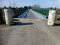
 Red Bridge - geograph.org.uk - 299322.jpg 640 × 426; 126 KB
-
 Ridley Lane - geograph.org.uk - 229074.jpg 640 × 480; 102 KB
-
 Straight as a canal - geograph.org.uk - 138557.jpg 640 × 426; 59 KB
-
 The River Yarrow nears its end - geograph.org.uk - 138535.jpg 640 × 426; 96 KB
_-_geograph.org.uk_-_4255110.jpg)
_-_geograph.org.uk_-_4254816.jpg)


_-_geograph.org.uk_-_4254803.jpg)
_-_geograph.org.uk_-_4254814.jpg)


_at_Bank_Hall,_Bretherton.jpg)


_-_geograph.org.uk_-_4202252.jpg)


_-_geograph.org.uk_-_2280793.jpg)
_-_geograph.org.uk_-_2092317.jpg)
_-_geograph.org.uk_-_4255115.jpg)
_-_geograph.org.uk_-_4256210.jpg)
_heading_north_-_geograph.org.uk_-_4256213.jpg)


_-_geograph.org.uk_-_4255097.jpg)
_-_geograph.org.uk_-_4255078.jpg)
_-_geograph.org.uk_-_4255104.jpg)
_near_Four_Lane_Ends_-_geograph.org.uk_-_4255083.jpg)
.jpg)


,_Bretherton_-_geograph.org.uk_-_2092328.jpg)


