Category:Bride, Isle of Man
Vai alla navigazione
Vai alla ricerca
parrocchia dell'Isola di Man  | |||||
| Carica un file multimediale | |||||
| Istanza di |
| ||||
|---|---|---|---|---|---|
| Luogo | Ayre, isola di Man, Mare d'Irlanda | ||||
 | |||||
Bride (Manx: Skeerey Vreeshey), named after St. Brigid, is a parish in the Sheading of Ayre and lies in the extreme north of the Isle of Man, UK.
Sottocategorie
Questa categoria contiene un'unica sottocategoria, indicata di seguito.
B
- Bride Parish Church (8 F)
File nella categoria "Bride, Isle of Man"
Questa categoria contiene 127 file, indicati di seguito, su un totale di 127.
-
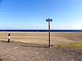
 "Winkie" and footpath sign - Point of Ayre - geograph.org.uk - 4871834.jpg 4 832 × 3 783; 4,38 MB
-
 'The Winkie', Point of Ayre - geograph.org.uk - 5569719.jpg 1 248 × 1 600; 277 KB
-
 A Kink In The Road to Cranstal - geograph.org.uk - 5347052.jpg 424 × 640; 65 KB
-
 A Little Glen Near Kionlough - geograph.org.uk - 5346845.jpg 640 × 424; 72 KB
-
 A view to the brine pumping plant remains - geograph.org.uk - 5569961.jpg 1 343 × 1 600; 729 KB
-
 A16 near Point of Ayre - geograph.org.uk - 5363517.jpg 1 280 × 851; 410 KB
-
 Abandoned Farm at Phurt - geograph.org.uk - 5346975.jpg 640 × 424; 74 KB
-
 Abandoned farmhouse at Phurt - geograph.org.uk - 4871861.jpg 5 184 × 3 888; 6,78 MB
-
 Almost Like Tundra - geograph.org.uk - 6121417.jpg 1 024 × 678; 197 KB
-
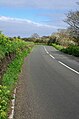
 Approaching Bride - geograph.org.uk - 5347056.jpg 424 × 640; 49 KB
-
 Approaching The Plantation - geograph.org.uk - 6121465.jpg 1 024 × 678; 159 KB
-
 At The Point of Ayre - geograph.org.uk - 4871842.jpg 4 769 × 3 563; 6,41 MB
-
 Ayres dunes, Isle of Man.jpg 2 627 × 3 964; 2,71 MB
-
 Ayres Nature Reserve Panorama - geograph.org.uk - 6121347.jpg 1 024 × 334; 110 KB
-
 Ayres viewing tower, Isle of Man 01.jpg 3 872 × 2 582; 1,25 MB
-
 Beach at Point of Ayre - geograph.org.uk - 5460572.jpg 800 × 600; 136 KB
-
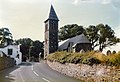 Bride Church - geograph.org.uk - 3452177.jpg 640 × 436; 449 KB
-
 Bride Church - geograph.org.uk - 4503270.jpg 4 608 × 3 456; 6,1 MB
-
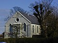 Bride Methodist Church - geograph.org.uk - 787298.jpg 640 × 480; 114 KB
-
 Bride Methodist Church, Lamb Hill, Bride - geograph.org.uk - 4871863.jpg 4 852 × 3 888; 3,73 MB
-
 Bride, Public toilets - geograph.org.uk - 4503030.jpg 4 608 × 3 456; 6,31 MB
-
 Brine pumping plant remains - geograph.org.uk - 5569949.jpg 1 600 × 1 113; 429 KB
-
 Brine pumping plant remains, alternative view - geograph.org.uk - 5569965.jpg 1 600 × 1 188; 434 KB
-
 Choughs at the Point of Ayre - geograph.org.uk - 5569733.jpg 1 600 × 1 292; 374 KB
-
 Cliff Erosion North of The Dog Mills - geograph.org.uk - 5346830.jpg 640 × 424; 96 KB
-
 Cranstal Cottage - geograph.org.uk - 5347038.jpg 640 × 424; 57 KB
-
 Derelict farmhouse - geograph.org.uk - 3616209.jpg 640 × 480; 101 KB
-
 Dogs Must Be On Leads - geograph.org.uk - 6121448.jpg 1 024 × 713; 154 KB
-
 Dunes Marram Grass and Ayres Beach - geograph.org.uk - 6121397.jpg 1 024 × 678; 131 KB
-
 Farmland Near Phurt - geograph.org.uk - 2389097.jpg 640 × 480; 159 KB
-

-

-
 Foghorn , Point of Ayre - geograph.org.uk - 4679914.jpg 4 608 × 3 072; 1,5 MB
-
 Foghorn at Point of Ayre - geograph.org.uk - 5390767.jpg 640 × 427; 39 KB
-
 Foghorn at The Point of Ayre - geograph.org.uk - 2389078.jpg 1 280 × 960; 559 KB
-
 Foghorn, Point of Ayre - geograph.org.uk - 5363613.jpg 851 × 1 280; 294 KB
-
 Foghorn, Point of Ayre - geograph.org.uk - 5569922.jpg 1 330 × 1 600; 163 KB
-
 Footpath to Ballaquark farm - geograph.org.uk - 5347030.jpg 640 × 424; 84 KB
-
 Former Cliff Top Fence - geograph.org.uk - 5346834.jpg 640 × 424; 74 KB
-
 Fungus on the footpath - geograph.org.uk - 5569780.jpg 1 600 × 1 204; 331 KB
-
 Gorse and The Point of Ayre Lighthouse - geograph.org.uk - 4871856.jpg 5 010 × 3 439; 4,64 MB
-
 Gravel Pit at Point of Ayre - geograph.org.uk - 3406116.jpg 640 × 424; 58 KB
-
 Gully and sandy cliffs - geograph.org.uk - 3620004.jpg 1 920 × 960; 500 KB
-
 Isle of Man Northern Plain - geograph.org.uk - 1986293.jpg 3 456 × 2 592; 3,26 MB
-
 Landslip near Shellag Point - geograph.org.uk - 3620024.jpg 1 920 × 1 276; 647 KB
-
 Lighthouse , Point of Ayre - geograph.org.uk - 4679911.jpg 4 608 × 3 072; 1,44 MB
-
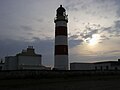
 Lighthouse at Point of Ayre - geograph.org.uk - 2145557.jpg 1 024 × 768; 112 KB
-
 Lighthouse at Point of Ayre - geograph.org.uk - 5457962.jpg 800 × 600; 119 KB
-
 Lighthouse on shingle beach, Point of Ayre - geograph.org.uk - 2145548.jpg 1 024 × 768; 196 KB
-
 Lighthouses and fog horn at Point of Ayre - geograph.org.uk - 2145551.jpg 1 024 × 768; 120 KB
-
 Low Cliff North of Phurt - geograph.org.uk - 5346994.jpg 640 × 424; 85 KB
-
 Marram grass, The Ayres - geograph.org.uk - 5363648.jpg 1 280 × 851; 546 KB
-
 Marram Grass, The Ayres - geograph.org.uk - 5569751.jpg 1 249 × 1 600; 442 KB
-
 Mini Glen - geograph.org.uk - 5346850.jpg 424 × 640; 99 KB
-
 Motorcycle near Point of Ayre - geograph.org.uk - 5362332.jpg 1 280 × 851; 449 KB
-
 My Dog Doesn't Count^ - geograph.org.uk - 6121440.jpg 1 024 × 678; 176 KB
-
 Once in a blue moon - geograph.org.uk - 3620038.jpg 1 400 × 930; 112 KB
-
 Pasture South of Cranstal - geograph.org.uk - 5347045.jpg 640 × 424; 69 KB
-
 Path to the Light - geograph.org.uk - 3406098.jpg 424 × 640; 71 KB
-
 Point of Ayre - geograph.org.uk - 2389051.jpg 1 280 × 960; 763 KB
-
 Point of Ayre - geograph.org.uk - 2389073.jpg 1 280 × 960; 685 KB
-
 Point of Ayre - geograph.org.uk - 2389082.jpg 1 280 × 960; 696 KB
-
 Point of Ayre Beach - geograph.org.uk - 3406101.jpg 640 × 424; 90 KB
-
 Point of Ayre Beach - geograph.org.uk - 5363542.jpg 1 280 × 851; 487 KB
-
 Point of Ayre Foghorn Installation - geograph.org.uk - 4871850.jpg 4 759 × 3 501; 2,35 MB
-
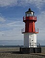
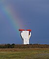
 Point of Ayre Lighthouse "Winkie" - geograph.org.uk - 2255070.jpg 800 × 496; 111 KB
-
 Point of Ayre lighthouse (35972447832).jpg 1 920 × 1 275; 1,36 MB
-
 Point of Ayre Lighthouse - geograph.org.uk - 2389044.jpg 960 × 1 280; 655 KB
-
 Point of Ayre Lighthouse - geograph.org.uk - 2389075.jpg 1 280 × 960; 486 KB
-
 Point of Ayre Lighthouse - geograph.org.uk - 3452160.jpg 640 × 438; 341 KB
-
 Point of Ayre Lighthouse - geograph.org.uk - 3616183.jpg 640 × 480; 60 KB
-
 Point of Ayre Lighthouse - geograph.org.uk - 4821954.jpg 640 × 480; 34 KB
-
 Point of Ayre Lighthouse - geograph.org.uk - 5363501.jpg 851 × 1 280; 444 KB
-
 Point of Ayre Lighthouse - geograph.org.uk - 5363522.jpg 1 280 × 851; 388 KB
-
 Point of Ayre lighthouse - geograph.org.uk - 5390751.jpg 640 × 427; 43 KB
-
 Point of Ayre Lighthouse - geograph.org.uk - 5569726.jpg 1 222 × 1 600; 236 KB
-
 Point of Ayre Lighthouse, "Winkie" - geograph.org.uk - 2389036.jpg 960 × 1 280; 632 KB
-
 Point of Ayre Lighthouses - geograph.org.uk - 2389067.jpg 1 280 × 960; 805 KB
-
 Point of Ayre on the Isle of Man - geograph.org.uk - 2109085.jpg 600 × 800; 102 KB
-
 Point of Ayre, End of the Road - geograph.org.uk - 2389088.jpg 1 280 × 960; 912 KB
-
 Public toilets at Bride - geograph.org.uk - 5783097.jpg 640 × 427; 81 KB
-
 Raad ny Foillan at The Ayres - geograph.org.uk - 6121494.jpg 1 024 × 678; 172 KB
-

-
 Rocks on the Raad ny Foillan - geograph.org.uk - 5346858.jpg 640 × 424; 88 KB
-

-

-
 Sand Dunes at the Point of Ayre - geograph.org.uk - 3406109.jpg 640 × 424; 42 KB
-
 Shore below Ballavarkish - geograph.org.uk - 762103.jpg 640 × 480; 84 KB
-
 Shoreline Crow - geograph.org.uk - 5569847.jpg 1 600 × 1 178; 413 KB
-

-
 Stone Wall at the Point of Ayre - geograph.org.uk - 3406104.jpg 640 × 424; 50 KB
-
 Thatched Cottage at Cranstal - geograph.org.uk - 3452149.jpg 640 × 436; 470 KB
-
 Thatched Cottage at Cranstal - geograph.org.uk - 3504786.jpg 438 × 640; 495 KB
-
 The 'Stena Mersey' off the Point of Ayre - geograph.org.uk - 5569802.jpg 1 600 × 1 103; 215 KB
-
 The Ayres - geograph.org.uk - 779139.jpg 640 × 480; 106 KB
-
 The Ayres - geograph.org.uk - 779146.jpg 640 × 475; 113 KB
-
 The Ayres - geograph.org.uk - 779149.jpg 640 × 478; 121 KB
-
 The Ayres - geograph.org.uk - 779154.jpg 640 × 480; 156 KB
-
 The Ayres - geograph.org.uk - 779160.jpg 640 × 480; 129 KB
-
 The Ayres Nature Reserve - geograph.org.uk - 5363622.jpg 1 280 × 851; 363 KB
-
 The Ayres Nature Reserve - geograph.org.uk - 5569747.jpg 1 600 × 1 141; 361 KB
-
 The Ayres Visitor Centre - geograph.org.uk - 6121376.jpg 1 024 × 678; 127 KB
-
 The Dog Mills, Raad ny Foillan - geograph.org.uk - 4618929.jpg 1 024 × 763; 190 KB
-
 The Dog Mills, steps - geograph.org.uk - 4618918.jpg 1 024 × 768; 232 KB
-
 The Edge of Land ^ Sea - geograph.org.uk - 3406107.jpg 640 × 424; 56 KB
-
 The Foghorn and the Winkie - geograph.org.uk - 5391765.jpg 640 × 480; 56 KB
-
 The foghorn at Point of Ayre - geograph.org.uk - 3617821.jpg 640 × 480; 51 KB
-
 The Isle of Man's north-eastern coast - geograph.org.uk - 5569772.jpg 1 600 × 1 120; 371 KB
-

-
 The Path to Ayres Point - geograph.org.uk - 6121414.jpg 1 024 × 678; 140 KB
-
 The Rectory at Bride - geograph.org.uk - 3617819.jpg 640 × 480; 112 KB
-
 The Road to the Ayres - geograph.org.uk - 6121363.jpg 1 024 × 678; 166 KB
-
 The Winkie at Point of Ayre - geograph.org.uk - 5390756.jpg 640 × 425; 42 KB
-
 Three in a row - geograph.org.uk - 4679931.jpg 4 608 × 3 072; 1,13 MB
-

-
 Track through The Ayres Nature Reserve - geograph.org.uk - 5553585.jpg 2 592 × 1 944; 1,44 MB
-
 Track through The Ayres Nature Reserve - geograph.org.uk - 5553588.jpg 2 592 × 1 944; 1,49 MB
-
 Trees round the car park - geograph.org.uk - 4679901.jpg 4 608 × 3 072; 1,75 MB
-
 View east from the view point - geograph.org.uk - 4679906.jpg 4 608 × 3 072; 1,51 MB
-
 View from Bride church - geograph.org.uk - 779100.jpg 640 × 480; 118 KB
-
 Wall By The A11 - geograph.org.uk - 5347025.jpg 424 × 640; 70 KB
-
 Welcome to Bride - geograph.org.uk - 787285.jpg 640 × 448; 171 KB
-
 Winkie light - geograph.org.uk - 4679927.jpg 3 072 × 4 608; 1,37 MB
-
 Winkie Light ^ The Borders - geograph.org.uk - 3406094.jpg 640 × 424; 42 KB
-
 Winkie Light, Point of Ayre - geograph.org.uk - 5363560.jpg 1 280 × 851; 433 KB
-
 Winkie Light, Point of Ayre - geograph.org.uk - 5363592.jpg 851 × 1 280; 292 KB
-
 Winkie Light, Point of Ayre - geograph.org.uk - 5363599.jpg 1 280 × 851; 280 KB


.jpg)


_-_geograph.org.uk_-_2109131.jpg)


_at_Point_of_Ayre_-_geograph.org.uk_-_3616194.jpg)


