Category:Broadwoodwidger
Aller à la navigation
Aller à la recherche
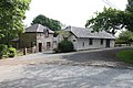
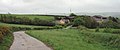
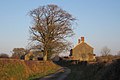
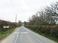
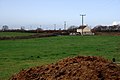
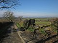
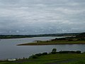
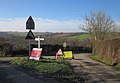
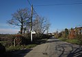
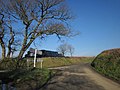
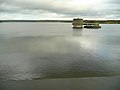
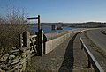
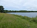
English: Broadwoodwidger is a village and civil parish in the Torridge district of Devon, England. According to the 2001 census it had a population of 548. The village is just off the A30 road, and is about eight miles east of Launceston in Cornwall, and 13 miles west of Okehampton. Roadford Reservoir, which is also called Roadford Lake, is to the north-east of the village, and the River Wolf passes at the bottom of the hillside on which the village stands.
village britannique  | |||||
| Téléverser des médias | |||||
| Nature de l’élément | |||||
|---|---|---|---|---|---|
| Lieu | Torridge, Devon, Angleterre du Sud-Ouest, Angleterre | ||||
 | |||||
Sous-catégories
Cette catégorie comprend seulement la sous-catégorie ci-dessous.
S
Média dans la catégorie « Broadwoodwidger »
Cette catégorie comprend 338 fichiers, dont les 200 ci-dessous.
(page précédente) (page suivante)-
 A bend in the River Wolf near Broadwoodwidger - geograph.org.uk - 1701140.jpg 640 × 426 ; 154 kio
-
 A Damp Field - geograph.org.uk - 2229936.jpg 1 024 × 682 ; 200 kio
-
 A long way from Waterloo - geograph.org.uk - 2926466.jpg 640 × 427 ; 104 kio
-
 A Road to Nowhere - geograph.org.uk - 2229971.jpg 1 024 × 682 ; 319 kio
-
 A30 in valley of River Wolf - geograph.org.uk - 2840916.jpg 800 × 601 ; 336 kio
-
 A30 northeast of Staddon - geograph.org.uk - 3224207.jpg 3 648 × 2 048 ; 1,35 Mio
-
 A30 south of Eastlake Wood - geograph.org.uk - 3224209.jpg 3 648 × 2 048 ; 1,43 Mio
-
 Access road to Roadford Lake car park in Combe Park - geograph.org.uk - 5015599.jpg 1 600 × 1 200 ; 826 kio
-
 Access track to Eastlake Farm - geograph.org.uk - 5015596.jpg 1 600 × 1 200 ; 784 kio
-

-
 Approaching Norton Cottages - geograph.org.uk - 2806356.jpg 640 × 480 ; 110 kio
-
 Approaching Park Cottage from the south - geograph.org.uk - 5011108.jpg 1 600 × 1 200 ; 792 kio
-
 Arable field south of Dubbs Cross - geograph.org.uk - 2806139.jpg 640 × 412 ; 66 kio
-
 Arable field south of Dubbs Cross - geograph.org.uk - 2806142.jpg 640 × 402 ; 71 kio
-
 Ashmill - geograph.org.uk - 2804489.jpg 640 × 456 ; 79 kio
-
 Ashwater former station geograph-3240610-by-Ben-Brooksbank.jpg 2 346 × 1 383 ; 3,14 Mio
-
 Barn at crossroads - geograph.org.uk - 2806269.jpg 640 × 480 ; 90 kio
-
 Barn near Nethercott - geograph.org.uk - 2806346.jpg 640 × 343 ; 38 kio
-
 Barn near Upcott Cross - geograph.org.uk - 2806365.jpg 640 × 432 ; 57 kio
-
 Beside a brook south of Broadwoodwidger - geograph.org.uk - 1701129.jpg 640 × 426 ; 159 kio
-
 Boardwalk in Goodacre Wood - geograph.org.uk - 5011129.jpg 1 600 × 1 200 ; 840 kio
-
 Boldford Bridge - geograph.org.uk - 3708549.jpg 640 × 480 ; 113 kio
-

-
 Bridge near Thorne Park - geograph.org.uk - 488330.jpg 640 × 480 ; 160 kio
-
 Bridge on lane near Buddle - geograph.org.uk - 2802773.jpg 640 × 480 ; 124 kio
-
 Bridge on lane near Buddle - geograph.org.uk - 2802986.jpg 640 × 480 ; 113 kio
-
 Bridge over River Wolf near Broadwoodwidger - geograph.org.uk - 5010845.jpg 1 600 × 1 200 ; 813 kio
-
 Bridge over the River Carey at Ashmill - geograph.org.uk - 3703247.jpg 480 × 640 ; 79 kio
-
 Bridge over the Wolf - geograph.org.uk - 2799878.jpg 640 × 481 ; 96 kio
-
 Bridge, Drownsmill - geograph.org.uk - 2800055.jpg 490 × 640 ; 130 kio
-
 Broadwood Down - geograph.org.uk - 2801774.jpg 640 × 441 ; 51 kio
-
 Broadwoodwidger Primary School - geograph.org.uk - 247306.jpg 640 × 480 ; 84 kio
-
 Broadwoodwidger village (geograph 5010857).jpg 1 600 × 799 ; 517 kio
-
 Broadwoodwidger village green - geograph.org.uk - 1062279.jpg 640 × 480 ; 87 kio
-
 Broadwoodwidger, by Bears Farm - geograph.org.uk - 448041.jpg 640 × 427 ; 209 kio
-
 Broadwoodwidger, by Tower Hill farm - geograph.org.uk - 448030.jpg 640 × 427 ; 258 kio
-
 Broadwoodwidger, cottage and outbuildings - geograph.org.uk - 448055.jpg 640 × 427 ; 232 kio
-
 Broadwoodwidger, des res - geograph.org.uk - 448034.jpg 640 × 427 ; 291 kio
-
 Broadwoodwidger, Downicary Methodist Church - geograph.org.uk - 448031.jpg 640 × 427 ; 173 kio
-
 Broadwoodwidger, lane to Coombe Mill - geograph.org.uk - 448038.jpg 640 × 427 ; 234 kio
-
 Broadwoodwidger, near Cross Green - geograph.org.uk - 448045.jpg 640 × 427 ; 215 kio
-
 Broadwoodwidger, near Drownsmill - geograph.org.uk - 448066.jpg 640 × 427 ; 203 kio
-
 Broadwoodwidger, near Huntsdown - geograph.org.uk - 448043.jpg 640 × 427 ; 226 kio
-
 Broadwoodwidger, near Thorne - geograph.org.uk - 448063.jpg 640 × 427 ; 132 kio
-
 Broadwoodwidger, near Thorne Moor - geograph.org.uk - 448059.jpg 640 × 427 ; 157 kio
-
 Broadwoodwidger, on Broadwood Down - geograph.org.uk - 448057.jpg 640 × 427 ; 212 kio
-
 Broadwoodwidger, on Thorne Moor - geograph.org.uk - 448048.jpg 640 × 427 ; 225 kio
-
 Broadwoodwidger, Roadford Reservoir - geograph.org.uk - 81292.jpg 640 × 431 ; 142 kio
-
 Broadwoodwidger, Tower Hill - geograph.org.uk - 448029.jpg 640 × 427 ; 210 kio
-
 Broadwoodwidger, track to Nethercott - geograph.org.uk - 448051.jpg 640 × 427 ; 256 kio
-
 Brook north of the A30 road near Broadwoodwidger - geograph.org.uk - 1701130.jpg 640 × 426 ; 127 kio
-
 BUCKLE (FindID 874849).jpg 1 980 × 1 739 ; 668 kio
-
 Buddle - geograph.org.uk - 2802868.jpg 640 × 491 ; 117 kio
-
 Buildings at Buddle - geograph.org.uk - 2802791.jpg 480 × 640 ; 63 kio
-
 Camp Cottage - geograph.org.uk - 461128.jpg 640 × 480 ; 102 kio
-
 Car park entrance, Roadford Lake - geograph.org.uk - 2800423.jpg 640 × 470 ; 54 kio
-
 Carey valley - geograph.org.uk - 2806430.jpg 640 × 434 ; 86 kio
-
 Cottage and road near Goodacre - geograph.org.uk - 2801375.jpg 480 × 640 ; 91 kio
-
 Cottages at Tredown - geograph.org.uk - 425911.jpg 640 × 480 ; 75 kio
-
 Cottages near Broadwoodwidger - geograph.org.uk - 2801356.jpg 640 × 470 ; 98 kio
-
 Cycle track in Combe Park, by Roadford Lake - geograph.org.uk - 5015583.jpg 1 600 × 1 200 ; 800 kio
-
 Derelict cottage behind Thorndon House - geograph.org.uk - 425959.jpg 640 × 480 ; 96 kio
-
 Devon lane nr Dubbs Cross - geograph.org.uk - 2927233.jpg 640 × 427 ; 63 kio
-
 Diamond Jubilee sundial by Roadford Lake - geograph.org.uk - 5011186.jpg 1 600 × 1 200 ; 774 kio
-
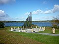 Diamond Jubilee Sundial, Roadford Lake - geograph.org.uk - 3184002.jpg 3 648 × 2 736 ; 4,44 Mio
-
 Drown's Mill, Broadwoodwidger - geograph.org.uk - 1929332.jpg 3 780 × 2 520 ; 3,33 Mio
-
 Drowned road at Roadford Lake - geograph.org.uk - 425901.jpg 472 × 640 ; 115 kio
-
 Dubbs Cross phone and post box - geograph.org.uk - 426051.jpg 640 × 582 ; 145 kio
-
 East Banbury Wood - geograph.org.uk - 2800417.jpg 640 × 460 ; 77 kio
-
 Eastlake Farm - geograph.org.uk - 425846.jpg 640 × 267 ; 43 kio
-
 Edge of field near Broadwoodwidger - geograph.org.uk - 2801759.jpg 640 × 419 ; 68 kio
-
 Edge of woodland below Rexton - geograph.org.uk - 2801787.jpg 640 × 435 ; 83 kio
-
 Emsworthy - geograph.org.uk - 2804632.jpg 640 × 425 ; 58 kio
-
 Entrance to East Banbury - geograph.org.uk - 1062247.jpg 640 × 480 ; 91 kio
-
 Entrance to Grinacombe Moor - geograph.org.uk - 3402356.jpg 640 × 480 ; 80 kio
-
 Evelyn's Orchard at Roadford Lake - geograph.org.uk - 5015587.jpg 1 600 × 1 200 ; 739 kio
-
 Evening Approaches - geograph.org.uk - 2232273.jpg 1 024 × 682 ; 178 kio
-
 Farm at Grove - geograph.org.uk - 2806391.jpg 640 × 372 ; 48 kio
-
 Farm buildings, Lower Rexton - geograph.org.uk - 2802077.jpg 640 × 440 ; 63 kio
-
 Farm road, Rexton - geograph.org.uk - 2802081.jpg 640 × 480 ; 99 kio
-
 Farm road, Rexton - geograph.org.uk - 2802101.jpg 535 × 640 ; 56 kio
-
 Farmhouse at Downsmill near Broadwoodwidger - geograph.org.uk - 1701146.jpg 640 × 426 ; 92 kio
-
 Farming stuff, Pinnacle - geograph.org.uk - 2804658.jpg 640 × 480 ; 83 kio
-
 Farmland near Kitcham - geograph.org.uk - 459020.jpg 640 × 452 ; 125 kio
-
 Field access track, Broadwood Down - geograph.org.uk - 2803208.jpg 466 × 640 ; 73 kio
-
 Field and Barn at Lower Moor - geograph.org.uk - 2230071.jpg 1 024 × 682 ; 279 kio
-
 Field and gateway near Broadwoodwidger - geograph.org.uk - 2801574.jpg 640 × 485 ; 71 kio
-
 Field and lane, Broadwoodwidger - geograph.org.uk - 2801518.jpg 640 × 477 ; 64 kio
-
 Field boundary hedge - geograph.org.uk - 426069.jpg 640 × 350 ; 45 kio
-
 Field edge and view, Rexton - geograph.org.uk - 2802225.jpg 640 × 480 ; 64 kio
-
 Field near Goodacre - geograph.org.uk - 2801364.jpg 640 × 406 ; 42 kio
-
 Field near Lower Moor - geograph.org.uk - 247304.jpg 640 × 480 ; 98 kio
-
 Field near Oakleigh Farm - geograph.org.uk - 605423.jpg 640 × 480 ; 115 kio
-
 Field near Thorndon Cross - geograph.org.uk - 2804705.jpg 640 × 401 ; 51 kio
-
 Field on Broadwood Down - geograph.org.uk - 2803114.jpg 640 × 474 ; 63 kio
-
 Field on Broadwood Down - geograph.org.uk - 2803135.jpg 640 × 386 ; 35 kio
-
 Field, Rexton - geograph.org.uk - 2802148.jpg 640 × 423 ; 60 kio
-
 Field, Westmanton - geograph.org.uk - 2804447.jpg 640 × 494 ; 69 kio
-
 Field, Westmanton - geograph.org.uk - 2804730.jpg 640 × 448 ; 59 kio
-
 Fields and Houses - geograph.org.uk - 2229990.jpg 1 024 × 682 ; 168 kio
-
 Fields near Lugworthy Cross - geograph.org.uk - 2230064.jpg 1 024 × 682 ; 189 kio
-
 Flooded wood near Thorn Barrow - geograph.org.uk - 488317.jpg 640 × 480 ; 159 kio
-
 Footbridge below Rexton - geograph.org.uk - 2801988.jpg 640 × 480 ; 112 kio
-
 Footpath in woodland by Roadford Lake - geograph.org.uk - 5011178.jpg 1 200 × 1 600 ; 870 kio
-
 Footpath to Goodacre Wood - geograph.org.uk - 2800921.jpg 520 × 640 ; 115 kio
-
 Former Lower Goodacre Farm - geograph.org.uk - 2804177.jpg 640 × 480 ; 63 kio
-
 Frankaborough derelict barn and cottage - geograph.org.uk - 426060.jpg 640 × 480 ; 88 kio
-
 Gate by the lane near Broadwoodwidger - geograph.org.uk - 2803235.jpg 640 × 469 ; 64 kio
-
 Gateway near Ashmill - geograph.org.uk - 488332.jpg 480 × 640 ; 115 kio
-
 Grass by the road, Goodacre Wood - geograph.org.uk - 2801310.jpg 640 × 443 ; 84 kio
-
 Grinacombe Moor - geograph.org.uk - 248986.jpg 640 × 480 ; 90 kio
-
 Haylage field - geograph.org.uk - 1062274.jpg 640 × 480 ; 77 kio
-
 Haylage field north of Broadwoodwidger - geograph.org.uk - 1062269.jpg 640 × 480 ; 90 kio
-
 Higher Fernhill - geograph.org.uk - 459032.jpg 640 × 480 ; 143 kio
-
 Higher Rexton - geograph.org.uk - 2802094.jpg 640 × 468 ; 75 kio
-
 Hillside below Rexton - geograph.org.uk - 2802014.jpg 640 × 480 ; 72 kio
-
 Houses at Rexon Cross - geograph.org.uk - 5010843.jpg 1 600 × 1 195 ; 811 kio
-
 Inlet ^ Headland Roadford Lake - geograph.org.uk - 2538834.jpg 640 × 480 ; 112 kio
-
 Inspection gallery beneath Roadford Dam - geograph.org.uk - 3653589.jpg 4 000 × 3 000 ; 1,42 Mio
-
 Ivyhouse Cross - geograph.org.uk - 3402308.jpg 640 × 442 ; 52 kio
-
 Junction, Broadwood Down - geograph.org.uk - 2803025.jpg 640 × 441 ; 64 kio
-
 Junction, Westweekmoor - geograph.org.uk - 2804278.jpg 640 × 443 ; 58 kio
-
 Lane and bridge at Drownsmill - geograph.org.uk - 2800005.jpg 640 × 480 ; 116 kio
-
 Lane at Drownsmill - geograph.org.uk - 2799895.jpg 485 × 640 ; 75 kio
-
 Lane at Pinnacle - geograph.org.uk - 2804428.jpg 480 × 640 ; 105 kio
-
 Lane below Buddle - geograph.org.uk - 2802889.jpg 468 × 640 ; 102 kio
-
 Lane east of Downicary - geograph.org.uk - 2806380.jpg 640 × 404 ; 52 kio
-
 Lane junction near Broadwoodwidger - geograph.org.uk - 2803312.jpg 640 × 480 ; 76 kio
-
 Lane junction, Upcott Mill - geograph.org.uk - 2802370.jpg 640 × 423 ; 76 kio
-
 Lane near Broadwoodwidger - geograph.org.uk - 2803296.jpg 640 × 480 ; 88 kio
-
 Lane near Huntsdown - geograph.org.uk - 2806443.jpg 640 × 490 ; 85 kio
-
 Lane near Nethercott - geograph.org.uk - 2806341.jpg 640 × 410 ; 51 kio
-
 Lane near Rexton - geograph.org.uk - 2802162.jpg 527 × 640 ; 92 kio
-
 Lane near Upcott Cross - geograph.org.uk - 2806283.jpg 640 × 414 ; 46 kio
-
 Lane on Broadwood Down - geograph.org.uk - 2802631.jpg 477 × 640 ; 107 kio
-
 Lane on Broadwood Down - geograph.org.uk - 2802678.jpg 640 × 502 ; 85 kio
-
 Lane past Rexton - geograph.org.uk - 2802199.jpg 542 × 640 ; 92 kio
-
 Lane past Rexton - geograph.org.uk - 2802210.jpg 640 × 480 ; 89 kio
-
 Lane past Woodland Farm - geograph.org.uk - 2806254.jpg 640 × 466 ; 64 kio
-
 Lane to Broad Down - geograph.org.uk - 2803276.jpg 640 × 480 ; 104 kio
-
 Lane to Cross Green - geograph.org.uk - 2806569.jpg 640 × 480 ; 70 kio
-
 Lane to Cross Green - geograph.org.uk - 2806593.jpg 640 × 426 ; 56 kio
-
 Lane to Downicary - geograph.org.uk - 2806403.jpg 640 × 385 ; 47 kio
-
 Lane to Downicary - geograph.org.uk - 2806419.jpg 640 × 445 ; 69 kio
-
 Lane to Dubbs Cross - geograph.org.uk - 2806146.jpg 640 × 398 ; 80 kio
-
 Lane to Dubbs Cross - geograph.org.uk - 2806189.jpg 640 × 461 ; 58 kio
-
 Lane to Dubbs Cross - geograph.org.uk - 2806227.jpg 640 × 411 ; 49 kio
-
 Lane to Emsworthy - geograph.org.uk - 2806439.jpg 640 × 480 ; 92 kio
-
 Lane to Kellacott - geograph.org.uk - 2800089.jpg 535 × 640 ; 86 kio
-
 Lane to Pinnacle - geograph.org.uk - 2804643.jpg 640 × 451 ; 55 kio
-
 Lane to Pinnacle - geograph.org.uk - 2804693.jpg 640 × 395 ; 55 kio
-
 Lane to Rexon - geograph.org.uk - 2800029.jpg 640 × 480 ; 109 kio
-
 Lane to Thorndon Cross - geograph.org.uk - 2804709.jpg 455 × 640 ; 38 kio
-
 Lane to Upcott Barton - geograph.org.uk - 2804582.jpg 640 × 480 ; 97 kio
-
 Lane to Upcott Barton - geograph.org.uk - 2806295.jpg 640 × 480 ; 78 kio
-
 Lane to Upcott Mill - geograph.org.uk - 2802291.jpg 640 × 424 ; 92 kio
-
 Lane to Upcott Mill - geograph.org.uk - 2802354.jpg 503 × 640 ; 100 kio
-
 Lane west of Kellacott - geograph.org.uk - 2800119.jpg 479 × 640 ; 100 kio
-

-
 Layby with Information near Eastlake Wood - geograph.org.uk - 4036548.jpg 640 × 421 ; 48 kio
-
 Line of former North Cornwall Railway - geograph.org.uk - 2806415.jpg 640 × 380 ; 57 kio
-
 Line of trees down valley, Broadwood Down - geograph.org.uk - 2802324.jpg 640 × 449 ; 109 kio
-
 Looking down inside the main tower at Roadford Dam - geograph.org.uk - 3653610.jpg 768 × 1 024 ; 90 kio
-
 Looking up inside the main tower at Roadford Dam - geograph.org.uk - 3653598.jpg 3 000 × 4 000 ; 2,27 Mio
-
 Looking up inside the main tower at Roadford Dam - geograph.org.uk - 3653658.jpg 1 024 × 768 ; 102 kio
-

-
 Lugworthy Cross - geograph.org.uk - 3402287.jpg 640 × 480 ; 48 kio
-
 Meadow and woodland by Roadford Lake - geograph.org.uk - 5011193.jpg 1 600 × 1 200 ; 785 kio
-
 Meadow by Roadford Lake - geograph.org.uk - 2801115.jpg 640 × 505 ; 113 kio
-
 Moor's Mill - geograph.org.uk - 247292.jpg 640 × 480 ; 152 kio
-
 Norton Barton Manor - geograph.org.uk - 460211.jpg 640 × 480 ; 131 kio
-
 Norton Cottages - geograph.org.uk - 460208.jpg 640 × 480 ; 80 kio
-
 November Lane - geograph.org.uk - 2229952.jpg 768 × 1 024 ; 291 kio
-
 Oaks by the lane near Rexton - geograph.org.uk - 2802153.jpg 480 × 640 ; 76 kio
-
 Oaks, Westweekmoor - geograph.org.uk - 2804288.jpg 640 × 471 ; 75 kio
-
 On the Road to Westweekmoor - geograph.org.uk - 2230004.jpg 682 × 1 024 ; 275 kio
-
 On the south shore of Roadford Reservoir - geograph.org.uk - 3524440.jpg 640 × 480 ; 64 kio
-
 Once the LSWR North Cornwall railway - geograph.org.uk - 2926520.jpg 640 × 427 ; 113 kio
-
 Once the Railway to Padstow - geograph.org.uk - 2936764.jpg 640 × 427 ; 135 kio
-
 Ordnance Survey Cut Mark - geograph.org.uk - 3860607.jpg 480 × 640 ; 128 kio
-
 Ordnance Survey Cut Mark - geograph.org.uk - 3860618.jpg 480 × 640 ; 117 kio
-
 Ordnance Survey Cut Mark - geograph.org.uk - 3860634.jpg 480 × 640 ; 125 kio
-
 Overflow tower at Roadford Lake - geograph.org.uk - 1062261.jpg 640 × 480 ; 47 kio
-
 Overflow tower, Roadford - geograph.org.uk - 2801025.jpg 640 × 428 ; 46 kio
-
 Overgrown gate, former access to Combe Park - geograph.org.uk - 5015598.jpg 1 200 × 1 600 ; 876 kio
-
 Overgrown Thorndon Trig, FB S5740 - geograph.org.uk - 3275428.jpg 2 560 × 1 920 ; 4,43 Mio
-
 Passing place north of Broadwoodwidger - geograph.org.uk - 5010865.jpg 1 600 × 1 195 ; 732 kio
-
 Pasture near Kellacott - geograph.org.uk - 2800105.jpg 640 × 418 ; 51 kio
-
 Pasture near Kellacott - geograph.org.uk - 2800202.jpg 640 × 416 ; 62 kio
-
 Pasture near Upcott Barton - geograph.org.uk - 2806300.jpg 640 × 473 ; 57 kio
-
 Pasture, Westmanton - geograph.org.uk - 2804725.jpg 640 × 480 ; 89 kio
-
 Path along Roadford dam - geograph.org.uk - 2800879.jpg 640 × 438 ; 63 kio
-
 Path beside Goodacre inlet of Roadford Lake - geograph.org.uk - 5011126.jpg 1 600 × 1 200 ; 961 kio
-
 Path through meadow by Roadford Lake - geograph.org.uk - 5011124.jpg 1 600 × 1 200 ; 802 kio
-
 Peacock, Westmanton - geograph.org.uk - 2804442.jpg 640 × 483 ; 136 kio
-
 Pink house near Vennmoor Plantation - geograph.org.uk - 426531.jpg 640 × 324 ; 65 kio
-
 Power station below Roadford Dam - geograph.org.uk - 5011148.jpg 1 600 × 1 200 ; 703 kio
-
 Private farm track - geograph.org.uk - 1062245.jpg 640 × 480 ; 100 kio
-
 Promontory, Roadford Lake - geograph.org.uk - 2801086.jpg 640 × 360 ; 44 kio
-
 Raodford Lake Information Display - geograph.org.uk - 2538831.jpg 640 × 480 ; 162 kio


.jpg)


.jpg)


