Category:Brodsworth
Naar navigatie springen
Naar zoeken springen
English: Category:Villages in Doncaster
Nederlands: Brodsworth is een dorp (village) en civil parish in het bestuurlijke gebied Doncaster, in het Engelse graafschap South Yorkshire. De civil parish telt
plaats in South Yorkshire | |||||
| Media uploaden | |||||
| Is een | |||||
|---|---|---|---|---|---|
| Locatie | Doncaster, Zuid-Yorkshire, Yorkshire and the Humber, Engeland | ||||
 | |||||
Ondercategorieën
Deze categorie bevat de volgende 2 subcategorieën, van de 2 in totaal.
B
Media in categorie "Brodsworth"
Deze categorie bevat de volgende 200 bestanden, van in totaal 311.
(vorige pagina) (volgende pagina)-
 'Bob' in the Pet Cemetery at Brodsworth Hall - geograph.org.uk - 3399922.jpg 1.024 × 715; 224 kB
-
 40 mph on Green Lane (B6422) - geograph.org.uk - 6052187.jpg 1.600 × 1.067; 278 kB
-
 5-Way Road Junction in Pickburn - geograph.org.uk - 5118166.jpg 4.521 × 3.352; 3,84 MB
-
 A grizzled ash - geograph.org.uk - 3110487.jpg 1.600 × 1.200; 333 kB
-
 A1(M) - beware tractors^ - geograph.org.uk - 2645999.jpg 640 × 428; 79 kB
-
 A1(M) - end of motorway 1-2 mile - geograph.org.uk - 2646011.jpg 640 × 428; 70 kB
-
 A1(M) - sign at junction 37 - geograph.org.uk - 2646047.jpg 640 × 428; 73 kB
-

-
 A1(M), J38 - geograph.org.uk - 4790343.jpg 640 × 388; 35 kB
-
 A1(M), southbound - geograph.org.uk - 4806353.jpg 640 × 378; 25 kB
-
 A1(M), southbound - geograph.org.uk - 4806354.jpg 640 × 367; 31 kB
-
 A1(M), southbound - geograph.org.uk - 4806356.jpg 640 × 380; 25 kB
-

-

-
 A635 heading east. - geograph.org.uk - 534180.jpg 640 × 438; 72 kB
-
 After the harvest. - geograph.org.uk - 507827.jpg 640 × 480; 143 kB
-
 An ivy fence^ - geograph.org.uk - 3149594.jpg 1.024 × 462; 206 kB
-
 Applying fertiliser under a threatening sky - geograph.org.uk - 5723288.jpg 1.024 × 768; 272 kB
-
 Approaching Junction 37 of the A1(M) - geograph.org.uk - 3996313.jpg 3.872 × 2.592; 2,79 MB
-
 At junction 37 of the A1(M) - geograph.org.uk - 2040670.jpg 640 × 480; 44 kB
-
 At last sunshine and warmth at Brodsworth Hall - geograph.org.uk - 4936743.jpg 1.024 × 768; 327 kB
-
 B6422 towards Brodsworth - geograph.org.uk - 2603191.jpg 1.600 × 1.200; 475 kB
-
 Barn at brodsworth - geograph.org.uk - 1119581.jpg 640 × 480; 81 kB
-
 Bilham Row - geograph.org.uk - 4227839.jpg 1.600 × 1.200; 433 kB
-
 Bilham Row - geograph.org.uk - 5118152.jpg 4.608 × 3.456; 3,69 MB
-

-
 Bridge taking Roman Ridge over a former colliery line - geograph.org.uk - 6051578.jpg 2.042 × 1.531; 1,91 MB
-
 Bridleway heading west near Rat Hill - geograph.org.uk - 2616280.jpg 1.600 × 1.200; 555 kB
-
 Bridleway in Hampole Wood - geograph.org.uk - 2832108.jpg 3.072 × 2.304; 1,61 MB
-
 Bridleway in Hampole Wood - geograph.org.uk - 5212396.jpg 4.608 × 3.456; 3,62 MB
-

-
 Bridleway towards Hampole Wood - geograph.org.uk - 2832089.jpg 3.072 × 2.304; 1,18 MB
-
 Broad Axe Field, in winter - geograph.org.uk - 6051689.jpg 1.600 × 1.200; 650 kB
-
 Brodsworth and Pickburn, aerial 2018 - geograph.org.uk - 5885051.jpg 800 × 533; 103 kB
-
 Brodsworth at War - geograph.org.uk - 5879987.jpg 640 × 800; 707 kB
-
 Brodsworth Church - geograph.org.uk - 2357075.jpg 640 × 480; 64 kB
-
 Brodsworth church - geograph.org.uk - 5836708.jpg 1.024 × 768; 357 kB
-
 Brodsworth community woodland - geograph.org.uk - 1630505.jpg 640 × 480; 87 kB
-
 Brodsworth Community Woodland - geograph.org.uk - 4662091.jpg 1.600 × 899; 294 kB
-
 Brodsworth Eyecatcher - geograph.org.uk - 2605180.jpg 1.145 × 738; 273 kB
-
 Brodsworth Hall (Eastern Elevation) - geograph.org.uk - 5454991.jpg 640 × 481; 400 kB
-
 Brodsworth Hall (Western Elevation) - geograph.org.uk - 5454962.jpg 640 × 481; 496 kB
-
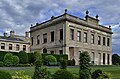
 Brodsworth Hall - geograph.org.uk - 1863804.jpg 640 × 481; 67 kB
-
 Brodsworth Hall - geograph.org.uk - 3149567.jpg 1.024 × 536; 154 kB
-
 Brodsworth Hall - geograph.org.uk - 3216989.jpg 2.048 × 1.536; 1,05 MB
-
 Brodsworth Hall - geograph.org.uk - 3399897.jpg 833 × 1.024; 240 kB
-
 Brodsworth Hall - geograph.org.uk - 4145516.jpg 1.024 × 662; 150 kB
-
 Brodsworth Hall - geograph.org.uk - 4145525.jpg 1.024 × 683; 146 kB
-
 Brodsworth Hall - geograph.org.uk - 4704195.jpg 1.024 × 768; 267 kB
-
 Brodsworth Hall - geograph.org.uk - 5051873.jpg 3.650 × 2.409; 4,68 MB
-
 Brodsworth Hall - geograph.org.uk - 5051875.jpg 3.678 × 2.456; 5,91 MB
-
 Brodsworth Hall - geograph.org.uk - 6003074.jpg 640 × 480; 52 kB
-
 Brodsworth Hall - geograph.org.uk - 6003802.jpg 640 × 360; 41 kB
-
 Brodsworth Hall and Gardens - geograph.org.uk - 5454977.jpg 640 × 480; 575 kB
-

-
 Brodsworth Hall Eyecatcher - geograph.org.uk - 1869133.jpg 640 × 480; 152 kB
-
 Brodsworth Hall fern garden - geograph.org.uk - 3668147.jpg 1.024 × 768; 295 kB
-
 Brodsworth Hall from the Laburnum Tunnel - geograph.org.uk - 5036335.jpg 3.678 × 2.456; 5,77 MB
-
 Brodsworth Hall from the Summer House - geograph.org.uk - 5051924.jpg 3.678 × 2.456; 5,13 MB
-
 Brodsworth Hall from the west lawns - geograph.org.uk - 5051882.jpg 3.678 × 2.456; 4,38 MB
-
 Brodsworth Hall Gardens - geograph.org.uk - 5454968.jpg 640 × 481; 646 kB
-
 Brodsworth Hall Gardens - geograph.org.uk - 5837748.jpg 1.024 × 768; 341 kB
-
 Brodsworth Hall Gardens - geograph.org.uk - 5837750.jpg 1.024 × 768; 345 kB
-
 Brodsworth Hall Grotto - geograph.org.uk - 1869146.jpg 640 × 480; 140 kB
-
 Brodsworth Hall Temple - geograph.org.uk - 1869144.jpg 640 × 480; 108 kB
-
 Brodsworth Hall, A leafy plant after a shower of rain - geograph.org.uk - 5051829.jpg 3.678 × 2.456; 5,86 MB
-

-
 Brodsworth Hall, Doncaster - geograph.org.uk - 4145509.jpg 1.024 × 662; 180 kB
-
 Brodsworth Hall, English Heritage Visitor Centre - geograph.org.uk - 5051788.jpg 4.933 × 3.249; 7,12 MB
-

-
 Brodsworth Hall, first floor, Fanlight above the staircase - geograph.org.uk - 5051864.jpg 3.874 × 2.619; 4,99 MB
-
 Brodsworth Hall, first floor, Paneling around the staircase - geograph.org.uk - 5051867.jpg 3.678 × 2.456; 4,38 MB
-
 Brodsworth Hall, first floor, The staircase - geograph.org.uk - 5051859.jpg 4.979 × 3.132; 7,6 MB
-

-
 Brodsworth Hall, ground floor, The Drawing Room - geograph.org.uk - 5051849.jpg 4.434 × 2.820; 7,67 MB
-
 Brodsworth Hall, main entrance - geograph.org.uk - 5051840.jpg 5.520 × 3.680; 7,63 MB
-
 Brodsworth Hall, northern aspect - geograph.org.uk - 5051837.jpg 4.316 × 2.728; 5,42 MB
-
 Brodsworth Hall, Orchids in the unmown section of the garden - geograph.org.uk - 5051936.jpg 3.679 × 2.456; 3,41 MB
-
 Brodsworth Hall, St. Michael and All Angels church - geograph.org.uk - 5051804.jpg 3.611 × 2.345; 3,88 MB
-
 Brodsworth Hall, St. Michael and All Angels church - geograph.org.uk - 5051939.jpg 3.678 × 2.456; 5,72 MB
-
 Brodsworth Hall, The "Eye Catcher" - geograph.org.uk - 5051911.jpg 3.678 × 2.456; 4,9 MB
-
 Brodsworth Hall, The Fountain Garden (1) - geograph.org.uk - 5454957.jpg 640 × 480; 491 kB
-
 Brodsworth Hall, The Fountain Garden (2) - geograph.org.uk - 5454965.jpg 640 × 481; 541 kB
-
 Brodsworth Hall, The Fountain Garden (detail) - geograph.org.uk - 5051896.jpg 3.679 × 2.456; 6,8 MB
-
 Brodsworth Hall, The Fountain Garden - geograph.org.uk - 5051892.jpg 3.678 × 2.456; 4,75 MB
-
 Brodsworth Hall, The Grotto and Fern Dell - geograph.org.uk - 5051918.jpg 3.678 × 2.456; 6,46 MB
-
 Brodsworth Hall, The opaque internal window in the west hall - geograph.org.uk - 5051846.jpg 4.347 × 2.890; 6,61 MB
-
 Brodsworth Hall, The path from the visitor centre - geograph.org.uk - 5051795.jpg 3.678 × 2.456; 5,37 MB
-
 Brodsworth Hall, The Rock Garden from the Summer House - geograph.org.uk - 5051923.jpg 3.678 × 2.456; 6,24 MB
-
 Brodsworth Hall, The Rose Pergola - geograph.org.uk - 5051934.jpg 3.678 × 2.456; 6,54 MB
-
 Brodsworth Hall, The Summer House - geograph.org.uk - 5051905.jpg 3.678 × 2.456; 4,47 MB
-
 Brodsworth Hall, The Target House (detail) - geograph.org.uk - 5051931.jpg 3.678 × 2.456; 4,28 MB
-
 Brodsworth Hall, The Target House - geograph.org.uk - 5051928.jpg 3.678 × 2.455; 4,99 MB
-
 Brodsworth Hall, The well disguised public conveniences - geograph.org.uk - 5051822.jpg 3.678 × 2.456; 5,83 MB
-
 Brodsworth Hall, The West Lawns - geograph.org.uk - 5051880.jpg 3.950 × 2.592; 5,77 MB
-

-
 Brodsworth hall. - geograph.org.uk - 3528746.jpg 640 × 392; 75 kB
-
 Brodsworth Park - geograph.org.uk - 5454976.jpg 640 × 481; 498 kB
-
 Brodsworth Park - geograph.org.uk - 5724948.jpg 1.024 × 768; 247 kB
-
 Brodsworth Park - geograph.org.uk - 5837830.jpg 1.024 × 768; 257 kB
-
 Brodsworth parkland - geograph.org.uk - 924015.jpg 640 × 427; 79 kB
-
 Brodsworth Village Scene - geograph.org.uk - 5118158.jpg 4.495 × 3.352; 3,75 MB
-
 Brodsworth, Church Lane - geograph.org.uk - 5454997.jpg 640 × 480; 397 kB
-
 Buildings at Tithe Barn - geograph.org.uk - 4227902.jpg 1.600 × 1.200; 507 kB
-
 Buildings at Tithe Barn - geograph.org.uk - 4502766.jpg 1.024 × 768; 165 kB
-
 Bus shelter on Scawsby Lane - geograph.org.uk - 4227876.jpg 1.600 × 1.200; 443 kB
-
 Bus Shelters and Wide Grass Verge on Barnsley Road - geograph.org.uk - 5305221.jpg 4.608 × 3.456; 3,79 MB
-
 B^Q distribution centre - geograph.org.uk - 5405780.jpg 4.608 × 3.456; 5,76 MB
-
 Cart shed, Brodsworth - geograph.org.uk - 5719803.jpg 1.024 × 768; 210 kB
-
 Chapel Plantation - geograph.org.uk - 5723276.jpg 1.024 × 768; 247 kB
-
 Chimney View - geograph.org.uk - 3110418.jpg 1.308 × 1.061; 118 kB
-
 Communications mast on Doncaster Road - geograph.org.uk - 2603177.jpg 1.600 × 1.309; 264 kB
-
 Covered reservoir, Adwick le Street - geograph.org.uk - 6050982.jpg 2.736 × 1.824; 1,98 MB
-
 Crop field at Norman Hill - geograph.org.uk - 2787127.jpg 1.024 × 768; 165 kB
-
 Crop Field Pictured from Roman Ridge - geograph.org.uk - 5305293.jpg 4.608 × 3.456; 3,76 MB
-
 Cyclamen flowering under a leafless tree - geograph.org.uk - 3436306.jpg 1.024 × 768; 224 kB
-
 Dark clouds over Broad Axe field - geograph.org.uk - 6052178.jpg 2.736 × 1.824; 1,83 MB
-
 Doncaster Bypass (A1M) - geograph.org.uk - 4830537.jpg 640 × 427; 315 kB
-
 Doncaster Bypass (A1M) - geograph.org.uk - 4830721.jpg 640 × 427; 321 kB
-

-
 Doncaster Bypass (A1M) at Red House - geograph.org.uk - 4830457.jpg 640 × 480; 343 kB
-
 Doncaster Bypass (A1M) at Stane Hill - geograph.org.uk - 4830542.jpg 640 × 427; 317 kB
-
 Doncaster Bypass (A1M) near Windy Mount - geograph.org.uk - 4830500.jpg 640 × 427; 307 kB
-
 Doncaster Road heading south - geograph.org.uk - 2603181.jpg 1.600 × 1.200; 575 kB
-
 Enjoying the band at Brodsworth Hall - geograph.org.uk - 5836692.jpg 1.024 × 768; 265 kB
-
 Entrance to Bilham Lodge - geograph.org.uk - 2787099.jpg 1.024 × 768; 172 kB
-
 Entrance to Brodsworth Hall - geograph.org.uk - 2372013.jpg 3.648 × 2.736; 3,62 MB
-
 Fagus sylvatica - geograph.org.uk - 3110467.jpg 1.200 × 1.600; 504 kB
-
 Farm building, Home Farm, Brodsworth - geograph.org.uk - 5719799.jpg 1.024 × 768; 149 kB
-
 Farm sign - geograph.org.uk - 584117.jpg 640 × 480; 124 kB
-
 Farm track near Leys Hill Bridge - geograph.org.uk - 2603186.jpg 1.600 × 1.200; 564 kB
-
 Farm track running west from Roman Ridge - geograph.org.uk - 6051596.jpg 1.824 × 2.736; 2,38 MB
-
 Farm track, Brodsworth - geograph.org.uk - 5719777.jpg 1.024 × 768; 346 kB
-
 Farmland at Brodsworth - geograph.org.uk - 5719702.jpg 1.024 × 768; 166 kB
-
 Farmland between Scawsby Lane and Roman Ridge - geograph.org.uk - 6051667.jpg 1.600 × 1.067; 503 kB
-
 Farmland east of Freestone Quarry Plantation - geograph.org.uk - 4117898.jpg 1.024 × 768; 134 kB
-
 Farmland east of Scawsby Lane - geograph.org.uk - 6051672.jpg 2.736 × 1.824; 2,7 MB
-
 Farmland near Brodsworth Park - geograph.org.uk - 5118172.jpg 4.608 × 3.456; 4,31 MB
-
 Farmland next to Church Lane - geograph.org.uk - 5454994.jpg 640 × 480; 523 kB
-
 Farmland off Scawsby Lane - geograph.org.uk - 2602306.jpg 1.600 × 1.200; 506 kB
-
 Farmland towards Hampole Wood - geograph.org.uk - 2616277.jpg 1.600 × 1.200; 514 kB
-
 Fern Dell, Brodsworth Hall - geograph.org.uk - 2605190.jpg 1.600 × 1.132; 565 kB
-
 Fern Dell, Brodsworth Hall - geograph.org.uk - 2605198.jpg 1.600 × 1.200; 632 kB
-
 Field adjacent to Freestone Quarry - geograph.org.uk - 5719694.jpg 1.024 × 768; 169 kB
-
 Field edge along Street Lane - geograph.org.uk - 2787132.jpg 1.024 × 768; 202 kB
-
 Field of oilseed rape, Pickburn - geograph.org.uk - 5723254.jpg 1.024 × 768; 238 kB
-
 Field Road (track) - geograph.org.uk - 2603170.jpg 1.600 × 1.200; 514 kB
-
 Fly-tipped rubbish in Hanging Woods - geograph.org.uk - 6052331.jpg 1.600 × 1.200; 730 kB
-
 Footbridge over the A1(M) - geograph.org.uk - 2606352.jpg 4.320 × 3.240; 4,43 MB
-
 Footpath junction on Roman Ridge - geograph.org.uk - 6051572.jpg 2.916 × 2.186; 3,06 MB
-
 Footpath to Green Lane - geograph.org.uk - 4502774.jpg 1.024 × 768; 307 kB
-
 Formal Gardens - geograph.org.uk - 3216992.jpg 2.048 × 1.536; 1,36 MB
-
 Fountain in Brodsworth Hall Gardens - geograph.org.uk - 5837626.jpg 768 × 1.024; 234 kB
-
 Freestone quarry lane. - geograph.org.uk - 4830117.jpg 640 × 349; 68 kB
-

-
 Glebe Farm, Brodsworth - geograph.org.uk - 4227829.jpg 1.600 × 1.200; 572 kB
-
 Grazing land off Green Lane - geograph.org.uk - 2602295.jpg 1.600 × 1.200; 381 kB
-
 Green farmland on a sunny winter's day - geograph.org.uk - 2787066.jpg 1.024 × 768; 125 kB
-
 Green Lane passes under the motorway at Leys Hill Bridge - geograph.org.uk - 4227871.jpg 1.600 × 1.200; 553 kB
-
 Green Lane towards Brodsworth - geograph.org.uk - 2602318.jpg 1.600 × 1.200; 539 kB
-
 Green Road - geograph.org.uk - 1119571.jpg 480 × 640; 129 kB
-
 Harvest near Brodsworth Hall. - geograph.org.uk - 507883.jpg 640 × 480; 153 kB
-
 Highfields Viewed from Roman Ridge - geograph.org.uk - 5305301.jpg 4.608 × 3.456; 3,83 MB
-
 Houses in Eskdale Walk, Scawsby, Doncaster - geograph.org.uk - 6052180.jpg 2.736 × 1.824; 2,16 MB
-
 Houses on Charter Drive, Doncaster - geograph.org.uk - 6051682.jpg 2.736 × 1.824; 2,32 MB
-
 In the gardens at Brodsworth Hall - geograph.org.uk - 6003800.jpg 640 × 480; 55 kB
-
 Italianate Urns - geograph.org.uk - 3110429.jpg 1.494 × 1.132; 102 kB
-
 J37, A1(M) - geograph.org.uk - 4790334.jpg 640 × 426; 42 kB
-
 Junction 38, A1(M) - geograph.org.uk - 2515285.jpg 640 × 430; 52 kB
-
 Junction of Roman Ridge and Alwyn Avenue - geograph.org.uk - 6052172.jpg 3.887 × 2.915; 3,36 MB
-
 Late spring sundown - geograph.org.uk - 5406144.jpg 4.608 × 3.456; 4,15 MB
-
 Leaving Brodsworth - geograph.org.uk - 2719401.jpg 640 × 410; 62 kB
-
 Ling Field Lane and wind turbines - geograph.org.uk - 5719715.jpg 1.024 × 768; 190 kB
-
 Ling Field Road - geograph.org.uk - 4572268.jpg 4.645 × 3.453; 3,87 MB
-
 Ling Field Road - geograph.org.uk - 5723194.jpg 1.024 × 768; 184 kB
-
 Ling Field Road - geograph.org.uk - 5723251.jpg 1.024 × 768; 215 kB
-
 Ling Lane north of Brodsworth - geograph.org.uk - 4572381.jpg 5.184 × 3.888; 4,89 MB
-
 Lion Headed Urn - geograph.org.uk - 3110434.jpg 987 × 1.193; 91 kB
-
 Loading up with fertiliser - geograph.org.uk - 5725175.jpg 1.024 × 768; 200 kB
-

-
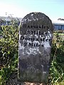
 Milestone at Brodsworth, South Yorkshire, England.jpg 640 × 480; 167 kB
-
 Milestone outside Scawsby Ridgwood School.jpg 480 × 640; 413 kB
-
 Motor vehicles banned on the Roman Ridge byway - geograph.org.uk - 6052165.jpg 1.600 × 1.067; 462 kB
-
 Narrow Balk from Lound Lane - geograph.org.uk - 4572376.jpg 5.184 × 3.888; 5,5 MB
-
 New bungalows being built on Layden Drive - geograph.org.uk - 6051685.jpg 1.600 × 1.067; 526 kB
-
 New hedge along Roman Ridge - geograph.org.uk - 6051679.jpg 1.600 × 1.199; 587 kB
-
 New housing, Vulcan Crescent, Scawsby - geograph.org.uk - 6052130.jpg 2.736 × 1.824; 2,24 MB
-
 New red bin, Brodsworth Community Woodlands - geograph.org.uk - 5719747.jpg 1.024 × 768; 270 kB
-
 Oilseed rape and Chapel Plantation - geograph.org.uk - 5723257.jpg 1.024 × 768; 223 kB
-
 Oilseed rape and electricity supply line - geograph.org.uk - 5723260.jpg 1.024 × 768; 185 kB
-
 Oilseed rape and Hill Farm - geograph.org.uk - 5725205.jpg 1.024 × 768; 237 kB
-
 Oilseed rape and houses at Pickburn - geograph.org.uk - 5725199.jpg 1.024 × 768; 203 kB
-
 On Ling Field Road heading north - geograph.org.uk - 4572286.jpg 5.096 × 3.649; 4,68 MB
-
 On the A1(M) - geograph.org.uk - 2040676.jpg 640 × 480; 54 kB
-
 On the A1(M) near Adwick le Street - geograph.org.uk - 2040684.jpg 640 × 480; 56 kB
-
 On the Roman Road - geograph.org.uk - 2461667.jpg 576 × 768; 87 kB
-
 Ordnance Survey Cut Mark - geograph.org.uk - 4016067.jpg 4.000 × 3.000; 5,12 MB
-
 Oughtibridge brass band in concert at Brodsworth Hall - geograph.org.uk - 4187450.jpg 4.896 × 3.672; 386 kB
-
 Over the crops to the massive B ^ Q warehouse - geograph.org.uk - 2832102.jpg 3.072 × 2.304; 1,15 MB
-
 Paddocks off Green Lane - geograph.org.uk - 6051592.jpg 2.736 × 1.824; 2,28 MB

_-_geograph.org.uk_-_6052187.jpg)


_-_beware_tractors%5E_-_geograph.org.uk_-_2645999.jpg)
_-_end_of_motorway_1-2_mile_-_geograph.org.uk_-_2646011.jpg)
_-_sign_at_junction_37_-_geograph.org.uk_-_2646047.jpg)
_-_the_leaves_are_starting_to_fall_-_geograph.org.uk_-_2646036.jpg)
,_J38_-_geograph.org.uk_-_4790343.jpg)
,_southbound_-_geograph.org.uk_-_4806353.jpg)
,_southbound_-_geograph.org.uk_-_4806354.jpg)
,_southbound_-_geograph.org.uk_-_4806356.jpg)


_-_geograph.org.uk_-_3996313.jpg)
_-_geograph.org.uk_-_2040670.jpg)


_-_geograph.org.uk_-_5454991.jpg)
_-_geograph.org.uk_-_5454962.jpg)


_-_geograph.org.uk_-_5454957.jpg)
_-_geograph.org.uk_-_5454965.jpg)
_-_geograph.org.uk_-_5051896.jpg)


_-_geograph.org.uk_-_5051931.jpg)


_-_geograph.org.uk_-_4830537.jpg)
_-_geograph.org.uk_-_4830721.jpg)
_at_Adwick_le_Street_-_geograph.org.uk_-_4830507.jpg)
_at_Red_House_-_geograph.org.uk_-_4830457.jpg)
_at_Stane_Hill_-_geograph.org.uk_-_4830542.jpg)
_near_Windy_Mount_-_geograph.org.uk_-_4830500.jpg)


_-_geograph.org.uk_-_2603170.jpg)

_-_geograph.org.uk_-_2606352.jpg)


_-_geograph.org.uk_-_4790334.jpg)
_-_geograph.org.uk_-_2515285.jpg)


_-_geograph.org.uk_-_247466.jpg)


_-_geograph.org.uk_-_2040676.jpg)
_near_Adwick_le_Street_-_geograph.org.uk_-_2040684.jpg)


