Category:Broxbourne
Aller à la navigation
Aller à la recherche
localité britannique  | |||||
| Téléverser des médias | |||||
| Nature de l’élément |
| ||||
|---|---|---|---|---|---|
| Lieu | district de Broxbourne, Hertfordshire, Angleterre de l'Est, Angleterre | ||||
| À ne pas confondre avec | |||||
 | |||||
English: Broxbourne is a commuter town in the Broxbourne borough of Hertfordshire in the East of England with a population of 13,298 in 2001.
Italiano: Broxbourne è un paese di 13.298 abitanti della contea dell' Hertfordshire, in Inghilterra.
Nederlands: Broxbourne is een plaats in het district Broxbourne, in het Engelse graafschap Hertfordshire. De plaats telt 13.298 inwoners.
Norsk bokmål: Broxbourne er et administrativt distrikt i Hertfordshire, England. Det ble opprettet 1. april 1974 ved at Hoddesdon og Cheshunt ble slått sammen.
Română: Broxbourne este un oraş şi un district nemetropolitan în Regatul Unit, în comitatul Hertfordshire, în regiunea East, Anglia. Districtul are o populaţie de 88.900 locuitori, din care 13.298 locuiesc în oraşul propriu zis Broxbourne. Cu toate că districtul este numit după numele oraşului Broxbourne, reşedinţa acestuia este oraşul Cheshunt.
Sous-catégories
Cette catégorie comprend 10 sous-catégories, dont les 10 ci-dessous.
Média dans la catégorie « Broxbourne »
Cette catégorie comprend 60 fichiers, dont les 60 ci-dessous.
-
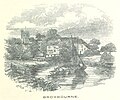 ECR(1851) p23a - Broxbourne.jpg 948 × 792 ; 243 kio
-
 2022-02-05 Bridge at end of Broxbourne Mill Stream.jpg 3 419 × 1 923 ; 1,54 Mio
-
 2022-02-05 Bridge over the Lea near The Crown, Broxbourne.jpg 2 729 × 1 535 ; 1,36 Mio
-
 2022-02-05 Broxbourne Rowing Club.jpg 3 416 × 1 921 ; 1,44 Mio
-
 2022-02-05 New River Bridge, Broxbourne 1.jpg 3 104 × 2 328 ; 1,41 Mio
-
 2022-02-05 New River Bridge, Broxbourne 2.jpg 3 618 × 2 713 ; 2,76 Mio
-
 2022-02-05 New River by Broxbourne station.jpg 3 599 × 2 699 ; 2,57 Mio
-
 2022-02-05 Pulham Manufactory, Broxbourne 1.jpg 2 407 × 3 210 ; 2,01 Mio
-
 2022-02-05 Pulham Manufactory, Broxbourne 2.jpg 2 844 × 3 792 ; 3,02 Mio
-
 2022-02-05 Pulham Manufactory, Broxbourne 3.jpg 3 576 × 2 682 ; 2,92 Mio
-
 2022-02-05 Pulham Manufactory, Broxbourne 4.jpg 3 485 × 2 613 ; 1,4 Mio
-
 2022-02-05 The Crown pub, Broxbourne.jpg 3 890 × 2 188 ; 2,3 Mio
-
 A10 north from Cock Lane - geograph.org.uk - 846065.jpg 640 × 480 ; 61 kio
-
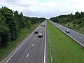 A10 south from Cock Lane - geograph.org.uk - 846059.jpg 640 × 480 ; 72 kio
-
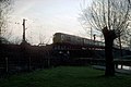 Approaching Broxbourne Station - geograph.org.uk - 1116881.jpg 640 × 425 ; 67 kio
-

-
 Bridge over New River - geograph.org.uk - 1250998.jpg 640 × 426 ; 105 kio
-
 Bridge over New River - geograph.org.uk - 1251007.jpg 640 × 426 ; 108 kio
-

-
 Bridge over The River Lea at Nazeing - geograph.org.uk - 108985.jpg 640 × 480 ; 146 kio
-
 Broxbourne Boat Centre.JPG 2 304 × 1 728 ; 1,8 Mio
-
 Broxbourne Lido.JPG 2 304 × 1 728 ; 1,49 Mio
-
 Broxbourne Pump Station.jpg 3 840 × 2 160 ; 1,58 Mio
-
 Broxbourne pumping station 2020-08-23.jpg 3 830 × 2 553 ; 3,68 Mio
-
 Broxbourne Sailing Club - geograph.org.uk - 157505.jpg 640 × 480 ; 72 kio
-
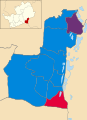 Broxbourne UK local election 2014.svg 924 × 1 266 ; 178 kio
-
 Broxbourne, Recreation Ground - geograph.org.uk - 81194.jpg 640 × 480 ; 100 kio
-
 Carthagena Weir1.JPG 2 304 × 1 728 ; 1,8 Mio
-
 Cecilia Bosanquet nee Franks.jpg 800 × 1 031 ; 177 kio
-
 Cheetah (9710696277).jpg 1 500 × 1 029 ; 1,2 Mio
-
 Duck by New River - geograph.org.uk - 1251008.jpg 640 × 415 ; 122 kio
-
 Geese - geograph.org.uk - 1250993.jpg 640 × 321 ; 101 kio
-
 George Richard Smith Bosanquet 1906.jpg 800 × 881 ; 122 kio
-

-
 Hertford Regional College - Broxbourne Campus Atrium Area.jpg 3 840 × 5 760 ; 8,67 Mio
-
 Hertford Regional College - Broxbourne Campus External View.jpg 2 700 × 1 800 ; 3,49 Mio
-
 Horses Grazing Baas Hill Broxbourne - geograph.org.uk - 155154.jpg 640 × 480 ; 69 kio
-
 House by the New River - geograph.org.uk - 1250986.jpg 640 × 422 ; 92 kio
-
 Lea Navigation at Nazeing - geograph.org.uk - 1444034.jpg 640 × 480 ; 98 kio
-
 Lee Valley Walk.JPG 2 304 × 1 728 ; 1,63 Mio
-
 Looking down Churchfields at Broxbourne - geograph.org.uk - 782857.jpg 640 × 480 ; 79 kio
-
 Meux Plaque.jpg 3 064 × 3 030 ; 2,12 Mio
-
 Nazeing New Road - geograph.org.uk - 1444036.jpg 640 × 480 ; 169 kio
-
 New River - geograph.org.uk - 1251001.jpg 640 × 426 ; 99 kio
-
 New River, Broxbourne - geograph.org.uk - 442436.jpg 640 × 479 ; 126 kio
-
 New River, Broxbourne - geograph.org.uk - 442439.jpg 640 × 461 ; 124 kio
-
 New River, Broxbourne - geograph.org.uk - 442442.jpg 640 × 479 ; 121 kio
-
 Railway Bridge at Old Mill Broxbourne - geograph.org.uk - 108990.jpg 640 × 480 ; 207 kio
-
 River Lea Navigation - geograph.org.uk - 161097.jpg 640 × 480 ; 95 kio
-
 Road bridge over the Lea Navigation at Nazeing - geograph.org.uk - 1444029.jpg 640 × 480 ; 185 kio
-
 Sale ad Broxbournebury 1946.jpg 800 × 612 ; 212 kio
-
 Suburban Housing Broxbourne Herts - geograph.org.uk - 156006.jpg 640 × 480 ; 86 kio
-
 Tennis Courts - geograph.org.uk - 1250988.jpg 640 × 426 ; 119 kio
-
 The New River, Broxbourne - geograph.org.uk - 80995.jpg 640 × 480 ; 144 kio
-
 The New River, Broxbourne - geograph.org.uk - 86217.jpg 640 × 480 ; 119 kio
-
 The New River, Spitalbrook - geograph.org.uk - 307151.jpg 640 × 480 ; 104 kio
-
 View from St Augustine's Church, Broxbourne - geograph.org.uk - 442435.jpg 640 × 480 ; 115 kio
-
 View from St Augustine's Church, Broxbourne - geograph.org.uk - 442444.jpg 640 × 445 ; 124 kio
-
 Nazeing New Road crossing the River Lea - geograph.org.uk - 368147.jpg 640 × 480 ; 97 kio
-
 River Lee Flood Relief Channel - geograph.org.uk - 201984.jpg 640 × 480 ; 111 kio
_p23a_-_Broxbourne.jpg)


.jpg)


