Category:Brynford
Vai alla navigazione
Vai alla ricerca
village and community in Flintshire, Wales   | |||||
| Carica un file multimediale | |||||
| Istanza di | |||||
|---|---|---|---|---|---|
| Luogo | Flintshire, Galles | ||||
 | |||||
Cymraeg: Pentref a chymuned yn Sir y Fflint yw Brynffordd (Saesneg: Brynford). Saif i'r de-orllewin o dref Treffynnon ar y ffordd B5121, fymryn i'r de o'r briffordd A55.
English: Brynford is a village in Flintshire, Wales. It is located to the south west of the town of Holywell and near the A55 road (North Wales Expressway). At the 2001 Census, Brynford had a population of 1,098.
Sottocategorie
Questa categoria contiene un'unica sottocategoria, indicata di seguito.
M
File nella categoria "Brynford"
Questa categoria contiene 75 file, indicati di seguito, su un totale di 75.
-
 2010 Wales Flintshire Community Brynford map.svg 512 × 568; 494 KB
-
 2024 Wales Flintshire Community Brynford map.svg 512 × 568; 394 KB
-
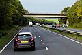
 A55 eastbound near Calcoed - geograph.org.uk - 2346218.jpg 640 × 480; 32 KB
-
 A55 eastbound near Milwr - geograph.org.uk - 2346274.jpg 640 × 480; 35 KB
-
 A55 near Brynford, looking west - geograph.org.uk - 2231220.jpg 640 × 480; 44 KB
-
 A55 near Dolphin - geograph.org.uk - 4419818.jpg 1 800 × 1 350; 323 KB
-
 A55 near Pantasaph - geograph.org.uk - 2344746.jpg 640 × 480; 34 KB
-
 Bridge over the A55, North of Brynford - geograph.org.uk - 5615719.jpg 640 × 427; 355 KB
-
 Bridleway leading from Calcot Hall - geograph.org.uk - 3734898.jpg 3 264 × 2 448; 6,5 MB
-
 Brynford church - geograph.org.uk - 182123.jpg 640 × 480; 113 KB
-
 Brynford County Primary School - geograph.org.uk - 6147876.jpg 4 000 × 3 000; 2,39 MB
-
 Brynford Village Green - geograph.org.uk - 33781.jpg 512 × 384; 62 KB
-
 By way - geograph.org.uk - 2274781.jpg 4 000 × 3 000; 5,02 MB
-
 Calcoed Lane enclosed between hedges and heading for Babel - geograph.org.uk - 5981244.jpg 4 000 × 3 000; 3,52 MB
-
 Calcoed Methodist Church and its burial ground - geograph.org.uk - 5981762.jpg 4 000 × 3 000; 3,34 MB
-
 Calcoed Road - geograph.org.uk - 2274775.jpg 4 000 × 3 000; 5,02 MB
-
 Calcot Hall - Old and New - geograph.org.uk - 4392250.jpg 4 608 × 2 592; 2,58 MB
-
 Common Path - geograph.org.uk - 2274697.jpg 4 000 × 3 000; 5,04 MB
-
 Cottage near Brynford - geograph.org.uk - 132322.jpg 619 × 525; 41 KB
-
 Crooked Path - geograph.org.uk - 2274725.jpg 3 000 × 4 000; 4,91 MB
-
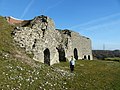
 Derelict chapel, Dolphin - geograph.org.uk - 4417830.jpg 1 800 × 1 350; 465 KB
-
 Ebenezer Chapel, Dolphin 01.jpg 4 000 × 3 000; 5,03 MB
-
 Ebenezer Chapel, Dolphin 02.jpg 4 000 × 3 000; 4,73 MB
-
 Ffordd Calcoed - geograph.org.uk - 2238552.jpg 4 000 × 3 000; 5,88 MB
-
 Fifty one Twenty One - geograph.org.uk - 2274799.jpg 4 000 × 3 000; 5,97 MB
-

-
 Gelli gate - geograph.org.uk - 2274792.jpg 4 000 × 3 000; 5,1 MB
-
 Gelli Power - geograph.org.uk - 2274806.jpg 4 000 × 3 000; 5,02 MB
-
 Heathercote Track - geograph.org.uk - 2274764.jpg 4 000 × 3 000; 4,72 MB
-
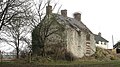
 Henblas - geograph.org.uk - 4418832.jpg 1 800 × 1 350; 610 KB
-
 Henblas, Brynford 01.jpg 4 000 × 3 000; 4,72 MB
-
 Henblas, Brynford 02.jpg 4 000 × 3 000; 4,78 MB
-
 Lay-by on the A5026 - geograph.org.uk - 6147862.jpg 4 000 × 3 000; 2,54 MB
-
 Layby just west of Junction 32 - geograph.org.uk - 6144000.jpg 640 × 427; 85 KB
-
 Layby on the Westbound A55 near Milwr - geograph.org.uk - 5615689.jpg 640 × 480; 344 KB
-
 Lead Mine shaft - geograph.org.uk - 2769484.jpg 640 × 480; 99 KB
-
 Lime kilns at Bryn Mawr (Aberdo Quarry) 01.jpg 4 000 × 3 000; 4,44 MB
-
 Lime kilns at Bryn Mawr (Aberdo Quarry) 02.jpg 4 000 × 3 000; 4,94 MB
-
 Lime kilns at Bryn Mawr (Aberdo Quarry) 03.jpg 3 000 × 4 000; 3,86 MB
-
 Lime kilns at Bryn Mawr (Aberdo Quarry) 04.jpg 4 000 × 3 000; 4,53 MB
-
 Limekilns at Pant y Pydew - geograph.org.uk - 2769696.jpg 640 × 480; 84 KB
-
 Limekilns at Pant y Pydew - geograph.org.uk - 2769703.jpg 640 × 480; 99 KB
-
-
 Near Pen-y-Henblas - geograph.org.uk - 4418854.jpg 1 800 × 1 350; 556 KB
-

-
 Old Calcot Hall - geograph.org.uk - 4392258.jpg 4 608 × 2 592; 3,97 MB
-
 Old Lime Kilns - geograph.org.uk - 4392274.jpg 4 608 × 2 592; 5,37 MB
-
 Open farm gate - geograph.org.uk - 6147861.jpg 4 000 × 3 000; 2,43 MB
-
 Overbridge near Pantasaph - geograph.org.uk - 6144003.jpg 640 × 427; 75 KB
-
 Pant cudd - geograph.org.uk - 2232539.jpg 4 000 × 3 000; 5,57 MB
-
 Path into the disused Pen yr Henblas Quarries - geograph.org.uk - 5981781.jpg 4 000 × 3 000; 3,16 MB
-
 Pen - Y - Pylle - geograph.org.uk - 2274868.jpg 4 000 × 3 000; 5,99 MB
-
 Pen -Y - Pylle - geograph.org.uk - 2274835.jpg 4 000 × 3 000; 4,64 MB
-
 Pen yr Henblas Quarry 1 - geograph.org.uk - 5554466.jpg 640 × 480; 67 KB
-
 Pen yr Henblas Quarry 2 - geograph.org.uk - 5554469.jpg 640 × 480; 72 KB
-
 Pen-yr-Henblas - geograph.org.uk - 4418881.jpg 1 800 × 1 350; 651 KB
-
 Pen-yr-Henblas - geograph.org.uk - 4418887.jpg 1 800 × 1 350; 612 KB
-
 Pen-yr-hwylfa Farm - geograph.org.uk - 5114852.jpg 6 000 × 4 000; 4,44 MB
-
 Pentre Chert Formation - geograph.org.uk - 5554450.jpg 640 × 480; 110 KB
-
 Remains of a former quarry on Bryn Mawr - geograph.org.uk - 5114842.jpg 6 000 × 4 000; 3,97 MB
-
 Road near Pen-yr-hwylfa - geograph.org.uk - 5981772.jpg 4 000 × 3 000; 2,5 MB
-
 Road near Pen-yr-hwylfa Farm - geograph.org.uk - 5981777.jpg 4 000 × 3 000; 3,05 MB
-
 Sheep above Dolphin - geograph.org.uk - 5114872.jpg 5 651 × 3 768; 4,42 MB
-
 Sheep street - geograph.org.uk - 2274710.jpg 4 000 × 3 000; 5,87 MB
-
 St Michael's Church, Brynford - geograph.org.uk - 6147872.jpg 4 000 × 3 000; 2,25 MB
-
 Standing stones - geograph.org.uk - 2274788.jpg 4 000 × 3 000; 5,94 MB
-
 Tafarn Glan-yr-Afon (Glan-yr-Afon Inn) - geograph.org.uk - 4417824.jpg 1 800 × 1 350; 511 KB
-
 The Crooked Horn - geograph.org.uk - 2274718.jpg 4 000 × 3 000; 5,84 MB
-
 The industrial countryside - geograph.org.uk - 5554482.jpg 640 × 480; 75 KB
-
 The Vicarage, Brynford - geograph.org.uk - 6147874.jpg 4 000 × 3 000; 2,29 MB
-
 Towards Pant-y-Pwll Dwr - geograph.org.uk - 4418868.jpg 1 800 × 1 350; 547 KB
-
 Track at Pant y Pydew - geograph.org.uk - 4418928.jpg 1 800 × 1 350; 407 KB
-
 Track at Pen-Y-Ball Top - geograph.org.uk - 5981766.jpg 4 000 × 3 000; 4,26 MB
-
 Under power - geograph.org.uk - 2274826.jpg 3 000 × 4 000; 5,68 MB
-
 Yr Eglwys Fethodistaidd - geograph.org.uk - 2238554.jpg 4 000 × 3 000; 4,94 MB


_01.jpg)
_02.jpg)
_03.jpg)
_04.jpg)


_-_geograph.org.uk_-_4417824.jpg)


