Category:Buckfastleigh
Zur Navigation springen
Zur Suche springen
Kleinstadt im Vereinigten Königreich  | |||||
| Medium hochladen | |||||
| Ist ein(e) | |||||
|---|---|---|---|---|---|
| Liegt in Schutzgebiet | |||||
| Ort | Teignbridge, Devon, Südwestengland, England | ||||
| Eventuell gleichwertig | Buckfastleigh (Wikimedia-Dublette, Civil Parish in England) | ||||
| offizielle Website | |||||
 | |||||
English: Images relating to the town of Buckfastleigh, Devon, England. For more information see the Wikipedia article Buckfastleigh.
Unterkategorien
Es werden 12 von insgesamt 12 Unterkategorien in dieser Kategorie angezeigt:
In Klammern die Anzahl der enthaltenen Kategorien (K), Seiten (S), Dateien (D)
B
- Buckfastleigh Town Hall (1 D)
- Buckfastleigh War Memorial (1 D)
C
- Chris Eccleshall guitar workshop (11 D)
L
R
- Reeds Cave (6 D)
T
V
W
Medien in der Kategorie „Buckfastleigh“
Folgende 200 Dateien sind in dieser Kategorie, von 413 insgesamt.
(vorherige Seite) (nächste Seite)-
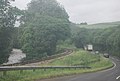
 A 4x4 free zone^ - geograph.org.uk - 3941901.jpg 4.681 × 3.143; 3,98 MB
-

-
 A not so ancient oak - geograph.org.uk - 5883987.jpg 640 × 480; 107 KB
-

-
 A38 and Quarry Face - geograph.org.uk - 942750.jpg 640 × 427; 122 KB
-
 A38 from Old Totnes Road - geograph.org.uk - 1994914.jpg 640 × 480; 517 KB
-
 A38, Buckfastleigh - geograph.org.uk - 1367423.jpg 640 × 455; 79 KB
-
 A38, Buckfastleigh - geograph.org.uk - 1367431.jpg 640 × 455; 97 KB
-
 A38, Buckfastleigh - geograph.org.uk - 1367438.jpg 640 × 455; 85 KB
-
 A38, South of Buckfastleigh - geograph.org.uk - 1367420.jpg 640 × 455; 70 KB
-
 A384 near Buckfastleigh - geograph.org.uk - 5246928.jpg 1.024 × 768; 343 KB
-
-
 Abbotswell House, Buckfastleigh - geograph.org.uk - 1125636.jpg 640 × 480; 87 KB
-
 Alley, Buckfastleigh - geograph.org.uk - 1361863.jpg 640 × 480; 145 KB
-
 Alleyway leading to houses - geograph.org.uk - 5688140.jpg 1.600 × 1.069; 370 KB
-
 An Elephant Tooth in Joint Mitnor Cave - geograph.org.uk - 3536567.jpg 3.008 × 2.256; 1,4 MB
-
 At Buckfastleigh Station - geograph.org.uk - 5039784.jpg 640 × 423; 92 KB
-
 Austin's Bridge - geograph.org.uk - 5222604.jpg 3.072 × 2.048; 1,5 MB
-
 Austin's Bridge - geograph.org.uk - 5222607.jpg 2.048 × 3.072; 1,55 MB
-

-

-
 Baker's Pit Cave entrance in 1961.jpg 996 × 823; 274 KB
-
 Barbers and post office, Buckfast - geograph.org.uk - 6387757.jpg 1.600 × 1.200; 594 KB
-
 Bat Caves - geograph.org.uk - 2943411.jpg 424 × 640; 334 KB
-
 BedfordSB-181ECV.jpg 1.024 × 683; 509 KB
-
 Beneath Austin's Bridge - geograph.org.uk - 5222612.jpg 2.048 × 3.072; 1,46 MB
-
 Between The Globe and The White Hart - geograph.org.uk - 944410.jpg 640 × 509; 97 KB
-
 Bigadon House in 1962 - geograph.org.uk - 216756.jpg 1.839 × 1.197; 326 KB
-
 Bigadon House in 1962 - geograph.org.uk - 216758.jpg 1.861 × 1.198; 396 KB
-
 Bigadon House in 1973 - geograph.org.uk - 216759.jpg 1.800 × 1.209; 421 KB
-
-
 Bossell Road - geograph.org.uk - 2291879.jpg 800 × 600; 382 KB
-
 Bossell Road, Buckfastleigh - geograph.org.uk - 3374782.jpg 640 × 459; 51 KB
-
 Bridge over Dean Burn, Buckfastleigh - geograph.org.uk - 6299934.jpg 1.600 × 1.200; 909 KB
-
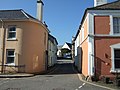
 Bridge Street, Buckfastleigh - geograph.org.uk - 1124253.jpg 486 × 640; 75 KB
-
 Brook alongside Station Road, Buckfastleigh - geograph.org.uk - 1937402.jpg 1.024 × 768; 199 KB
-
 Buckfast , Abbey Car Park - geograph.org.uk - 6260658.jpg 6.000 × 4.000; 6,63 MB
-
 Buckfast , Buckfast Abbey - geograph.org.uk - 6260669.jpg 6.000 × 4.000; 6,25 MB
-
 Buckfast , Buckfast Abbey - geograph.org.uk - 6260907.jpg 4.000 × 6.000; 6,1 MB
-
 Buckfast , Buckfast Abbey - geograph.org.uk - 6260920.jpg 4.000 × 6.000; 7,1 MB
-
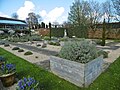
 Buckfast , Buckfast Abbey Burial Ground - geograph.org.uk - 6260940.jpg 6.000 × 4.000; 6,44 MB
-
 Buckfast , Buckfast Abbey Burial Ground - geograph.org.uk - 6260944.jpg 6.000 × 4.000; 7,19 MB
-
 Buckfast , Buckfast Abbey Burial Ground - geograph.org.uk - 6260946.jpg 6.000 × 4.000; 6,29 MB
-
 Buckfast , Buckfast Abbey Burial Ground - geograph.org.uk - 6260948.jpg 6.000 × 4.000; 6,8 MB
-
 Buckfast , Buckfast Abbey Burial Ground - geograph.org.uk - 6261154.jpg 6.000 × 4.000; 6,6 MB
-
 Buckfast , Buckfast Abbey Gardens - geograph.org.uk - 6260911.jpg 6.000 × 4.000; 6,36 MB
-
 Buckfast , Buckfast Abbey Gardens - geograph.org.uk - 6260914.jpg 6.000 × 4.000; 6,47 MB
-
 Buckfast , Buckfast Abbey Gardens - geograph.org.uk - 6260921.jpg 6.000 × 4.000; 6,45 MB
-
 Buckfast , Buckfast Abbey Gardens - geograph.org.uk - 6260926.jpg 6.000 × 4.000; 6,24 MB
-
 Buckfast , Buckfast Abbey Gardens - geograph.org.uk - 6260927.jpg 6.000 × 4.000; 6,38 MB
-
 Buckfast , Buckfast Abbey Grounds - geograph.org.uk - 6260855.jpg 4.000 × 6.000; 7,36 MB
-
 Buckfast , Buckfast Abbey Methodist Church - geograph.org.uk - 6260853.jpg 6.000 × 4.000; 7,21 MB
-
 Buckfast , Buckfast Abbey Side Altar - geograph.org.uk - 6260900.jpg 4.000 × 6.000; 7,01 MB
-
 Buckfast , Buckfast Abbey Side Chapel - geograph.org.uk - 6260860.jpg 4.000 × 6.000; 4,97 MB
-
 Buckfast , Buckfast Abbey Stained Glass - geograph.org.uk - 6260863.jpg 6.000 × 4.000; 7,17 MB
-
 Buckfast , Buckfast Abbey Statue - geograph.org.uk - 6260675.jpg 4.000 × 6.000; 5,64 MB
-
 Buckfast , Buckfast Abbey Statue - geograph.org.uk - 6260930.jpg 4.000 × 6.000; 6,2 MB
-
 Buckfast , Buckfast Road - geograph.org.uk - 6260950.jpg 6.000 × 4.000; 6,06 MB
-
 Buckfast , David Clarke Commercial Repairs - geograph.org.uk - 6261216.jpg 6.000 × 4.000; 7,74 MB
-
 Buckfast , Footpath - geograph.org.uk - 6260954.jpg 6.000 × 4.000; 7,17 MB
-
 Buckfast , Footpath - geograph.org.uk - 6260955.jpg 6.000 × 4.000; 6,39 MB
-
 Buckfast , Footpath - geograph.org.uk - 6261011.jpg 6.000 × 4.000; 6,61 MB
-
 Buckfast , Footpath - geograph.org.uk - 6261186.jpg 4.000 × 6.000; 7,55 MB
-
 Buckfast , Footpath - geograph.org.uk - 6261205.jpg 6.000 × 4.000; 6,6 MB
-
 Buckfast , Footpath - geograph.org.uk - 6261213.jpg 6.000 × 4.000; 7,83 MB
-
 Buckfast , Grassy Field - geograph.org.uk - 6261040.jpg 6.000 × 4.000; 7,48 MB
-
 Buckfast , Northgate House - geograph.org.uk - 6260936.jpg 6.000 × 4.000; 6,3 MB
-
 Buckfast , Northwood Lane - geograph.org.uk - 6260932.jpg 6.000 × 4.000; 6,25 MB
-
 Buckfast , Small Lane - geograph.org.uk - 6260953.jpg 6.000 × 4.000; 7,5 MB
-
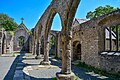
 Buckfast Abbey - geograph.org.uk - 5915380.jpg 1.200 × 1.600; 552 KB
-
 Buckfast Abbey - geograph.org.uk - 6013880.jpg 2.920 × 5.184; 5,07 MB
-
 Buckfast Abbey - interior - geograph.org.uk - 6013877.jpg 5.184 × 3.888; 6,16 MB
-
 Buckfast Abbey - interior - geograph.org.uk - 6013878.jpg 3.888 × 5.184; 5,76 MB
-
 Buckfast Abbey - waterwheel - geograph.org.uk - 6013876.jpg 5.184 × 2.920; 6,49 MB
-
 Buckfast Abbey Mill - geograph.org.uk - 6299324.jpg 5.238 × 3.491; 4,23 MB
-
 Buckfast Abbey on a wet day - geograph.org.uk - 6017096.jpg 1.024 × 768; 142 KB
-
-
 Buckfast Lower Mill - geograph.org.uk - 2457028.jpg 640 × 480; 66 KB
-
 Buckfast Methodist Chapel - geograph.org.uk - 2521972.jpg 3.872 × 2.592; 5,09 MB
-
 Buckfast Methodist Chapel - geograph.org.uk - 3654460.jpg 484 × 640; 88 KB
-
 Buckfast Upper Mill - geograph.org.uk - 2457062.jpg 640 × 480; 79 KB
-
 Buckfast, Abbey Inn - geograph.org.uk - 5339041.jpg 1.024 × 769; 199 KB
-
 Buckfast, churchyard - geograph.org.uk - 5338235.jpg 1.024 × 741; 301 KB
-
 Buckfast, community centre - geograph.org.uk - 5338578.jpg 1.024 × 768; 164 KB
-
 Buckfast, garden - geograph.org.uk - 5337892.jpg 1.024 × 768; 246 KB
-
 Buckfast, gateway - geograph.org.uk - 5338243.jpg 1.024 × 768; 170 KB
-
 Buckfast, Methodist church - geograph.org.uk - 5337883.jpg 1.024 × 768; 232 KB
-
 Buckfast, national park marker - geograph.org.uk - 5338593.jpg 1.024 × 769; 226 KB
-
 Buckfast, physic garden - geograph.org.uk - 5337912.jpg 1.024 × 768; 222 KB
-
 Buckfast, River Dart - geograph.org.uk - 5338926.jpg 1.024 × 768; 211 KB
-
 Buckfast, sensory garden - geograph.org.uk - 5337900.jpg 1.024 × 768; 254 KB
-
 Buckfast, St. Mary's - geograph.org.uk - 5969444.jpg 658 × 1.024; 99 KB
-
 Buckfastleigh (6113703016).jpg 3.648 × 2.056; 1,07 MB
-
 Buckfastleigh , Church Cross Cottages - geograph.org.uk - 6261047.jpg 6.000 × 4.000; 6,03 MB
-
 Buckfastleigh , Church Road - geograph.org.uk - 6261083.jpg 6.000 × 4.000; 7,9 MB
-
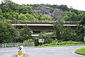
 Buckfastleigh , Devon Expressway A38 - geograph.org.uk - 6339743.jpg 6.000 × 4.000; 6,37 MB
-
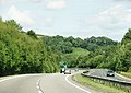
 Buckfastleigh , Devon Expressway A38 - geograph.org.uk - 6339745.jpg 6.000 × 4.000; 7,26 MB
-
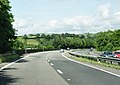
 Buckfastleigh , Devon Expressway A38 - geograph.org.uk - 6339746.jpg 6.000 × 4.000; 6,11 MB
-
 Buckfastleigh , Footpath - geograph.org.uk - 6261190.jpg 6.000 × 4.000; 6,89 MB
-
 Buckfastleigh , Grassy Field - geograph.org.uk - 6261053.jpg 6.000 × 4.000; 7,14 MB
-
 Buckfastleigh , Grassy Field - geograph.org.uk - 6261063.jpg 6.000 × 4.000; 6,59 MB
-
 Buckfastleigh , Holy Trinity Church - geograph.org.uk - 6261130.jpg 4.000 × 6.000; 6,02 MB
-
 Buckfastleigh , Holy Trinity Church - geograph.org.uk - 6261146.jpg 6.000 × 4.000; 6,98 MB
-
 Buckfastleigh , Holy Trinity Church - geograph.org.uk - 6261156.jpg 6.000 × 4.000; 6,43 MB
-
 Buckfastleigh , Holy Trinity Church - geograph.org.uk - 6261159.jpg 4.000 × 6.000; 6,34 MB
-
 Buckfastleigh , Holy Trinity Churchyard - geograph.org.uk - 6261082.jpg 6.000 × 4.000; 7,25 MB
-
 Buckfastleigh , Holy Trinity Churchyard - geograph.org.uk - 6261114.jpg 6.000 × 4.000; 7,01 MB
-
 Buckfastleigh , Holy Trinity Churchyard - geograph.org.uk - 6261150.jpg 6.000 × 4.000; 7,87 MB
-
 Buckfastleigh , Holy Trinity Churchyard - geograph.org.uk - 6261162.jpg 6.000 × 4.000; 6,52 MB
-
 Buckfastleigh , Holy Trinity Churchyard - geograph.org.uk - 6261173.jpg 4.000 × 6.000; 7,03 MB
-
 Buckfastleigh , Holy Trinity Churchyard - geograph.org.uk - 6261179.jpg 6.000 × 4.000; 7,7 MB
-
 Buckfastleigh , Holy Trinity Churchyard - geograph.org.uk - 6261183.jpg 6.000 × 4.000; 6,1 MB
-
 Buckfastleigh , Holy Trinity Hamlyn Memorial - geograph.org.uk - 6261125.jpg 4.000 × 6.000; 7,03 MB
-
 Buckfastleigh , Holy Trinity Lych Gate - geograph.org.uk - 6261087.jpg 6.000 × 4.000; 7,43 MB
-
 Buckfastleigh , Road View - geograph.org.uk - 6261202.jpg 6.000 × 4.000; 6,9 MB
-
 Buckfastleigh - Hamlyn House - geograph.org.uk - 892810.jpg 640 × 427; 236 KB
-

-
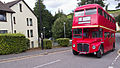
 Buckfastleigh - Western National 137 FJ8967.JPG 1.024 × 768; 517 KB
-
 Buckfastleigh fire station - geograph.org.uk - 255828.jpg 640 × 426; 177 KB
-
 Buckfastleigh Fire Station - geograph.org.uk - 67668.jpg 640 × 440; 266 KB
-
 Buckfastleigh from Church Steps - geograph.org.uk - 1124090.jpg 640 × 480; 83 KB
-
 Buckfastleigh Medical Centre - geograph.org.uk - 5688129.jpg 1.600 × 1.069; 233 KB
-
 Buckfastleigh Primary School - geograph.org.uk - 6299919.jpg 1.600 × 1.200; 815 KB
-
 Buckfastleigh Sewage Treatment Works - geograph.org.uk - 5111372.jpg 1.600 × 1.200; 606 KB
-
 Buckfastleigh sewage works - geograph.org.uk - 1994524.jpg 640 × 480; 410 KB
-
 Buckfastleigh Skatepark - geograph.org.uk - 6300005.jpg 1.600 × 1.200; 1.021 KB
-
 Buckfastleigh stream.JPG 1.440 × 2.160; 1,12 MB
-
 Buckfastleigh street.JPG 1.440 × 2.160; 716 KB
-
 Buckfastleigh, ^67 Fore Street - geograph.org.uk - 5613143.jpg 960 × 1.280; 435 KB
-
 BuckfastleighRoad.JPG 2.048 × 1.536; 1,82 MB
-
 Bus at Buckfastleigh - geograph.org.uk - 5111219.jpg 3.666 × 2.320; 2,24 MB
-
 Calcite Flows in Joint Mitnor Cave, Buckfastleigh - geograph.org.uk - 3536593.jpg 3.804 × 2.853; 2,3 MB
-
 Centre of Buckfastleigh - geograph.org.uk - 3941853.jpg 4.576 × 2.977; 2,89 MB
-
 Chapel Street, Buckfastleigh - geograph.org.uk - 3374832.jpg 483 × 640; 47 KB
-
 Chimney, Buckfastleigh - geograph.org.uk - 1359561.jpg 640 × 480; 123 KB
-
 Church Cross Road - geograph.org.uk - 4000690.jpg 1.600 × 1.063; 461 KB
-
 Church Steps, Buckfastleigh - geograph.org.uk - 1124085.jpg 480 × 640; 106 KB
-
 Church Street, Buckfastleigh - geograph.org.uk - 1124176.jpg 640 × 472; 85 KB
-
 Class 3 English Electric 6975 - geograph.org.uk - 5865532.jpg 1.024 × 768; 188 KB
-
 Close, Buckfastleigh - geograph.org.uk - 5222568.jpg 3.072 × 2.048; 1,29 MB
-
 Colston - geograph.org.uk - 1995875.jpg 640 × 480; 440 KB
-
 Colston from the A384 - geograph.org.uk - 14669.jpg 640 × 428; 114 KB
-
 Colston Road leaves Rill Wood - geograph.org.uk - 1995098.jpg 640 × 480; 595 KB
-

-

-
 Coprolites in the talus cone of Joint Mitnor Cave - geograph.org.uk - 3536578.jpg 3.401 × 2.551; 1,51 MB
-
 Cordyline australis - geograph.org.uk - 26974.jpg 484 × 640; 65 KB
-

-
 Cottages along Church Street - geograph.org.uk - 3941923.jpg 1.600 × 1.056; 307 KB
-
 Cottages along Plymouth Road - geograph.org.uk - 3941885.jpg 1.600 × 1.087; 325 KB
-
 Cottages along Station Road - geograph.org.uk - 3941859.jpg 4.886 × 3.005; 3,65 MB
-
 Courtyard off Fore Street, Buckfastleigh - geograph.org.uk - 4045283.jpg 1.600 × 1.186; 483 KB
-
 Crest Hill meets Market Street - geograph.org.uk - 3941903.jpg 4.759 × 3.033; 2,88 MB
-
 Crompton Diesel D6501 Sea King - geograph.org.uk - 5865523.jpg 1.024 × 768; 153 KB
-
 Crossing The Dart - geograph.org.uk - 5038320.jpg 640 × 475; 126 KB
-
 Crossroads, Buckfastleigh - geograph.org.uk - 4275153.jpg 800 × 532; 132 KB
-
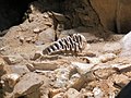
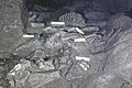
 Crushed bones in Joint Mitnor Cave, Higher Kiln Quarry - geograph.org.uk - 2841609.jpg 2.301 × 1.726; 1,29 MB
-
 Crushed Bones in Joint Mitnor Cave, Higher Kiln Quarry - geograph.org.uk - 2841616.jpg 2.416 × 1.812; 1,44 MB
-
 Cut Mark, Buckfastleigh, ^67 Fore Street - geograph.org.uk - 5613139.jpg 960 × 1.280; 384 KB
-
 Dart at Salmon leap 1.JPG 2.048 × 1.536; 1,41 MB
-
 Dart at Salmon leap 2.JPG 2.048 × 1.536; 1,42 MB
-
 Dartbridge Road (B3380) - geograph.org.uk - 3941966.jpg 1.600 × 1.005; 411 KB
-
 Detail of the drain on St Luke's church - geograph.org.uk - 2291871.jpg 600 × 800; 386 KB
-

-
 Drive to Rill Farm - geograph.org.uk - 1995110.jpg 640 × 480; 553 KB
-
 Driveway, Bigadon - geograph.org.uk - 4601395.jpg 1.920 × 2.560; 1,41 MB
-
 Duck and Cottages, Buckfastleigh - geograph.org.uk - 1123745.jpg 640 × 480; 92 KB
-

-
 Edge of a field of maize - geograph.org.uk - 1992656.jpg 640 × 480; 482 KB
-
 Elevated A38 by Whitecleaves Quarry - geograph.org.uk - 1993313.jpg 640 × 480; 443 KB
-
 Elliot Plain, Buckfastleigh - geograph.org.uk - 1123732.jpg 640 × 480; 70 KB
-
 Elliot Plain, Buckfastleigh - geograph.org.uk - 1937391.jpg 1.024 × 768; 115 KB
-
 Elliott Plain, Buckfastleigh - geograph.org.uk - 1994888.jpg 640 × 480; 347 KB
-

-
 Face Garden - geograph.org.uk - 3264802.jpg 600 × 800; 169 KB
-
 Farm Barn, later Museum, at Pengelly Cave Studies Centre - geograph.org.uk - 2841476.jpg 3.072 × 2.048; 1,81 MB
-
 Field by the River Dart - geograph.org.uk - 5246921.jpg 1.024 × 768; 172 KB
-
 Field with trees, near Austin's bridge - geograph.org.uk - 1936792.jpg 1.024 × 768; 185 KB
-
 Fields alongside the railway line - geograph.org.uk - 1936778.jpg 1.024 × 768; 178 KB
-
 Fields And Woods Near Buckfastleigh - geograph.org.uk - 5038326.jpg 640 × 443; 95 KB
-
 Fine town house - Station Road - geograph.org.uk - 3941857.jpg 4.880 × 3.094; 3,22 MB
-

-
 Footpath - geograph.org.uk - 4275128.jpg 800 × 532; 185 KB
-
 Footpath above Buckfastleigh - geograph.org.uk - 1124093.jpg 640 × 480; 93 KB
-
 Footpath from Bilberryhill to River Mardle - geograph.org.uk - 6387741.jpg 1.200 × 1.600; 1,06 MB
-
 Footpath from Church Hill to Buckfast - geograph.org.uk - 6387752.jpg 1.200 × 1.600; 1,11 MB
-
 Footpath near Bilberryhill - geograph.org.uk - 3374844.jpg 480 × 640; 108 KB
-
 Footpath to Bilberryhill - geograph.org.uk - 3817482.jpg 1.024 × 768; 480 KB
-
 Fore St Buckfastleigh - geograph.org.uk - 2881622.jpg 428 × 640; 52 KB
-
 Fore Street - Buckfastleigh - geograph.org.uk - 3941974.jpg 4.763 × 3.154; 2,9 MB
-
 Fore Street Buckfastleigh - geograph.org.uk - 942827.jpg 640 × 427; 95 KB
-
 Fore Street, Buckfastleigh (2) - geograph.org.uk - 1123705.jpg 463 × 640; 65 KB
-
 Fore Street, Buckfastleigh - geograph.org.uk - 1123671.jpg 549 × 640; 75 KB
-
 Fore Street, Buckfastleigh - geograph.org.uk - 2422827.jpg 1.024 × 683; 116 KB
-
 Fore Street, Buckfastleigh - geograph.org.uk - 3374819.jpg 640 × 487; 55 KB
-
 Fore Street, Buckfastleigh - geograph.org.uk - 5046948.jpg 1.600 × 1.200; 427 KB
-
 Fore Street, Buckfastleigh - geograph.org.uk - 5683930.jpg 1.024 × 777; 151 KB
-
 Fore Street, Buckfastleigh, Devon, Looking East - geograph.org.uk - 4045267.jpg 1.600 × 1.200; 424 KB
-
 Former mill on Mardle Way - geograph.org.uk - 3941950.jpg 1.600 × 984; 423 KB
-
 Garage on Dartbridge Road (B3380) - geograph.org.uk - 3941962.jpg 4.884 × 3.060; 3,56 MB


.jpg)


_-_geograph.org.uk_-_3941966.jpg)


_-_geograph.org.uk_-_1123705.jpg)


_-_geograph.org.uk_-_3941962.jpg)