Category:Buckland, Oxfordshire
Aller à la navigation
Aller à la recherche
localité britannique du comté anglais d'Oxfordshire .jpg) | |||||
| Téléverser des médias | |||||
| Nature de l’élément | |||||
|---|---|---|---|---|---|
| Lieu | Vale of White Horse, Oxfordshire, Angleterre du Sud-Est, Angleterre | ||||
| Superficie |
| ||||
| site officiel | |||||
 | |||||
English: Buckland is a village and civil parish in the Vale of White Horse district of the English county of Oxfordshire. In 1974 it was transferred from Berkshire.
Sous-catégories
Cette catégorie comprend 11 sous-catégories, dont les 11 ci-dessous.
B
- Buckland House, Oxfordshire (10 F)
C
- Carswell Manor (3 F)
G
- Gainfield (3 F)
- St George's church, Buckland (3 F)
H
L
- Lamb Inn, Buckland (3 F)
M
- St Mary's Church, Buckland (7 F)
T
- Tadpole Bridge (20 F)
- Tenfoot Bridge (5 F)
- The Trout, Buckland (9 F)
Média dans la catégorie « Buckland, Oxfordshire »
Cette catégorie comprend 261 fichiers, dont les 200 ci-dessous.
(page précédente) (page suivante)-
 1-4 Barcote Cottages, Buckland - geograph.org.uk - 6199272.jpg 4 000 × 3 000 ; 4,64 Mio
-
 5-8 Barcote Cottages, Buckland - geograph.org.uk - 6199268.jpg 4 000 × 3 000 ; 4,88 Mio
-
 A420 passing woods near Buckland - geograph.org.uk - 2745579.jpg 800 × 600 ; 340 kio
-

-
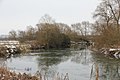
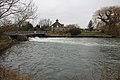 Across the weir pool - geograph.org.uk - 2279240.jpg 1 024 × 683 ; 211 kio
-
 An attractive corner of Buckland - geograph.org.uk - 2685150.jpg 640 × 427 ; 94 kio
-
 Another bend - geograph.org.uk - 2231089.jpg 1 024 × 683 ; 179 kio
-
 Approaching the turning to Buckland - geograph.org.uk - 1878165.jpg 640 × 480 ; 77 kio
-

-
 Armco by the fencing - geograph.org.uk - 2277688.jpg 1 024 × 683 ; 308 kio
-
 B4508 towards Pusey - geograph.org.uk - 6267833.jpg 640 × 480 ; 85 kio
-
 B4508 towards Pusey - geograph.org.uk - 6267836.jpg 800 × 600 ; 111 kio
-
 Barcote Barn, Barcote Lane - geograph.org.uk - 6199277.jpg 4 000 × 3 000 ; 4,82 Mio
-
 Barcote Barn, Barcote Lane - geograph.org.uk - 6200263.jpg 4 000 × 3 000 ; 4,47 Mio
-
 Barcote Cottages - geograph.org.uk - 6200260.jpg 4 000 × 3 000 ; 4,83 Mio
-
 Barcote Lane - geograph.org.uk - 3985017.jpg 640 × 428 ; 97 kio
-
 Barcote Lane - geograph.org.uk - 6201169.jpg 4 000 × 3 000 ; 4,91 Mio
-
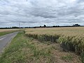
 Barley field, Buckland Marsh - geograph.org.uk - 2427212.jpg 1 024 × 680 ; 165 kio
-
 Barns at Rectory Farm - geograph.org.uk - 2115091.jpg 800 × 600 ; 99 kio
-
 Benchmark by the door - geograph.org.uk - 2279201.jpg 533 × 800 ; 152 kio
-
 Benchmark on bridge of St George's Road - geograph.org.uk - 2119539.jpg 800 × 600 ; 219 kio
-

-

-
 Benchmark on Dairy Cottages - geograph.org.uk - 2115073.jpg 600 × 800 ; 201 kio
-
 Benchmark on gatepost of Stud Cottage - geograph.org.uk - 2115129.jpg 768 × 1 024 ; 288 kio
-
 Benchmark on Pusey Furze Cottage - geograph.org.uk - 2113599.jpg 600 × 800 ; 219 kio
-
 Benchmark on St Mary's Church - geograph.org.uk - 2114947.jpg 600 × 800 ; 149 kio
-
 Benchmark on wall of Croft Lodge beside A420 - geograph.org.uk - 2119513.jpg 600 × 800 ; 161 kio
-
 Benchmark on ^8 Barcote Cottages - geograph.org.uk - 2119556.jpg 768 × 1 024 ; 327 kio
-
 Blue Tractor - geograph.org.uk - 2454517.jpg 3 816 × 2 232 ; 1,71 Mio
-
 Boat by a Willow - geograph.org.uk - 2236042.jpg 1 024 × 683 ; 185 kio
-
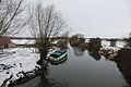
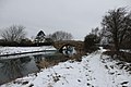
 Boats in the snow - geograph.org.uk - 2225787.jpg 1 024 × 683 ; 189 kio
-
 Boats moored near the weir at Rushey Lock - geograph.org.uk - 2202281.jpg 1 024 × 742 ; 364 kio
-
 Boats on the Thames - geograph.org.uk - 2236031.jpg 1 024 × 683 ; 129 kio
-
 Bridge in the distance - geograph.org.uk - 2232291.jpg 1 024 × 683 ; 179 kio
-
 Bridlepath to Buckland Marsh - geograph.org.uk - 6199412.jpg 4 000 × 3 000 ; 4,65 Mio
-
 Bridleway heading to Buckland - geograph.org.uk - 3269709.jpg 1 024 × 768 ; 204 kio
-
 Bridleway near the Thames - geograph.org.uk - 6196889.jpg 4 000 × 3 000 ; 5,03 Mio
-
 Bridleway to St Hugh's School - geograph.org.uk - 2400111.jpg 1 500 × 1 000 ; 191 kio
-
 Bridleway West of Carswell - geograph.org.uk - 2399994.jpg 3 552 × 2 232 ; 2,03 Mio
-
 Lamb Inn Buckland Oxfordshire.jpg 640 × 480 ; 124 kio
-
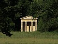 Buckland Aviary.jpg 949 × 712 ; 587 kio
-
 Buckland Fundamental Bench Mark - geograph.org.uk - 2119583.jpg 600 × 800 ; 211 kio
-
 Buckland Fundamental Bench mark - geograph.org.uk - 2277672.jpg 533 × 800 ; 144 kio
-
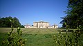 Buckland House - geograph.org.uk - 2404427.jpg 3 968 × 2 232 ; 1,82 Mio
-
 Buckland in late spring - geograph.org.uk - 873642.jpg 640 × 480 ; 88 kio
-
 Buckland manorial buildings - geograph.org.uk - 6196874.jpg 4 000 × 3 000 ; 4,8 Mio
-
 Buckland on the hill - geograph.org.uk - 2233397.jpg 1 024 × 683 ; 176 kio
-
 Buckland Road approaches junction with Summerside Road - geograph.org.uk - 3043664.jpg 3 516 × 2 551 ; 1,8 Mio
-
 Buckland Road approaches Tadpole Bridge and passes The Trout - geograph.org.uk - 3043728.jpg 3 574 × 2 433 ; 1,16 Mio
-
 Buckland Road beside the Arch Plantation - geograph.org.uk - 3043704.jpg 3 438 × 2 525 ; 1,76 Mio
-
 Buckland Road enters Buckland Marsh - geograph.org.uk - 3043713.jpg 3 431 × 2 446 ; 1,34 Mio
-
 Buckland Road north of the B4508 junction - geograph.org.uk - 3043614.jpg 640 × 467 ; 55 kio
-
 Buckland Road northeast of Gainfield Farm - geograph.org.uk - 3043600.jpg 3 495 × 2 591 ; 1,23 Mio
-
 Buckland Road west of Mount Pleasant Farm - geograph.org.uk - 3043654.jpg 3 460 × 2 399 ; 1,04 Mio
-
 Buckland Telephone Exchange, Oxon - geograph.org.uk - 5533093.jpg 2 592 × 1 944 ; 1,36 Mio
-

-

-
 Carswell Marsh - geograph.org.uk - 3269728.jpg 1 024 × 768 ; 244 kio
-
 Carswell Marsh Farm - geograph.org.uk - 6199388.jpg 4 000 × 3 000 ; 4,78 Mio
-
 Chimney Meadows - geograph.org.uk - 2228478.jpg 1 024 × 683 ; 188 kio
-
 Church of St Mary, Buckland, Oxfordshire - geograph.org.uk - 4514677.jpg 1 024 × 663 ; 197 kio
-
 Corrugated sides - geograph.org.uk - 2282624.jpg 1 024 × 683 ; 156 kio
-
 Cottages at the junction of Buckland Road and St Georges Road - geograph.org.uk - 3043686.jpg 3 600 × 2 590 ; 1,3 Mio
-
 Cross roads on the A420 - geograph.org.uk - 2113709.jpg 800 × 600 ; 105 kio
-
 Crossroads on the B4508, Gainfield - geograph.org.uk - 6269039.jpg 5 184 × 3 888 ; 5,18 Mio
-
 Disappears past the pillbox - geograph.org.uk - 2281605.jpg 1 024 × 683 ; 89 kio
-
 Down the other side - geograph.org.uk - 2233361.jpg 533 × 800 ; 194 kio
-

-
 Elizabeth II postbox on the B4508, Gainfield - geograph.org.uk - 6269035.jpg 2 685 × 4 128 ; 3,66 Mio
-
 Entrance to Croft Lodge off A420 - geograph.org.uk - 2119605.jpg 800 × 600 ; 131 kio
-
 Farmland near Ragnell Copse - geograph.org.uk - 6199297.jpg 4 000 × 3 000 ; 4,76 Mio
-
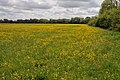
 Farmland, Buckland - geograph.org.uk - 2678354.jpg 640 × 480 ; 170 kio
-
 Farmland, Buckland - geograph.org.uk - 2678416.jpg 640 × 480 ; 151 kio
-
 Farmland, Buckland - geograph.org.uk - 2816199.jpg 640 × 480 ; 185 kio
-
 Farmland, Buckland - geograph.org.uk - 2816213.jpg 640 × 480 ; 140 kio
-
 Farmland, Buckland - geograph.org.uk - 2816311.jpg 640 × 480 ; 145 kio
-
 Farmland, Buckland - geograph.org.uk - 2816317.jpg 640 × 480 ; 115 kio
-
 Farmland, Buckland - geograph.org.uk - 6185701.jpg 1 024 × 683 ; 243 kio
-
 Farmland, Buckland - geograph.org.uk - 6185702.jpg 1 024 × 683 ; 228 kio
-
 Farmland, Buckland - geograph.org.uk - 6185703.jpg 1 024 × 683 ; 267 kio
-
 Farmland, Buckland - geograph.org.uk - 6185705.jpg 1 024 × 683 ; 188 kio
-
 Farmland, Buckland - geograph.org.uk - 6190581.jpg 1 024 × 683 ; 195 kio
-
 Farmland, Buckland - geograph.org.uk - 6190588.jpg 1 024 × 683 ; 157 kio
-
 Farmland, Buckland - geograph.org.uk - 6190594.jpg 1 024 × 683 ; 159 kio
-
 Farmland, Buckland - geograph.org.uk - 6190603.jpg 1 024 × 675 ; 173 kio
-
 Farmland, Duxford - geograph.org.uk - 387330.jpg 640 × 480 ; 145 kio
-
 Fenced off by the road - geograph.org.uk - 2277667.jpg 533 × 800 ; 180 kio
-
 Field and pylons near Buckland - geograph.org.uk - 3647679.jpg 640 × 332 ; 34 kio
-
 Field of rape by Buckland - geograph.org.uk - 2400092.jpg 1 500 × 1 000 ; 211 kio
-
 Field of rape by the bridleway - geograph.org.uk - 2400107.jpg 1 500 × 1 000 ; 271 kio
-
 Field of rape near Buckland - geograph.org.uk - 2400102.jpg 1 500 × 1 000 ; 266 kio
-
 Fill point at the moorings - geograph.org.uk - 2279249.jpg 1 024 × 683 ; 200 kio
-
 Filling station and cafe by A420 - geograph.org.uk - 2745588.jpg 800 × 600 ; 361 kio
-
 Filling station on the A420 - geograph.org.uk - 3813430.jpg 640 × 480 ; 147 kio
-
 First one in sight - geograph.org.uk - 2227639.jpg 1 024 × 683 ; 279 kio
-
 Fisherman on Tenfoot Bridge - geograph.org.uk - 6195313.jpg 4 000 × 3 000 ; 4,62 Mio
-
 Fishing round the bend - geograph.org.uk - 2227529.jpg 1 024 × 683 ; 228 kio
-
 Flooding at Rushey Lock (1), River Thames - geograph.org.uk - 2202294.jpg 1 024 × 756 ; 273 kio
-
 Flooding at Rushey Lock (2), River Thames - geograph.org.uk - 2202306.jpg 1 024 × 753 ; 273 kio
-
 Fly tipping, Buckland Road - geograph.org.uk - 3985166.jpg 640 × 480 ; 117 kio
-
 Footbridge over Rushey Weir - geograph.org.uk - 2427467.jpg 1 024 × 680 ; 238 kio
-

-

-
 Footpath from the bridge - geograph.org.uk - 2233390.jpg 533 × 800 ; 146 kio
-
 Footpath Over Carswell Golf Course - geograph.org.uk - 2472584.jpg 1 600 × 900 ; 484 kio
-
 Footpath to Carswell - geograph.org.uk - 5074635.jpg 2 592 × 1 944 ; 2,05 Mio
-
 Frog from the side - geograph.org.uk - 2279195.jpg 1 024 × 683 ; 239 kio
-
 Fundamental Benchmark - geograph.org.uk - 2277677.jpg 533 × 800 ; 114 kio
-
 Gate from the road - geograph.org.uk - 2239788.jpg 1 024 × 683 ; 241 kio
-
 Gate in the path - geograph.org.uk - 2281569.jpg 1 024 × 683 ; 185 kio
-
 Gates and lodge, Barcote Park - geograph.org.uk - 3985050.jpg 640 × 428 ; 119 kio
-
 Grasses by the bank - geograph.org.uk - 2281586.jpg 1 024 × 683 ; 97 kio
-
 Hall's Barn - geograph.org.uk - 309784.jpg 640 × 480 ; 85 kio
-
 Heading for the A420 - geograph.org.uk - 1004812.jpg 640 × 427 ; 59 kio
-
 High water at Tadpole Bridge, near Bampton, Oxon - geograph.org.uk - 5889239.jpg 1 024 × 681 ; 236 kio
-
 Horseshoe Bend - geograph.org.uk - 2282644.jpg 2 093 × 755 ; 308 kio
-
 Ice by the bridge - geograph.org.uk - 2225782.jpg 1 024 × 683 ; 181 kio
-
 Ice flow by the bridge - geograph.org.uk - 2236047.jpg 1 024 × 683 ; 124 kio
-
 Ice on the river - geograph.org.uk - 2227640.jpg 1 024 × 683 ; 175 kio
-

-
 Landscape surrounding Mount Pleasant Farm, near Stanford in the Vale - geograph.org.uk - 3451926.jpg 4 288 × 2 848 ; 4,31 Mio
-
 Looking at the bend - geograph.org.uk - 2231079.jpg 1 024 × 683 ; 236 kio
-
 Looking at the front - geograph.org.uk - 2231072.jpg 1 024 × 683 ; 293 kio
-
 Looking downstream - geograph.org.uk - 2232310.jpg 1 024 × 683 ; 143 kio
-
 Looking north towards Buckland Marsh - geograph.org.uk - 2121594.jpg 800 × 600 ; 133 kio
-
 Looking over a field to Ayre's Common Plantation - geograph.org.uk - 2568108.jpg 1 500 × 1 000 ; 130 kio
-
 Meadowland to the east of Radcot - geograph.org.uk - 2427422.jpg 1 024 × 680 ; 280 kio
-
 Meandering Thames - geograph.org.uk - 2427424.jpg 1 024 × 680 ; 177 kio
-
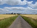
 Minor road towards Buckland - geograph.org.uk - 6267835.jpg 800 × 600 ; 122 kio
-
 Minor road, Gainfield - geograph.org.uk - 6268533.jpg 800 × 600 ; 102 kio
-
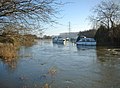 Moored boats on a flooded River Thames - geograph.org.uk - 2201283.jpg 1 024 × 753 ; 326 kio
-
 More bends - geograph.org.uk - 2281610.jpg 1 024 × 683 ; 113 kio
-
 More ice on the bend - geograph.org.uk - 2227587.jpg 1 024 × 683 ; 237 kio
-
 Neglected footpath, Buckland Marsh Farm - geograph.org.uk - 6199400.jpg 4 000 × 3 000 ; 5,31 Mio
-
 Oilseed rape crop, Gainfield - geograph.org.uk - 6267839.jpg 800 × 600 ; 102 kio
-
 Old Milestone north of Buckland (geograph 5622213).jpg 1 040 × 1 618 ; 297 kio
-
 On the other bank - geograph.org.uk - 2282602.jpg 1 024 × 683 ; 74 kio
-
 Open entrance - geograph.org.uk - 2281598.jpg 1 024 × 683 ; 214 kio
-
 Orchard House, Buckland, Oxfordshire - geograph.org.uk - 4522556.jpg 617 × 640 ; 155 kio
-
 Path by the bends - geograph.org.uk - 2231091.jpg 1 024 × 683 ; 274 kio
-
 Path heading to Rushey Lock - geograph.org.uk - 3269733.jpg 1 024 × 768 ; 253 kio
-
 Path near Rectory Farm - geograph.org.uk - 6196879.jpg 4 000 × 3 000 ; 4,63 Mio
-
 Path to Marriage Hill - geograph.org.uk - 3269726.jpg 1 024 × 768 ; 210 kio
-
 Path towards Ragnell Cottages - geograph.org.uk - 3269738.jpg 1 024 × 768 ; 180 kio
-
 Path under the branch - geograph.org.uk - 2233383.jpg 1 024 × 683 ; 329 kio
-
 Peeking through the ... - geograph.org.uk - 2281616.jpg 1 024 × 683 ; 211 kio
-
 Pile of Posts - geograph.org.uk - 2408350.jpg 3 968 × 2 232 ; 2,05 Mio
-

-
 Pillbox by the Thames - geograph.org.uk - 911434.jpg 640 × 426 ; 66 kio
-
 Pillbox in the field - geograph.org.uk - 2282607.jpg 1 024 × 683 ; 158 kio
-
 Pillbox on the bend - geograph.org.uk - 2281582.jpg 1 024 × 683 ; 238 kio
-
 Pine Avenue near Buckland - geograph.org.uk - 2527231.jpg 3 620 × 2 232 ; 1,71 Mio
-
 Plant in front - geograph.org.uk - 2279205.jpg 533 × 800 ; 132 kio
-
 Ploughed field near Mount Pleasant Farm - geograph.org.uk - 2568111.jpg 1 500 × 1 000 ; 178 kio
-
 Public bridleway to Buckland Warren - geograph.org.uk - 6203153.jpg 4 000 × 3 000 ; 4,66 Mio
-
 Public footpath to Buckland - geograph.org.uk - 6196856.jpg 4 000 × 3 000 ; 4,71 Mio
-
 Public footpath to Buckland Marsh Farm - geograph.org.uk - 6199422.jpg 4 000 × 3 000 ; 4,76 Mio
-
 Public footpath to Gimbro Copse - geograph.org.uk - 6202235.jpg 4 000 × 3 000 ; 4,47 Mio
-

-
 Quadtrac farm tractor - geograph.org.uk - 2052407.jpg 2 304 × 1 704 ; 1,4 Mio
-
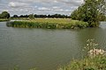
 River Thames - geograph.org.uk - 3269784.jpg 1 024 × 768 ; 134 kio
-
 River Thames - geograph.org.uk - 3269797.jpg 1 024 × 768 ; 257 kio
-
 River Thames - geograph.org.uk - 3269802.jpg 1 024 × 768 ; 267 kio
-
 River Thames - geograph.org.uk - 3269809.jpg 1 024 × 768 ; 204 kio
-
 River Thames - geograph.org.uk - 3269823.jpg 1 024 × 768 ; 169 kio
-
 River Thames - geograph.org.uk - 911482.jpg 640 × 426 ; 63 kio
-
 River Thames - geograph.org.uk - 911492.jpg 640 × 422 ; 68 kio
-
 River Thames - geograph.org.uk - 911522.jpg 640 × 417 ; 62 kio
-
 River Thames between Tadpole Bridge ^ Rushey Lock, Oxon - geograph.org.uk - 4523712.jpg 1 024 × 749 ; 216 kio
-
 River Thames near Buckand - geograph.org.uk - 3647645.jpg 640 × 417 ; 76 kio
-
 River Thames near Buckland - geograph.org.uk - 3641872.jpg 640 × 495 ; 104 kio
-
 River Thames near Buckland - geograph.org.uk - 3641902.jpg 640 × 399 ; 56 kio
-
 River Thames near Buckland - geograph.org.uk - 3641913.jpg 587 × 640 ; 84 kio
-
 River Thames near Buckland - geograph.org.uk - 3641951.jpg 640 × 430 ; 74 kio
-
 River Thames near Buckland - geograph.org.uk - 3641954.jpg 640 × 431 ; 97 kio
-
 River Thames near Buckland - geograph.org.uk - 3641960.jpg 640 × 433 ; 65 kio
-
 River Thames near Buckland - geograph.org.uk - 3647630.jpg 640 × 385 ; 61 kio
-
 River Thames near Rushey Lock - geograph.org.uk - 2427465.jpg 1 024 × 680 ; 179 kio
-
 River Thames near Rushey Weir - geograph.org.uk - 2427469.jpg 1 024 × 680 ; 171 kio
-
 River Thames nr Buckland - geograph.org.uk - 3623708.jpg 640 × 438 ; 79 kio
-
 River Thames nr Tadpole Bridge - geograph.org.uk - 706284.jpg 640 × 480 ; 132 kio
-
 Rivet on top - geograph.org.uk - 2237252.jpg 1 024 × 683 ; 241 kio
-
 Road from Bampton near junction with St George's Road - geograph.org.uk - 6199433.jpg 4 000 × 3 000 ; 5,23 Mio
-
 Road to Buckland - geograph.org.uk - 2236061.jpg 1 024 × 683 ; 114 kio
-
 Road to Halls Barn - geograph.org.uk - 2538239.jpg 3 568 × 2 232 ; 1,28 Mio
-
 Road to the Bridge - geograph.org.uk - 2236072.jpg 1 024 × 683 ; 149 kio
-
 Rushey Lock from the Thames Path National Trail - geograph.org.uk - 5887772.jpg 4 608 × 3 456 ; 5,29 Mio
-
 Rushey Weir, River Thames - geograph.org.uk - 6199406.jpg 4 000 × 3 000 ; 5,01 Mio
-
 Rushy Weir - geograph.org.uk - 2427208.jpg 1 024 × 680 ; 228 kio
-
 Sign on the road - geograph.org.uk - 2277659.jpg 1 024 × 683 ; 197 kio
-
 Small Gains Wood by A420 - geograph.org.uk - 5527564.jpg 1 600 × 1 068 ; 693 kio
-
 Snow on the bridge - geograph.org.uk - 2232301.jpg 533 × 800 ; 129 kio
-
 St George's Road - geograph.org.uk - 3269718.jpg 1 024 × 768 ; 207 kio
-
 St Georges Road junction with Buckland Road - geograph.org.uk - 3043701.jpg 3 471 × 2 280 ; 1,82 Mio
-
 St Georges St Buckland - geograph.org.uk - 5313507.jpg 640 × 427 ; 70 kio
-
 St. George's Road, Buckland - geograph.org.uk - 2685177.jpg 640 × 427 ; 85 kio
-
 Stile by the gate - geograph.org.uk - 2225804.jpg 1 024 × 683 ; 239 kio
-
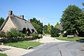
 Street, Buckland - geograph.org.uk - 3985131.jpg 640 × 480 ; 96 kio
-
 Summerside Road, Buckland - geograph.org.uk - 2685191.jpg 640 × 427 ; 83 kio


,_River_Thames_-_geograph.org.uk_-_2202294.jpg)
,_River_Thames_-_geograph.org.uk_-_2202306.jpg)


.jpg)


