Category:Buildings in Bradford
Zur Navigation springen
Zur Suche springen
Wikimedia-Kategorie | |||||
| Medium hochladen | |||||
| Ist ein(e) | |||||
|---|---|---|---|---|---|
| Kategorie kombiniert die Themen |
| ||||
| |||||
Unterkategorien
Es werden 64 von insgesamt 64 Unterkategorien in dieser Kategorie angezeigt:
In Klammern die Anzahl der enthaltenen Kategorien (K), Seiten (S), Dateien (D)
- Gymnasiums in Bradford (1 D)
- Industry buildings in Bradford (25 D)
*
A
- Aldersley Farm (2 D)
- Atrium, University of Bradford (15 D)
B
- Bandstand, Lister Park, Bradford (11 D)
C
- Car washes in Bradford (6 D)
- Connaught Rooms, Bradford (4 D)
F
H
- High Point, Bradford (15 D)
K
L
M
N
- Nursing homes in Bradford (3 D)
O
P
- Paper Hall, Bradford (6 D)
Q
- Queen's Hall, Bradford (1 D)
R
- Royal Chambers, Bradford (1 D)
- Royds Hall, Bradford (9 D)
S
T
- The 1 in 12 Club (2 D)
- The Gatehaus, Bradford (4 D)
- Tong Hall, Tong, Bradford (4 D)
- Trades Hall, Bradford (4 D)
U
- Upper Headley Hall (2 D)
W
Medien in der Kategorie „Buildings in Bradford“
Folgende 187 Dateien sind in dieser Kategorie, von 187 insgesamt.
-
 1 Corinthians 13 (16202616910).jpg 3.267 × 1.800; 3,06 MB
-
 13.4.16 2 Bradford 07 (25814082653).jpg 6.016 × 4.000; 5,3 MB
-

-
 Ambrozja (8759819710).jpg 2.245 × 3.246; 3,58 MB
-
 Arkwright Hall - Thornton Road - geograph.org.uk - 406059.jpg 640 × 514; 69 KB
-

-

-
 Belvedere, Urban Garden, Bradford (5230153628).jpg 1.875 × 2.136; 2,9 MB
-
 Betty's Lodge, St. Ives Estate - geograph.org.uk - 375200.jpg 640 × 480; 149 KB
-
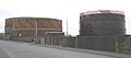 Birks Hall Gas Works - geograph.org.uk - 362496.jpg 639 × 283; 20 KB
-
 Bolton House, Bradford - geograph.org.uk - 4667294.jpg 640 × 480; 230 KB
-
 Bradford (10931126264).jpg 1.979 × 1.979; 2,61 MB
-

-
 Bradford City Morgue (former) (4733023487).jpg 2.052 × 1.584; 3,27 MB
-
 Bradford Collage Proposal 1.jpg 3.264 × 3.264; 10,77 MB
-
 Bradford Collage Proposal 2.jpg 3.264 × 3.264; 10,8 MB
-
 Bradford montage 2022.jpg 3.507 × 4.961; 2,57 MB
-

-
 Bradford Properties - Leeds Road - geograph.org.uk - 1542790.jpg 502 × 640; 80 KB
-
 Broom Street - Wakefield Road - geograph.org.uk - 1800777.jpg 640 × 480; 49 KB
-
 Burger King on Broadway, Bradford.jpg 3.648 × 2.736; 1,76 MB
-
 Canal Road, Bradford (6522176197).jpg 2.387 × 2.953; 3,98 MB
-
 Channing way Bradford.jpg 3.264 × 2.448; 1,67 MB
-
 Church House (4348180981).jpg 4.042 × 2.682; 7,17 MB
-
 City House - Cheapside - geograph.org.uk - 620024.jpg 391 × 640; 23 KB
-
 Dale Street 1 (2294058855).jpg 2.560 × 1.920; 3,01 MB
-
 Dale Street 2 (2294055161).jpg 1.920 × 2.560; 2,96 MB
-
 Dale Street, Bradford (2293830351).jpg 1.212 × 1.820; 477 KB
-
 Derby Place - Leeds Road - geograph.org.uk - 397308.jpg 638 × 315; 39 KB
-
-
 Fire damage at Vincent Street - geograph.org.uk - 401257.jpg 640 × 429; 257 KB
-
 Fire escape (2109458340).jpg 1.551 × 2.242; 1,79 MB
-
 Fire escape (2294047099).jpg 1.920 × 2.560; 1,23 MB
-

-

-
-

-

-

-
 Glyde House, Little Horton Lane, Bradford (14436514917).jpg 3.066 × 1.988; 4,21 MB
-
 Habib's Restaurant, formerly Ye Barrack Tavern, Bradford Moor.jpg 2.136 × 1.654; 862 KB
-

-
-
 House next to St Paul's Church - Kirkgate - geograph.org.uk - 435372.jpg 640 × 489; 103 KB
-
 Hustlergate (13434767693).jpg 2.430 × 2.635; 2,74 MB
-
 I remember when it was all banks round here ... (9255361625).jpg 2.106 × 1.404; 2,05 MB
-
 Impressive building on Usher Street - geograph.org.uk - 3581754.jpg 1.924 × 1.337; 656 KB
-
 Institution for the Blind (6220624839).jpg 2.614 × 4.000; 7,44 MB
-
 IT Learning Centre - Sunbridge Road - geograph.org.uk - 1802967.jpg 640 × 426; 71 KB
-
 It's (Still) a Mean Old Scene.jpg 2.535 × 2.537; 4,47 MB
-
 Ivegate (13154872773).jpg 2.676 × 3.350; 4,34 MB
-
 Ivegate, Bradford (5456527185).jpg 1.685 × 3.710; 3,44 MB
-
 J B Priestley - geograph.org.uk - 932031.jpg 640 × 425; 52 KB
-
 J Cawthra and Co Ltd, Entrance - geograph.org.uk - 1433980.jpg 640 × 480; 70 KB
-
 Jacob's Well, Bradford (7623133326).jpg 2.615 × 3.661; 4,91 MB
-
 JCT 600 - Sticker Lane - geograph.org.uk - 1708147.jpg 640 × 391; 46 KB
-
 JR is back (8027400803).jpg 1.795 × 2.513; 2,96 MB
-
 Kinder Haven Nursery - Sticker Lane - geograph.org.uk - 1708383.jpg 640 × 480; 70 KB
-
 Kirkgate (11358841695).jpg 2.323 × 2.229; 4,18 MB
-
 Kirkgate (13472666175).jpg 1.845 × 3.075; 3,66 MB
-
 Kirkgate Community Centre - Kirkgate - geograph.org.uk - 435388.jpg 640 × 444; 67 KB
-
 La Plata House (2249317348).jpg 2.423 × 1.874; 3,25 MB
-
 Leeds Road Baths (former) (23034121969).jpg 3.576 × 2.371; 5,65 MB
-
 Lower Ash Grove, Bradford (8097724114).jpg 2.354 × 2.295; 3,98 MB
-
 Manor Row (12862489613).jpg 1.469 × 2.057; 2,98 MB
-
 Manor Row (12862849694).jpg 2.061 × 1.625; 2,68 MB
-
 Manor Row, Bradford (5456535447).jpg 1.943 × 3.367; 3,47 MB
-
 Manor Row, Bradford (5947085006).jpg 2.451 × 3.379; 5,89 MB
-
 Melbourne Almshouses (2262675899).jpg 1.720 × 1.892; 2,52 MB
-
 Melbourne Terrace, Bradford (7992817653).jpg 2.847 × 2.540; 6,63 MB
-
 Middle Street, Bradford (17248624715).jpg 3.452 × 2.521; 7,08 MB
-

-
 Milligan and Forbes Warehouse.JPG 2.592 × 1.944; 1,31 MB
-
 Moorside Mills (22551650895).jpg 1.974 × 3.202; 4,53 MB
-
 Morrisons HQ, Bradford - geograph.org.uk - 372718.jpg 640 × 463; 170 KB
-
 Mr Brown, meet Mr Muff (6941136023).jpg 1.462 × 1.369; 1,12 MB
-
 Nab End (1950568205).jpg 3.027 × 2.482; 3,05 MB
-
 Napoleon's Casino - Bolton Road - geograph.org.uk - 597098.jpg 640 × 480; 24 KB
-
 New Augustus Street, Bradford (2) - geograph.org.uk - 1514952.jpg 640 × 480; 69 KB
-
 New Market Place, Bradford - geograph.org.uk - 835048.jpg 472 × 640; 73 KB
-
 Newcastle House, Barkerend Road BD1 - geograph.org.uk - 1484506.jpg 640 × 480; 70 KB
-
 Number One, The Interchange (2035453626).jpg 1.223 × 1.111; 415 KB
-
 Nur Solicitors - Leeds Road - geograph.org.uk - 1542932.jpg 325 × 640; 48 KB
-
 Oastler.jpg 500 × 333; 31 KB
-
 Odeon and Town Hall (5499885835).jpg 4.080 × 2.310; 5,28 MB
-
 Odeon dome and town hall steeple (2104096206).jpg 2.390 × 1.708; 3,4 MB
-
 Odeon Scaffolding (7448849750).jpg 4.004 × 2.669; 7,07 MB
-

-

-
 Pearl Assurance House, Bradford (4130524375).jpg 2.778 × 4.011; 8,4 MB
-
 Piccadeli (14285027546).jpg 2.320 × 2.320; 3,76 MB
-
 Piccadilly 1833 (2329626376).jpg 2.460 × 1.473; 832 KB
-
 Police Office (former), Wakefield Road, Bowling, Bradford (16548619630).jpg 2.419 × 3.346; 5,72 MB
-
 Portland House - Sticker Lane - geograph.org.uk - 632371.jpg 640 × 442; 35 KB
-
 Primrose Hill - Great Horton Road - geograph.org.uk - 1084157.jpg 480 × 640; 214 KB
-
 Quebec Street 2 (2228453645).jpg 1.920 × 2.560; 2,86 MB
-
 Quebec Street 4 (2229254442).jpg 659 × 988; 1,02 MB
-
 Quebec Street, Bradford 3 (2228459399).jpg 1.920 × 2.560; 3,15 MB
-
 Queen Anne Chambers (4080668351).jpg 2.688 × 3.829; 6,78 MB
-
 Rawson Place, Bradford (2246347747).jpg 1.920 × 1.920; 2,92 MB
-
 Rawson Place, Bradford (5456529949).jpg 2.117 × 3.373; 3,93 MB
-
 Rawson Quarter facade-Bradford-1200.jpg 1.200 × 900; 228 KB
-
 Reevy Road, Bradford - geograph.org.uk - 350976.jpg 434 × 640; 96 KB
-
 Revolution - Morley Street - geograph.org.uk - 735048.jpg 640 × 521; 70 KB
-
 Richard Dunn Sports Centre.jpg 2.000 × 1.336; 2,03 MB
-
 Riddella Fashions - East Parade - geograph.org.uk - 564276.jpg 640 × 472; 50 KB
-
 Royal Mail - Lower Kirkgate - geograph.org.uk - 475085.jpg 640 × 380; 50 KB
-
 Salem Street, Bradford (12861835023).jpg 1.682 × 2.001; 3,23 MB
-
 Sancorp House - Leeds Road - geograph.org.uk - 536252.jpg 640 × 424; 42 KB
-
 Schillerverein-Unity Hall-Masonic Hall, Rawson Square, Bradford (6917637973).jpg 1.913 × 2.856; 3,72 MB
-
 Scoresby Street, Little Germany (8148286327).jpg 2.588 × 2.401; 3,09 MB
-
 Shed (2295969609).jpg 2.560 × 1.920; 3,75 MB
-
 Shipley Glen Tramway tramshed.jpg 2.506 × 1.671; 4,26 MB
-
 Should I stay or should I go? (6928938739).jpg 1.173 × 1.835; 1,96 MB
-

-
 Spicy Corner (12915057194).jpg 2.919 × 2.919; 4,59 MB
-
 Spicy Corner (5598061129).jpg 1.684 × 2.125; 2,74 MB
-
 Spire and spirelets (13317187884).jpg 2.605 × 3.927; 5,76 MB
-
 St Catherine's Home, St Mary's Road, Bradford (16210672068).jpg 2.206 × 2.139; 3,17 MB
-

-

-
 St. Enoch's Road - geograph.org.uk - 391856.jpg 640 × 429; 217 KB
-
 Stairs 2 (2294841500).jpg 1.920 × 2.560; 3,33 MB
-
 Standard Buildings (2248525561).jpg 1.786 × 2.555; 3,1 MB
-
 Sunbridge Road (16830767426).jpg 3.256 × 4.096; 8 MB
-
 Sunbridge Road (22231641489).jpg 1.628 × 2.442; 3,27 MB
-
 Sunbridge Road (9077768549).jpg 3.451 × 2.301; 4,58 MB
-
 Sunbridge Road, Bradford (16659746988).jpg 2.622 × 2.977; 5,1 MB
-
 Sunbridge Road, Bradford (16846181132).jpg 2.012 × 3.353; 4,91 MB
-
 Telegraph & Argus Building, Hall Ings, Bradford (23271446709).jpg 2.627 × 3.037; 4,23 MB
-
 Telewest NOC, Broad Lane - geograph.org.uk - 34732.jpg 640 × 480; 109 KB
-

-
 That beautiful 60s architecture (1799226543).jpg 1.312 × 903; 408 KB
-
 The Beauties of Bradford 1 (7852142958).jpg 2.985 × 3.989; 7,53 MB
-
 The Connaught Rooms - Manningham Lane - geograph.org.uk - 388641.jpg 637 × 621; 81 KB
-
 The Crop Shop - Otley Road - geograph.org.uk - 1599055.jpg 590 × 640; 128 KB
-
 The Former YEB Depot, Parry Lane, Bradford - geograph.org.uk - 1728954.jpg 2.048 × 1.536; 631 KB
-
 The In Plaice (11123901644).jpg 1.664 × 2.394; 3,18 MB
-

-
 The Prospect, Bolton Road, Bradford (7011844663).jpg 2.439 × 2.507; 3,19 MB
-
 Thomas Cook, Bradford.jpg 3.648 × 2.736; 2,11 MB
-
 Thomas Cooke-Bradford-1200.jpg 1.200 × 864; 187 KB
-
 Thorpe Buildings (2828183343).jpg 2.262 × 1.851; 3,78 MB
-
 Tong Hall Lodge - geograph.org.uk - 352198.jpg 637 × 446; 84 KB
-
 Tordoff's Buildings (4131288576).jpg 3.776 × 2.829; 7,44 MB
-
 Tordoff's Buildings - Sunbridge Road - geograph.org.uk - 392523.jpg 635 × 502; 75 KB
-
 Tower (2254672093).jpg 1.920 × 2.560; 3,55 MB
-
 Tyersal Private Hire - Sticker Lane - geograph.org.uk - 1708126.jpg 466 × 640; 77 KB
-
-
 Upper Millergate (10464806014).jpg 1.931 × 2.896; 2,82 MB
-
 Upper Millergate (8145684195).jpg 1.791 × 2.394; 2,38 MB
-
 Upper Millergate - Sunbridge Road (10875094636).jpg 2.170 × 2.505; 2,96 MB
-
 Urban Nature (8795607549).jpg 2.564 × 2.982; 4,9 MB
-
 Warehouse (4348927162).jpg 4.224 × 3.168; 11,51 MB
-
 We buy... we sell (8169899349).jpg 1.281 × 2.788; 1,75 MB
-
 Weather vane on Midland Mills, Valley Road, Bradford.jpg 2.275 × 3.413; 3,91 MB
-
 Wesley House Day Nursery - Cross Road - geograph.org.uk - 612235.jpg 640 × 437; 30 KB
-
 West Bowling Social Club - Birch Lane - geograph.org.uk - 638078.jpg 640 × 480; 45 KB
-
 Westgate (22405235962).jpg 1.389 × 2.084; 2,34 MB
-
 Wheelden print - Wakefield Road - geograph.org.uk - 1800633.jpg 640 × 387; 59 KB
-
 Wilton Street, Bradford (4733020717).jpg 1.519 × 1.519; 2,52 MB
-
 Window (9911834586).jpg 2.389 × 3.062; 7,23 MB
-
 Women Zone - Hubert Street - geograph.org.uk - 509697.jpg 640 × 400; 34 KB
-
 Women's Bath (7461948334).jpg 2.212 × 1.342; 2,1 MB
-
 Working Late (8185927726).jpg 2.447 × 2.447; 4,04 MB
-
 Yorkshire BS Headquarters - geograph.org.uk - 1434137.jpg 640 × 480; 70 KB
-
-

-

-
 Building, Briggate, Shipley - geograph.org.uk - 556587.jpg 640 × 443; 74 KB
-
 Chester Street - geograph.org.uk - 735043.jpg 640 × 456; 61 KB
-
 Cliffe Castle - Lodge - geograph.org.uk - 478070.jpg 640 × 462; 47 KB
-
 Disused Lodge - Bowling Cemetery - geograph.org.uk - 441094.jpg 640 × 482; 84 KB
-
 Faweather Grange - geograph.org.uk - 410480.jpg 640 × 480; 56 KB
-
 Faweather Grange from Sconce Lane - geograph.org.uk - 410477.jpg 640 × 480; 49 KB
-
 Haincliffe Lodge - Hainworth Wood Road - geograph.org.uk - 1349848.jpg 640 × 480; 310 KB
-
 Hall Ings, Bradford - geograph.org.uk - 1436245.jpg 640 × 480; 72 KB
-

-

-
 Keeper's Lodge - geograph.org.uk - 367936.jpg 640 × 480; 95 KB
-
 Lodge at Bingley Cemetery - geograph.org.uk - 427991.jpg 640 × 476; 99 KB
-

-
 Lodge at Tong Cemetery - geograph.org.uk - 492311.jpg 640 × 571; 72 KB
-

-

-

-
 St. Enoch's Road - geograph.org.uk - 391849.jpg 640 × 429; 225 KB
.jpg)
.jpg)

.jpg)


.jpg)


.jpg)

_(4733023487).jpg)


.jpg)

.jpg)

.jpg)
.jpg)
.jpg)


.jpg)
.jpg)


.jpg)


.jpg)
.jpg)

.jpg)

_a_Mean_Old_Scene.jpg)
.jpg)
.jpg)


.jpg)

.jpg)

.jpg)
.jpg)

.jpg)
_(23034121969).jpg)
.jpg)
.jpg)
.jpg)
.jpg)
.jpg)
.jpg)
.jpg)
.jpg)


.jpg)

.jpg)
.jpg)

_-_geograph.org.uk_-_1514952.jpg)


.jpg)


.jpg)
.jpg)
.jpg)


.jpg)
.jpg)
.jpg)
,_Wakefield_Road,_Bowling,_Bradford_(16548619630).jpg)


.jpg)
.jpg)
.jpg)
.jpg)
.jpg)
.jpg)


.jpg)

.jpg)
.jpg)
.jpg)

.jpg)

.jpg)
.jpg)
.jpg)
.jpg)


.jpg)
.jpg)
.jpg)
.jpg)
.jpg)
.jpg)
.jpg)
.jpg)


.jpg)
.jpg)


.jpg)

.jpg)


.jpg)

.jpg)

.jpg)


.jpg)
.jpg)
.jpg)
.jpg)
.jpg)
.jpg)


.jpg)

.jpg)
.jpg)

.jpg)
.jpg)


