Category:Buildings in Northampton
Zur Navigation springen
Zur Suche springen
Wikimedia-Kategorie | |||||
| Medium hochladen | |||||
| Ist ein(e) | |||||
|---|---|---|---|---|---|
| Kategorie kombiniert die Themen | |||||
| |||||
Unterkategorien
Es werden 37 von insgesamt 37 Unterkategorien in dieser Kategorie angezeigt:
In Klammern die Anzahl der enthaltenen Kategorien (K), Seiten (S), Dateien (D)
6
7
- 78 Derngate (7 D)
A
B
- Barratt Shoe Factory (5 D)
C
- Cineworld Northampton (2 D)
- County Hall, Northampton (2 D)
D
E
- Express Lift Tower, Northampton (13 D)
G
- Gas holders in Northampton (4 D)
H
- Hotels in Northampton (1 D)
- Houses in Northampton (227 D)
M
- Mosques in Northampton (1 D)
N
- North Gate bus station (8 D)
- Northampton Castle (6 D)
- Northampton Crown Court (1 D)
- Northampton power station (1 D)
P
R
- Restaurants in Northampton (8 D)
- Royal & Derngate (10 D)
S
- Schools in Northampton (12 D)
- Sessions House, Northampton (3 D)
- St John's Hall, Northampton (4 D)
Medien in der Kategorie „Buildings in Northampton“
Folgende 116 Dateien sind in dieser Kategorie, von 116 insgesamt.
-
 1 Gold Street - geograph.org.uk - 2544384.jpg 959 × 1.280; 323 KB
-
 10 Mercer's Row - geograph.org.uk - 2544353.jpg 959 × 1.280; 335 KB
-
 10, Mercers Row - geograph.org.uk - 3179641.jpg 640 × 427; 100 KB
-
 24 Guildhall Road, Northampton.jpg 3.735 × 2.101; 1,79 MB
-
 78 and 80, Derngate - geograph.org.uk - 1183641.jpg 479 × 640; 97 KB
-
 A@a from And. collection Bedford England" - panoramio.jpg 1.200 × 1.600; 532 KB
-
 Adelaide Terrace, Barrack Road, Northampton - geograph.org.uk - 2250904.jpg 1.024 × 780; 166 KB
-
 Alfred Street - geograph.org.uk - 2404196.jpg 480 × 640; 74 KB
-
 Archway Cottages - geograph.org.uk - 2492181.jpg 640 × 480; 77 KB
-
 Arthur Street - geograph.org.uk - 3311923.jpg 480 × 640; 58 KB
-
 Balestra - geograph.org.uk - 2622305.jpg 480 × 640; 79 KB
-
 Barry Road Boys School, Barry Road - geograph.org.uk - 1411276.jpg 640 × 480; 69 KB
-
 Barry Road School Swimming Baths - geograph.org.uk - 2543912.jpg 1.280 × 959; 288 KB
-
 BBC Radio Northampton - geograph.org.uk - 2622289.jpg 640 × 480; 98 KB
-
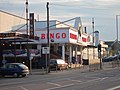 Beacon Bingo - geograph.org.uk - 2492098.jpg 640 × 480; 76 KB
-
 Berkeley House - geograph.org.uk - 2544405.jpg 1.280 × 959; 357 KB
-
 Billing Road - geograph.org.uk - 2404176.jpg 640 × 480; 78 KB
-
 Billing Road - geograph.org.uk - 2452696.jpg 640 × 480; 66 KB
-
 Bowling alley on Weedon Road, Northampton - geograph.org.uk - 5402690.jpg 2.256 × 1.662; 1,24 MB
-
 Bridge Street - geograph.org.uk - 1805618.jpg 640 × 480; 78 KB
-
 Bridge Street - geograph.org.uk - 1805699.jpg 480 × 640; 83 KB
-
 Britannia Building Society - geograph.org.uk - 2415793.jpg 480 × 640; 88 KB
-
 Broadcasting House, Northampton.jpg 542 × 450; 44 KB
-
 Building at Chapel Place - geograph.org.uk - 2544255.jpg 1.280 × 959; 311 KB
-
 Buildings in Duston village.jpg 3.264 × 2.448; 1,6 MB
-
 Burlington Complex, Northampton.jpg 4.032 × 2.088; 2,5 MB
-
 Castilian Court (1) - geograph.org.uk - 2544307.jpg 940 × 1.280; 305 KB
-
 Castilian Court (2) - geograph.org.uk - 2544310.jpg 871 × 1.280; 280 KB
-
 Cedar Road School - geograph.org.uk - 1757107.jpg 640 × 480; 83 KB
-
 Cheyne Walk - geograph.org.uk - 1862407.jpg 640 × 480; 102 KB
-
 Cheyne Walk Northampton.jpg 5.039 × 2.186; 6,53 MB
-

-
 Christchurch Medical Centre - geograph.org.uk - 2543877.jpg 1.280 × 959; 221 KB
-
 Christchurch Medical Centre - geograph.org.uk - 3264598.jpg 640 × 480; 69 KB
-
 Church's Works in St James Northampton.jpg 3.150 × 1.905; 3,46 MB
-
 City Buildings - geograph.org.uk - 2544296.jpg 959 × 1.280; 333 KB
-
 Claremont and Beaumont Courts - geograph.org.uk - 819742.jpg 640 × 441; 56 KB
-
 Clarke Road - geograph.org.uk - 1850217.jpg 640 × 480; 69 KB
-
 Cliftonville Care - geograph.org.uk - 2404170.jpg 640 × 480; 81 KB
-
 Colwyn Road - geograph.org.uk - 3929322.jpg 640 × 480; 73 KB
-
 Colwyn Road - geograph.org.uk - 4945891.jpg 640 × 480; 66 KB
-

-
 Cotton End, Northampton, England.jpg 2.842 × 2.029; 2,73 MB
-
 County Hall, George Row, Northampton.jpg 4.032 × 3.024; 2,8 MB
-
 Covington Street - geograph.org.uk - 2543914.jpg 1.280 × 959; 279 KB
-
 Cripps Leisure Centre - geograph.org.uk - 2451506.jpg 640 × 480; 66 KB
-
 Crockett & Jones Northampton.jpg 4.672 × 3.156; 8 MB
-
 Cynthia Spencer Day Hospice - geograph.org.uk - 3619405.jpg 640 × 478; 79 KB
-
 Cynthia Spencer Hospice - geograph.org.uk - 3619409.jpg 640 × 478; 67 KB
-
 Danes Camp East Hunsbury.jpg 1.358 × 1.285; 243 KB
-
 Dodridge Centre, St James End, Northampton.jpg 3.972 × 2.172; 5,44 MB
-
 Duke Street - geograph.org.uk - 4814125.jpg 640 × 480; 63 KB
-
 Dunster Street - geograph.org.uk - 3497696.jpg 640 × 478; 85 KB
-
 Dunster Street - geograph.org.uk - 3517620.jpg 640 × 478; 54 KB
-
 Dunster Street - geograph.org.uk - 4633438.jpg 640 × 480; 88 KB
-
 Duston - geograph.org.uk - 273796.jpg 640 × 480; 81 KB
-
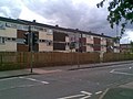
 Duston Village Houses.jpg 2.864 × 1.342; 1,36 MB
-
 Edwardian conservatory.jpg 2.288 × 1.712; 785 KB
-
 Errol Flynn Filmhouse - part of Derngate Theatre Complex, Northampton, England.jpg 1.683 × 1.080; 1,94 MB
-
 Fetter Street - geograph.org.uk - 2049970.jpg 640 × 480; 80 KB
-
 Field ^ Trek - geograph.org.uk - 2415796.jpg 640 × 480; 91 KB
-
 Former bus depot St James Road Northampton.jpg 4.436 × 2.537; 6,39 MB
-
 Former County Police Offices - geograph.org.uk - 2544344.jpg 1.280 × 959; 288 KB
-
 Former County Police Offices - geograph.org.uk - 2544348.jpg 959 × 1.280; 337 KB
-
 Former Methodist Chapel - geograph.org.uk - 2543949.jpg 1.280 × 959; 346 KB
-
 Ghost sign, 31-33 Semilong Road, Northampton (17040745601).jpg 2.048 × 1.536; 823 KB
-
 Ghost sign, 31-33 Semilong Road, Northampton (17041303965).jpg 2.048 × 1.536; 685 KB
-
 Guildhall Road, Northampton.jpg 3.012 × 3.556; 7,03 MB
-
 Henry Street - geograph.org.uk - 4938781.jpg 640 × 480; 69 KB
-
 Indian image Church's Shoe Factory St James.jpg 5.184 × 3.456; 10,83 MB
-
 Inside the hall - geograph.org.uk - 1437068.jpg 640 × 480; 72 KB
-
 Kettering Road Music and Arts Centre - geograph.org.uk - 2415409.jpg 640 × 480; 56 KB
-
 Lodge Farm - geograph.org.uk - 2898989.jpg 640 × 480; 75 KB
-

-
 Main Post Office, St Giles's Street - geograph.org.uk - 2544325.jpg 944 × 1.280; 301 KB
-
 Maltings by St James Road - geograph.org.uk - 2487507.jpg 640 × 480; 89 KB
-
 Marvels Mill Northampton.jpg 1.070 × 662; 504 KB
-
 Mercer's Row - geograph.org.uk - 1759216.jpg 640 × 480; 97 KB
-
 Mereway fire station - geograph.org.uk - 629690.jpg 640 × 427; 187 KB
-
 Mobile Phone Trade offices on Broad Street, Northampton (geograph 5400329).jpg 2.304 × 1.728; 827 KB
-
 Nat West Drapery Nton.JPG 2.468 × 3.771; 5,24 MB
-
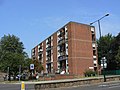
 New Life Apartments, Spring Boroughs - geograph.org.uk - 819750.jpg 480 × 640; 50 KB
-
 NEWLIFE (1) - geograph.org.uk - 2544408.jpg 940 × 1.280; 296 KB
-
 NEWLIFE (4) - geograph.org.uk - 2544436.jpg 1.280 × 959; 336 KB
-
 Nortamptonas 20240511 100958.jpg 4.032 × 3.024; 4,93 MB
-
 Northampton - Saint Crispins - geograph.org.uk - 270783.jpg 640 × 480; 115 KB
-
 Northampton 020 1 Victoria Promenade (49951038128).jpg 4.032 × 3.035; 4,19 MB
-
 Northampton 023 78 and 76 Derngate (49951829837).jpg 2.428 × 3.234; 3,25 MB
-
 Northampton 028 66 Derngate (50021653608).jpg 3.884 × 2.921; 4,11 MB
-
 Northampton 088 Shops and buildings (50386100632).jpg 4.086 × 3.062; 4,63 MB
-
 Northampton 113 3-4 The Parade (50516191986).jpg 2.714 × 3.621; 3,39 MB
-
 Northampton 157 St Lawrence House (50585645918).jpg 4.411 × 3.314; 4,37 MB
-
 Northampton 20240511 102851.jpg 4.032 × 3.024; 4,22 MB
-
 Northampton City Estates.jpg 4.160 × 3.120; 2,82 MB
-
 Northampton Co-Operative Building (geograph 2049879).jpg 640 × 480; 72 KB
-
 Northampton Corporation transport offices.jpg 3.044 × 2.110; 4,3 MB
-
 Northampton House - geograph.org.uk - 2049871.jpg 480 × 640; 77 KB
-
 Northampton Rugby Club shop - geograph.org.uk - 5402631.jpg 2.304 × 1.728; 826 KB
-
 Northampton TA Centre, Drill Hall - geograph.org.uk - 4080977.jpg 640 × 480; 64 KB
-
 Northampton Working Men's Club - geograph.org.uk - 1525320.jpg 640 × 426; 48 KB
-

-
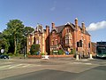
 NorthamptonshireCentralLibrary.jpg 1.649 × 1.727; 1,4 MB
-
 OldCellarsNpton.jpg 1.536 × 2.048; 546 KB
-
 Phipps Albion Brewery, Northampton.jpg 1.227 × 930; 495 KB
-
 Sol Central Northampton.jpg 1.440 × 1.767; 994 KB
-
 Southbridge Development, Northampton, England.jpg 3.594 × 2.532; 5,13 MB
-
-
 St James Park Stadium - geograph.org.uk - 1436935.jpg 640 × 480; 72 KB
-
 Stockmead Road - geograph.org.uk - 3801872.jpg 640 × 480; 76 KB
-
 The Avenue - geograph.org.uk - 2452366.jpg 640 × 480; 72 KB
-
 The Church venue in Northampton.jpg 4.032 × 3.024; 4,97 MB
-
 The old hospital - geograph.org.uk - 1411233.jpg 640 × 480; 61 KB
-

-
 General Infirmary, Northampton, England. Line engraving. Wellcome V0014035.jpg 5.520 × 1.495; 4,24 MB
-
 Walter Tull House, Northampton.jpg 4.032 × 3.024; 3,66 MB
-
 Westonia Court - Retirement Living.jpg 4.032 × 3.024; 3,97 MB


_-_geograph.org.uk_-_2544307.jpg)
_-_geograph.org.uk_-_2544310.jpg)


.jpg)
.jpg)


.jpg)


_-_geograph.org.uk_-_2544408.jpg)
_-_geograph.org.uk_-_2544436.jpg)


.jpg)
.jpg)
.jpg)
.jpg)
.jpg)
.jpg)


.jpg)


