Category:Buildings in Watford
Zur Navigation springen
Zur Suche springen
Wikimedia-Kategorie | |||||
| Medium hochladen | |||||
| Ist ein(e) | |||||
|---|---|---|---|---|---|
| Kategorie kombiniert die Themen |
| ||||
| |||||
Unterkategorien
Es werden 20 von insgesamt 20 Unterkategorien in dieser Kategorie angezeigt:
In Klammern die Anzahl der enthaltenen Kategorien (K), Seiten (S), Dateien (D)
- Offices in Watford (12 D)
1
C
- Watford Colosseum (2 D)
F
G
- Garston Bus Depot (6 D)
L
- Leavesden Road Bus Depot (5 D)
M
O
- Odhams Press Hall (3 D)
P
- Palace Theatre, Watford (7 D)
T
V
W
- Watford Place (8 D)
Medien in der Kategorie „Buildings in Watford“
Folgende 140 Dateien sind in dieser Kategorie, von 140 insgesamt.
-
 1a Carey Place, Watford, January 2023.jpg 4.032 × 3.024; 3,48 MB
-
 73 Clarendon Road, Watford.jpg 1.500 × 1.125; 348 KB
-
 75 Clarendon Road, Watford - demolition.jpg 1.500 × 1.125; 459 KB
-
 75 Clarendon Road, Watford.jpg 2.028 × 1.522; 619 KB
-
 97 High Street, Watford, January 2023.jpg 3.024 × 4.032; 3,69 MB
-
 Car wash in Garston - geograph.org.uk - 2102704.jpg 640 × 461; 62 KB
-
 Cassiobury Court, Watford.jpg 4.597 × 2.219; 6,05 MB
-
 Central Leisure Centre, Watford - geograph.org.uk - 714216.jpg 640 × 464; 311 KB
-
 Century Retail Park, Watford - geograph.org.uk - 4819446.jpg 3.008 × 2.008; 979 KB
-

-
 Charter-Place-Watford-20061029-001.jpg 3.031 × 2.006; 1,01 MB
-
 Children's Section, Watford Central Library - geograph.org.uk - 4426289.jpg 1.280 × 960; 347 KB
-
 City Hall, Watford, 2023 01.jpg 2.241 × 1.681; 1,24 MB
-
 Clubhouse front view.jpg 554 × 348; 89 KB
-

-
 Entrance on Carey Place, Watford, January 2023.jpg 3.024 × 4.032; 3,72 MB
-
 Entrance to Marchwood House, Garston - geograph.org.uk - 6171049.jpg 2.592 × 1.944; 1,36 MB
-
 Exchange Road crosses High Street - geograph.org.uk - 1866829.jpg 1.600 × 1.200; 329 KB
-
 Former Central Hall Cinema and Bingo hall, Watford - geograph.org.uk - 4708784.jpg 3.264 × 2.448; 1,79 MB
-
 Former London Orphan Asylum - geograph.org.uk - 4801865.jpg 1.000 × 753; 278 KB
-
 Former London Orphan Asylum - geograph.org.uk - 4801867.jpg 1.000 × 638; 287 KB
-
 Fullerian Crescent, Watford - geograph.org.uk - 3008473.jpg 640 × 480; 61 KB
-
 GOC Harrow Weald–Bushey 076 Watford Heath (34271950661).jpg 4.288 × 3.216; 3,72 MB
-
 Green Electricity^ - geograph.org.uk - 3649606.jpg 1.024 × 768; 116 KB
-
 Grove Mill - geograph.org.uk - 2160591.jpg 640 × 427; 221 KB
-
 Hertfordshire County Council buildings - geograph.org.uk - 1834174.jpg 1.024 × 768; 206 KB
-
 Hille House, Watford panorama.jpg 4.332 × 2.044; 1,25 MB
-
 Hille House, Watford.jpg 3.504 × 1.793; 813 KB
-
 Holiday Inn, Watford - geograph.org.uk - 2489812.jpg 640 × 430; 85 KB
-
 Holywell Community Centre - geograph.org.uk - 3929857.jpg 3.072 × 2.304; 1,19 MB
-
 Holywell Community Centre - geograph.org.uk - 3929880.jpg 2.983 × 2.241; 1,45 MB
-
 Holywell Community Centre - geograph.org.uk - 3929902.jpg 3.072 × 2.304; 1,28 MB
-
 Holywell Community Centre sign - geograph.org.uk - 3929990.jpg 2.260 × 3.017; 1,6 MB
-
 Jewson Building Materials - geograph.org.uk - 3364879.jpg 640 × 480; 95 KB
-
 John Lewis, Watford - geograph.org.uk - 4770336.jpg 640 × 404; 40 KB
-
 McDonald's on the High Street - geograph.org.uk - 1866766.jpg 1.600 × 1.200; 285 KB
-

-
 O'Neills on The Parade - geograph.org.uk - 1866812.jpg 1.600 × 1.200; 354 KB
-
 Oceana nightclub, Watford - geograph.org.uk - 1915682.jpg 2.592 × 1.944; 2,92 MB
-
 Oxhey, The Villiers Arms - geograph.org.uk - 2791625.jpg 640 × 455; 73 KB
-
 Pedestrian crossing by West Herts College (geograph 3948700).jpg 2.560 × 1.920; 2,01 MB
-
 Premier Inn and A411 - geograph.org.uk - 4348646.jpg 640 × 370; 47 KB
-
 Premier Inn, Watford - geograph.org.uk - 4769929.jpg 640 × 426; 47 KB
-
 Premier Inn, Watford - geograph.org.uk - 4858922.jpg 640 × 426; 49 KB
-
 Pump House Theatre ^ Arts Centre, Watford - geograph.org.uk - 4819436.jpg 3.008 × 2.008; 1,34 MB
-
 Roofscape, Watford - geograph.org.uk - 4769927.jpg 640 × 426; 50 KB
-
 Salters Gardens - geograph.org.uk - 3365289.jpg 640 × 480; 129 KB
-
 Santander Bank Branch in Watford Harlequin Centre - geograph.org.uk - 6189260.jpg 2.592 × 1.944; 1,38 MB
-
 Seventh Day Adventist's Missionary Training College Stanborough Pk Watford.jpg 1.503 × 930; 681 KB
-
 Skylight, Watford - geograph.org.uk - 3312364.jpg 4.052 × 3.029; 5,76 MB
-
 Tandy House, Home of the National Bobath Cerebral Palsy Centre.png 1.000 × 1.333; 1,95 MB
-
 Tandy House.jpg 3.000 × 4.000; 3,66 MB
-
 The former Prudential office building on The Parade - geograph.org.uk - 1866822.jpg 1.600 × 1.200; 429 KB
-
 The Gossamers on the corner of Falcon Way - geograph.org.uk - 3139894.jpg 2.048 × 1.536; 1,46 MB
-
 The Grove - geograph.org.uk - 2160574.jpg 640 × 427; 249 KB
-
 The Grove Mill - geograph.org.uk - 5329362.jpg 1.600 × 1.200; 813 KB
-
 The Grove pumping station, Watford - geograph.org.uk - 131628.jpg 640 × 480; 107 KB
-
 The Horns - panoramio.jpg 5.616 × 3.744; 11,31 MB
-
 The Lodge sign - geograph.org.uk - 3929886.jpg 2.304 × 3.072; 1,73 MB
-
 The Lodge, Holywell - geograph.org.uk - 3929895.jpg 3.072 × 2.304; 1,55 MB
-
 The old and the new - geograph.org.uk - 4165477.jpg 800 × 531; 107 KB
-
 The Orchard Primary School rebuild - geograph.org.uk - 4148139.jpg 640 × 480; 90 KB
-
 The Peace Hospice, Watford - geograph.org.uk - 703239.jpg 640 × 480; 390 KB
-
 The Pyramid, 161-165 High Street, Watford - geograph.org.uk - 3312353.jpg 4.288 × 3.216; 4,69 MB
-
 The Railway Arms - geograph.org.uk - 3365235.jpg 640 × 480; 118 KB
-
 The Red Lion, Watford - geograph.org.uk - 5150027.jpg 3.264 × 2.448; 2,19 MB
-
 The spiral ramp of Church Car Park - geograph.org.uk - 2970413.jpg 2.560 × 1.920; 1,34 MB
-
 The Tudor Arms - geograph.org.uk - 4518535.jpg 640 × 428; 103 KB
-

-
 Tonino ^ Son, ice cream manufacturers - geograph.org.uk - 3365686.jpg 640 × 428; 102 KB
-
 Top Golf at Watford - geograph.org.uk - 5600452.jpg 640 × 480; 49 KB
-
 Tower block on the A41 from Phillipers - geograph.org.uk - 3139873.jpg 1.536 × 2.048; 1,36 MB
-
 Vicarage Road by Watford hospital - geograph.org.uk - 3117517.jpg 2.048 × 1.536; 1,4 MB
-
 Vimco Superstore on Whippendell Road, Watford - geograph.org.uk - 5100706.jpg 2.304 × 1.728; 861 KB
-
 Watford - 48005930411.jpg 2.304 × 3.072; 1,39 MB
-
 Watford - 48005930911.jpg 3.072 × 2.304; 1,44 MB
-
 Watford - 48005938383.jpg 2.304 × 3.072; 1,4 MB
-
 Watford - 48005939098.jpg 2.304 × 3.072; 1,21 MB
-
 Watford - 48005939288.jpg 3.072 × 2.304; 1,36 MB
-
 Watford - 48006017862.jpg 2.304 × 3.072; 1,43 MB
-
 Watford - 48006018357.jpg 2.304 × 3.072; 1,32 MB
-
 Watford - 48006018442.jpg 3.072 × 2.304; 1,26 MB
-
 Watford Central Library - geograph.org.uk - 4817336.jpg 1.280 × 851; 401 KB
-
 Watford Central Premier inn - geograph.org.uk - 5181529.jpg 640 × 427; 332 KB
-
 Watford County Court.jpg 1.889 × 1.348; 1,08 MB
-
 Watford Fire Station - geograph.org.uk - 1629629.jpg 640 × 480; 73 KB
-
 Watford fire station - geograph.org.uk - 280017.jpg 640 × 427; 214 KB
-
 Watford Fire Station - geograph.org.uk - 735579.jpg 640 × 480; 81 KB
-
 Watford fire station ALP.jpg 2.592 × 1.456; 1,05 MB
-
 Watford fire station herts.jpg 2.592 × 1.456; 950 KB
-
 Watford fire station.jpg 2.592 × 1.456; 1,11 MB
-
 Watford Football Club - geograph.org.uk - 3899895.jpg 4.320 × 3.240; 3,55 MB
-
 Watford Former London Orphan Asylum.jpg 640 × 480; 71 KB
-
 Watford Heath, Royal Oak - geograph.org.uk - 4411905.jpg 640 × 476; 67 KB
-
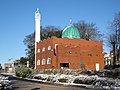 Watford Jamia Mosque - geograph.org.uk - 1626800.jpg 640 × 480; 84 KB
-
-
 Watford Laundry (1) - geograph.org.uk - 1384629.jpg 640 × 480; 67 KB
-
 Watford Laundry (2) - geograph.org.uk - 1384639.jpg 480 × 640; 74 KB
-
 Watford Magistrates' Court - geograph.org.uk - 93473.jpg 640 × 480; 162 KB
-
 Watford Police Station - geograph.org.uk - 236500.jpg 640 × 480; 109 KB
-
 Watford Premier Inn - geograph.org.uk - 5376818.jpg 640 × 426; 57 KB
-
 Watford PSB - geograph.org.uk - 5181518.jpg 640 × 480; 337 KB
-
 Watford Public Library - geograph.org.uk - 703187.jpg 640 × 424; 387 KB
-
 Watford skyline Exchange Road.jpg 7.906 × 3.186; 7,28 MB
-
 Watford Telephone Exchange (1) - geograph.org.uk - 3482352.jpg 3.072 × 2.304; 1,75 MB
-
 Watford Telephone Exchange (2) - geograph.org.uk - 3482365.jpg 3.072 × 2.304; 1,77 MB
-
 Watford Telephone Exchange - geograph.org.uk - 3928789.jpg 3.072 × 2.304; 980 KB
-
 Watford, Bedford Almshouses - geograph.org.uk - 4404801.jpg 640 × 480; 61 KB
-
 Watford, Charter Place and the HSBC bank - geograph.org.uk - 116672.jpg 640 × 480; 119 KB
-
 Watford, Charter Place car park - geograph.org.uk - 1883186.jpg 640 × 506; 67 KB
-
 Watford, Church car park - geograph.org.uk - 4404663.jpg 640 × 480; 77 KB
-

-

-

-
 Watford, Former Barclays Bank - geograph.org.uk - 691522.jpg 640 × 480; 65 KB
-

-

-
 Watford, Former Mecca Bingo Hall - geograph.org.uk - 4404640.jpg 640 × 480; 59 KB
-

-
 Watford, Gasometer - geograph.org.uk - 95985.jpg 640 × 480; 112 KB
-
 Watford, Geo. Ausden metal recyclers - geograph.org.uk - 944180.jpg 640 × 480; 84 KB
-
 Watford, Jurys Inn - geograph.org.uk - 1883120.jpg 640 × 480; 61 KB
-

-
-
 Watford, Que Pasa - geograph.org.uk - 1883514.jpg 640 × 480; 70 KB
-
 Watford, Queen's Road - geograph.org.uk - 1883406.jpg 640 × 480; 82 KB
-
 Watford, Queen's Road, The Broadway - geograph.org.uk - 1883445.jpg 640 × 450; 64 KB
-

-
 Watford, Sun Printers' Clock Tower - geograph.org.uk - 732287.jpg 640 × 480; 85 KB
-
 Watford, The Bedford Almshouses - geograph.org.uk - 116636.jpg 640 × 480; 79 KB
-
 Watford, The former Cottage Hospital - geograph.org.uk - 1322201.jpg 640 × 480; 67 KB
-
 Watford, The Grove Mill - geograph.org.uk - 73761.jpg 640 × 425; 116 KB
-
 Watford, The Harlequin Centre - geograph.org.uk - 758635.jpg 640 × 480; 82 KB
-

-

-
 Watford, Town centre roofscape - geograph.org.uk - 116660.jpg 640 × 480; 117 KB
-

-

-

-
 Window and Plaque in Market Street - geograph.org.uk - 6208025.jpg 2.592 × 1.944; 1,35 MB


.jpg)


.jpg)


_-_geograph.org.uk_-_1384629.jpg)
_-_geograph.org.uk_-_1384639.jpg)


_-_geograph.org.uk_-_3482352.jpg)
_-_geograph.org.uk_-_3482365.jpg)


