Category:Bundesstraße 12
Salta a la navigazzion
Và a cercà
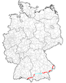
strada federal de la Germania   | |||||
| Carega su un fail audio / video | |||||
| L'è un(a) | |||||
|---|---|---|---|---|---|
| Sit |
| ||||
| Prupetare | |||||
| Mantegnesto da | |||||
| Longhesa |
| ||||
| |||||
Sotocategorie
Quella categoria chì la gh'ha 5 sot-categorie chì de sota, su un numer complessiv de 5.
Fail in la categoria "Bundesstraße 12"
Quella categoria chì la gh'ha denter 26 i fail riportad chì de sota, su un total de 26.
-
 18.9.20 Passau and Hals 078 (50365947442).jpg 5 472 × 3 648; 7,4 MByte
-
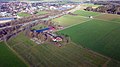
 Autobahnkreuz mit B12 (Motorway crossing B12) - geo.hlipp.de - 37396.jpg 640 × 498; 50 KByte
-
 B 12 Freyung.jpg 1 458 × 1 944; 880 KByte
-
 B 12-Brücke, Freyung.jpg 3 264 × 2 448; 3,21 MByte
-
 B012 Verlauf.png 300 × 375; 88 KByte
-
 B012 Verlauf.svg 320 × 400; 44 KByte
-
 B12 im Landkreis Passau.JPG 2 900 × 1 800; 1,96 MByte
-
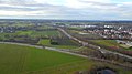
 B12 im Landkreis Rottal-Inn.jpg 2 700 × 1 800; 2,48 MByte
-
 B12 Weitnau.jpg 4 032 × 3 024; 2,49 MByte
-
 Blick über die B12 Richtung Beckstetten - panoramio.jpg 2 816 × 2 120; 1,43 MByte
-
 Buchloe, B12 und A96.jpg 4 000 × 2 250; 3,33 MByte
-
 Bundesstraße 12 bei Germaringen.jpg 1 690 × 2 411; 616 KByte
-
 Das Ridmonument , Kaufbeuren - panoramio.jpg 2 816 × 2 120; 1,41 MByte
-
 DOP40 - Landkreis Oberallgäu 32583 5277 (Bayerische Vermessungsverwaltung).tif 2 500 × 2 500; 15,92 MByte
-
 Einmündung B12 in BAB 96 Buchloe.jpg 4 000 × 2 250; 3,99 MByte
-
 Gymnasium Buchloe, mit B12 und A96 (02).jpg 4 000 × 2 250; 3,67 MByte
-
 Gymnasium Buchloe, mit B12 und A96 (03).jpg 4 000 × 2 250; 4,03 MByte
-
 Gymnasium Buchloe, mit B12 und A96 (06).jpg 4 000 × 2 250; 3,98 MByte
-
 Marktl - Bergham - Motiv - 2022 04 29-2.jpg 6 960 × 4 640; 5,59 MByte
-
 Marktl - Bergham - Motiv - 2022 04 29-3.jpg 6 960 × 4 640; 5,68 MByte
-
 Passau 20190724 DSC0554 (48374051682).jpg 5 568 × 3 712; 13,06 MByte
-
 Ridkapelle Buchloe, mit B12 und A96 (08).jpg 4 000 × 2 250; 4,32 MByte
-
 Thalham v SO (i Vordergrund B12).jpg 16 320 × 5 815; 15,54 MByte
-
 Tunnel im Landkreis Freyung-Grafenau.JPG 4 495 × 2 830; 5,62 MByte
-
 Unterthingau Überquerung der B12 - panoramio.jpg 1 280 × 960; 478 KByte
-
 Wasserscheide Rhein - Donau 947 m ü. NN - Bundesstraße 12 - Hellengerst.jpg 5 184 × 3 888; 7,6 MByte
.jpg)
_-_geo.hlipp.de_-_37396.jpg)


.jpg)
.jpg)
.jpg)


.jpg)
.jpg)


.jpg)