Category:Bursledon
Aller à la navigation
Aller à la recherche
village britannique  | |||||
| Téléverser des médias | |||||
| Nature de l’élément | |||||
|---|---|---|---|---|---|
| Lieu | Eastleigh, Hampshire, Angleterre du Sud-Est, Angleterre | ||||
| Population |
| ||||
| Réputé identique à | Bursledon (page en doublon, paroisse civile) | ||||
 | |||||
Sous-catégories
Cette catégorie comprend 11 sous-catégories, dont les 11 ci-dessous.
B
- Bursledon Brickworks Museum (19 F)
- Bursledon railway station (10 F)
- Bursledon War Memorial (3 F)
- Bursledon Windmill (25 F)
J
- The Jolly Sailor, Bursledon (11 F)
L
- Linden Tree pub, Bursledon (3 F)
S
- St Paul's Church, Bursledon (14 F)
Média dans la catégorie « Bursledon »
Cette catégorie comprend 196 fichiers, dont les 196 ci-dessous.
-
 "Preventer" passes the Jolly Sailor - geograph.org.uk - 4494669.jpg 1 384 × 1 000 ; 1,11 Mio
-
 "The Vine Inn" - geograph.org.uk - 2845778.jpg 1 024 × 768 ; 159 kio
-
 'Mayflower' at Bursledon - geograph.org.uk - 6239269.jpg 3 420 × 2 280 ; 7,73 Mio
-
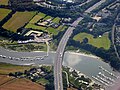
 A27 railway bridge crosses - geograph.org.uk - 3291995.jpg 3 648 × 2 736 ; 1,91 Mio
-
 A27-A3024-A3025 roundabout - geograph.org.uk - 5908818.jpg 1 024 × 684 ; 269 kio
-
 A3024 Bursledon Road - geograph.org.uk - 3291745.jpg 3 366 × 2 538 ; 1,44 Mio
-
 A3024 Bursledon Road at site entrance - geograph.org.uk - 5908864.jpg 1 024 × 684 ; 210 kio
-
 Aluminium forest on the River Hamble - geograph.org.uk - 5613686.jpg 3 264 × 2 448 ; 3,68 Mio
-
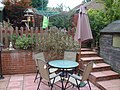 Back Garden.jpg 3 648 × 2 736 ; 3,63 Mio
-
 Badnam Creek, River Hamble - geograph.org.uk - 60892.jpg 640 × 480 ; 89 kio
-
 Barn in Bursledon - geograph.org.uk - 1991648.jpg 1 280 × 960 ; 482 kio
-
 Barns near West End Road - geograph.org.uk - 3018949.jpg 640 × 427 ; 74 kio
-
-
 Blossom on Bursledon High Street - geograph.org.uk - 2845776.jpg 1 024 × 768 ; 241 kio
-
 Blundell Lane Bridge over the M27 - geograph.org.uk - 3735127.jpg 640 × 480 ; 275 kio
-
 Blundell Lane Bridge, M27 - geograph.org.uk - 2857317.jpg 640 × 370 ; 39 kio
-
 Boat lift at Deacons Boatyard - geograph.org.uk - 5613755.jpg 2 448 × 3 264 ; 1,9 Mio
-
 Boat out of water, Bursledon - geograph.org.uk - 5613680.jpg 3 264 × 2 448 ; 3,36 Mio
-
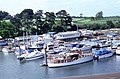
 Boats at Bursledon, Hampshire - geograph.org.uk - 1740078.jpg 3 872 × 2 592 ; 3,52 Mio
-
 Boats moored on the River Hamble - geograph.org.uk - 2627270.jpg 640 × 420 ; 100 kio
-
 Boats on the Hamble - geograph.org.uk - 4494651.jpg 1 974 × 1 000 ; 1,51 Mio
-
 Boatyard north of Bursledon Bridge - geograph.org.uk - 1375444.jpg 640 × 427 ; 198 kio
-
 Borough of Eastleigh , M27 Motorway - geograph.org.uk - 5738913.jpg 6 000 × 4 000 ; 5,61 Mio
-
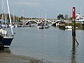
 Bridge Over The Hamble at Bursledon - geograph.org.uk - 2491959.jpg 640 × 298 ; 57 kio
-
 Burlesdon - Chineham Barn - geograph.org.uk - 2952734.jpg 800 × 600 ; 134 kio
-
 Burlesdon - Chineham Barn - geograph.org.uk - 2952746.jpg 800 × 600 ; 166 kio
-
 Burlesdon - Hiltingbury Granary - geograph.org.uk - 2952847.jpg 800 × 600 ; 201 kio
-
 Burlesdon - Hiltingbury Granary - geograph.org.uk - 2952880.jpg 800 × 600 ; 227 kio
-
 Burseldon Windmill - geograph.org.uk - 6150179.jpg 4 592 × 3 448 ; 7,29 Mio
-
 Bursledon - Road triangle - geograph.org.uk - 4493668.jpg 1 423 × 1 000 ; 1,39 Mio
-
 Bursledon - The Jolly Sailor - geograph.org.uk - 4494632.jpg 1 468 × 1 000 ; 1,21 Mio
-
 Bursledon Bridge - geograph.org.uk - 5613769.jpg 3 264 × 2 448 ; 4,2 Mio
-
 Bursledon Cemetery (1) - geograph.org.uk - 2061406.jpg 640 × 480 ; 102 kio
-
 Bursledon Cemetery (2) - geograph.org.uk - 2061405.jpg 640 × 480 ; 114 kio
-
 Bursledon Green - geograph.org.uk - 1553648.jpg 640 × 426 ; 116 kio
-
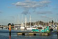
 Bursledon marina on the River Hamble - geograph.org.uk - 3176656.jpg 4 752 × 3 168 ; 2,37 Mio
-
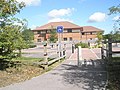
 Bursledon railway station, Hampshire - geograph.org.uk - 4775281.jpg 1 600 × 1 200 ; 526 kio
-

-
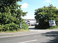 Business premises opposite Hound Manor - geograph.org.uk - 1464578.jpg 640 × 480 ; 121 kio
-
 Car Park Tesco Bursledon Towers - geograph.org.uk - 1659001.jpg 640 × 480 ; 64 kio
-
 Chamberlayne Road - geograph.org.uk - 2061433.jpg 640 × 480 ; 93 kio
-
 Chapel for sale - geograph.org.uk - 2844968.jpg 1 024 × 768 ; 201 kio
-
 Church Lane arrives at Bridge Road - geograph.org.uk - 2847299.jpg 1 024 × 612 ; 167 kio
-
 Crossing the River Hamble - geograph.org.uk - 3572272.jpg 1 024 × 768 ; 75 kio
-
 Deacons Marina - geograph.org.uk - 5613678.jpg 3 264 × 2 448 ; 4,28 Mio
-
 Deacons Marina, Bursledon - geograph.org.uk - 5613762.jpg 3 264 × 2 448 ; 3,9 Mio
-
 Dodwell Farm - geograph.org.uk - 50840.jpg 640 × 480 ; 142 kio
-
 Dodwell Lane Bridge, M27 - geograph.org.uk - 2857315.jpg 640 × 430 ; 33 kio
-
 Durncomb's Copse - geograph.org.uk - 37392.jpg 640 × 427 ; 201 kio
-
 Footbridge into Piland's Wood - geograph.org.uk - 4292827.jpg 640 × 480 ; 192 kio
-
 Footbridge on Mallards Moor - geograph.org.uk - 2845787.jpg 1 024 × 768 ; 351 kio
-
 Footpath between Kew Lane and School Road - geograph.org.uk - 2847287.jpg 1 024 × 768 ; 227 kio
-
 Footpath by Bursledon church - geograph.org.uk - 2845746.jpg 768 × 1 024 ; 279 kio
-
 Footpath from Kew Lane - geograph.org.uk - 2845781.jpg 1 024 × 768 ; 329 kio
-
 Footpath junction with Church Lane - geograph.org.uk - 2847291.jpg 1 024 × 768 ; 254 kio
-
 Footpath markers in Bursledon wildlife area - geograph.org.uk - 3320507.jpg 800 × 717 ; 251 kio
-
 Footpath to Hound - geograph.org.uk - 2847269.jpg 1 024 × 768 ; 255 kio
-
 Footpath with pond off School Road - geograph.org.uk - 2847289.jpg 1 024 × 768 ; 290 kio
-
 Greyladyes Arts Foundation and bell tower - geograph.org.uk - 2799450.jpg 3 537 × 2 527 ; 1,24 Mio
-
 Hamble Viaduct, Bursledon.jpg 3 816 × 2 592 ; 4,68 Mio
-
 Here be Pirates - geograph.org.uk - 6239273.jpg 3 600 × 2 400 ; 7,74 Mio
-
 House boat by River Hamble - geograph.org.uk - 6265455.jpg 5 184 × 3 456 ; 972 kio
-
 Houses, The Acorns - geograph.org.uk - 4292818.jpg 640 × 480 ; 165 kio
-
 Humber Gardens - geograph.org.uk - 1553623.jpg 640 × 426 ; 95 kio
-
 Interesting bits and pieces at the boatyard - geograph.org.uk - 3320477.jpg 800 × 600 ; 147 kio
-
 Jolly Sailor Inn from its jetty - geograph.org.uk - 4494612.jpg 1 333 × 1 000 ; 1,18 Mio
-
 Jolly Sailor sign - geograph.org.uk - 5436196.jpg 2 733 × 3 644 ; 2,4 Mio
-
 Jolly Sailor, Bursledon - Rear entrance - geograph.org.uk - 4494594.jpg 1 333 × 1 000 ; 1,32 Mio
-
 Junction of footpath with Kew Lane - geograph.org.uk - 2847285.jpg 1 024 × 768 ; 341 kio
-
 Junction of School Lane and Church Road - geograph.org.uk - 2799385.jpg 3 548 × 2 638 ; 2,18 Mio
-
 Junction of ways east of Mallards Moor - geograph.org.uk - 2845783.jpg 1 024 × 768 ; 351 kio
-
 Lands End Road meets the Hamble River - geograph.org.uk - 2799472.jpg 3 648 × 2 736 ; 1,61 Mio
-
 Lionheart Way - geograph.org.uk - 1553628.jpg 640 × 426 ; 105 kio
-
 Lionheart Way - geograph.org.uk - 1553631.jpg 640 × 426 ; 104 kio
-
 Lionheart Way - geograph.org.uk - 1553636.jpg 640 × 426 ; 91 kio
-
 Lionheart Way - geograph.org.uk - 1553660.jpg 640 × 426 ; 95 kio
-
 Long Lane - geograph.org.uk - 6265451.jpg 4 000 × 3 000 ; 1,12 Mio
-
 Looking back over Bursledon Market car park - geograph.org.uk - 1640103.jpg 480 × 640 ; 94 kio
-
 Looking down Lands End Road - geograph.org.uk - 2845771.jpg 1 024 × 768 ; 188 kio
-

-
 Looking through the porch at Bursledon church - geograph.org.uk - 2845739.jpg 768 × 1 024 ; 187 kio
-
 Looking up Lands End Road - geograph.org.uk - 2845774.jpg 1 024 × 768 ; 193 kio
-
 Lowford Hill - geograph.org.uk - 5095773.jpg 640 × 480 ; 122 kio
-
 Lowford Hill - geograph.org.uk - 5095780.jpg 640 × 480 ; 72 kio
-
 Lowford Hill Close - geograph.org.uk - 5095767.jpg 640 × 480 ; 79 kio
-
 M27 at Bursledon - geograph.org.uk - 6239286.jpg 4 320 × 2 880 ; 7,76 Mio
-
 M27 at Bursledon - geograph.org.uk - 6239291.jpg 3 420 × 2 280 ; 7,59 Mio
-
 M27 crossing River Hamble - geograph.org.uk - 3205061.jpg 640 × 428 ; 70 kio
-
 M27 crossing the River Hamble - geograph.org.uk - 4725655.jpg 640 × 494 ; 43 kio
-
 M27 Motorway Crossing the River Hamble - geograph.org.uk - 5049742.jpg 640 × 480 ; 497 kio
-
 M27 nearing Dodwell Lane bridge - geograph.org.uk - 3205068.jpg 640 × 428 ; 82 kio
-
 M27 west approaching Dodwell lane bridge - geograph.org.uk - 2864858.jpg 640 × 457 ; 57 kio
-
 M27, Dodwell Lane Bridge - geograph.org.uk - 3735081.jpg 640 × 480 ; 265 kio
-
 M27, south of J8 - geograph.org.uk - 2857313.jpg 640 × 430 ; 38 kio
-
 Moorings linked to Deacons Boat Yard - geograph.org.uk - 1375499.jpg 640 × 427 ; 146 kio
-

-
 Narrow section of Botley Road - geograph.org.uk - 3046400.jpg 640 × 482 ; 126 kio
-
 Nature reserve, High Street, Bursledon - geograph.org.uk - 1436569.jpg 640 × 480 ; 161 kio
-
 Old farm buildings in Blundell Lane - geograph.org.uk - 2792026.jpg 640 × 482 ; 70 kio
-
 Old Post Office, Bursledon, Hampshire - geograph.org.uk - 1740420.jpg 3 872 × 2 592 ; 3,51 Mio
-
 On the footbridge at Bursledon station - geograph.org.uk - 2845752.jpg 1 024 × 768 ; 348 kio
-
 On the River Hamble, Bursledon - geograph.org.uk - 1740085.jpg 3 872 × 2 592 ; 3,6 Mio
-
 On the River Hamble, Bursledon - geograph.org.uk - 1740090.jpg 3 872 × 2 592 ; 3,39 Mio
-
 Overlooking the River Hamble at Bursledon - geograph.org.uk - 1737803.jpg 3 872 × 2 592 ; 5 Mio
-
 Path to the Jolly Sailor at Bursledon - geograph.org.uk - 399540.jpg 640 × 473 ; 138 kio
-
 Peewit Hill Close, Bursledon - geograph.org.uk - 1033906.jpg 640 × 427 ; 105 kio
-
 Penelope Gardens - geograph.org.uk - 1553654.jpg 640 × 426 ; 107 kio
-
 Phoenix Close - geograph.org.uk - 1553603.jpg 640 × 426 ; 95 kio
-
 Pirate Pikey's Paradise - geograph.org.uk - 1375279.jpg 640 × 427 ; 150 kio
-
 Portsmouth Road - geograph.org.uk - 5095797.jpg 640 × 480 ; 81 kio
-
 Portsmouth Road - geograph.org.uk - 5095802.jpg 640 × 480 ; 69 kio
-
 Pound Road - geograph.org.uk - 2847273.jpg 1 024 × 768 ; 172 kio
-
 Priors Hill Lane - geograph.org.uk - 2847271.jpg 1 024 × 768 ; 273 kio
-
 Public Hard beside Bursledon Bridge - geograph.org.uk - 1375362.jpg 640 × 427 ; 199 kio
-
 Queueing for cash - geograph.org.uk - 1986928.jpg 1 280 × 960 ; 469 kio
-
 Rail bridge and marina seen from Blundell Lane - geograph.org.uk - 2847304.jpg 1 024 × 768 ; 152 kio
-
 Railway bridge at Salterns, Bursledon - geograph.org.uk - 60969.jpg 640 × 480 ; 116 kio
-
 Recreation Ground - geograph.org.uk - 815737.jpg 640 × 480 ; 76 kio
-
 Remains of the fighting top HMS Sultan - geograph.org.uk - 6224386.jpg 4 000 × 3 000 ; 3,88 Mio
-
 Remains of the fighting top HMS Sultan - geograph.org.uk - 6231768.jpg 4 000 × 3 000 ; 4,79 Mio
-
 River Hamble - geograph.org.uk - 3735124.jpg 640 × 480 ; 257 kio
-
 River Hamble - geograph.org.uk - 5436198.jpg 5 184 × 3 456 ; 5,5 Mio
-
 River Hamble at Bursledon - geograph.org.uk - 1740263.jpg 3 872 × 2 592 ; 3,49 Mio
-
 River Hamble at Bursledon - geograph.org.uk - 2436176.jpg 640 × 425 ; 184 kio
-
 River Hamble, Swanwick Marina - geograph.org.uk - 5049745.jpg 640 × 420 ; 251 kio
-
 River Hamble-Bursledon - geograph.org.uk - 731112.jpg 640 × 414 ; 61 kio
-
 Rose Cottage, School Road, Bursledon (May 2019).JPG 2 800 × 1 800 ; 2,24 Mio
-
 Rowing Boat on the Hamble, Bursledon - geograph.org.uk - 1740302.jpg 3 872 × 2 592 ; 3,45 Mio
-
 Rutland Gardens - geograph.org.uk - 5095789.jpg 640 × 480 ; 103 kio
-
 School Road, Bursledon, Hampshire - geograph.org.uk - 1742336.jpg 3 872 × 2 592 ; 4,14 Mio
-
 Sign at "The Lone Barn" - geograph.org.uk - 2847279.jpg 768 × 1 024 ; 140 kio
-
 Sign at the "Fox and Hounds" - geograph.org.uk - 2847280.jpg 768 × 1 024 ; 110 kio
-
 Sign Gantry, M27 Windhover - geograph.org.uk - 3735089.jpg 640 × 480 ; 231 kio
-
 Southampton to Portsmouth railway line - geograph.org.uk - 6265458.jpg 5 184 × 3 456 ; 1,9 Mio
-
 Station Hill - geograph.org.uk - 2845761.jpg 1 024 × 768 ; 226 kio
-
 Station Road, Bursledon - geograph.org.uk - 6125898.jpg 851 × 1 280 ; 443 kio
-
 Station Road, Bursledon - geograph.org.uk - 6126082.jpg 1 280 × 851 ; 624 kio
-

-
 Stored boats at Bursledon - geograph.org.uk - 5613751.jpg 3 264 × 2 448 ; 4,71 Mio
-
 Sunnyfield Rise - geograph.org.uk - 1553568.jpg 640 × 427 ; 124 kio
-
 Sunnyfield Rise - geograph.org.uk - 1553574.jpg 640 × 427 ; 133 kio
-
 Sunnyfield Rise - geograph.org.uk - 1553579.jpg 640 × 427 ; 112 kio
-
 Sunnyfield Rise - geograph.org.uk - 1553583.jpg 640 × 427 ; 125 kio
-
 Sunnyfield Rise - geograph.org.uk - 1557136.jpg 640 × 427 ; 89 kio
-
 Tesco extra - geograph.org.uk - 5095757.jpg 640 × 480 ; 59 kio
-
 Tesco extra store, Bursledon Towers - geograph.org.uk - 294988.jpg 640 × 480 ; 80 kio
-
 Tesco Extra, Bursledon - geograph.org.uk - 1986921.jpg 1 280 × 960 ; 461 kio
-
 The Elephant Boatyard, Bursledon - geograph.org.uk - 5613664.jpg 3 264 × 2 448 ; 3,75 Mio
-
 The Elephant Boatyard, Bursledon - geograph.org.uk - 5613666.jpg 3 264 × 2 448 ; 3,42 Mio
-
 The Elephant Boatyard, Bursledon, Hampshire - geograph.org.uk - 1737750.jpg 2 592 × 3 872 ; 3,3 Mio
-
 The Hamble from the M27 - geograph.org.uk - 540925.jpg 640 × 439 ; 68 kio
-
 The Hamble leading to Bursledon Bridge - geograph.org.uk - 4494660.jpg 1 333 × 1 000 ; 1,09 Mio
-
 The M27 bridge over the River Hamble - geograph.org.uk - 3320472.jpg 800 × 600 ; 94 kio
-
 The M27 looking east from Blundell Lane - geograph.org.uk - 2847307.jpg 1 024 × 768 ; 130 kio
-
 The M27 looking west from Blundell Lane - geograph.org.uk - 2847312.jpg 1 024 × 768 ; 169 kio
-
 The Manor House pub at Old Netley - geograph.org.uk - 2972182.jpg 640 × 482 ; 67 kio
-
 The Old Post Office in the High Street - geograph.org.uk - 2799462.jpg 3 648 × 2 736 ; 1,91 Mio
-
 The Old Post Office, Bursledon - geograph.org.uk - 1436575.jpg 640 × 480 ; 82 kio
-
 The Old School, School Lane, Bursledon (May 2019) (2).JPG 3 000 × 2 000 ; 2,59 Mio
-

-
 The railway line at Bursledon looking south - geograph.org.uk - 2845756.jpg 1 024 × 768 ; 278 kio
-

-
 The Vine Inn, Bursledon - geograph.org.uk - 1436582.jpg 640 × 480 ; 100 kio
-
 The way down to "The Jolly Sailor" - geograph.org.uk - 2845766.jpg 768 × 1 024 ; 326 kio
-
 Train between Bursledon and Hamble - geograph.org.uk - 4292843.jpg 640 × 480 ; 123 kio
-
 Train between Hamble and Bursledon - geograph.org.uk - 4293671.jpg 640 × 480 ; 138 kio
-
 Train departs Bursledon station - geograph.org.uk - 3176652.jpg 4 752 × 3 168 ; 3,96 Mio
-
 Tree near River Hamble - geograph.org.uk - 6265454.jpg 5 184 × 3 456 ; 2,23 Mio
-
 View down Hamble Lane - geograph.org.uk - 2872426.jpg 640 × 482 ; 86 kio
-
 Viewpoint at Bursledon, Hampshire - geograph.org.uk - 1740398.jpg 3 872 × 2 592 ; 4,89 Mio
-
 Weather vane by Mallards Moor - geograph.org.uk - 3332313.jpg 800 × 579 ; 34 kio
-
 Weather vane near Bursledon station - geograph.org.uk - 2845748.jpg 1 024 × 768 ; 73 kio
-
 Weather vane on Kew Lane - geograph.org.uk - 2845780.jpg 1 024 × 1 024 ; 306 kio
-
 Weather vane on Lands End Road - geograph.org.uk - 2845773.jpg 1 024 × 768 ; 54 kio
-
 Weathercock on Bursledon church - geograph.org.uk - 2845742.jpg 768 × 1 024 ; 76 kio
-
 Weathervane in Kew Lane - geograph.org.uk - 3320502.jpg 800 × 534 ; 88 kio
-
 West End Road - geograph.org.uk - 3284884.jpg 640 × 480 ; 89 kio
-
 Westbound exit slip for M27 junction 8 - geograph.org.uk - 3572274.jpg 1 024 × 585 ; 71 kio
-
 Windhover Small holding - geograph.org.uk - 1637942.jpg 640 × 480 ; 70 kio
-
 Yachts on the Hamble, Bursledon - geograph.org.uk - 1740272.jpg 3 872 × 2 592 ; 4,77 Mio
-
 Bridleway, approaching railway bridge - geograph.org.uk - 1436618.jpg 640 × 480 ; 189 kio
-
 Bursledon Boatyards and Marinas - geograph.org.uk - 399535.jpg 640 × 473 ; 117 kio
-
 Bursledon station car park and Station Hill - geograph.org.uk - 238574.jpg 640 × 480 ; 352 kio
-
 Cottages in Bursledon - geograph.org.uk - 1436557.jpg 640 × 480 ; 79 kio
-
 Deacons boatyard, Bursledon Bridge - geograph.org.uk - 1436505.jpg 640 × 480 ; 87 kio
-
 Dumbleton's Tower, Thornhill - geograph.org.uk - 29382.jpg 640 × 480 ; 106 kio
-
 Eastlands Boat Yard and Business Park, Swanwick - geograph.org.uk - 465906.jpg 640 × 427 ; 135 kio
-
 Footpath across Mallards Moor - geograph.org.uk - 1436602.jpg 640 × 480 ; 174 kio
-
 Hamble Lane - geograph.org.uk - 75043.jpg 640 × 480 ; 72 kio
-
 Looking up the Hamble - geograph.org.uk - 399524.jpg 640 × 480 ; 90 kio
-
 Mallards Road - geograph.org.uk - 147894.jpg 640 × 459 ; 53 kio
-
 River Hamble - geograph.org.uk - 238580.jpg 640 × 480 ; 275 kio
-
 River Hamble and M27 road bridge - geograph.org.uk - 24042.jpg 640 × 480 ; 66 kio
-
 River Hamble and the Jolly Sailor - geograph.org.uk - 238588.jpg 640 × 480 ; 382 kio
-
 River Hamble, Manor Farm Country Park - geograph.org.uk - 64932.jpg 640 × 480 ; 54 kio
-


_-_geograph.org.uk_-_2061406.jpg)
_-_geograph.org.uk_-_2061405.jpg)


.JPG)


_(2).JPG)


