Category:Butlers Marston
Aller à la navigation
Aller à la recherche
village britannique | |||||
| Téléverser des médias | |||||
| Nature de l’élément | |||||
|---|---|---|---|---|---|
| Lieu | Stratford-on-Avon, Warwickshire, Midlands de l'Ouest, Angleterre | ||||
| Population |
| ||||
| Superficie |
| ||||
 | |||||
English: Butlers Marston is a village and civil parish on the River Dene in south-eastern Warwickshire, England. The village is part of Stratford-on-Avon district, and in the 2001 census it had a population of 226.
Sous-catégories
Cette catégorie comprend 2 sous-catégories, dont les 2 ci-dessous.
Média dans la catégorie « Butlers Marston »
Cette catégorie comprend 50 fichiers, dont les 50 ci-dessous.
-
 'Keep left at the chimney' - geograph.org.uk - 1490056.jpg 428 × 640 ; 55 kio
-
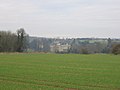 A distant view of Compton Verney - geograph.org.uk - 100974.jpg 640 × 480 ; 55 kio
-
 Bank Close Butlers Marston - geograph.org.uk - 6020023.jpg 640 × 425 ; 160 kio
-
 Barn near Butlers Marston - geograph.org.uk - 2050351.jpg 2 000 × 1 500 ; 187 kio
-
 Old Wesleyan Chapel, Butlers Marston - geograph.org.uk - 100942.jpg 640 × 480 ; 131 kio
-
 Butlers Marston - geograph.org.uk - 1779510.jpg 2 000 × 1 499 ; 170 kio
-
 Butlers Marston - geograph.org.uk - 4747954.jpg 1 600 × 1 200 ; 511 kio
-
 Butlers Marston-The Old Garage - geograph.org.uk - 4747960.jpg 1 600 × 1 366 ; 511 kio
-

-
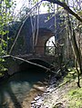 Double arch bridge on the S^MJR, near Combrook - geograph.org.uk - 1809277.jpg 1 500 × 1 989 ; 208 kio
-
 Double arch bridge on the S^MJR, near Combrook - geograph.org.uk - 1810138.jpg 1 500 × 2 003 ; 286 kio
-
 Driveway to Tubs End Farm - geograph.org.uk - 6020031.jpg 640 × 427 ; 213 kio
-
 Entrance drive to Moorlands - geograph.org.uk - 2048333.jpg 2 000 × 1 504 ; 240 kio
-
 Farm track on Herd Hill - geograph.org.uk - 2048415.jpg 2 000 × 1 501 ; 221 kio
-
 Farmland near Pillerton Hersey - geograph.org.uk - 5311355.jpg 1 024 × 768 ; 299 kio
-

-
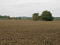
 Field to the southwest of Butlers Marston - geograph.org.uk - 2051925.jpg 2 000 × 1 500 ; 178 kio
-
 Field to the WSW of Butlers Marston - geograph.org.uk - 2051943.jpg 2 000 × 1 500 ; 204 kio
-
 Flooded meadow opposite footpath to Combrook - geograph.org.uk - 1779499.jpg 2 000 × 1 504 ; 153 kio
-
 Footbridge on footpath to Herd Hill Farm - geograph.org.uk - 2048684.jpg 2 000 × 1 507 ; 205 kio
-
 Footpath to Herd Hill Farm - geograph.org.uk - 2049725.jpg 2 000 × 1 497 ; 232 kio
-
 Footpath to Herd Hill Farm - geograph.org.uk - 2049745.jpg 2 000 × 1 497 ; 222 kio
-
 Grain drying and silage plant, Herd Hill Farm - geograph.org.uk - 2052324.jpg 2 000 × 1 504 ; 245 kio
-
 Hedgerow and stubble field - geograph.org.uk - 2052368.jpg 2 000 × 1 497 ; 263 kio
-
 Herd Hill Farm - geograph.org.uk - 2052414.jpg 2 000 × 1 495 ; 202 kio
-
 Horses at Butlers Marston - geograph.org.uk - 100951.jpg 640 × 480 ; 92 kio
-

-
 Junction on Tysoe Road - geograph.org.uk - 2048720.jpg 2 000 × 1 496 ; 233 kio
-
 Lane to Little Kineton - geograph.org.uk - 2049775.jpg 2 000 × 1 500 ; 273 kio
-
 Lane to Little Kineton - geograph.org.uk - 2052378.jpg 2 000 × 1 500 ; 193 kio
-
 Life on a curve - geograph.org.uk - 1491970.jpg 640 × 428 ; 57 kio
-
 Oxhouse Farm SSSI - geograph.org.uk - 2286443.jpg 640 × 441 ; 121 kio
-
 Ploughed field and clump of trees - geograph.org.uk - 2051957.jpg 2 000 × 1 500 ; 217 kio
-
 Ploughed field and hedgerow - geograph.org.uk - 2051986.jpg 2 000 × 1 500 ; 184 kio
-
 Ploughed field near Park Slade Farm - geograph.org.uk - 2050362.jpg 2 000 × 1 500 ; 213 kio
-
 Right of way marker by bridleway to Oxhouse Farm - geograph.org.uk - 3519394.jpg 2 000 × 1 333 ; 1,1 Mio
-
 Row of cottages, Butlers Marston - geograph.org.uk - 100947.jpg 640 × 480 ; 111 kio
-
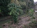 Small brook, Butlers Marston - geograph.org.uk - 1779521.jpg 2 000 × 1 497 ; 235 kio
-
 Stubble field near Hall Farm - geograph.org.uk - 2052141.jpg 2 000 × 1 496 ; 226 kio
-
 Stubble field near Herd Hill Farm - geograph.org.uk - 2052352.jpg 2 000 × 1 508 ; 226 kio
-
 Trackbed and disused bridge on the S^MJR, near Combrook - geograph.org.uk - 1810107.jpg 2 000 × 1 504 ; 354 kio
-
 Trees by the brook - geograph.org.uk - 1810075.jpg 1 500 × 1 992 ; 213 kio
-
 Tubs End Farm - geograph.org.uk - 1935075.jpg 640 × 480 ; 114 kio
-
 Tysoe Rd near Hall Farm - geograph.org.uk - 6022086.jpg 640 × 427 ; 232 kio
-
 View ENE from top of Herd Hill - geograph.org.uk - 2052435.jpg 2 000 × 1 500 ; 209 kio
-
 Village cross, Butler's Marston - geograph.org.uk - 1491975.jpg 640 × 428 ; 53 kio
-
 Village pond at Little Kineton - geograph.org.uk - 450847.jpg 640 × 480 ; 155 kio
-
 Butlers Marston - geograph.org.uk - 99369.jpg 640 × 480 ; 96 kio
-
 Butlers Marston old school - geograph.org.uk - 99365.jpg 640 × 480 ; 90 kio
-
 View over Combrook - geograph.org.uk - 100998.jpg 640 × 480 ; 67 kio


