Category:Caerhun
Aller à la navigation
Aller à la recherche
hamlet and community in Conwy County Borough, Wales, UK   | |||||
| Téléverser des médias | |||||
| Nature de l’élément | |||||
|---|---|---|---|---|---|
| Lieu | Conwy, pays de Galles | ||||
| Population |
| ||||
| Superficie |
| ||||
 | |||||
Brezhoneg: Caerhun zo ur gêriadenn, bet parrez, war lez kleiz ar Stêr Conwy, er c'hreisteiz da Henryd hag en hanternoz da Dolgarrog, e bwrgeisdref Conwy, en hanternoz Kembre.
Cymraeg: Mae Caerhun yn safle caer Rufeinig Canovium, ar y ffordd Rufeinig rhwng Deva (Caer) a Segontium (Caernarfon). Saif ar lan orllewinol Afon Conwy, rhwng Tŷ'n-y-groes a Dolgarrog ar y B5106, a gerllaw man lle gellir rhydio'r afon. Mae'n 24 milltir o Segontium, taith diwrnod i droedfilwyr Rhufeinig.
English: Caerhun is a village and rural community (and former civil parish) on the west bank of the River Conwy, to the south of Henryd and to the north of Dolgarrog, in Conwy County Borough, north Wales.
Sous-catégories
Cette catégorie comprend 7 sous-catégories, dont les 7 ci-dessous.
Média dans la catégorie « Caerhun »
Cette catégorie comprend 669 fichiers, dont les 200 ci-dessous.
(page précédente) (page suivante)-
 "Please shut the gate" - one of two on this road - geograph.org.uk - 2430825.jpg 4 592 × 3 056 ; 6,16 Mio
-
 A derelict building - geograph.org.uk - 2052553.jpg 4 592 × 3 056 ; 4,49 Mio
-
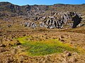
 A false summit of Pen y Castell - geograph.org.uk - 2050982.jpg 4 592 × 3 056 ; 4,49 Mio
-
 A fence leading towards the Pen-y-gaer tumulus - geograph.org.uk - 2052396.jpg 4 592 × 3 056 ; 4,56 Mio
-
 A fence with no barbed wire - geograph.org.uk - 2050193.jpg 4 592 × 3 056 ; 6,51 Mio
-
 A harebell - geograph.org.uk - 2052583.jpg 4 592 × 3 056 ; 2,31 Mio
-
 A high plain - geograph.org.uk - 1945011.jpg 4 592 × 3 056 ; 3,19 Mio
-
 A huge boulder by the path - an erratic^ - geograph.org.uk - 2052268.jpg 4 592 × 3 056 ; 3,58 Mio
-
 A key road junction in the maze hiding the Roman Road car park - geograph.org.uk - 2049491.jpg 4 592 × 3 056 ; 4,71 Mio
-
 A ladder stile near Craig Cefn Coch - geograph.org.uk - 2052204.jpg 4 592 × 3 056 ; 4,33 Mio
-
 A lane in Rowen in 1987 - geograph.org.uk - 2404553.jpg 899 × 633 ; 120 kio
-
 A lonely tree - geograph.org.uk - 2050062.jpg 4 592 × 3 056 ; 3,51 Mio
-
 A one-gate flood - geograph.org.uk - 6088013.jpg 800 × 600 ; 100 kio
-
 A path on Tal-y-Fan - geograph.org.uk - 2397464.jpg 640 × 480 ; 108 kio
-
 A ruined farmhouse at Hafod-y-cae - geograph.org.uk - 2430848.jpg 4 592 × 3 056 ; 6,03 Mio
-
 A stile - geograph.org.uk - 2050881.jpg 4 592 × 3 056 ; 3,95 Mio
-
 A tributary to the Afon Tafolog - geograph.org.uk - 2050091.jpg 4 592 × 3 056 ; 5,64 Mio
-
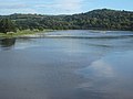
 A view across Afon Conwy - geograph.org.uk - 5153842.jpg 640 × 480 ; 194 kio
-
 A view of the Conwy Estuary from the path at Bwlch-y-gaer - geograph.org.uk - 2052351.jpg 4 592 × 3 056 ; 4,01 Mio
-
 A young Rowan stands proud above the gorse - geograph.org.uk - 961241.jpg 640 × 480 ; 158 kio
-
 Abandoned dwellings - geograph.org.uk - 981169.jpg 640 × 480 ; 129 kio
-
 Abandoned farmhouse at Hafoty Gwyn - geograph.org.uk - 2049478.jpg 4 592 × 3 056 ; 5,65 Mio
-
 Above Craig Eigiau - geograph.org.uk - 5390913.jpg 1 600 × 1 200 ; 377 kio
-

-
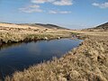
 Afon Conwy - geograph.org.uk - 2429278.jpg 1 280 × 960 ; 619 kio
-
 Afon Conwy - geograph.org.uk - 2942198.jpg 640 × 480 ; 30 kio
-
 Afon Conwy - geograph.org.uk - 3203654.jpg 640 × 488 ; 40 kio
-
 Afon Conwy - geograph.org.uk - 4286961.jpg 640 × 480 ; 38 kio
-
 Afon Conwy - geograph.org.uk - 4286966.jpg 640 × 480 ; 28 kio
-
 Afon Conwy - geograph.org.uk - 4286971.jpg 640 × 480 ; 31 kio
-
 Afon Conwy - geograph.org.uk - 4286973.jpg 640 × 480 ; 30 kio
-
 Afon Conwy - geograph.org.uk - 5153843.jpg 640 × 480 ; 175 kio
-
 Afon Conwy downstream - geograph.org.uk - 2107962.jpg 640 × 480 ; 68 kio
-
 Afon Conwy from St Mary's churchyard - geograph.org.uk - 4120947.jpg 640 × 480 ; 65 kio
-
 Afon Conwy from Tal-y-cafn bridge - geograph.org.uk - 2430453.jpg 4 592 × 3 056 ; 4,42 Mio
-
 Afon Dulyn - geograph.org.uk - 4979609.jpg 640 × 480 ; 90 kio
-
 Afon Dulyn - geograph.org.uk - 6054379.jpg 800 × 600 ; 155 kio
-
 Afon Dulyn 2 - geograph.org.uk - 4979657.jpg 640 × 480 ; 92 kio
-
 Afon Dulyn 2 - geograph.org.uk - 6054384.jpg 800 × 600 ; 163 kio
-
 Afon Dulyn footbridge - geograph.org.uk - 6112330.jpg 600 × 800 ; 170 kio
-
 Afon Dulyn gorge - geograph.org.uk - 6112334.jpg 800 × 600 ; 165 kio
-
 Afon Eigiau - geograph.org.uk - 5019047.jpg 1 066 × 1 600 ; 457 kio
-
 Afon Garreg Wen - geograph.org.uk - 4958954.jpg 640 × 480 ; 89 kio
-
 Afon Garreg-wen - geograph.org.uk - 961203.jpg 640 × 480 ; 88 kio
-
 Afon Garreg-wen - geograph.org.uk - 961234.jpg 640 × 480 ; 75 kio
-
 Afon Porth-llwyd - geograph.org.uk - 6062815.jpg 800 × 600 ; 114 kio
-
 Afon Porth-llwyd - geograph.org.uk - 6087991.jpg 600 × 800 ; 166 kio
-
 Afon Porth-llwyd - geograph.org.uk - 6088018.jpg 800 × 600 ; 131 kio
-
 Afon Porth-llwyd - geograph.org.uk - 6122964.jpg 600 × 800 ; 130 kio
-
 Afon Porth-llwyd with birch - geograph.org.uk - 6118878.jpg 800 × 600 ; 136 kio
-
 Afon Roe - geograph.org.uk - 2979794.jpg 640 × 480 ; 118 kio
-
 Afon Roe - geograph.org.uk - 410300.jpg 640 × 360 ; 143 kio
-
 Afon Tafolog - geograph.org.uk - 2050068.jpg 3 056 × 4 592 ; 3,97 Mio
-
 Aircraft Wreckage Below Carnedd Llewelyn - geograph.org.uk - 5390857.jpg 1 200 × 1 600 ; 836 kio
-
 Aircraft Wreckage Below Foel Grach - geograph.org.uk - 5884473.jpg 1 200 × 1 600 ; 598 kio
-
 Aircraft Wreckage On Foel Lwyd - geograph.org.uk - 5975295.jpg 1 200 × 1 600 ; 906 kio
-
 Among the stones (1) - geograph.org.uk - 981432.jpg 640 × 480 ; 103 kio
-
 An Easter Walk in the Conwy Valley - 1 - geograph.org.uk - 406819.jpg 640 × 360 ; 80 kio
-
 An Easter Walk in the Conwy Valley - 12 - geograph.org.uk - 407045.jpg 640 × 359 ; 145 kio
-
 An Easter Walk in the Conwy Valley - 13 - geograph.org.uk - 407048.jpg 640 × 359 ; 104 kio
-
 An Easter Walk in the Conwy Valley - 3 - geograph.org.uk - 406831.jpg 640 × 360 ; 72 kio
-
 An Easter Walk in the Conwy Valley - 4 - geograph.org.uk - 406840.jpg 640 × 360 ; 68 kio
-
 An Easter Walk in the Conwy Valley - 5 - geograph.org.uk - 406849.jpg 640 × 360 ; 105 kio
-
 An Easter Walk in the Conwy Valley - 6 - geograph.org.uk - 406863.jpg 640 × 359 ; 133 kio
-
 An Easter Walk in the Conwy Valley - 7 - geograph.org.uk - 406868.jpg 640 × 360 ; 150 kio
-
 An Easter Walk in the Conwy Valley - 8 - geograph.org.uk - 406871.jpg 3 503 × 1 972 ; 1,76 Mio
-
 Ancient tree near Bron-y-Gadair - geograph.org.uk - 4140806.jpg 2 816 × 2 112 ; 1,08 Mio
-
 Approaching Rhiw - geograph.org.uk - 1564722.jpg 640 × 427 ; 214 kio
-
 Approaching The Top of Cwm Eigiau - geograph.org.uk - 5676676.jpg 1 600 × 1 200 ; 496 kio
-
 Ascending Foel Grach - geograph.org.uk - 3031005.jpg 2 288 × 1 712 ; 772 kio
-
 B5106 and the cemetery on the right near Caerhûn - geograph.org.uk - 4607590.jpg 1 024 × 768 ; 142 kio
-
 B5106 at Caerhun - geograph.org.uk - 2480528.jpg 640 × 481 ; 49 kio
-
 B5106 heading south - geograph.org.uk - 4607606.jpg 1 024 × 768 ; 114 kio
-
 B5106 looking south - geograph.org.uk - 2480526.jpg 640 × 480 ; 54 kio
-
 B5106 through Ty'n-y-groes - geograph.org.uk - 4607948.jpg 1 024 × 768 ; 135 kio
-
 Barclodiad y Gawres - geograph.org.uk - 4504264.jpg 1 600 × 1 200 ; 558 kio
-
 Barracks Cwm Eigiau - geograph.org.uk - 1884200.jpg 2 288 × 1 712 ; 798 kio
-
 Blackthorn blossom - geograph.org.uk - 6113394.jpg 800 × 600 ; 135 kio
-
 Boggy Terrain, Cwm Eigiau - geograph.org.uk - 5390868.jpg 1 600 × 1 200 ; 880 kio
-
 Boggy valley floor - geograph.org.uk - 3127135.jpg 1 024 × 680 ; 219 kio
-
 Bont Newydd - geograph.org.uk - 6069836.jpg 800 × 600 ; 129 kio
-
 Bottom of the hill - geograph.org.uk - 1564729.jpg 640 × 427 ; 180 kio
-
 Bottom of the hill - geograph.org.uk - 1564763.jpg 640 × 427 ; 175 kio
-
 Boulder field - geograph.org.uk - 4965184.jpg 640 × 480 ; 87 kio
-
 Boulder field around Llyn Llyffant - geograph.org.uk - 910504.jpg 640 × 480 ; 116 kio
-
 Boulder garden - geograph.org.uk - 4979785.jpg 640 × 480 ; 95 kio
-
 Boulder-strewn ground - geograph.org.uk - 4966633.jpg 640 × 480 ; 89 kio
-
 Boulder-strewn hillside - geograph.org.uk - 4966653.jpg 640 × 480 ; 88 kio
-
 Boulders and coffee stop - geograph.org.uk - 4987167.jpg 640 × 480 ; 89 kio
-
 Boulders and Penygadair - geograph.org.uk - 2979049.jpg 640 × 480 ; 101 kio
-
 Breach in the Dam Wall, Llyn Eigiau - geograph.org.uk - 3031056.jpg 2 288 × 1 712 ; 802 kio
-
 Breached Cwm Eigiau dam wall - geograph.org.uk - 3127168.jpg 1 024 × 680 ; 182 kio
-
 Breached dam of Llyn Eigiau - geograph.org.uk - 1702320.jpg 1 600 × 1 200 ; 450 kio
-
 Bridge over Rowlyn Leat - geograph.org.uk - 6069855.jpg 800 × 600 ; 117 kio
-
 Bridge over stream - geograph.org.uk - 2979082.jpg 640 × 480 ; 100 kio
-
 Bristol Mercury Engine - geograph.org.uk - 5019086.jpg 1 600 × 1 200 ; 764 kio
-
 Bristol Mercury Radial Engine, Cwm Eigiau - geograph.org.uk - 5019065.jpg 1 600 × 1 200 ; 771 kio
-
 Bryn-gwenith farmstead - geograph.org.uk - 6062724.jpg 800 × 600 ; 139 kio
-
 Bryn-gwenith summit - geograph.org.uk - 6062745.jpg 800 × 600 ; 95 kio
-
 Bungalow in Rowen - geograph.org.uk - 1564827.jpg 640 × 426 ; 212 kio
-
 Bwlch y Ddeufaen - geograph.org.uk - 1560523.jpg 640 × 427 ; 172 kio
-
 Bwlch y Ddeufaen - geograph.org.uk - 1560534.jpg 640 × 426 ; 176 kio
-
 Bwlch y Ddeufaen - geograph.org.uk - 3654493.jpg 1 600 × 1 200 ; 647 kio
-
 Bwlch y Ddeufaen - geograph.org.uk - 4746487.jpg 640 × 480 ; 53 kio
-
 Bwlch y Ddeufaen from the ladder stile - geograph.org.uk - 1958208.jpg 640 × 480 ; 90 kio
-
 Bwlch y Ddeufaen in July - geograph.org.uk - 1958178.jpg 640 × 480 ; 88 kio
-
 Bwlch y Ddeufaen, Pass of the Two Stones - geograph.org.uk - 1874842.jpg 640 × 480 ; 75 kio
-
 Cae Coch - geograph.org.uk - 2432790.jpg 4 592 × 3 056 ; 4,93 Mio
-
 Caer Rhun Hall - geograph.org.uk - 3839860.jpg 640 × 480 ; 103 kio
-
 Caer Rhun Hall courtyard - geograph.org.uk - 3842562.jpg 640 × 480 ; 105 kio
-
 Caer Rhun Hall east corner - geograph.org.uk - 3842534.jpg 640 × 480 ; 108 kio
-
 Caer Rhun Hall west corner - geograph.org.uk - 3842547.jpg 640 × 480 ; 119 kio
-
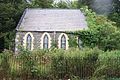
 Caerhun Chapel.jpg 3 024 × 4 032 ; 4,19 Mio
-
 Caerhun Farm Caravan Club Certified Site - 5 - geograph.org.uk - 412949.jpg 640 × 360 ; 72 kio
-
 Caerhun looking East - geograph.org.uk - 6119440.jpg 4 000 × 3 000 ; 4,68 Mio
-
 Caerhun looking towards Coed-y-Borthol - geograph.org.uk - 6119452.jpg 4 000 × 3 000 ; 4,84 Mio
-
 CaerhunRiverConwy9010465.JPG 2 048 × 1 536 ; 623 kio
-
 Cairn on Pen yr Helgi Du - geograph.org.uk - 3383931.jpg 1 024 × 680 ; 198 kio
-
 Cairn on Pen yr Helgi Du - geograph.org.uk - 3383937.jpg 1 024 × 680 ; 261 kio
-
 Capel Seion-Zion Chapel - geograph.org.uk - 4516996.jpg 1 000 × 531 ; 574 kio
-
 Capel Soar - geograph.org.uk - 6069769.jpg 800 × 600 ; 114 kio
-
 Capel Soar - geograph.org.uk - 6069798.jpg 800 × 600 ; 120 kio
-
 Car park below Llyn Eigiau - geograph.org.uk - 1963053.jpg 640 × 480 ; 48 kio
-
 Carnedd Llewelyn Summit View - geograph.org.uk - 3347028.jpg 1 600 × 1 200 ; 795 kio
-
 Carnedd Penyborth-goch, Drum - geograph.org.uk - 2931644.jpg 2 592 × 1 944 ; 1,21 Mio
-
 Carnedd Penyborth-goch, Drum - geograph.org.uk - 5724854.jpg 1 600 × 1 200 ; 384 kio
-
 Carnedd y Ddelw - geograph.org.uk - 6045994.jpg 1 024 × 683 ; 125 kio
-
 Carnedd y Ddelw, Cairn of the Idol - geograph.org.uk - 1874864.jpg 640 × 480 ; 90 kio
-
 Carnivorous rocks^ - geograph.org.uk - 981440.jpg 480 × 640 ; 177 kio
-
 Cattle on Tremorfa Road - geograph.org.uk - 5081394.jpg 640 × 427 ; 92 kio
-
 Cefn Tal-llyn-Eigiau - geograph.org.uk - 3345854.jpg 1 024 × 680 ; 209 kio
-
 Ceiling decoration in Zion Chapel, Rowen - geograph.org.uk - 4497476.jpg 480 × 640 ; 50 kio
-
 Centre of Afon Conwy from bridge - geograph.org.uk - 2107966.jpg 640 × 480 ; 56 kio
-
 Cerrig Cochion - geograph.org.uk - 3123471.jpg 1 024 × 680 ; 211 kio
-
 Cerrig Pryfaid - geograph.org.uk - 4504229.jpg 1 600 × 1 200 ; 898 kio
-
 Ceunant Afon Tafolog - Afon Tafolog gorge - geograph.org.uk - 6227447.jpg 640 × 522 ; 96 kio
-
 Chevaux de frise, Pen-y-gaer hill fort - geograph.org.uk - 2829430.jpg 640 × 480 ; 101 kio
-
 Church cottages - geograph.org.uk - 2979494.jpg 640 × 480 ; 100 kio
-
 Church of St Mary in Canovium Roman Fort off the B5106 Caerhun - geograph.org.uk - 3659644.jpg 5 184 × 3 456 ; 4,73 Mio
-
 Church of St Mary in Canovium Roman Fort off the B5106 Caerhun - geograph.org.uk - 3659646.jpg 5 184 × 3 456 ; 4,54 Mio
-
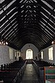 Church of St Mary in Canovium Roman Fort off the B5106 Caerhun - geograph.org.uk - 3659649.jpg 3 293 × 4 939 ; 4,46 Mio
-
 Church of St Mary in Canovium Roman Fort off the B5106 Caerhun - geograph.org.uk - 3659651.jpg 3 356 × 5 034 ; 4,59 Mio
-
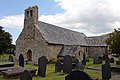
 Church of St Mary, Caerhun, Conwy - geograph.org.uk - 2250755.jpg 2 592 × 1 727 ; 3,19 Mio
-
 Cleaved outcrop - geograph.org.uk - 4987152.jpg 640 × 480 ; 91 kio
-
 Cliff and lake shore - geograph.org.uk - 4987170.jpg 480 × 640 ; 96 kio
-
 Climbing road - geograph.org.uk - 4363811.jpg 640 × 480 ; 104 kio
-
 Coed Gorswen National Nature Reserve - geograph.org.uk - 4141128.jpg 2 816 × 2 112 ; 1,22 Mio
-
 Coedty Reservoir - geograph.org.uk - 1945614.jpg 4 592 × 3 056 ; 4,5 Mio
-
 Coedty Reservoir view - geograph.org.uk - 6111287.jpg 800 × 600 ; 109 kio
-
 Contractor's compound - geograph.org.uk - 3866976.jpg 640 × 480 ; 61 kio
-
 Contrasting weather - geograph.org.uk - 2873541.jpg 640 × 480 ; 95 kio
-
 Conway Road looking south - geograph.org.uk - 2480539.jpg 640 × 481 ; 85 kio
-
 Conwy River - geograph.org.uk - 2429281.jpg 1 280 × 960 ; 624 kio
-
 Conwy Valley from Rowen Youth Hostel - geograph.org.uk - 4132180.jpg 2 816 × 2 112 ; 1,01 Mio
-
 Corlan and Melynllyn track - geograph.org.uk - 4987154.jpg 640 × 480 ; 95 kio
-
 Cottage gardens, Pontwgan - geograph.org.uk - 2981286.jpg 640 × 480 ; 100 kio
-
 Cottages at Rowen - geograph.org.uk - 2397506.jpg 640 × 480 ; 119 kio
-
 Cottages in Rowen - geograph.org.uk - 2871115.jpg 3 296 × 2 472 ; 1,9 Mio
-
 Cottages in Rowen - geograph.org.uk - 4495163.jpg 640 × 480 ; 79 kio
-
 Cottages outside Caerhun - geograph.org.uk - 110420.jpg 640 × 480 ; 188 kio
-
 Cottages, Llanbedr-y-cennin - geograph.org.uk - 2979474.jpg 640 × 480 ; 98 kio
-
 Cotton grass - geograph.org.uk - 2178009.jpg 2 288 × 1 712 ; 886 kio
-
 Cotton Grass - geograph.org.uk - 4988399.jpg 640 × 480 ; 106 kio
-
 Crag and waterfall with tree - geograph.org.uk - 4958987.jpg 640 × 480 ; 89 kio
-
 Crags on Craig Eigiau - geograph.org.uk - 3347147.jpg 1 024 × 680 ; 211 kio
-
 Craig Eigiau - geograph.org.uk - 2871227.jpg 640 × 480 ; 65 kio
-
 Craig Eigiau and Llyn Eigiau - geograph.org.uk - 1341323.jpg 640 × 426 ; 53 kio
-
 Craig yr Ysfa - geograph.org.uk - 2368420.jpg 518 × 690 ; 150 kio
-
 Cwm Eagiau - geograph.org.uk - 3383933.jpg 1 024 × 680 ; 130 kio
-
 Cwm Eigiau - geograph.org.uk - 2871207.jpg 640 × 480 ; 88 kio
-
 Cwm Eigiau - geograph.org.uk - 3126278.jpg 680 × 1 024 ; 198 kio
-
 Cwm Eigiau - geograph.org.uk - 4745584.jpg 4 608 × 3 456 ; 4,14 Mio
-
 Cwm Eigiau Cottage - geograph.org.uk - 3346579.jpg 1 024 × 680 ; 259 kio
-

-
 Cwm Eigiau from Craig yr Ysfa - geograph.org.uk - 2319463.jpg 4 231 × 1 024 ; 1,45 Mio
-
 Cwm Eigiau from the slopes of Pen yr Helgi Du - geograph.org.uk - 4898267.jpg 1 600 × 1 129 ; 511 kio
-
 Cwm Eigiau slate quarry - geograph.org.uk - 3122448.jpg 1 024 × 680 ; 273 kio
-
 Cwm Eigiau slate quarry - geograph.org.uk - 3126288.jpg 1 024 × 680 ; 232 kio
-
 Cwm Eigiau slate quarry - geograph.org.uk - 3126318.jpg 1 024 × 680 ; 186 kio
-
 Cwm Eigiau view from Craig yr Ysfa - geograph.org.uk - 3182491.jpg 3 648 × 2 736 ; 4,51 Mio
-
 Dam And Spillway, Coedty Reservoir - geograph.org.uk - 5966889.jpg 1 600 × 1 200 ; 456 kio
-
 Damp valley bottom - geograph.org.uk - 2981392.jpg 640 × 480 ; 96 kio
-
 Deep pool - geograph.org.uk - 6122968.jpg 800 × 600 ; 100 kio
-
 Deep snow on Foel Fras - geograph.org.uk - 1937798.jpg 1 766 × 1 149 ; 298 kio
-
 Disused chapel near Bod Hyfryd - geograph.org.uk - 222140.jpg 640 × 427 ; 129 kio
-
 Disused Leat Near Bwlch-y-gaer - geograph.org.uk - 5966873.jpg 1 600 × 1 200 ; 614 kio
-
 Disused quarry - geograph.org.uk - 6069830.jpg 800 × 600 ; 150 kio
-
 Does the rainbow promise better weather^ - geograph.org.uk - 2022461.jpg 4 592 × 3 056 ; 3,85 Mio
-
 Dolerite outcrops - geograph.org.uk - 1359552.jpg 640 × 480 ; 82 kio
-
 Door To The Secret Garden - geograph.org.uk - 412986.jpg 640 × 360 ; 83 kio
-
 Driveway at Coed-mawr Hall - geograph.org.uk - 2397508.jpg 640 × 480 ; 148 kio
-
 Drum with the "other" Foel Lwyd to the right - geograph.org.uk - 2050799.jpg 4 592 × 3 056 ; 3,59 Mio
-
 Dry stone wall near Rowen - geograph.org.uk - 4141130.jpg 2 816 × 2 112 ; 981 kio
-
 Dulyn - geograph.org.uk - 3030972.jpg 2 288 × 1 712 ; 1,03 Mio
-
 Dulyn leat - geograph.org.uk - 4979800.jpg 480 × 640 ; 93 kio
-
 Dulyn Reservoir - geograph.org.uk - 3347152.jpg 1 024 × 680 ; 177 kio
-
 Dulyn Reservoir and Valve House - geograph.org.uk - 5019031.jpg 1 600 × 1 200 ; 682 kio
-
 Dulyn Reservoir from Craig Fawr - geograph.org.uk - 4899058.jpg 1 600 × 1 152 ; 486 kio
-
 Dulyn weir - geograph.org.uk - 4979791.jpg 640 × 480 ; 85 kio
-


_-_geograph.org.uk_-_981432.jpg)


