Category:California Trail
Przejdź do nawigacji
Przejdź do wyszukiwania
historic migration route in the western United States  Kalifornská stezka v Nevadě | |||||
| Prześlij plik multimedialny | |||||
| Jest to |
| ||||
|---|---|---|---|---|---|
| Miejsce |
| ||||
| Operator | |||||
| oficjalna strona internetowa | |||||
| |||||
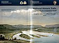
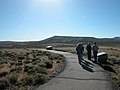
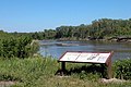
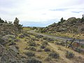
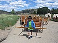
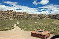
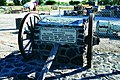
English: The pioneer California Trail — a 19th century emigrant trail of about 2,000 miles (3,200 km) across western North America, from the Missouri River to the present day state of California.
- A National Historic Trail of the United States. The eastern half followed the Oregon Trail route before diverging southwest.
Podkategorie
Poniżej wyświetlono 41 spośród wszystkich 41 podkategorii tej kategorii.
+
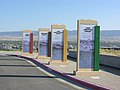
- Signs of the California National Historic Trail (47 plików)
3
- 3-Trails Corridor (30 plików)
A
B
- Benson Grist Mill (5 plików)
C
- California Trail Intepretive Center (15 plików)
- Camp at the Humboldt River in art (4 pliki)
- Castle Rock (Summit County, Utah) (15 plików)
- Cherokee Pass (3 pliki)
- Courthouse and Jailhouse Rock (9 plików)
D
- Devil's Gate (Wyoming) (26 plików)
E
F
- Fort Hall (20 plików)
G
- Gardner Junction Park (7 plików)
H
- Susan Haile grave (10 plików)
I
- Ice Slough (Wyoming) (11 plików)
M
- Mahaffie Stagecoach Stop and Farm Historic Site (6 plików)
- Martin's Cove (5 plików)
- Mormon Handcart Historic Site (5 plików)
- Mormon Station State Historic Park (11 plików)
N
- National Frontier Trails Museum (15 plików)
O
- O'Fallon's Bluff (Lincoln County, Nebraska) (17 plików)
- Overland Pass (Nevada) (35 plików)
P
- Parting of the Ways (3 pliki)
S
- Split Rock (Wyoming) (12 plików)
- St. Joseph Riverfront Landing (10 plików)
- Sweetwater Station (Emigrant Trail) (19 plików)
W
- Carl David Weber (9 plików)
Pliki w kategorii „California Trail”
Poniżej wyświetlono 200 spośród wszystkich 279 plików w tej kategorii.
(poprzednia strona) (następna strona)-
 Wpdms california trail3.png 300 × 200; 24 KB
-

-

-

-
-
-

-
 2014-06-04 12 16 52 California Trail Marker for the Elko Hot Hole.JPG 3264 × 2448; 2,91 MB
-

-

-

-

-

-

-

-

-

-

-

-

-

-

-

-

-

-

-

-

-

-

-

-

-

-

-

-

-

-
-

-

-

-

-

-

-

-
-
-
-
-

-
-

-
-

-

-
-
-

-

-

-

-

-

-

-
-

-

-
-

-
-

-

-
-

-

-

-
-

-

-

-
-

-

-
-
-

-

-

-
-

-

-
-
-
-

-

-

-

-

-

-

-

-

-

-
-

-

-
-

-
-
-

-

-

-

-

-
-

-

-

-

-

-

-

-

-

-

-

-
-
-

-

-
-

-
-

-
-

-

-

-
-

-

-

-

-

-
-

-

-

-

-

-

-

-
 Auto Tour Route 2016-07-12 298.jpg 3264 × 2176; 1,66 MB
-
 Auto Tour Route 2016-07-12 299.jpg 2176 × 3264; 1,52 MB
-
 Auto Tour Route Interp Guide Across Wyoming.jpg 3507 × 2552; 1,61 MB
-
 Auto Tour Route Interp Guide Along the Snake River Plain Thorugh Idaho.jpg 3495 × 2552; 1,56 MB
-
 Auto Tour Route Interp Guide Nebraska and Northeastern Colorado.jpg 3507 × 2552; 1,39 MB
-
 Auto Tour Route Interp Guide Western Missouri THrough Northeastern Kansas.jpg 3507 × 2552; 1,61 MB
-
 Auto Trail marker 2017-09-27 1441.jpg 4608 × 3072; 3,66 MB
-

-
-

-

-

-

-

-

-
-
-

-
-

-

-

-

-

-

-

-

-

-

-

-

-
-

-
-

-
-
-

-

-
 Beckwourth Trail - Peavine Springs.jpg 1536 × 2048; 1,13 MB
-
 Buckland Station Historical Marker 192.jpg 2448 × 3264; 3,93 MB
-

-

-

-
-


_on_the_California,_Oregon,_and_Santa_Fe_National_Historic_Trails_(2003)_(bef3b10a-c7f5-4042-9538-d1f1007f45c0).JPG)
_on_the_California,_Oregon,_and_Santa_Fe_National_Historic_Trails_(2003)_(621ef9e2-2a73-4b19-87b7-ea7b6e12e13a).JPG)
_on_the_California,_Oregon,_and_Santa_Fe_National_Historic_Trails_(2003)_(10f3d5cd-e263-4628-b8ab-b4cc72a148c6).jpg)
_on_the_California,_Oregon,_and_Santa_Fe_National_Historic_Trails_(2004)_(03830995-ac3f-46cc-b16a-13482d5971f0).jpg)
_on_the_California_and_Oregon_National_Historic_Trails_(2003)_(f9959b6c-69f8-4ba6-92e7-472edf9899c6).JPG)
_on_the_California,_Oregon,_and_Santa_Fe_National_Historic_Trails_(2004)_(38f7ea31-c116-4d40-b33c-cb947c5a087a).jpg)


_about_21.7_miles_north_of_Wilkins-Montello_Road_(Elko_County_Route_765)_in_Elko_County,_Nevada.JPG)
_about_17.0_miles_east_of_Little_Goose_Creek_in_Elko_County,_Nevada.JPG)
_about_17.0_miles_east_of_Little_Goose_Creek_in_Elko_County,_Nevada.JPG)


_about_17.2_miles_north_of_Wilkins-Montello_Road_(Elko_County_Route_765)_in_Elko_County,_Nevada.JPG)
_about_17.2_miles_north_of_Wilkins-Montello_Road_(Elko_County_Route_765)_in_Elko_County,_Nevada.JPG)
_about_11.4_miles_north_of_Wilkins-Montello_Road_(Elko_County_Route_765).JPG)
_about_11.4_miles_north_of_Wilkins-Montello_Road_(Elko_County_Route_765)_in_Rock_Springs,_Nevada.JPG)
_about_21.2_miles_east_of_U.S._Route_93_in_Elko_County,_Nevada.JPG)
_about_21.2_miles_east_of_U.S._Route_93_in_Elko_County,_Nevada.JPG)
_about_14.7_miles_east_of_U.S._Route_93_in_Elko_County,_Nevada.JPG)
_about_14.7_miles_east_of_U.S._Route_93_in_Elko_County,_Nevada.JPG)
_about_14.7_miles_east_of_U.S._Route_93_in_Elko_County,_Nevada.JPG)
_about_14.7_miles_east_of_U.S._Route_93_in_Elko_County,_Nevada.JPG)
_about_14.7_miles_east_of_U.S._Route_93_in_Elko_County,_Nevada.JPG)
_about_14.7_miles_east_of_U.S._Route_93_in_Elko_County,_Nevada.JPG)
_about_14.7_miles_east_of_U.S._Route_93_in_Elko_County,_Nevada.JPG)
_about_3.7_miles_east_of_U.S._Route_93_in_Elko_County,_Nevada.JPG)
_about_3.7_miles_east_of_U.S._Route_93_in_Elko_County,_Nevada.JPG)
_about_3.7_miles_east_of_U.S._Route_93_in_Elko_County,_Nevada.JPG)
_about_3.7_miles_east_of_U.S._Route_93_in_Elko_County,_Nevada.JPG)
_about_3.7_miles_east_of_U.S._Route_93_in_Elko_County,_Nevada.JPG)


_in_Elko_County,_Nevada.jpg)
_on_the_California_and_Oregon_National_Historic_Trails_(2003)_(6efdd51c-b3ed-4785-9366-d09b7420acd1).JPG)
_on_the_California_and_Oregon_National_Historic_Trails_(2003)_(8a8904f2-4385-4bb4-b0fd-19f91344aea6).JPG)
_on_the_California_and_Oregon_National_Historic_Trails_(2003)_(cb5c691c-3544-4ba5-b4f7-ceaaa508268d).JPG)
_on_the_California_and_Oregon_National_Historic_Trails_(2003)_(0cd51afd-7559-4c43-ba4a-668c02675308).JPG)
_on_the_California_and_Pony_Express_National_Historic_Trails_(2003)_(56781d16-21e1-4afd-813a-4e7578841414).jpg)
_on_the_California,_Oregon,_and_Pony_Express_National_Historic_Trails_(2003)_(84784730-017b-4418-9f41-ac3d010bb4f4).JPG)
_on_the_California,_Oregon,_and_Santa_Fe_National_Historic_Trails_(2003)_(e1a3077e-3680-4611-8f3e-46f619b8d2ee).JPG)
_on_the_California_and_Oregon_National_Historic_Trails_(2003)_(dbc9c787-8c06-40eb-99bb-4da6f5690370).JPG)
_on_the_California,_Oregon,_and_Santa_Fe_National_Historic_Trails_(2003)_(da140db9-44f7-4a23-908e-7180c3718a5e).JPG)
_on_the_California,_Oregon,_and_Santa_Fe_National_Historic_Trails_(2003)_(80582ac4-2222-4cb9-aae6-39e9fb455952).JPG)
_on_the_California,_Oregon,_and_Santa_Fe_National_Historic_Trails_(2003)_(d1b837d0-f5ca-4dee-9e66-b452fcd5fd9d).JPG)
_on_the_California,_Oregon,_and_Santa_Fe_National_Historic_Trails_(2003)_(55782bfb-c93d-40b9-a91e-ebe78be1ada3).JPG)
_on_the_California,_Mormon_Pioneer,_and_Pony_Express_National_Historic_Trails_(2003)_(cde088e3-d32b-4602-876b-4943c3fbacc0).jpg)
_on_the_California_National_Historic_Trail_(2006)_(f1639f2f-34b7-4ecb-a676-833d03bcfdef).JPG)
_on_the_California_National_Historic_Trail_(2008)_(717eb356-4f23-4b7c-b782-a853ea9cb586).jpg)
_on_the_California,_Oregon,_and_Pony_Express_National_Historic_Trails_(2005)_(e123fa58-4820-4d0d-8ad9-d39ac0f986c9).jpg)
_on_the_California_and_Oregon_National_Historic_Trails_(2007)_(4d825f62-af63-4421-913a-ef52290a7ccc).JPG)
_on_the_California,_Mormon_Pioneer,_Oregon,_and_Pony_Express_National_Historic_Trails_(2006)_(2bfa5960-4097-4f6b-898a-78fb9790c384).JPG)
_on_the_California_National_Historic_Trail_(2008)_(8e48e5b0-88b3-4448-b052-2ffd92913c3e).jpg)
_on_the_California_and_Oregon_National_Historic_Trails_(2008)_(f245c488-429d-4c53-a361-9ded73714153).jpg)
_on_the_California,_Oregon,_and_Pony_Express_National_Historic_Trails_(2005)_(ba0df7d8-60e9-4fec-9fcf-9e55f2862567).jpg)
_on_the_California_and_Mormon_Pioneer_National_Historic_Trails_(2008)_(1dda1658-ce94-4f25-8ca9-f9aff7f8857b).jpg)
_on_the_California_and_Oregon_National_Historic_Trails_(2008)_(90958809-ef12-4b2a-bcd1-a369824b5ba8).jpg)
_on_the_California,_Mormon_Pioneer,_and_Pony_Express_National_Historic_Trails_(2008)_(c5911087-f094-4710-b1fd-7fd69831a408).jpg)
_on_the_California_National_Historic_Trail_(2008)_(44b8c69a-0f12-4c9e-a895-65ed7c85e381).jpg)
_on_the_California_National_Historic_Trail_(2010)_(f6984b4b-20ed-4ee3-843b-d600236ecc41).jpg)
_on_the_California,_Mormon_Pioneer,_and_Oregon_National_Historic_Trails_(2006)_(09a4ed81-72d3-47f5-af8e-d1c506508cd1).JPG)
_on_the_California_and_Oregon_National_Historic_Trails_(2007)_(a6ce6793-ac80-4dc5-be80-2a67d47b3a05).JPG)
_on_the_California_and_Mormon_Pioneer_National_Historic_Trails_(2008)_(981f7524-7577-4507-a945-58ac945e968e).jpg)
_on_the_California_National_Historic_Trail_(2011)_(3940119f-e8bc-4f60-aaa5-8a5bc026fe48).jpg)
_on_the_California_and_Mormon_Pioneer_National_Historic_Trails_(2008)_(e0d99645-b5de-4924-9541-9326c4b3545f).jpg)
_on_the_California_and_Oregon_National_Historic_Trails_(2007)_(5ea25516-efd2-46b2-9196-ca0d7678bfcf).jpg)
_(70ffa19f-0c64-48ce-b1c8-6b20a93b8bcb).jpg)
_on_the_California_National_Historic_Trail_(2008)_(ed74c979-2fcc-409e-8da7-d9dacba2f11d).jpg)
_on_the_California_National_Historic_Trail_(2006)_(ed720120-c4e3-4af4-9870-0c872f1261c6).JPG)
_on_the_California,_Oregon,_and_Pony_Express_National_Historic_Trail_(2005)_(6558310f-f615-4da5-ae55-26d22a87276f).jpg)
_(cbc5515e-f4e5-4be5-880d-2c9a15fe95d5).jpg)
_on_the_California,_Mormon_Pioneer,_and_Oregon_National_Historic_Trails_(2006)_(7af1872f-b512-48d5-8023-74e2c6d8cb51).JPG)
_on_the_California_and_Oregon_National_Historic_Trails_(2007)_(2ec1352c-12fe-465d-bb81-ac5cdad99d71).jpg)
_on_the_California,_Oregon,_and_Pony_Express_National_Historic_Trails_(2005)_(34ce7de6-b5d4-44c5-91eb-2f924a5c83eb).jpg)
_on_the_California_National_Historic_Trail_(2008)_(0c207194-fb71-4f96-874d-7212e0f07d0f).jpg)
_(82a6113c-9ece-418d-8402-1715a4475a38).jpg)
_on_the_California,_Oregon,_and_Pony_Express_National_Historic_Trail_(2005)_(702dd13f-b702-41a2-b2d7-566d7875cc84).jpg)
_on_the_California_and_Oregon_National_Historic_Trails_(2007)_(25e04de9-accc-487f-a82a-95efa4df712f).jpg)
_on_the_California_National_Historic_Trail_(2008)_(a4f1f734-7d88-4c33-8b41-65c6cf82a8e9).jpg)
_on_the_California_National_Historic_Trail_(2008)_(4500a876-e5d5-4ba2-972f-1143f3668c78).jpg)
_(24bdedc2-dd4f-4e7f-af0a-27300fdccf49).jpg)
_on_the_California,_Oregon,_and_Pony_Express_National_Historic_Trails_(2006)_(a868b962-66ec-46f2-a201-b733921fbb1d).JPG)
_on_the_California_and_Oregon_National_Historic_Trails_(2007)_(d544276d-c247-4831-98c5-6e1100fec4eb).JPG)
_on_the_California_National_Historic_Trail_(2008)_(08cd7742-b3ce-4ec6-93ed-e28cb47c97d5).jpg)
_on_the_California,_Mormon_Pioneer,_Oregon,_and_Pony_Express_National_Historic_Trails_(2006)_(487fde52-b766-48db-8e01-a8c101ec7015).JPG)
_on_the_California_and_Oregon_National_Historic_Trails_(2007)_(d02e88e3-1a53-4eea-ba60-9aedfc7a3570).jpg)
_on_the_California_and_Oregon_National_Historic_Trails_(2007)_(92be0272-e6f2-4094-9940-a210aa60e885).jpg)
_on_the_California,_Oregon,_and_Pony_Express_National_Historic_Trails_(2006)_(fc6b8bad-ceb4-4f8c-ac1d-486a0f0da3b7).JPG)
_(26105b91-0b5f-4073-8e99-64a10bc6e728).jpg)
_on_the_California_and_Oregon_National_Historic_Trails_(2005)_(2de184a7-0fc5-40ad-bd74-25b2e9650d23).jpg)
_on_the_California_National_Historic_Trail_(2008)_(ba7a9434-3770-40b9-8f27-b4e636575663).jpg)
_on_the_California_National_Historic_Trail_(2008)_(dde03972-1188-42a4-962f-0057807f558c).jpg)
_on_the_California,_Mormon_Pioneer,_and_Oregon_National_Historic_Trails_(2006)_(d1221dff-e418-4876-84f7-735b08a8cc25).JPG)
_on_the_California,_Mormon_Pioneer,_and_Pony_Express_National_Historic_Trails_(2008)_(81721da9-9042-4634-a924-e42f72e6823a).jpg)
_on_the_California_National_Historic_Trail_(2007)_(fb75ca39-ea20-460e-8137-3492d7bbd7a6).JPG)
_on_the_California_National_Historic_Trail_(2008)_(26365277-6c8d-4030-af38-eb4f15f7043d).jpg)
_on_the_California_and_Mormon_Pioneer_National_Historic_Trails_(2008)_(7cd060ef-fd47-4f68-91ec-f8afb44ebbfa).jpg)
_on_the_California_National_Historic_Trail_(2008)_(cb6384ff-bd0b-46ab-b7ac-c52bd3f25ef4).jpg)
_on_the_California,_Mormon_Pioneer,_Oregon,_and_Pony_Express_National_Historic_Trails_(2006)_(0438c200-87c0-422c-b5f0-41812269f2ca).JPG)
_on_the_California_and_Oregon_National_Historic_Trails_(2006)_(5fae7f89-2dc0-4c92-aaa1-d8d2978fa2ce).JPG)
_on_the_California_National_Historic_Trail_(2008)_(4ba26b58-70b9-43d4-b92b-6310f0beb34a).jpg)
_(dea0a818-506a-4f14-8608-c69cf44c757e).jpg)
_(03f8a3fc-4bd2-4399-9072-6ae2bec03f7d).jpg)
_on_the_California,_Mormon_Pioneer,_and_Oregon_National_Historic_Trails_(2006)_(cc6cf417-ffe4-40ae-9ec0-4b893b2e1d20).JPG)
_on_the_California,_Mormon_Pioneer,_and_Oregon_National_Historic_Trails_(2006)_(2d400074-7c4c-433c-8e7c-fc44deec5878).JPG)
_on_the_California,_Mormon_Pioneer,_Oregon,_Pony_Express_National_Historic_Trails_(2006)_(c3ac2cfb-90c7-46e0-a5f7-afa0a9329bf7).JPG)
_on_the_California,_Mormon_Pioneer,_Oregon,_and_Pony_Express_National_Historic_Trails_(2006)_(5916db7f-2804-483a-86a9-1bc5a33b1ead).JPG)
_on_the_California_and_Mormon_Pioneer_National_Historic_Trails_(2006)_(9c19a70c-f64b-47d8-be39-33a6d026c8c1).JPG)
_on_the_California_and_Oregon_National_Historic_Trails_(2007)_(5c30caec-36fd-4174-a866-71f710f52854).jpg)
_on_the_California_National_Historic_Trail_(2008)_(7edaab05-6bac-4f43-81a8-7f65efea0b4b).jpg)
_on_the_California_and_Mormon_Pioneer_National_Historic_Trails_(2009)_(06681b53-9c35-4b94-8bd1-e09a5d27a16c).jpg)
_on_the_California,_Mormon_Pioneer,_and_Oregon_National_Historic_Trails_(2006)_(4b291890-5e04-45b1-b1fd-7633284bb9f9).JPG)
_on_the_California_National_Historic_Trail_(2008)_(8c7f27c7-30e9-47b9-bf38-758ba3627562).jpg)
_on_the_California_and_Oregon_National_Historic_Trails_(2007)_(acbb44b8-71ae-46d7-aae2-74ef34fdea42).JPG)
_on_the_California_and_Mormon_Pioneer_National_Historic_Trails_(2004)_(2addfe6a-07fc-4c88-a044-b73794dc479d).jpg)
_on_the_California,_Oregon,_and_Pony_Express_National_Historic_Trails_(2005)_(319b1f02-5edb-402a-b4ad-4d0fc9fddaab).jpg)
_on_the_California_and_Oregon_National_Historic_Trails_(2008)_(611b77df-f019-4270-b3f0-d6ade0562e5d).jpg)
_on_the_California_and_Oregon_National_Historic_Trails_(2003)_(7039cbff-472d-4bf7-8e42-39c498b69090).JPG)
_on_the_California_and_Oregon_National_Historic_Trail_(2003)_(81cc21aa-0748-43d6-a6fb-6f6c5319dd20).JPG)
_on_the_California_National_Historic_Trail_(2008)_(41f0575a-8b4d-4a79-ae42-412fee093434).jpg)
.jpg)
_on_the_California_and_Oregon_National_Historic_Trails_(2003)_(c037e958-0c5d-4606-a5bc-b78fc30ea4ae).jpg)
_on_the_California_and_Oregon_National_Historic_Trails_(2003)_(ed643539-4200-41ae-814f-8db6a45e9bad).jpg)
_on_the_California,_Mormon_Pioneer,_Oregon,_and_Pony_Express_National_Historic_Trails_(2006)_(d8ed85ee-cb9c-49a1-987e-950b268e7ad0).JPG)
_on_the_California_and_Oregon_National_Historic_Trails_(2007)_(7316f5c4-35ae-4271-9024-42d3c8e1c264).jpg)
_on_the_California,_Mormon_Pioneer,_and_Oregon_National_Historic_Trails_(2006)_(e86b5a55-a553-4665-8b25-58cfca157924).JPG)
_on_the_California_and_Mormon_Pioneer_National_Historic_Trails_(2010)_(fb4fc2f1-d674-4ff0-8b59-50e07bd56857).jpg)
_(c427b71c-87bd-4531-95c1-2c28f574e4f4).jpg)
_on_the_California,_Mormon_Pioneer,_and_Oregon_National_Historic_Trails_(2006)_(561eeadd-8d7a-425c-bd00-4313cca60b36).JPG)
_on_the_California,_Oregon,_and_Pony_Express_National_Historic_Trails_(2005)_(ecea54be-382a-4867-ba7b-33cdc11faf3b).jpg)
_on_the_California_and_Oregon_National_Historic_Trails_(2007)_(2a2868b3-5ff8-4d5e-965d-0e563e27c53b).jpg)
_on_the_California_National_Historic_Trail_(2008)_(7ffd768d-8a5c-475f-8f73-e5002a9d2419).jpg)
_on_the_California_and_Oregon_National_Historic_Trails_(2006)_(2af57fb8-6dba-45f6-9fac-bca41638e11c).JPG)
_on_the_California_National_Historic_Trail_(2008)_(48f2bf74-4148-474a-bddf-48128f3328c0).jpg)
_on_the_California,_Mormon_Pioneer,_and_Oregon_National_Historic_Trails_(2006)_(acca10fd-e024-4236-b120-e79146a5990a).JPG)
_(50019e7f-0206-4acf-8171-945a5df21f10).jpg)
_on_the_California,_Mormon_Pioneer,_and_Pony_Express_National_Historic_Trails_(2008)_(366f56fe-fd71-439f-a4f2-43076e85670f).jpg)
_on_the_California_National_Historic_Trail_(2008)_(c3764175-b48b-4036-8c1a-7bce6a928959).jpg)
_on_the_California,_Oregon,_and_Pony_Express_National_Historic_Trails_(2005)_(2ba1f0fb-705f-43fa-935d-5718956118b2).jpg)
_on_the_California,_Mormon_Pioneer,_and_Pony_Express_National_Historic_Trail_(2008)_(9dcbb4c5-629b-4666-bb22-63cbb0a1489b).jpg)
_on_the_California_National_Historic_Trail_(2007)_(7a90cae0-8fec-4e0e-9dc6-8381dc0ceb13).JPG)
.jpg)
.jpg)


_on_the_California_National_Historic_Trail_(2009)_(7fd84792-ba45-4dcd-8341-580c9848fe98).jpg)
_on_the_California,_Mormon_Pioneer,_Oregon,_and_Pony_Express_National_Historic_Trails_(2006)_(48a5b876-4cac-4a00-9257-b23a8c5da588).JPG)
_on_the_California_National_Historic_Trail_(2008)_(526d081f-595e-4135-8671-92cc1da86827).jpg)
_on_the_California_National_Historic_Trail_(2008)_(d8f78e1b-f064-42c8-9a69-f832c8d022ab).jpg)
_on_the_California,_Mormon_Pioneer,_and_Oregon_National_Historic_Trails_(454fe115-32c4-440d-b366-9dc5bb46856b).JPG)
_on_the_California,_Mormon_Pioneer,_and_Oregon_National_Historic_Trails_(2005)_(45c2ff23-f465-430e-b499-ab76dc073928).JPG)
_on_the_California,_Mormon_Pioneer,_Oregon,_and_Pony_Express_National_Historic_Trails_(2006)_(07e2fc96-0a1e-4972-82ef-f70f8ced5a5d).jpg)
_on_the_California_and_Oregon_National_Historic_Trails_(2006)_(672a7b2b-abd4-4987-84aa-6129fa94d36a).JPG)
_on_the_California_National_Historic_Trail_(2008)_(21b9809e-52da-48f0-8986-14d865e1d746).jpg)
_on_the_California,_Mormon_Pioneer,_and_Oregon_National_Historic_Trails_(2003)_(eed42956-974a-43ee-9e98-104384d4d854).JPG)
_on_the_California_National_Historic_Trail_(2008)_(a3ccfaff-346a-4f63-9459-1c23ea110682).jpg)
_on_the_California,_Mormon_Pioneer,_and_Oregon_National_Historic_Trails_(2003)_(49008a89-8329-4aac-93d1-cd43c3407933).JPG)
_on_the_California,_Mormon_Pioneer,_and_Oregon_National_Historic_Trails_(2006)_(60d470a9-5701-4d6d-9c87-7619bddee23b).JPG)
_on_the_California,_Mormon_Pioneer,_and_Oregon_National_Historic_Trails_(2003)_(d0150bdd-9dca-4942-8f27-6f7a4cd68dfd).JPG)
_(a17c4b16-00c3-44f6-813d-1d2585869eb1).jpg)
.JPG)
_on_the_California,_Mormon_Pioneer,_and_Oregon_National_Historic_Trails_(2003)_(2e585715-fe81-47cc-9ed5-4ee9b45708a6).JPG)
_on_the_California_National_Historic_Trail_(2010)_(aa0a7f86-593c-4cb8-8fae-1af1dcd81a64).jpg)
_on_the_California,_Mormon_Pioneer,_Oregon,_and_Pony_Express_National_Historic_Trails_(2006)_(a1fdf41c-aaec-4808-bb8b-c1f4878d889d).JPG)
_on_the_California_National_Historic_Trail_(2009)_(65b8933b-fd10-4a1f-a18f-1308c63ac780).jpg)
_on_the_California,_Mormon_Pioneer,_Oregon,_and_Pony_Express_National_Historic_Trails_(2006)_(56e3b1cc-31a8-410a-95e5-4d1f756c085f).JPG)
_on_the_California_National_Historic_Trail_(2008)_(92c49082-e4b7-4fb0-b982-846f74de4f96).jpg)
_on_the_California,_Mormon_Pioneer,_and_Oregon_National_Historic_Trails_(2007)_(45898a46-c844-40c1-ac05-96ec25972b19).JPG)
_(e71f4d45-b672-4baf-82f6-291a8e199162).jpg)
_on_the_California_and_Mormon_Pioneer_National_Historic_Trails_(2004)_(c8978772-bf73-4f0e-9452-ba829c8513dc).jpg)
_on_the_California_National_Historic_Trail_(2008)_(65c5e7e3-6050-4595-bcbb-7a9fee4ef830).jpg)
_on_the_California,_Mormon_Pioneer,_and_Oregon_National_Historic_Trails_(2006)_(35525775-1581-44e1-90d1-1bc033cf7aed).JPG)
_on_the_California_National_Historic_Trail_(2009)_(7452f161-c09a-4e44-bd53-7366a1435bc1).jpg)
_on_the_(02412d62-6703-4fff-a67c-c426151426d9).JPG)
_on_the_California,_Mormon_Pioneer,_and_Oregon_National_Historic_Trails_(2004)_(ffe5f94f-4ae4-4b7e-a0a4-b3a81fd9981c).JPG)
_(48999f8f-0b7f-4768-9721-605d97d4153c).jpg)
_on_the_California,_Mormon_Pioneer,_and_Oregon_National_Historic_Trails_(2006)_(6fe82879-51de-4e2c-a3c5-b6648aee2a71).JPG)


_on_the_California_and_Oregon_National_Historic_Trails_(2005)_(c535029f-8e58-4f2c-ac58-0ceda6c9ce98).JPG)
_on_the_California_National_Historic_Trail_(2003)_(6756d731-fa3d-46c9-ac6a-76d19cff95ba).JPG)
_on_the_California_National_Historic_Trail_(2009)_(a08c1088-43c7-46cf-8185-4c758309e228).jpg)
_on_the_California_National_Historic_Trail_(2008)_(38592829-f7eb-402d-b6f4-901119964281).jpg)
_on_the_California_and_Pony_Express_National_Historic_Trails_(2008)_(d77fe1ed-b0c6-46b5-8fa1-bdb9221d0845).jpg)
Kategorie:
- National Historic Trails of the United States
- Trails in California
- Trails in Idaho
- Trails in Wyoming
- Western United States
- Wild West
- History of the United States (1789–1849)
- History of the United States (1849–1865)
- History of California
- History of Nevada
- History of Idaho
- History of Utah
- Wagon Routes across Wyoming
- Oregon Trail
- California in the 1840s
- California in the 1850s
- Emigrant trails
- National Park Service in California
- National Park Service in Nevada
- National Park Service in Idaho
- National Park Service in Utah
- National Park Service in Wyoming
- National Park Service in Nebraska
- National Park Service in Kansas
- National Park Service in Missouri
- Historic roads and trails in the United States
- Westward expansion of the United States
- History of the Rocky Mountains
- Pre-statehood history of California