Category:Carbrooke
Aller à la navigation
Aller à la recherche
English: Carbrooke is a village and civil parish in the Breckland district of mid-Norfolk, East Anglia, England in the United Kingdom. It is with an estimated population of 1,310 as of 2007.
localité britannique du comté anglais de Norfolk  | |||||
| Téléverser des médias | |||||
| Nature de l’élément | |||||
|---|---|---|---|---|---|
| Lieu | Breckland, Norfolk, Angleterre de l'Est, Angleterre | ||||
| Population |
| ||||
| Superficie |
| ||||
| Réputé identique à | Carbrooke (page en doublon, paroisse civile) | ||||
 | |||||
Sous-catégories
Cette catégorie comprend 2 sous-catégories, dont les 2 ci-dessous.
C
P
Média dans la catégorie « Carbrooke »
Cette catégorie comprend 226 fichiers, dont les 200 ci-dessous.
(page précédente) (page suivante)-
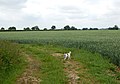 A bend in a farm track - geograph.org.uk - 1348598.jpg 640 × 447 ; 96 kio
-
 A handsome tree beside a farm track - geograph.org.uk - 1347729.jpg 485 × 640 ; 131 kio
-
 A large barley field - geograph.org.uk - 907197.jpg 640 × 442 ; 191 kio
-
 A large field of beans - geograph.org.uk - 1347851.jpg 640 × 480 ; 129 kio
-
 A strip of bright yellow - geograph.org.uk - 1347834.jpg 640 × 480 ; 101 kio
-
 A woodland edge - geograph.org.uk - 1348876.jpg 640 × 480 ; 107 kio
-
 Aerolite Garage on Norwich Road, Watton - geograph.org.uk - 6543752.jpg 1 892 × 1 236 ; 1,32 Mio
-
 An overgrown drinking pond - geograph.org.uk - 1348976.jpg 640 × 616 ; 106 kio
-
 Arable landscape - geograph.org.uk - 6173922.jpg 1 024 × 768 ; 256 kio
-
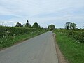
 B1108 to Norwich - geograph.org.uk - 6204006.jpg 1 024 × 768 ; 245 kio
-
 B1108 to Norwich - geograph.org.uk - 6204225.jpg 1 024 × 768 ; 236 kio
-
 B1108 towards Watton - geograph.org.uk - 6204210.jpg 1 024 × 768 ; 233 kio
-
 Belt of trees beside farm track (1) - geograph.org.uk - 1348589.jpg 640 × 426 ; 168 kio
-
 Belt of trees beside farm track (2) - geograph.org.uk - 1348592.jpg 640 × 426 ; 153 kio
-
 Belt of trees beside farm track (3) - geograph.org.uk - 1348605.jpg 640 × 465 ; 113 kio
-
 Bend in farm road - geograph.org.uk - 1347823.jpg 640 × 480 ; 135 kio
-
 Beside the track - geograph.org.uk - 907232.jpg 480 × 640 ; 194 kio
-
 Bridge Street, Carbrooke - geograph.org.uk - 5434149.jpg 640 × 397 ; 76 kio
-
 Broadmoor Lane - geograph.org.uk - 278309.jpg 640 × 480 ; 100 kio
-
 Broadmoor Lane To Carbrooke - geograph.org.uk - 293280.jpg 640 × 480 ; 90 kio
-
 Broadmoor Road towards Carbrooke - geograph.org.uk - 5393321.jpg 640 × 480 ; 53 kio
-
 Broadmoor Road, Carbrooke - geograph.org.uk - 5393785.jpg 2 848 × 2 136 ; 1,43 Mio
-
 Bush Farm House - geograph.org.uk - 6174738.jpg 1 024 × 768 ; 346 kio
-
 Carbrooke - village green - geograph.org.uk - 710247.jpg 640 × 464 ; 142 kio
-
 Carbrooke Garage - geograph.org.uk - 5434163.jpg 640 × 480 ; 65 kio
-
 Carbrooke Hall, Broadmoor - geograph.org.uk - 6544848.jpg 1 920 × 1 280 ; 1,66 Mio
-
 Carbrooke Mill in Mill Lane - geograph.org.uk - 6159970.jpg 3 456 × 2 592 ; 2,36 Mio
-
 Carbrooke Road from near Bush Farm - geograph.org.uk - 6159701.jpg 3 456 × 2 592 ; 3,75 Mio
-
 Carbrooke Road, near Bush Farm and Grape Farm - geograph.org.uk - 6159700.jpg 3 456 × 2 592 ; 3,97 Mio
-
 Carbrooke village sign - geograph.org.uk - 3719244.jpg 1 944 × 2 592 ; 1,66 Mio
-
 Carbrooke village sign - geograph.org.uk - 6803847.jpg 2 652 × 2 652 ; 1,15 Mio
-
 Carbrooke village sign - geograph.org.uk - 6803849.jpg 4 608 × 3 072 ; 5,78 Mio
-
 Carbrooke, houses opposite the church - geograph.org.uk - 5541472.jpg 640 × 480 ; 60 kio
-
 Cereal crop east of Shipdham Road - geograph.org.uk - 5434172.jpg 640 × 480 ; 78 kio
-
 Cereal crops - geograph.org.uk - 6164899.jpg 1 024 × 768 ; 209 kio
-
 Chestnut Plantation - geograph.org.uk - 5393308.jpg 640 × 480 ; 60 kio
-
 Clogged up stream from bridge - geograph.org.uk - 6164930.jpg 1 024 × 768 ; 375 kio
-
 Close up, Elizabeth II postbox on Broadmoor Road, Carbrooke - geograph.org.uk - 5393784.jpg 1 359 × 2 688 ; 741 kio
-

-
 Cottage on a corner on Broadmoor Road - geograph.org.uk - 6159982.jpg 3 456 × 2 592 ; 3,87 Mio
-
 Cottages on Church Street - geograph.org.uk - 710231.jpg 640 × 460 ; 130 kio
-
 Cottages on Church Street, Carbrooke - geograph.org.uk - 5434165.jpg 640 × 480 ; 61 kio
-
 Cotteridge's Plantation - geograph.org.uk - 5434175.jpg 640 × 480 ; 76 kio
-
 Country Lane, heading towards Ovington - geograph.org.uk - 2967271.jpg 3 648 × 2 736 ; 2,96 Mio
-
 Deer-stalking Norfolk-style - geograph.org.uk - 905832.jpg 640 × 465 ; 196 kio
-
 Distant view of Carbrooke Church - geograph.org.uk - 6173912.jpg 1 024 × 769 ; 248 kio
-
 Dog roses in a hedgerow near Carbrooke - geograph.org.uk - 1348601.jpg 640 × 441 ; 137 kio
-
 Earthwork, site of an ancient Preceptory - geograph.org.uk - 6159934.jpg 3 456 × 2 592 ; 3,84 Mio
-
 East on Drury Lane - geograph.org.uk - 6208963.jpg 1 024 × 768 ; 324 kio
-
 East on Drury Lane Carbrooke - geograph.org.uk - 6208931.jpg 1 024 × 768 ; 277 kio
-
 East on road to Waterworks - geograph.org.uk - 6173925.jpg 1 024 × 768 ; 217 kio
-
 East on track beside Waterworks - geograph.org.uk - 6174634.jpg 1 024 × 768 ; 213 kio
-
 Elizabeth II postbox on Broadmoor Road, Carbrooke - geograph.org.uk - 5393783.jpg 2 848 × 2 136 ; 1,43 Mio
-
 Elizabeth II postbox on Shipdham Road, Carbrooke - geograph.org.uk - 5436387.jpg 480 × 640 ; 123 kio
-
 Elizabeth II postbox, Drurylane - geograph.org.uk - 5436391.jpg 2 848 × 2 136 ; 1,47 Mio
-
 Entering Carbrooke - geograph.org.uk - 5434145.jpg 640 × 480 ; 81 kio
-
 Entrance to Bush Farm - geograph.org.uk - 6166033.jpg 1 024 × 768 ; 305 kio
-
 Entrance to Farm House - geograph.org.uk - 6208936.jpg 1 024 × 768 ; 389 kio
-
 Entrance to Footpath - geograph.org.uk - 6204202.jpg 768 × 1 024 ; 375 kio
-
 Entrance to Place of Springs - geograph.org.uk - 6208946.jpg 1 024 × 768 ; 398 kio
-
 Entrance to Three Acres - geograph.org.uk - 6208961.jpg 1 024 × 768 ; 335 kio
-
 Ewe with lively quadruplets - geograph.org.uk - 710227.jpg 640 × 454 ; 183 kio
-
 Ex RAF Watton former Airmen's Mess - geograph.org.uk - 5025183.jpg 3 200 × 2 400 ; 1,67 Mio
-
 Farm entrance - geograph.org.uk - 6208928.jpg 1 024 × 768 ; 208 kio
-
 Farm road past a crop of field beans - geograph.org.uk - 1347840.jpg 640 × 480 ; 110 kio
-
 Farm road past a crop of field beans - geograph.org.uk - 1347846.jpg 640 × 480 ; 101 kio
-
 Farm track beside a wheat field - geograph.org.uk - 1347462.jpg 518 × 640 ; 144 kio
-
 Farm track near Carbrooke - geograph.org.uk - 1347450.jpg 640 × 426 ; 92 kio
-
 Farm track off Shipdham Road - geograph.org.uk - 5434173.jpg 640 × 480 ; 74 kio
-
 Farm track skirting woodland - geograph.org.uk - 1348885.jpg 640 × 480 ; 104 kio
-
 Farmland at Broadmoor Farm, Carbrooke - geograph.org.uk - 3719194.jpg 2 592 × 1 944 ; 1,53 Mio
-
 Farmland north of Carbrooke - geograph.org.uk - 1348819.jpg 640 × 480 ; 83 kio
-
 Farmland north of Watton - geograph.org.uk - 3719272.jpg 2 592 × 1 944 ; 2,1 Mio
-
 Farmland north of Watton - geograph.org.uk - 3719289.jpg 2 592 × 1 944 ; 1,94 Mio
-
 Farmtrack leading west - geograph.org.uk - 1347837.jpg 640 × 480 ; 98 kio
-
 Field beans - geograph.org.uk - 1347866.jpg 480 × 640 ; 137 kio
-
 Field beans and wild mustard - geograph.org.uk - 1347825.jpg 640 × 480 ; 98 kio
-
 Field gate with sign - geograph.org.uk - 6166014.jpg 1 024 × 768 ; 210 kio
-
 Field off Mill Lane near Carbrooke - geograph.org.uk - 5393310.jpg 640 × 480 ; 58 kio
-
 Field off Summer Lane - geograph.org.uk - 5393305.jpg 640 × 480 ; 60 kio
-
 Field south of Carbrooke - geograph.org.uk - 3719250.jpg 2 592 × 1 944 ; 1,89 Mio
-
 Field, Shrublands - geograph.org.uk - 5393302.jpg 640 × 480 ; 64 kio
-
 Fields of wheat - geograph.org.uk - 1348834.jpg 640 × 480 ; 80 kio
-
 Footpath beside arable crop - geograph.org.uk - 6173975.jpg 1 024 × 768 ; 217 kio
-
 Footpath sign - geograph.org.uk - 6174689.jpg 1 024 × 769 ; 233 kio
-
 Fox and rabbits - geograph.org.uk - 710254.jpg 480 × 640 ; 167 kio
-
 Garden on Church Street, Carbrooke - geograph.org.uk - 6545724.jpg 1 892 × 1 236 ; 2 Mio
-
 Gated track beside Waterworks - geograph.org.uk - 6174626.jpg 1 024 × 768 ; 202 kio
-
 Grassy headland beside rape crop - geograph.org.uk - 6174679.jpg 768 × 1 024 ; 290 kio
-
 Hay bales beside wood - geograph.org.uk - 905825.jpg 640 × 480 ; 195 kio
-
 Hay bales tightly wound - geograph.org.uk - 905828.jpg 640 × 480 ; 199 kio
-
 Hay meadow surrounded by woodland - geograph.org.uk - 907258.jpg 640 × 386 ; 128 kio
-
 Heading into Carbrooke - geograph.org.uk - 6209657.jpg 1 024 × 768 ; 390 kio
-
 Heading north from Carbrooke - geograph.org.uk - 5434171.jpg 640 × 480 ; 67 kio
-
 Hendon Avenue, Watton - geograph.org.uk - 6159906.jpg 3 456 × 2 592 ; 3,82 Mio
-
 House beside Church Street - geograph.org.uk - 710235.jpg 640 × 480 ; 192 kio
-
 House near Carbrooke Hall - geograph.org.uk - 5393316.jpg 640 × 480 ; 86 kio
-
 House on Shipdham Road, Carbrooke - geograph.org.uk - 6545757.jpg 1 848 × 1 162 ; 1,73 Mio
-
 Houses on Church Street, Carbrooke - geograph.org.uk - 5434157.jpg 640 × 480 ; 78 kio
-
 Houses on Hendon Avenue - geograph.org.uk - 5393298.jpg 640 × 480 ; 52 kio
-
 Information sign - geograph.org.uk - 6174674.jpg 1 024 × 769 ; 109 kio
-
 Junction of Drury Lane and Summer Lane - geograph.org.uk - 6209650.jpg 1 024 × 768 ; 262 kio
-
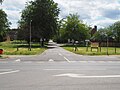
 Junction of two minor country roads - geograph.org.uk - 6164884.jpg 1 024 × 768 ; 282 kio
-
 Junction with minor road towards Watton or Carbrooke - geograph.org.uk - 6166031.jpg 1 024 × 768 ; 188 kio
-
 Lilies on Church Street, Carbrooke - geograph.org.uk - 6545721.jpg 1 920 × 1 280 ; 2,04 Mio
-
 Looking across B1108 into Portal Avenue - geograph.org.uk - 6203997.jpg 1 024 × 768 ; 241 kio
-
 Looking across model airplane field - geograph.org.uk - 6174670.jpg 1 024 × 769 ; 240 kio
-
 Looking along Drury Lane - geograph.org.uk - 6209643.jpg 1 024 × 768 ; 210 kio
-
 Looking down minor road to Ovington - geograph.org.uk - 6164905.jpg 1 024 × 768 ; 291 kio
-
 Looking down Summer Lane - geograph.org.uk - 6209661.jpg 1 024 × 768 ; 230 kio
-
 Looking east towards Woodrising - geograph.org.uk - 1347717.jpg 640 × 626 ; 151 kio
-
 Looking into Waterworks - geograph.org.uk - 6174644.jpg 1 024 × 768 ; 306 kio
-
 Looking south along Church Street - geograph.org.uk - 710244.jpg 640 × 458 ; 141 kio
-
 Looking towards Carbrooke - geograph.org.uk - 6164892.jpg 1 024 × 768 ; 331 kio
-
 Looking towards Carbrooke - geograph.org.uk - 6164943.jpg 1 024 × 768 ; 213 kio
-
 Looking towards Carbrooke Church - geograph.org.uk - 6173952.jpg 1 024 × 769 ; 202 kio
-
 Looking towards Watton over fields - geograph.org.uk - 6164939.jpg 1 024 × 768 ; 227 kio
-
 Low Farm, Scoulton - geograph.org.uk - 5936413.jpg 3 456 × 2 592 ; 3,05 Mio
-
 Memorial to 25th Bomb Group (RCN. SP.) - geograph.org.uk - 6377251.jpg 4 608 × 3 072 ; 6,55 Mio
-
 Memorial to 25th Bomb Group (RCN. SP.) - geograph.org.uk - 6377253.jpg 4 608 × 3 072 ; 6,2 Mio
-
 Mill Lane towards Carbrooke - geograph.org.uk - 5393311.jpg 640 × 480 ; 68 kio
-
 Minor road junction, Caudlesprings - geograph.org.uk - 5434143.jpg 640 × 480 ; 62 kio
-
 Minor road over bridge - geograph.org.uk - 6164953.jpg 1 024 × 768 ; 274 kio
-
 Minor road to Carbrooke - geograph.org.uk - 6204239.jpg 1 024 × 768 ; 169 kio
-
 Minor road to Watton - geograph.org.uk - 6164897.jpg 1 024 × 768 ; 249 kio
-
 Mixed wheat and barley - geograph.org.uk - 908505.jpg 480 × 640 ; 180 kio
-
 Newly rebuilt bridge on minor road to Ovington - geograph.org.uk - 6164909.jpg 1 024 × 768 ; 307 kio
-
 Northeast along a farm track - geograph.org.uk - 1347727.jpg 637 × 640 ; 151 kio
-
 Norwich Road (B1108) towards Hingham - geograph.org.uk - 5393304.jpg 640 × 480 ; 64 kio
-
 Norwich Road (B1108) towards Hingham - geograph.org.uk - 5393315.jpg 2 848 × 2 136 ; 1,46 Mio
-
 Norwich Road (B1108) towards Hingham - geograph.org.uk - 5393317.jpg 640 × 480 ; 90 kio
-
 Norwich Road at the junction of Broadmoor Road - geograph.org.uk - 6542622.jpg 1 920 × 1 280 ; 1,39 Mio
-
 Norwich road before Watton - geograph.org.uk - 6544850.jpg 1 892 × 1 236 ; 1,24 Mio
-
 Oak tree in wheat field - geograph.org.uk - 1348840.jpg 640 × 480 ; 113 kio
-
 Oak tree in wheat field - geograph.org.uk - 1348858.jpg 620 × 606 ; 101 kio
-
 Oilseed rape crop near Southmoor Farm - geograph.org.uk - 5393313.jpg 640 × 480 ; 101 kio
-
 Ordnance Survey Cut Mark - geograph.org.uk - 4217785.jpg 640 × 480 ; 118 kio
-
 Private farmland east of Carbrooke - geograph.org.uk - 1347829.jpg 640 × 480 ; 116 kio
-
 Public Footpath - geograph.org.uk - 6174684.jpg 1 024 × 768 ; 286 kio
-
 Public Footpath sign - geograph.org.uk - 6209663.jpg 768 × 1 024 ; 509 kio
-
 RAF Watton station memorial - geograph.org.uk - 5025170.jpg 3 456 × 2 592 ; 3,73 Mio
-
 Rain is badly needed - geograph.org.uk - 1348945.jpg 640 × 480 ; 146 kio
-
 Rape crop - geograph.org.uk - 6173929.jpg 1 024 × 768 ; 254 kio
-
 Red Barn Farm, Northacre near Caston - geograph.org.uk - 5936710.jpg 3 456 × 2 592 ; 3,77 Mio
-

-
 Road to Water House and Waterworks - geograph.org.uk - 6166023.jpg 1 024 × 768 ; 260 kio
-
 Shipdham Road, Carbrooke - geograph.org.uk - 5436389.jpg 2 848 × 2 136 ; 1,15 Mio
-
 Shipdham Road, Carbrooke - geograph.org.uk - 6545758.jpg 1 918 × 1 278 ; 1,62 Mio
-
 Sign on Broadmoor Road... - geograph.org.uk - 6159995.jpg 3 456 × 2 592 ; 3,75 Mio
-
 Site of former Knights Hospitallers Commandery - geograph.org.uk - 710219.jpg 480 × 640 ; 152 kio
-
 Small sewage treatment works and storage facility - geograph.org.uk - 5936715.jpg 3 456 × 2 592 ; 3,82 Mio
-
 South along a farm track - geograph.org.uk - 1347719.jpg 640 × 426 ; 120 kio
-
 South on Summer Lane - geograph.org.uk - 6209659.jpg 1 024 × 768 ; 288 kio
-
 South on Summer Lane - geograph.org.uk - 6209664.jpg 1 024 × 768 ; 203 kio
-
 South-East Of Carbrooke - geograph.org.uk - 293219.jpg 640 × 480 ; 98 kio
-
 Southwest on Drury Lane - geograph.org.uk - 6209645.jpg 1 024 × 768 ; 294 kio
-
 Spinney in wheat field - geograph.org.uk - 1348908.jpg 640 × 521 ; 75 kio
-
 Spinney surrounded by a field of beans - geograph.org.uk - 1347850.jpg 640 × 480 ; 111 kio
-
 St Peter and St Paul School, Carbrooke - geograph.org.uk - 5434155.jpg 640 × 480 ; 71 kio
-
 St Peter ^ St Paul primary school, Carbrooke - geograph.org.uk - 6545720.jpg 1 920 × 1 280 ; 1,33 Mio
-
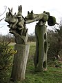
 Stone mushrooms - geograph.org.uk - 710250.jpg 480 × 640 ; 187 kio
-
 Stream viewed from bridge - geograph.org.uk - 6164923.jpg 1 024 × 768 ; 314 kio
-
 Sugarbeet stand north of Carbrooke - geograph.org.uk - 1347443.jpg 640 × 440 ; 135 kio
-
 Summer Lane near Dove Barn - geograph.org.uk - 6159922.jpg 3 456 × 2 592 ; 2,46 Mio
-
 Summer Lane To Carbrooke - geograph.org.uk - 293200.jpg 640 × 480 ; 110 kio
-
 Summer Lane towards Carbrooke - geograph.org.uk - 5393306.jpg 640 × 480 ; 59 kio
-
 Symbolic plough near Carbrooke village hall - geograph.org.uk - 6803859.jpg 4 608 × 3 072 ; 5,88 Mio
-
 The eastern end of Drury Lane - geograph.org.uk - 6159924.jpg 3 456 × 2 592 ; 3,93 Mio
-
 The end of a farm track - geograph.org.uk - 1347457.jpg 640 × 465 ; 112 kio
-
 The Flying Fish pub, Watton - geograph.org.uk - 4438667.jpg 4 320 × 3 240 ; 4,01 Mio
-
 The Flying Fish public house and restaurant - geograph.org.uk - 6159910.jpg 3 456 × 2 592 ; 2,53 Mio
-
 The garden at Carbrooke Hall, Broadmoor - geograph.org.uk - 6544849.jpg 1 920 × 1 280 ; 1,56 Mio
-
 The sign of The Flying Fish - geograph.org.uk - 6159912.jpg 2 592 × 3 456 ; 3,12 Mio
-
 The western end of Drury Lane, Carbrooke - geograph.org.uk - 6159905.jpg 3 456 × 2 592 ; 3,89 Mio
-
 Thinking about it - geograph.org.uk - 907254.jpg 640 × 419 ; 185 kio
-
 Towards Carbrooke Church - geograph.org.uk - 293424.jpg 640 × 480 ; 95 kio
-
 Track along a belt of trees - geograph.org.uk - 1348890.jpg 640 × 480 ; 86 kio
-
 Track beside a spinney - geograph.org.uk - 1347725.jpg 640 × 477 ; 129 kio
-
 Track beside wheat crop - geograph.org.uk - 6174693.jpg 1 024 × 768 ; 259 kio
-
 Track junction near Carbrooke Fen - geograph.org.uk - 905822.jpg 640 × 480 ; 194 kio
-
 Track leading west - geograph.org.uk - 907206.jpg 640 × 456 ; 153 kio
-
 Track past Carbrooke Fen - geograph.org.uk - 907219.jpg 480 × 640 ; 173 kio
-
 Tree in a wheat field - geograph.org.uk - 1348611.jpg 640 × 479 ; 76 kio
-
 Trees by Norwich Road, Watton - geograph.org.uk - 6560770.jpg 1 920 × 1 280 ; 1,65 Mio
-
 View across Rape field - geograph.org.uk - 6174006.jpg 1 024 × 768 ; 201 kio
-
 View along a belt of trees - geograph.org.uk - 1348919.jpg 480 × 640 ; 117 kio
-
 View along a field margin - geograph.org.uk - 1347826.jpg 640 × 480 ; 116 kio
-
 View south towards Carbrooke Fen - geograph.org.uk - 907260.jpg 640 × 480 ; 170 kio
-
 View south-west along a farm track - geograph.org.uk - 1348903.jpg 640 × 480 ; 101 kio
-
 Waterworks House - geograph.org.uk - 6174735.jpg 1 024 × 768 ; 296 kio
-
 Waterworks near Carbrooke - geograph.org.uk - 6174015.jpg 1 024 × 768 ; 213 kio
-
 Watton model airplane field - geograph.org.uk - 6174659.jpg 1 024 × 769 ; 275 kio
-
 West on Drury Lane - geograph.org.uk - 6209654.jpg 1 024 × 768 ; 297 kio
-
 West on Drury Lane Carbrooke - geograph.org.uk - 6208919.jpg 1 024 × 768 ; 239 kio
-
 West towards Watton on Drury Lane Carbrooke - geograph.org.uk - 6208955.jpg 1 024 × 768 ; 283 kio
-
 Wheat crop with Carbrooke Church in the distance - geograph.org.uk - 6174703.jpg 1 024 × 769 ; 230 kio
-
 Wild flowers growing beside the ditch - geograph.org.uk - 907237.jpg 480 × 640 ; 176 kio
-
 Windmill near Carbrooke (geograph 5393309).jpg 640 × 480 ; 66 kio
-
 Woodland and wheat, Carbrooke - geograph.org.uk - 1347731.jpg 640 × 426 ; 101 kio
-
 You can't say we didn't tell you - geograph.org.uk - 908511.jpg 640 × 480 ; 196 kio


_-_geograph.org.uk_-_1348589.jpg)
_-_geograph.org.uk_-_1348592.jpg)
_-_geograph.org.uk_-_1348605.jpg)


,_Watton_-_geograph.org.uk_-_5393297.jpg)


_-_geograph.org.uk_-_6377251.jpg)
_-_geograph.org.uk_-_6377253.jpg)


_towards_Hingham_-_geograph.org.uk_-_5393304.jpg)
_towards_Hingham_-_geograph.org.uk_-_5393315.jpg)
_towards_Hingham_-_geograph.org.uk_-_5393317.jpg)


.jpg)

