Category:Carlisle
Pereiti į navigaciją
Jump to search


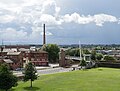
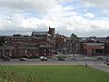
cathedral city in Cumbria, England  Vista aèria del centre històric de Carlisle  | |||||
| Įkelti mediją | |||||
| Tai yra |
| ||||
|---|---|---|---|---|---|
| Vieta |
| ||||
| Svarbus įvykis |
| ||||
| Gyventojų skaičius |
| ||||
| Plotas |
| ||||
| Aukštis virš jūros lygio |
| ||||
| Seka po |
| ||||
| Skiriasi nuo | |||||
| oficiali svetainė | |||||
 | |||||
Subkategorijos
Rodomos 24 subkategorijos (iš viso yra 24 subkategorijos).
A
B
- Border Television (6 F)
C
- Carlisle Racecourse (8 F)
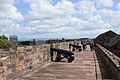
- Carlisle Castle (132 F)
- Coats of arms of Carlisle (6 F)
- Carlisle City Council (2 F)
E
- Edenside cricket ground (5 F)
F
P
- Post boxes in Carlisle (13 F)
R
- RIB I 0957 (1 F)
S
T
U
- Uxelodunum (4 F)
W
Daugialypės terpės rinkmenos kategorijoje „Carlisle“
Šioje kategorijoje yra viena rinkmena.
(ankstesnis puslapis) (kitas puslapis)-
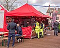
 "The Kings Head", Fisher Street - March 2018 - geograph.org.uk - 5718106.jpg 652 × 1 250; 668 KiB
-
 'No Household Waste' in this litter bin - geograph.org.uk - 5689642.jpg 640 × 480; 389 KiB
-
 'The Music House', Trinity School - geograph.org.uk - 5904913.jpg 1 024 × 768; 796 KiB
-
 13-15 English Street - geograph.org.uk - 5839340.jpg 965 × 1 280; 332 KiB
-
 Carlisle siege coin 802156.jpg 800 × 373; 287 KiB
-
 21-25 English Street, Carlisle - geograph.org.uk - 5839338.jpg 938 × 1 280; 364 KiB
-
 31 – 37 Fisher Street, Carlisle - geograph.org.uk - 5839352.jpg 1 280 × 996; 305 KiB
-
 7 Portland Square.jpg 2 592 × 3 888; 4,65 MiB
-
 70032 at Carlisle, 1965 - geograph.org.uk - 6159373.jpg 1 280 × 860; 285 KiB
-
 A pair of stone beasts holding shields - geograph.org.uk - 6115481.jpg 1 024 × 768; 910 KiB
-
 A peaceful Cathedral Close, August 2017 - geograph.org.uk - 5510543.jpg 640 × 480; 74 KiB
-
 A track running through Teviotdale farmland - geograph.org.uk - 537835.jpg 640 × 480; 106 KiB
-
 A View Over Castle Way - geograph.org.uk - 5489117.jpg 1 600 × 1 213; 373 KiB
-
 A wet day at Carlisle Cathedral - geograph.org.uk - 6155067.jpg 2 592 × 1 936; 1,86 MiB
-
 A7 - geograph.org.uk - 319547.jpg 640 × 480; 216 KiB
-
 A7 Canonbie Bypass - geograph.org.uk - 334890.jpg 640 × 480; 102 KiB
-
 A7 Canonbie Bypass - geograph.org.uk - 334894.jpg 640 × 480; 80 KiB
-
 Abberley House, Victoria Place, Carlisle - geograph.org.uk - 5849710.jpg 1 024 × 768; 349 KiB
-
 Abbey Street and Castle Street - geograph.org.uk - 5281655.jpg 640 × 427; 325 KiB
-
 Above Billhope Burn - geograph.org.uk - 571488.jpg 640 × 480; 85 KiB
-
 Agricultural Machinery Dealers - geograph.org.uk - 136371.jpg 640 × 483; 76 KiB
-
 Akenshaw Burn - geograph.org.uk - 764167.jpg 640 × 423; 108 KiB
-
 Allotments by St. Nicholas Bridge - geograph.org.uk - 749801.jpg 640 × 481; 343 KiB
-
 Alma block, Carlisle Castle - geograph.org.uk - 6311810.jpg 5 611 × 3 646; 5,81 MiB
-
 An urban horse chestnut tree in bloom - geograph.org.uk - 5485390.jpg 562 × 640; 432 KiB
-
 Andrew's Sike - geograph.org.uk - 322434.jpg 480 × 640; 106 KiB
-
 Annetwell Street-Abbey Street, June 2017 - geograph.org.uk - 5440751.jpg 1 500 × 872; 1,28 MiB
-
 Antiques centre in a converted church - geograph.org.uk - 5485386.jpg 640 × 480; 348 KiB
-
 Antonstown Burn - geograph.org.uk - 1198399.jpg 640 × 480; 133 KiB
-
 Antonstown Burn - geograph.org.uk - 663018.jpg 427 × 640; 62 KiB
-
 Approaching a funfair in Scotch Street - geograph.org.uk - 5516559.jpg 480 × 640; 56 KiB
-
 Approaching St Cuthbert, Carlisle - geograph.org.uk - 5510630.jpg 640 × 480; 79 KiB
-

-
 Approaching Tullie House - geograph.org.uk - 5516546.jpg 480 × 640; 59 KiB
-
 Areal des Meilenkastell 66 , Stanwix Bank (GB), Blick aus Nord.png 1 593 × 1 192; 4,04 MiB
-
 Arnhem block, Carlisle Castle - geograph.org.uk - 6311824.jpg 4 002 × 3 001; 3,29 MiB
-
 At the buffer stops at Carlisle - geograph.org.uk - 5937528.jpg 1 024 × 768; 507 KiB
-
 Avenue of lime trees, Carlisle Cemetery - geograph.org.uk - 902686.jpg 640 × 474; 411 KiB
-
 Avenue of trees on the road to Kershope - geograph.org.uk - 687990.jpg 640 × 480; 116 KiB
-

-
 Balloon Seller at Carlisle - geograph.org.uk - 6006754.jpg 610 × 640; 145 KiB
-
 BandQ car park, Carlisle - geograph.org.uk - 579880.jpg 640 × 480; 86 KiB
-
 Bandstand, Carlisle city centre, 2007 - geograph.org.uk - 5484614.jpg 640 × 480; 354 KiB
-
 Bank Erosion - geograph.org.uk - 92930.jpg 640 × 427; 91 KiB
-
 Barclays Bank, Carlisle - geograph.org.uk - 5006424.jpg 640 × 480; 76 KiB
-
 Baron's Dike - geograph.org.uk - 689265.jpg 640 × 480; 326 KiB
-
 Bellevue - geograph.org.uk - 663755.jpg 427 × 640; 98 KiB
-
 Bells Burn - geograph.org.uk - 743246.jpg 640 × 427; 67 KiB
-

-
 Bench in the woods, Kingmoor - geograph.org.uk - 1055929.jpg 640 × 480; 403 KiB
-
 Bench mark, Blackfriars Street, Carlisle - geograph.org.uk - 5839326.jpg 1 280 × 1 133; 412 KiB
-
 Bench mark, Carlisle Market, Fisher Street - geograph.org.uk - 5840791.jpg 960 × 1 280; 411 KiB
-
 Benchmark on Botcherby Community Centre - geograph.org.uk - 6374963.jpg 683 × 1 024; 218 KiB
-
 Benchmark on Church, Chapel Street - geograph.org.uk - 4777749.jpg 671 × 1 024; 254 KiB
-

-
 Benchmark on step of ^2 Hartington Place - geograph.org.uk - 6309863.jpg 1 024 × 683; 258 KiB
-
 Benchmark on wall at NE corner of Chatsworth Square - geograph.org.uk - 4740570.jpg 1 024 × 683; 283 KiB
-
 Benchmark on ^1 Lismore Place - geograph.org.uk - 6355840.jpg 1 024 × 683; 183 KiB
-
 Benchmark on ^28 Corporation Road - geograph.org.uk - 6273681.jpg 1 024 × 683; 213 KiB
-
 Benchmark on ^90 Lowther Street - geograph.org.uk - 4776332.jpg 683 × 1 024; 258 KiB
-
 Benchmarks on Abbey Gate, Paternoster Row - geograph.org.uk - 5217884.jpg 686 × 1 024; 235 KiB
-
 Big Gun at Carlisle Castle - geograph.org.uk - 6409694.jpg 768 × 1 024; 612 KiB
-
 Black Burn - geograph.org.uk - 1495781.jpg 640 × 329; 75 KiB
-
 Blackfriars Street - geograph.org.uk - 5516621.jpg 480 × 640; 73 KiB
-
 Blacklyne Common - geograph.org.uk - 662553.jpg 427 × 640; 79 KiB
-
 Blacklyne House - geograph.org.uk - 569619.jpg 640 × 480; 125 KiB
-
 Blacklyne House - geograph.org.uk - 662982.jpg 640 × 427; 76 KiB
-

-

-

-
 Bombing Target on Long Moss, Spadeadam - geograph.org.uk - 445825.jpg 640 × 427; 56 KiB
-
 Botchergate, Carlisle - geograph.org.uk - 6396177.jpg 1 632 × 918; 612 KiB
-
 Boundary of English and Scotch Streets - geograph.org.uk - 5516506.jpg 640 × 480; 104 KiB
-
 Boundary Wall - geograph.org.uk - 453216.jpg 640 × 427; 122 KiB
-
 Boundary Wall - geograph.org.uk - 453240.jpg 640 × 427; 113 KiB
-
 Brampton Live 2007 - geograph.org.uk - 635058.jpg 640 × 480; 83 KiB
-
 Brick surface road in Carlisle - geograph.org.uk - 5849699.jpg 1 024 × 768; 456 KiB
-
 Bridge - panoramio - Neil Boothman.jpg 1 944 × 2 592; 2,38 MiB
-
 Bridge demolition in progress - geograph.org.uk - 853987.jpg 640 × 479; 290 KiB
-
 Briscomire Bridge - geograph.org.uk - 351671.jpg 640 × 480; 140 KiB
-
 Broad Head - geograph.org.uk - 528615.jpg 480 × 640; 78 KiB
-
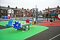 Broad Street play area - geograph.org.uk - 5290689.jpg 640 × 426; 289 KiB
-

-
 Bus in English Street - geograph.org.uk - 5510532.jpg 640 × 480; 55 KiB
-
 Bus shelter near Moss Knowe - geograph.org.uk - 283928.jpg 640 × 480; 96 KiB
-

-
 Bus stops on English Street, Carlisle - geograph.org.uk - 6148177.jpg 1 600 × 1 090; 292 KiB
-
 Bush Brow, Carlisle - geograph.org.uk - 5841232.jpg 1 280 × 960; 379 KiB
-
-

-
 Business premises in Castle Street - geograph.org.uk - 5516544.jpg 640 × 480; 73 KiB
-
 Cairn Bridge - geograph.org.uk - 283812.jpg 640 × 480; 188 KiB
-
 Caldew Railway Bridge - last chance to see - geograph.org.uk - 853982.jpg 480 × 640; 225 KiB
-
 Caldewgate underwater - geograph.org.uk - 4786688.jpg 640 × 480; 90 KiB
-
 Cam Beck - geograph.org.uk - 352897.jpg 640 × 480; 161 KiB
-
 Candlemas Cottage - panoramio.jpg 3 072 × 1 728; 2,47 MiB
-
 Captain's Tower and Keep, Carlisle Castle - geograph.org.uk - 6311775.jpg 4 894 × 3 998; 3,22 MiB
-
 Car park off Botchergate, Carlisle - geograph.org.uk - 6396165.jpg 4 032 × 2 268; 2,4 MiB
-

-
 Car park, Carlisle - geograph.org.uk - 5146020.jpg 640 × 480; 95 KiB
-
 Car Park, Englishgate Plaza - geograph.org.uk - 5485380.jpg 640 × 427; 265 KiB
-
 Carlisle - Bank Street - geograph.org.uk - 5216481.jpg 1 536 × 2 048; 636 KiB
-
 Carlisle - County Hotel - 20180916141018.jpg 4 608 × 3 456; 2,87 MiB
-
 Carlisle - County Hotel - 20180916141030.jpg 4 608 × 3 456; 2,56 MiB
-
 Carlisle - English Street - geograph.org.uk - 5216529.jpg 4 608 × 3 456; 6,1 MiB
-
 Carlisle - geograph.org.uk - 5801646.jpg 4 032 × 2 564; 1,78 MiB
-
 Carlisle - panoramio.jpg 2 560 × 1 920; 504 KiB
-
 Carlisle - Pedestrinised Bank Street - geograph.org.uk - 5216339.jpg 4 608 × 3 456; 6,99 MiB
-
 Carlisle Bus Station - geograph.org.uk - 5817014.jpg 4 608 × 3 456; 4,4 MiB
-
 Carlisle canal basin by William Brown.jpg 1 200 × 699; 822 KiB
-
 Carlisle Castle - geograph.org.uk - 4737590.jpg 1 024 × 617; 87 KiB
-
 Carlisle Castle - geograph.org.uk - 5005790.jpg 640 × 458; 48 KiB
-
 Carlisle Castle - geograph.org.uk - 6148762.jpg 1 600 × 1 129; 375 KiB
-
 Carlisle Castle - geograph.org.uk - 6409709.jpg 1 024 × 768; 449 KiB
-
 Carlisle Castle Inner Bailey Keep and Wall - geograph.org.uk - 6409686.jpg 1 024 × 768; 560 KiB
-
 Carlisle Castle, coat of arms - geograph.org.uk - 6148233.jpg 960 × 1 280; 698 KiB
-
 Carlisle Castle, courtyard - geograph.org.uk - 6147659.jpg 1 280 × 853; 335 KiB
-
 Carlisle Castle, flag atop the keep - geograph.org.uk - 6148291.jpg 1 280 × 960; 345 KiB
-
 Carlisle Castle, gargoyle - geograph.org.uk - 6148282.jpg 960 × 1 280; 432 KiB
-
 Carlisle Castle, guns on the ramparts - geograph.org.uk - 6311812.jpg 6 000 × 4 000; 7,36 MiB
-
 Carlisle Castle, inner castle wall and keep - geograph.org.uk - 6147661.jpg 1 280 × 960; 411 KiB
-
 Carlisle Castle, inside the halfmoon battery - geograph.org.uk - 6147674.jpg 1 280 × 960; 501 KiB
-
 Carlisle Castle, main gate - geograph.org.uk - 6147365.jpg 1 280 × 960; 476 KiB
-
 Carlisle Castle, moat - geograph.org.uk - 5510607.jpg 640 × 480; 46 KiB
-
 Carlisle Castle, outer wall - geograph.org.uk - 6148246.jpg 1 280 × 960; 351 KiB
-
 Carlisle Castle, roof garden - geograph.org.uk - 6148287.jpg 1 280 × 853; 357 KiB
-
 Carlisle Castle, the keep and inner-bailey wall - geograph.org.uk - 6312536.jpg 5 328 × 3 870; 3,06 MiB
-
 Carlisle cathedral "summer" 2017 - geograph.org.uk - 5516542.jpg 640 × 480; 67 KiB
-
 Carlisle Cathedral - geograph.org.uk - 5281666.jpg 640 × 427; 363 KiB
-
 Carlisle Cathedral - geograph.org.uk - 6276123.jpg 1 024 × 683; 212 KiB
-
 Carlisle Cathedral - geograph.org.uk - 6402468.jpg 3 888 × 5 184; 5,7 MiB
-
 Carlisle Cathedral - geograph.org.uk - 6409705.jpg 1 024 × 683; 653 KiB
-
 Carlisle Cathedral - March 2016 (1) - geograph.org.uk - 4891515.jpg 722 × 1 250; 1,16 MiB
-
 Carlisle Cathedral - March 2016 (10) - geograph.org.uk - 4891576.jpg 839 × 1 250; 1,09 MiB
-
 Carlisle Cathedral - March 2016 (2) - geograph.org.uk - 4891518.jpg 785 × 1 250; 698 KiB
-
 Carlisle Cathedral - March 2016 (3) - geograph.org.uk - 4891523.jpg 769 × 1 250; 788 KiB
-
 Carlisle Cathedral - March 2016 (4) - geograph.org.uk - 4891526.jpg 1 250 × 828; 1,11 MiB
-
 Carlisle Cathedral - March 2016 (5) - geograph.org.uk - 4891536.jpg 876 × 1 250; 1,19 MiB
-
 Carlisle Cathedral - March 2016 (6) - geograph.org.uk - 4891545.jpg 762 × 1 250; 947 KiB
-
 Carlisle Cathedral - March 2016 (7) - geograph.org.uk - 4891550.jpg 1 250 × 990; 1,45 MiB
-
 Carlisle Cathedral - March 2016 (8) - geograph.org.uk - 4891553.jpg 670 × 1 250; 821 KiB
-
 Carlisle Cathedral - March 2016 (9) - geograph.org.uk - 4891556.jpg 1 250 × 858; 608 KiB
-

-
 Carlisle Cathedral from the Air.jpg 640 × 480; 110 KiB
-
 Carlisle cathedral precinct - geograph.org.uk - 6152324.jpg 1 280 × 853; 544 KiB
-
 Carlisle cathedral, ceiling - geograph.org.uk - 6154416.jpg 853 × 1 280; 651 KiB
-
 Carlisle cathedral, choir - geograph.org.uk - 6154421.jpg 960 × 1 280; 545 KiB
-
 Carlisle cathedral, choir stalls - geograph.org.uk - 6154443.jpg 1 280 × 960; 385 KiB
-
 Carlisle cathedral, choir stalls - geograph.org.uk - 6154446.jpg 1 280 × 960; 411 KiB
-
 Carlisle cathedral, east window - geograph.org.uk - 6153367.jpg 960 × 1 280; 577 KiB
-
 Carlisle cathedral, main entrance - geograph.org.uk - 6153353.jpg 1 280 × 1 280; 707 KiB
-
 Carlisle cathedral, south side - geograph.org.uk - 6153357.jpg 960 × 1 280; 515 KiB
-
 Carlisle Cathedral... - geograph.org.uk - 6313185.jpg 6 000 × 4 000; 5,5 MiB
-
 Carlisle Citadel - geograph.org.uk - 6006769.jpg 640 × 503; 89 KiB
-
 Carlisle citadel - geograph.org.uk - 6154817.jpg 1 280 × 960; 325 KiB
-
 Carlisle citadel - geograph.org.uk - 6154842.jpg 1 280 × 853; 381 KiB
-
 Carlisle Citadel Station - geograph.org.uk - 5841240.jpg 1 280 × 923; 288 KiB
-
 Carlisle Citadel station - geograph.org.uk - 6062347.jpg 1 600 × 1 200; 346 KiB
-
 Carlisle Citadel Station - geograph.org.uk - 6148231.jpg 1 600 × 1 081; 348 KiB
-
 Carlisle Citadel station - Platform 3 - March 2018 - geograph.org.uk - 5703245.jpg 990 × 1 250; 1 022 KiB
-
 Carlisle Citadel, east tower - geograph.org.uk - 5839303.jpg 1 280 × 995; 368 KiB
-
 Carlisle city centre - geograph.org.uk - 1731484.jpg 640 × 452; 108 KiB
-
 Carlisle civic centre - geograph.org.uk - 6310963.jpg 3 798 × 3 663; 3,24 MiB
-
 Carlisle College - geograph.org.uk - 6366940.jpg 800 × 600; 103 KiB
-
-
 Carlisle Crematorium - geograph.org.uk - 902687.jpg 640 × 480; 345 KiB
-
 Carlisle Cricket Club Pavilion (geograph 3223770).jpg 1 024 × 768; 366 KiB
-

-
 Carlisle Fairtrade City - geograph.org.uk - 957681.jpg 640 × 480; 118 KiB
-
 Carlisle from the castle.jpg 1 280 × 960; 626 KiB
-
 Carlisle Gas Works - geograph.org.uk - 856391.jpg 640 × 480; 108 KiB
-
 Carlisle Hairdressing Room - geograph.org.uk - 6149028.jpg 1 600 × 1 438; 464 KiB
-
 Carlisle Magistrates Court - geograph.org.uk - 6146563.jpg 1 600 × 933; 254 KiB
-
 Carlisle magistrates' court - geograph.org.uk - 6310954.jpg 4 277 × 3 246; 1,78 MiB
-
 Carlisle Main Image.jpg 1 201 × 1 321; 285 KiB
-
 Carlisle market cross and tourist information centre - geograph.org.uk - 6276088.jpg 1 024 × 683; 174 KiB
-
 Carlisle Market Square September 2022.jpg 4 032 × 3 024; 2,9 MiB
-
 Carlisle Market, Fisher Street - geograph.org.uk - 5840801.jpg 1 280 × 954; 310 KiB
-
 Carlisle Methodist Central Hall.jpg 4 032 × 3 024; 2,26 MiB
-
 Carlisle Milestone - geograph.org.uk - 1528454.jpg 427 × 640; 117 KiB
-
 Carlisle Ping-Pong Club - Market Street - June 2017 - geograph.org.uk - 5420172.jpg 1 500 × 1 216; 1,94 MiB
-
 Carlisle Railway Station - geograph.org.uk - 5601093.jpg 640 × 438; 56 KiB
-
 Carlisle Railway Station - geograph.org.uk - 5601100.jpg 640 × 423; 61 KiB
-
 Carlisle railway station - geograph.org.uk - 6264545.jpg 4 032 × 3 024; 3,76 MiB
-
 Carlisle Railway Station, August 2017 - geograph.org.uk - 5510528.jpg 640 × 480; 73 KiB
-
 Carlisle station - geograph.org.uk - 6154838.jpg 1 280 × 960; 397 KiB
-
 Carlisle UK local election 2015 map.svg 1 252 × 1 346; 667 KiB
-
 Carlisle United badge in stone - geograph.org.uk - 4868527.jpg 640 × 480; 459 KiB
-
 Carlisle War Memorial - geograph.org.uk - 6409707.jpg 767 × 1 024; 500 KiB
-
 Carlisle wards 2018.svg 1 252 × 1 346; 667 KiB
-
 Carlisle welcome sign - geograph.org.uk - 938308.jpg 640 × 479; 288 KiB
-
 Carlisle's Market Place - 29 March 2018 (1) - geograph.org.uk - 5720284.jpg 934 × 1 250; 1,08 MiB
-
 Carlisle's Market Place - 29 March 2018 (2) - geograph.org.uk - 5720287.jpg 1 250 × 825; 1,28 MiB
-
 Carlisle's Market Place - 29 March 2018 (3) - geograph.org.uk - 5720290.jpg 1 250 × 987; 1,1 MiB
-
 Carlisle-14-Haus-2009-gje.jpg 3 072 × 2 048; 2,91 MiB
-
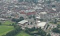 Carlisleaerial.jpg 506 × 308; 96 KiB
-

-

-
 Carwinley Burn upstream of Hillback Bridge - geograph.org.uk - 564984.jpg 640 × 477; 188 KiB
-
 Castle Carrock Reservoir - geograph.org.uk - 1433190.jpg 640 × 480; 349 KiB


,_Blick_aus_Nord.png)


_Nature_Reserve_-_geograph.org.uk_-_1054644.jpg)


_-_geograph.org.uk_-_4685327.jpg)


_-_geograph.org.uk_-_5420156.jpg)
_-_geograph.org.uk_-_5420157.jpg)


_-_geograph.org.uk_-_4891515.jpg)
_-_geograph.org.uk_-_4891576.jpg)
_-_geograph.org.uk_-_4891518.jpg)
_-_geograph.org.uk_-_4891523.jpg)
_-_geograph.org.uk_-_4891526.jpg)
_-_geograph.org.uk_-_4891536.jpg)
_-_geograph.org.uk_-_4891545.jpg)
_-_geograph.org.uk_-_4891550.jpg)
_-_geograph.org.uk_-_4891553.jpg)
_-_geograph.org.uk_-_4891556.jpg)


.jpg)


_-_geograph.org.uk_-_5720284.jpg)
_-_geograph.org.uk_-_5720287.jpg)
_-_geograph.org.uk_-_5720290.jpg)


