Category:Castle Ashby
Aller à la navigation
Aller à la recherche
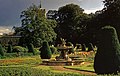
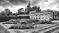
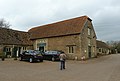
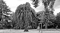
Castle Ashby is the name of a civil parish, an estate village and an English country house in rural Northamptonshire.
village britannique  | |||||
| Téléverser des médias | |||||
| Nature de l’élément | |||||
|---|---|---|---|---|---|
| Lieu | West Northamptonshire, Northamptonshire, Midlands de l'Est, Angleterre | ||||
| Population |
| ||||
| Superficie |
| ||||
| Réputé identique à | Castle Ashby (page en doublon, paroisse civile) | ||||
 | |||||
Sous-catégories
Cette catégorie comprend 6 sous-catégories, dont les 6 ci-dessous.
Média dans la catégorie « Castle Ashby »
Cette catégorie comprend 93 fichiers, dont les 93 ci-dessous.
-
 Agricultural heap - geograph.org.uk - 5104046.jpg 640 × 480 ; 101 kio
-
 FormalGardenCA.jpg 1 536 × 2 048 ; 653 kio
-

-
 Beautiful pigs, Castle Ashby Gardens farmyard - geograph.org.uk - 3746959.jpg 480 × 640 ; 475 kio
-
 Carved stone gryphon, Castle Ashby Gardens - geograph.org.uk - 3746975.jpg 640 × 640 ; 437 kio
-
 Castle Ashby (29325241048).jpg 16 170 × 10 282 ; 16,93 Mio
-
 Castle Ashby (43196552361).jpg 16 298 × 10 282 ; 14,09 Mio
-
 Castle Ashby - geograph.org.uk - 2004762.jpg 640 × 480 ; 73 kio
-
 Castle Ashby avenue (51532598370).jpg 7 339 × 4 128 ; 26,78 Mio
-
 Castle Ashby aviary (51530868972).jpg 5 056 × 2 844 ; 9,85 Mio
-
 Castle Ashby fuchsia house (51532596690).jpg 8 688 × 4 887 ; 29,36 Mio
-
 Castle Ashby Haha front.JPG 1 536 × 2 048 ; 594 kio
-
 Castle Ashby Lake - geograph.org.uk - 722479.jpg 640 × 480 ; 67 kio
-
 Castle Ashby maltese cross (51530871677).jpg 8 139 × 4 578 ; 23,91 Mio
-
 Castle Ashby rainbow garden (51530869857).jpg 7 726 × 4 346 ; 25,25 Mio
-
 Castle Ashby red & white (51531675306).jpg 6 962 × 3 916 ; 17,14 Mio
-
 Castle Ashby Rural Shopping Yard - geograph.org.uk - 4390592.jpg 1 488 × 1 000 ; 1,06 Mio
-
 Castle Ashby terracotta (51532388559).jpg 7 282 × 4 096 ; 25,25 Mio
-
 Castle Ashby weeping (51531669016).jpg 7 264 × 4 086 ; 18,38 Mio
-
 Castle Ashby, The Castle-geograph-4390597-by-Rob-Farrow.jpg 1 919 × 1 000 ; 1,31 Mio
-
 Chadstone, a hamlet - geograph.org.uk - 3169167.jpg 1 920 × 2 560 ; 979 kio
-

-
 Cricket ground, Castle Ashby - geograph.org.uk - 3747051.jpg 640 × 480 ; 465 kio
-
 Dial plate of sundial, Castle Ashby Gardens - geograph.org.uk - 3747081.jpg 640 × 480 ; 490 kio
-
 Estate buildings, Castle Ashby - geograph.org.uk - 5104035.jpg 640 × 480 ; 107 kio
-
 Falcon Hotel Castle Ashby.jpg 3 024 × 2 420 ; 2,28 Mio
-
 Farm buildings at Chadstone Lodge - geograph.org.uk - 4166609.jpg 1 600 × 1 066 ; 385 kio
-
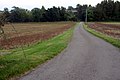
 Farm track towards Station Lodge - geograph.org.uk - 6143957.jpg 1 600 × 1 066 ; 360 kio
-
 Farmland by the A428 with Sandpit Spinney beyond - geograph.org.uk - 4166285.jpg 1 600 × 1 066 ; 370 kio
-
 Fishing lake by Castle Ashby - geograph.org.uk - 6143636.jpg 1 600 × 1 066 ; 502 kio
-

-
 Footbridge on the path to Denton - geograph.org.uk - 4166301.jpg 1 600 × 1 067 ; 497 kio
-
 Gate House of the drive to Castle Ashby House - geograph.org.uk - 253141.jpg 640 × 471 ; 126 kio
-
 Grendon Quarter Pond - geograph.org.uk - 169452.jpg 640 × 480 ; 90 kio
-
 Grendon Quarter Pond - geograph.org.uk - 6143961.jpg 1 600 × 1 066 ; 361 kio
-

-
 Hedgerow in a wheatfield - geograph.org.uk - 5851839.jpg 1 600 × 1 066 ; 506 kio
-
 Hopyard Spinney - geograph.org.uk - 4166295.jpg 1 600 × 1 067 ; 307 kio
-
 Italianate fountain and screen, Castle Ashby Gardens (geograph 3747057).jpg 512 × 640 ; 503 kio
-
 Lane by Grendon Quarter Pond - geograph.org.uk - 6143960.jpg 1 600 × 1 066 ; 467 kio
-
 Line of Brook to Engine Pond - geograph.org.uk - 169437.jpg 640 × 480 ; 118 kio
-
 Northamptonshire Round footpath - geograph.org.uk - 5851781.jpg 1 600 × 1 066 ; 691 kio
-
 On the Northamptonshire Round - geograph.org.uk - 5580874.jpg 480 × 640 ; 71 kio
-
 On the Northamptonshire Round - geograph.org.uk - 5580875.jpg 640 × 480 ; 59 kio
-
 Ornamental Gates, Castle Ashby, Northamptonshire - geograph.org.uk - 1062165.jpg 640 × 436 ; 376 kio
-
-
 Over Castle Ashby haha.jpg 2 048 × 1 536 ; 712 kio
-
 Parkhill Farm, Castle Ashby - geograph.org.uk - 279968.jpg 640 × 480 ; 96 kio
-
 Path across the fields to Denton - geograph.org.uk - 4166299.jpg 1 200 × 1 600 ; 466 kio
-
 Path down to Chadstone Lodge - geograph.org.uk - 4166606.jpg 1 600 × 1 066 ; 442 kio
-
 Pool and sundial, Castle Ashby Gardens (geograph 3747063).jpg 640 × 640 ; 679 kio
-
 Pylon in the field - geograph.org.uk - 5851819.jpg 1 600 × 1 066 ; 238 kio
-

-
 Scotland Pond fishing lake - geograph.org.uk - 6143654.jpg 1 600 × 1 066 ; 322 kio
-
 Shopping Yard, Castle Ashby (geograph 3747148).jpg 640 × 360 ; 271 kio
-
 Sign, Castle Ashby Shopping Yard - geograph.org.uk - 3746231.jpg 480 × 640 ; 393 kio
-

-
 St Mary Magdalene, Castle Ashby - Effigy - geograph.org.uk - 4995755.jpg 1 000 × 475 ; 253 kio
-
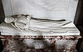 St Mary Magdalene, Castle Ashby - Effigy - geograph.org.uk - 4995760.jpg 1 000 × 632 ; 245 kio
-
 St Mary Magdalene, Castle Ashby - Font - geograph.org.uk - 4995749.jpg 667 × 1 000 ; 260 kio
-
 St Mary Magdalene, Castle Ashby - Ledger slab - geograph.org.uk - 4995763.jpg 769 × 1 000 ; 541 kio
-
 St Mary Magdalene, Castle Ashby - Monument - geograph.org.uk - 4995750.jpg 552 × 1 000 ; 217 kio
-
 St Mary Magdalene, Castle Ashby - Monument - geograph.org.uk - 4995751.jpg 1 000 × 720 ; 400 kio
-
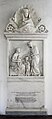 St Mary Magdalene, Castle Ashby - Monument - geograph.org.uk - 4995752.jpg 438 × 1 000 ; 155 kio
-
 St Mary Magdalene, Castle Ashby - Organ - geograph.org.uk - 4995756.jpg 610 × 1 000 ; 315 kio
-
 St Mary Magdalene, Castle Ashby - Poppyhead - geograph.org.uk - 4995765.jpg 637 × 1 000 ; 268 kio
-
 St Mary Magdalene, Castle Ashby - Poppyhead - geograph.org.uk - 4995768.jpg 687 × 1 000 ; 243 kio
-
 St Mary Magdalene, Castle Ashby - Pulpit - geograph.org.uk - 4995753.jpg 650 × 1 000 ; 288 kio
-
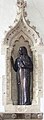 St Mary Magdalene, Castle Ashby - Statue - geograph.org.uk - 4995761.jpg 368 × 1 000 ; 174 kio
-
 St Mary Magdalene, Castle Ashby - Tomb - geograph.org.uk - 4995759.jpg 1 000 × 672 ; 234 kio
-
 Stile on the Northamptonshire Round footpath - geograph.org.uk - 5851772.jpg 1 066 × 1 600 ; 570 kio
-
 Terracotta Bridge and Dam - geograph.org.uk - 32421.jpg 480 × 640 ; 205 kio
-
 The Avenue, Castle Ashby - geograph.org.uk - 3169144.jpg 2 560 × 1 920 ; 1 024 kio
-
 The Avenue, Castle Ashby - geograph.org.uk - 5851776.jpg 1 600 × 1 066 ; 421 kio
-
 The End of Scotland Pond - geograph.org.uk - 169446.jpg 640 × 480 ; 116 kio
-
-
 The road to Chadstone - geograph.org.uk - 4166596.jpg 1 600 × 1 066 ; 328 kio
-
 The road to Grendon - geograph.org.uk - 5851818.jpg 1 600 × 1 066 ; 397 kio
-
 Track into woodland, Castle Ashby - geograph.org.uk - 5104024.jpg 640 × 480 ; 178 kio
-
 Trees by Yardley Road - geograph.org.uk - 5851827.jpg 1 600 × 1 066 ; 460 kio
-
 Victorian beehives, Castle Ashby Gardens - geograph.org.uk - 3746977.jpg 640 × 640 ; 473 kio
-
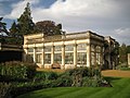 Victorian conservatory, Castle Ashby Gardens - geograph.org.uk - 3746966.jpg 640 × 480 ; 414 kio
-

-
 Way marker on the Northamptonshire Round - geograph.org.uk - 4166318.jpg 1 600 × 1 067 ; 621 kio
-
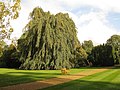 Weeping beech, Castle Ashby Gardens (geograph 3747104).jpg 640 × 480 ; 441 kio
-

-

-
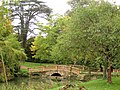
 Wooden Bridge - geograph.org.uk - 301134.jpg 640 × 480 ; 116 kio
-
 Woodland path by The Basin - geograph.org.uk - 6143640.jpg 1 600 × 1 066 ; 712 kio
-

-
 Wrought-iron bar fence, Castle Ashby Gardens (geograph 3747122).jpg 480 × 640 ; 619 kio
-

-
 Station Road - geograph.org.uk - 169458.jpg 640 × 480 ; 108 kio


.jpg)
.jpg)

.jpg)
.jpg)
.jpg)


.jpg)
.jpg)
.jpg)

.jpg)
.jpg)


,_Castle_Ashby_Gardens_-_geograph.org.uk_-_3746900.jpg)


.jpg)


.jpg)


.jpg)


.jpg)


.jpg)

