Category:Castle Bytham
Aller à la navigation
Aller à la recherche
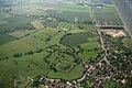
English: Castle Bytham is a picturesque village of around 300 houses in South Kesteven in south Lincolnshire at . Overlooking the village is an 11th century Norman castle mound; the castle itself was destroyed by Henry III in February 1221, even though he was only fourteen. The site in Saxon times was owned by Morcar, also known as Morkere, the brother-in-law of King Harold. His grandson married Lady Godiva.
localité britannique du comté anglais de Lincolnshire  | |||||
| Téléverser des médias | |||||
| Nature de l’élément | |||||
|---|---|---|---|---|---|
| Lieu | Castle Bytham, South Kesteven, Lincolnshire, Midlands de l'Est, Angleterre | ||||
 | |||||
Sous-catégories
Cette catégorie comprend 8 sous-catégories, dont les 8 ci-dessous.
B
- Bytham Castle (9 F)
C
- Castle Bytham Village Hall (4 F)
- Castle Bytham Village Sign (4 F)
J
L
- Little Haw Wood (4 F)
M
Média dans la catégorie « Castle Bytham »
Cette catégorie comprend 267 fichiers, dont les 200 ci-dessous.
(page précédente) (page suivante)-
 A Dyke overflow'd - geograph.org.uk - 6084551.jpg 6 032 × 4 014 ; 5,84 Mio
-
 A full dyke - geograph.org.uk - 6084561.jpg 4 014 × 6 032 ; 6,03 Mio
-
 A half-remember'd stream - geograph.org.uk - 6084569.jpg 6 032 × 4 014 ; 3,92 Mio
-
 A Poppy (geograph 5841719).jpg 6 032 × 4 014 ; 4,23 Mio
-
 A shed conversion - geograph.org.uk - 6009091.jpg 6 032 × 4 014 ; 5,42 Mio
-
 A shop in a shed - geograph.org.uk - 6532144.jpg 8 827 × 4 109 ; 7,18 Mio
-
 A Sugar Beet - geograph.org.uk - 5589895.jpg 6 000 × 4 000 ; 4,43 Mio
-
 Ajuga reptans - geograph.org.uk - 5841712.jpg 4 014 × 6 032 ; 3,52 Mio
-
 Autumn hedgerow - geograph.org.uk - 5589915.jpg 6 000 × 4 000 ; 7,83 Mio
-
 Autumn sown crop near Castle Bytham - geograph.org.uk - 6386221.jpg 1 024 × 768 ; 164 kio
-
 Baby Hawthorn - geograph.org.uk - 5837080.jpg 4 014 × 6 032 ; 6,14 Mio
-
 Beet field. Cleared - geograph.org.uk - 5590501.jpg 6 000 × 4 000 ; 4,99 Mio
-
 Building materials - geograph.org.uk - 6009085.jpg 6 032 × 4 014 ; 3,93 Mio
-
 Building plot - geograph.org.uk - 6532306.jpg 6 252 × 4 164 ; 3,74 Mio
-
 Buildings in Castle Bytham - geograph.org.uk - 6625921.jpg 1 600 × 1 200 ; 152 kio
-
 Bus Shelter, High Street, Castle Bytham - geograph.org.uk - 1614295.jpg 640 × 480 ; 86 kio
-
 Bytham Heights, Castle Bytham - geograph.org.uk - 1539797.jpg 640 × 480 ; 59 kio
-
 Cabbage Hill - geograph.org.uk - 5790418.jpg 6 032 × 4 014 ; 4,53 Mio
-
 Cabbage Hill - geograph.org.uk - 5925424.jpg 6 032 × 4 014 ; 4,1 Mio
-
 Cabbagehill Wood - geograph.org.uk - 2633847.jpg 4 000 × 3 000 ; 4,04 Mio
-
 Cabbagehill Wood - geograph.org.uk - 6418973.jpg 1 024 × 768 ; 188 kio
-
 Castle Bytham Motte and Bailey, aerial 2017 (2) - geograph.org.uk - 5435999.jpg 1 024 × 683 ; 131 kio
-
 Castle Bytham Motte and Bailey, aerial 2017 - geograph.org.uk - 5435991.jpg 640 × 427 ; 67 kio
-
 Castle Bytham post office - geograph.org.uk - 269753.jpg 640 × 480 ; 157 kio
-
 CASTLE BYTHAM QUARRY 04.jpg 4 608 × 3 456 ; 8,49 Mio
-
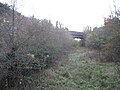 Castle Bytham railway station (site), Lincolnshire - geograph.org.uk - 4290387.jpg 1 600 × 1 200 ; 445 kio
-
 Castle Bytham Telephone Exchange - geograph.org.uk - 6287459.jpg 2 592 × 1 944 ; 1,39 Mio
-
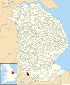 Castle Bytham UK parish locator map.svg 1 086 × 1 305 ; 3,7 Mio
-
 Castle Bytham village pump.jpg 640 × 480 ; 101 kio
-
 Castlegate, Castle Bytham - geograph.org.uk - 1614210.jpg 640 × 480 ; 67 kio
-
 Castlegate, Castle Bytham - geograph.org.uk - 6387822.jpg 1 024 × 768 ; 152 kio
-
 Cemetery - geograph.org.uk - 5887461.jpg 640 × 480 ; 85 kio
-
 Chain and padlock on gate on track to Creeton - geograph.org.uk - 6626074.jpg 1 600 × 1 317 ; 172 kio
-
 Chenopodium album - geograph.org.uk - 6583560.jpg 4 163 × 6 251 ; 2,18 Mio
-
 Church gate - geograph.org.uk - 6272217.jpg 4 500 × 3 000 ; 7,1 Mio
-
 Church Lane, Castle Bytham - geograph.org.uk - 1614314.jpg 640 × 480 ; 113 kio
-
 Church Lane, Castle Bytham - geograph.org.uk - 6387692.jpg 1 024 × 768 ; 286 kio
-
 Clipsham Road - geograph.org.uk - 3176371.jpg 640 × 480 ; 61 kio
-
 Clipsham Road - geograph.org.uk - 3176377.jpg 640 × 480 ; 79 kio
-
 Clipsham Road - geograph.org.uk - 3720311.jpg 1 024 × 768 ; 113 kio
-
 Clipsham Road - geograph.org.uk - 5463432.jpg 3 776 × 2 520 ; 3,98 Mio
-
 Clipsham Road - geograph.org.uk - 5887486.jpg 640 × 480 ; 62 kio
-
 Clipsham Road entering Rutland - geograph.org.uk - 5463443.jpg 3 776 × 2 520 ; 4,15 Mio
-
 Clipsham Road, Castle Bytham - geograph.org.uk - 1614388.jpg 640 × 480 ; 62 kio
-
 Clipsham Road, Castle Bytham - geograph.org.uk - 1614395.jpg 640 × 480 ; 62 kio
-
 Clipsham Yew Tree Avenue, aerial, 2006 - geograph.org.uk - 3006595.jpg 427 × 640 ; 75 kio
-
 Common Toadflax - geograph.org.uk - 6590885.jpg 4 163 × 6 251 ; 2,08 Mio
-
 Continuing construction - geograph.org.uk - 6084580.jpg 6 032 × 4 014 ; 6,53 Mio
-
 Cottages, Castle Bytham - geograph.org.uk - 6387817.jpg 1 024 × 768 ; 164 kio
-
 Counthorpe Lane running down to Glen Brook and Glen Road - geograph.org.uk - 5463233.jpg 3 776 × 2 520 ; 4,09 Mio
-
 Counthorpe Lane towards Castle Bytham - geograph.org.uk - 3176340.jpg 640 × 480 ; 87 kio
-
 Counthorpe Lane towards Castle Bytham - geograph.org.uk - 6625931.jpg 1 600 × 1 236 ; 151 kio
-
 Counthorpe Lane towards Creeton - geograph.org.uk - 6625932.jpg 1 600 × 1 159 ; 115 kio
-
 Countryside near Castle Bytham seen from Station Road - geograph.org.uk - 4546097.jpg 4 000 × 3 000 ; 4,2 Mio
-
 County Boundary - geograph.org.uk - 5887520.jpg 640 × 480 ; 84 kio
-
 Cow Pasture Lane - geograph.org.uk - 5887505.jpg 640 × 480 ; 62 kio
-
 Cow Pasture Lane, Clipsham - geograph.org.uk - 1539779.jpg 640 × 480 ; 89 kio
-
 Crossroads south of Castle Bytham - geograph.org.uk - 5463409.jpg 3 776 × 2 520 ; 4,24 Mio
-
 Cuckoo Spit - geograph.org.uk - 5825006.jpg 6 032 × 4 014 ; 3 Mio
-
 Culverted ditch - geograph.org.uk - 6009088.jpg 3 257 × 4 686 ; 2,24 Mio
-
 Decayed hedgerow - geograph.org.uk - 5831154.jpg 6 032 × 4 014 ; 4,07 Mio
-
 Disused quarry - geograph.org.uk - 6532148.jpg 6 252 × 4 164 ; 3,14 Mio
-
 Disused quarry at Castle Bytham near Bourne, Lincolnshire - geograph.org.uk - 4581705.jpg 1 764 × 1 181 ; 732 kio
-
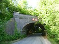 Disused railway bridge along Morkery Lane - geograph.org.uk - 4546372.jpg 4 000 × 3 000 ; 4,06 Mio
-
 Disused railway bridge along Morkery Lane - geograph.org.uk - 4546378.jpg 4 000 × 3 000 ; 4,04 Mio
-
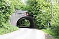 Disused Railway Bridge over Morkery Lane - geograph.org.uk - 3505479.jpg 2 256 × 1 504 ; 2,76 Mio
-
 Down the dip on Morkery Lane - geograph.org.uk - 4546109.jpg 4 000 × 3 000 ; 4,27 Mio
-
 Ducks Crossing Ahead, Castle Bytham - geograph.org.uk - 1614246.jpg 640 × 480 ; 89 kio
-
 Entrance to Cabbage Hill Wood - geograph.org.uk - 5831148.jpg 6 032 × 4 014 ; 7,85 Mio
-
 Entrance to Castle Farm, Castle Bytham - geograph.org.uk - 6393401.jpg 1 024 × 768 ; 182 kio
-
 Farm buildings, Castle Bytham - geograph.org.uk - 3176357.jpg 640 × 382 ; 44 kio
-
 Farm track near Park House Farm - geograph.org.uk - 6202074.jpg 1 024 × 768 ; 119 kio
-
 Farmland off Clipsham Road - geograph.org.uk - 3176375.jpg 640 × 480 ; 86 kio
-
 Farmland, Glenside - geograph.org.uk - 3176345.jpg 640 × 480 ; 86 kio
-
 Field edge - geograph.org.uk - 3284021.jpg 4 320 × 3 240 ; 6,05 Mio
-
 Field Edge near Castle Bytham - geograph.org.uk - 5589875.jpg 6 000 × 4 000 ; 5,7 Mio
-
 Field entrance off Counthorpe Lane - geograph.org.uk - 3176338.jpg 640 × 480 ; 104 kio
-
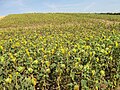 Field of sunflowers - geograph.org.uk - 5888493.jpg 640 × 480 ; 141 kio
-
 Field panorama - geograph.org.uk - 5589890.jpg 15 000 × 3 342 ; 7,92 Mio
-
 Fields west of Counthorpe Lane - geograph.org.uk - 6625933.jpg 1 600 × 1 124 ; 137 kio
-
 Fiery red brick in Castle Bytham - geograph.org.uk - 6387812.jpg 1 024 × 768 ; 217 kio
-
 Flag on the Castle - geograph.org.uk - 3869208.jpg 4 896 × 3 672 ; 6,5 Mio
-
 Flax crop Castle Bytham-Geograph-1936014-by-Bob-Harvey.jpg 4 000 × 2 248 ; 2,63 Mio
-
 Footbridge and Castle Mound, Castle Bytham - geograph.org.uk - 6393392.jpg 1 024 × 768 ; 269 kio
-
 Footpath - geograph.org.uk - 5888475.jpg 640 × 480 ; 67 kio
-
 Footpath and Finger Post - geograph.org.uk - 5887492.jpg 640 × 480 ; 75 kio
-
 Footpath bridge and stile - geograph.org.uk - 6200190.jpg 4 896 × 3 672 ; 6,65 Mio
-
 Footpath To Bytham - geograph.org.uk - 184443.jpg 640 × 480 ; 114 kio
-
 Footpath to Castle Bytham - geograph.org.uk - 4449790.jpg 4 320 × 3 240 ; 5,2 Mio
-
 Footpath to Creeton - geograph.org.uk - 6386224.jpg 1 024 × 768 ; 181 kio
-
 Footpath to Creeton - geograph.org.uk - 6393396.jpg 1 024 × 768 ; 188 kio
-
 Footpath to Little Bytham Road - geograph.org.uk - 6393400.jpg 1 024 × 768 ; 147 kio
-
 Ford at Castle Farm, Castle Bytham (geograph 1836632).jpg 3 872 × 2 592 ; 2,35 Mio
-
 Former commercial premises, Pinfold Lane, Castle Bytham - geograph.org.uk - 6387678.jpg 1 024 × 768 ; 173 kio
-
 Former park - geograph.org.uk - 5789699.jpg 18 434 × 3 090 ; 7,95 Mio
-
 Former Post Office, Castle Bytham - geograph.org.uk - 6387683.jpg 1 024 × 768 ; 159 kio
-
 Former School, Castle Bytham-Geograph-2297810-by-Bob-Harvey.jpg 4 000 × 2 248 ; 2,21 Mio
-
 Former telephone box - geograph.org.uk - 6272154.jpg 3 000 × 4 500 ; 5,24 Mio
-
 Fragment of hedge - geograph.org.uk - 5855789.jpg 6 032 × 4 014 ; 5,1 Mio
-
 Framed by trees - geograph.org.uk - 4221095.jpg 4 896 × 3 672 ; 6,77 Mio
-
 Gate on track to Creeton - geograph.org.uk - 6626075.jpg 1 600 × 1 180 ; 110 kio
-
 Gate to Pasture Lane (also public footpath) - geograph.org.uk - 3720312.jpg 1 024 × 768 ; 136 kio
-

-
 Gates for building plots - geograph.org.uk - 6532376.jpg 6 252 × 4 164 ; 3,26 Mio
-
 Glen Brook (geograph 3176354).jpg 640 × 480 ; 137 kio
-
 Glen Brook, Castle Bytham - geograph.org.uk - 6393404.jpg 1 024 × 768 ; 245 kio
-
 Glen Road by Cabbagehill Wood - geograph.org.uk - 2633842.jpg 4 000 × 3 000 ; 4,02 Mio
-
 Glen Road heading north - geograph.org.uk - 3176355.jpg 640 × 480 ; 87 kio
-
 Glen Road, Castle Bytham - geograph.org.uk - 1614196.jpg 640 × 480 ; 75 kio
-
 Glen Road, Castle Bytham - geograph.org.uk - 3176360.jpg 640 × 480 ; 64 kio
-
 Greenhouses near Castle Bytham - geograph.org.uk - 121123.jpg 640 × 480 ; 56 kio
-
 Heap end and hedge - geograph.org.uk - 5589910.jpg 6 000 × 4 000 ; 5,32 Mio
-
 Heathcote Road at Castle Bytham, near Bourne, Lincolnshire - geograph.org.uk - 4421500.jpg 1 771 × 1 170 ; 863 kio
-
 Heathcote Road, Castle Bytham - geograph.org.uk - 1614280.jpg 640 × 480 ; 85 kio
-
 Heavy construction - geograph.org.uk - 5838314.jpg 9 788 × 4 458 ; 7,12 Mio
-
 Hide - geograph.org.uk - 3284026.jpg 4 320 × 3 240 ; 6,17 Mio
-
 High Street - geograph.org.uk - 5887441.jpg 640 × 480 ; 73 kio
-
 High Street - geograph.org.uk - 6272162.jpg 4 500 × 3 000 ; 6,21 Mio
-
 High Street, Castle Bytham - geograph.org.uk - 1614349.jpg 640 × 480 ; 86 kio
-
 Hillside - geograph.org.uk - 6440990.jpg 13 000 × 5 013 ; 7,31 Mio
-
 Hillside with Quarry - geograph.org.uk - 5838773.jpg 6 032 × 4 014 ; 4,32 Mio
-
 Hoisting the flag - geograph.org.uk - 6381676.jpg 6 240 × 4 160 ; 5,3 Mio
-
 Holywell Quarry, aerial 2020 - geograph.org.uk - 6360701.jpg 1 024 × 683 ; 129 kio
-
 Holywell Road - geograph.org.uk - 4546037.jpg 4 000 × 3 000 ; 4,17 Mio
-
 Holywell Road approaching Pillowsyke Holt - geograph.org.uk - 5463428.jpg 3 776 × 2 520 ; 4,26 Mio
-
 House in Station Road - geograph.org.uk - 6532380.jpg 6 252 × 4 164 ; 2,93 Mio
-
 House in Station Road - geograph.org.uk - 6532634.jpg 5 957 × 3 967 ; 5,2 Mio
-
 House on Glenside - geograph.org.uk - 3176350.jpg 640 × 464 ; 71 kio
-
 Houses on Clipsham Road, Castle Bytham - geograph.org.uk - 1540101.jpg 640 × 480 ; 62 kio
-
 Houses on Glen Road, Castle Bytham - geograph.org.uk - 3176358.jpg 640 × 404 ; 68 kio
-
 Houses on Hollywell Road, Castle Bytham - geograph.org.uk - 1540180.jpg 640 × 480 ; 57 kio
-
 Houses on Holywell Road, Castle Bytham - geograph.org.uk - 3176368.jpg 640 × 480 ; 49 kio
-
 In Castle Bytham village - geograph.org.uk - 5786362.jpg 2 592 × 1 944 ; 1,22 Mio
-
 Inside the community shop - geograph.org.uk - 6532122.jpg 4 163 × 6 251 ; 6,56 Mio
-
 Is this the way^ - geograph.org.uk - 6202682.jpg 1 024 × 768 ; 204 kio
-
 It's just not natural - geograph.org.uk - 5831147.jpg 4 014 × 6 032 ; 3,86 Mio
-

-
 Kit Cars - geograph.org.uk - 4041730.jpg 4 896 × 3 672 ; 6,74 Mio
-
 Lane to Park House Farm - geograph.org.uk - 6386710.jpg 1 024 × 768 ; 178 kio
-
 Leaves - geograph.org.uk - 5838779.jpg 6 032 × 4 014 ; 3,03 Mio
-
 Linaria vulgaris - geograph.org.uk - 6590881.jpg 4 163 × 6 251 ; 2,15 Mio
-
 Linseed field near Castle Bytham, flowers.jpg 1 750 × 1 180 ; 162 kio
-
 Linseed field near Castle Bytham, footpath.jpg 1 750 × 1 313 ; 527 kio
-
 Linseed field near Castle Bytham, poppies.jpg 1 750 × 1 313 ; 521 kio
-
 Looking up Cabbage Hill - geograph.org.uk - 2633832.jpg 4 000 × 3 000 ; 4,12 Mio
-
 Mixed planting - geograph.org.uk - 5789696.jpg 5 431 × 4 698 ; 7,79 Mio
-
 Morkery Lane - geograph.org.uk - 3715342.jpg 1 024 × 689 ; 192 kio
-
 Morkery Lane - geograph.org.uk - 3715346.jpg 1 024 × 768 ; 114 kio
-
 Morkery Lane - geograph.org.uk - 4546130.jpg 4 000 × 3 000 ; 4,18 Mio
-
 Morkery Lane - geograph.org.uk - 4546157.jpg 4 000 × 3 000 ; 4 Mio
-
 Morkery Lane - geograph.org.uk - 5888517.jpg 640 × 480 ; 70 kio
-

-
 Morris Dancing - geograph.org.uk - 3487160.jpg 640 × 480 ; 78 kio
-
 Mr Harris' gate mechanism - geograph.org.uk - 5834465.jpg 6 032 × 4 014 ; 6,46 Mio
-
 New community shop - geograph.org.uk - 6532118.jpg 6 252 × 4 164 ; 3,27 Mio
-
 New road - geograph.org.uk - 6532314.jpg 6 252 × 4 164 ; 3,68 Mio
-
 New tree - geograph.org.uk - 5837077.jpg 4 014 × 6 032 ; 4,8 Mio
-
 Notice on telephone exchange - geograph.org.uk - 4041721.jpg 4 896 × 3 672 ; 6,73 Mio
-
 Off-grid house in construction - geograph.org.uk - 6200186.jpg 4 896 × 3 672 ; 6,44 Mio
-
 Old and Older - geograph.org.uk - 4203314.jpg 4 896 × 3 672 ; 6,64 Mio
-
 Old pit at Castle Bytham - geograph.org.uk - 6393398.jpg 1 024 × 768 ; 161 kio
-
 Old railway trackbed at Castle Bytham - geograph.org.uk - 4546090.jpg 4 000 × 3 000 ; 4,19 Mio
-
 Openreach - geograph.org.uk - 6532320.jpg 6 252 × 4 164 ; 3,45 Mio
-
 Ordnance Survey Cut Mark - geograph.org.uk - 4125808.jpg 4 000 × 3 000 ; 3,88 Mio
-
 Pantile roofs near the church - geograph.org.uk - 6270210.jpg 4 500 × 3 000 ; 4,28 Mio
-
 Park House Farm - geograph.org.uk - 6202071.jpg 1 024 × 768 ; 213 kio
-
 Path through ripening wheat - geograph.org.uk - 5463438.jpg 3 776 × 2 520 ; 4,24 Mio
-
 Permissive footpath - geograph.org.uk - 6625934.jpg 1 600 × 1 184 ; 200 kio
-
 Permissive footpath - geograph.org.uk - 6626076.jpg 1 600 × 1 257 ; 302 kio
-
 Permissive footpath - geograph.org.uk - 6626077.jpg 1 600 × 1 103 ; 276 kio
-
 Permissive footpath - geograph.org.uk - 6626078.jpg 1 600 × 1 252 ; 299 kio
-
 Permissive footpath sign - geograph.org.uk - 6626079.jpg 1 600 × 1 328 ; 186 kio
-
 Permissive footpath sign - geograph.org.uk - 6626080.jpg 1 600 × 1 178 ; 143 kio
-
 Permissive path off Counthorpe Lane - geograph.org.uk - 6418974.jpg 1 024 × 768 ; 233 kio
-
 Pinfold Lane, Castle Bytham - geograph.org.uk - 1576624.jpg 640 × 480 ; 96 kio
-
 Pinfold Lane, Castle Bytham - geograph.org.uk - 1614354.jpg 640 × 480 ; 66 kio
-
 Pinus radiata - geograph.org.uk - 5789694.jpg 5 322 × 6 783 ; 6,81 Mio
-
 Pipeline marker - geograph.org.uk - 5888483.jpg 640 × 480 ; 76 kio
-
 Plantation trees - geograph.org.uk - 5859977.jpg 6 032 × 4 014 ; 4,06 Mio
-
 Ploughed field - geograph.org.uk - 5887470.jpg 640 × 480 ; 93 kio
-
 Pop-up bike shop - geograph.org.uk - 6532139.jpg 6 252 × 4 164 ; 5,24 Mio
-
 Potter's Hill - geograph.org.uk - 1058308.jpg 640 × 427 ; 81 kio
-
 Private road off Morkery Lane - geograph.org.uk - 4546142.jpg 4 000 × 3 000 ; 4,08 Mio
-
 Protected shake hole - geograph.org.uk - 6386705.jpg 1 024 × 768 ; 436 kio
-
 Quarry panorama - geograph.org.uk - 6532295.jpg 13 686 × 4 394 ; 7,94 Mio
-
 Quarry track - geograph.org.uk - 5859899.jpg 6 032 × 4 014 ; 7,38 Mio
-
 Red Barn Quarry - geograph.org.uk - 5789691.jpg 8 802 × 3 986 ; 7,68 Mio
-
 Regal Gardens, Castle Bytham - geograph.org.uk - 1540108.jpg 640 × 480 ; 58 kio
-
 Remains of castle precincts, Castle Bytham (geograph 6387831).jpg 1 024 × 768 ; 178 kio
-
 Reviewing the fight - geograph.org.uk - 3487182.jpg 4 320 × 3 240 ; 5,71 Mio
-
 Road through Pillowsyke Holt - geograph.org.uk - 4546029.jpg 4 000 × 3 000 ; 4,07 Mio
-
 Roadside Nature Reserve alongside Holywell Road - geograph.org.uk - 4546054.jpg 4 000 × 3 000 ; 4,1 Mio
-
 Roadside Nature Reserve alongside Holywell Road - geograph.org.uk - 4546058.jpg 4 000 × 3 000 ; 4,27 Mio
-
 Roses in the hedgerow alongside Morkery Lane - geograph.org.uk - 4546114.jpg 4 000 × 3 000 ; 3,99 Mio
-
 Sapling - geograph.org.uk - 5838777.jpg 4 014 × 6 032 ; 7,39 Mio
-
 School Farmhouse, Castle Bytham (geograph 6387791).jpg 1 024 × 768 ; 168 kio
-
 Service 4 to Stamford - geograph.org.uk - 1540162.jpg 640 × 480 ; 49 kio
-
 Shop car park - geograph.org.uk - 6532129.jpg 6 252 × 4 164 ; 5,53 Mio
-
 Signboard at the community shop - geograph.org.uk - 6532127.jpg 4 163 × 6 251 ; 4,55 Mio
-
 Sluice Gate, Glen Road, Castle Bytham - geograph.org.uk - 1614177.jpg 640 × 480 ; 133 kio


.jpg)


_-_geograph.org.uk_-_5435999.jpg)


,_Lincolnshire_-_geograph.org.uk_-_4290387.jpg)


.jpg)


_-_geograph.org.uk_-_3720312.jpg)


.jpg)


.jpg)


.jpg)


