Category:Castle Carrock
Aller à la navigation
Aller à la recherche
localité britannique du comté anglais de Cumbria  | |||||
| Téléverser des médias | |||||
| Nature de l’élément | |||||
|---|---|---|---|---|---|
| Lieu | cité de Carlisle, Cumbria, Angleterre du Nord-Ouest, Angleterre | ||||
 | |||||
Sous-catégories
Cette catégorie comprend 4 sous-catégories, dont les 4 ci-dessous.
Média dans la catégorie « Castle Carrock »
Cette catégorie comprend 255 fichiers, dont les 200 ci-dessous.
(page précédente) (page suivante)-
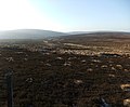 Across the fell to Crook Burn - geograph.org.uk - 2764483.jpg 640 × 528 ; 72 kio
-
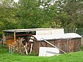 Agricultural buildings north of Castle Carrock - geograph.org.uk - 2664160.jpg 640 × 480 ; 112 kio
-
 Animal Pens, Binney Bank - geograph.org.uk - 2925147.jpg 600 × 450 ; 118 kio
-
 B6413 south of High Gelt Bridge - geograph.org.uk - 3308231.jpg 640 × 480 ; 124 kio
-
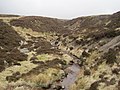 Black Sike - geograph.org.uk - 2938041.jpg 600 × 450 ; 105 kio
-

-
 Bog ashphodel on Cold Fell - geograph.org.uk - 3080137.jpg 640 × 480 ; 83 kio
-
 Bridge over New Water - geograph.org.uk - 2925188.jpg 600 × 450 ; 131 kio
-
 Bridge over Old Water - geograph.org.uk - 2925173.jpg 600 × 450 ; 148 kio
-
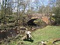 Bridge over the River Gelt - geograph.org.uk - 2925137.jpg 600 × 450 ; 158 kio
-
 Bridleway towards New Water - geograph.org.uk - 2925269.jpg 600 × 450 ; 93 kio
-
 Bridleway towards Old Water - geograph.org.uk - 2925214.jpg 600 × 450 ; 77 kio
-
 Bridleway towards Old Water - geograph.org.uk - 2925273.jpg 600 × 450 ; 87 kio
-
 Brown Fell - geograph.org.uk - 3149452.jpg 1 500 × 856 ; 1,16 Mio
-
 Brown Fell - geograph.org.uk - 4181158.jpg 640 × 480 ; 75 kio
-

-
 Castle Carrock village - geograph.org.uk - 5564253.jpg 2 444 × 1 833 ; 884 kio
-
 Causeway by the River Gelt - geograph.org.uk - 3612932.jpg 1 066 × 800 ; 471 kio
-
 Cleugh of un-named sike east of Gairs - geograph.org.uk - 4180342.jpg 640 × 480 ; 99 kio
-
 Cold Fell shelter, trig point and cairn - geograph.org.uk - 2754958.jpg 1 024 × 769 ; 218 kio
-
 Cottages at Greenwell - geograph.org.uk - 4768897.jpg 1 066 × 800 ; 282 kio
-
 Currick and rock outcrop east of Gairs - geograph.org.uk - 4169185.jpg 640 × 480 ; 95 kio
-

-
 Currick east of Gairs - geograph.org.uk - 4177291.jpg 640 × 480 ; 99 kio
-
 Currick on Brown Fell above Gairs (2) - geograph.org.uk - 4176136.jpg 640 × 480 ; 69 kio
-
 Currick on Brown Fell above Gairs - geograph.org.uk - 4176125.jpg 640 × 480 ; 71 kio
-
 Currick on the southern slopes of Brown Fell - geograph.org.uk - 4169181.jpg 640 × 480 ; 75 kio
-
 Currick on the southern slopes of Brown Fell - geograph.org.uk - 4273292.jpg 640 × 480 ; 80 kio
-
 Disused mine below Tarnmonath Fell - geograph.org.uk - 4180359.jpg 640 × 480 ; 73 kio
-

-
 Disused mine buildings southeast of Gairs - geograph.org.uk - 4180353.jpg 640 × 480 ; 84 kio
-
 Disused mine buildings southeast of Gairs - geograph.org.uk - 4273341.jpg 640 × 480 ; 80 kio
-
 Duke of Cumberland - geograph.org.uk - 1283979.jpg 640 × 423 ; 104 kio
-
 Falls Near Hynam Weir - geograph.org.uk - 3322033.jpg 1 024 × 685 ; 247 kio
-
 Farm Buildings, Binney Bank - geograph.org.uk - 2925142.jpg 600 × 450 ; 117 kio
-
 Farmland, Castle Carrock - geograph.org.uk - 4335481.jpg 640 × 480 ; 212 kio
-
 Farmland, Castle Carrock - geograph.org.uk - 4342046.jpg 640 × 480 ; 178 kio
-
 Fell Foot - geograph.org.uk - 1237902.jpg 640 × 480 ; 145 kio
-
 Field and trees north of Castle Carrock - geograph.org.uk - 2664169.jpg 640 × 480 ; 77 kio
-
 Field with sheep near Castle Carrock - geograph.org.uk - 4235401.jpg 640 × 480 ; 151 kio
-
 Field with sheep near Castle Carrock - geograph.org.uk - 4235410.jpg 640 × 480 ; 128 kio
-
 Field, sheep and muck heap near Black Moss - geograph.org.uk - 4235384.jpg 640 × 480 ; 163 kio
-
 Field, sheep and muck heap near Black Moss - geograph.org.uk - 4235392.jpg 640 × 480 ; 142 kio
-
 Fields near Castle Carrock - geograph.org.uk - 4235415.jpg 640 × 480 ; 148 kio
-
 Flooded road at Tarn Lodge - geograph.org.uk - 4235331.jpg 640 × 480 ; 181 kio
-
 Footpath above Gairs - geograph.org.uk - 6029985.jpg 5 184 × 3 888 ; 870 kio
-
 Footpath round the foot of Brown Fell - geograph.org.uk - 1776164.jpg 640 × 480 ; 100 kio
-
 Footpath through Knotts Wood - geograph.org.uk - 6029875.jpg 5 184 × 3 888 ; 1,53 Mio
-
 Footpath to Talkin - geograph.org.uk - 216890.jpg 600 × 450 ; 284 kio
-
 Footpath towards Gairs - geograph.org.uk - 6029890.jpg 5 184 × 3 888 ; 824 kio
-
 Footpath towards Gairs - geograph.org.uk - 6029903.jpg 5 184 × 3 888 ; 752 kio
-

-
 Ford on the Castle Carrock Beck - geograph.org.uk - 4768903.jpg 1 066 × 800 ; 385 kio
-
 Ford through Old Water - geograph.org.uk - 2925168.jpg 600 × 450 ; 136 kio
-
 Gairs - geograph.org.uk - 3517207.jpg 640 × 480 ; 97 kio
-
 Gairs - geograph.org.uk - 3617584.jpg 1 066 × 800 ; 221 kio
-
 Gairs - geograph.org.uk - 4180387.jpg 640 × 480 ; 119 kio
-
 Gairs - geograph.org.uk - 6427809.jpg 1 600 × 900 ; 274 kio
-
 Gairs and sheepfold from slopes of Brown Fell - geograph.org.uk - 2754927.jpg 1 024 × 768 ; 233 kio
-
 Gairs and Simmerson Hill - geograph.org.uk - 4274134.jpg 640 × 480 ; 70 kio
-
 Gairs from the north - geograph.org.uk - 2754921.jpg 1 024 × 768 ; 260 kio
-
 Gelt Hall, Castle Carrock - geograph.org.uk - 2890640.jpg 816 × 612 ; 231 kio
-
 Geltsdale Rain Gauge - geograph.org.uk - 3164975.jpg 2 816 × 2 112 ; 1,26 Mio
-
 Geltsdale Road, Castle Carrock - geograph.org.uk - 1437901.jpg 640 × 480 ; 315 kio
-
 GPO marker - geograph.org.uk - 159110.jpg 640 × 480 ; 157 kio
-
 Graystone Beck - geograph.org.uk - 1776482.jpg 640 × 480 ; 111 kio
-
 Greenwell - geograph.org.uk - 4768896.jpg 1 066 × 800 ; 234 kio
-
 Greenwell - geograph.org.uk - 4768898.jpg 1 066 × 800 ; 392 kio
-
 Hornby's House - geograph.org.uk - 3215835.jpg 640 × 480 ; 100 kio
-
 House for Water Works Worker - geograph.org.uk - 2925185.jpg 600 × 450 ; 88 kio
-
 How Gill Valley and Castle Carrock Fell - geograph.org.uk - 3617591.jpg 1 066 × 800 ; 174 kio
-
 Hynam - geograph.org.uk - 1283924.jpg 640 × 404 ; 82 kio
-
 Hynam Bridge - geograph.org.uk - 2070877.jpg 3 872 × 2 592 ; 3,54 Mio
-
 Hynam Bridge and the River Gelt - geograph.org.uk - 2925108.jpg 1 600 × 1 200 ; 775 kio
-
 Hynam Waterfall, River Gelt - geograph.org.uk - 2925115.jpg 1 600 × 1 200 ; 702 kio
-
 Icy footpath near Gairs - geograph.org.uk - 1736913.jpg 640 × 480 ; 115 kio
-
 Jockey Shield - geograph.org.uk - 1284709.jpg 640 × 395 ; 72 kio
-

-
 Knarsdale Common south of Three Pikes - geograph.org.uk - 3230123.jpg 640 × 480 ; 87 kio
-
 Lakeland View from Middle Top NY5852 - geograph.org.uk - 2791580.jpg 1 024 × 534 ; 104 kio
-

-

-
 Little Blacklaw Hill - geograph.org.uk - 3224740.jpg 640 × 480 ; 76 kio
-
 Lone rowan tree near Gairs - geograph.org.uk - 4180392.jpg 640 × 480 ; 93 kio
-
 Long Byres holiday cottages - geograph.org.uk - 571017.jpg 640 × 480 ; 156 kio
-
 Longdyke Farm - geograph.org.uk - 1284013.jpg 640 × 239 ; 34 kio
-
 Magpies on Road to Geltsdale House - geograph.org.uk - 461852.jpg 480 × 640 ; 107 kio
-
 Middle Top - geograph.org.uk - 1284046.jpg 640 × 402 ; 78 kio
-
 Middle Top - geograph.org.uk - 1284763.jpg 640 × 409 ; 84 kio
-
 Mine spoil heaps southeast of Gairs - geograph.org.uk - 4274131.jpg 640 × 480 ; 80 kio
-
 Minor road near Castle Carrock - geograph.org.uk - 6159220.jpg 2 592 × 1 944 ; 1,41 Mio
-
 Moorland above Gairs - geograph.org.uk - 4273304.jpg 640 × 480 ; 92 kio
-
 Moorland above New And Old Water - geograph.org.uk - 2938036.jpg 600 × 450 ; 70 kio
-
 Moorland above New Water - geograph.org.uk - 2938013.jpg 600 × 450 ; 82 kio
-
 Moorland below Little Blacklaw Hill - geograph.org.uk - 3231099.jpg 640 × 480 ; 84 kio
-
 Moorland between Brown Fell and Cold Fell - geograph.org.uk - 4176120.jpg 640 × 480 ; 88 kio
-
 Moorland between Brown Fell and Cold Fell - geograph.org.uk - 4269623.jpg 640 × 480 ; 86 kio
-

-

-
-
 Moorland east of Gairs - geograph.org.uk - 4177337.jpg 640 × 480 ; 72 kio
-
 Moorland east of Gairs - geograph.org.uk - 4177352.jpg 640 × 480 ; 85 kio
-
 Moorland east of Gairs - geograph.org.uk - 4177396.jpg 640 × 480 ; 80 kio
-
 Moorland east of Gairs - geograph.org.uk - 4273298.jpg 640 × 480 ; 71 kio
-
 Moorland east of Gairs - geograph.org.uk - 4273333.jpg 640 × 480 ; 94 kio
-
 Moorland east of Geltsdale Middle - geograph.org.uk - 3230113.jpg 640 × 480 ; 69 kio
-
 Moorland near Crookburn Pike - geograph.org.uk - 2938023.jpg 600 × 450 ; 80 kio
-

-
 Moorland on the southern side of Brown Fell - geograph.org.uk - 4269638.jpg 640 × 480 ; 86 kio
-
 Moorland southwest of Three Pikes - geograph.org.uk - 3224707.jpg 640 × 480 ; 83 kio
-
 Moorland west of Three Pikes (2) - geograph.org.uk - 3224723.jpg 640 × 480 ; 80 kio
-
 Moorland west of Three Pikes - geograph.org.uk - 3215844.jpg 640 × 480 ; 63 kio
-
 Moorland west of Three Pikes - geograph.org.uk - 3224715.jpg 640 × 480 ; 80 kio
-
 Moorland, Castle Carrock - geograph.org.uk - 6137456.jpg 1 024 × 768 ; 237 kio
-
 Moorland, Geltsdale - geograph.org.uk - 780157.jpg 640 × 480 ; 107 kio
-
 Moorland, Geltsdale - geograph.org.uk - 780164.jpg 640 × 480 ; 117 kio
-
 Moorland, Geltsdale - geograph.org.uk - 781223.jpg 640 × 480 ; 102 kio
-
 Moorland, Geltsdale - geograph.org.uk - 781675.jpg 640 × 480 ; 121 kio
-
 Moorland, Knaresdale - geograph.org.uk - 6137439.jpg 1 024 × 768 ; 269 kio
-
 Moorland, Knaresdale - geograph.org.uk - 6137462.jpg 1 024 × 768 ; 254 kio
-
 Moving sheep between fields, Longdyke Farm - geograph.org.uk - 2599917.jpg 640 × 480 ; 76 kio
-
 North-west from the slopes of Cold Fell - geograph.org.uk - 2754943.jpg 1 024 × 768 ; 182 kio
-
 Old railway goods van near Castle Carrock - geograph.org.uk - 2664153.jpg 640 × 480 ; 107 kio
-
 Old Water - geograph.org.uk - 2938078.jpg 600 × 450 ; 130 kio
-
 Old Water Bridge - geograph.org.uk - 3617576.jpg 1 066 × 800 ; 286 kio
-
 Old Water Bridge, Geltsdale - geograph.org.uk - 2938089.jpg 600 × 450 ; 89 kio
-
 Old Water Valley - geograph.org.uk - 3617558.jpg 1 066 × 800 ; 362 kio
-
 Old Water Valley - geograph.org.uk - 3617560.jpg 1 066 × 800 ; 412 kio
-
 Pasture, Castle Carrock - geograph.org.uk - 4342053.jpg 640 × 480 ; 194 kio
-
 Pasture, Castle Carrock - geograph.org.uk - 4342067.jpg 640 × 480 ; 194 kio
-
 Path from Jockey Shield - geograph.org.uk - 3517286.jpg 640 × 480 ; 103 kio
-
 Peat haggs northwest of Great Blacklaw Hill - geograph.org.uk - 3080131.jpg 640 × 480 ; 98 kio
-
 Pile of stones on Brown Fell above Gairs - geograph.org.uk - 2754935.jpg 1 024 × 769 ; 174 kio
-
 Pumping Station, Old and New Water, Geltsdale - geograph.org.uk - 2925178.jpg 600 × 450 ; 122 kio
-
 Rapids on Old Water - geograph.org.uk - 3617567.jpg 1 066 × 800 ; 389 kio
-

-
 Remains of bridge, New Water - geograph.org.uk - 2925282.jpg 600 × 450 ; 119 kio
-
 Remains of bridge, New Water - geograph.org.uk - 2925288.jpg 600 × 450 ; 111 kio
-
 River Gelt - geograph.org.uk - 2925138.jpg 600 × 450 ; 161 kio
-
 River Gelt - geograph.org.uk - 3617524.jpg 1 066 × 800 ; 417 kio
-
 River Gelt - geograph.org.uk - 6029780.jpg 5 184 × 3 888 ; 911 kio
-
 Rock outcrop above Gairs - geograph.org.uk - 4177259.jpg 640 × 480 ; 75 kio
-
 Rock outcrop below Three Pikes - geograph.org.uk - 3215790.jpg 640 × 480 ; 93 kio
-

-

-

-
 Rock outcrops on Brown Fell - geograph.org.uk - 4176139.jpg 640 × 480 ; 106 kio
-
 Ruined Shooting Box, Old Water - geograph.org.uk - 2938076.jpg 600 × 450 ; 87 kio
-
-
 Sheepfold below Lord's Seat - geograph.org.uk - 2925321.jpg 600 × 450 ; 69 kio
-
 Sheepfold below Middle Top - geograph.org.uk - 2925218.jpg 600 × 450 ; 82 kio
-
 Sheepfold east of Gairs (2) - geograph.org.uk - 4177316.jpg 640 × 480 ; 83 kio
-
 Sheepfold east of Gairs - geograph.org.uk - 4169190.jpg 640 × 480 ; 82 kio
-
 Sheepfold near Old Water Bridge - geograph.org.uk - 2938084.jpg 600 × 450 ; 91 kio
-
 Sheepfold, Old Water Valley - geograph.org.uk - 3617532.jpg 1 066 × 800 ; 277 kio
-
 Sheepfold, Old Water Valley - geograph.org.uk - 3617578.jpg 1 066 × 800 ; 232 kio
-
 Sheepfold, Tarnmonath Fell - geograph.org.uk - 781596.jpg 640 × 480 ; 157 kio
-
 Shelter Cairn, Crookburn Pike - geograph.org.uk - 2938028.jpg 600 × 450 ; 87 kio
-
 Shelter Cairn, Crookburn Pike - geograph.org.uk - 2938031.jpg 600 × 450 ; 93 kio
-
 Silo at Tarn Lodge Farm - geograph.org.uk - 4235326.jpg 640 × 481 ; 152 kio
-
 Simmerson Hill - geograph.org.uk - 4177375.jpg 640 × 480 ; 76 kio
-
 Small rock outcrop north of Three Pikes - geograph.org.uk - 3224725.jpg 640 × 481 ; 95 kio
-
 Small Waterfall, Black Sike - geograph.org.uk - 2938047.jpg 600 × 450 ; 143 kio
-
 Small Waterfall, New Water - geograph.org.uk - 2937976.jpg 600 × 450 ; 111 kio
-
 Small Waterfalls, Black Sike - geograph.org.uk - 2938068.jpg 600 × 450 ; 125 kio
-
 Small Waterfalls, New Water - geograph.org.uk - 2937980.jpg 600 × 450 ; 126 kio
-
 Snow on the slopes of Tarnmonath Fell - geograph.org.uk - 1775488.jpg 640 × 480 ; 90 kio
-
 Summit plateau, Great Blacklaw Hill - geograph.org.uk - 1776715.jpg 640 × 480 ; 106 kio
-
 Take a Seat^ - geograph.org.uk - 1284029.jpg 427 × 640 ; 141 kio
-
 Tarn Lodge, Castle Carrock.jpg 640 × 480 ; 233 kio
-
 Tarnmonath Fell - geograph.org.uk - 1284733.jpg 640 × 394 ; 80 kio
-
 Tarnmonath Fell - geograph.org.uk - 3617586.jpg 1 066 × 800 ; 188 kio
-
 The B6413 through Castle Carrock - geograph.org.uk - 2890658.jpg 816 × 612 ; 166 kio
-
 The B6413 through Castle Carrock - geograph.org.uk - 2890679.jpg 816 × 612 ; 151 kio
-
 The B6413 to Newbiggin - geograph.org.uk - 5778547.jpg 2 592 × 1 944 ; 1,33 Mio
-
 The cleugh of New Water below Butt Hill - geograph.org.uk - 3229692.jpg 640 × 480 ; 84 kio
-
-
 The green at Castle Carrock - geograph.org.uk - 2888815.jpg 816 × 612 ; 174 kio
-
 The headwaters of Crook Burn - geograph.org.uk - 3231069.jpg 640 × 480 ; 88 kio
-
 The headwaters of How Gill - geograph.org.uk - 4169197.jpg 640 × 480 ; 68 kio
-
 The road to Castle Carrock - geograph.org.uk - 5778538.jpg 2 592 × 1 944 ; 1,6 Mio
-
 The road to Castle Carrock - geograph.org.uk - 5778540.jpg 2 592 × 1 944 ; 1,27 Mio
-
 The southern slopes of Brown Fell (2) - geograph.org.uk - 4177366.jpg 640 × 480 ; 74 kio
-
 The southern slopes of Brown Fell - geograph.org.uk - 4177365.jpg 640 × 480 ; 78 kio
-
 The southern slopes of Brown Fell - geograph.org.uk - 4273296.jpg 640 × 480 ; 86 kio
-
 The summit of Cold Fell (2) - geograph.org.uk - 4169142.jpg 640 × 480 ; 81 kio
-
 The summit of Cold Fell (3) - geograph.org.uk - 4176078.jpg 640 × 480 ; 73 kio
-
 The summit of Cold Fell - geograph.org.uk - 3080143.jpg 640 × 480 ; 82 kio
-
 The top of Brown Fell - geograph.org.uk - 4269627.jpg 640 × 480 ; 89 kio
-
 The top of Brown Fell - geograph.org.uk - 4269635.jpg 640 × 480 ; 60 kio
-
 The upper valley of How Gill - geograph.org.uk - 4180366.jpg 640 × 480 ; 60 kio
-

-
 The valley of How Gill around Gairs - geograph.org.uk - 4177382.jpg 640 × 480 ; 47 kio
-
 The valley of How Gill below Simmerson Hill - geograph.org.uk - 4177378.jpg 640 × 480 ; 68 kio
-
 The valley of How Gill north of Gairs - geograph.org.uk - 4177371.jpg 640 × 480 ; 66 kio
-
 The Weary Sportsman, Castle Carrock - geograph.org.uk - 5174034.jpg 640 × 427 ; 277 kio
-
 The western slopes of Cold Fell (2) - geograph.org.uk - 4269633.jpg 640 × 480 ; 66 kio
-
 The western slopes of Cold Fell - geograph.org.uk - 4176113.jpg 640 × 480 ; 74 kio
-
 Tottergill - geograph.org.uk - 1284006.jpg 427 × 640 ; 80 kio
-
 Tough walking between Brown Fell ^ Cold Fell - geograph.org.uk - 2757202.jpg 1 024 × 769 ; 321 kio


_-_geograph.org.uk_-_4176136.jpg)


_-_geograph.org.uk_-_4273347.jpg)


_-_geograph.org.uk_-_3224723.jpg)


_-_geograph.org.uk_-_4273328.jpg)


_-_geograph.org.uk_-_4177316.jpg)


_-_geograph.org.uk_-_4177366.jpg)


_-_geograph.org.uk_-_4169142.jpg)
_-_geograph.org.uk_-_4176078.jpg)


_-_geograph.org.uk_-_4269633.jpg)


