Category:Category A listed buildings in Midlothian
Zur Navigation springen
Zur Suche springen
Council areas (municipalities) of Scotland: Aberdeen · Aberdeenshire · Angus · Argyll and Bute · Clackmannanshire · Dumfries and Galloway · Dundee · East Ayrshire · East Dunbartonshire · East Lothian · East Renfrewshire · Edinburgh · Falkirk · Fife · Glasgow · Highland · Inverclyde · Midlothian · Moray · North Ayrshire · North Lanarkshire · Outer Hebrides · Orkney Islands · Perth and Kinross · Renfrewshire · Scottish Borders · Shetland Islands · South Ayrshire · South Lanarkshire · Stirling · West Dunbartonshire · West Lothian
Wikimedia-Kategorie | |||||
| Medium hochladen | |||||
| Ist ein(e) | |||||
|---|---|---|---|---|---|
| |||||
Unterkategorien
Es werden 25 von insgesamt 25 Unterkategorien in dieser Kategorie angezeigt:
In Klammern die Anzahl der enthaltenen Kategorien (K), Seiten (S), Dateien (D)
A
- Arniston House (13 D)
B
- Bilston Viaduct (25 D)
- Bush House (5 D)
C
- Crichton Castle stables (8 D)
D
- Dalkeith Corn Exchange (6 D)
- Dalkeith Palace conservatory (11 D)
- Dalkeith Tolbooth (7 D)
F
- Ford House, Midlothian (6 D)
H
- Hawthornden Castle (4 D)
L
- Lady Victoria Colliery (15 D)
- Lions Gate, Midlothian (2 D)
- Lothian Bridge (10 D)
M
- Maiden Bridge (Newbattle) (9 D)
- Mavisbank House (22 D)
- Montagu Bridge (10 D)
N
O
- Oxenfoord Castle (6 D)
P
- Preston Hall, Midlothian (1 D)
R
- Rosebery Farm (3 D)
V
- Vogrie House (4 D)
Medien in der Kategorie „Category A listed buildings in Midlothian“
Folgende 11 Dateien sind in dieser Kategorie, von 11 insgesamt.
-
 17thC sundial, Newbattle Abbey (geograph 2314937).jpg 488 × 640; 82 KB
-
 17thC sundial, Newbattle Abbey (geograph 2314944).jpg 480 × 640; 62 KB
-
 Detail of pediment and datestone on front elevation of Tolbooth.jpg 5.472 × 3.401; 8,32 MB
-
 Doocot, Mavisbank (geograph 3964806).jpg 640 × 480; 257 KB
-
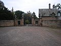
 Gates of Newbattle Abbey.jpg 634 × 450; 74 KB
-
 Gateway to Woolmet House (geograph 1844648).jpg 1.024 × 768; 103 KB
-
 King's Gate entrance to Dalkeith Park - geograph.org.uk - 605175.jpg 640 × 480; 71 KB
-
 Newbattle Old Bridge - geograph.org.uk - 937301.jpg 640 × 480; 128 KB
-
 Oxenfoord Viaduct (geograph 2363572).jpg 640 × 480; 107 KB
-
 Parkend, Bridge Street, Penicuik - geograph.org.uk - 911908.jpg 640 × 427; 79 KB
-
 The Temple, Preston Hall (geograph 2437518).jpg 800 × 530; 102 KB
.jpg)
.jpg)

.jpg)

.jpg)


.jpg)

.jpg)