Category:Cawston, Norfolk
Aller à la navigation
Aller à la recherche
localité britannique du comté anglais de Norfolk  | |||||
| Téléverser des médias | |||||
| Nature de l’élément | |||||
|---|---|---|---|---|---|
| Lieu | Broadland, Norfolk, Angleterre de l'Est, Angleterre | ||||
| Superficie |
| ||||
| Réputé identique à | Cawston (page en doublon, paroisse civile) | ||||
 | |||||

Sous-catégories
Cette catégorie comprend 10 sous-catégories, dont les 10 ci-dessous.
B
- The Bell, Cawston (2 F)
C
- Cawston railway station (6 F)
D
E
- Environs of Cawston, Norfolk (4 F)
F
- Farms in Cawston, Norfolk (20 F)
H
- Houses in Cawston, Norfolk (12 F)
N
S
Média dans la catégorie « Cawston, Norfolk »
Cette catégorie comprend 266 fichiers, dont les 200 ci-dessous.
(page précédente) (page suivante)-
 A carpet of bracken - geograph.org.uk - 972825.jpg 480 × 640 ; 164 kio
-
 A crop of oilseed rape - geograph.org.uk - 1319265.jpg 640 × 480 ; 84 kio
-
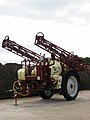 A crop sprayer - geograph.org.uk - 552516.jpg 480 × 640 ; 53 kio
-
 A fallen tree beside the path - geograph.org.uk - 553661.jpg 480 × 640 ; 127 kio
-
 A garden full of nettles - geograph.org.uk - 1317097.jpg 480 × 640 ; 138 kio
-
 A mossy track - geograph.org.uk - 639284.jpg 640 × 480 ; 106 kio
-
 A sheet of ice - geograph.org.uk - 636434.jpg 480 × 640 ; 60 kio
-
 A small island - geograph.org.uk - 639288.jpg 480 × 640 ; 63 kio
-
 A steep ascent - geograph.org.uk - 1018520.jpg 480 × 640 ; 161 kio
-
 A sunny seat - geograph.org.uk - 1018498.jpg 480 × 640 ; 175 kio
-
 Access track to rifle range - geograph.org.uk - 1018362.jpg 640 × 444 ; 142 kio
-
 Across the field - geograph.org.uk - 1257865.jpg 640 × 480 ; 103 kio
-
 Agricultural sheds at Beer House Farm - geograph.org.uk - 553650.jpg 640 × 480 ; 48 kio
-
 Aircraft Hangar at Oulton - geograph.org.uk - 6120417.jpg 3 456 × 2 592 ; 2,08 Mio
-

-
 Approach to Cawston from the west - geograph.org.uk - 567797.jpg 480 × 640 ; 93 kio
-
 Approach to roundabout B1145-B1149 - geograph.org.uk - 457629.jpg 640 × 480 ; 41 kio
-
 Approaching Birds Lane from farm track - geograph.org.uk - 640474.jpg 637 × 438 ; 51 kio
-
 Approaching the woods - geograph.org.uk - 972754.jpg 640 × 480 ; 142 kio
-
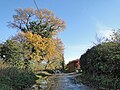
 Autumn colours beside Holt Road - geograph.org.uk - 3757708.jpg 480 × 640 ; 292 kio
-
 Autumn colours in Haveringland Wood - geograph.org.uk - 3757711.jpg 640 × 480 ; 278 kio
-
 Autumnal scene - geograph.org.uk - 5608195.jpg 3 456 × 2 592 ; 4 Mio
-
 B1149 approaching Cawston - geograph.org.uk - 5951128.jpg 2 592 × 1 944 ; 2,59 Mio
-
 B1149 Holt Road - geograph.org.uk - 3472383.jpg 3 072 × 2 304 ; 1,26 Mio
-
 B1149 Holt Road - geograph.org.uk - 3473376.jpg 3 072 × 2 304 ; 1,28 Mio
-
 B1149 Holt Road - geograph.org.uk - 3473637.jpg 3 072 × 2 304 ; 1,32 Mio
-
 B1149 Holt Road - geograph.org.uk - 3473647.jpg 3 072 × 2 304 ; 1,66 Mio
-
 B1149 Holt Road ^ Bridge - geograph.org.uk - 3473629.jpg 3 072 × 2 304 ; 1,36 Mio
-
 Back Lane sign - geograph.org.uk - 3472395.jpg 3 072 × 2 304 ; 1,55 Mio
-
 Back Lane, Eastgate - geograph.org.uk - 3472392.jpg 3 072 × 2 304 ; 1,54 Mio
-
 Bare trees after an overnight blow - geograph.org.uk - 5608186.jpg 3 456 × 2 592 ; 3,89 Mio
-
 Beech trees in Great Wood - geograph.org.uk - 4323329.jpg 640 × 480 ; 230 kio
-
 Beech trees on the edge of Great Wood - geograph.org.uk - 4323326.jpg 640 × 480 ; 292 kio
-
 Beeches and Birches - geograph.org.uk - 972760.jpg 480 × 640 ; 166 kio
-
 Beside the footpath - geograph.org.uk - 972793.jpg 480 × 640 ; 212 kio
-
 Birches in Great Wood - geograph.org.uk - 4323334.jpg 601 × 640 ; 212 kio
-
 Birds Lane - geograph.org.uk - 640456.jpg 640 × 480 ; 66 kio
-
 Bluestone Plantation near Holt Road (B1149) - geograph.org.uk - 553643.jpg 480 × 640 ; 110 kio
-
 Bluestone Railway Station - entrance - geograph.org.uk - 1319185.jpg 640 × 480 ; 138 kio
-
 Boathouse in the reeds - geograph.org.uk - 637651.jpg 640 × 480 ; 184 kio
-
 Booton Claypits, Booton - geograph.org.uk - 304190.jpg 640 × 376 ; 80 kio
-
 Botany Bay Farm - geograph.org.uk - 518057.jpg 640 × 480 ; 74 kio
-
 Brandiston Road - geograph.org.uk - 636412.jpg 480 × 640 ; 79 kio
-
 Brick rubble - geograph.org.uk - 4323820.jpg 640 × 480 ; 285 kio
-
 Brick-built blast shelter - geograph.org.uk - 4323821.jpg 640 × 493 ; 287 kio
-
 Bridleway past Cawston Hospital - geograph.org.uk - 3975503.jpg 640 × 480 ; 288 kio
-
 Broadland Wineries - car park - geograph.org.uk - 1317086.jpg 640 × 445 ; 70 kio
-
 Broadland Wineries - entrance - geograph.org.uk - 1317083.jpg 640 × 448 ; 83 kio
-
 Bumblebee feasting on a leek flower - geograph.org.uk - 584752.jpg 640 × 480 ; 88 kio
-
 Buxton Road east of Holt Road - geograph.org.uk - 5968005.jpg 1 600 × 990 ; 544 kio
-
 Buxton Road sign - geograph.org.uk - 3472385.jpg 3 072 × 2 304 ; 1,49 Mio
-
 Buxton Road towards Great Wood - geograph.org.uk - 5968011.jpg 1 600 × 1 071 ; 1,04 Mio
-
 Buxton Road, Eastgate - geograph.org.uk - 5951121.jpg 2 592 × 1 944 ; 2,45 Mio
-
 Cauliflower past its best - detail - geograph.org.uk - 584756.jpg 640 × 480 ; 97 kio
-
 Cauliflower past its best - geograph.org.uk - 584753.jpg 640 × 480 ; 106 kio
-
 Caution - Shooting Area - geograph.org.uk - 972847.jpg 480 × 640 ; 177 kio
-
 Cawston cemetery and War Memorial - geograph.org.uk - 5608178.jpg 3 456 × 2 592 ; 3,87 Mio
-
 Cawston Circular Walk footpath - geograph.org.uk - 6120374.jpg 3 456 × 2 592 ; 1,86 Mio
-
 Cawston College Lake.JPG 2 304 × 1 728 ; 1,78 Mio
-
 Cawston Manor House - geograph.org.uk - 5608205.jpg 3 456 × 2 592 ; 3,98 Mio
-
 Cawston Park Hospital - geograph.org.uk - 567819.jpg 640 × 480 ; 46 kio
-
 Cawston Village Hall - geograph.org.uk - 3015353.jpg 640 × 480 ; 100 kio
-
 Cawston Village Hall - geograph.org.uk - 567795.jpg 640 × 480 ; 57 kio
-
 Cawston village sign - geograph.org.uk - 4170124.jpg 1 024 × 768 ; 270 kio
-
 Cawston Water Tower - geograph.org.uk - 457626.jpg 480 × 640 ; 74 kio
-

-
 Cawston, St Agnes - geograph.org.uk - 6363003.jpg 3 456 × 4 608 ; 5,21 Mio
-
 Cawston, The Village Sign - geograph.org.uk - 4464062.jpg 3 695 × 2 602 ; 4,89 Mio
-
 Concrete farm track - geograph.org.uk - 4039147.jpg 640 × 480 ; 148 kio
-
 Concrete track to aircraft dispersals - geograph.org.uk - 4039107.jpg 640 × 480 ; 149 kio
-
 Cottages on Booton Road, Cawston - geograph.org.uk - 5967990.jpg 1 600 × 1 064 ; 748 kio
-
 Dead-nettles and stinging nettles - geograph.org.uk - 1257793.jpg 480 × 640 ; 189 kio
-
 Dog walk from caravan site at Martintole Farm - geograph.org.uk - 3597529.jpg 3 264 × 2 448 ; 1,69 Mio
-
 Downhill towards Quakers Wood - geograph.org.uk - 760470.jpg 480 × 640 ; 176 kio
-
 Easton Way sign - geograph.org.uk - 3472540.jpg 3 072 × 2 304 ; 1,56 Mio
-
 Easton Way, The Ratcatchers Arms Public House sign ^ Postbox - geograph.org.uk - 3472535.jpg 3 072 × 2 304 ; 1,23 Mio
-
 Entrance into a field - geograph.org.uk - 756472.jpg 640 × 480 ; 157 kio
-
 Entrance into a private garden - geograph.org.uk - 1317506.jpg 502 × 640 ; 91 kio
-
 Entrance to Cawston Park Hospital - geograph.org.uk - 492754.jpg 640 × 480 ; 87 kio
-

-
 Everything goes downhill from here - geograph.org.uk - 5951117.jpg 2 592 × 1 944 ; 2,89 Mio
-
 Exit from car park - geograph.org.uk - 972662.jpg 640 × 453 ; 127 kio
-
 Feed bin and water for pheasants and partridges - geograph.org.uk - 552607.jpg 480 × 640 ; 113 kio
-
 Fence surrounding new reservoir by Quebec Farm - geograph.org.uk - 4323268.jpg 640 × 480 ; 225 kio
-
 Field adjoining Great Wood - geograph.org.uk - 972818.jpg 480 × 640 ; 148 kio
-
 Field adjoining the Marriott's Way - geograph.org.uk - 1317545.jpg 640 × 480 ; 83 kio
-
 Fields by Quebec Farm - geograph.org.uk - 4323239.jpg 640 × 480 ; 153 kio
-
 First glimpse - geograph.org.uk - 639281.jpg 480 × 640 ; 75 kio
-
 Fishing platform - geograph.org.uk - 639293.jpg 480 × 640 ; 90 kio
-
 Flowering Cauliflower - geograph.org.uk - 584759.jpg 480 × 640 ; 125 kio
-
 Flowering shrubs alongside the footpath - geograph.org.uk - 1317121.jpg 640 × 480 ; 94 kio
-

-
 Footpath from Haveringland to Holt Road - geograph.org.uk - 3757718.jpg 640 × 480 ; 290 kio
-
 Footpath from Haveringland to Holt Road - geograph.org.uk - 3757722.jpg 640 × 480 ; 279 kio
-
 Footpath sign and church at Cawston - geograph.org.uk - 6120377.jpg 3 456 × 2 592 ; 3,86 Mio
-
 Footpath through a clearing - geograph.org.uk - 972749.jpg 480 × 640 ; 176 kio
-
 Footpath through Haveringland Wood - geograph.org.uk - 3757712.jpg 480 × 640 ; 293 kio
-
 Footpath to Haveringland - geograph.org.uk - 3757726.jpg 480 × 640 ; 274 kio
-
 Footpath to Holt Road (B1149) - geograph.org.uk - 4323275.jpg 640 × 480 ; 179 kio
-
 Footpath to Perrys Lane - geograph.org.uk - 1257772.jpg 640 × 480 ; 149 kio
-
 Footpath to the B1145 - geograph.org.uk - 1257862.jpg 640 × 480 ; 120 kio
-
 Forestry road in Cawston, Norfolk- geograph.org.uk - 973013.jpg 640 × 455 ; 126 kio
-
 Forestry road through Great Wood - geograph.org.uk - 972841.jpg 480 × 640 ; 134 kio
-
 Forestry track - geograph.org.uk - 972872.jpg 480 × 640 ; 138 kio
-
 Formerly clay pits, now a fishing pond - geograph.org.uk - 636443.jpg 640 × 480 ; 57 kio
-
 Holt Road, 12 miles from Holt on the B1149 - geograph.org.uk - 5951139.jpg 2 592 × 1 944 ; 2,94 Mio
-
 Houses bordering Cawston Churchyard - geograph.org.uk - 5369676.jpg 640 × 480 ; 76 kio
-
 Hut foundation amongst the trees - geograph.org.uk - 4323825.jpg 640 × 554 ; 324 kio
-
 Hut foundation amongst the trees - geograph.org.uk - 4323827.jpg 640 × 480 ; 281 kio
-
 Hut foundation amongst the trees - geograph.org.uk - 4323828.jpg 640 × 480 ; 276 kio
-
 Hut foundations on Site 5 - geograph.org.uk - 4323830.jpg 640 × 561 ; 331 kio
-
 Industrial units at The Old Station Yard - geograph.org.uk - 1316971.jpg 640 × 480 ; 92 kio
-
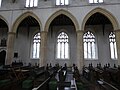
 Inside St Agnes, Cawston (1) - geograph.org.uk - 5368885.jpg 480 × 640 ; 55 kio
-
 Inside St Agnes, Cawston (10) - geograph.org.uk - 5369116.jpg 480 × 640 ; 61 kio
-
 Inside St Agnes, Cawston (11) - geograph.org.uk - 5369119.jpg 480 × 640 ; 73 kio
-
 Inside St Agnes, Cawston (12) - geograph.org.uk - 5369122.jpg 480 × 640 ; 67 kio
-
 Inside St Agnes, Cawston (13) - geograph.org.uk - 5369588.jpg 480 × 640 ; 69 kio
-
 Inside St Agnes, Cawston (14) - geograph.org.uk - 5369591.jpg 640 × 480 ; 60 kio
-
 Inside St Agnes, Cawston (15) - geograph.org.uk - 5369593.jpg 640 × 480 ; 88 kio
-
 Inside St Agnes, Cawston (16) - geograph.org.uk - 5369599.jpg 480 × 640 ; 59 kio
-
 Inside St Agnes, Cawston (17) - geograph.org.uk - 5369601.jpg 480 × 640 ; 61 kio
-
 Inside St Agnes, Cawston (18) - geograph.org.uk - 5369604.jpg 480 × 640 ; 60 kio
-
 Inside St Agnes, Cawston (19) - geograph.org.uk - 5369665.jpg 640 × 480 ; 63 kio
-
 Inside St Agnes, Cawston (2) - geograph.org.uk - 5368897.jpg 480 × 640 ; 70 kio
-
 Inside St Agnes, Cawston (3) - geograph.org.uk - 5368902.jpg 480 × 640 ; 62 kio
-
 Inside St Agnes, Cawston (4) - geograph.org.uk - 5368905.jpg 640 × 480 ; 56 kio
-
 Inside St Agnes, Cawston (5) - geograph.org.uk - 5368909.jpg 480 × 640 ; 50 kio
-
 Inside St Agnes, Cawston (6) - geograph.org.uk - 5368912.jpg 480 × 640 ; 83 kio
-
 Inside St Agnes, Cawston (7) - geograph.org.uk - 5369098.jpg 640 × 480 ; 48 kio
-
 Inside St Agnes, Cawston (8) - geograph.org.uk - 5369102.jpg 640 × 480 ; 82 kio
-
 Inside St Agnes, Cawston (9) - geograph.org.uk - 5369104.jpg 640 × 480 ; 82 kio
-
 Ivy vines climbing towards the sun - geograph.org.uk - 553665.jpg 480 × 640 ; 140 kio
-

-
 Ivy-clad trees beside the new reservoir - geograph.org.uk - 4323277.jpg 640 × 480 ; 144 kio
-
 Larch Plantation - geograph.org.uk - 1317541.jpg 640 × 480 ; 89 kio
-
 Large agricultural building - geograph.org.uk - 5608204.jpg 3 456 × 2 592 ; 3,88 Mio
-

-
 Leeks and cauliflower crop at Middle Farm, Oulton - geograph.org.uk - 6120431.jpg 3 456 × 2 592 ; 3,94 Mio
-
 Little utilised road at Southgate, Cawston - geograph.org.uk - 5608183.jpg 3 456 × 2 592 ; 3,12 Mio
-
 Looking north across stubble - geograph.org.uk - 636452.jpg 640 × 480 ; 56 kio
-

-

-
 Memorial to American Airmen at Cawston, Norfolk - geograph.org.uk - 1985555.jpg 640 × 480 ; 102 kio
-
 Morris Minors - geograph.org.uk - 1316984.jpg 640 × 448 ; 72 kio
-
 New housing - geograph.org.uk - 1317078.jpg 640 × 447 ; 62 kio
-
 New office units - geograph.org.uk - 1317072.jpg 640 × 423 ; 49 kio
-
 New office units in Chapel Street - geograph.org.uk - 1317075.jpg 640 × 480 ; 71 kio
-
 Next year's crop - geograph.org.uk - 636420.jpg 640 × 480 ; 86 kio
-
 Norwich Road sign - geograph.org.uk - 3473312.jpg 3 072 × 2 304 ; 1,67 Mio
-
 Oh^ What a grey day - geograph.org.uk - 6120439.jpg 3 456 × 2 592 ; 1,29 Mio
-
 Old Farm Cottage on Old Friendship Lane - geograph.org.uk - 5967999.jpg 1 600 × 1 093 ; 716 kio
-
 Old Friendship Lane towards Eastgate - geograph.org.uk - 5967996.jpg 1 600 × 1 094 ; 620 kio
-
 Old Milestone - geograph.org.uk - 1816665.jpg 1 200 × 1 600 ; 637 kio
-
 Old track to Quebec Farm - geograph.org.uk - 4323204.jpg 640 × 480 ; 284 kio
-
 Open Land and Woodland by Marriott's Way - geograph.org.uk - 454701.jpg 640 × 480 ; 75 kio
-
 Overgrown ride in Great Wood - geograph.org.uk - 972994.jpg 462 × 640 ; 137 kio
-
 Path through Hundred Acre Plantation - geograph.org.uk - 3600954.jpg 3 264 × 2 448 ; 2,63 Mio
-
 Path through the forest - geograph.org.uk - 553614.jpg 480 × 640 ; 128 kio
-
 Path to Docking Farm - geograph.org.uk - 1317540.jpg 640 × 480 ; 81 kio
-
 Path to the Oakes Family Field - geograph.org.uk - 1317060.jpg 640 × 499 ; 106 kio
-
 Perrys Lane near Perrys Lane Farm, Cawston - geograph.org.uk - 5608199.jpg 3 456 × 2 592 ; 3,83 Mio
-
 Pond reflection - geograph.org.uk - 636449.jpg 640 × 480 ; 68 kio
-
 Private - No Fishing - geograph.org.uk - 639308.jpg 480 × 640 ; 87 kio
-
 Pump house by Quebec Farm - geograph.org.uk - 4323263.jpg 640 × 606 ; 230 kio
-
 Pump house by Quebec Farm - geograph.org.uk - 4323265.jpg 640 × 567 ; 217 kio
-
 Pumphouse by the new reservoir near Quebec Farm - geograph.org.uk - 4323260.jpg 640 × 480 ; 183 kio
-
 RAF Memorial, Cawston - geograph.org.uk - 5970406.jpg 1 600 × 1 063 ; 871 kio
-
 Railway relics - geograph.org.uk - 1317069.jpg 640 × 501 ; 85 kio
-
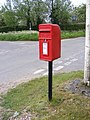 Ratcatchers Public House Postbox - geograph.org.uk - 3472511.jpg 2 304 × 3 072 ; 1,64 Mio
-
 Ratcatchers Public House Postbox - geograph.org.uk - 3472518.jpg 2 304 × 3 072 ; 1,63 Mio
-
 Ratcatchers Public House Postbox - geograph.org.uk - 3472520.jpg 2 304 × 3 072 ; 1,53 Mio
-
 Road sign turned sideways - geograph.org.uk - 891340.jpg 640 × 480 ; 136 kio
-
 Road to Heydon ^ Wood Dalling - geograph.org.uk - 3473658.jpg 3 072 × 2 304 ; 1,56 Mio
-
 Roadsign on Buxton Road - geograph.org.uk - 4573691.jpg 2 304 × 3 072 ; 2,8 Mio
-
 Roadsign on Easton Way - geograph.org.uk - 3473318.jpg 2 304 × 3 072 ; 1,55 Mio
-
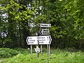 Roadsigns on the B1149 Holt Road - geograph.org.uk - 3473650.jpg 3 072 × 2 304 ; 1,69 Mio
-
 Rodwell Cor, Eastgate - geograph.org.uk - 3472405.jpg 3 072 × 2 304 ; 1,35 Mio
-

-
 Scarlet runner beans in a field - geograph.org.uk - 584764.jpg 480 × 640 ; 112 kio
-

-
 Solitary trees growing in clearing - geograph.org.uk - 972673.jpg 480 × 640 ; 123 kio
-
 South towards the B1145 (Cawston Road) - geograph.org.uk - 553618.jpg 480 × 640 ; 112 kio
-
 Southgate bridge, Cawston - geograph.org.uk - 5608190.jpg 3 456 × 2 592 ; 4,01 Mio
-
 Southgate bridge, Cawston - geograph.org.uk - 5608192.jpg 3 456 × 2 592 ; 3,9 Mio
-
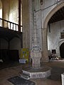
 St Agnes, Cawston, ancient chest - geograph.org.uk - 5369584.jpg 640 × 480 ; 49 kio
-
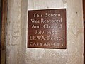
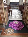
 St Agnes, Cawston, backless pews - geograph.org.uk - 5352077.jpg 640 × 480 ; 70 kio
-
 St Agnes, Cawston, choir stalls - geograph.org.uk - 5369581.jpg 640 × 480 ; 65 kio
-
 St Agnes, Cawston, church path - geograph.org.uk - 5368852.jpg 640 × 480 ; 78 kio
-
 St Agnes, Cawston, churchyard - geograph.org.uk - 5352074.jpg 640 × 480 ; 66 kio
-
 St Agnes, Cawston, font - geograph.org.uk - 5369594.jpg 480 × 640 ; 52 kio
-
 St Agnes, Cawston, funeral cart - geograph.org.uk - 5352075.jpg 640 × 480 ; 69 kio
-
 St Agnes, Cawston, God spede the Plow - geograph.org.uk - 5368868.jpg 480 × 640 ; 59 kio
-
 St Agnes, Cawston, graves - geograph.org.uk - 5368856.jpg 640 × 480 ; 77 kio
-
 St Agnes, Cawston, incumbency board - geograph.org.uk - 5369670.jpg 640 × 480 ; 51 kio
-
 St Agnes, Cawston, lectern - geograph.org.uk - 5369606.jpg 480 × 640 ; 68 kio
-
 St Agnes, Cawston, ledger slab (1) - geograph.org.uk - 5369629.jpg 480 × 640 ; 62 kio
-
 St Agnes, Cawston, ledger slab (2) - geograph.org.uk - 5369635.jpg 640 × 480 ; 81 kio
-
 St Agnes, Cawston, ledger slab (3) - geograph.org.uk - 5369636.jpg 640 × 480 ; 74 kio
-
 St Agnes, Cawston, ledger slab (7) - geograph.org.uk - 5369646.jpg 640 × 480 ; 49 kio
-
 St Agnes, Cawston, ledger slab (8) - geograph.org.uk - 5369649.jpg 480 × 640 ; 65 kio


_-_geograph.org.uk_-_553643.jpg)


_-_geograph.org.uk_-_4323330.jpg)


_-_geograph.org.uk_-_4323275.jpg)


_-_geograph.org.uk_-_5368885.jpg)
_-_geograph.org.uk_-_5369116.jpg)
_-_geograph.org.uk_-_5369119.jpg)
_-_geograph.org.uk_-_5369122.jpg)
_-_geograph.org.uk_-_5369588.jpg)
_-_geograph.org.uk_-_5369591.jpg)
_-_geograph.org.uk_-_5369593.jpg)
_-_geograph.org.uk_-_5369599.jpg)
_-_geograph.org.uk_-_5369601.jpg)
_-_geograph.org.uk_-_5369604.jpg)
_-_geograph.org.uk_-_5369665.jpg)
_-_geograph.org.uk_-_5368897.jpg)
_-_geograph.org.uk_-_5368902.jpg)
_-_geograph.org.uk_-_5368905.jpg)
_-_geograph.org.uk_-_5368909.jpg)
_-_geograph.org.uk_-_5368912.jpg)
_-_geograph.org.uk_-_5369098.jpg)
_-_geograph.org.uk_-_5369102.jpg)
_-_geograph.org.uk_-_5369104.jpg)


_ready_for_harvesting_-_geograph.org.uk_-_584750.jpg)


_in_a_field_-_geograph.org.uk_-_584749.jpg)

_-_geograph.org.uk_-_553618.jpg)


_-_geograph.org.uk_-_5369629.jpg)
_-_geograph.org.uk_-_5369635.jpg)
_-_geograph.org.uk_-_5369636.jpg)
_-_geograph.org.uk_-_5369646.jpg)
_-_geograph.org.uk_-_5369649.jpg)