Category:Chacombe
Vai alla navigazione
Vai alla ricerca
village and civil parish in Northamptonshire, United Kingdom .jpg) | |||||
| Carica un file multimediale | |||||
| Istanza di | |||||
|---|---|---|---|---|---|
| Luogo | West Northamptonshire, Northamptonshire, Midlands Orientali, Inghilterra | ||||
| Popolazione |
| ||||
| Superficie |
| ||||
| sito web ufficiale | |||||
 | |||||
Sottocategorie
Questa categoria contiene le 3 sottocategorie indicate di seguito, su un totale di 3.
G
P
- Chacombe Priory (3 F)
File nella categoria "Chacombe"
Questa categoria contiene 58 file, indicati di seguito, su un totale di 58.
-
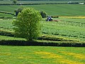
 A field by the A361 - geograph.org.uk - 1996104.jpg 1 500 × 953; 198 KB
-
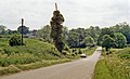
 B4525 southwest of Chacombe Lodge Farm - geograph.org.uk - 2926861.jpg 3 541 × 2 634; 1,31 MB
-
 B4525 west of Stanwell Farm - geograph.org.uk - 3403915.jpg 3 648 × 2 736; 1,84 MB
-
 Banbury Road to Banbury - geograph.org.uk - 1996070.jpg 1 500 × 987; 259 KB
-
 Banbury Road to Chacombe - geograph.org.uk - 1996059.jpg 1 500 × 980; 257 KB
-
 Banbury Road to Chacombe - geograph.org.uk - 1996088.jpg 1 500 × 1 000; 235 KB
-
 Banbury Road to the A361 - geograph.org.uk - 1996093.jpg 1 500 × 1 000; 264 KB
-
 Banbury Road towards Chacombe - geograph.org.uk - 1768560.jpg 640 × 480; 69 KB
-
 Banbury Road towards Chacombe - geograph.org.uk - 3627820.jpg 1 066 × 800; 233 KB
-
 Bridleway to Chacombe - geograph.org.uk - 202583.jpg 640 × 480; 73 KB
-
 Chacombe Footpath - geograph.org.uk - 2627632.jpg 640 × 480; 93 KB
-
 Chacombe Ford - geograph.org.uk - 3261165.jpg 3 872 × 2 592; 2,42 MB
-
 Chacombe Lodge Farm - geograph.org.uk - 2627646.jpg 640 × 480; 85 KB
-
 Chacombe Village sign.jpg 2 576 × 1 932; 1,5 MB
-
 Chacombe, cottages (geograph 2647514).jpg 1 024 × 764; 168 KB
-
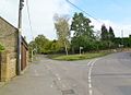
 Chacombe, road junction - geograph.org.uk - 2647491.jpg 1 024 × 757; 155 KB
-
 Chacombe, Thorpe Road (geograph 2647477).jpg 1 024 × 768; 163 KB
-
 Chacombe, village green (geograph 2647500).jpg 1 024 × 743; 165 KB
-
 Chacombe-Great Central Railway (Banbury branch) - geograph.org.uk - 5403161.jpg 1 600 × 1 044; 732 KB
-
 Chacombe-Silver Street (geograph 2632315).jpg 640 × 480; 70 KB
-
 Chalcombe Road Halt site geograph-3148169-by-Ben-Brooksbank.jpg 2 398 × 1 449; 3,12 MB
-
 Cherwell Valley - geograph.org.uk - 4508888.jpg 640 × 426; 27 KB
-
 Church Lane (geograph 1969797).jpg 800 × 600; 166 KB
-
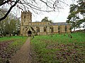 Church of St Peter and St Paul, Chacombe - geograph.org.uk - 6353331.jpg 1 024 × 768; 290 KB
-
 Cottage in Chacombe - geograph.org.uk - 4577935.jpg 1 537 × 978; 556 KB
-
 Cottages in Silver Street - geograph.org.uk - 4839274.jpg 1 613 × 1 047; 1 MB
-
 County Boundary - geograph.org.uk - 214400.jpg 640 × 480; 108 KB
-
 Cycle track to Banbury - geograph.org.uk - 1996108.jpg 1 500 × 986; 330 KB
-
-
 Drive towards Unnamed Farm Buildings - geograph.org.uk - 3627816.jpg 1 066 × 800; 175 KB
-
 Farmland, Chacombe - geograph.org.uk - 6166394.jpg 1 024 × 768; 274 KB
-
 Field Entrance - geograph.org.uk - 3490842.jpg 640 × 480; 104 KB
-
 Field near Castle Farm - geograph.org.uk - 2400811.jpg 640 × 480; 118 KB
-
 Fields near Jeff's Farm - geograph.org.uk - 2400846.jpg 640 × 480; 103 KB
-
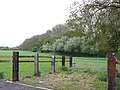
 Footpath Signs - geograph.org.uk - 3627828.jpg 1 066 × 800; 297 KB
-
 Footpath to A361 - geograph.org.uk - 2698708.jpg 640 × 480; 85 KB
-
 Footpath to Chacombe - geograph.org.uk - 1996132.jpg 1 500 × 1 000; 278 KB
-
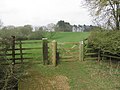
 Gate to a field - geograph.org.uk - 1996078.jpg 1 500 × 971; 211 KB
-
 Jurassic Way - geograph.org.uk - 202585.jpg 640 × 480; 73 KB
-
 Road past Cherwell Edge Golf Club - geograph.org.uk - 2400828.jpg 640 × 480; 58 KB
-
 Seven Shires Way - geograph.org.uk - 2699712.jpg 640 × 480; 92 KB
-
 Seven Shires Way - geograph.org.uk - 2699720.jpg 640 × 480; 96 KB
-
 Signpost in village of Chacombe.jpg 2 576 × 1 932; 1,4 MB
-
 Silver Street, Chacombe - geograph.org.uk - 2143786.jpg 640 × 459; 129 KB
-
 Storm over Chacombe hill - geograph.org.uk - 945391.jpg 640 × 428; 17 KB
-
 T-Junction , Banbury Road and A361 - geograph.org.uk - 3627833.jpg 1 066 × 800; 222 KB
-
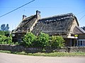
 Thatched cottages on Banbury Road (geograph 1995902).jpg 1 500 × 1 000; 191 KB
-
 Thatching in Chacombe - geograph.org.uk - 202586.jpg 640 × 480; 76 KB
-
 The A361 to Banbury - geograph.org.uk - 1996130.jpg 1 500 × 1 000; 190 KB
-
 The A361 to Daventry - geograph.org.uk - 1996127.jpg 1 500 × 1 000; 154 KB
-
 The Green by Silver Street - geograph.org.uk - 1995914.jpg 1 500 × 959; 230 KB
-
 The Jurassic Way approaching Chacombe from the south - geograph.org.uk - 3028537.jpg 3 524 × 2 618; 1,51 MB
-
 The Jurassic Way between Middleton Cheney and Chacombe - geograph.org.uk - 3028552.jpg 4 000 × 3 000; 4,69 MB
-
 The Jurassic Way close to Chacombe - geograph.org.uk - 3024828.jpg 3 520 × 2 539; 2,37 MB
-
 The old Daventry Road to Banbury - geograph.org.uk - 1996111.jpg 1 500 × 1 000; 240 KB
-
 Track runs along the field boundary - geograph.org.uk - 1768573.jpg 640 × 480; 85 KB
-
 Tunnel under Dismantled Railway - geograph.org.uk - 3627811.jpg 1 066 × 800; 407 KB
-
 Unnamed Farm Buildings - geograph.org.uk - 3627814.jpg 1 066 × 800; 272 KB


.jpg)

.jpg)
.jpg)
_-_geograph.org.uk_-_5403161.jpg)
.jpg)


.jpg)


.jpg)


