Category:Chania Regional Unit
Vai alla navigazione
Vai alla ricerca
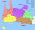
English: Chania (Greek: Περιφερειακή ενότητα Χανίων) is one of the four regional units of Crete. The capital is the city of Chania. The regional unit of Chania is subdivided into 7 municipalities : Apokoronas, Chania, Gavdos, Kantanos-Selino, Kissamos, Platanias and Sfakia.
Français : Le district régional de Chania (Περιφερειακή ενότητα Χανίων) est une division administrative de la Crète, constitué de 7 dèmes (municipalités, ou communes) : Apokoronas, Chania, Gavdos, Kantanos-Selino, Kissamos, Platanias et Sfakia.
unità periferica greca   | |||||
| Carica un file multimediale | |||||
| Istanza di |
| ||||
|---|---|---|---|---|---|
| Luogo | Crete Region, Decentralized Administration of Crete, Grecia | ||||
| Capitale | |||||
| Data di inizio |
| ||||
| Popolazione |
| ||||
| Superficie |
| ||||
| sito web ufficiale | |||||
 | |||||
Sottocategorie
Questa categoria contiene le 9 sottocategorie indicate di seguito, su un totale di 9.
C
K
L
P
File nella categoria "Chania Regional Unit"
Questa categoria contiene 39 file, indicati di seguito, su un totale di 39.
-
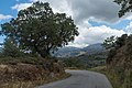 A road in Chania region.jpg 4 137 × 2 758; 4,04 MB
-
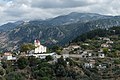
 Byzantine church of Saint Georgios in Anidri.jpg 1 903 × 1 903; 606 KB
-
 Cherethiana Panorama.jpg 8 544 × 1 656; 2,05 MB
-
 Citizens of Karanos.jpg 3 963 × 2 642; 3,21 MB
-
 Coluber gemonensis gemonensis - Δεντρογαλιά.jpg 4 000 × 3 000; 4,96 MB
-
 Drapanos.jpg 2 448 × 3 264; 3,91 MB
-
 Fractals.jpg 720 × 452; 304 KB
-
 GR-Fahne-spyros-kayales.jpg 3 264 × 4 928; 4,21 MB
-
 Gramvousa island chania.jpg 4 224 × 3 136; 4,94 MB
-
 K01 274 Bruchsteinmauerwerk.jpg 3 855 × 2 588; 4,52 MB
-
 KrZourva1.jpg 3 280 × 2 170; 1,29 MB
-
 Lakkoi village 2021-10-17-1.jpg 4 067 × 2 711; 3,53 MB
-
 Lakkoi village 2021-10-17-2.jpg 3 704 × 2 469; 3,2 MB
-
 N. Chanion.png 2 538 × 2 196; 737 KB
-
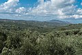 Nature of Chania region-1.jpg 4 181 × 2 787; 3,84 MB
-
 Nature of Chania region-2.jpg 4 152 × 2 768; 5,34 MB
-
 Neglected by the sun.jpg 720 × 481; 40 KB
-
 Olive Tree Museum of Vouves 2021-10-16.jpg 4 113 × 2 649; 3,09 MB
-
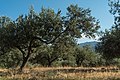
 Olive trees in Chania region-1.jpg 4 090 × 2 727; 4,74 MB
-
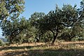
 Olive trees in Chania region-2.jpg 3 984 × 2 656; 5,7 MB
-
 Olive trees in Chania region-3.jpg 4 188 × 2 792; 7,13 MB
-
 PE Chanion in Greece.svg 911 × 768; 1,51 MB
-
 PE Chanion.png 2 538 × 2 196; 747 KB
-
 Samaria Gorge - panoramio (1).jpg 4 928 × 3 264; 3,14 MB
-
 Sanctuary (18886563).jpeg 1 542 × 2 048; 420 KB
-
 Somewhere in Chania region.jpg 4 072 × 2 715; 5,95 MB
-
 Topography Variations of Western Crete, Greece, as seen from Space.JPG 2 534 × 1 593; 1,53 MB
-
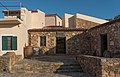
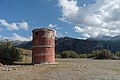 Unidentified construction in Chania region.jpg 4 177 × 2 785; 3,61 MB
-
 View from a road in Chania region, Crete 2021-10-17-1.jpg 3 660 × 2 440; 3,06 MB
-
 View from a road in Chania region, Crete 2021-10-17-2.jpg 3 798 × 2 532; 2,96 MB
-
 View from a road in Chania region, Crete 2021-10-17-3.jpg 3 744 × 2 496; 3,84 MB
-
 View from a road in Chania region, Crete 2021-10-17-4.jpg 4 087 × 2 725; 4,33 MB
-
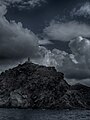
 View of Palaiochora from the antenna hill close to the town.jpg 6 293 × 2 212; 3,1 MB
-
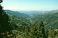
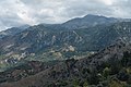
 View to mountains from a road in Chania region 2021-10-17-1.jpg 3 927 × 2 618; 3,19 MB
-
 View to mountains from a road in Chania region 2021-10-17-2.jpg 4 003 × 2 668; 3,86 MB
-
 View to mountains from Lakkoi village.jpg 3 572 × 2 381; 2,59 MB
-
 View to mountains from Zourva.jpg 4 021 × 2 681; 3,61 MB
-
 Κόψη Κατσίγιαννης Μύτης.jpg 3 000 × 4 000; 4,32 MB
-
 Κοντά στην παραλία "Λύκος".jpg 2 048 × 1 279; 875 KB


.jpg)
.jpeg)


