Category:Chapel Haddlesey
Aller à la navigation
Aller à la recherche
localité britannique  | |||||
| Téléverser des médias | |||||
| Nature de l’élément | |||||
|---|---|---|---|---|---|
| Lieu | Selby, Yorkshire du Nord, Yorkshire-et-Humber, Angleterre | ||||
 | |||||
Sous-catégories
Cette catégorie comprend 2 sous-catégories, dont les 2 ci-dessous.
Média dans la catégorie « Chapel Haddlesey »
Cette catégorie comprend 69 fichiers, dont les 69 ci-dessous.
-
 A house on the outskirts of Chapel Haddlesey - geograph.org.uk - 3068669.jpg 800 × 600 ; 98 kio
-
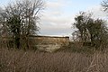
 A public footpath near East Haddlesey - geograph.org.uk - 3068658.jpg 800 × 600 ; 107 kio
-
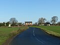
 A19 at Chapel Haddlesey village boundary - geograph.org.uk - 5921316.jpg 1 024 × 703 ; 111 kio
-
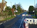 A19 closed at Chapel Haddlesey - geograph.org.uk - 6003642.jpg 1 280 × 960 ; 417 kio
-
 A19 near Eggborough - geograph.org.uk - 2749737.jpg 853 × 1 280 ; 273 kio
-
 A19 near Lodge Farm - geograph.org.uk - 5921325.jpg 1 024 × 702 ; 98 kio
-
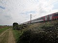 An express on the East Coast Mainline - geograph.org.uk - 5137496.jpg 4 588 × 3 430 ; 4,48 Mio
-

-
 Autumn colours on the Selby Canal - geograph.org.uk - 4728347.jpg 1 024 × 768 ; 136 kio
-
 Barley Field towards Eastfield House Farm - geograph.org.uk - 1378615.jpg 640 × 480 ; 48 kio
-
 Benchmark on Mill Field Road school, West Haddlesey - geograph.org.uk - 3172203.jpg 2 048 × 1 536 ; 624 kio
-
 Canal near Paperhouse Farm - geograph.org.uk - 5766374.jpg 640 × 427 ; 264 kio
-
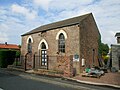
 Chapel Haddelsy, The Old Methodist Chapel - geograph.org.uk - 99946.jpg 640 × 480 ; 122 kio
-
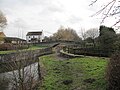
 Chapel Haddlesey Bridge - geograph.org.uk - 6003639.jpg 1 280 × 960 ; 492 kio
-
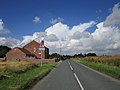
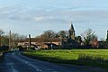 Chapel Haddlesey from the east - geograph.org.uk - 6003638.jpg 1 280 × 851 ; 270 kio
-
 Chapel in Chapel Haddlesey - geograph.org.uk - 1726922.jpg 2 816 × 2 112 ; 2,59 Mio
-
 Converting the Wesleyan Chapel - geograph.org.uk - 5137483.jpg 4 594 × 3 438 ; 5,33 Mio
-
 Drain beside Paperhouse Lane - geograph.org.uk - 5765964.jpg 640 × 427 ; 230 kio
-
 Drainage channel bridge - geograph.org.uk - 2749735.jpg 1 280 × 853 ; 372 kio
-
 Drainage tunnel at Paper House Bridge - geograph.org.uk - 6001569.jpg 1 280 × 946 ; 427 kio
-
 Drainage tunnel, Selby Canal, West Haddlesey - geograph.org.uk - 6003686.jpg 1 280 × 960 ; 462 kio
-
 Eastfield House Farm - geograph.org.uk - 6003635.jpg 1 280 × 960 ; 236 kio
-
 Farmland by the ECML - geograph.org.uk - 2409674.jpg 640 × 496 ; 36 kio
-
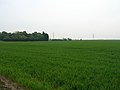 Farmland near Chapel Haddlesey - geograph.org.uk - 2397081.jpg 1 600 × 1 200 ; 348 kio
-
 Fields and canal towpath - geograph.org.uk - 5766373.jpg 640 × 427 ; 230 kio
-
 Flood bank of the River Aire at Hall Garths - geograph.org.uk - 4795729.jpg 1 024 × 768 ; 160 kio
-
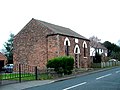
 Former Wesleyan Methodist Chapel, Chapel Haddlesey - geograph.org.uk - 6003645.jpg 1 280 × 896 ; 367 kio
-
 Gas installation off Fox Lane - geograph.org.uk - 1378593.jpg 640 × 480 ; 43 kio
-
 Haddlesey Bridge under repair - geograph.org.uk - 6003671.jpg 1 280 × 832 ; 540 kio
-
 Haddlesey Old Lock, River Aire, Yorkshire - geograph.org.uk - 214913.jpg 640 × 458 ; 103 kio
-
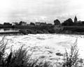 Haddlesey Weir, River Aire, Yorkshire - geograph.org.uk - 377362.jpg 640 × 508 ; 114 kio
-
 Houses in Chapel Haddlesey - geograph.org.uk - 1726905.jpg 2 816 × 2 112 ; 2,95 Mio
-
 Island House, Chapel Haddlesey - geograph.org.uk - 3173197.jpg 2 048 × 1 536 ; 514 kio
-
 Landscape near Eggborough - geograph.org.uk - 2749741.jpg 1 280 × 853 ; 382 kio
-
 Lane through the trees at Haddlesey Manor - geograph.org.uk - 1378609.jpg 640 × 480 ; 89 kio
-
 Lodge Farm - geograph.org.uk - 2397074.jpg 1 600 × 1 200 ; 614 kio
-
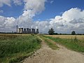
 Looking to Eggborough Power Station - geograph.org.uk - 5305069.jpg 640 × 426 ; 25 kio
-
 Looking to Eggborough Power Station - geograph.org.uk - 5305073.jpg 640 × 426 ; 25 kio
-
 Mute swan preparing to take off, on the Selby Canal - geograph.org.uk - 4728357.jpg 1 024 × 768 ; 135 kio
-
 Mute swan running on the surface of the Selby Canal - geograph.org.uk - 4728362.jpg 1 024 × 768 ; 178 kio
-
 Old milestone (geograph 6706127).jpg 1 200 × 1 600 ; 553 kio
-
 On the edge of Chapel Haddlesey Ings - geograph.org.uk - 6391699.jpg 5 146 × 3 462 ; 3,04 Mio
-
 Paper House Bridge, Selby Canal - geograph.org.uk - 6001574.jpg 1 280 × 960 ; 503 kio
-
 Paper House Lane - geograph.org.uk - 6001575.jpg 1 280 × 958 ; 365 kio
-
 Paperhouse Bridge - geograph.org.uk - 5630506.jpg 4 000 × 3 000 ; 2,91 Mio
-
 Paperhouse Bridge - geograph.org.uk - 5765931.jpg 640 × 427 ; 233 kio
-
 Paperhouse Bridge over the Selby Canal - geograph.org.uk - 5121848.jpg 1 600 × 1 065 ; 513 kio
-
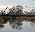
 Paperhouse Bridge, from the north - geograph.org.uk - 4728342.jpg 1 024 × 768 ; 157 kio
-
 Park, West Haddlesey - geograph.org.uk - 2397083.jpg 1 600 × 1 200 ; 584 kio
-
 Ploughed field by the East Coast Main Line - geograph.org.uk - 2343579.jpg 640 × 430 ; 29 kio
-
 Public footpath near East Haddlesey - geograph.org.uk - 1378636.jpg 640 × 480 ; 62 kio
-
 Public footpath, East Haddlesey - geograph.org.uk - 4795734.jpg 1 024 × 768 ; 119 kio
-
 Rape-field and Temple Drain - geograph.org.uk - 498735.jpg 640 × 480 ; 117 kio
-
 Ridge and furrow field at Chapel Haddlesey - geograph.org.uk - 6003648.jpg 1 280 × 960 ; 485 kio
-
 River Aire Weir at Chapel Haddlesey - geograph.org.uk - 1726943.jpg 2 816 × 2 112 ; 2,77 Mio
-
 Selby Canal at Paper House Bridge - geograph.org.uk - 6001597.jpg 960 × 1 280 ; 413 kio
-
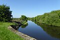 Selby Canal in West Haddlesey - geograph.org.uk - 5765995.jpg 640 × 427 ; 225 kio
-
 Selby Canal, just south of Paperhouse Bridge - geograph.org.uk - 4728345.jpg 1 024 × 768 ; 144 kio
-
 Street scene in Chapel Haddlesey - geograph.org.uk - 5137477.jpg 4 572 × 3 408 ; 5,17 Mio
-
 Stubble field, north of Bridge Farm - geograph.org.uk - 2586581.jpg 1 024 × 768 ; 154 kio
-
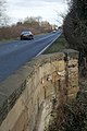
 The A19 to Selby - geograph.org.uk - 2147487.jpg 800 × 600 ; 206 kio
-

-
 The road to East Haddlesey and Temple Hirst - geograph.org.uk - 4795736.jpg 1 024 × 768 ; 125 kio
-
 The site of Haddlesey Old Lock - geograph.org.uk - 3173195.jpg 2 048 × 1 536 ; 527 kio
-
 Train to London impressions (13754134884).jpg 1 529 × 2 048 ; 1,07 Mio
-
 View south from Lodge Farm on Fox Lane - geograph.org.uk - 6391688.jpg 5 067 × 3 801 ; 3,8 Mio
-
 View south to Eggborough Power Station - geograph.org.uk - 6391708.jpg 5 010 × 3 561 ; 3,55 Mio
-
 Waiting for lunch - geograph.org.uk - 1167689.jpg 640 × 585 ; 76 kio
-
 Waterlogged farmland, east of Haddlesey Manor - geograph.org.uk - 4795718.jpg 1 024 × 768 ; 136 kio


.jpg)


.jpg)


