Category:Charney Bassett
Vai alla navigazione
Vai alla ricerca
Villaggio inglese nella Contea dell'Oxfordshire  | |||||
| Carica un file multimediale | |||||
| Istanza di | |||||
|---|---|---|---|---|---|
| Luogo | Vale of White Horse, Oxfordshire, Sud Est dell'Inghilterra, Inghilterra | ||||
| sito web ufficiale | |||||
 | |||||
English: Charney Bassett is a village and civil parish about 9 miles west of Abingdon-on-Thames, 6 miles north of Wantage and 5 miles east of Faringdon in the Vale of White Horse District of Oxfordshire. In 1974 it was transferred from Berkshire.
Sottocategorie
Questa categoria contiene le 6 sottocategorie indicate di seguito, su un totale di 6.
C
- Charney Bassett war memorial (4 F)
- Cherbury Camp (5 F)
M
- Charney Manor (4 F)
P
W
- Watermill at Charney Bassett (1 F)
File nella categoria "Charney Bassett"
Questa categoria contiene 83 file, indicati di seguito, su un totale di 83.
-
 A field of sheep by Poplars Farm - geograph.org.uk - 2864351.jpg 1 500 × 1 000; 244 KB
-
 Aerial view of Cherbury Camp - geograph.org.uk - 3417762.jpg 1 253 × 709; 285 KB
-
 Arable field near Charney Bassett - geograph.org.uk - 2864326.jpg 1 500 × 1 000; 246 KB
-
 Arable field near Charney Bassett - geograph.org.uk - 2864336.jpg 1 500 × 1 000; 388 KB
-
 Bridge and junction on the Longworth Road - geograph.org.uk - 6237844.jpg 4 000 × 3 000; 4,61 MB
-
 Bridge Over The Ock - geograph.org.uk - 3499030.jpg 4 320 × 3 240; 4,46 MB
-
 Bridge over the River Ock - geograph.org.uk - 2864340.jpg 1 500 × 1 000; 329 KB
-
 Bridleway beside the harvested fields - geograph.org.uk - 2052360.jpg 2 304 × 1 704; 1,79 MB
-
 Buckland Road by Minmere Farm - geograph.org.uk - 2864333.jpg 1 500 × 1 000; 276 KB
-
 Buckland Road in Charney Bassett - geograph.org.uk - 2864338.jpg 1 500 × 1 000; 186 KB
-
 Buckland Road junction with track to Bushey Barn - geograph.org.uk - 3043156.jpg 3 530 × 2 400; 1,18 MB
-
 Buckland Road south of Bushey Barn - geograph.org.uk - 3043162.jpg 3 502 × 2 480; 1,25 MB
-
 Buckland Road towards Charney Bassett - geograph.org.uk - 6268538.jpg 800 × 600; 200 KB
-

-
 Bucklands Road - geograph.org.uk - 5650800.jpg 640 × 480; 58 KB
-
 Bushy Barn entrance from the Buckland Road - geograph.org.uk - 2052349.jpg 2 304 × 1 704; 1,55 MB
-
 By Buckland Rd. Charney Bassett - geograph.org.uk - 3498393.jpg 4 320 × 3 240; 3,75 MB
-
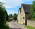
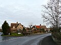
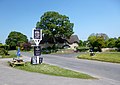
 Centre of Charney Bassett - geograph.org.uk - 2833610.jpg 640 × 427; 213 KB
-
 Cereal crop near Minmere Farm - geograph.org.uk - 6268543.jpg 800 × 600; 103 KB
-
 Cereal crop off Buckland Road - geograph.org.uk - 6268534.jpg 800 × 600; 102 KB
-
-
 Charney Bassett - geograph.org.uk - 6269878.jpg 800 × 468; 77 KB
-
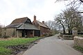 Charney Bassett Water Mill and House - geograph.org.uk - 5313143.jpg 640 × 427; 72 KB
-
 Charney Bassett.JPG 2 560 × 1 920; 2,31 MB
-
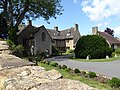 Charney Manor - geograph.org.uk - 6237849.jpg 4 000 × 3 000; 4,6 MB
-
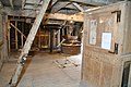
 Charney Mill - gear room - geograph.org.uk - 3518004.jpg 640 × 427; 74 KB
-
 Charney Mill - stone floor - geograph.org.uk - 3518028.jpg 640 × 427; 81 KB
-
 Charney water mill - bin floor - geograph.org.uk - 3518556.jpg 409 × 640; 89 KB
-
 Charney water mill - geograph.org.uk - 3517966.jpg 427 × 640; 106 KB
-
 Charney water mill - geograph.org.uk - 3517983.jpg 640 × 427; 82 KB
-
 Charney water mill - geograph.org.uk - 3518562.jpg 640 × 417; 123 KB
-
 Charney water mill - stone floor - geograph.org.uk - 3518549.jpg 640 × 427; 74 KB
-
 Charney watermill, Charney Bassett - geograph.org.uk - 3457524.jpg 640 × 427; 69 KB
-
 Cherbury Camp - geograph.org.uk - 5650809.jpg 640 × 480; 69 KB
-
 Cherbury Camp - geograph.org.uk - 6237882.jpg 4 000 × 3 000; 4,71 MB
-
 Church ^ Manor, Charney Bassett - geograph.org.uk - 3503354.jpg 4 320 × 3 102; 3,57 MB
-
 Churchyard at Charney Bassett - geograph.org.uk - 2833531.jpg 640 × 427; 216 KB
-
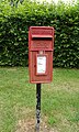 Elizabeth II postbox, Charney Bassett - geograph.org.uk - 6269875.jpg 2 946 × 4 922; 4,4 MB
-
 Entrance to Northmead Farm - geograph.org.uk - 1724208.jpg 640 × 480; 86 KB
-
 Farmland towards Bedlam Plantation - geograph.org.uk - 6268539.jpg 800 × 600; 104 KB
-
 Farmland, Charney Bassett - geograph.org.uk - 2816350.jpg 640 × 480; 183 KB
-
 Farmland, Charney Bassett - geograph.org.uk - 2816354.jpg 640 × 480; 172 KB
-
 Farmland, Charney Bassett - geograph.org.uk - 2816357.jpg 640 × 480; 170 KB
-
 Farmland, Longworth - geograph.org.uk - 6185698.jpg 1 024 × 683; 198 KB
-
 Field beside woodland, Charney Bassett - geograph.org.uk - 6268542.jpg 800 × 600; 110 KB
-
 House in New Road - geograph.org.uk - 2833541.jpg 640 × 427; 209 KB
-
 Houses on New Road, Charney Bassett - geograph.org.uk - 6268547.jpg 800 × 600; 142 KB
-
-
 K6 telephone box and Elizabeth II postbox, Charney Bassett - geograph.org.uk - 6269877.jpg 2 742 × 2 795; 1,72 MB
-
 Late Summer Colours - geograph.org.uk - 4166714.jpg 1 600 × 1 300; 689 KB
-
 Lyford Bridge over the River Ock - geograph.org.uk - 2864313.jpg 1 500 × 1 000; 424 KB
-
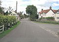 Main Street junction in Charney Bassett - geograph.org.uk - 3043121.jpg 3 648 × 2 584; 1,46 MB
-
 Main Street junction with New Road - geograph.org.uk - 3043136.jpg 3 648 × 2 736; 1,25 MB
-
 Minor road near Poplars Farm - geograph.org.uk - 6268554.jpg 800 × 600; 173 KB
-
 Minor road towards West Hanney - geograph.org.uk - 6268556.jpg 800 × 600; 150 KB
-

-

-
 Outside The Chequers - geograph.org.uk - 3498413.jpg 4 110 × 2 916; 2,86 MB
-
 Public footpath towards Cherbury Camp - geograph.org.uk - 6237857.jpg 4 000 × 3 000; 4,42 MB
-
 Rampart at Cherbury - geograph.org.uk - 4163071.jpg 1 600 × 1 142; 540 KB
-
 River Ock at Charney.JPG 800 × 600; 203 KB
-
 River Ock from Northmead Lane - geograph.org.uk - 3041189.jpg 3 648 × 2 736; 2,71 MB
-
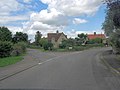
 Road junction in Charney Bassett - geograph.org.uk - 2864330.jpg 1 500 × 995; 317 KB
-
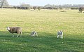 Sheep at Poplars Farm - geograph.org.uk - 2833716.jpg 640 × 397; 201 KB
-
 Spraying at Northfield Farm - geograph.org.uk - 2833526.jpg 640 × 428; 228 KB
-
 St Peter's Church in Charney Bassett - geograph.org.uk - 2864329.jpg 1 500 × 988; 248 KB
-
 The Chequers - geograph.org.uk - 3043146.jpg 3 648 × 2 736; 1,94 MB
-
 The Green, Charney Bassett - geograph.org.uk - 2833535.jpg 640 × 387; 184 KB
-
 The River Ock at Charney Bassett - geograph.org.uk - 2864343.jpg 1 000 × 1 500; 436 KB
-
 The River Ock at Charney Bassett - geograph.org.uk - 2864344.jpg 1 000 × 1 500; 508 KB
-
 The River Ock at Lyford - geograph.org.uk - 2864315.jpg 1 500 × 1 000; 425 KB
-
 The River Ock from Lyford Bridge - geograph.org.uk - 2864316.jpg 1 500 × 1 000; 564 KB
-
 The River Ock, Charney Bassett - geograph.org.uk - 6268549.jpg 800 × 600; 155 KB
-
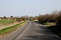 The road to Charney Bassett - geograph.org.uk - 2864335.jpg 1 500 × 1 000; 213 KB
-
 The road to Lyford - geograph.org.uk - 2864324.jpg 1 500 × 1 000; 212 KB
-
 The road to West Hanney - geograph.org.uk - 2864347.jpg 1 500 × 1 000; 414 KB
-
 Track and farmland, Charney Bassett - geograph.org.uk - 2816331.jpg 640 × 480; 130 KB
-
 Track and grazing near Poplars Farm - geograph.org.uk - 6268552.jpg 800 × 600; 92 KB
-
 Track to Pusey - geograph.org.uk - 5650803.jpg 640 × 480; 69 KB
-

-
 Tyres for the Horses - geograph.org.uk - 4162940.jpg 4 000 × 3 000; 3,41 MB
-
 View From The Mill - geograph.org.uk - 3524035.jpg 4 110 × 2 946; 2,67 MB
-
 Village Hall, Chapel Street - geograph.org.uk - 6237854.jpg 4 000 × 3 000; 4,79 MB


