Category:Chaurikharka
Zur Navigation springen
Zur Suche springen
Village Development Committee in Nepal  | |||||
| Medium hochladen | |||||
| Ist ein(e) | |||||
|---|---|---|---|---|---|
| Ort | Solukhumbu, Provinz Koshi, Nepal | ||||
 | |||||
Unterkategorien
Diese Kategorie enthält folgende Unterkategorie:
In Klammern die Anzahl der enthaltenen Kategorien (K), Seiten (S), Dateien (D)
L
Medien in der Kategorie „Chaurikharka“
Folgende 50 Dateien sind in dieser Kategorie, von 50 insgesamt.
-
 1st Day hike. Medical Center and Hospital at the Lukla. - panoramio.jpg 1.936 × 1.296; 941 KB
-

-
 3rd Day of the hike. Mountain view from the Kharkateng. - panoramio.jpg 1.936 × 1.296; 742 KB
-
 4th Day hike. View of the village Kothe from the top pathway. - panoramio.jpg 1.936 × 1.291; 721 KB
-
 5th Day of the hike. The road to the pass just above Thangna. - panoramio.jpg 1.936 × 1.296; 1,01 MB
-
 Benkar Guest House after Earthquake.jpg 480 × 640; 74 KB
-
 Broken Buddha Lodge at Chaurikharka Nepal after April 2015 Earthquake.jpg 1.243 × 1.440; 297 KB
-
 Broken House at Chaurikharka,Nepal.jpg 576 × 446; 94 KB
-
 Chutang - the center of the village. - panoramio.jpg 1.936 × 1.296; 944 KB
-

-
 Dudh Koshi River, Nepal.jpg 4.032 × 2.688; 7,78 MB
-
 Dudh Koshi Valley, Dudh Koshi River 2, Nepal.jpg 4.032 × 2.688; 7,74 MB
-
 Dudh Koshi Valley, Dudh Koshi River 3, Nepal.jpg 4.032 × 2.688; 6,28 MB
-
 Dudh Koshi Valley, Dudh Koshi River, Nepal.jpg 4.032 × 2.688; 8,13 MB
-
 Dudh Koshi Valley, Forest, Nepal.jpg 4.032 × 2.688; 8,29 MB
-
 Dudh Koshi Valley, Jorsale, Children of Nepal.jpg 3.245 × 2.688; 6,56 MB
-
 Dudh Koshi Valley, Jorsale, Nepalese wooden house, Nepal.jpg 4.032 × 2.688; 8,63 MB
-
 Dudh Koshi Valley, Nepal.jpg 4.032 × 2.688; 5,47 MB
-
 Dudh Koshi Valley, Sherpa, Nepal.jpg 4.032 × 2.688; 9,58 MB
-
 Dudh Koshi Valley, Suspension footbridge 2, Nepal.jpg 4.032 × 2.688; 7,67 MB
-
 Dudh Koshi Valley, Suspension footbridge, Nepal.jpg 4.032 × 2.688; 8,49 MB
-
 Dudh Koshi Valley, Terraces, Nepal.jpg 4.032 × 2.688; 5,59 MB
-
 Dudh Koshi Valley, Tree trunk, Nepal.jpg 4.032 × 2.688; 6,87 MB
-
 Dudh Koshi Valley, Tree, Nepal.jpg 4.032 × 2.688; 5,56 MB
-
 Dudh Kosi river and a small village opposite Chaurikharka.jpg 3.075 × 2.212; 7,53 MB
-
 Dudh Kosi river near Chaurikharka.jpg 2.628 × 1.940; 4,96 MB
-
 General view of the valley and Lukla. - panoramio.jpg 1.936 × 1.296; 923 KB
-
 Good houses are near the Kharikhola. - panoramio.jpg 1.936 × 1.296; 1,3 MB
-
 In some places trail in Sibuje requires special attention. - panoramio.jpg 1.936 × 1.296; 1,06 MB
-
 Kharkateng at an altitude of 4080 meters. 2nd overnight in tents. - panoramio.jpg 1.936 × 1.296; 913 KB
-
 KHARKATENG is located at a height of 4080m. GPS place is exact. - panoramio.jpg 1.936 × 1.296; 977 KB
-
 Kosi or Koshi River near Village Ghat Nepal.jpg 2.890 × 2.017; 1,87 MB
-

-
 Kothe - a loggia and a shop. End of the 3th Day of the hike, Evening. - panoramio.jpg 1.936 × 1.296; 942 KB
-
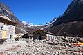
 KOTHE. Afternoon was dried the things in the loggia. - panoramio.jpg 1.936 × 1.296; 1,04 MB
-
 Loggia in Sibuje. End the 11th Day of the hike, overnight in the Loggia. - panoramio.jpg 1.936 × 1.296; 877 KB
-

-
 Lukla, landing at the airport. - panoramio.jpg 1.936 × 1.291; 368 KB
-
 Mani stone, near Lukla, Nepal - panoramio.jpg 1.024 × 1.024; 788 KB
-
 Morning, the start of the trail. - panoramio.jpg 1.936 × 1.296; 763 KB
-
 Morning. A view down to the valley from the level of 4200 meters. - panoramio.jpg 1.936 × 1.296; 646 KB
-
 Mountain view from the Chutang. - panoramio.jpg 1.936 × 1.291; 452 KB
-
 On approach to the Thangna. - panoramio.jpg 1.936 × 1.296; 1,05 MB
-
 Orphaned house near the trail. - panoramio.jpg 1.936 × 1.296; 1,08 MB
-
-
 Thangna. View from the moraine. November 2012. - panoramio.jpg 1.936 × 1.296; 915 KB
-
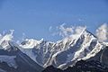
 Valley Hinky. View of the Kyashar - 6770 m. - panoramio.jpg 1.936 × 1.296; 957 KB
-
 Very close to the pass Zetra La from Kharkateng. - panoramio.jpg 1.936 × 1.296; 945 KB
-
 View on Chutang with the ascent route to the pass. - panoramio.jpg 1.936 × 1.296; 752 KB
-
 Zetra La pass - 4520 meters. - panoramio.jpg 1.936 × 1.296; 583 KB


_is_located_on_the_slope_in_the_forest_at_an_altitude_of_3650m,_GPS._Bad_weather_again._-_panoramio.jpg)


