Category:Cheltenham
Zur Navigation springen
Zur Suche springen
Stadt in Gloucestershire, England   | |||||
| Medium hochladen | |||||
| Aussprache (Audiodatei) | |||||
|---|---|---|---|---|---|
| Ist ein(e) | |||||
| Ort | Cheltenham, Gloucestershire, Südwestengland, England | ||||
| Datum der Gründung, Erstellung, Entstehung, Erbauung |
| ||||
| Einwohnerzahl |
| ||||
| Fläche |
| ||||
| Verschieden von | |||||
| offizielle Website | |||||
 | |||||
Unterkategorien
Es werden 21 von insgesamt 21 Unterkategorien in dieser Kategorie angezeigt:
In Klammern die Anzahl der enthaltenen Kategorien (K), Seiten (S), Dateien (D)
B
- Benhall Park (12 D)
C
- Cheltenham Spa Express (3 D)
E
G
H
N
- Neptune Fountain, Cheltenham (27 D)
P
S
T
W
- Westley's Library (10 D)
Medien in der Kategorie „Cheltenham“
Folgende 200 Dateien sind in dieser Kategorie, von 304 insgesamt.
(vorherige Seite) (nächste Seite)-
 "The Salt Way" towards Winstone - geograph.org.uk - 1515818.jpg 640 × 480; 136 KB
-
 A wintery Coldwell Bottom - geograph.org.uk - 1156360.jpg 640 × 426; 32 KB
-
 A4015, Cheltenham - geograph.org.uk - 1224237.jpg 640 × 480; 132 KB
-
 A417 to Gloucester - geograph.org.uk - 1070154.jpg 640 × 480; 132 KB
-
 A429 through Oxfordshire, Oxfordshire - panoramio.jpg 2.048 × 1.536; 775 KB
-
 Adam Henson at Cheltenham, Cotswolds, England-14Jan2010.jpg 2.136 × 2.848; 1,26 MB
-
 After a storm... - geograph.org.uk - 1500832.jpg 640 × 481; 110 KB
-
 Albert Road - geograph.org.uk - 881377.jpg 640 × 480; 122 KB
-

-
 Andover Road, Norwood Road Junction - geograph.org.uk - 1127416.jpg 640 × 360; 190 KB
-

-
 Asquith Road Allotments - geograph.org.uk - 1124526.jpg 640 × 360; 211 KB
-
 Bath Parade during the July 2007 floods - geograph.org.uk - 1122941.jpg 640 × 427; 214 KB
-
 Bath Terrace Car Park, Cheltenham - geograph.org.uk - 1127552.jpg 640 × 425; 224 KB
-
 Battledown Trading Estate, Cheltenham (geograph 4199422).jpg 800 × 451; 221 KB
-
 Berkeley Place By Night.jpg 4.912 × 3.264; 3,12 MB
-
 Berkeley Place Transitions Between Night and Day.jpg 4.912 × 3.264; 3,31 MB
-
 Bike to School Week sign, Benhall, Cheltenham.jpg 5.184 × 3.888; 6,79 MB
-
 Blackthorn blossom (close-up) - geograph.org.uk - 376094.jpg 480 × 640; 100 KB
-
 Blackthorn blossom - geograph.org.uk - 376092.jpg 480 × 640; 148 KB
-
 Blackthorn Hedge in Flower.jpg 2.048 × 1.536; 983 KB
-
 Blason de Cheltenham.svg 284 × 352; 448 KB
-
 Boxing Day sunrise at Southbury - geograph.org.uk - 1511300.jpg 640 × 480; 91 KB
-
 Brandon House (geograph 4775078).jpg 800 × 531; 131 KB
-
 Brian jones grave.jpg 1.262 × 984; 631 KB
-
 Buzzard cloaking its prey - geograph.org.uk - 1500827.jpg 640 × 481; 102 KB
-
 Cambray Place, Cheltenham (geograph 7343984).jpg 1.024 × 771; 411 KB
-
 Cambray Place, Cheltenham (geograph 7343989).jpg 1.024 × 771; 443 KB
-
 Cambray Place.jpg 4.912 × 3.264; 3,09 MB
-
 Capt' Gorgeous - 28519005268.jpg 4.752 × 3.168; 7,07 MB
-
 Capt' Gorgeous - 40583881720.jpg 4.752 × 3.168; 10,32 MB
-
 Capt' Gorgeous - 41668606864.jpg 4.752 × 3.168; 9,39 MB
-
 Certificate of twinning link.jpg 3.116 × 2.311; 1,95 MB
-
 Charles Henry Mackintosh Grave.jpg 1.224 × 1.632; 356 KB
-
 Charlton Park Gate - geograph.org.uk - 1122982.jpg 640 × 480; 288 KB
-
 Cheltenham - panoramio (13).jpg 3.132 × 2.104; 2,35 MB
-
 Cheltenham - panoramio (6).jpg 4.608 × 3.456; 3,97 MB
-
 Cheltenham - panoramio (7).jpg 4.608 × 3.456; 4,88 MB
-
 Cheltenham - panoramio.jpg 4.608 × 3.456; 4,43 MB
-
 Cheltenham and Tewkesbury from Leckhampton Hill (6966).jpg 4.288 × 2.848; 5,21 MB
-
 Cheltenham and the Malverns from Leckhampton Hill (6962).jpg 4.288 × 2.848; 6,45 MB
-
 Cheltenham and the Malverns from Leckhampton Hill (6971).jpg 4.288 × 2.848; 6,51 MB
-
 Cheltenham Borough Council 2024.svg 360 × 185; 3 KB
-
 Cheltenham by Richard Dighton.jpg 2.400 × 1.744; 1,22 MB
-
 Cheltenham Cruikshank.jpg 2.000 × 1.226; 1,51 MB
-
Cheltenham en gb.ogg 1,1 s; 29 KB
-
 Cheltenham from Leckhampton Hill (6970).jpg 4.288 × 2.848; 6,41 MB
-
 Cheltenham from Leckhampton Hill (6973).jpg 4.288 × 2.848; 6,25 MB
-
 Cheltenham from Leckhampton Hill (6977).jpg 4.288 × 2.848; 6,82 MB
-
 Cheltenham from Leckhampton Hill (6978).jpg 4.288 × 2.848; 6,2 MB
-
 Cheltenham from Leckhampton Hill.jpg 11.800 × 2.671; 11,55 MB
-
 Cheltenham OSM 03.png 1.190 × 1.164; 1,97 MB
-
 Cheltenham UK ward map 2024.svg 694 × 681; 203 KB
-
 Cheltenham, Promenade, statue - geograph.org.uk - 1096996.jpg 640 × 479; 65 KB
-
 Cheltenham, Promenade, The Lodge - geograph.org.uk - 1096990.jpg 640 × 479; 48 KB
-
 Cheltenham.from.leckhampton.arp.jpg 2.143 × 1.582; 977 KB
-
 Cheltenhamtwp 04.JPG 1.600 × 1.200; 497 KB
-

-
 Chiildren's Play Equipment, Benhall Park, Cheltenham, UK.jpg 2.048 × 1.536; 1,53 MB
-

-
 Cleevelands Drive, Cheltenham - geograph.org.uk - 1569577.jpg 640 × 480; 276 KB
-
 Clubhouse, Tewkesbury Road - geograph.org.uk - 1408663.jpg 640 × 409; 249 KB
-
 Copper Beech tree, Montpellier Gardens, Cheltenham.jpg 4.000 × 3.000; 2,53 MB
-
 Cotswold Bowl Ten Pin Bowling Lanes - geograph.org.uk - 5332.jpg 640 × 480; 55 KB
-
 Cox's Meadow during the July 2007 floods - geograph.org.uk - 1122927.jpg 640 × 427; 156 KB
-
 Cox's meadow flood storage basin. - geograph.org.uk - 1122919.jpg 640 × 480; 284 KB
-
 Cricket in Bourton - panoramio.jpg 360 × 240; 53 KB
-
 CTLFC Squad 2012-13.jpg 2.048 × 1.536; 632 KB
-
 Dean Close School - geograph.org.uk - 5330.jpg 640 × 480; 63 KB
-
 Dean Close School Logo.jpg 890 × 502; 46 KB
-
 Devil's Chimney and Cheltenham.jpg 3.656 × 2.696; 3,89 MB
-
 Dragon and Onion lamp post.jpg 4.080 × 2.720; 2,68 MB
-
 Dunalley Street, Cheltenham - geograph.org.uk - 1569492.jpg 640 × 480; 226 KB
-
 Earthworks on Leckhampton Hill - geograph.org.uk - 654216.jpg 640 × 426; 82 KB
-
 Escaped Elephants - Cheltenham Town Center.jpeg 3.264 × 2.448; 2,6 MB
-
 Flowers for sale - geograph.org.uk - 1224233.jpg 499 × 640; 123 KB
-
 Former gas works site - geograph.org.uk - 871347.jpg 640 × 480; 97 KB
-
 GottingenSign.JPG 857 × 664; 74 KB
-
 Government offices, Parabola Road - geograph.org.uk - 1336309.jpg 640 × 480; 135 KB
-
 Great Norwood Street - geograph.org.uk - 1127439.jpg 640 × 360; 47 KB
-
 Grobmalzonka.jpg 384 × 512; 100 KB
-
 Hays Cottages Almshouses, Naunton Park - geograph.org.uk - 1124524.jpg 640 × 360; 231 KB
-
 HFF iron work - Flickr - Orchids love rainwater.jpg 4.016 × 1.938; 1,89 MB
-
 Houses in Leckhampton from Leckhampton Hill (6974).jpg 4.288 × 2.848; 6,36 MB
-
 If it rains any more... - geograph.org.uk - 1083317.jpg 640 × 480; 77 KB
-
 Illustration at page 50, Folk-lore, volume 4, 1893.png 1.631 × 1.184; 1,47 MB
-
 Imperial Square Gardens (29849015218).jpg 5.184 × 3.888; 7,53 MB
-
 In loving memory of the K6 - geograph.org.uk - 2221973.jpg 391 × 640; 98 KB
-
 Inside Beechwood Shopping Centre - geograph.org.uk - 1083329.jpg 640 × 480; 110 KB
-
 Jessica Bellhouse of Cotswold Grange.jpg 800 × 896; 104 KB
-
 John Waddingham circa 1860.jpg 800 × 1.125; 227 KB
-

-
 Kate Chruscicka.jpg 3.599 × 2.059; 4,06 MB
-
 King George III taking the waters at Cheltenham. Coloured aq Wellcome L0025125.jpg 1.306 × 1.522; 790 KB
-
 Lypiatt Street - geograph.org.uk - 426311.jpg 640 × 480; 74 KB
-
 Male Hairy-footed Bee. Anthophora plumipes - Flickr - gailhampshire.jpg 2.936 × 2.760; 1,13 MB
-
 Marchants Optare Solo KX14 FJO , Royal Well Bus Station Cheltenham 16.3.18 (25991792467).jpg 5.184 × 3.456; 2,23 MB
-
 Mature Tree in Benhall, Cheltenham at sunset.jpg 2.048 × 1.536; 1.024 KB
-
 Mill cottage 1.jpg 2.000 × 3.008; 2,78 MB
-
 Mill cottage 3.jpg 2.000 × 3.008; 2,72 MB
-
 Mill cottage.jpg 3.008 × 2.000; 3 MB
-
 Montpellier Walk and the caryatids - geograph.org.uk - 288715.jpg 640 × 480; 76 KB
-
 Municipal Gardens, Cheltenham - geograph.org.uk - 955955.jpg 640 × 376; 78 KB
-
 Natural Play Equipment in Benhall Park, Cheltenham.jpg 5.184 × 3.456; 10,02 MB
-
 Naunton Crescent - geograph.org.uk - 1127291.jpg 640 × 360; 194 KB
-
 Naunton Lane looking south west - geograph.org.uk - 1127271.jpg 640 × 360; 237 KB
-
 Naunton Park Gardens - geograph.org.uk - 1124519.jpg 640 × 360; 246 KB
-

-
 Naunton Park Road - geograph.org.uk - 1124529.jpg 640 × 360; 245 KB
-
 Nemophora scabiosella . Adelidae - Flickr - gailhampshire.jpg 1.256 × 1.220; 380 KB
-
 New Development, Oakley - geograph.org.uk - 864462.jpg 640 × 411; 242 KB
-
 New flats on the old Coliseum cinema site (geograph 3075350).jpg 640 × 464; 76 KB
-
 Notgrove Barrow - panoramio (1).jpg 2.144 × 1.424; 1,71 MB
-
 Notgrove Barrow - panoramio.jpg 2.144 × 1.424; 1,11 MB
-
 Oak tree bark in Benhall Woods.jpg 2.048 × 1.536; 1,66 MB
-

-
 Old Bath Road to Mead Road footpath - geograph.org.uk - 1122974.jpg 640 × 480; 287 KB
-
 Old Milestone, A40 Cheltenham (geograph 6969141).jpg 1.024 × 745; 407 KB
-
 Old Petrol Pump outside The Plough Inn, Ford - panoramio.jpg 2.736 × 3.648; 5,22 MB
-
 Ordnance Survey Drawings - Cheltenham (OSD 172).jpg 5.637 × 3.914; 4,89 MB
-
 Ordnance Survey One-Inch Sheet 143 Gloucester & Malvern, Published 1946.jpg 8.181 × 9.556; 12,07 MB
-
 Ordnance Survey One-Inch Sheet 143 Gloucester & Malvern, Published 1953.jpg 8.327 × 9.966; 12,85 MB
-
 Ordnance Survey One-Inch Sheet 143 Gloucester & Malvern, Published 1968.jpg 8.331 × 9.901; 11,58 MB
-
 Ordnance Survey One-Inch Sheet 144 Cheltenham & Evesham, Published 1946.jpg 10.983 × 12.830; 16,59 MB
-
 Ordnance Survey One-Inch Sheet 144 Cheltenham & Evesham, Published 1968.jpg 8.331 × 9.918; 10,7 MB
-
 Ordnance Survey One-Inch Sheet 144 Cheltenham and Evesham, Published 1953.jpg 8.343 × 9.932; 11,43 MB
-
 Ordnance Survey One-Inch Sheet 157 Swindon, Published 1940.jpg 8.198 × 9.537; 10,75 MB
-
 Ordnance Survey One-Inch Sheet 92 Gloucester & Forest of Dean, Published 1919.jpg 12.150 × 8.410; 43,4 MB
-
 P1050214 - Flickr - gailhampshire.jpg 2.592 × 2.022; 703 KB
-
 Packing up the market stalls - geograph.org.uk - 1224117.jpg 640 × 480; 131 KB
-
 Paddy Power balloon arch, Cheltenham (33420135096).jpg 5.184 × 3.888; 2 MB
-
 Paddy-power-sign.jpg 360 × 240; 38 KB
-

-
 Panorama of Cheltenham.jpg 6.220 × 2.767; 2,97 MB
-

-
 Parkland Road, Cheltenham - geograph.org.uk - 1132270.jpg 640 × 480; 170 KB
-
 Phone box on Albert Road - geograph.org.uk - 881381.jpg 480 × 640; 140 KB
-
 Pittville Park.jpg 1.346 × 757; 304 KB
-
 Playground - geograph.org.uk - 705285.jpg 640 × 480; 73 KB
-
 Prestocheltenham.jpg 591 × 401; 167 KB
-
 Promenade looking towards Hight Street Cheltenham England.jpg 1.076 × 842; 207 KB
-
 Promenade looking towards Queen's Hotel, Cheltenham, England-LCCN2002696529.jpg 3.700 × 2.747; 3,9 MB
-
 Promenade looking towards Queen's Hotel, Cheltenham, England-LCCN2002696529.tif 3.700 × 2.747; 29,08 MB
-
 Promenade looking towards Queens Hotel Cheltenham England.jpg 1.075 × 837; 204 KB
-
 QEFM chelt radio.jpg 3.150 × 2.367; 1,81 MB
-
 Recycling Bins, Cheltenham, UK.jpg 2.048 × 1.536; 1,54 MB
-
 Restaurant, Cheltenham - geograph.org.uk - 862971.jpg 640 × 480; 99 KB
-
 River Dikler - geograph.org.uk - 280938.jpg 640 × 480; 102 KB
-

-
 Roundabout, Fiddlers Green Lane - geograph.org.uk - 880959.jpg 640 × 480; 114 KB
-
 Sandford Park (42815751785).jpg 3.888 × 5.184; 9,49 MB
-
 Sandford Park (43671953292).jpg 5.184 × 3.888; 8,55 MB
-

-
 Sandford Park - geograph.org.uk - 888129.jpg 480 × 640; 97 KB
-
 Sandford Park, Cheltenham - geograph.org.uk - 888113.jpg 640 × 480; 103 KB
-
 Sandford Parks Lido 2005.jpg 640 × 480; 56 KB
-
 Saxman, Cheltenham (33304984002).jpg 3.682 × 4.772; 2,15 MB
-
 Semi-detached houses, Gloucester Road - geograph.org.uk - 1381947.jpg 640 × 480; 115 KB
-
 Shadows in Cheltenham Bus Station - geograph.org.uk - 1639786.jpg 640 × 480; 81 KB
-
 Sheep grazing near Moor's Copse - geograph.org.uk - 255991.jpg 640 × 480; 137 KB
-
 Shurdington road, Bath road junction - geograph.org.uk - 1550930.jpg 640 × 480; 73 KB
-
 SochiSign.jpg 548 × 638; 159 KB
-
 Standing deadwood with Woodpecker holes, Benhall Park, Cheltenham.jpg 5.184 × 3.456; 5,73 MB
-
 Stormhank653 oli 20190130.jpg 720 × 700; 591 KB
-
 Stormhank653 oli 20240103.jpg 720 × 700; 512 KB
-
 Stow rugby club - geograph.org.uk - 451179.jpg 640 × 477; 45 KB
-
 Sub-station, Springbank - geograph.org.uk - 880963.jpg 640 × 480; 116 KB
-
 Synagogue Lane, Cheltenham - road sign (3830872025).jpg 2.816 × 2.112; 1,17 MB
-
 Synagogue Lane, Cheltenham - road sign (3831669432).jpg 2.816 × 2.112; 1,16 MB
-

-
 Telltale puff of smoke - geograph.org.uk - 1508429.jpg 640 × 449; 81 KB
-
 Terry Wogan at Cheltenham Literature Festival.jpg 1.035 × 1.491; 1,29 MB
-
 Tewkesbury Road, Cheltenham 1 - geograph.org.uk - 1187351.jpg 640 × 480; 191 KB
-
 Tewkesbury Road, Cheltenham 2 - geograph.org.uk - 1187353.jpg 640 × 480; 204 KB
-
 The Brewery, Cheltenham 1 - geograph.org.uk - 1638923.jpg 640 × 481; 251 KB
-
 The Brewery, Cheltenham 2 - geograph.org.uk - 1638929.jpg 640 × 480; 242 KB
-
 The Cambray, Cheltenham - geograph.org.uk - 888103.jpg 640 × 480; 70 KB
-
 The Cobblers Corner - geograph.org.uk - 1468775.jpg 640 × 479; 62 KB
-
 The Courtyard shops - geograph.org.uk - 1381909.jpg 640 × 350; 69 KB
-
 The cricket ground. - geograph.org.uk - 1086982.jpg 640 × 426; 84 KB
-
 The Garden Cafe, Montpellier Gardens - geograph.org.uk - 1381922.jpg 640 × 324; 72 KB
-
 The Norwood Roundabout - geograph.org.uk - 1124488.jpg 583 × 640; 68 KB
-
 The Park near Moorend Park Road - geograph.org.uk - 1127237.jpg 640 × 444; 274 KB
-
 The River Chelt - geograph.org.uk - 888125.jpg 480 × 640; 129 KB
-
 There's always one - geograph.org.uk - 1224149.jpg 640 × 430; 142 KB
-
 Thirlestaine Hall - geograph.org.uk - 1013938.jpg 848 × 544; 127 KB
-
 Thirlestaine Hall main entrance - geograph.org.uk - 1122968.jpg 640 × 480; 242 KB
-
 Towards St Marks - geograph.org.uk - 862972.jpg 480 × 640; 111 KB
-
 Town Hall Box Office - geograph.org.uk - 680978.jpg 640 × 480; 75 KB
-
 Tracking deer - geograph.org.uk - 376098.jpg 640 × 426; 69 KB
-
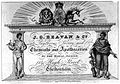 Trade card for J. G. Bevan and Company Wellcome L0001151.jpg 1.704 × 1.198; 1,07 MB
-

-

-
-

-
 The promenade, Cheltenham. Steel engraving. Wellcome V0012486.jpg 648 × 486; 84 KB
-

-
 The well walk at Cheltenham. Engraving by J. Springsguth. Wellcome V0020119.jpg 3.036 × 2.280; 3,32 MB
-
 View across the Promenade, Cheltenham - geograph.org.uk - 1121468.jpg 640 × 480; 218 KB
-
 View along North Street, A46 - geograph.org.uk - 1224101.jpg 480 × 640; 107 KB


.jpg)


_-_geograph.org.uk_-_376094.jpg)


.jpg)


.jpg)
.jpg)


.jpg)
.jpg)
.jpg)

.jpg)
.jpg)
.jpg)


.jpg)
.jpg)
.jpg)
.jpg)


.jpg)


.jpg)


.jpg)


.jpg)
.jpg)


.jpg)

.jpg)


.jpg)

_-_geograph.org.uk_-_1132215.jpg)


.jpg)
.jpg)
_during_the_July_2007_floods_-_geograph.org.uk_-_1122938.jpg)


.jpg)


.jpg)
.jpg)
.jpg)


